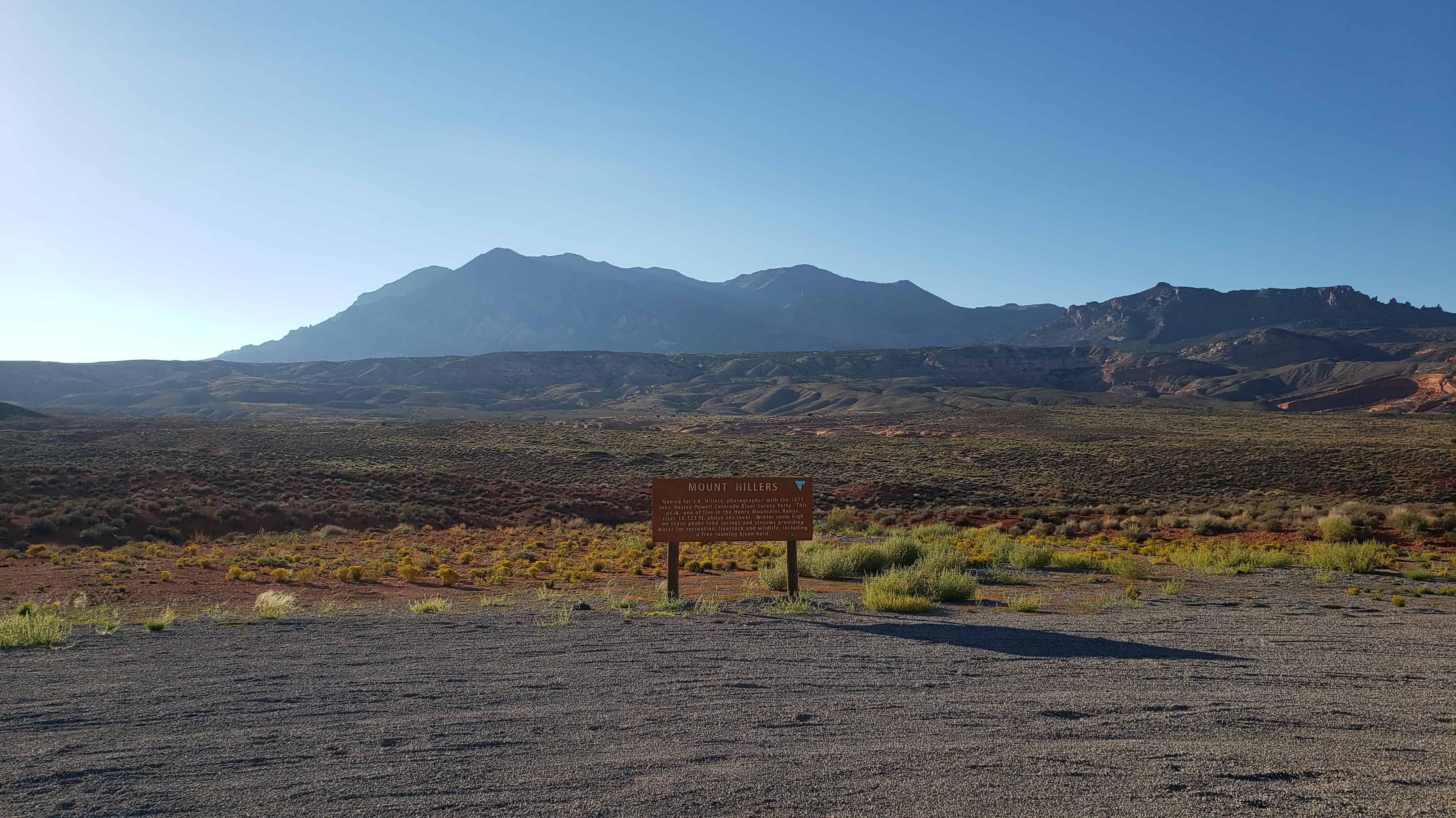
Named for J.K. Hillers, photographer with the 1871 John Wesley Powell Colorado River Survey Party. This peak, one of five in the Henry Mountains Range, rises 10,723 ft. above sea level. Winter snow high on these peaks feed springs and streams providing water for recreation, livestock and wildlife, including a free roaming bison herd.
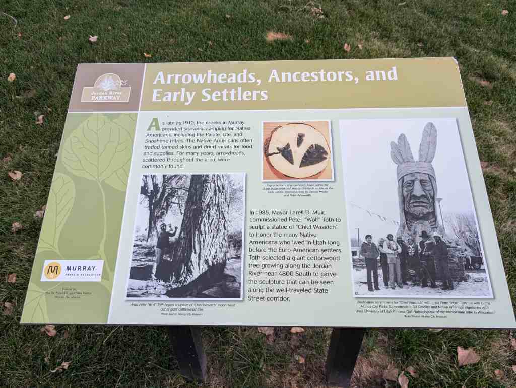
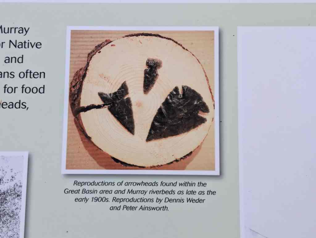
Arrowheads, Ancestors, and Early Settlers As late as 1910, the creeks in Murray provided seasonal camping for Native Americans, including the Paiute, Ute, and Shoshone tribes. The Native Americans often traded tanned skins and dried meats for food and supplies. For many years, arrowheads, scattered throughout the area, were commonly found.
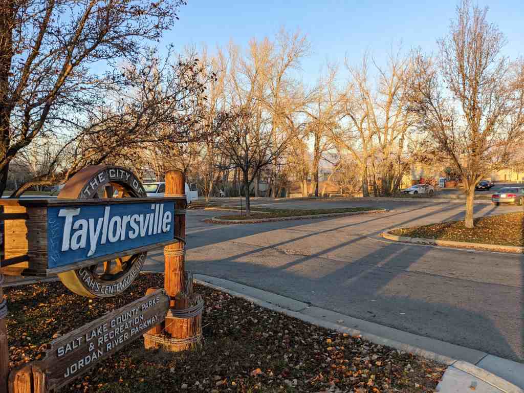
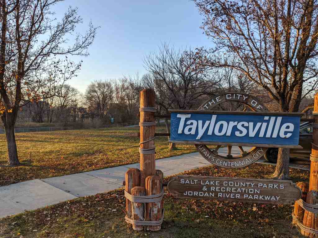
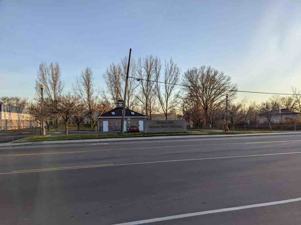
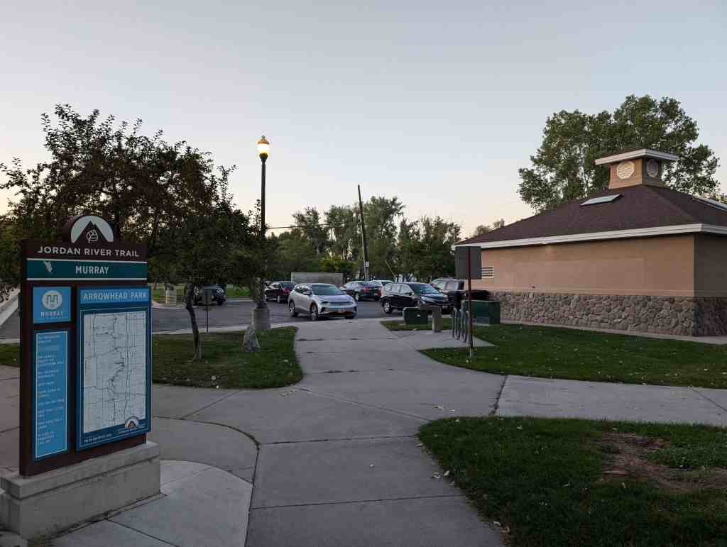
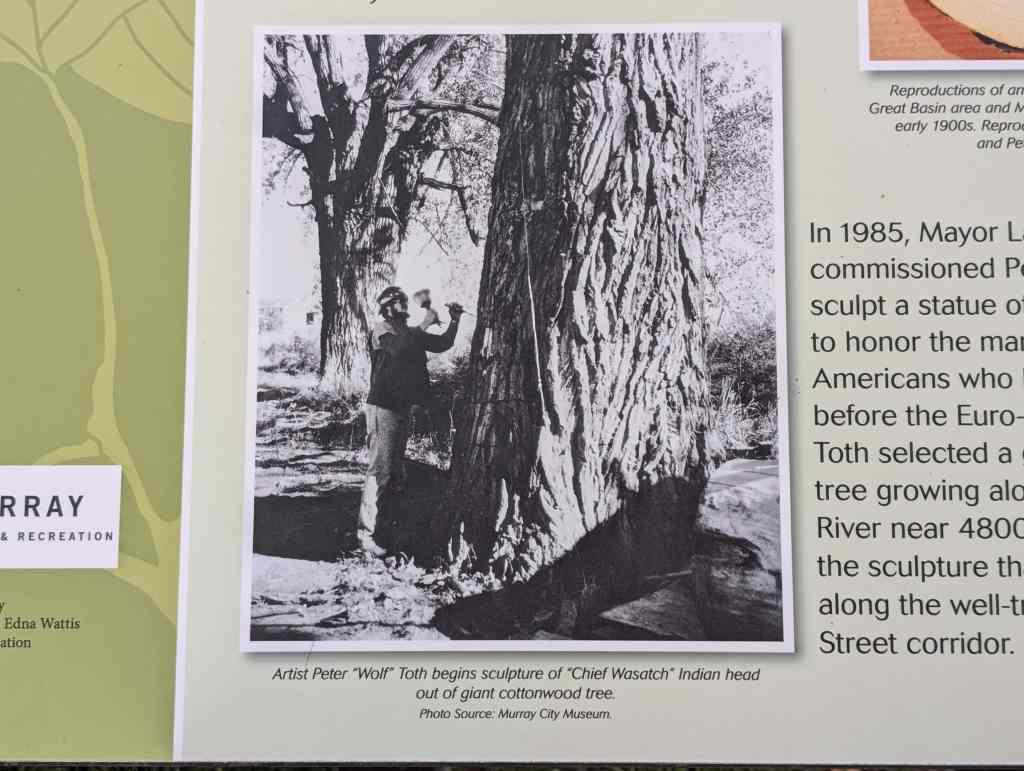
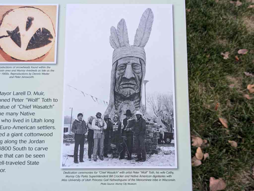
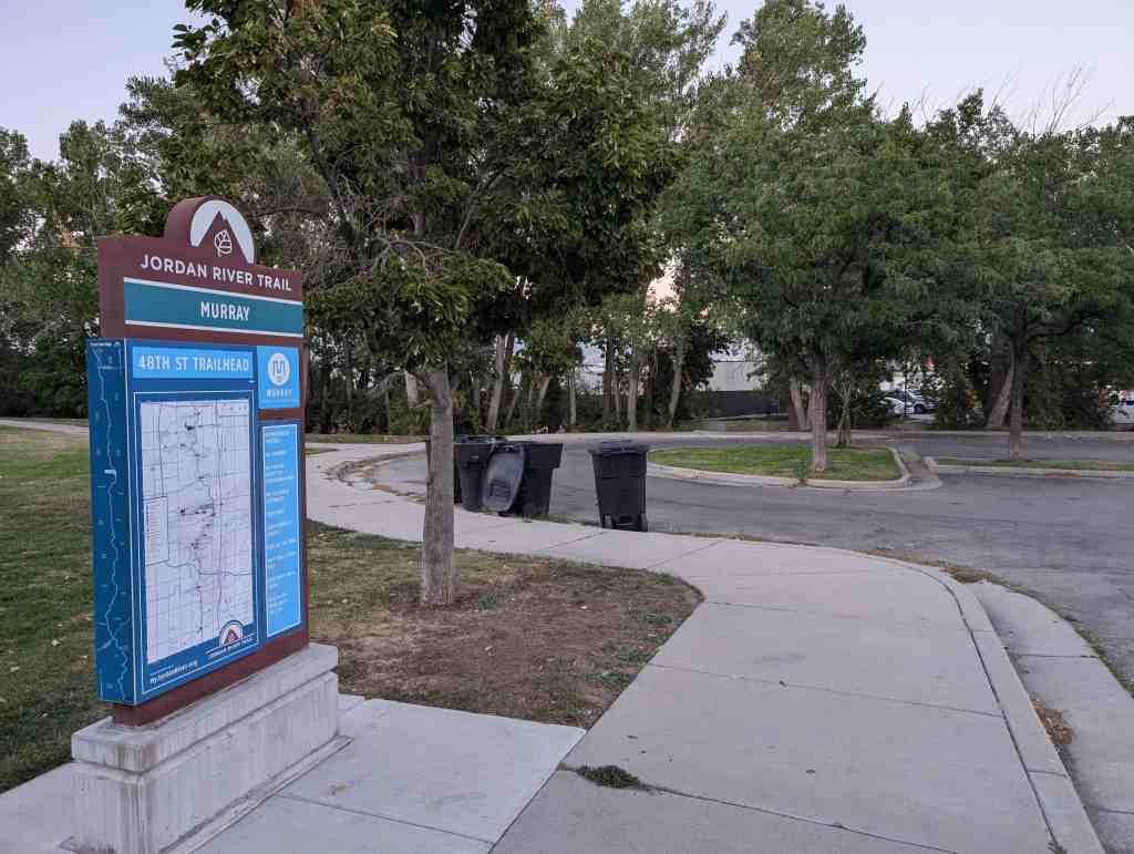
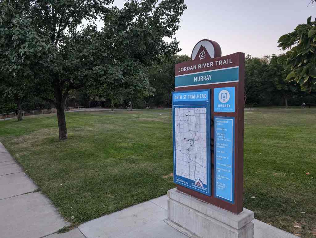
In 1985, Mayor Larell D. Muir, commissioned Peter “Wolf” Toth to sculpt a statue of “Chief Wasatch” to honor the many Native Americans who lived in Utah long before the Euro-American settlers. Toth selected a giant cottonwood tree growing along the Jordan River near 4800 South to carve the sculpture that can be seen along the well-traveled State Street corridor.
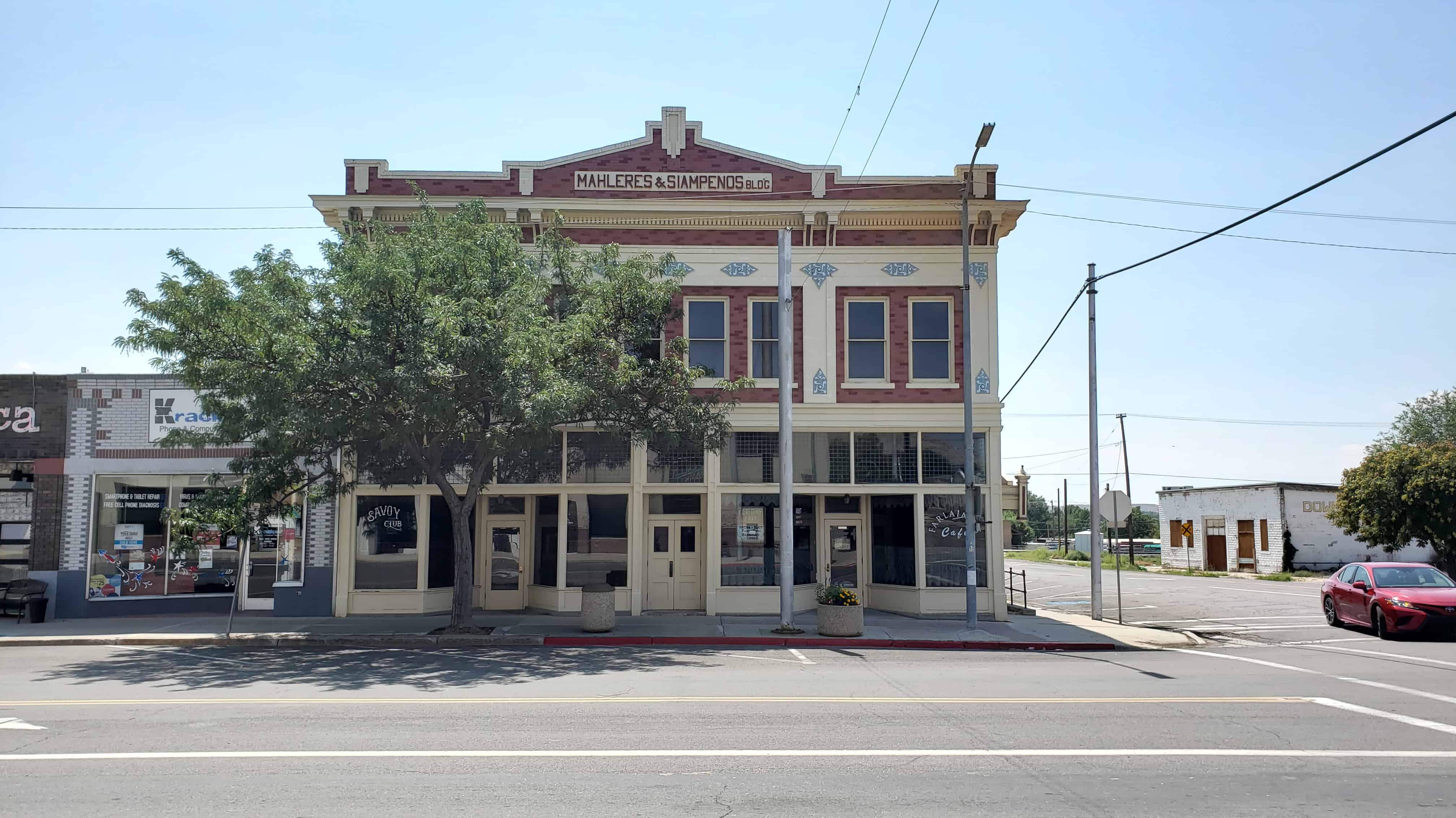
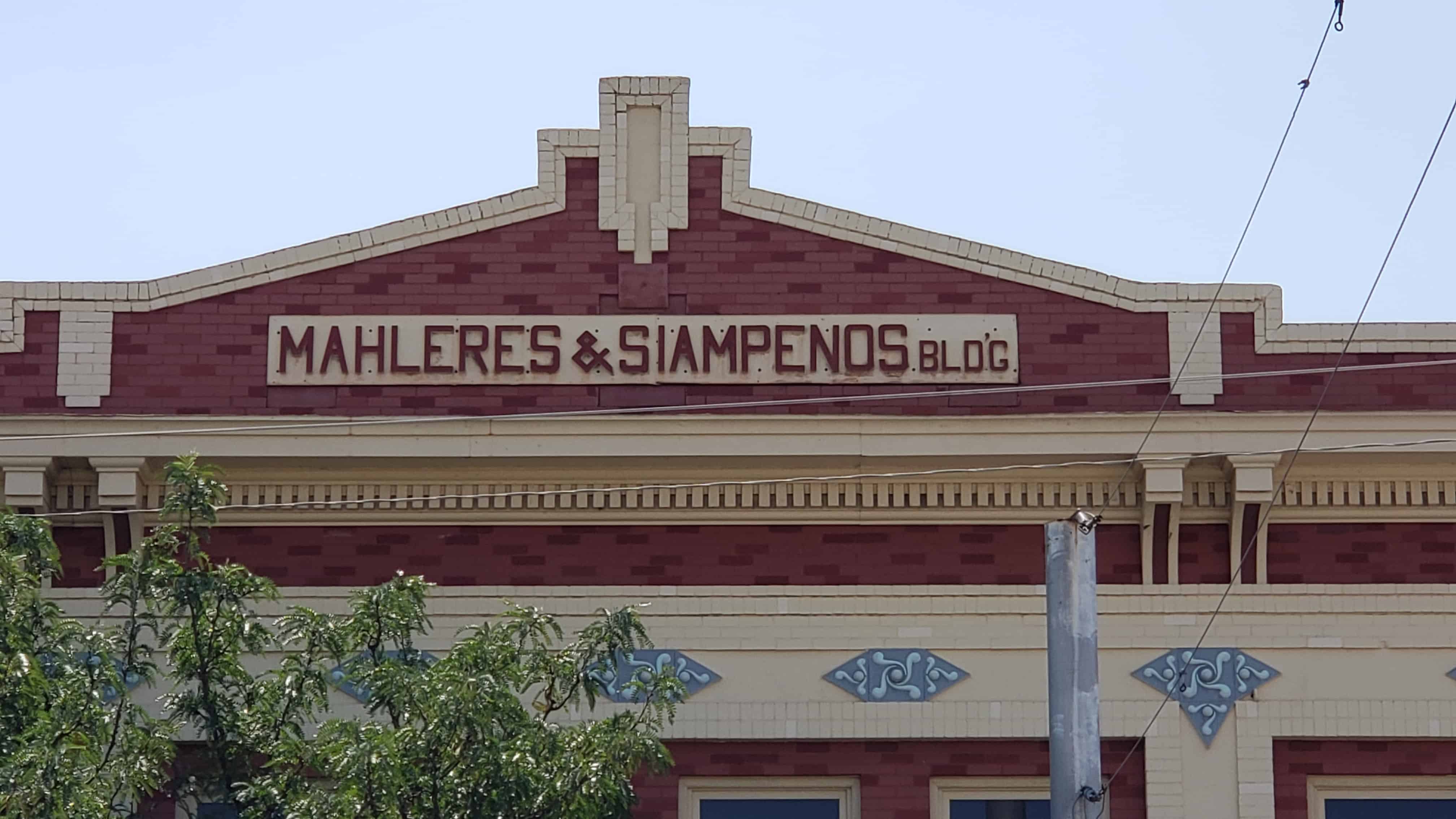
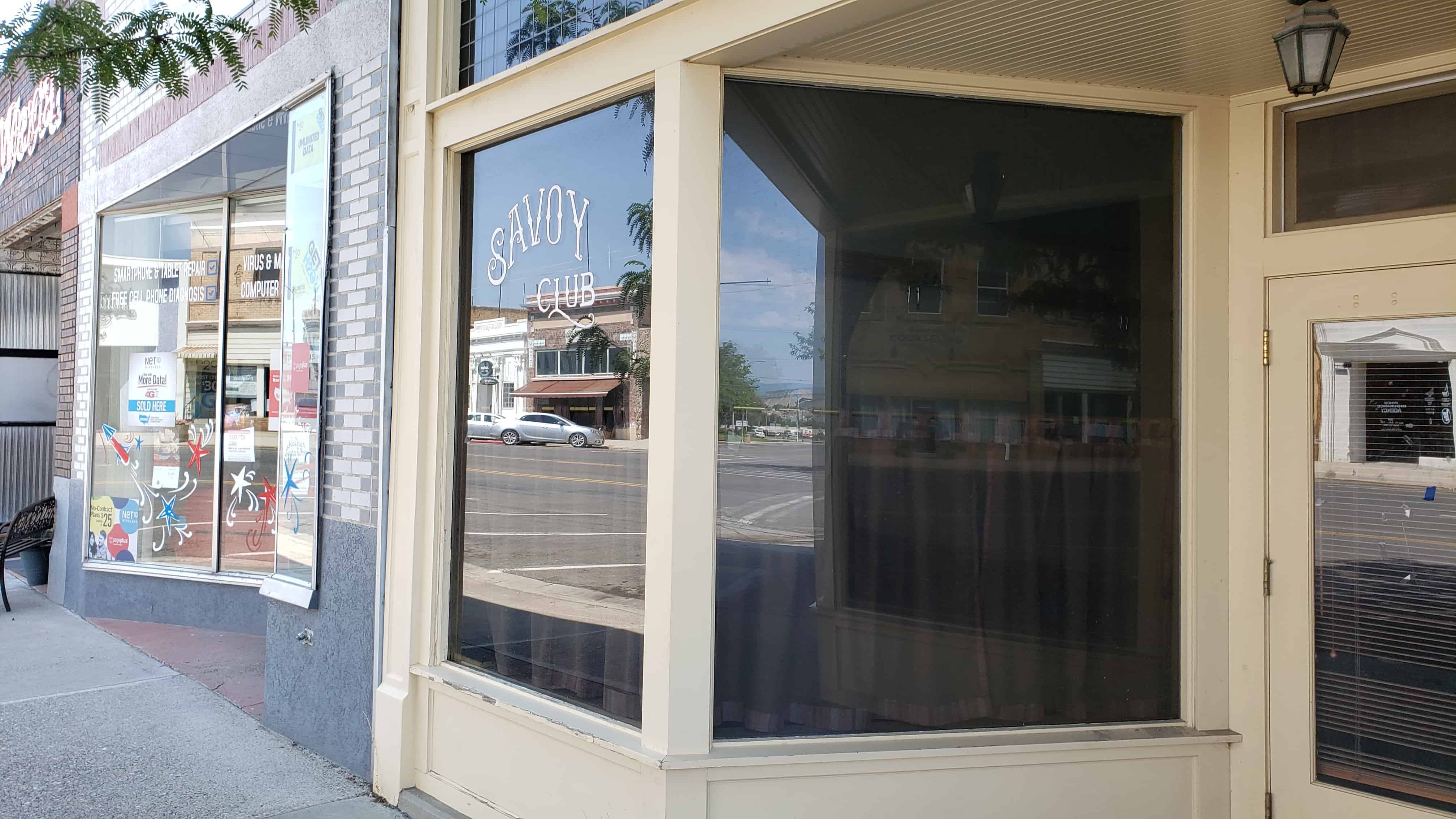
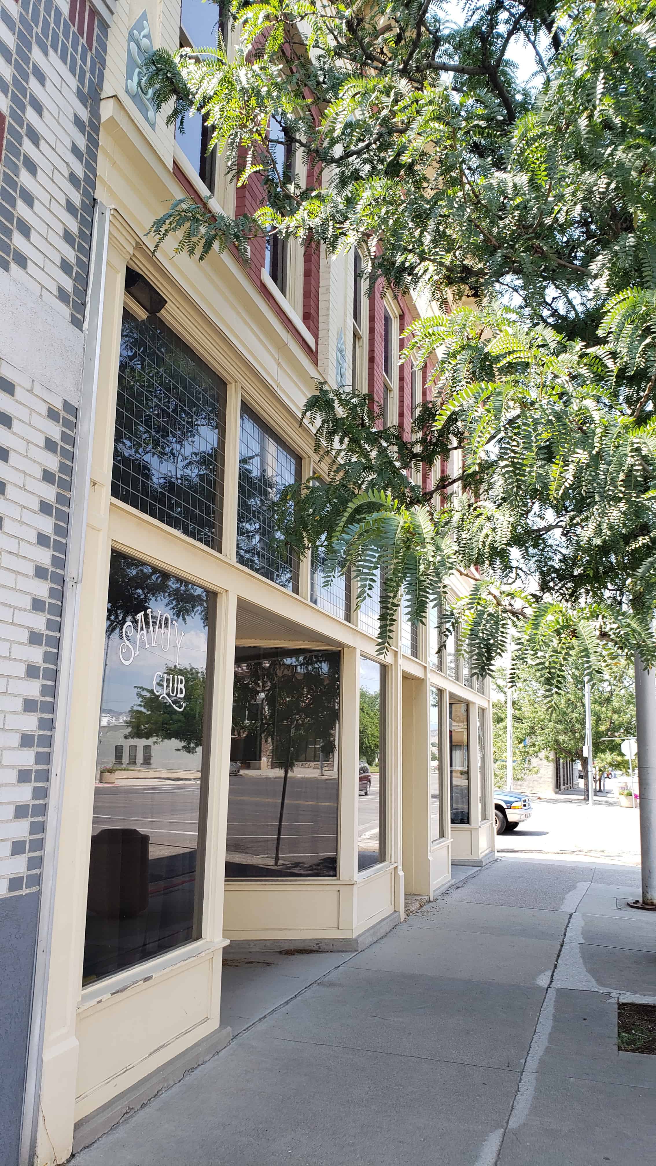
Parker & Weeter Block / Mahleres & Siampenos Building 87 West Main Street in Price, Utah
The Mahleres-Siampenos Building built in 1913 is locally significant as one of the oldest commercial buildings in Price still to retain most of its outstanding architectural features and traditional uses. It exemplifies much of the enduring commercial development that made Price the leading business center of eastern Utah, and remains an outstanding local example of twentieth century commercial architecture which combines elements of the Classical Revival style with the massing and decorative elements of the Prairie Style.
Listed on the National Register of Historic Places (#82004115), the text on this page is from the nomination form from when it was added.
The present Mahleres-Siampenos building was originally known as the Parker and Weeter Block when it was built in 1913. It was constructed on the site of the original Weeter Lumber Company yard, the first enterprise of its kind in Price. John C. Weeter owned both the land and the building, which he constructed in partnership with Frank L. Parker and James W. Loofbourow. Weeter Lumber Co. was also responsible for building many of Price’s other pre-World War I structures; the owners insured that their edifice would be among the finest in that city.
The building has passed through very few owners in its long existence, testifying to its viability as a commercial structure. During the first few years it was managed by Loofbourow, secretary of the J. C. Weeter Lumber Company and later mayor of Price (1924-25). Later, Frank L. Parker obtained sole ownership from his two partners. Parker’s widow, Mary, deeded the building to Harry Mahleres in 1938, who granted one-half interest to Sam Sampenos a year later. (Please note that Siampenos and Sampinos are variations on the same name; the spellings differ on the building and the deed.) Harry Mahleres had actually had an interest in the building before his purchase, investing $59.50 for improvements in 1921. After purchase by Mahleres and Sampinos, the name of the building was changed to that of its present owners, the heirs of the purchasers.
Harry Mahleres and Sam Sampinos were brothers-in-law, since Harry was married to Sam’s sister Ourania. They came from nearby villages in the mountains of central Greece, where sheepherding was a way of life. Upon arrival in America in the early 1900’s both men first worked at odd jobs and later went into the sheep business. Their success at breeding sheep enabled them to buy this building, as well as several other properties which they held in common(including their family home and a ranch out in Nine Mile Canyon where the sheep were sometimes pastured.) No doubt some of the Greek architectural features of this building, especially the ornamental façade, appealed to these Greek men who always retained a love of their native land.
From its construction, the Mahleres-Siampenos Building housed a variety of commercial interests, just as it does today. On the ground floor, the left-hand side has always been a bar. The initial manager was John Causer, who ran the Bank Club 66 bar at that location. Around 1920 the name was changed to Gilners, and the Miners Club formed part of the enterprise. In 1971 the Savoy Club began operation on the premises, where it remains. (This last bar was originally in the grand old Savoy Hotel, across the street to the west, one of Price’s finest landmarks. The hotel was torn down in the late sixties to create a parking lot, but its name is preserved in the business housed in the Mahleres-Siampenos Building.)
The right-hand side of the ground floor has usually been a restaurant. The earliest proprietors were Nick Rinette and Mr. Capitolo, who ran an Italian and French restaurant on the premises for many years. During the 1940’s the Bureau of Land Management office utilized this space, and beginning in the early 1950’s the Hi Spot Restaurant opened in this part of the building. The Hi Spot was first a confectionary, along the lines of the traditional Greek coffee-house, run by immigrant Greeks but catering to people of all nationalities. The first proprietor, Tom Anest, sold out in 1958 to John Sampinos, the nephew of Sam Sampinos and Harry Mahleres. He and his family made the Hi Spot into a restaurant and something of a Price institution. When John retired on May 30, 1980, the community expressed regret at his departure, which was prominently featured in the local newspaper, the Price Sun Advocate. The restaurant currently rests in the capable hands Andy and Reva Douros who maintain the tradition of an eating and meeting place in this building.
The upper floor of the structure was originally a rooming house, or hotel. The first managers are unknown, but the second were Mr. & Mrs. Ernest Sumner, who rented the entire upstairs as well as running a furniture store further east on Price’s Main Street. Around 1920 it became known as the Central Hotel, a name it bore until it closed c. 1960.
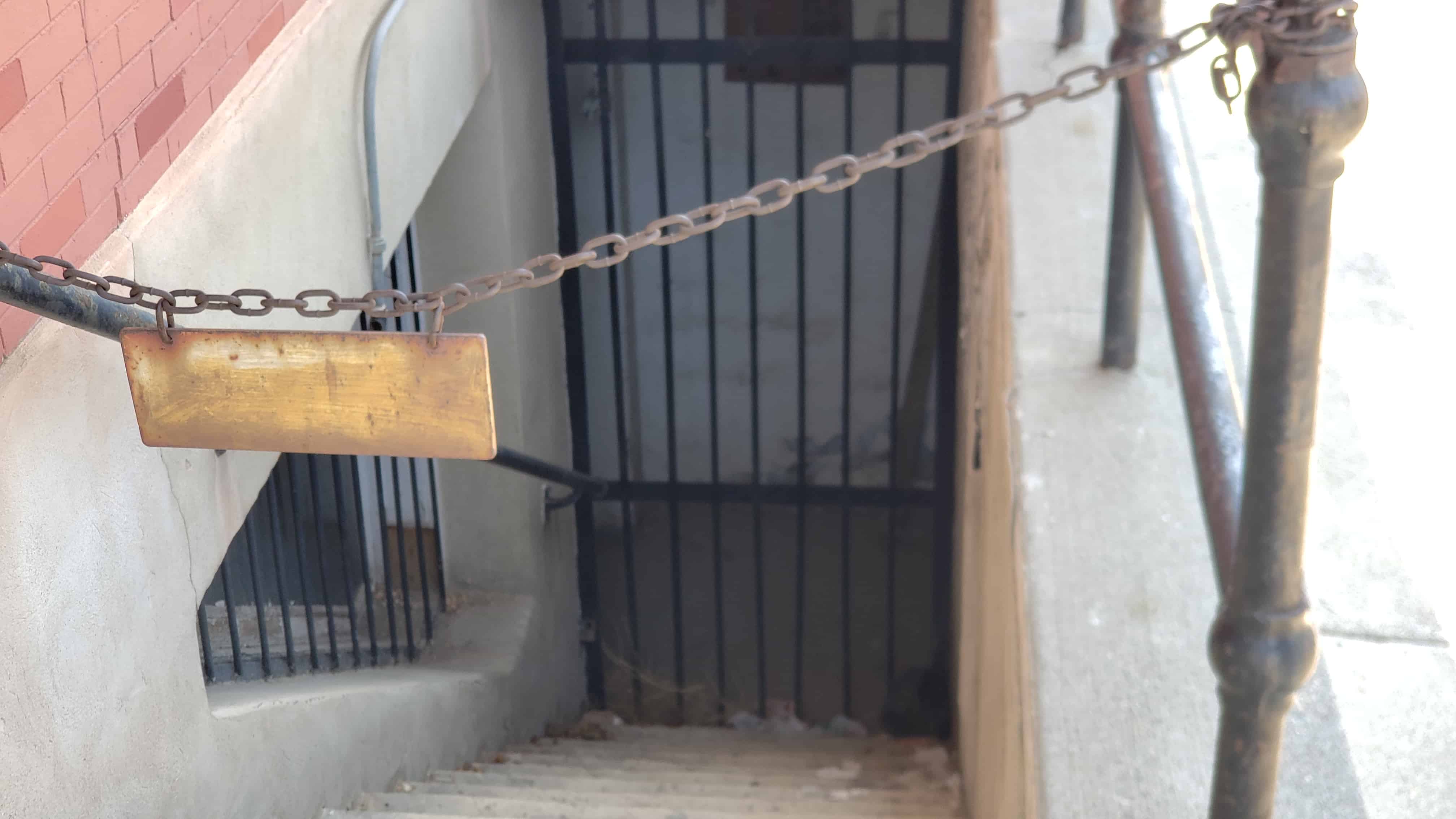
The basement of this structure also saw a variety of uses. At first it was utilized for meetings of various clubs: Rotarians, Kiwanas, the American Legion. On several occasions Rinette and Capitolo catered banquets for the clubs on these premises. At other times, dances were held there. During the sixties these functions ceased, and the basement remained unoccupied until 1977, when it housed Infinity Music record shop for a few months. The basement is once again vacant, although it had been remodeled to accommodate this last business.
In the future, the Mahleres-Siampenos Building will undoubtedly continue to house the type of business that it has consistently maintained since construction. The Savoy Club will remain; the Hi Spot is due for some interior remodeling to facilitate the operation of the restaurant. The owners have begun to give some thought to remodeling the upstairs hotel, which could then be reopened for use. There is no doubt that the building will be preserved and will continue to act an an amalgam of Price’s varied, enduring commercial enterprises.
The Mahleres-Siampenos building is a two story brick building, three bays wide and six bays deep with a flat roof. It has elements of the Prairie Style. Classical elements include the paired brackets and dentils at the cornice line. The Prairie Style influence is evident in the horizontality of the building emphasized by the bands of fenestration and accented cornice line. The central projection on the parapet, the geometric quality of the blocky massing of the building, and the geometric ornament are all characteristics common to Prairie Style design in commercial buildings.
The first floor of the façade was originally divided into two commercial spaces each with a recessed entry, which was separated by a recessed central door that offers access to the second floor. The same arrangement still exists except that there is no longer a recessed entrance to the shop on the south half of the building. The panel of windows that spanned the width of the building over the first floor establishments have since been filled in.
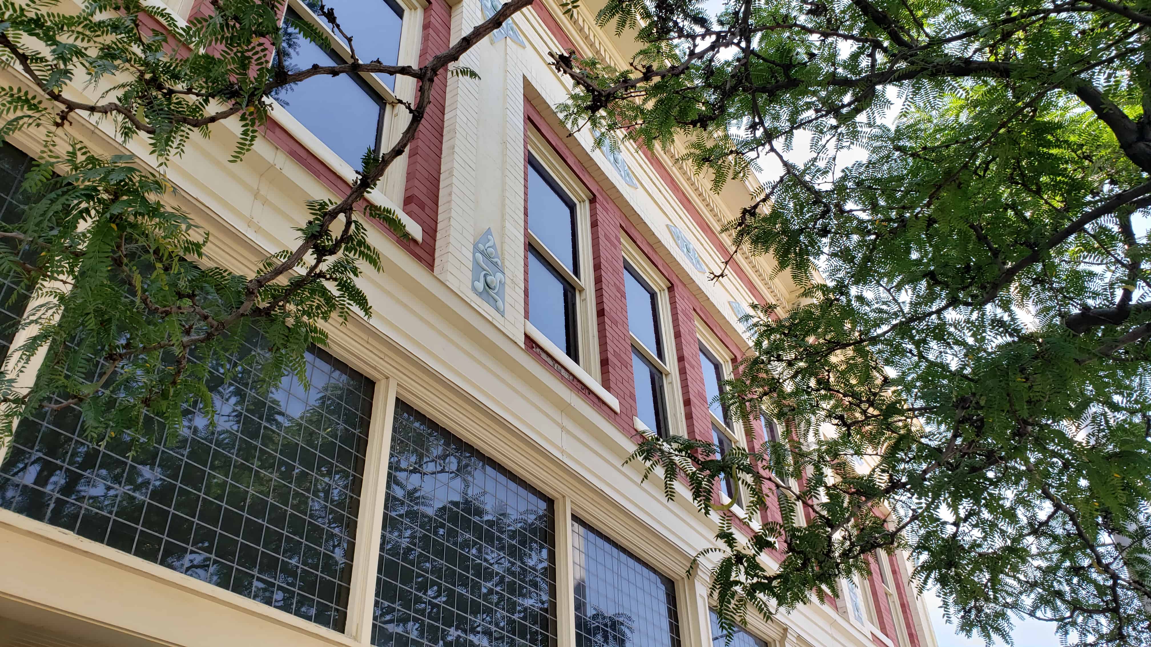
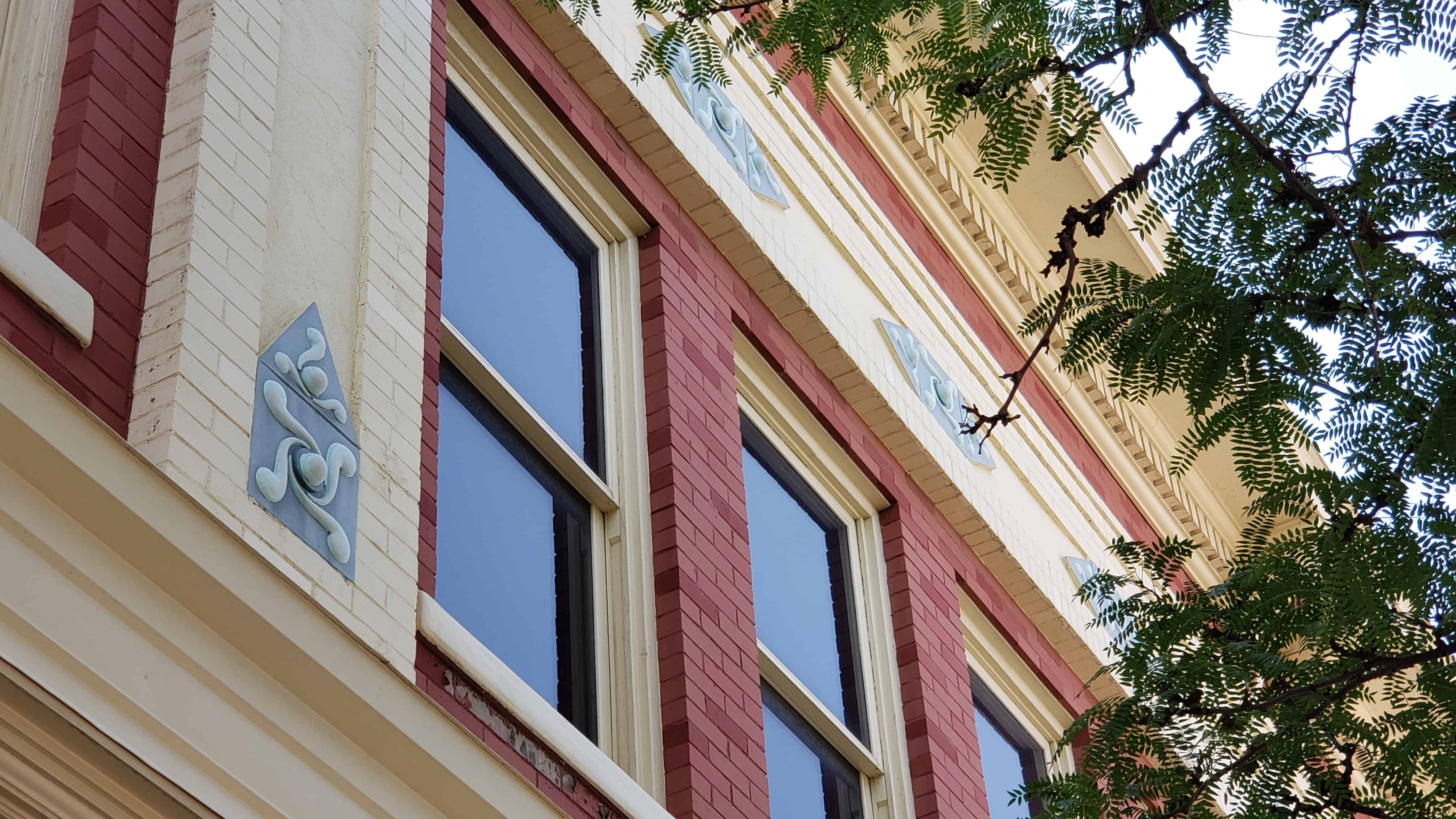
The windows on the second story are the double hung sash type. Across the façade they are grouped so that four windows are centered between two pairs of windows. Down the north side of the building there are two windows per bay. The windows are set into a darker brick and the bays are outlined and divided by bands of a light color brick. Within the panel above the windows and separating the bays, defined by the light color brick, are geometric decorative elements reminiscent of Prairie Style design. Above the second story windows is a projecting cornice supported by paired brackets and a line of dentils. The cornice is topped by a parapet which is outlined by a band of light colored brick and ornamented at the corners and at projecting points along the wall with a simple geometric ornament, also reminiscent of Prairie Style design.
The building has received few alterations. No changes are evident above the first floor, and on the first floor only the south half of the façade and the band of windows above the shops appear to have been changed. A hood over the basement steps has been removed. These changes, however, have not affected the original integrity of the building.
The Joseph Adams House is significant as one of the best remaining examples of the turn-of-the-century farm house in Utah’s Davis County. Located between the two large metropolitan areas of Salt Lake City and Ogden, Davis County became the garden spot of the Wasatch front as a considerable number of prosperous family farms were operated in the county; however, in the last few decades much of the farmland has been appropriated for housing subdivisions, schools, shopping centers, highways, and other urban structures. The Joseph Adams House and out buildings, located in a grove of trees and surrounded by pasture land, provides a glimpse of the by-gone rural-agricultural era of Davis County.
Located at 400 North Adamswood Road in Layton, Utah and added to the National Historic Register (#78002655) on February 17, 1978 (text on this page is mostly from that nomination form).
Joseph Samuel Adams was born at Quincy, Adams County, Illinois, September 19, 1841. Earlier his parents Elias and Malinda Railey Adams had joined the Church of Jesus Christ of Latter-day Saints and moved to Illinois to be with the main body of Mormons. Following the exodus from Illinois the Adams family moved to Mount Pisgah in May 1846 and remained there until 1850. In the spring of 1850 Elias Adams was released from his assignment at the Mount Pisgah way station and allowed to complete the journey to the Great Salt Lake Valley.
After their arrival in Salt Lake City, September 7, 1850, the Adams family immediately traveled north to the Kaysville settlement where Elias Adams claimed a parcel of land .approximately one by two miles.
Joseph Adams remained with his family in Kaysville until 1873 when he was called to serve as a colonizing missionary to northern Arizona. The mission proved a failure, and the group returned to Utah. However Joseph Adams left his mark in Arizona at House Rock Springs where his assessment of the mission, carved in stone, can still be read, “Joseph Adams from Kaysville to Arizona and busted June 4, A.D. 1873.”
Joseph returned to Kaysville and in February 1876 married Isabella “Belle” Smith. He purchased 80 acres of land from his father for 450 bushels of grain. In the spring of 1876 a large log house was constructed and several out buildings including the granary, cellar and wash house. The farm proved profitable and in 1889 Adams began construction of the present brick house. Brick for the house was made by Joseph Adams who had learned brick making from his father.
Joseph Adams died October 13, 1901. His wife “Belle” remained in the house until her death in 1944. Prior to that time his son Charles moved into the house and the property passed to him. Charles Adams died in 1966, and his wife, Minnie N. Adams, is the current owner. She has deeded the house and property to her son, Charles P. Adams, who has shown a strong commitment to the preservation of the house and property.
Of the original eighty-acre farm only six acres are included as the National Register property. The six acres include the following buildings: the house, constructed in 1889-1890; the wash house, constructed in 1876; the milk house, constructed c. 1900; the granary, buggy shed, and milking shed, constructed in 1876; and a garage, constructed c. 1920. Also on the property but not included in the nomination is a thresher shed constructed in 1959.
The Adams house is a good example of a basic “T” form, 2-story brick house (with a one-story shed addition), which uses Queen Anne style decorative elements without the variation in plan or massing characteristic of more elaborate Queen Anne buildings. The fine decorative detail, although limited to the front façade, makes for great visual interest. The first floor double two-over-two windows in the gable end framed by a brick arch, with a tracery pattern in the wood infill below the arch. The second floor windows above and the dormer window are set in raised brick corbelling. Both second story windows, one in the gable end and the dormer over the porch, are framed by raised corbelled brick.
The porch projects past the front of the house and is supported by six turned posts with bell and spindle fret work just below the porch roof line. The roof of the porch is broken by a projecting gable over the steps with a turned finial on the gable peak.
The wash house is approximately 10 feet by 14 feet. The log structure was constructed in 1876 for bathing and washing clothes.
The granary, located to the rear, southeast of the house, was constructed in 1876 and is built of wood on a stone foundation which comprises a cellar and is reached by an entry on the west side of the granary. The granary is reached by doors on the north.
Attached to the granary on the east is a buggy shed with three stalls which open to the north. Attached to the buggy shed to the east is the milking shed. It opens to the south. The milk house, a 4 foot by 6 foot wooden shed used to cool the milk is located approximately forty feet west of the granary.
The garage is located east of the house, approximately 120 feet and north of the granary approximately 60 feet. It is a wood frame structure.
The house and out buildings are surrounded by approximately four and a half acres of pasture land.
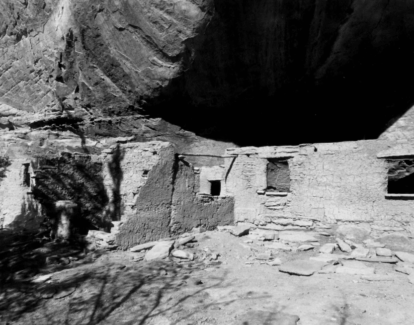
Cottonwood Canyon Cliff Dwelling (42Ka1504) was first recorded by Neil M. Judd in 1919 (see Judd 1926}. Judd did not excavate any of the site, although he did note some deterioration due to weather and cattle but the impact was- apparently small. Judd labelled this cliff dwelling “Cave 6,” one of more than twenty which he noted in Cottonwood, Indian and Farm Canyons. In October 1973, Michael Bunker of the Bureau of Land Management-Kanab recorded the site for the Kanab District Archeological site inventory, There have been no subsequent archeological activities at this site. However, during July 1966 Utah State University contracted with the BLM to stabilize portions of the site. Presently additional stabilization is being considered.
The BLM survey analyzed the cliff dwellings as being affiliated with the Virgin branch of the Anasazi culture area. The site is a Pueblo II-type and has been dated to A.D. 1100-1200. It is unknown at this time whether earlier components exist at the site, but excavations at another cliff dwelling in Cottonwood Canyon (42Ka1170; Judd 1926) did indicate Basketmaker occupation.
Ten to twelve structures were identified as probable living and storage structures by the BLM survey. (Judd had recorded nearly twenty structures.) This makes Cottonwood Canyon Cliff Dwelling the largest site in the drainage, and one of the largest in the Kanab vicinity. Cultural material observed by the BLM include: gray and corrugated ceramics; ashes, fire-cracked rocks and smoke-stained ceilings indicating hearths; and structure walls standing to a height of five feet. Other sites in Cottonwood Canyon have yielded cedar bark, corn stalks, a mountain goat-hair bag, stone slabs, sandals, digging sticks, basketry fragments, rabbit skin, corn kernals, beans and black-on-white ceramics. (Judd 1926)
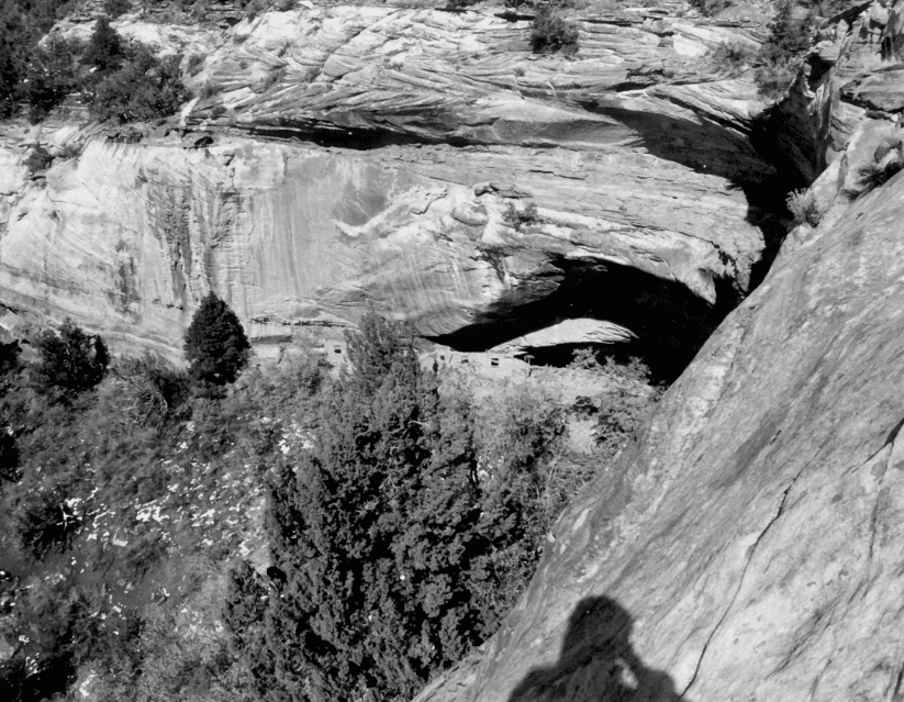
The cliff dwelling, is located under a semicircular overhang, 53 m long and 12 m deep, in the low enclosed sandstone cliff at the head of an unnamed eastern tributary of Cottonwood Canyon. The midden area which spills down the slope in front of the rock shelter is 530 m square. A spring flowed at the north end of the overhang at one point. Vegetation outside, the shelter currently consists of oak, cedar and pinion pine.
Intrusions at the site consist of pot holes adjacent to several structures. However, it is the opinion of the BLM survey that the majority of the site is undisturbed.
Although smaller cliff dwellings and other sites exist in the Cottonwood Canyons, the large size of 42Ka1504 makes it unique and significant in its own right. A “district” nomination of the entire Cottonwood drainage does not seem warranted at this time as no systematic survey of the area has been made. That should not detract from the integrity and importance of this site, alone. Unfortunately, although the Cottonwood Canyon Cliff Dwelling did not function in isolation and should not be considered so, insufficient data exists to nominate the canyon as a whole.
Taken by D.McFadden, June 1978Taken by D.McFadden, June 1978
The following are elements of the site’s significance:
Integrity – Where twenty or more rock shelters were noted by Judd in 1919, only 9 are officially recorded today. Some of these are not duplicates. Cottonwood Canyon Cliff Dwelling (42Ka1504) is one of the few listed in “good” condition. A comparison of photo- graphs from 1919 and 1978 indicates that little deterioration has occurred. The site’s condition, its proximity to Kanab and its accessibility would provide an excellent opportunity for public education. However, these same factors make it a prime candidate for looting.
Site – Most all other archeological structures in the Kanab vicinity are small storage units or rock art panels. This site combines both dwelling and storage units. According to present knowledge, there are. only two other sites similar to this one in the area. One is in a tributary to Johnson Canyon, which is approximately ten miles east of Kanab. The other is located on private ground a few miles farther up Cottonwood Canyon. This site, 42Kall40, completely excavated in 1919, contained only a few structures. Clearly, 42Ka1504 is unusually large. Even Judd (1926:114), a man well-acquainted with many Southwestern archeological sites, called it the “largest Cliff-dweller settlement visited by the writer during his archeological observations north of the Rio Colorado.”
Research Potential – Research questions would revolve around this problem of size. Because of its unique size, we would expect that Cottonwood Canyon Cliff Dwelling should exhibit unique intrasite spatial patterning indicative of a special political and social development. Additionally, there is the question of the specific culture history of the site itself. Should earlier component exist at this cliff dwelling as existed at other Cottonwood Canyon sites, then information concerning culture change could be recovered.
Cottonwood Canyon Cliff Dwelling would be a focal point in regional studies as it must have been a focal point in prehistoric regional activity. Its large size indicates that the site may have been an economic or political center for the Cottonwood canyons. What was the settlement pattern within the drainage? What was the relationship between this unusual site and other, more typical sites in the canyons? Answers to these questions could answer questions on settlement and organizational patterns in the Virgin Anasazi subarea as a whole.
There was a highway rest area at Tucker, it was demolished in 2010 and the Tie Fork Rest Area was built nearby, not much of Tucker remains other than the cemetery.
The Richards House was constructed in the early 1860 T s by Franklin D. Richards for his plural wife Rhoda H. Foss Richards. Franklin D. Richards married Rhoda after the death of Willard Richards, her first husband and Franklin D. Richard’s uncle.
Located at 386 North 100 East in Farmington, Utah and added to the National Historic Register (#77001303) on December 23, 1977.
Rhoda Foss Richards was born April 19, 1830, in Maine. She was baptized a member of the Church of Jesus Christ of Latter-day Saints in 1844 and in 1850 came to Utah with her mother, brother and sisters. The next year, November 30, 1851. she married Willard Richards, second counselor to President Brigham Young. One son, Calvin W. Richards, was born to Rhoda before Willard Richards died six weeks before his 50th birthday on March 11, 1854. One of several plural wives left by Willard Richards, Rhoda and other wives lived in Salt Lake City while several other wives lived in Farmington.
With no one directly responsible for the welfare of the Willard Richards family and the family facing acute financial problems, several wives wrote to Brigham Young seeking his advice. Following Young’s counsel, four of the wives, including Rhoda, married Franklin D. Richards on March 7, 1857. The marriage might have taken place earlier but Franklin D. Richards left for a proselyting mission to England two weeks after Willard’s death in March 1854 and did not return to Utah until October 1856.
Following the unsettled period caused by President James Buchanan’s sending a Federal Army to put down an alleged rebellion among the Mormons, Franklin D. Richards moved Rhoda to Farmington in 1858 where she occupied a log cabin until the three-room rock house was completed some time after the birth of twin boys, Ira and Exra, on July 27, 1860. Earlier another son, Hyrum, was born to Franklin and Rhoda on December 14, 1857. Later a daughter, Sarah Elizabeth, was born on October 31, 1862.
Rhoda lived in the Farmington home until her death in 1881. Although the official residence of Franklin D. Richards was Ogden, his journal notes frequent visits to Farmington to care for Rhoda and three other wives who lived in the community. An attractive lady of twenty-seven at the time of her marriage to Franklin, Rhoda seems to have been an understanding wife for whom Franklin had a great concern. A few days before her death, Franklin, upon her advice, reluctantly left to accompany other church authorities on a visit to the Southern part of Utah. In a biographical sketch of Rhoda Foss Richards, Mathias F. Cowley writes, “She was kind and lovable, yet firm for the right in everything whether of small or great importance. She and her family were very poor in this world’s goods, but rich in faith and the hopes of a glorious future. She was well educated but yet willing not only to be a school teacher but to milk a cow, feed chickens and attend to every essential work whether in the house or out of doors. She raised her family in the main with little help from her husband for his duties as a faithful apostle of the Lord called him away from home most of the time, and having a large family they had to struggle but it made them self reliant. . ..”
Franklin D. Richards was one of the most important intellectual leaders of the LDS church and Utah during the Nineteenth Century. Born April 2, 1821, in Richmond, Berkshire County, Massachusetts, he joined the Mormon Church in June 1838 and moved West first to Missouri and then Illinois. During the period from 1840 to 1845 he served several proselyting missions in the United States and in July 1846 he left for a two-year mission to England.
Arriving in Salt Lake City in October 1848 he was called as one of the Church’s twelve Apostles on February 12, 1849. In October 1849 he returned to England as President of the British Mission from January 1, 1851, until he left England for Utah in May 1852. Under his administration the Prepetual Emigration Fund, a system whereby emigrants could borrow from a fund to pay for their travel to Utah then return the money to the fund for the use of others, was established in England. A successful administrator and missionary, Franklin D. Richards served as President of the entire European Mission, which included the British, French, Scandinavian, Swiss, German, and Italian mission fields, from 1854 to 1856 and 1866 to 1868.
Following his return from the last mission he was asked to move to Ogden to be the presiding ecclesiastical authority in Weber County. In this capacity he represented Brigham Young at the ceremonies marking the completion of the Transcontinental Railroad on May 10, 1869.
During the polygamy crusade of the 1880 ! s he was described as the “visible head of the church.” While Church President John Taylor was forced into hiding because of the polygamy issue, Franklin D. Richards and his wives, “. . . conformed their mode of life to the requirements of the law.” Without harassment by Federal authorities, Franklin Richards, while in communication with his colleagues who were in hiding, was able to act in an official capacity for the church including presiding over the church general conferences from October 1884 to October 1887.
In 1884 Franklin D. Richards was assigned to assist the Church Historian, Wilford Woodruff, and in 1889, when Wilford Woodruff became President of the church, Franklin D. Richards was appointed Church Historian. As a:_ historian, Richards was devoted to objectivity and authenticity. “His administration was marked by an intense desire to secure the strictest accuracy possible, and to have all history subject to the most careful scrutiny that may be available.”
He assisted Hubert Howe Bancroft in his preparation of his History of Utah which was completed in 1885 but not published until 1889. He participated in the founding of the Utah Genealogical Society in November 1894 and served as its first president. Recognizing that Utah’s History extended beyond the bounds of “Mormon History,” he also participated in the founding of the Utah Historical Society in 1897 and served as its president until his death on December 9, 1899. His Presidential address of 1898, given less than three weeks after his appointment as president, sought to define areas of possible research into Utah’s varied past. He noted the areas of agriculture, irrigation, manufacturing, mining, architecture, transportation, communication, colonization, education, Mormon and non-Mormon religious institutions, literature, fine arts, invention, social customs, manners and morals, politics, and woman’s suffrage. Regarding architecture he noted, “The evolution of architecture, as exhibited in the advancement from primitive log cabin to the stately mansion, and from the plain adobe structure with its small openings and little sashes, to the imposing edifices, public and private, erected and beautified with sandstone, granite, marble, onyx and other costly materials, obtained within our borders, must not be forgotten.”
He concluded the address with an optimistic outlook for the newborn organization’s future, “I regard the organization of this society as the foundation for a superstructure which will be continuously added upon, as the years pass by, until an edifice will appear which will command the admiration of successive generations, which will be invaluable to our mountain State, which will rank among the foremost institutions of the kind in our beloved country, and which will aid materially in the education of our people and advance the welfare of mankind.”
Following the death of Rhoda Foss Richards in 1881 the house remained in her family’s possession, and in 1890 Ezra Richards brought his new bride, Amanda Reeder, to the Farmington home. A farmer by occupation, Ezra also served a mission to New Zealand from 1885 to 1888 where he directed the translation of the Book of Mormon into the Maori language. Later from 1896 to 1898 he served as President of the New Zealand Mission. He added a fourth room to the three-room house in 1904.
Ezra Richards died February 1, 1930. However, his wife Amanda lived in the house until her death on March 4,1962. The house is currently owned by Clara Richards, a daughter of Ezra and Amanda Richards and granddaughters of Franklin D. Richards.
The Richards house is significant as one of the early rock houses constructed in Farmington. Since the Franklin D. Richards residence in Ogden has been destroyed, the Farmington House is perhaps the best tangible reminder of the life of this early church leader and historian. The relationship which developed between Rhoda Richards and her first husband’s nephew is an example of the workings of polygamy among Nineteenth Century Mormons.
The original portion of the Franklin D. Richards House is a one-story, three room stone structure with a T-shaped plan. The stone used in the building is a hard, igneous stone gathered from nearby fields and riverbeds. The walls of multicolored stone are laid up in random rubble fashion. Basically vernacular in character, the Richards’ House is trimmed with a plain cornice and frieze and flat lintels and sills, all of plain, unmoulded wood. The window and door bays are square. The windows are 6/6 double-hung sash with simple beveled muntins.
The front porch, a hipped roof canopy which extends across the full length of the western side of the trunk of the T appears on early photographs with round wooden columns and brackets. It is likely that this porch, along with a one-story, frame, hipped wing along the eastern and southern sides of the trunk of the T, were added after 1890. The posts and brackets remain on the later porch, but the frame siding has been covered with newer sheathing. Fortunately, these exterior alterations are on the backside of the house and are not visible from the front view.
Inside, the original rooms retain their original dimensions, trim and spacial arrangements. One fireplace of c. 1890 vintage is also extant. The house has been carefully maintained so that the original design and fabric contribute to our knowledge of pioneer vernacular craftsmanship.