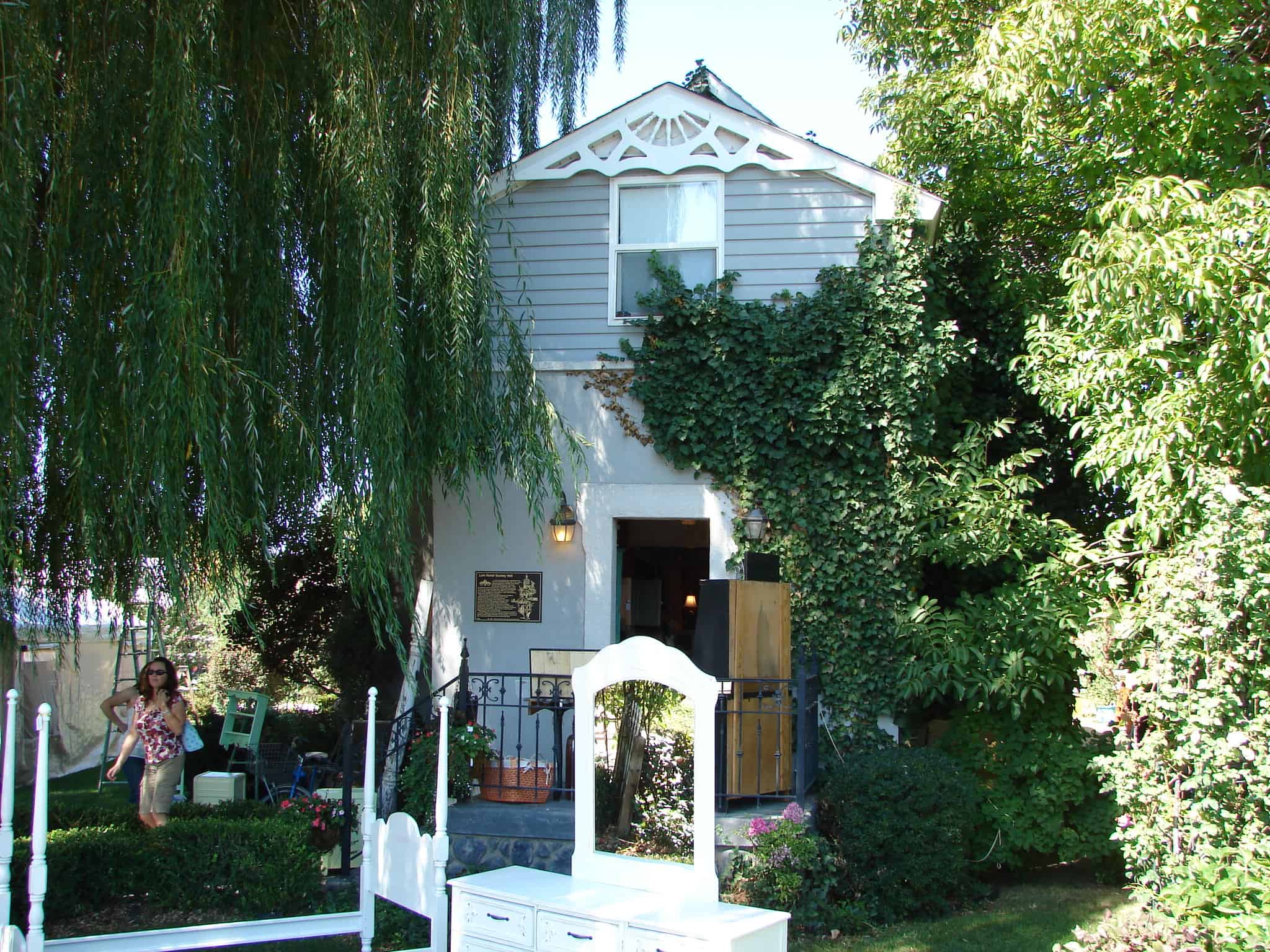
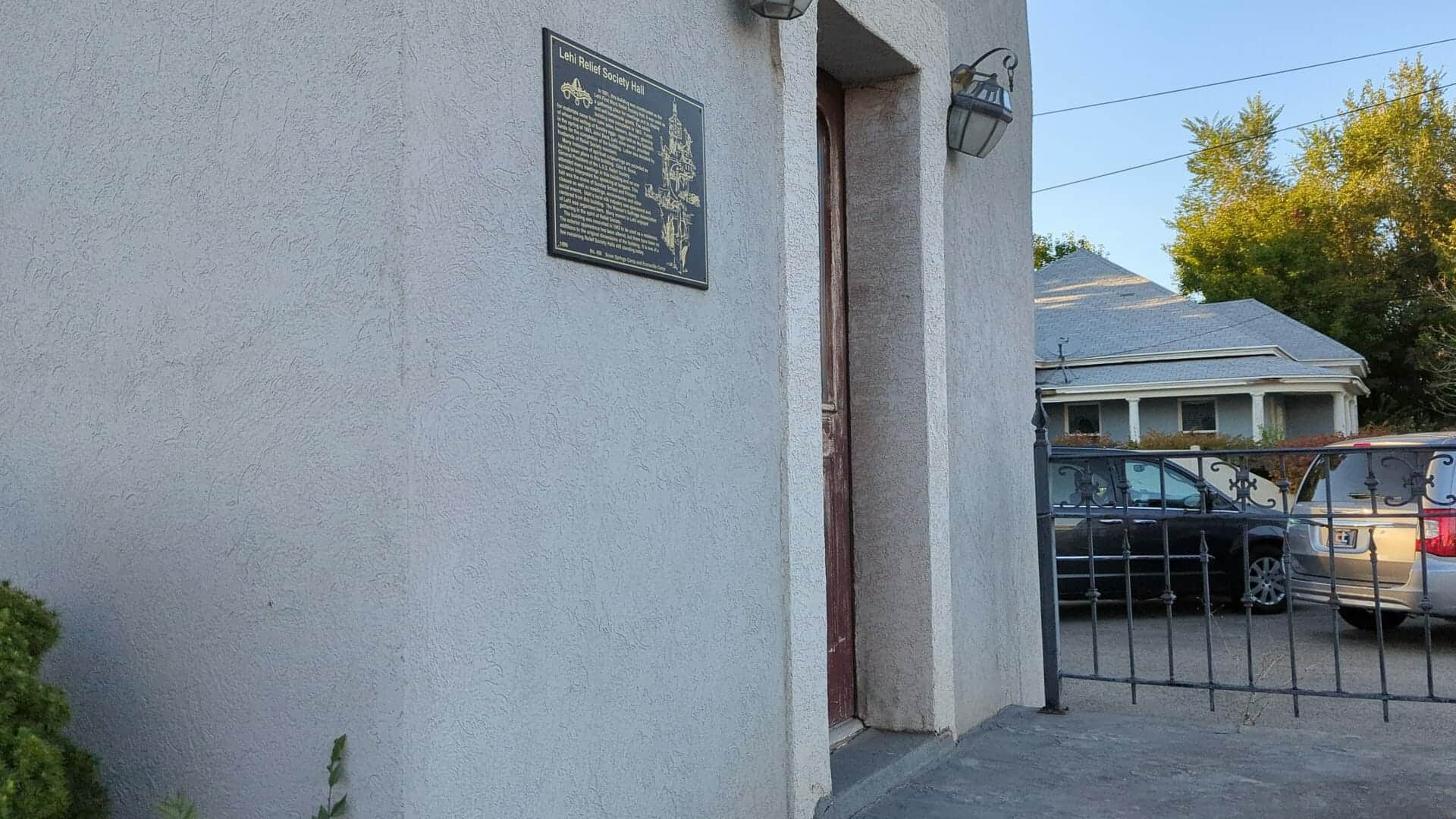
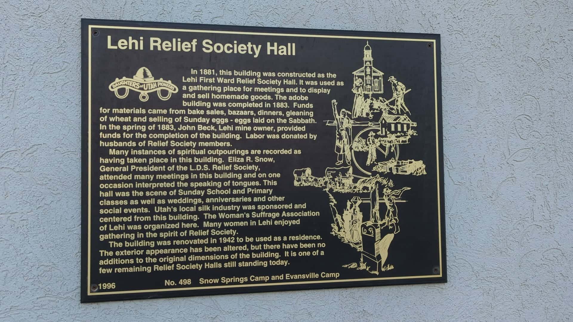
In 1881, this building was constructed as the Lehi First Ward Relief Society Hall. It was used as a gathering place for meetings and to display and sell homemade goods. The adobe building was completed in 1883. Funds for materials came from bake sales, bazaars, dinners, gleaning of wheat and selling of Sunday eggs – eggs laid on the Sabbath. In the spring of 1883, John Beck, Lehi mine owner, provided funds for the completion of the building. Labor was donated by husbands of Relief Society members.
Many instances of spiritual outpourings are recorded as having taken place in this building. Eliza R. Snow, General President of the L.D.S. Relief Society, attended many meetings in this building and on one occasion interpreted the speaking of tongues. This hall was the scene of Sunday School and Primary classes as well as weddings, anniversaries and other social events. Utah’s local silk industry was sponsored and centered from this building. The Women’s Suffrage Association of Lehi was organized here. Many women in Lehi enjoyed gathering in the spirit of Relief Society.
The building was renovated in 1942 to be used as a residence. The exterior appearance has been altered, but there have been no additions to the original dimensions of the building. It is one of a few remaining Relief Society Halls still standing today.
This is Daughters of Utah Pioneers historic marker #498 located at 212 West Main Street in Lehi, Utah
President Brigham Young, in 1876, gave the Relief Society sisters an assignment to store wheat for a time of need. This historic, oolite limestone building was constructed as a granary in response to this concept. Pioneer women and children followed the threshers to glean wheat leavings. They sold handmade items and Sunday eggs – eggs laid on Sunday – to purchase wheat to fill the bins. Wheat was given to the bishop for the needy, and grain was given to farmers for seed with a repayment of five bushels for each four bushels given.
Relief Society Wheat and flour were contributed to San Francisco after the earthquake in 1906 and to China during the famine in 1907.
In 1915, the granary was converted to a flour mill that functioned for forty years. In 1969, the granary and adjoining cooperative store were threatened with demolition but were preserved through valiant community efforts. The granary interior was completely reconstructed into The Central Utah Art Center in 1990.
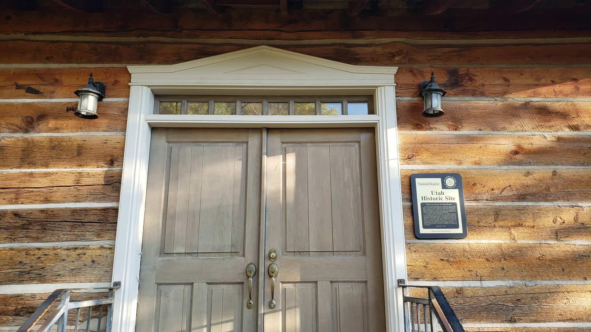
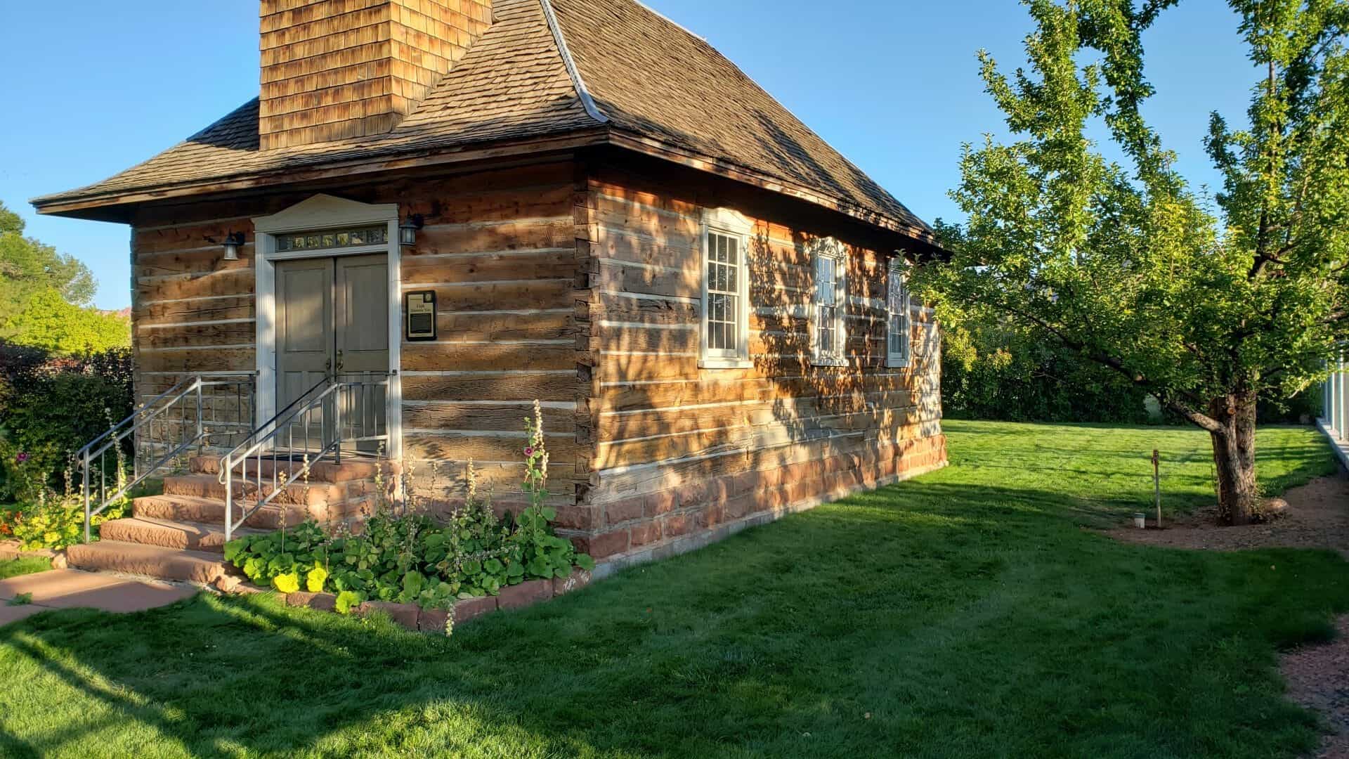
On September 18, 1898, construction began on the Torrey log church, later used also as a school. Local settlers furnished labor, cash, and materials for this unique log structure with its steep hip roof, flared eaves, square bell tower on the entry side, and a pink sandstone foundation. On December 19, 1898, school opened in this 21 X 37 foot, one-room building for students of Torrey and the surrounding ranches. This multi-purpose building was used for dances and other activities, including civic, social, and religious meetings until two, red sandstone buildings were constructed, one for a school and one for a church. However, use of this original log building continued both by the LDS Church and the community until the 1970s.
In the fall of 1990, the Church deeded the old, log building to the local Daughters of Utah Pioneers, Camp Radiare, with the provision that it was to be moved from Church property. Since that date, the building has received major restoration and renovation. This one-of-a-kind structure will continue to be used for religious, civic, and educational functions.
This is Daughters of Utah Pioneers historic marker #494, placed in 1996 and located at 59 East Main Street in Torrey, Utah.
Torrey Log Church and Schoolhouse
The Torrey Log Church/Schoolhouse, completed in 1898, is locally significant as the first church building and the first school building in the pioneer community of Torrey, settled in the 1890s. After a new multi-use building with classrooms was built in 1917 and a new meetinghouse was constructed in 1928, the Torrey Log Church/Schoolhouse continued to be used for various religious and social functions until the 1970s.
The building is architecturally significant as one of approximately one dozen remaining Church of Jesus Christ of Latter-day Saints meetinghouses built within the initial settlement phase. It is the only known example of a log meetinghouse still standing in the state. The building is made of sawn logs joined at the corners with carefully executed half-dovetailed notching. The building was relocated approximately 100 yards to the west to make room for the expansion of the neighboring 1928 sandstone meetinghouse. The Daughters of the Utah Pioneers have restored the building and are using it as a place to hold local meetings, continuing its traditional use for religious and social functions.
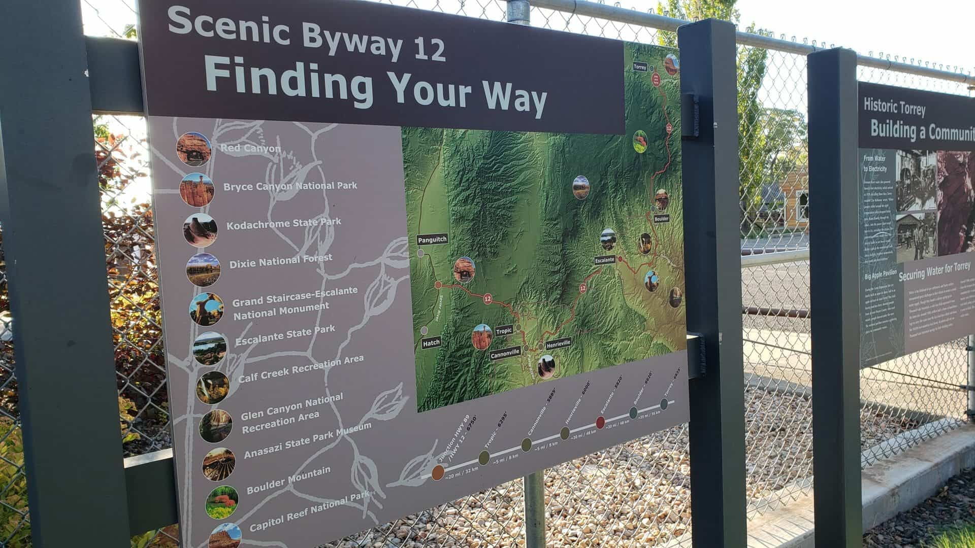
Building a Community Historic Torrey
From Water to Electricity Fremont River water also powered Torrey’s first electricity, which arrived in 1929. Recalling those days, Torrey resident Clay Robinson wrote, “When January rolled around the night temperatures often dropped below zero. Water flowing through the canal… into the power plant would turn to ice, curtailing the stream. The generating turbine would slow. The electric bulbs in our house would flicker. Light in the room would fade into a twilight, brighten momentarily, then zoom into total darkness.”
Big Apple Pavilion During the Great Depression, the Lee family built an open air dance hall in an apple orchard on Main Street. They held boxing matches there, drawing people from all over Wayne County. After each match, people danced under the stars. The restored pavilion remains a gathering place for community events.
Securing Water for Torrey Water is the lifeblood of any settlement, and Torrey settlers encountered great challenges in their efforts to secure a steady water supply. Though they found a culinary spring up on Thousand Lake Mountain, a wide lava field separated it from the town site. Around 1900, settlers built a flume of hand-hewn logs to carry the water over the lava bed into a ditch and down the 10,000-foot mountain into Torrey. Residents still rely on Thousand Lake Mountain springs for their drinking water.
Around 1900, settlers also began digging a canal to divert water from the Fremont River for irrigation. Fifteen years later, they completed the 11-mile canal. Robert Peden, a Scottish stone mason, cut a 500-foot section of the ditch through a solid rock shelf, using a pick-ax and mule, a project that took him 6 years to finish. This same canal provides Torrey’s irrigation water today.
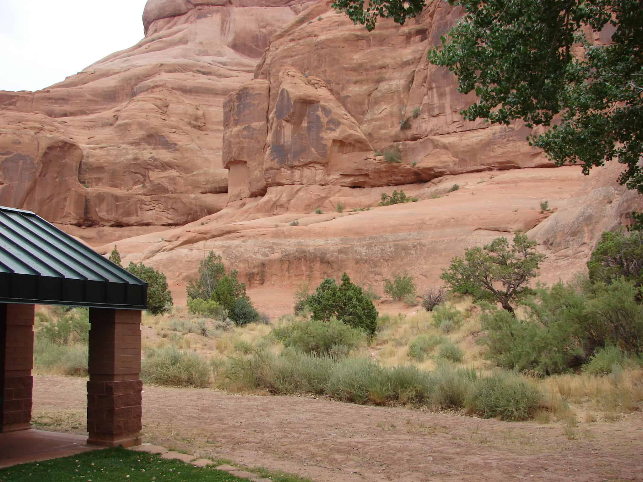
Kane Springs, San Juan County, was a major water stop along the historic Spanish Trail, in use from 1829 to 1848. Large trade caravans halted here and drank from the abundant spring waters. In autumn months, pack trains carried woolen textiles and raw wool over the trail from the settlements on the upper Rio Grande to the coastal towns of California. On reaching California, wool merchants exchanged their goods for horses and mules, which were driven back to New Mexico the following spring. It took trail riders over two months to complete the journey.
The 1,120-mile route, from Santa Fe, New Mexico, to Los Angeles, California, followed a northward looping course that passed through the rugged southern and central landscapes of Utah. This trail avoided the deep canyons of the Colorado River and the hostile Indians of Arizona.
In 1848, at the end of the Mexican war, the territory encompassing the Spanish Trail became part of the United States. Thereafter, caravan traffic followed direct east-west lines. In the post-trail period, the waters of Kane Springs refreshed weary travelers, cattle drovers, pioneer settlers, and outlaws.
Daughters of Utah Pioneers historic marker #487, located at the Kane Springs Rest Area on Highway 191 in Grand County, Utah.
Miles Morris Goodyear built this cabin on the lower Weber River as a way station and trading post. The cabin, along with other buildings became Fort Buenaventura meaning good venture. It was the first permanent settlement in the Utah Territory. Miles Goodyear (1817-1849) had traveled as far as Fort Hall in 1836 with Dr. Marcus Whitman’s party of Methodist Missionaries. Goodyear was a trapper, prospector and trader. His Indian wife Pomona was the daughter of Ute chief Peet-teet-neet. The couple had two children, William Miles and Mary Eliza.
Mormon Battalion Captain James Brown and Mary Black Brown bought Fort Buenaventura and all of Weber County for $1,950 in gold. Mary Brown made the cabin home for her family and made 1,000 pounds of cheese during the first year.
The Browns sold the cabin to Amos P. and Minerva Leontine Jones Stone. The Stone family lived in the cabin for a time, eventually using it as a blacksmith shop. A daughter, Minerva Pease Stone Shaw, in 1926 presented the cabin to Weber County Daughters of Utah Pioneers for preservation. It has been moved seven times, ultimately being placed at this site. In 1994 it was disassembled for preservation of the logs and reassembled in 1995 at this location to benefit posterity.
This page is for the D.U.P. Historic Marker about the Ephraim Pioneer Cemetery, for the page about the cemetery itself visit this page.
In 1854, Ephraim‘s first settlers erected a one and one half acre fort for housing and protection against Indian attacks. A cemetery was not included in their plans. The first pioneer to die was Mr. Manwaring. Permission had been granted to use Allred Settlement’s (Spring City’s) cemetery, and the funeral party was en route to that site when a warning came of a threatened Indian attack. Instructions were given to dig a grave, bury the body, and return to Fort Ephraim. This burial took place about two miles north of Ephraim and is the present site of Ephraim Pioneer Cemetery. It was used almost exclusively until May 1905. Mr. Manwaring’s grave site is unknown as are other burials recorded in journals but not on grave markers.
Numerous markers bear names of young children, as various diseases and malnutrition took a terrible toll in those early years. Ornate oolite, granite, and simple wooden markers dot the cemetery, most engraved with loving words, poetry, and decorative emblems. A striking granite marker designates the burial site of seven pioneers who were massacred by Indians in 1865. Seven Ephraimites, who drowned in Funks’ Lake in 1878, are buried nearby.
For many years, the cemetery had an unkempt appearance until 1990 when the present transformation occurred under the direction of the Ephraim Pioneer Cemetery Committee.
Check out all of the historic markers placed by the Daughters of Utah Pioneers at JacobBarlow.com/dup
The Knudsen Cabin, built by Porter Squires for Wilhelm and Laura Amelia C. Knudsen. In 1855 was one of the first permanent structures in Brigham City. Located on the corner of First East and First South, the original cabin was 14 feet x 16 feet. It had a lot running the full length of the inside walls and was entered by means of a small square outside door just below the gables. Six of their thirteen children were born in the cabin during the years from 1856-1865.
The Cabin was moved to Rees Pioneer Park in 1929 where it could be preserved as a typical pioneer dwelling. The move cost $15.00. Charles Squires, son of the original builder, was hired to do some restoration work for $221.00. It was dedicated September 8, 1929.
In 1993 Box Elder South Company Daughters of Utah Pioneers made arrangements to lease enough land to form a yard around the cabin permitting removal of the 1948 cover which had largely obscured it from view. Renovation and restoration followed including installation of a clay floor, cedar roof and half-loft; and planting of old fashioned flowers in the yard and furnishing the cabin with pioneer originals and replicas – all combining to create more fully the atmosphere of a 1855 pioneer home. Bronze plaque on chimney of cabin: Pioneer Cabin built by Porter Squires 1855 for Wm. Knudsen moved to this location 1929 by Box Elder County Daughters of Utah Pioneers.
The oldest Mormon settlement in the Blue Mountain Region was first known as South Montezuma. Later the name was changed to Verdure after the lush green growth along the stream bed. Verdure was settled by men of the Blue Mountain Mission March 11, 1887, under the direction of Pres. Francis A. Hammond of the San Juan Stake. He called George A. Adams, Frederick I. Jones, Parley R. Butt and Charles E. Walton to establish a new settlement at North Montezuma, later named Monticello. They first set up camp at Verdure to prepare for a permanent settlement at Monticello, six miles to the north.
When company members moved on to Monticello in 1888 the Adams and Butt families remained at Verdure. By 1894 they were joined by the Alvin Decker, Willard Butt, Lingo Christensen, R.P. Hott and Francis Nielson families. Nielson operated a store and a school out of his log home, the first church met in the Decker home, and in 1893 a post office was installed in the Adams home.
Verdure was a peaceful frontier village where cattle, farming and cheese-making were the main occupations. Gradually the settlers moved to Monticello.
Check out all of the historic markers placed by the Daughters of Utah Pioneers at JacobBarlow.com/dup
SCHOOLHOUSE – The second schoolhouse in Enoch was a two-story structure built on this site in 1917-1918. It was a brick building containing two classrooms, two libraries, two bathrooms and a furnace room. Only one room served as a classroom, and one was sometimes used as a playroom during the winter. Between twenty and thirty students a year attended this school in grades one through six. The building was used until Iron County bussed the students from Enoch to Cedar City. It was torn down some years later.
TITHING OFFICE – On the site across the street and one-half block to the west are the remains of the Bishop’s storehouse and tithing office. The wooden building, 20 feet by 17 feet 9 inches, had a tall peaked roof, an outside staircase, and looked like an ordinary granary. It contained bins both in the basement and on the main floor. These bins were used to store grain, potatoes and other crops that were brought in as tithing payments. Tithing produce was used to help those in need. Sometimes seed, such as wheat, was loaned to the farmers at planting time to be paid back after the harvest.
Check out all of the historic markers placed by the Daughters of Utah Pioneers at JacobBarlow.com/dup
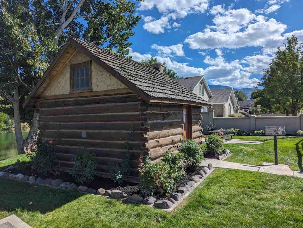
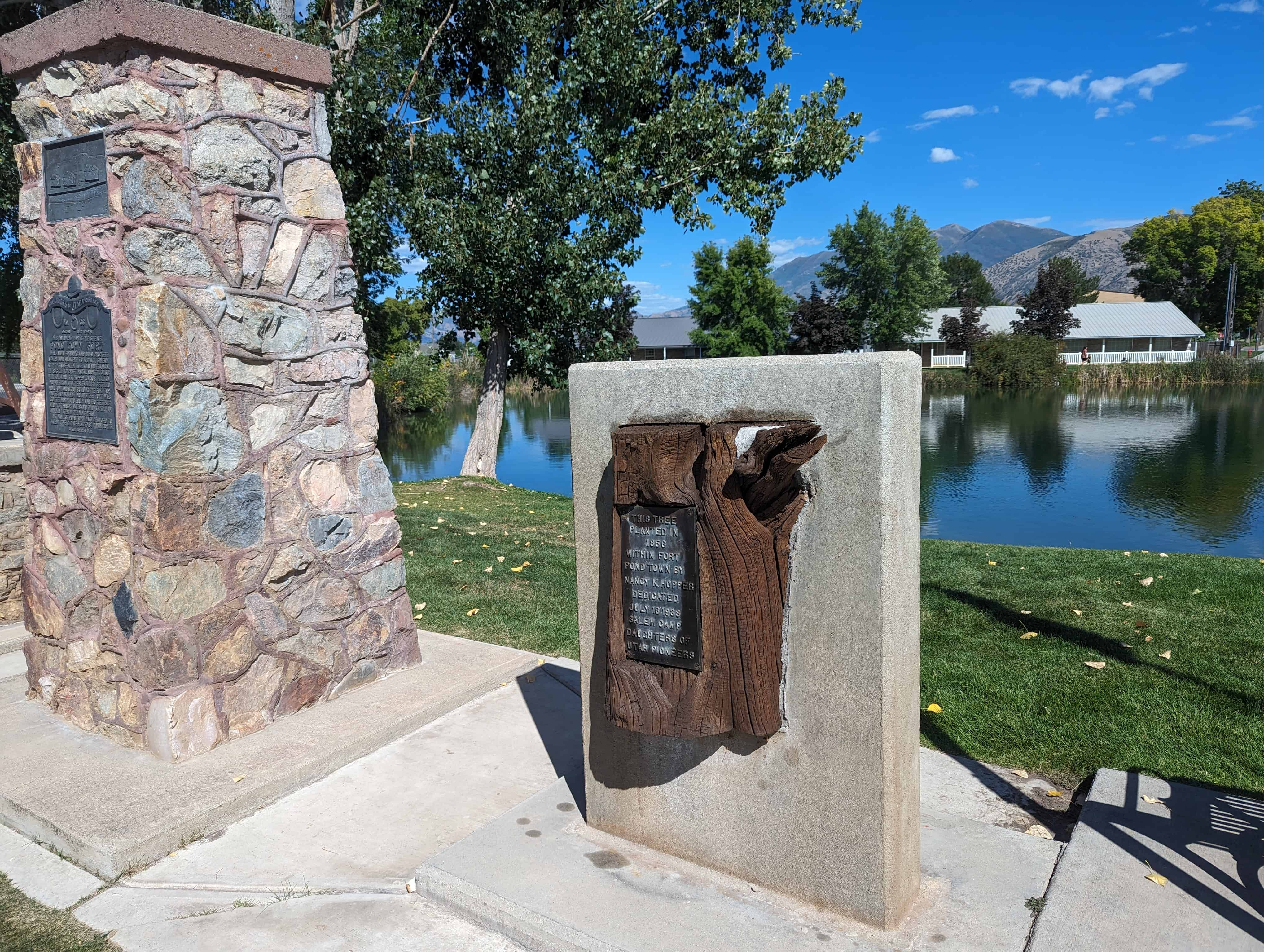
This log cabin was used as the first Post Office in Salem. It was built on the east bank of the Salem Pond by George Killiam, who served as postmaster from March 1, 1872 to 1877. Harry Nelson then purchased the cabin, moved it to the southeast part of Salem, and used if for a summer home. It was later sold to Chris Nelson, his brother, whose children played there until 1937, when it was purchased by the Daughters of Utah Pioneers. The cabin was next moved to a location northwest of the chapel of The Church of Jesus Christ of Latter-day Saints. On March 19, 1972, the cabin was moved to the southwest corner of the church lot when a new LDS Chapel was built. It has now been moved to the west bank of the Salem Pond at 13 South 300 West, renovated and furnished with pioneer artifacts.
The text above is from Daughters of Utah Pioneers historic marker #479, located at Salem Pond at 99 South 300 West in Salem, Utah