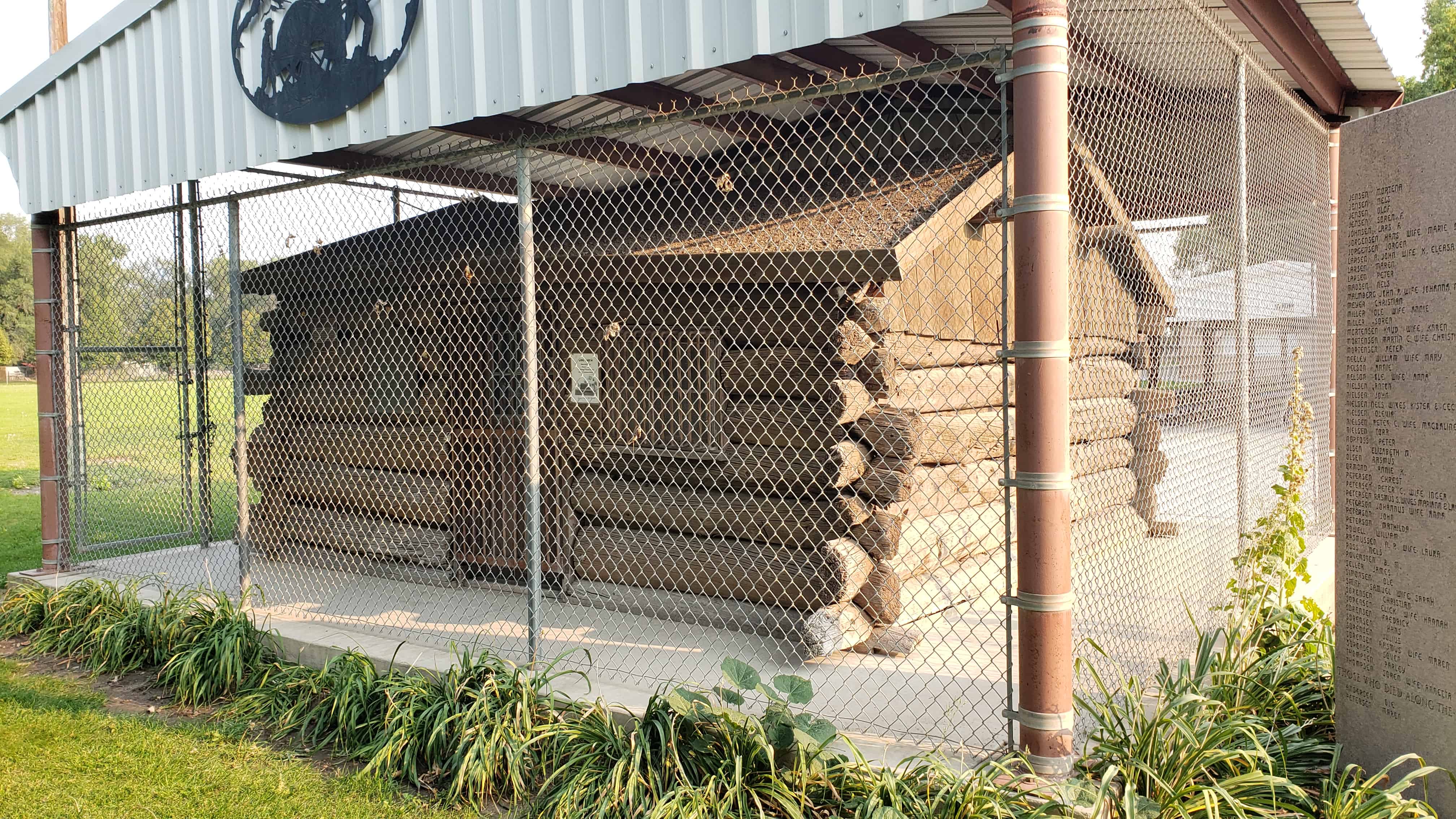
In 1866, a group of Mormon Scandinavians were called by the Latter-day Saints Church to establish this settlement and develop an irrigation project from the waters of the Malad River. Their first homes were dug-outs built in the west bank of the Bear River north of the steel bridge, which now spans the river. In the fall of 1867, they built homes in a fort for protection from the Indians. This cabin was built there by Lars C. Christensen and his wife, Christiane, handcart pioneers of 1859.
This is DUP Marker #99 located at Bear River City Park at 4549 West 5900 North in Bear River City, Utah
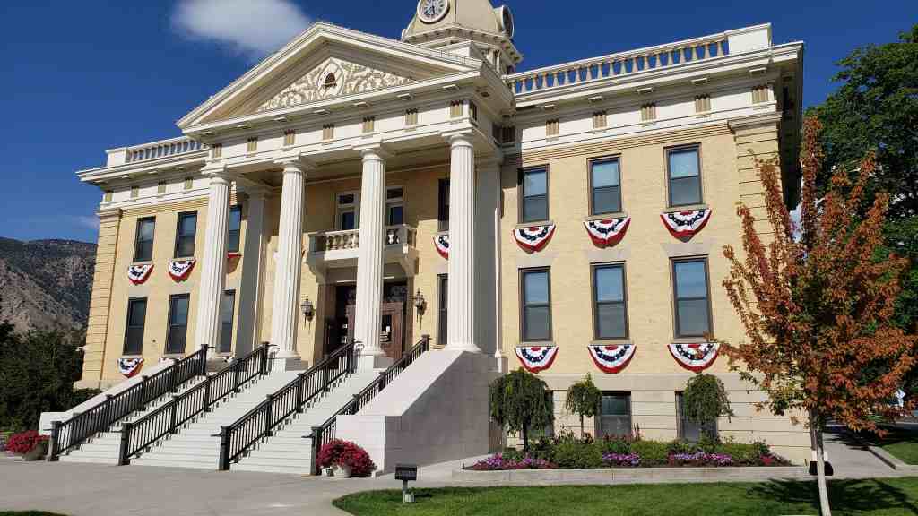
Constructed in 1857 and greatly enlarged in 1910, the Box Elder County Courthouse is historically significant as the center of government in Box Elder County for over 130 years. The building has housed virtually all departments of the county government, including the court and judge’s chambers, commission chambers, offices of the cleric, recorder, assessor, and so forth. No other courthouse has ever been built in the county, therefore, this is the only building associated with the administration of Box Elder County governmental affairs. The building is also architecturally significant as the best example of the Neo-Classical Revival style in both Brigham City and Box Elder County. The significant stylistic features are confined only to the 1910 section of the building; the 1857 section is now the non-descript rear wing. The Neo-Classical Revival style was used in Utah primarily just for public and institutional buildings, such as schools, civic buildings, and churches. No other examples of the style have been identified in the Brigham City area.
Located at 1 North Main Street in Brigham City, Utah
The county courthouse was begun in 1855 or 1856 as the first public building in the area. Vaughn Nielson in The History of Box Elder Stake stated that the rock walls for the basement story were all laid by the fall of 1856. After these basement walls were laid up and windows and doors installed, the structure was covered with a temporary roof, and the building was utilized for meetings and drama during the winter of 1856.
In 1857, two stories of adobe brick were built upon this foundation, but before the walls were finished, a strong wind partially blew them down. These walls were then rebuilt and the building was completed before the end of 1857. Lorenzo Snow, the leader of the community, stated that “by the fall of 1857 they had built the second and much better court house, the upper story of which was 45 x 65, while the original basement room was 22 x 45.” He says the roofing of the new structure was fastened with wooden pins.
The cost to construct this building came from donations or labor tithing provided by the townspeople, the vast majority of whom were members of the LDS or Mormon church. The men of the area were asked to spend one tenth of their time working, or were required to supply materials for the workers. Among those who labored on the building were George F. Hamson Sr. who donated ten thousand adobes, William Wrighton, D.M. Burbanks and Peter Baird did carpentry work, Lars Stranquist did rock masonry work, and Joshua Holland did plastering work.
As the only public building for a time, it had many uses: a church, a school, a dance hall, and a theater. Before the community was divided into wards (ecclesiastical boundaries) and separate churches were built, the people of the entire community met in the large upstairs room of the building for church services. It was the largest hall in town and had a gallery built into the entire west end of it with a choir loft under the gallery. A stage was located at the east end of the room and a table was placed on this stage which served as a pulpit during church meetings, When stage entertainment was held, public and church officials sat with their wives in the choir loft. After the town’s division into wards, the Fourth Ward continued to hold church services in the courthouse. They met in the down-stairs east room until 1880.
School was taught in the downstairs east room of the building as late as 1880 and theatrical productions were staged first in the basement, where the scenery was painted directly onto the walls, and later in the large hall upstairs where religious and social functions took place.
County and city government meetings were also held in the early courthouse. Brigham City was incorporated in 1867, and meetings with the mayor and city council at first took place quarterly, then by 1894 bi-monthly sessions were held.
By the early 1870’s there was a large bell which hung in the tower (on the roof) of the courthouse which signaled work time, lunch time, and quitting time with the Brigham City Co-operative enterprises. It also was a fire bell. Late in 1892, the old bell cracked and was replaced by a borrowed one. This one also cracked when it was rung too long celebrating Utah’s Statehood day on January 4, 1896. A town clock was procured in April 1887 for $433.15 and during this year the building was remodeled with a clock tower added plus Italianate detailing on the building. Around the turn of the century, the top floor of the courthouse was being used for the district courtroom, assessor’s office, commissioner’s chambers, sheriff’s office and judge’s chamber.
In January 1910 a major addition to the front (west end) of the original adobe structure was planned by the county commissioners. Local architects Funk and Wells designed this Neo-Classical style addition, which included four large pillars and a larger clock tower in which the 1887 clock would be placed. S.A. Sackett was accepted to do the construction with the low bid of $67,521.00.
By the spring of 1910, the new addition was well underway. it took a year and one-half to complete, and on November 14, 1911, county and district officials moved into the new wing. The Box Elder News of Thursday, November 9, 1911 gives a detailed description of the building and its interior arrangement.
Few changes have been made to the building since its completion. A new clock was purchased for the clock tower in 1950 and in 1960 a small addition was constructed on the northeast part of the building, which was the original adobe part. The architect was Don Frandsen and the contractor was Wayne A. Jensen. This new addition provided more office space for the assessor and treasurer plus additional office space in the basement. The board of education quarters on the top floor was also remodeled at that time – a section of the corridor was partitioned off for office spaces. the Daughters of Utah Pioneer’s relic hall that had been located in the several rooms at the top floor from 1928 until the 1940’s became more visible when it was put behind a glass partition in the hallway of the basement in 1948.24 Those exhibits were moved to the city museum-gallery in 1978 when the hallway was narrowed to accommodate an elevator for handicapped access. the board of education also moved out of the courthouse in March of 1977 when it acquired an old church building for its offices at 230 West 200 South.
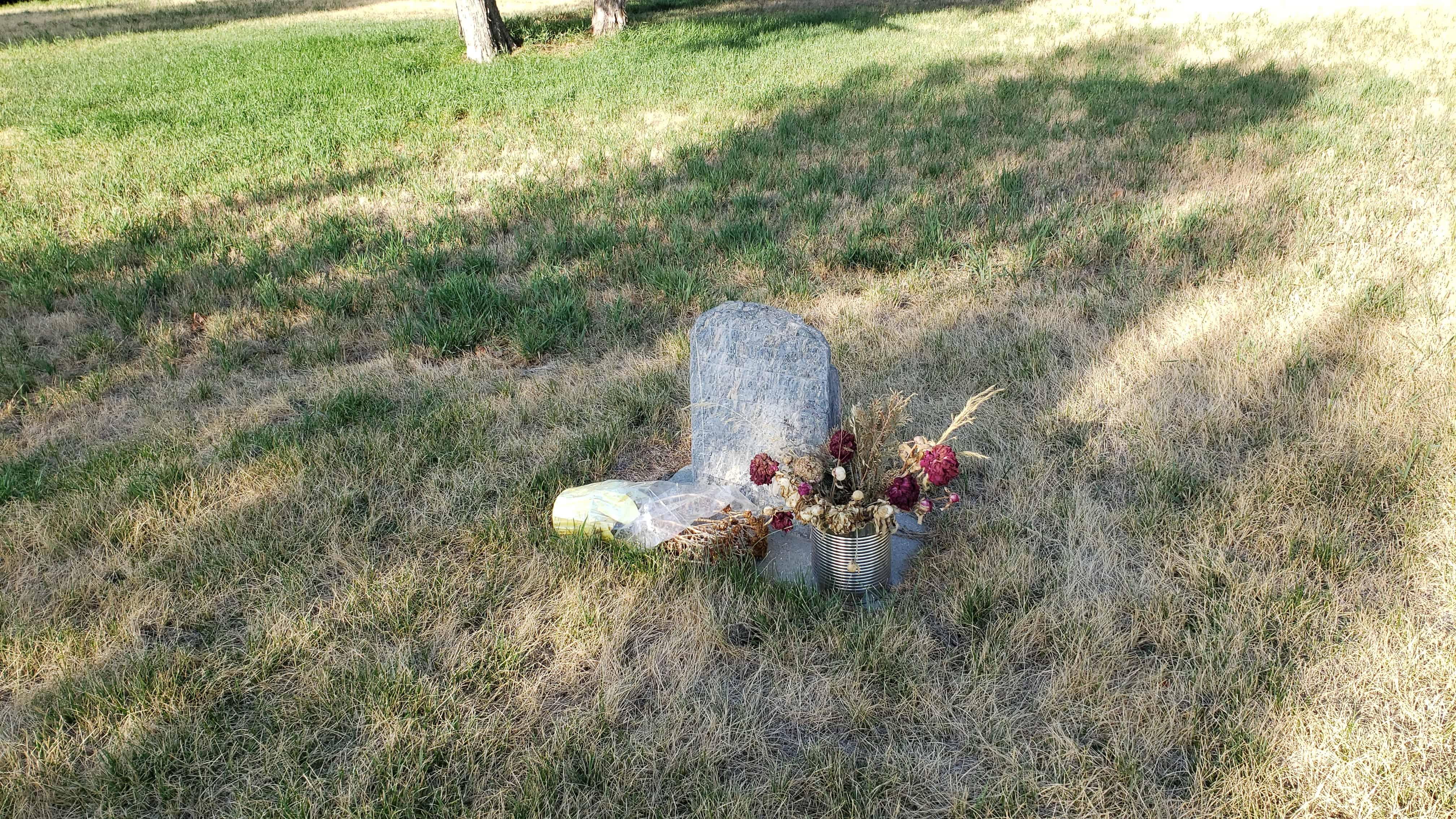
The Willard Pioneer Cemetery’s first burial was August 1854 with the death of five-day-old John Memorial, Jr., son of John Memorial (Memory) and Samantha Wells McCrary. This site, selected by Willard’s first settlers, is located one block east of the first group of log houses erected in Willard in 1851.
The McCrary baby was buried in the southwest corner of the the cemetery. Subsequent burials were north of this gravesite in order of the date of death. Loved ones were not buried by their families unless death immediately followed the last burial. For this reason, a new cemetery was chosen in 1869 on the foothills north of the original location. One hundred and fifty settlers were buried in this cemetery, and one hundred ten burials have been documented. Names of the other forty are being sought. That last known burial in this cemetery was in 1905.
The Willard flood of 1923 devastated this hallowed site. Floodwaters, cutting a large trench, caused markers and some remains of the graves to be washed into the field west of town. Located remains were brought back to the cemetery and buried in a common grave. Headstones and markers were replaced as accurately as possible.
In 1869 the United States Army sent First Lieutenant George M. Wheeler on a brief reconnaissance which later created the Country’s “Geographic Survey West of the One Hundredth Meridian”. This survey gave our leaders the first accurate mapping of the Western half of the Country, collecting data of the natural history, geology, geography, climate, weather and ethnology.
(From Box Elder County) Among the first settlers to this little valley was Kumen Tarbet. It is said that as he broke the ground from the sagebrush that he used oxen to pull the equipment. Oxen were eventually replaced with mules, and later came horses. Other early settlers were George Henrie, Fred Manning, Tony Nelson, John Adams, P.N. Pierce and John W. Deakin. It wasn’t an easy job clearing the ground of sagebrush and bunch grass. The process of railing, stacking, burning and then plowing with a team of mules or horses was accomplished by long hours and hard work.
Water was a premium. If you drilled a well and were blessed with good water, it was a great advantage. Some wells only produced warm air while others had warm, nasty water. One well, hand dug by the Peter Jensens, was over 400 feet deep and “Cemented up” from the bottom with pipes placed across at intervals as a ladder descended for repairs and maintenance. It is said that Mrs. George Shuman would stand above, holding a mirror so the suns rays could reflect light into the well enabling the workers to see. There was a community well located on the section lines, east of what is called the “Big Field”. Many families would haul water from there for themselves and livestock.
There were two blacksmiths in the valley: Fred Doutre, who also was a craftsman with leather, and Roy Southwell who served as a janitor for the school. Several of the teachers boarded in his home. The fist school was held in an old house in 1914, and in 1915 a new one-room school was built for eight grades and one teacher. The school burned the same night as Mr. Richard Ilger, the storekeeper, was murdered at the Blue Creek Store, and school for the rest of the year was discontinued. The next year a new two-room schoolhouse was built to accommodate two teachers. In 1934 there were four 9th graders and three 5th graders. This was the school’s final year.
A Blue Creek Store was located on the section line north of the Blue Creek Springs. It also housed a post office and was the family home. A third store was located about two miles north by the main road to Snowville. It contained the post office, the family home, and the gas station, and it was the school bus stop for the Snowville bus going to Bear River High School.
In March of 1900, just North of the Blue Creek Springs, Mr. Lewis Grant purchased 160 acres of ground. He built a large two story building which served as their home, a boarding house, and a dance hall. Some of their tenants were school teachers and weary travelers. Just north of their home Mr. Grant opened a store in 1910, selling much needed supplies to the area families and others in need as they were traveling.
Centerdale was an L.D.S. Branch of the Howell Ward. It was organized in 1914, with Peter Jensen as Presiding Elder. Other Presiding Elders were John Adams in 1917, Albert W. Bishop in 1918, John W. Smith in 1923. The total population of Centerdale Precinct was 131. Many baptisms for this area were performed in the large water trough at the Art Nelson Place. Many dances were held at this church building, and there was always a large crowd attending from several communities in the area. Mr. John Glenn played his accordion, and Arba Glenn was his accompanist. Civic functions and other forms of gatherings were held here. One event took place in 1940 when W.W. Whitney was the “Wheat King”. Harvesting 40 bushels per acre, he held a dance and watermelon bust. This was one of the many harvest dances held there.
With the coming of gas powered vehicles, better roads made traveling easier and faster. The families “staying on the farm” soon became part of the past. Electricity came to this valley in 1947, bringing more changes to the way of life. Ice no longer had to be cut during the winter from the reservoir and stored in sawdust or straw for the summer to keep food and drinks cold. As the many years have come and gone, so have many families, and experiences, memories of good times, names and faces fade.
Spiral Jetty is an earthwork sculpture constructed in April 1970 that is considered to be the most important work of American sculptor Robert Smithson. Smithson documented the construction of the sculpture in a 32-minute color film also titled Spiral Jetty.
Built on the northeastern shore of the Great Salt Lake near Rozel Point in Utah entirely of mud, salt crystals, and basalt rocks, Spiral Jetty forms a 1,500-foot-long , 15-foot-wide counterclockwise coil jutting from the shore of the lake.
The sculpture is sometimes visible and sometimes submerged, depending upon the water level of the Great Salt Lake. Spiral Jetty is now largely white against pink due to salt encrustation.
In 1999, the artwork was donated to Dia Art Foundation. Since its initial construction, those interested in its fate have dealt with questions of proposed changes in land use in the area surrounding the sculpture.
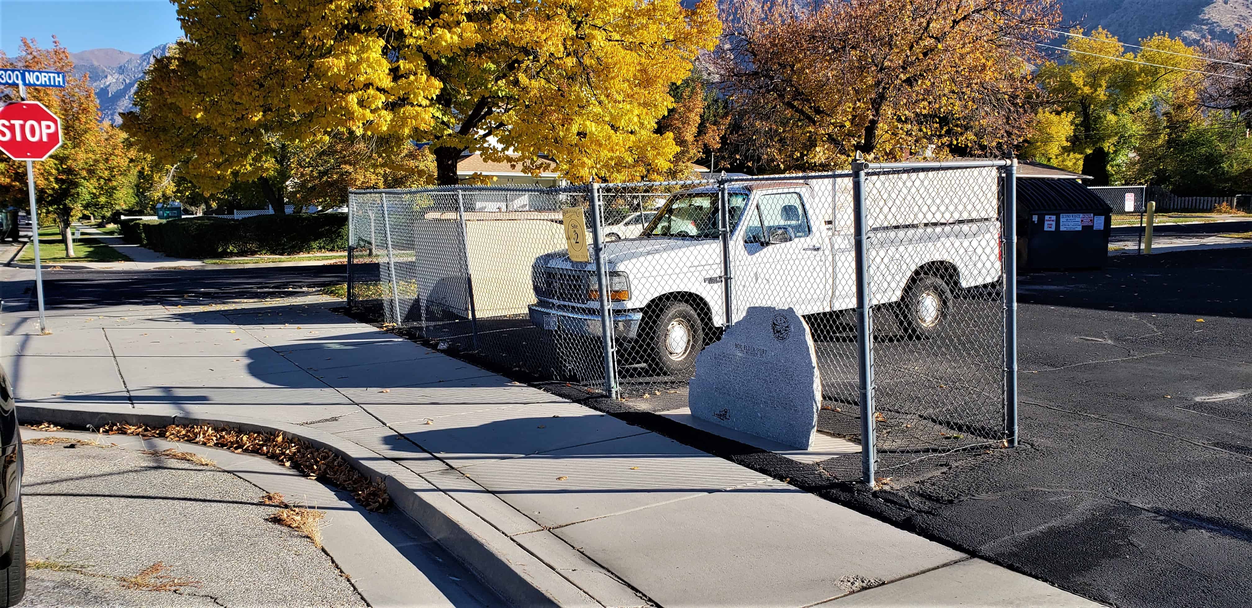
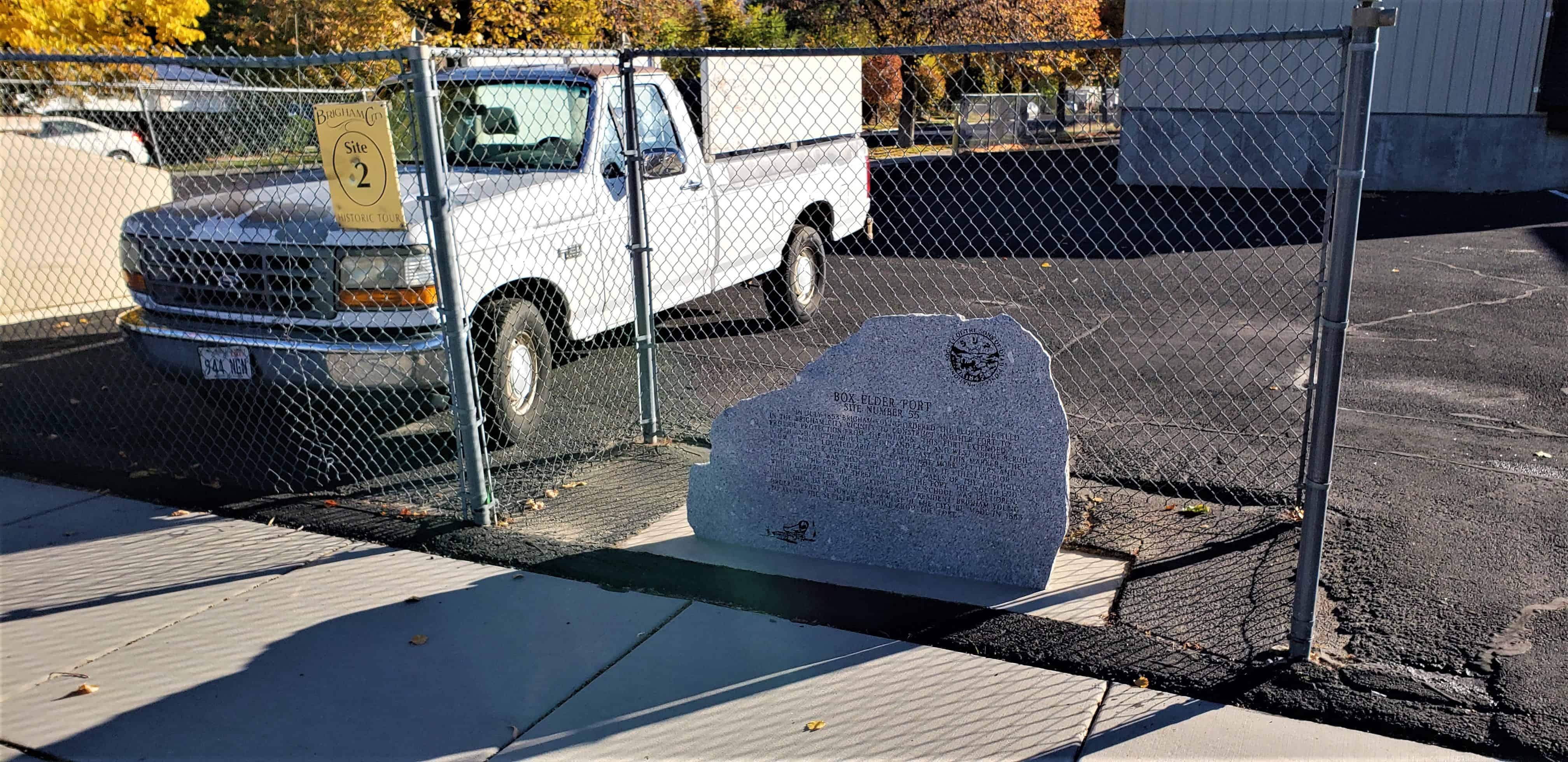
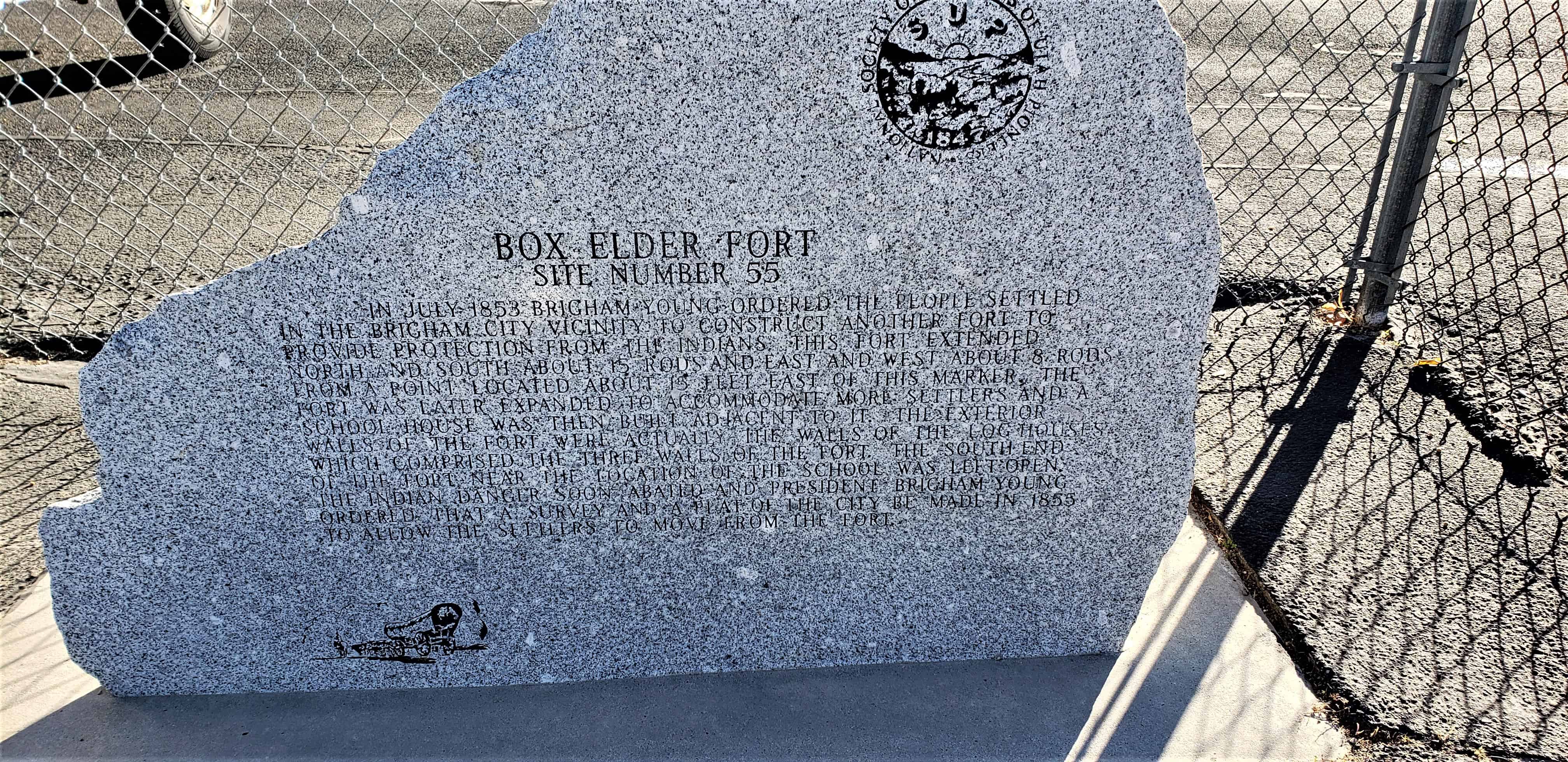
In July 1853 Brigham Young ordered the people settled in the Brigham City vicinity to construct another fort to provide protection from the Indians. This fort extended north and south about 15 rods and east and west about 8 rods from a point located about 15 feet east of this marker. The fort was later expanded to accommodate more settlers and a school house was then built adjacent to it. The exterior walls of the fort were actually the walls of the log houses which comprised the three walls of the fort. The south end of the fort near the location of the school was left open. The Indian danger soon abated and President Brigham Young ordered that a survey and a plat of the city be made in 1855 to allow the settlers to move from the fort.
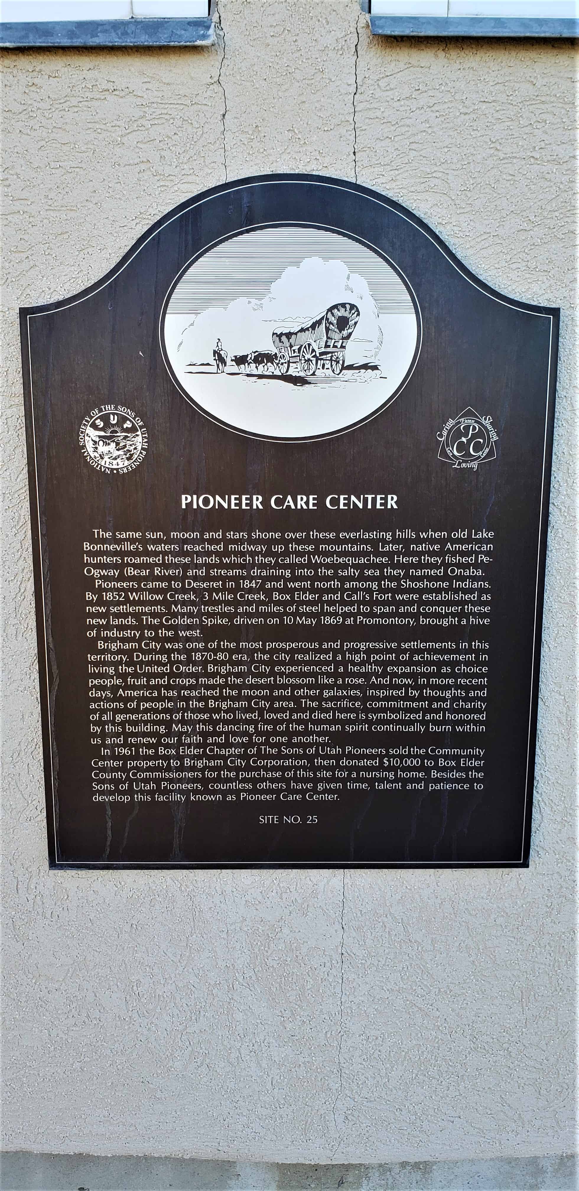
The same sun, moon and stars shone over these everlasting hills when old Lake Bonneville’s waters reached midway up these mountains. Later, native American hunters roamed these lands which they called Woebequachee. Here they fished Pe-Ogway (Bear River) and streams draining into the salty sea they named Onaba.
Pioneers came to Deseret in 1847 and went north among the Shoshone Indians. By 1852 Willow Creek, 3 Mile Creek, Box Elder and Call’s Fort were established as new settlements. Many trestles and miles of steel helped to span and conquer these new lands. The Golden Spike driven on 10 May 1869 at Promontory, brought a hive of industry to the west.
Brigham City was one of the most prosperous and progressive settlements in this territory. During the 1870-80 era, the city realized a high point of achievement in living the United Order. Brigham City experienced a healthy expansion as choice people, fruit and crops made the desert blossom like a rose. And now, in more recent days, America has reached the moon and other galaxies, inspired by thoughts and actions of people in the Brigham City area. The sacrifice, commitment and charity of all generations of those who lived, loved and died here is symbolized and honored by this building. May this dancing fire of the human spirit continually burn within us and renew our faith and love for one another.
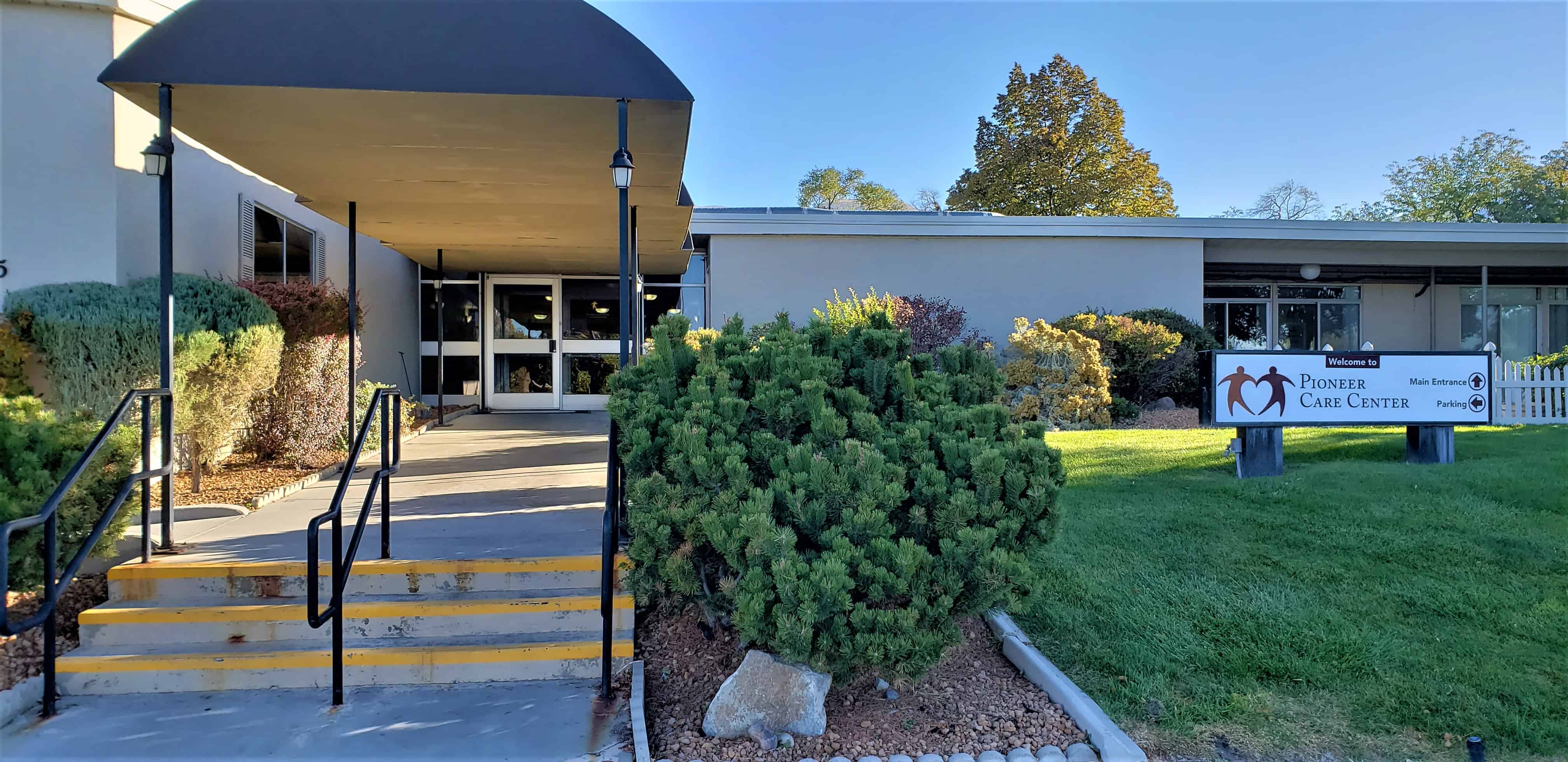
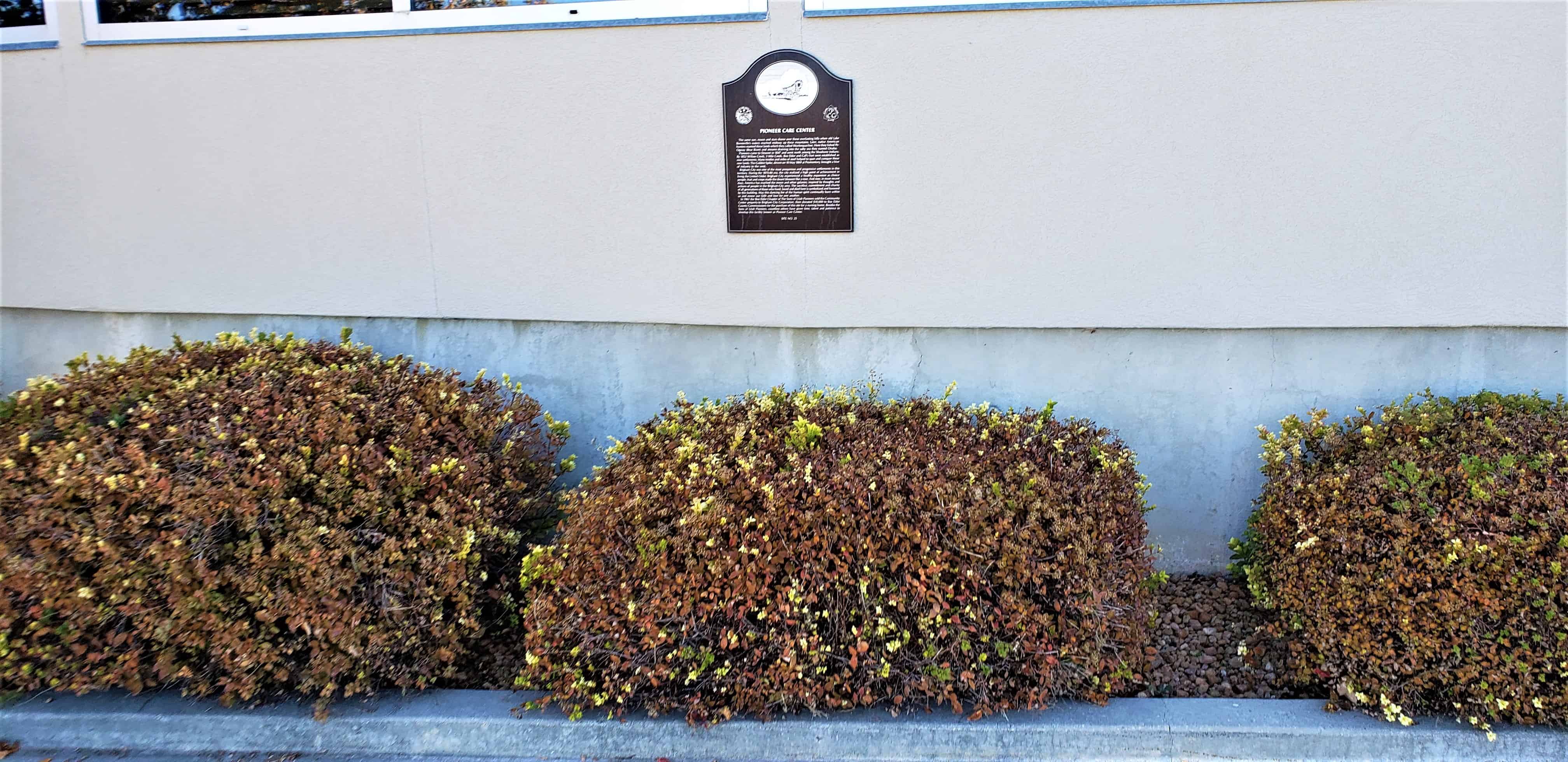
In 1961 the Box Elder Chapter of the Sons of Utah Pioneers sold the Community Center property to Brigham City Corporation, then donated $10,000 to Box Elder County Commissioners for the purchase of this site for a nursing home. Besides the Sons of Utah Pioneers, countless others have given time, talent and patience to develop this facility known as Pioneer Care Center.