
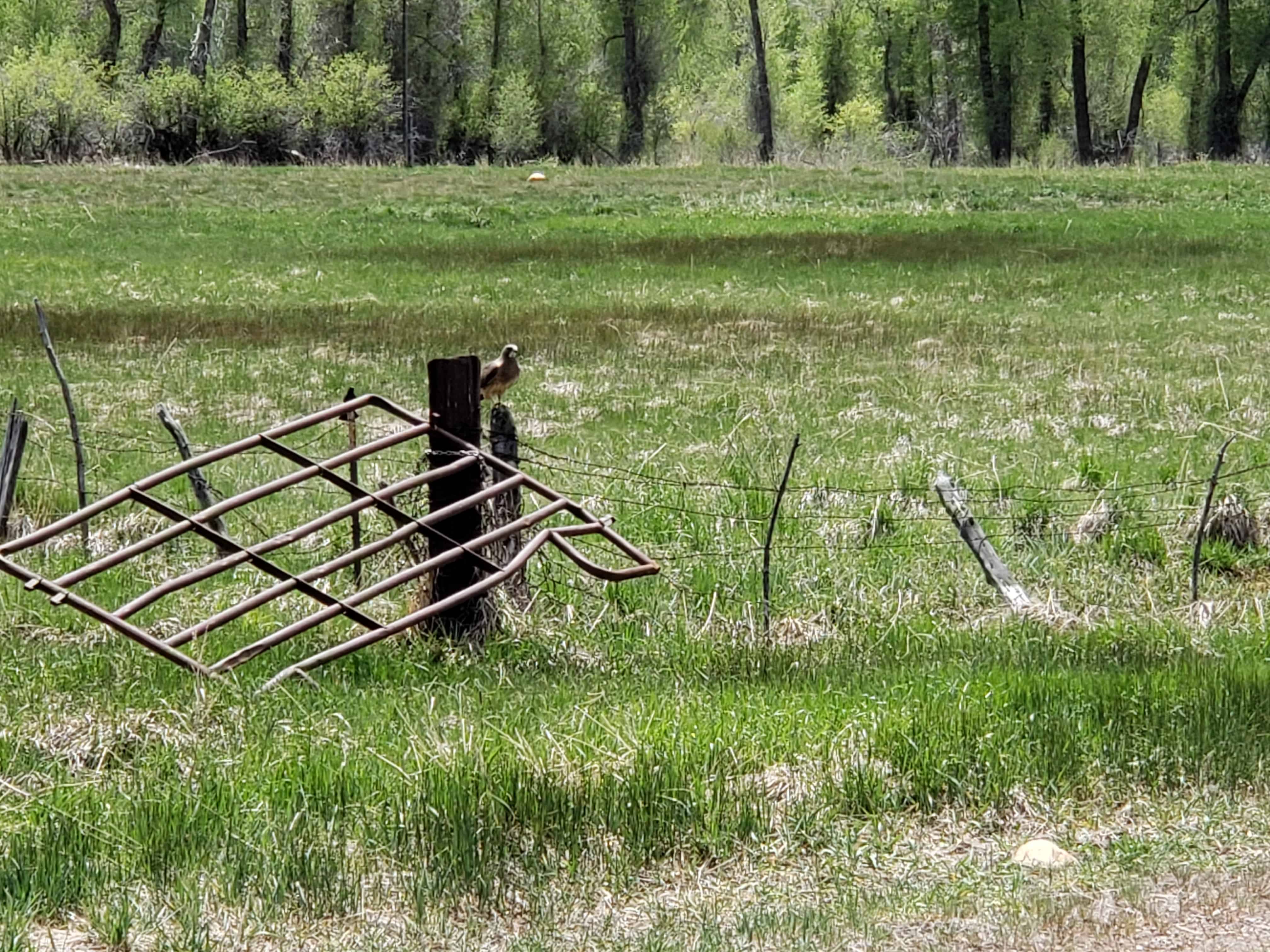
Deer Crest
23 Monday Feb 2015
Posted in Uncategorized

23 Monday Feb 2015
Posted in Uncategorized
22 Sunday Feb 2015
Posted in Uncategorized
Tags
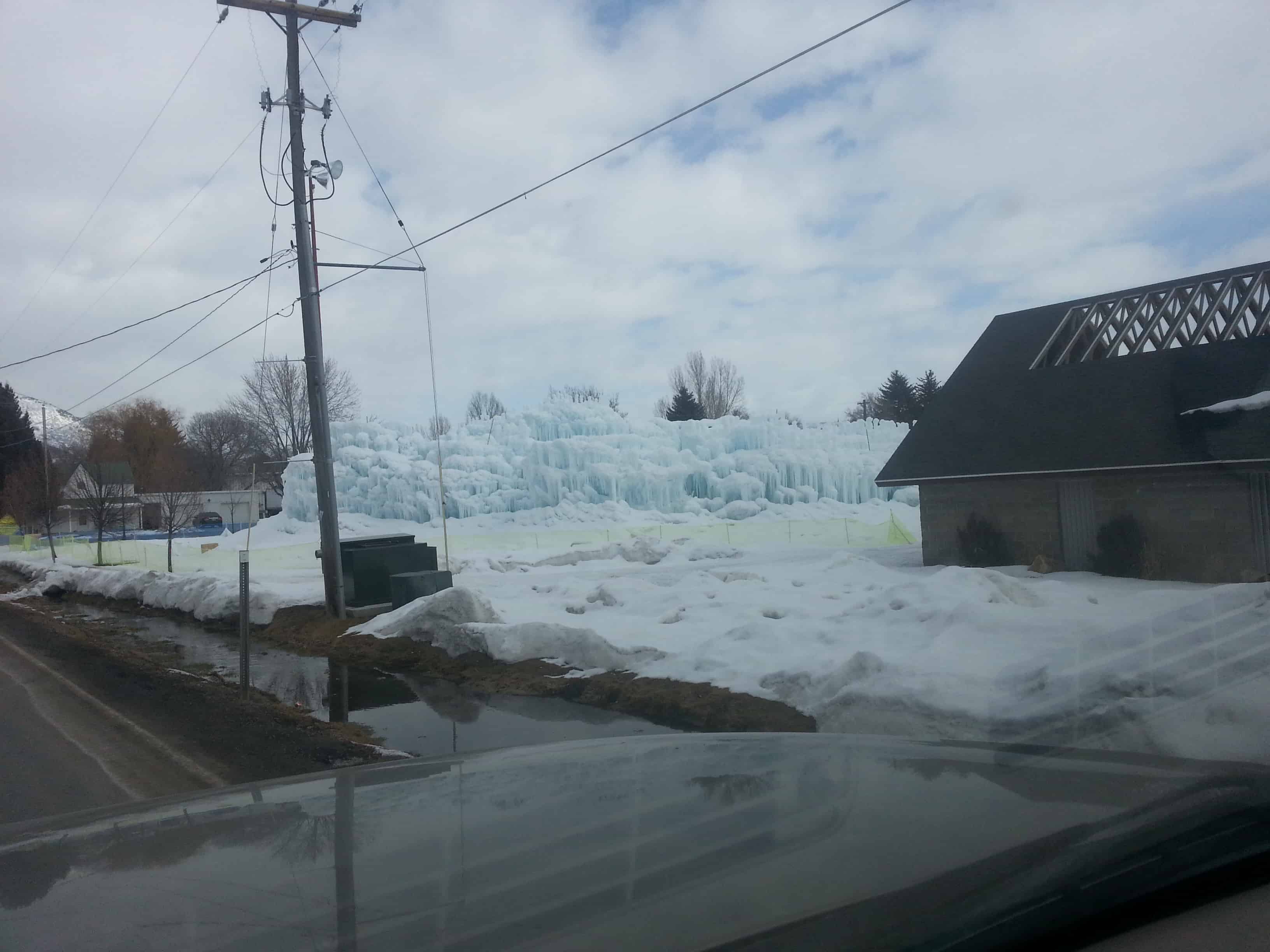


The ice castles in Midway are really cool, over the years I have seen people put hoses and sprinklers in their trees in their yards in Midway so the water will freeze and make awesome towers of ice, now there are “ice castles” that can be toured and explored.
See beautiful photos and videos or learn more at www.icecastles.com.
22 Sunday Feb 2015
Posted in Uncategorized
Tags
Forts, Heber City, historic, utah, utah county, Wallsburg, Wasatch County

WALLSBURG FORT
This monument stands 62 feet south, 2 feet east of the center of the fort built in 1862 by William M. Wall and the pioneers of Wallsburg. 20 families lived in the fort which was 400 feet square. This valley known to the Indians as Little Warm Valley, was later called Round Valley and finally Wallsburg, honoring its founder.
See other historic markers in the series on this page for UPTLA/SUP Markers.
See other Wallsburg related posts here.


25 Thursday Dec 2014
Posted in Uncategorized
Tags


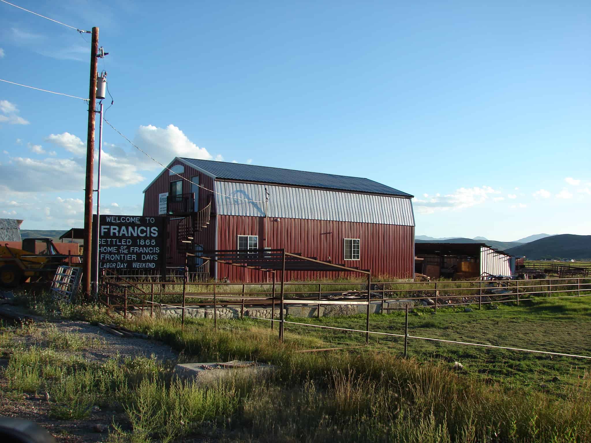
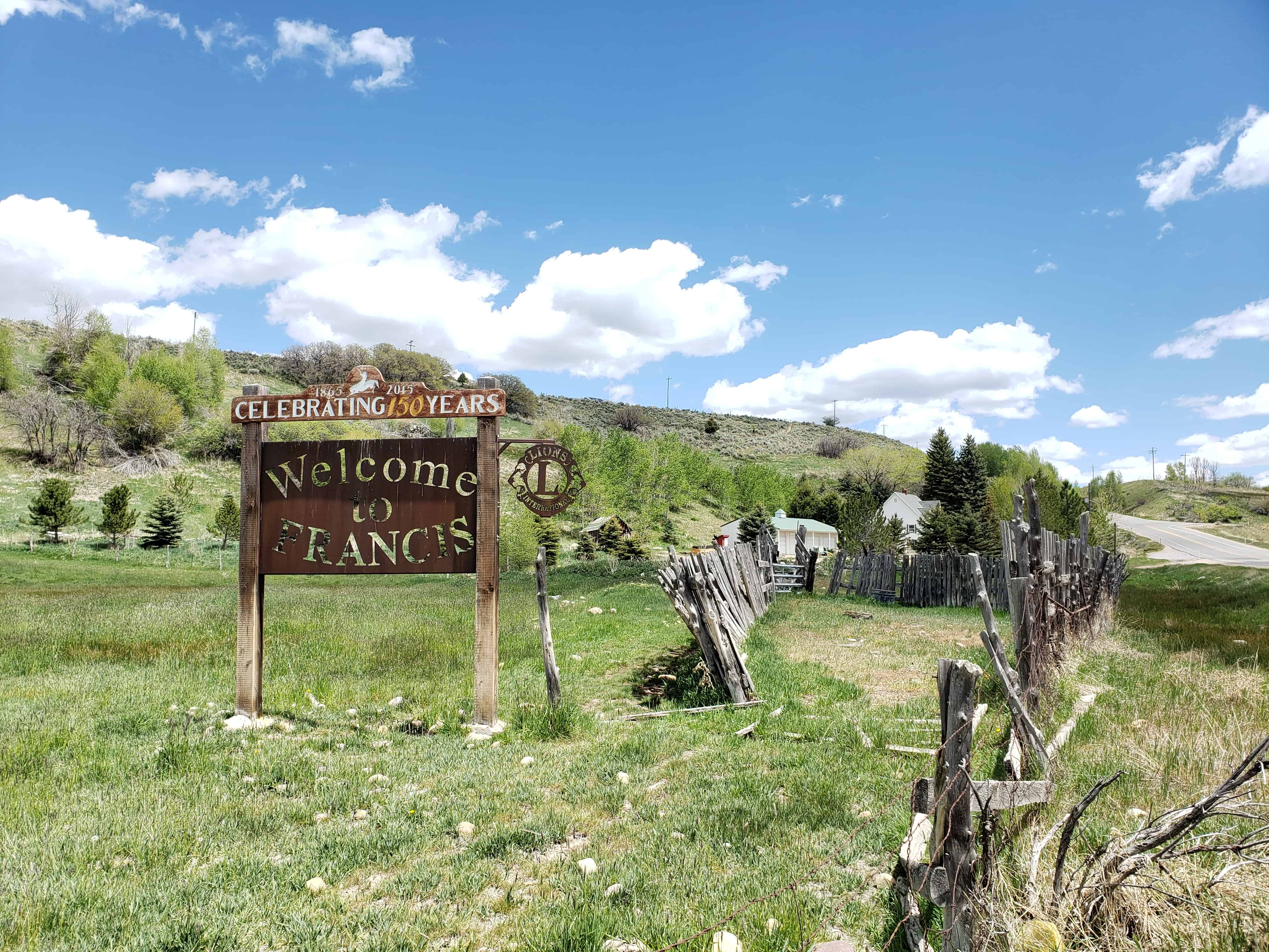
Francis is a town in Summit County. The population was 698 at the 2000 census.
The DUP Marker in Francis says:
Before settlement, Indians had summer camp here as feed for cattle, sheep, and horses was plentiful. Their carvings in caves can be seen near here. In 1870 Nathan Neibour homesteaded land here and built a cabin. He received a patent to the land in 1882 and warranty deed in 1885. These were the first such documents filed in this part of Utah Territory. An LDS Ward was organized Nov. 1889. Daniel J. Mitchell, Bishop. This land was given to local Daughters of Utah Pioneers in 1940 by Byron T. Mitchell.
Related:


08 Monday Dec 2014
Posted in Uncategorized
Tags

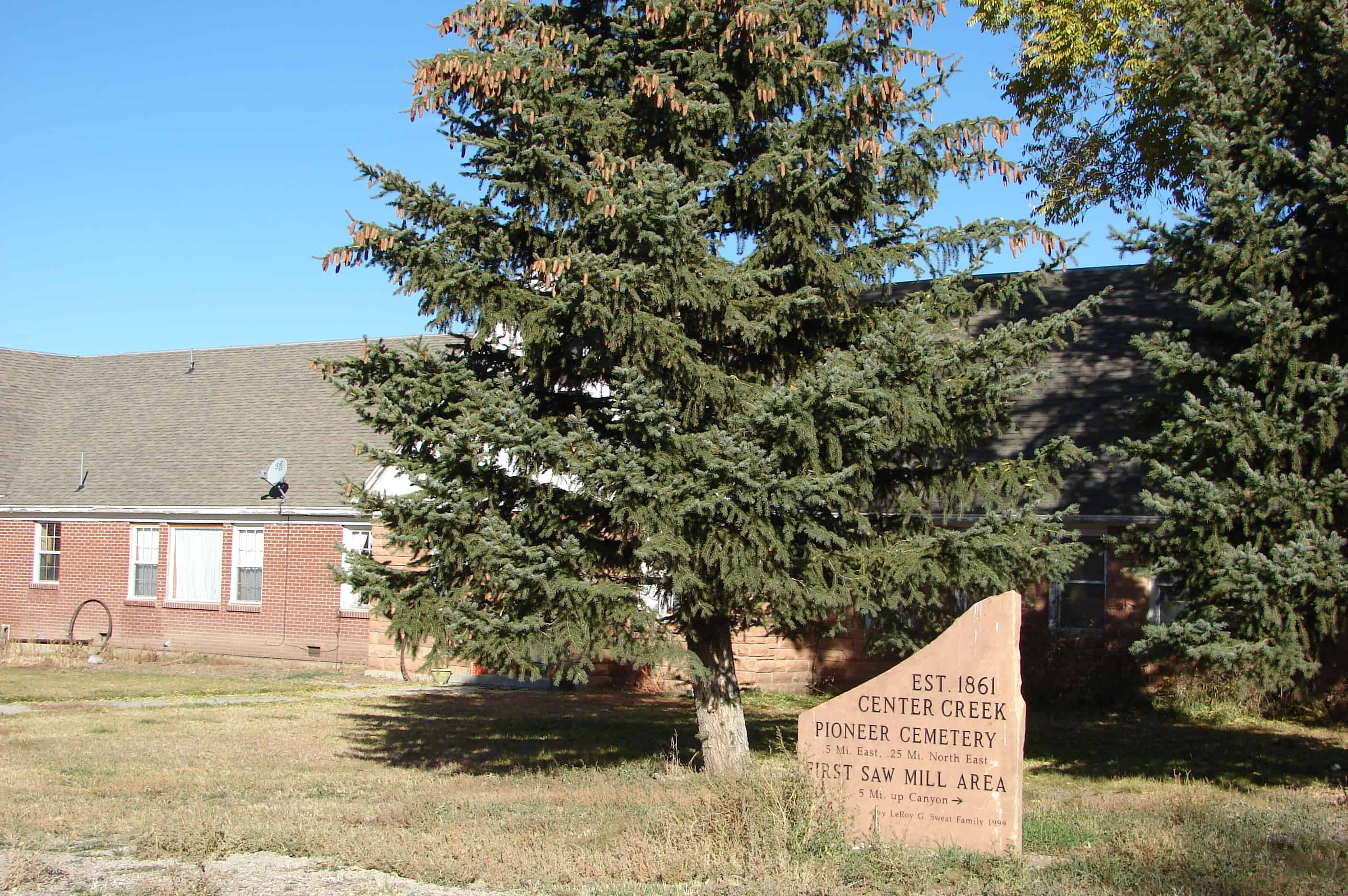
Daniels is a community near the mouth of Daniels Canyon on Daniels Creek. Daniels was first settled by Aaron Daniels. Nearby Edward Buys settled Buysville, which was soon absorbed into Daniels. Earlier names were Lake Creek and Center Creek, each a small settlement located next to their respective creeks. Center Creek still exists, but Lake Creek was absorbed into Heber City.(*)
Click here to see other places in Utah.
03 Wednesday Dec 2014
Posted in Uncategorized
Tags
Heber City, Orem, Provo, Provo Canyon, utah, utah county, Waterfalls
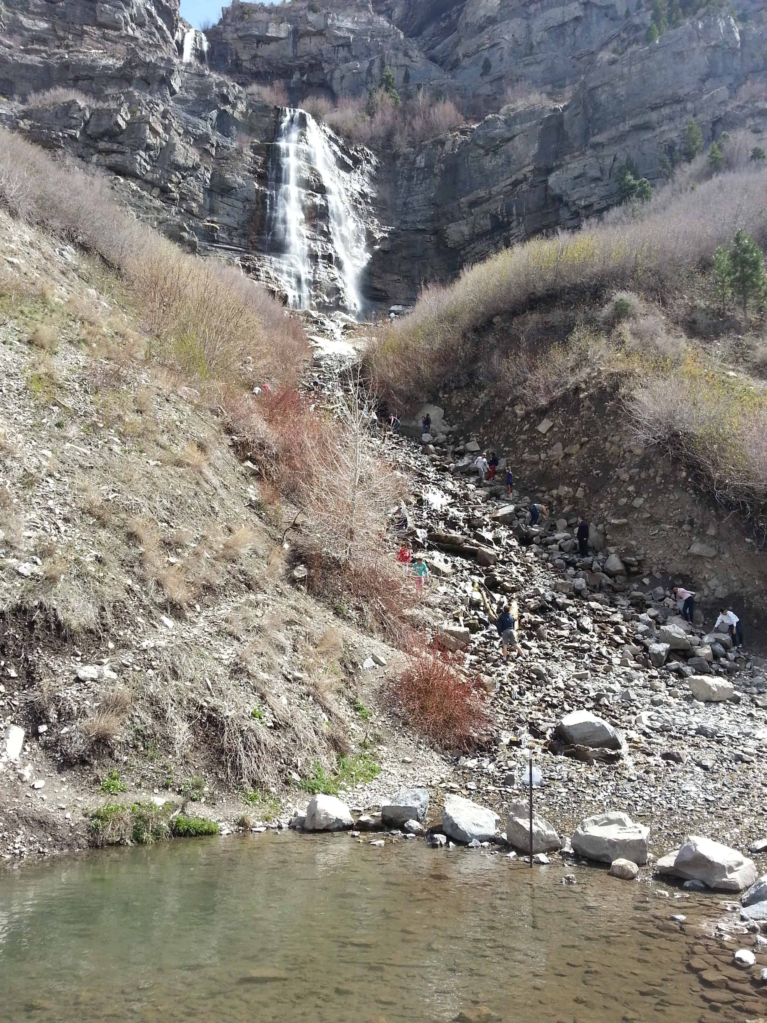


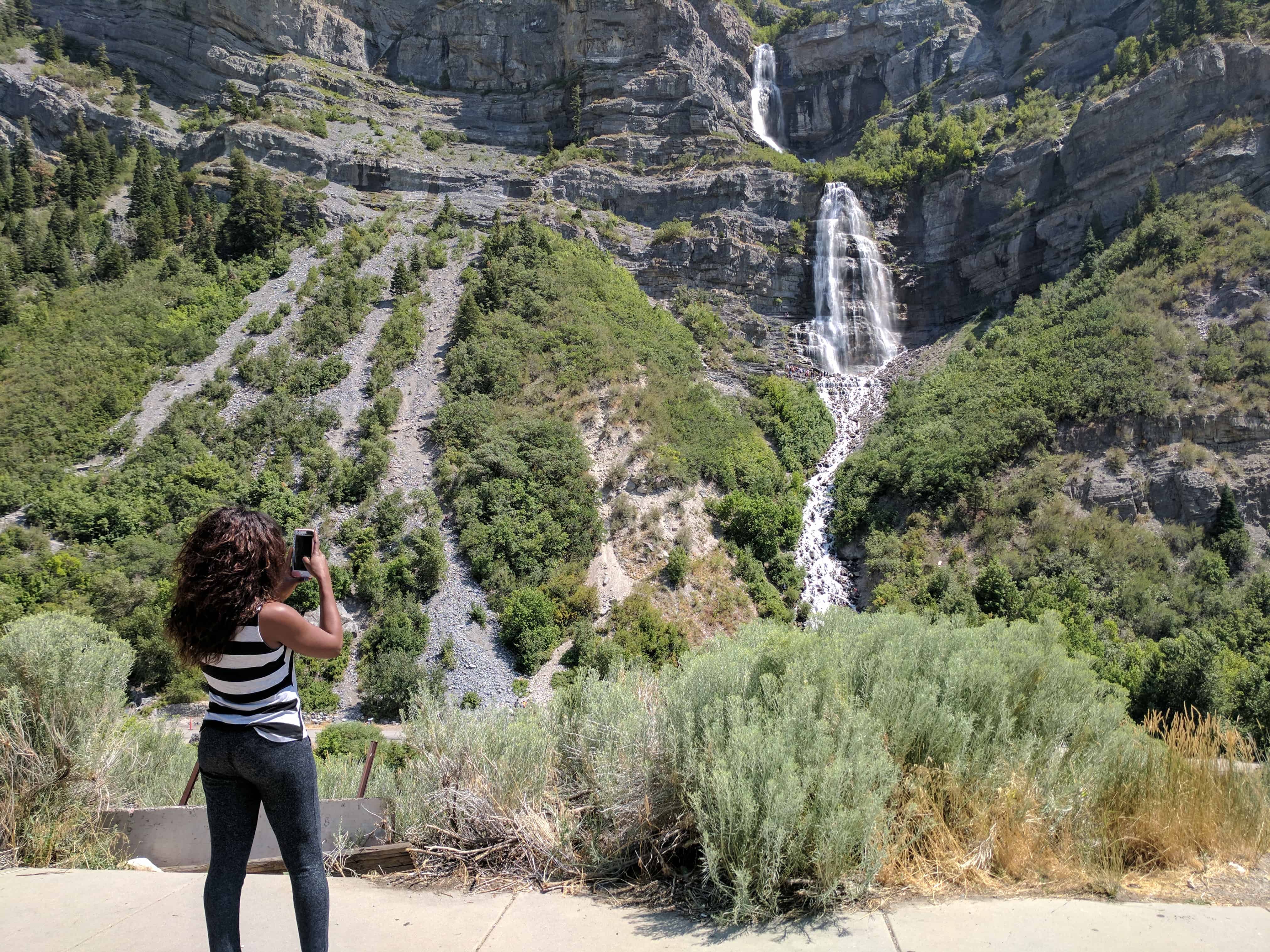
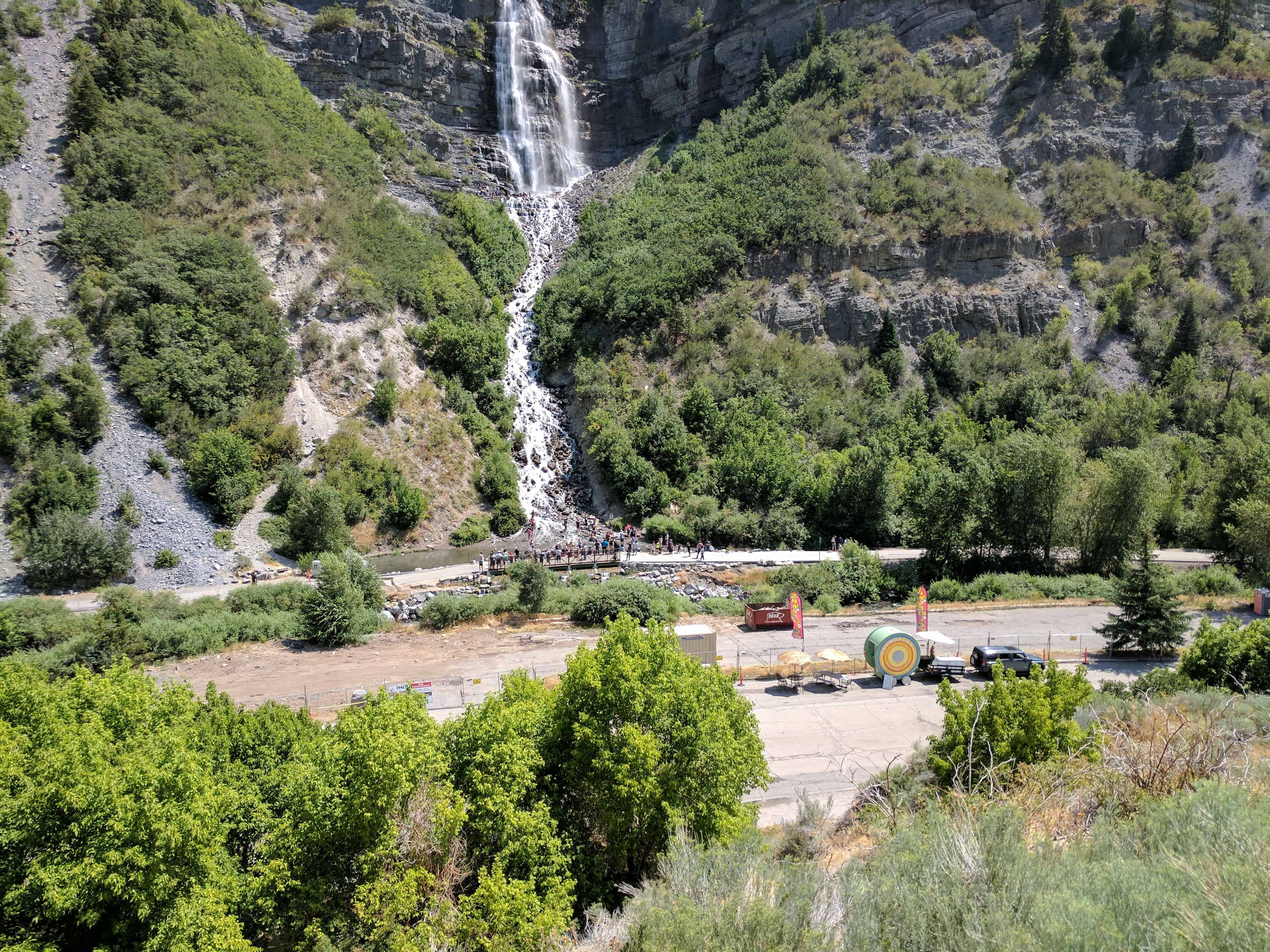
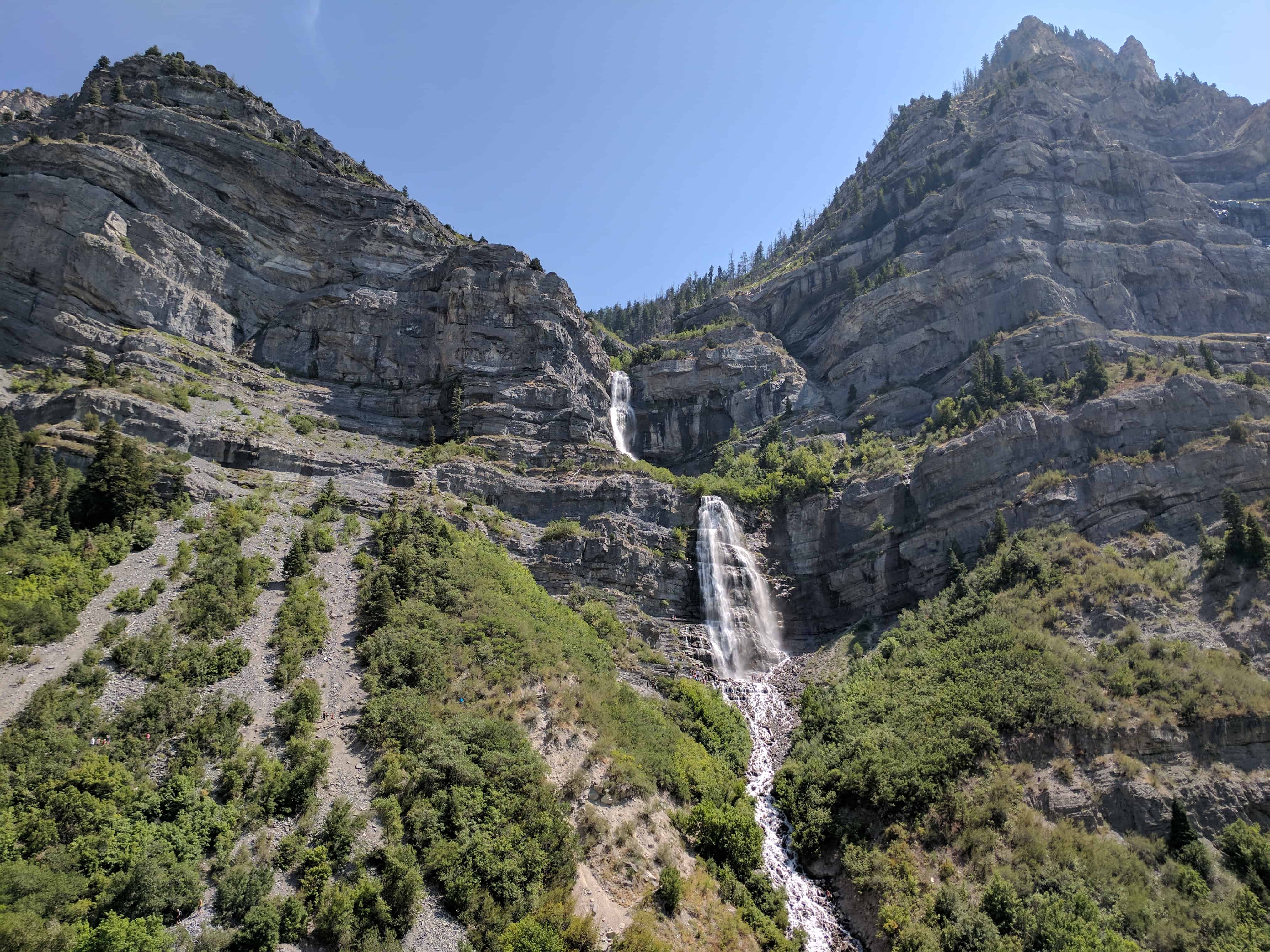
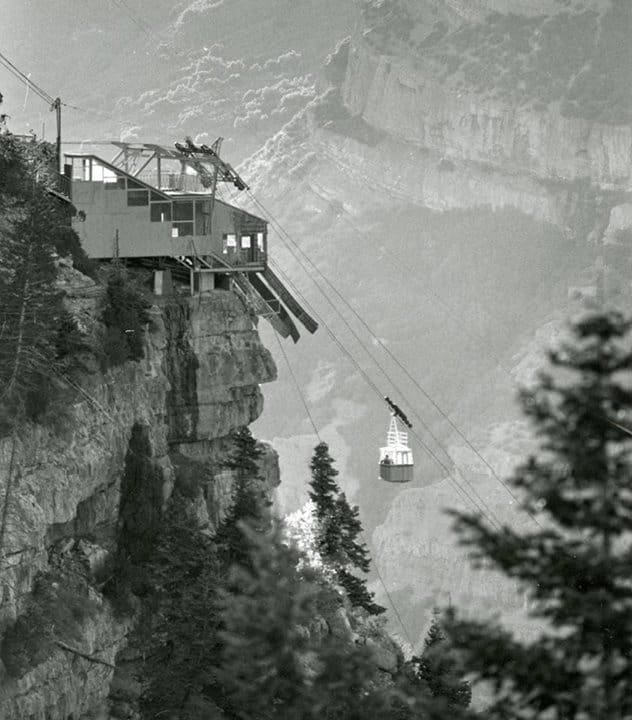
Bridal Veil Falls is a 607-foot tall waterfall in the south end of Provo Canyon, Utah. An aerial tramway service to the top of the falls was built in 1967 and the small, six-passenger tramway functioned as a recreational attraction until an avalanche destroyed the tram in early 1996. When the tramway was in operation prior to the 1996 avalanche, it was heralded as the WORLD’S STEEPEST AERIAL TRAMWAY, although that claim is difficult to ascertain. The magnificent falls are just four miles up the Provo Canyon. The falls are a favorite with visitors and locals alike. They can be seen from a scenic highway pullout or by taking an exit to where the base of the falls meets the Provo River. There is a small, cold swimming hole, and if you look carefully, you will find a dirt path that will take you up the mountain a bit for a closer view of the falls. The surrounding area is great for summer hiking and several trailheads begin at the falls. Bridal Veil falls is not only a summer attraction. In the winter, an icefall just to the right of the falls attracts experienced ice climbers. The icefall has been aptly named the Stairway to Heaven. The falls were a feature point along the route of the Heber Creeper tourist train until the train discontinued its service past the falls. The train tracks in front of the falls were removed and converted into a recreational trail. Now The falls and a small park just west of the falls (Bridal Veil Park) can also be accessed via U.S. Highway 189.(*)
Bridal Veil Falls – The Legend
Many moons ago, an Indian named Norita and a brave from a rival tribe, named Grey Eagle met and fell in love. They planned to meet near a streamlet high on the mountainside and elope to a land far away from both their tribes. On that fateful night, instead of her lover, Norita was confronted by braves from her own tribe. Fearing her lover had been destroyed she leapt from the high ledges.
Mother Nature was touched by her wild beauty, and she caught up Norita’s streaming tresses and made from them a Bridal Veil of falling water. From her flowing gown an alter was formed on the face of the mountain. Then her spirit was sent out as a mist, causing a green carpet to spread over the mountainside.
The intruders fled while her saddened lover stood and gazed down a the strange yet beautiful transformation. His grief was more than he could bear, so out of compassion for his sorrow, Mother Nature molded his massive frame into the mountain and stretched his mighty shoulders high into the heavens like silent sentinels to guard over his loved one. His cries of anguish were softened into love calls to whisper forever.

Bridal Veil Falls descends over step-like rock beds in the lower part of the Oquirrh Formation which was formed during the Pennsylvanian period. Pennsylvanian rock types, in rough order of decreasing abundance are: limestone, sandstone, shale, dolomite, halite, sylvite, conglomerate, and other minor salts.
In Utah, Pennsylvanian rocks and fossils are mostly of Marine Origin. The most commonly found are brachiopods, bryozoans, corals and crinoids.


The following I found online, they are not mine:

16 Sunday Nov 2014
Posted in Uncategorized

Charleston is at the northeast section of Deer Creek Reservoir, at the junction of U-113 and US-89. The town was settled in 1852. There are two versions of the name source. The first and more accepted is that it was named for Charles Shelton who surveyed the town. The other suggests that James Herbert stopped there on his mail route and told the men at the herders’ cabin that if they would put up a mailbox, he would deliver mail to them. A Mr. Winterton, one of the herders, remembered hearing of Charleston, South Carolina, so he made a mailbox, put it in a crotch of a tree and used that name.
Related posts:
15 Saturday Nov 2014
Posted in Uncategorized

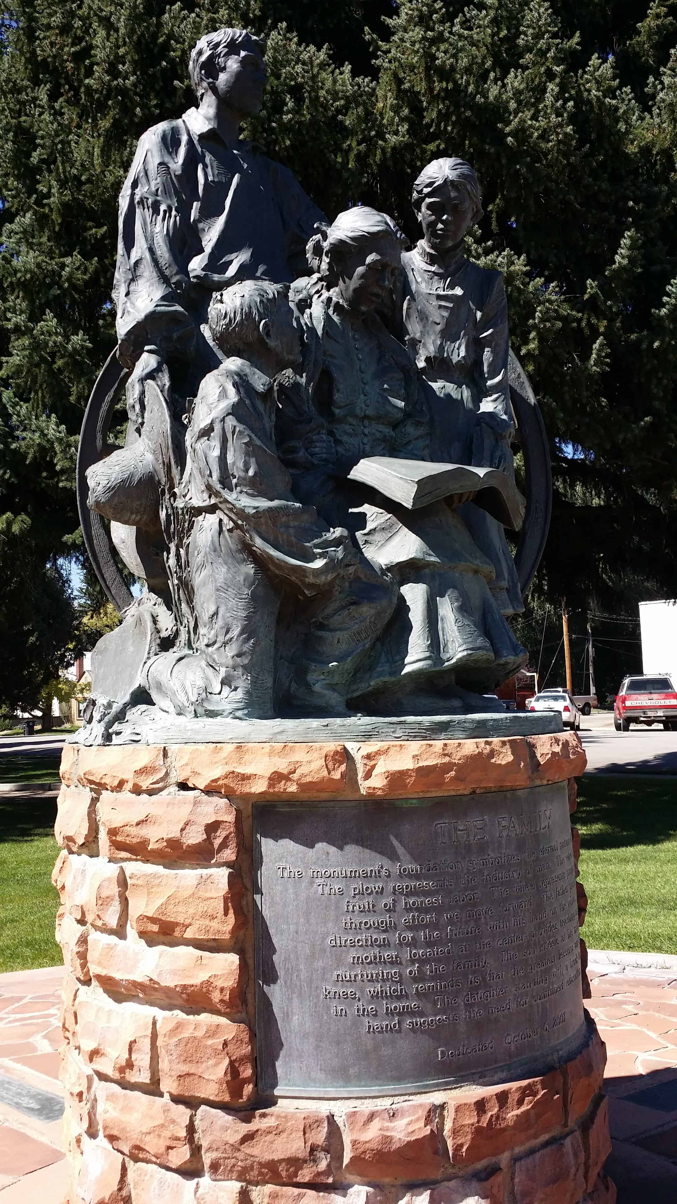
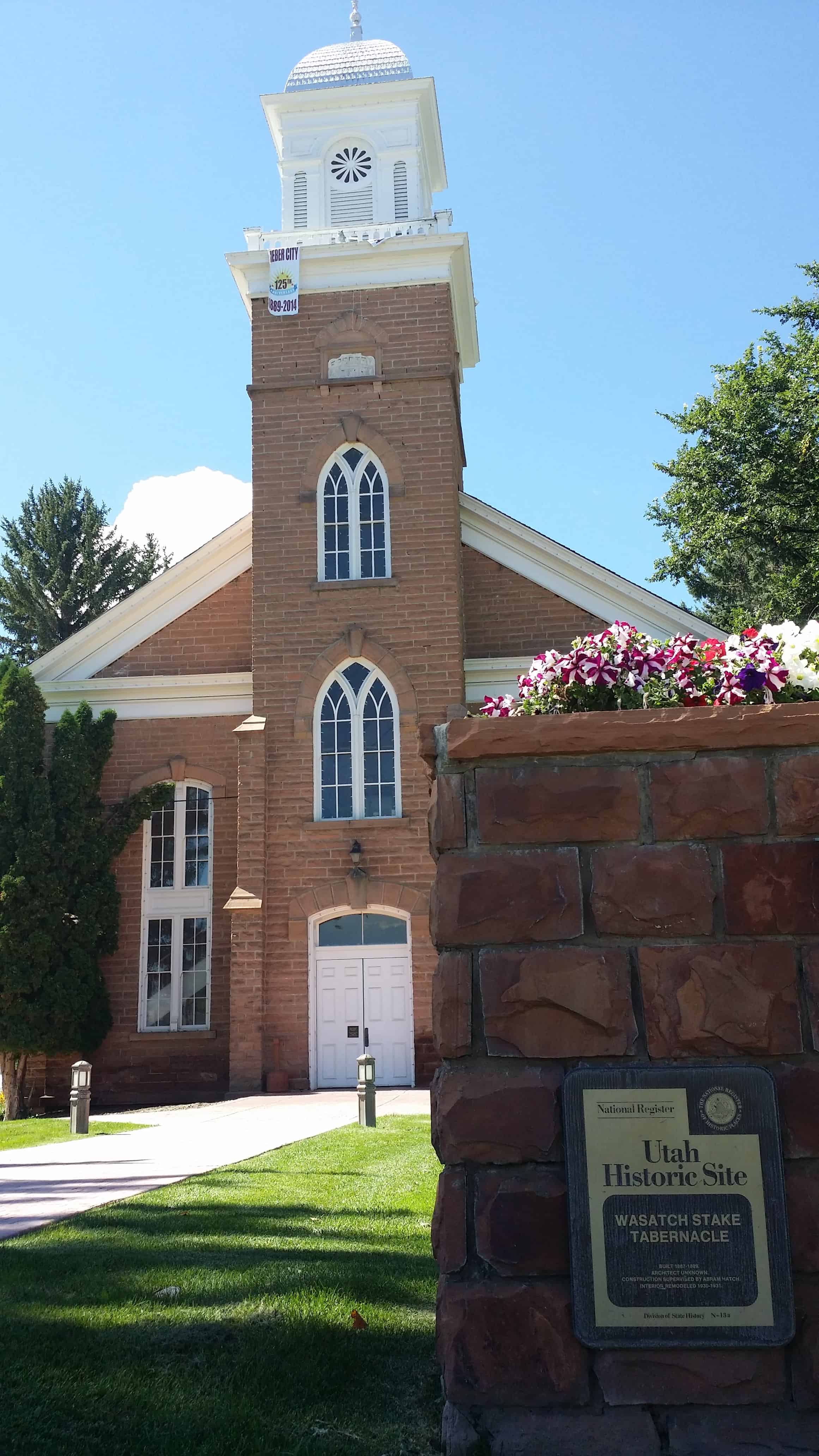
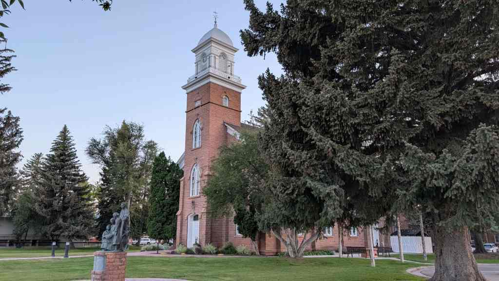
Wasatch Stake Tabernacle – Heber City, Utah
Built in 1887, this is one of the Tabernacles around Utah still standing – it is now used as a city office building but stands as an awesome reminder of what the pioneers did long ago.
Alexander Fortie, Jr. immigrated to America in 1866 from Glosgow, Scotland and was the designer and architect of this tabernacle, he also oversaw the carpentry work during its construction. His tools and tool chest are on display in the D.U.P. Museum.


The Utah Historic Marker outside says:
Built 1887-1889
Architect unknown, construction supervised by Abram Hatch. Interior remodeled 1930-1931.
The tabernacle is located at 75 North Main Street in Heber City, Utah and is part of the Historic Home Tour.

The tabernacle is located at 75 North Main Street next to the Amusement Hall in Heber City, Utah and was listed (together with the Amusement Hall as listing #70000633) on the National Historic Register on December 2, 1970.
The Tabernacle is significantly associated with the history of the area and reflects the religious, cultural and social aspirations of the settlers of Heber Valley, The Tabernacle is unique since there is no other such building in Heber Valley, and it is one of the few remaining outstanding early church structures left in Utah, In addition to being a typical early Mormon meeting house, it is part of the Heber Town Square which, in itself, is typical of the early Utah Town Square on which were located governmental recreational and religious structures.
The Wasatch Stake Tabernacle was built of red sandstone quarried from the mountains east of Heber near Lake Creek, It was begun in 1887 and dedicated May 5, 1889, at a cost of over $30,000. President Abram Hatch served as Superintendent, Elisha Averett directed the masonry work, and Alex Fortie the carpentry work. Frederick O. Buell fixed the metal shingles on the tower, and Francis Kirby oversaw the painting. Most of the labor was volunteer.
The good people of Heber City, who had toiled and sacrificed to build the Tabernacle, quite naturally took special pains to furnish and maintain their new stake house. The floors were scrubbed and bleached with homemade soap; homemade carpets were carefully laid down the aisles; the hard benches were sanded and smoothed and polished. Coal oil lamps were hung from the ceiling, and finally, a large bell was placed in the tower. The surrounding grounds were landscaped and cottonwood trees were planted.
In 1930-31, under the direction of President D, A. Broadbent, the inside was extensively remodeled at a cost of $20,000 and a new heating system installed. The side galleries and stand were taken out and a stage put in the west end. This describes its present condition. The structure is in good condition generally, although the interior needs painting and minor repairs.


13 Friday Jun 2014
Posted in Uncategorized
Tags
Hailstone, Heber City, Jordanelle, Keetley, Midway, park city, Provo River, Reservoirs, Wasatch County

Jordanelle Reservoir is seen off to the east of Highway 40 when traveling between Park City and Heber City.
The old towns of Keetley and Hailstone are now gone, being buried with water with the creation of the the dam and reservoir.
Jordanelle Dam is the largest water development project in the history of Utah.
Jordanelle Reservoir is one of the newest reservoirs in Utah. The Jordanelle Dam was constructed on the Provo River by the Bureau of Reclamation in 1992, and the reservoir filled to capacity in 1995.
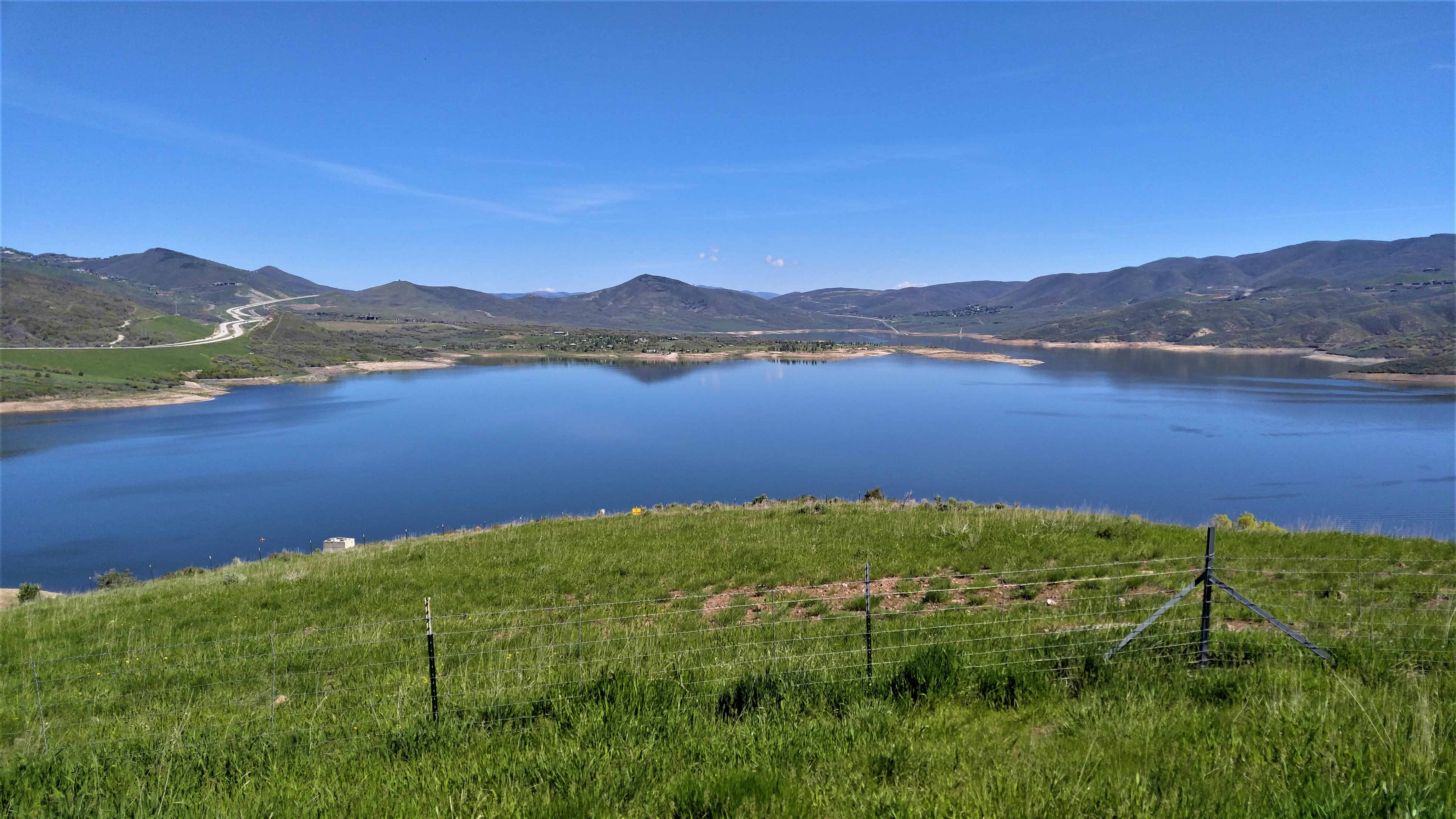

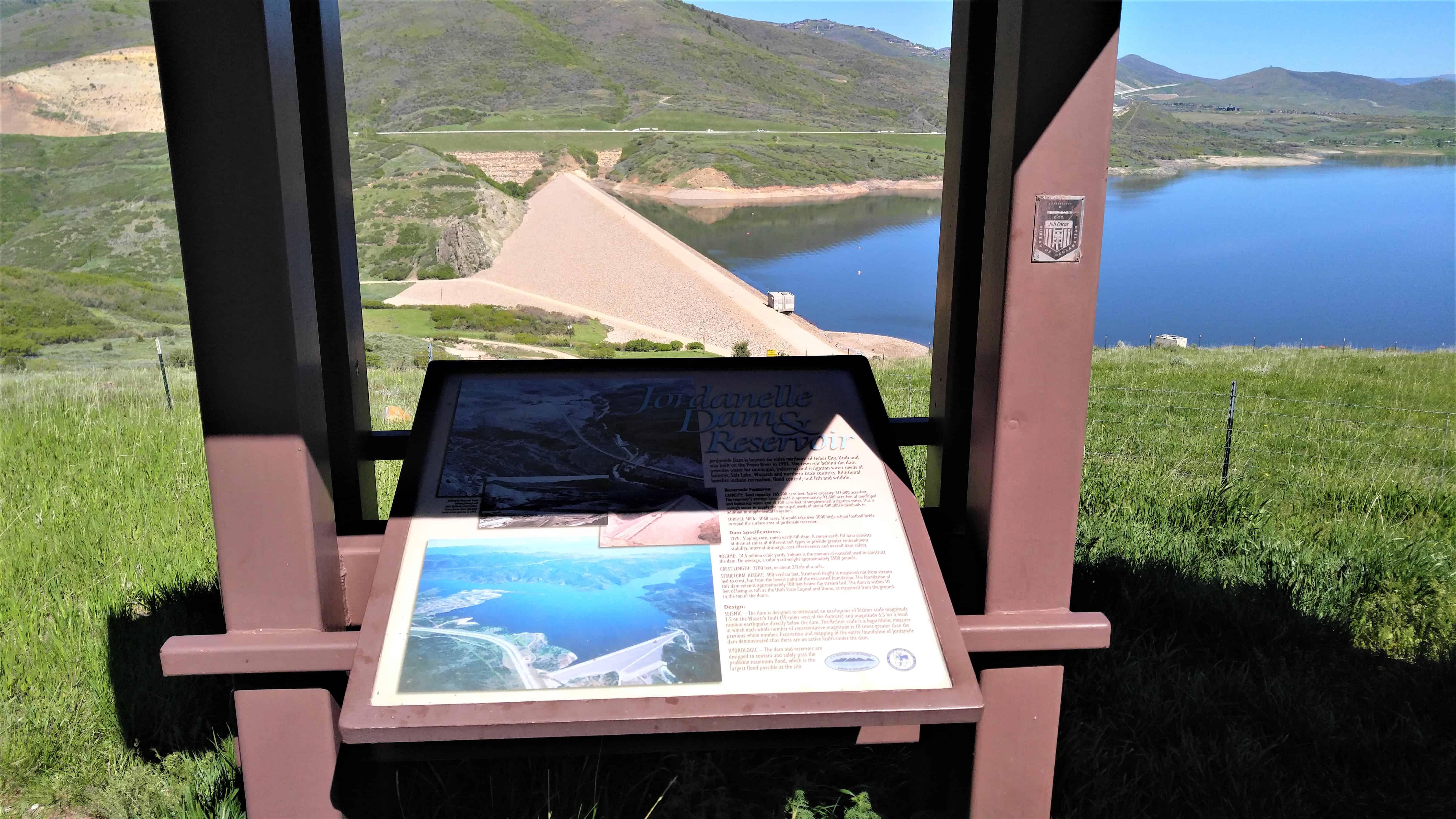


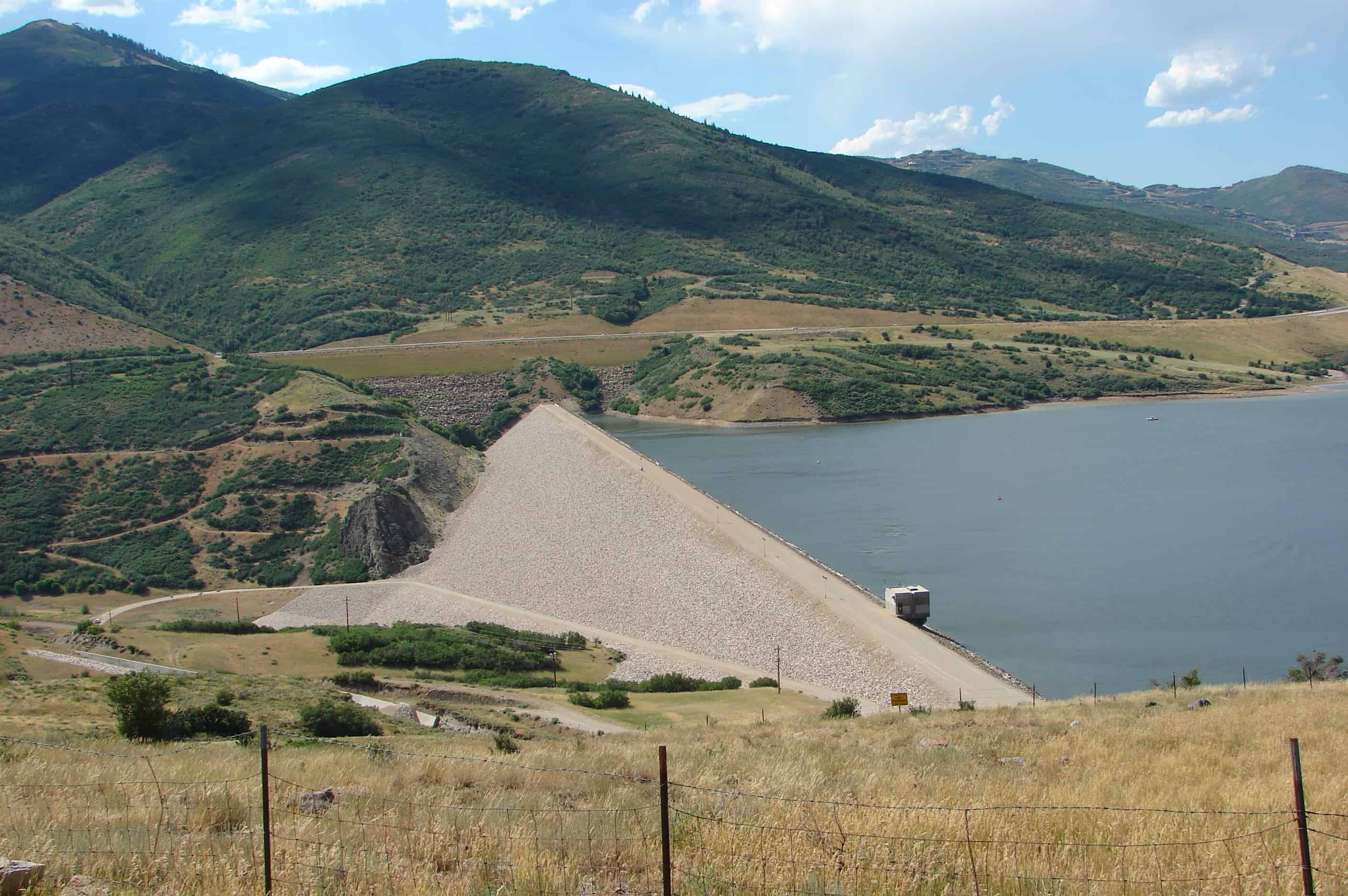

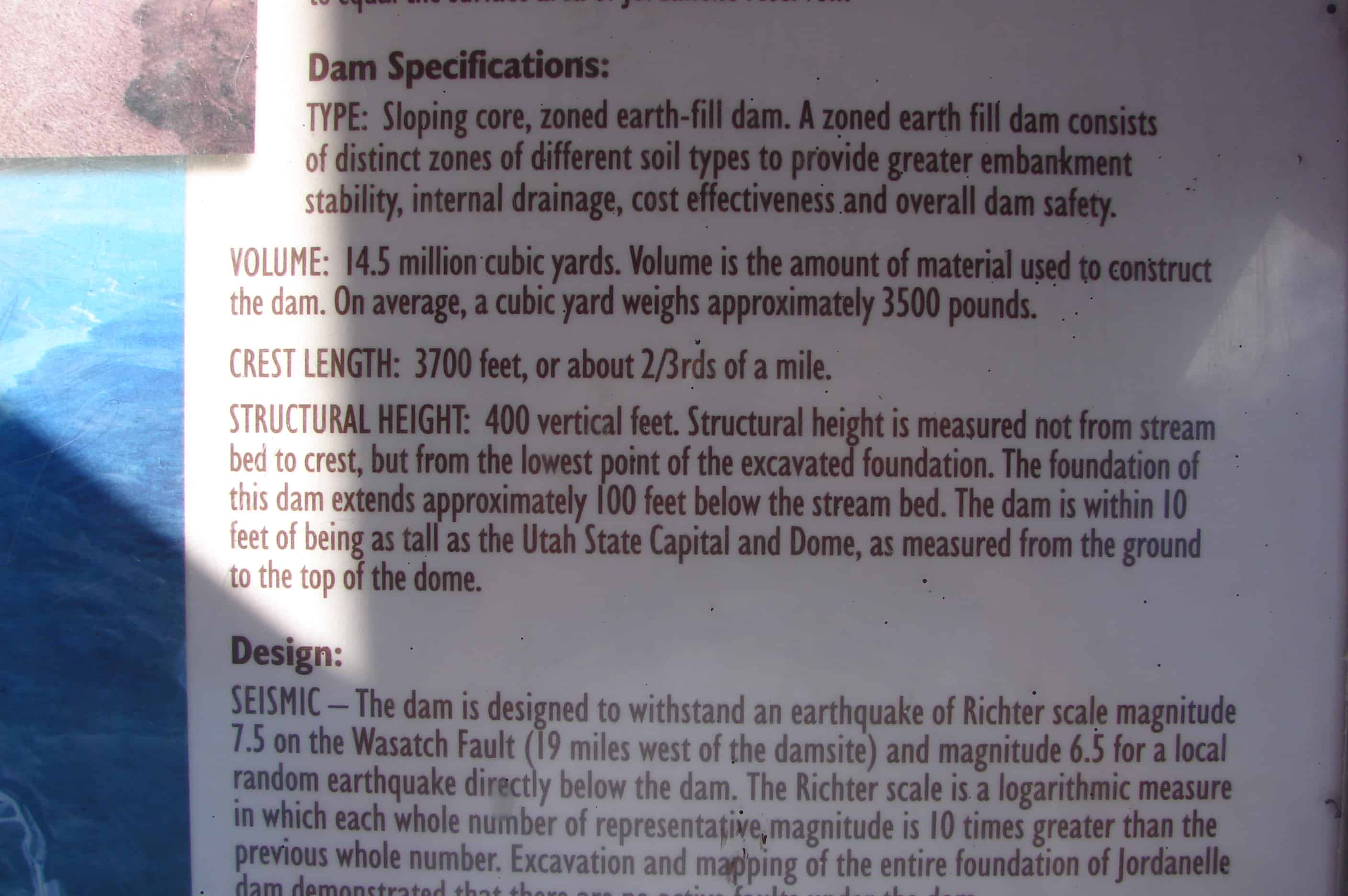


These 4 are from the overlook on the north, near Hideout.


04 Wednesday Jun 2014
Posted in Uncategorized
Tags

Plaque A: (Middle plaque) THE OLD FORT
In 1858 a group of men came from Provo, surveyed the valley into 20 acre plots and selected the townsite of Heber. The following winter twenty families stayed here. As protection from the Indians they built a fort 1 block south and 1 block west from this site. Homes built of cottonwood logs and joined together formed the outside walls of the fort. A schoolhouse 20 by 40 feet was built within the fort with two fireplaces and a stage. The building also served for church and socials. In 1860 the fort was enlarged to house forty-four families.
Plaque B: (On left) Elizabeth Carlile Jean Clotworth George Carlile John Crook John Carlile William Davidson James Carlile James Davis C. N. Carroll Richard Jones
Plaque C: (On right) John Jordan Alex Sessions John Lee Bradford Sessions James Laird John Sessions Hyrum Oaks Charles Thomas Thomas Rasband Elisha Thomas
Related Posts:


