Hilda Anderson Erickson, born in Ledsjö, Sweden October 11, 1859 was the last surviving immigrant pioneer. In 1866 at the age of 6 she crossed the plains with her family in the Abner Lowry Company. She married John A. Erickson in the Endowment House in 1882. Soon after the couple was called to serve an LDS mission among the Goshute Indians in Ibapah, Utah. Later the couple homesteaded the “Last Chance Ranch” with their son Perry and daughter, Amy.
A talented seamstress, tailor, and licensed obstetric, Hilda was known as the “Doctor” to many expectant mothers. After the ranch was sold Hilda opened a store in Grantsville which she operated for 21 years. She drove her own car until she was 94 and at 99 flew to Nauvoo, Ill. to be honored by the Centennial Commission of Utah. Her return flight was the first passenger jet airplane to land at the Salt Lake Airport. She passed away in Jan. 1968 at the age of 108.
Kate B. Carter in Our Pioneer Heritage said of Hilda, “Probably no woman in our state has lived a more energetic life.”
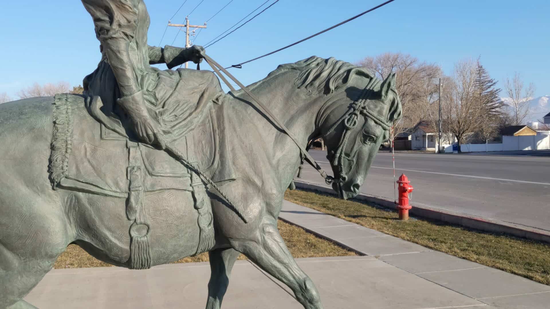
This monument to a grand lady was erected by the Sons of Utah Pioneers to honor all Utah pioneers.
Sculptor Peter M. Fillerup
Note: President James E. Faust dedicated this statue that stands in front of the Grantsville City Hall, on June 7, 1997. Hilda Anderson Erickson was the last survivor of 80,000 pioneers who crossed the plains prior to 1869 by handcart or wagon.
This is Sons of Utah Pioneers marker #69, located at 429 East Main Street in Grantsville, Utah
In 1880 Wm. G. (Bill) Reynolds and Moroni Taylor cut and faced two rough stone burrs which were set up in the “Old Fort” for mill purposes. They were turned by a horse attached to a sweep. Later these burrs were used to grind feed for livestock. In 1881 the first mill in Ashley Valley was built on this site. The land was given by Robert Bodily and the mill, equipped with machinery, was run by water power flumed to the mill. Wm. P. Reynolds and son Wm. G. (Bill) operated the mill for over forty years. It was destroyed by fire in 1934.
This is Daughters of Utah Pioneers historic marker #233 located in Maeser, Utah
During the Black Hawk War, on November 26, 1865, Ute Chief Tamaritz’s band of around twelve warriors raided the thinly populated settlement of Circleville—ill-prepared to defend itself—killing four citizens.
Believing that Paiutes had aligned with the Utes, regional militia officers decided to question “All straggling Indians in the vicinity.” After a skirmish between two local Paiutes and militia men near Fort Sanford, settlers received word that two Paiutes had shot a member of the Utah Militia, and the area’s military commander advised Circleville and Panguitch residents to disarm the Paiutes encamped near those settlements.
Circleville residents met and decided to convince the local band of Paiutes to come into town to hear a letter read by the local bishop. The men who complied were disarmed and placed under guard, and the women and children were held in a cellar.
What happened next is not clear. One recorded account states that two young Paiute men attempted an escape amid gunfire, one successfully; it was then decided to put all the captives to death. The settlers buried the bodies of their victims in a mass grave. Several young Paiute children thought too young to bear witness were spared and adopted by local families. Soon after the incident, Circleville was abandoned.
In 1874, Circleville was re-settled by another group of settlers.
On April 22, 2016, Representatives of the Town of Circleville, Paiute Tribe of Utah, Church of Jesus Christ of Latter-day Saints, Utah Division of State History, and Utah Westerners dedicated this monument. The monument was paid for by numerous caring organizations and individuals.
There used to be a big old log house in Circleville, Utah, beside the road where it curves near where the potato cellars are. Years ago the white men at Circleville locked up in that house all the Indians who were living nearby and told them they were going to cut their throats. They began doing this by taking them outside one at a time and cutting their throats.
There were two young men inside who decided they were going to escape. One said to the other, “We will have to dash through them and run just as they open the door.” They did this and ran through the white men who were gathered all around, some on horseback. They ran toward the cemetery on the hill to the north. And as they were going over it, one of the pursuing white men on horseback shot one of the Indians in his side by his ribs but it was only a flesh wound. From there they ran up into the mountains and then the wounded Indian put some Indian medicine on this wound and wrapped it in part of his shirt. The white men didn’t follow them far, so from there they went on over to Parowan or Beaver.
As told by Jimmy Timmican, Koosharem band (~1895–1972) who heard this story from Walker Ammon (~1854–1920) son of Chief Walker (~1815–1855)
To the Memory of the Koosharem Band Paiute Indian Tribe of Utah
Massacred by local Mormon Settlers April 22–24, 1866
During Utah’s Black Hawk War (1865–1872)
In remembrance of the innocent who were lost in this place so long ago. None of us can ever hope to describe the emotions that these people might have felt. All we can do is honor their existence as human beings.
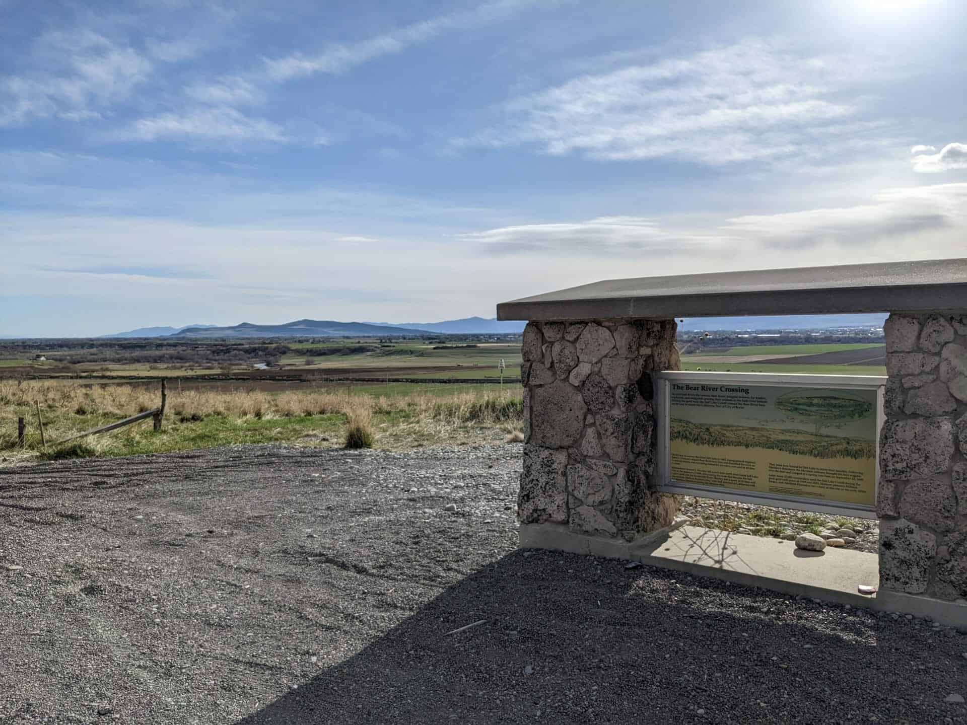
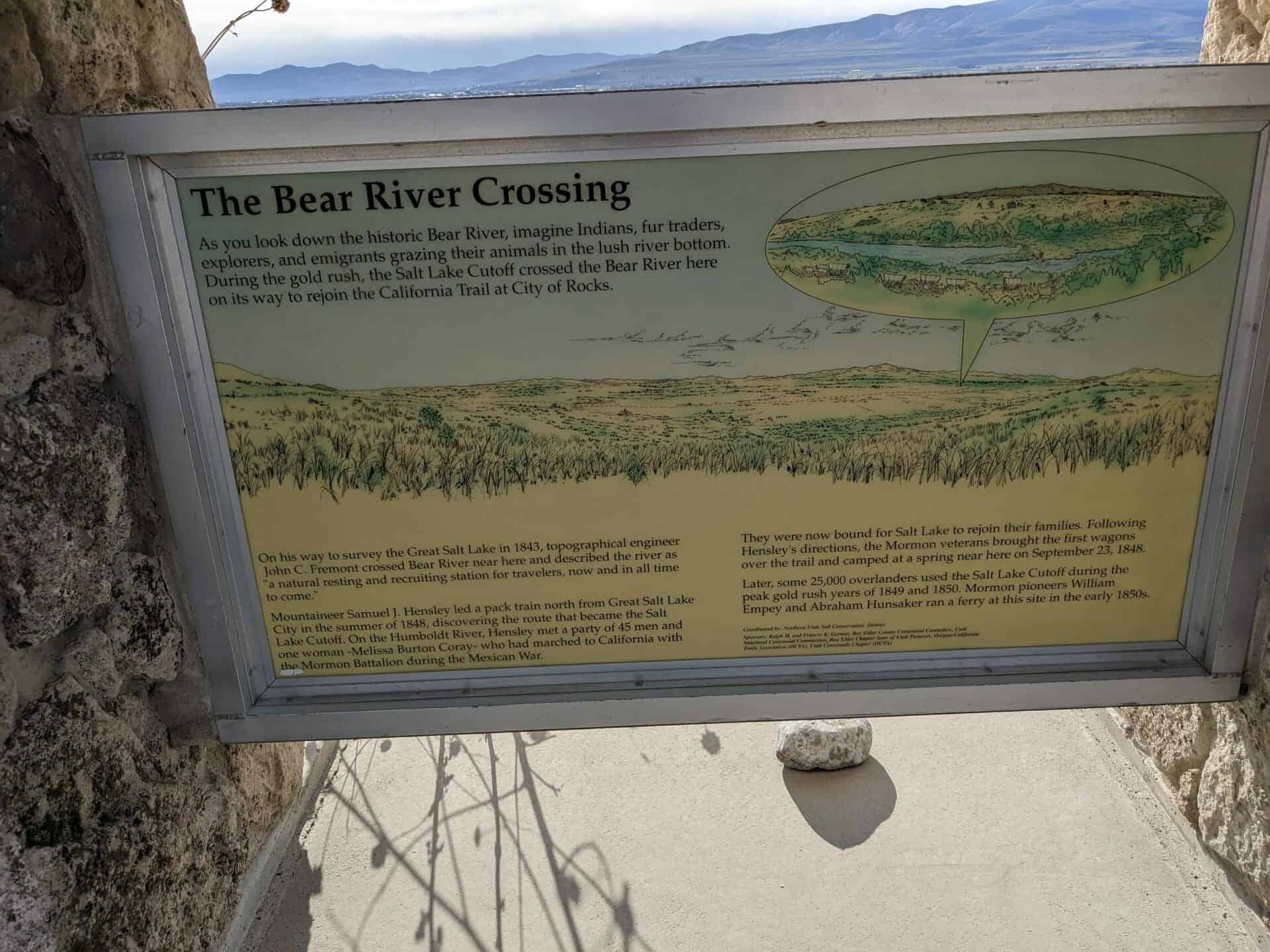
As you look down the historic Bear River, imagine Indians, fur traders, explorers, and emigrants grazing their animals in the lush river bottom. During the gold rush, the Salt Lake Cutoff crossed the Bear River here on its way to rejoin the California Trail at the City of Rocks.
On his way to survey the Great Salt Lake in 1843, topographical engineer John C. Freemont crossed Bear River near here and described the river as “a natural resting and recruiting station for travelers, now and in all time to come.”
Mountaineer Samuel J. Hensley led a pack train north from Great Salt Lake City in the summer of 1848, discovering the route that became the Salt Lake Cutoff. On the Humboldt River, Hensley met a part of 45 men and one woman – Melissa Burton Coray – who had marched to California with the Mormon Battalion during the Mexican War.
They were now bound for Salt Lake to rejoin their families. Following Hensley’s directions, the Mormon veterans brought the first wagons over the trail and camped at a spring near here on September 23, 1848.
Later, some 25,000 overlanders used the Salt Lake Cutoff during the peak gold rush years of 1849 and 1850. Mormon pioneers William Empey and Abraham Hunsaker ran a ferry at this site in the early 1850’s.
Crystal Spring was used as a watering place and campsite on an alternate route of the Mormon Trail in the mid-nineteenth century. The town site was designated as the provisional County Seat for Lincoln County in 1866. With the intention of organizing the new county, Governor Henry G. Blasdel left Carson City in April 1866, accompanied by over 20 people. After a perilous journey through Death Valley, California, they ran out of supplies and food. One man died; the others survived on lizards and other desert animals. The Governor and another man raced to Logan City to obtain supplies and returned lathe party so they reached Crystal Spring. The Governor found that the region lacked the number of voters necessary to meet the requirements to become a county. A year later the county government was organized at Hiko.
This is Nevada State Historical Marker #205, see others on this page: – Nevada Historic Markers
In 1865 a treaty was signed requiring the Indians to move to the Uintah Reservation, which had been established by Brigham Young in 1851. Lt. Pardon Dodds, the first official Indian agent, built a log cabin and fort in 1867 on the upper Duchesne River, one mile above Tabiona, which was used by soldiers during Indian uprisings. The agency was moved to Fort Duchesne in 1868. Later the fort was burned and rocks from the chimney, which stood as a landmark for many years, were used to build this monument.
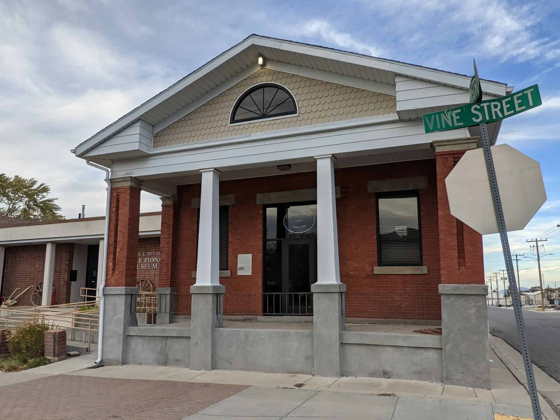
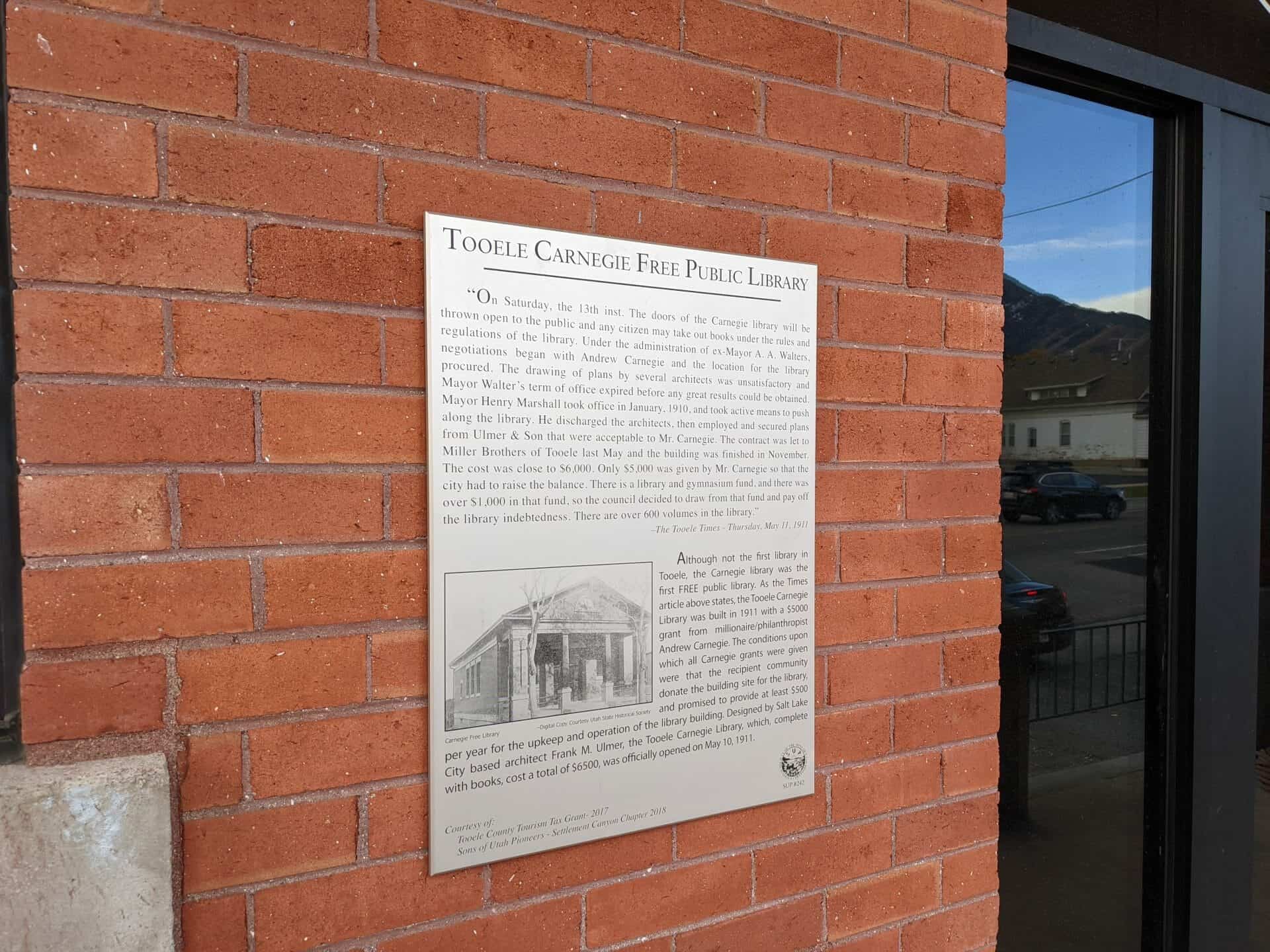
“On Saturday, the 13th inst. The doors of the Carnegie library will be thrown open to the public and any citizen may take out books under the rules and regulations of the library. Under the administration of ex-Mayor A. A. Walters, negotiations began with Andrew Carnegie and the location for the library procured. The drawing of plans by several architects, was unsatisfactory and Mayor Walter’s term of office expired before any great results could be obtained. Mayor Henry Marshall took office in January, 1910, and took active means to push along the library. He discharged the architects, then employed and secured plans from Ulmer & Son that were acceptable to Mr. Carnegie. The contract was let to Miller Brothers of Tooele last May and the building was finished in November. The cost was close to $6,000. Only $5,000 was given by Mr. Carnegie so that the city had to raise the balance. There is a library and gymnasium fund, and there was over $1,000 in that fund, so the council decided to draw from that fund and pay off the library indebtedness. There are over 600 volumes in the library.” – The Tooele Times – Thursday, May 11, 1911
Although not the first library in Tooele, the Carnegie library was the first FREE public library. As the Times article above states, the Tooele Carnegie Library was built in 1911 with a $5000 grant from millionaire/philanthropist Andrew Carnegie. The conditions upon which all Carnegie grants were given were that the recipient community donate the building site for the library, and promised to provide at least $500 per year for the upkeep and operation of the library building. Designed by Salt Lake City based architect Frank M. Ulmer, the Tooele Carnegie Library, which, complete with books, cost a total of $6500, was officially opened on May 10, 1911.
This page is for the Sons of Utah Pioneers historic marker on the building, the page directly for the building itself is located here: Tooele Carnegie Library
As winter gave way to spring in 1855, twelve missionaries were sent to southern Utah by Brigham Young to colonize this region. Fearing an attack by Indians, they began the ambitious project of building a fort. Their energies were initially directed at hauling stone which was plentiful and nearby. Local Indians, whom they trained and who were willing to help in exchange for food, assisted them. As soon as enough stone had been gathered, the work on Fort Santa Clara began in earnest. Four stone masons from Cedar City directed the work which took approximately three weeks to complete. While inspecting the fort during one of his visits south, Mormon Leader Brigham Young pronounced it, “the best fort in the territory.”
Because of the efforts of the missionaries, there was great peace among everyone who lived in this area. The fort was never attacked by Indians. The fort became the focal point for the Swiss Settlers who arrived in November 1861.
“On Christmas Day 1861, it started to rain. We were known to have a skiff of snow about this time of year, but this year it rained, and it rained for about a month and a half. The ground became completely saturated, and the small creeks feeding the Santa Clara became streams, and the Santa Clara became a torrent. Some small trees and other debris washed down from above, backed up the Santa Clara, and during the night of 4 February 1862, the Santa Clara ran over its bank and started entering the fort from the north gate. Sarah and I awoke with water in our cabin, and we rushed out into the night in our bed clothes to warn others. By then the water was washing away our cabin on the southwest corner of the fort. The women and children were carried to safety. Two hundred bushels of the Indian’s wheat was carried from the northwest cabin to safety before that wall collapsed. We were all exhausted from the effort. Sarah and I lost everything we had except for my horses and saddles. We rushed out into the night without taking time to dress. Many miraculous events took place that night. It was dark and raining, the fort was washing away. Wheat was saved, children led and carried to safety. Some were able to save some valuables, but most was lost. But God was good to them, not one life was taken.
At conference, 22 March 1862, Jacob Hamblin was called to be the new President of the Indian Mission. With the importance of his new position and the disaster of losing the fort in the flood, Jacob started building a new home. Most of Jacob’s garden area and orchard by the fort were destroyed, so he started again. The stone from the north wall of the fort was used in building the structure, and the Swiss people used the rest, so the last of the fort wall disappeared.” – Ira Hatch, Indian Missionary, by Richard Ira Elkins
Today, within the walls of some of the homes in our community, these rock walls still stand as a shelter to the inhabitants of this beautiful city of Santa Clara. Jacob Hamblin’s home, now registered as a historical site and open for public visits, is a reminder of the courage of those who fought the vagaries of nature and made this part of the world their garden.
How Would You Build a Fort?
A single community cabin was the starting point for the fort. The fort was to be one hundred feet long on each side with stone walls twelve feet high and about two feet thick. The plan called for seven cabins on each side of the fort. Each cabin was about twelve and one-half feet wide and twenty feet deep and had one door and one window. Stone fireplaces, placed in the center back wall of each cabin, provided a good portion of the outside wall of the fort. The inside cabin walls were of logs, except for the end cabins which had two walls of rock. The cabin roofs were supported on logs set into the rock on one end and on log walls on the inside of the fort. Protective gun ports were built into the outside rock walls. On the east and west side of the fort, defenders would lie on the roof tops to fire from the gun ports. Wooden ladders gave access to the raised platforms on the north and south sides. The main gate faced south; a smaller cattle gate was built into the center of the north wall. Entrance into the fort was gained by two doors on the south side which faced the road. These doors swung on heavy iron hinges built into the rock; heavy cross members, about three inches thick, were bolted to them for strength. The doors were locked with four by six inch beams placed into carriers. A large iron hasp held them closed when the beams were not needed.
The Stockyard
In 1996, the foundation of the Fort Santa Clara Stockyard was unearthed. The original stockyard was located some distance away from Fort Santa Clara so the animals would not be a nuisance to those living in the fort. The animals could be easily watched from the fort which was south from here toward the Santa Clara River.
The Missionaries
The monument is dedicated to the following men who colonized the Santa Clara area.
The five missionaries were:
Jacob Hamblin
Ira Hatch
Samuel Knight
Thales Haskell
Missionaries called at October 1853 General Conference to the Indian Mission, Southwest Territory:
Pahranagat Valley is named after a local Shoshone Native American Tribe. Three local springs fill the valley’s lakes, which farmers have used for irrigation since the mid-nineteenth century.
In the late 1860s, outlaws pastured hundreds of head of stolen cattle in the valley meadows.
In 1865, ore was discovered in the area. The following year, a stamp mill was established at Hiko, twenty miles to the north to crush the ore. Hiko became the center of activity for the valley and the county seat between 1866 and 1871, when local mining declined and Pioche claimed the county seat.
The valley received international notoriety in 1867 when Dan De Quille of the Territorial Enterprise published an article titled “The Rolling Stones of Pahranagat,” about magnetic traveling stones. De Quille was notorious for publishing comedy and satire, sometimes mistaken by his readership for truth. In this case, De Quille described these round stones as having a magical quality that, when scattered on the floor, would immediately began travelling toward a common center. De Quille published similar articles on the stones in 1876, 1879, and 1892.
The town of Alamo before you, established in 1900, is the valley’s largest present-day settlement. Watered by Pahranagat Creek, the area includes several ranches and the Pahranagat Valley National Wildlife Refuge.
This is Nevada State Historical Marker #38, see others on this page: – Nevada Historic Markers