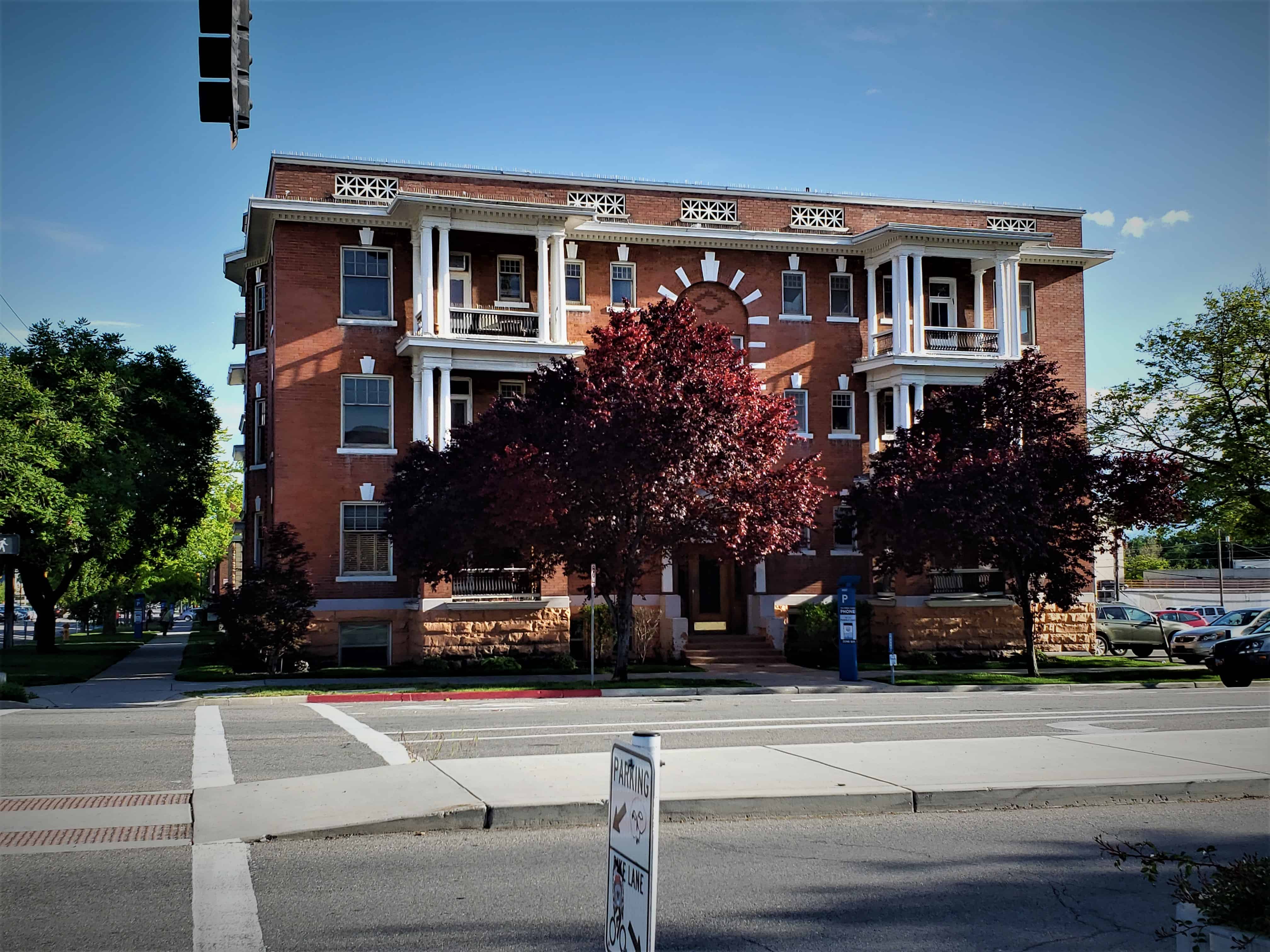
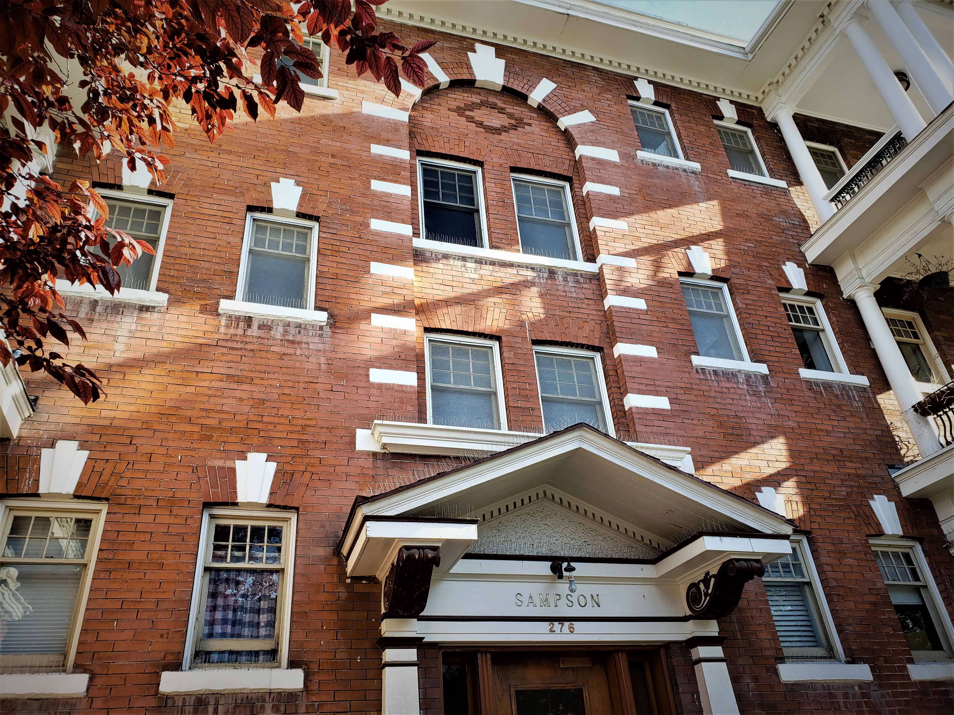
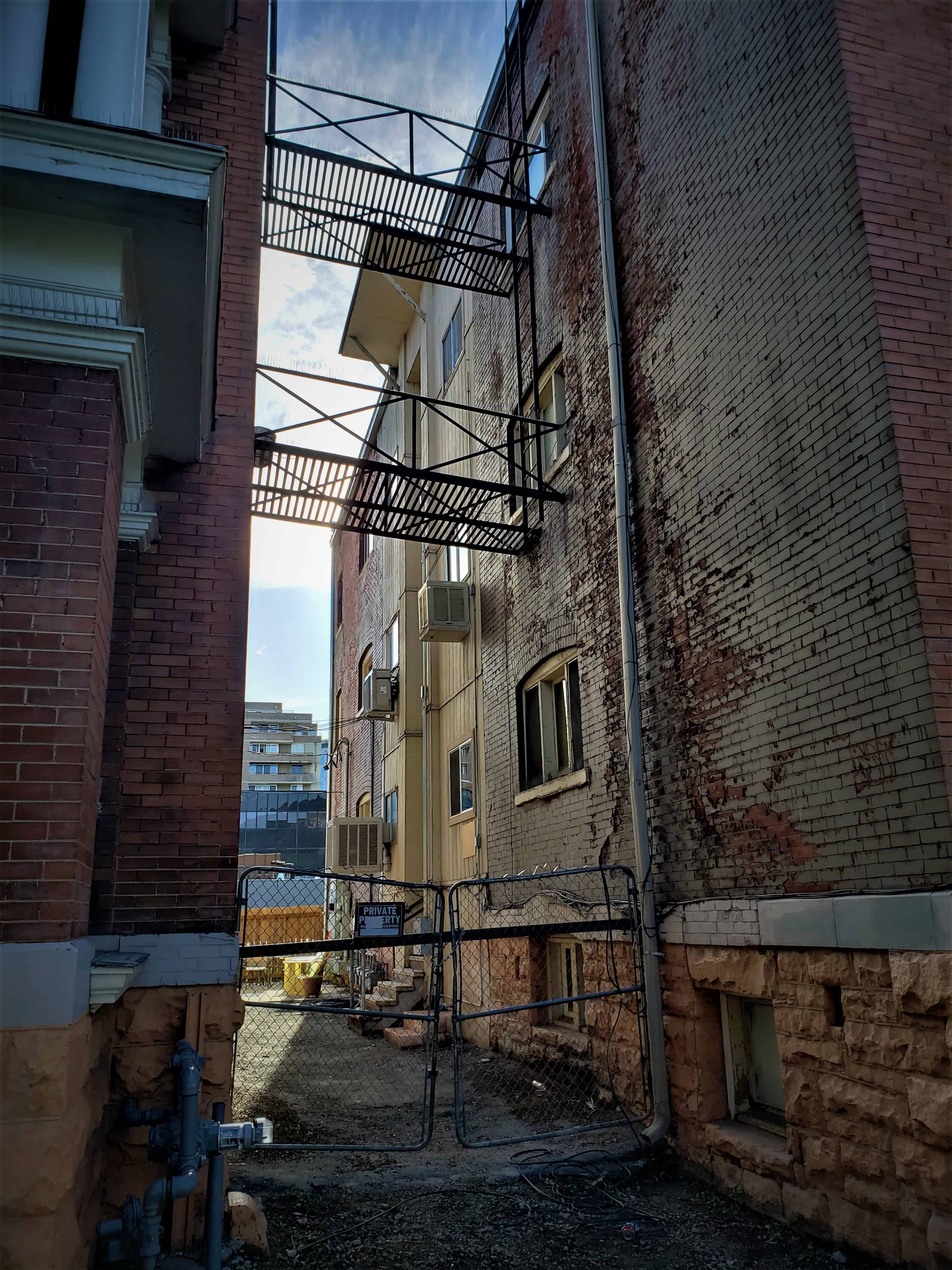
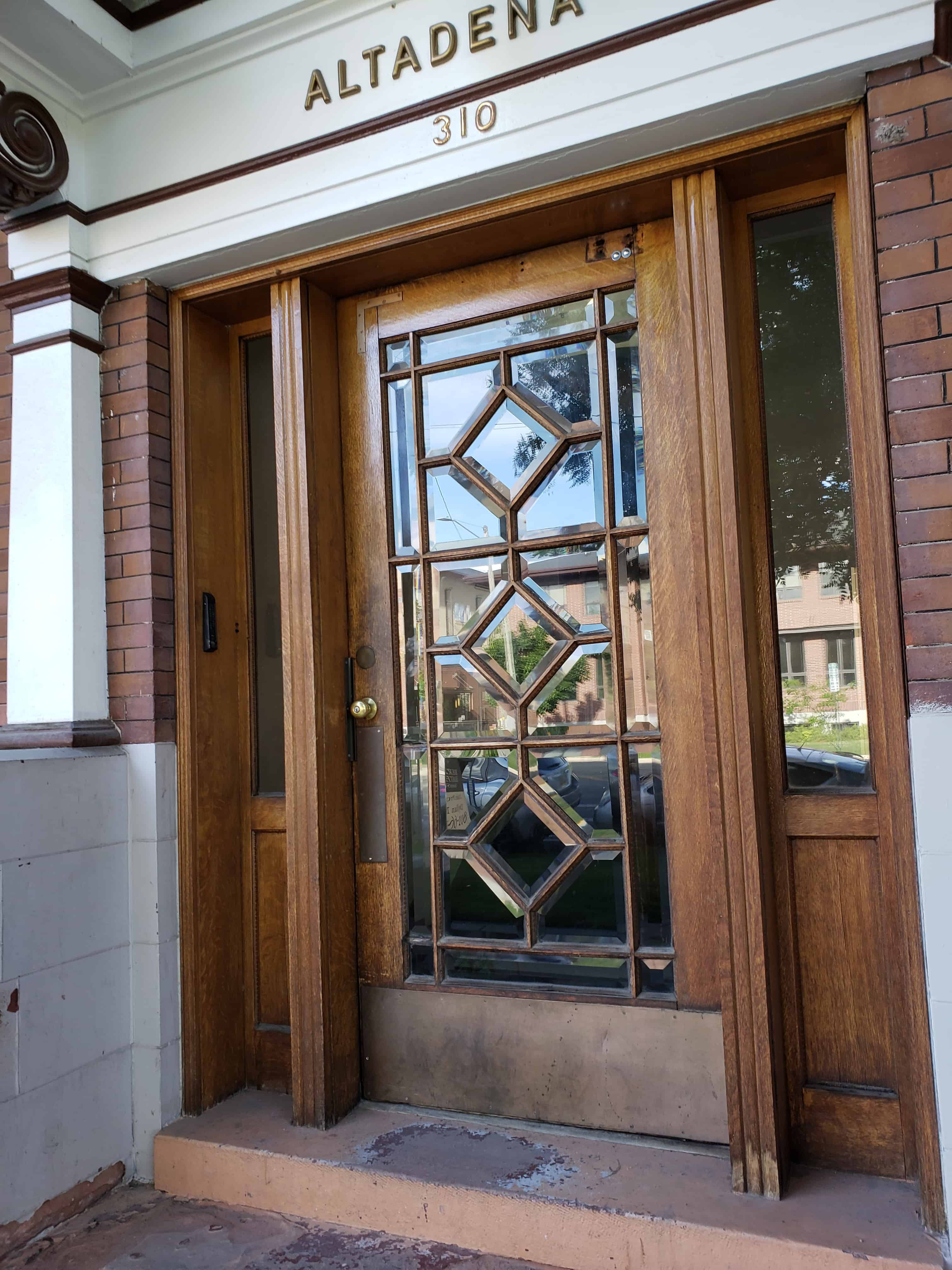
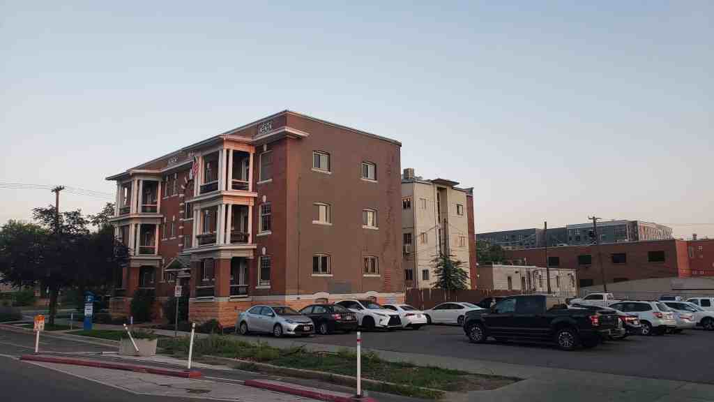
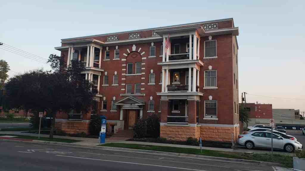
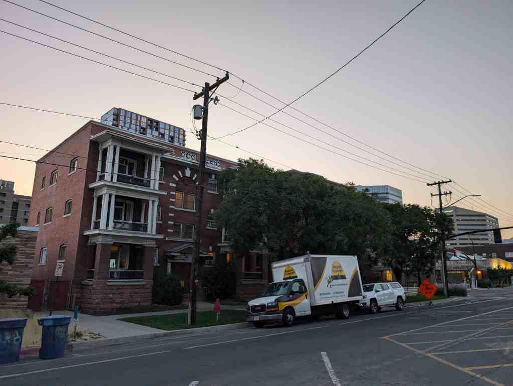
Sampson and Altadena: 276 East 300 South & 310 South 300 East in Salt Lake City, Utah
The twin apartment buildings Atadena and Sampson were built in 1905 or 1906 according to different sources. They are listing on the National Register of historic places and were built according to Wikipedia by Octavius Sampson for $21,000.
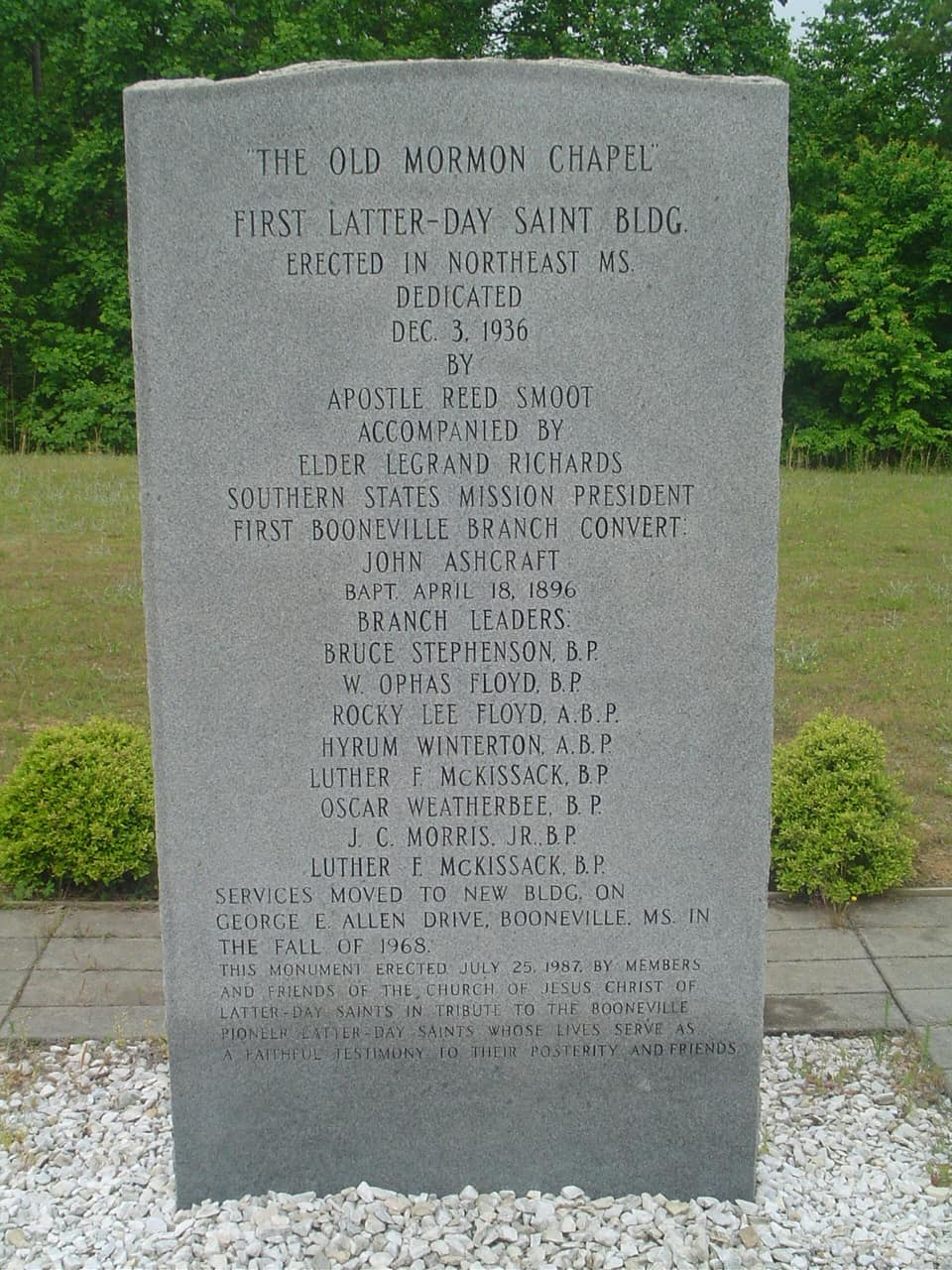
First Latter-Day Saint Building erected in Northeast Mississippi.
Dedicated December 3rd, 1936 by Apostle Reed Smoot, accompanied by Elder LeGrand Richards – Southern States Mission President. First Booneville Branch Convert, John Ashcraft – Baptized April 18, 1896.
Branch Leaders:
Bruce Stephenson, B.P.
W. Ophas Floyd, B.P.
Rocky Lee Floyd, A.B.P.
Hyrum Winterton, A.B.P.
Luther F. McKissack, B.P.
Oscar Weatherbee, B.P.
J.C. Morris, B.P.
Luther F. McKissack, B.P.
Services moved to new building on George E. Allen Drive, Boonville, MS. in the fall of 1968.
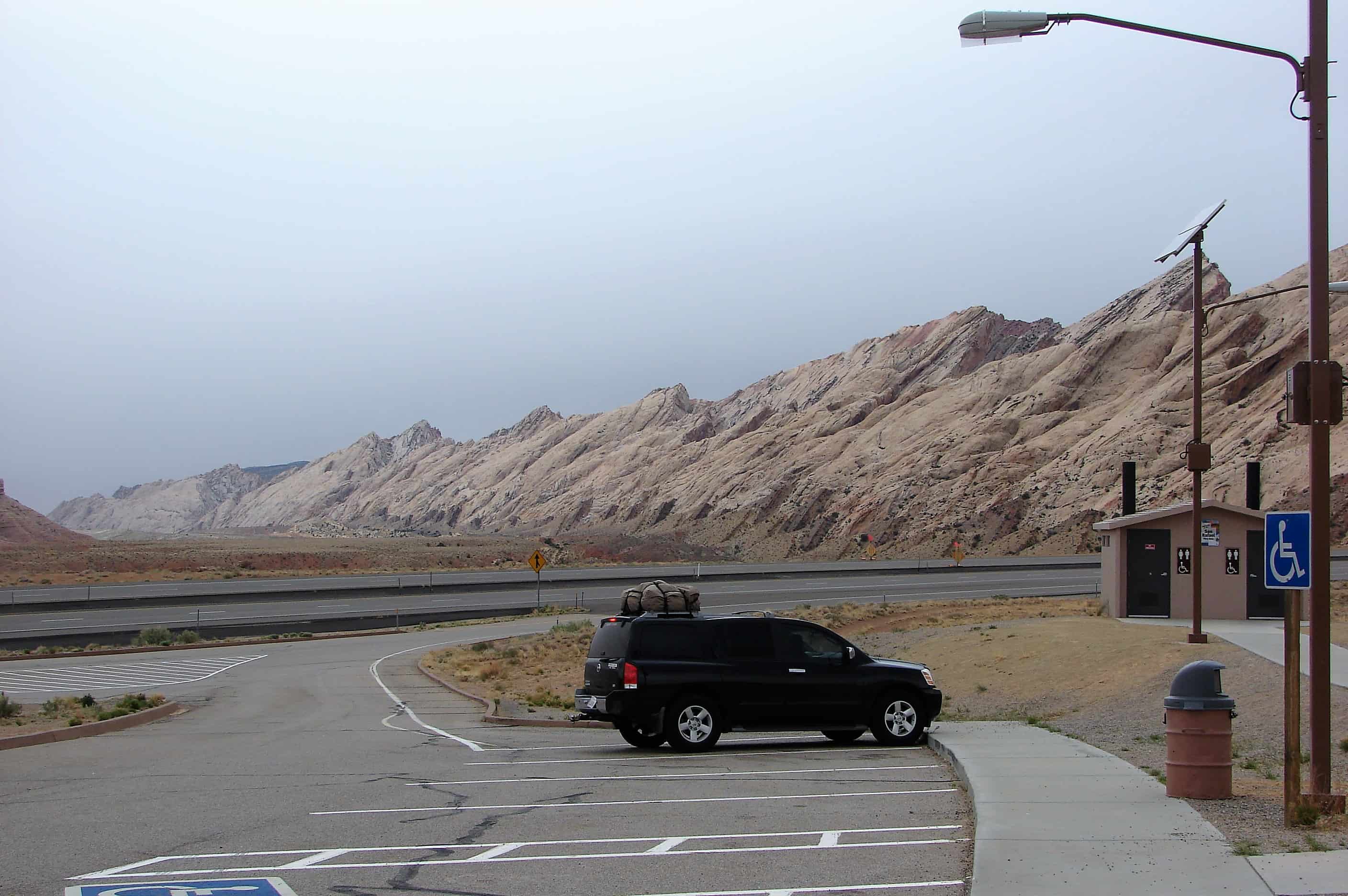
There are several rest areas to stop and see amazing views and read plaques and markers while traveling Interstate 70 across the San Rafael Swell in Utah.
This is also the longest stretch of freeway without gas so make sure you fill up, there are longer stretches of highway but as for freeway this is it.
Here is an assortment of some of the signs and things to see/read.
Forces at Work
The mountain to the southeast, the San Rafael Knob, is 7,921 feet above sea level, the highest point in the San Rafael Swell. This deep canyon is Devil’s Canyon. It cuts through the Carmel Formation, made of limestone and sandstone deposited in a sea that has gone for 180 million years.
The dramatically long and steep slopes below the Carmel are formed of Navajo sandstone, a formation prevalent through-out the Colorado Plateau, forming spectacular views throughout Utah and Colorado. You are still ascending the west side of the rock dome that is the San Rafael Swell. An anticline of huge proportions, the Swell was formed when forces below pushed up layers of rock in the earth’s crust. Erosion has worn away overlaying layers, forming the canyons, pinnacles, and peaks you see here and as you drive farther east. Imagine a rainbow with a rough and ragged flat top where every ribbon of color is revealed.
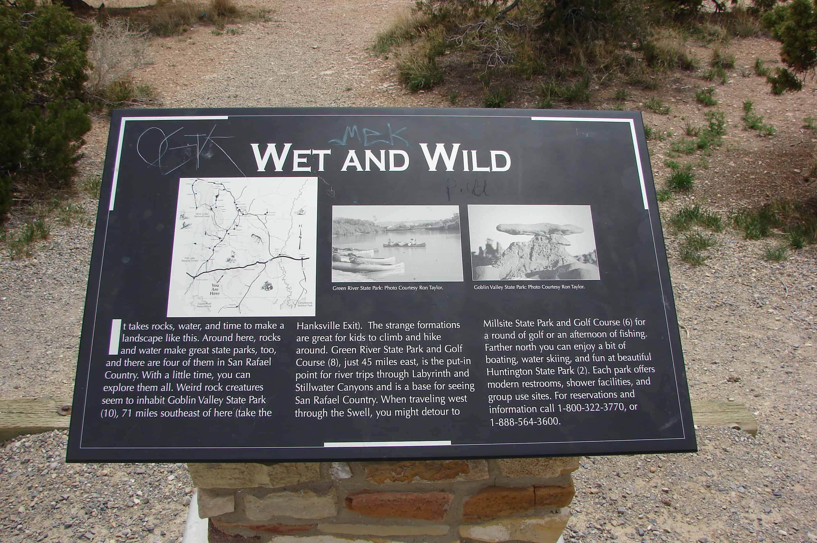
Wet and Wild
It takes rocks, water, and time to make a landscape like this. Around here, rocks and water make great state parks, too, and there are four of them in San Rafael County. With a little time, you can explore them all. Weird rock creatures seem to inhabit Goblin Valley State Park, 71 miles southeast of here (take the Hanksville Exit). The strange formations are great for kids to lcimb and hike around. Green River State Park and Golf Course, just 45 miles east, is the put-in point for river trips through Labyrinth and Stillwater Canyons and is a base for seeing San Rafael County. When traveling west through the Swell, you might detour to Millsite State Park and Golf Course for a round of gold or an afternoon of fishing. Father north you can enjoy a bit of beating, water skiing, and fun at beautiful Huntington State Park. Each park offers modern restrooms, shower facilities, and group use sites.
Home to Many
Humans have lived among these rocks and cliffs for longer than you can imagine. Archaeological investigations conducted as part of the interstate construction across the Swell during the 1970s and 1980s located over a hundred prehistoric sites. The sites show the hundreds of generations of Native American people inhabited this rugged land for thousands of years and in all seasons. Archaeologists explored sites from the early Archaic Period of hunting and gathering, about 9,500 years ago, up to historic ranching sites of the early 20th century. People survived by hunting and gathering until about the time of Christ, when small-scale agriculture, dependent on corn, beans, and squash, was adopted. Archaeological remains of these farmers, whom we call Fremonts, include small settlements of pit swellings, granaries, outdoor shaded work areas, hearths, storage pits, and trash mounds. The earliest evidence of farming on the Swell dates to about A.D. 500 at the Confluence Site. This site provided important insight into the transition from hunting and gathering to agriculture in the region, and predated previously known agriculture sites by 200 years, Bows and arrows and ceramics were the technological innovations of this time. Researchers found Fremont sites in the Ghost Rocks area, a few miles east of here, which is an upland environment and not well suited for growing corn. Study of the sites told archaeologists much about the Fremont way of life, which included hinting and gathering year-round and farming at lower elevations along riverbanks.
Ghost Rock
Imagine riding your horse through the San Rafael Swell in a heavy fog. Standing above the fog are two huge white rocks. Would you think you had seen a ghost? A cowboy thought so, hence its name – Ghost Rock. Cowboys in the Swell were a daring, tough lot, and the Swasey Brothers, (Charlie, Sid, Joe, and Rod) were tougher than most. They herded cows and rounded up wild horses here. Their cabin still stands, nestled in the white sandstone cliffs below, in an area called the Head of Sinbad. Here they built horse traps made from twisted juniper. It was here Joe had his “office” in an alcove in the white sandstone. Father east, Charlie bed Sid his herd of cattle that Sid couldn’t jump his horse across the deep San Rafael River gorge. It was about a 16-foot jump. He made the jump, won the cattle, and became a legend in San Rafael County.
Cowboys of the San Rafael
The Wild West is still wild in Castle Valley. Cowboys mounted on horseback still trail battle to high mountain pastures or to San Rafael Swell grazing allotments. During summer, rodeo cowboys take their chances on an eight-second ride at community-sponsored amateur rodeos such as the San Rafael Pro Rodeo, the Black Diamond Stampede, or sometimes just in the corral out back.
Almost anyone can enjoy a western adventure, brandin’, ropin’, and ridin’ with real cowboys of the San Rafael. Outfitters can guide you into the wilds of the San Rafael for the experience of a lifetime. You can reach the ranching communities of Castle Valley by taking the Moore Exit, following the Moore Road northwest to SR-10 and then north to Ferron. Turning south will take you to the town of Emery and on to the I-70 interchange at Fremont Junction.
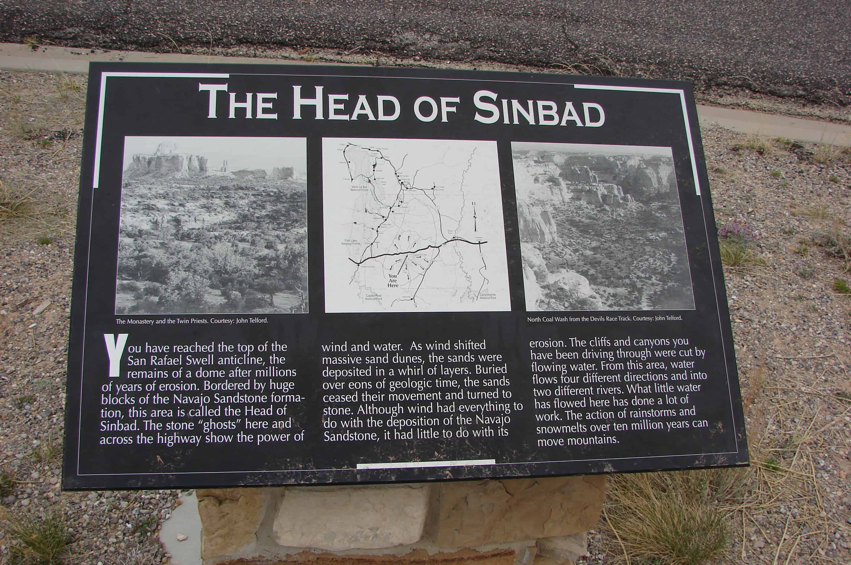
The Head of Sinbad
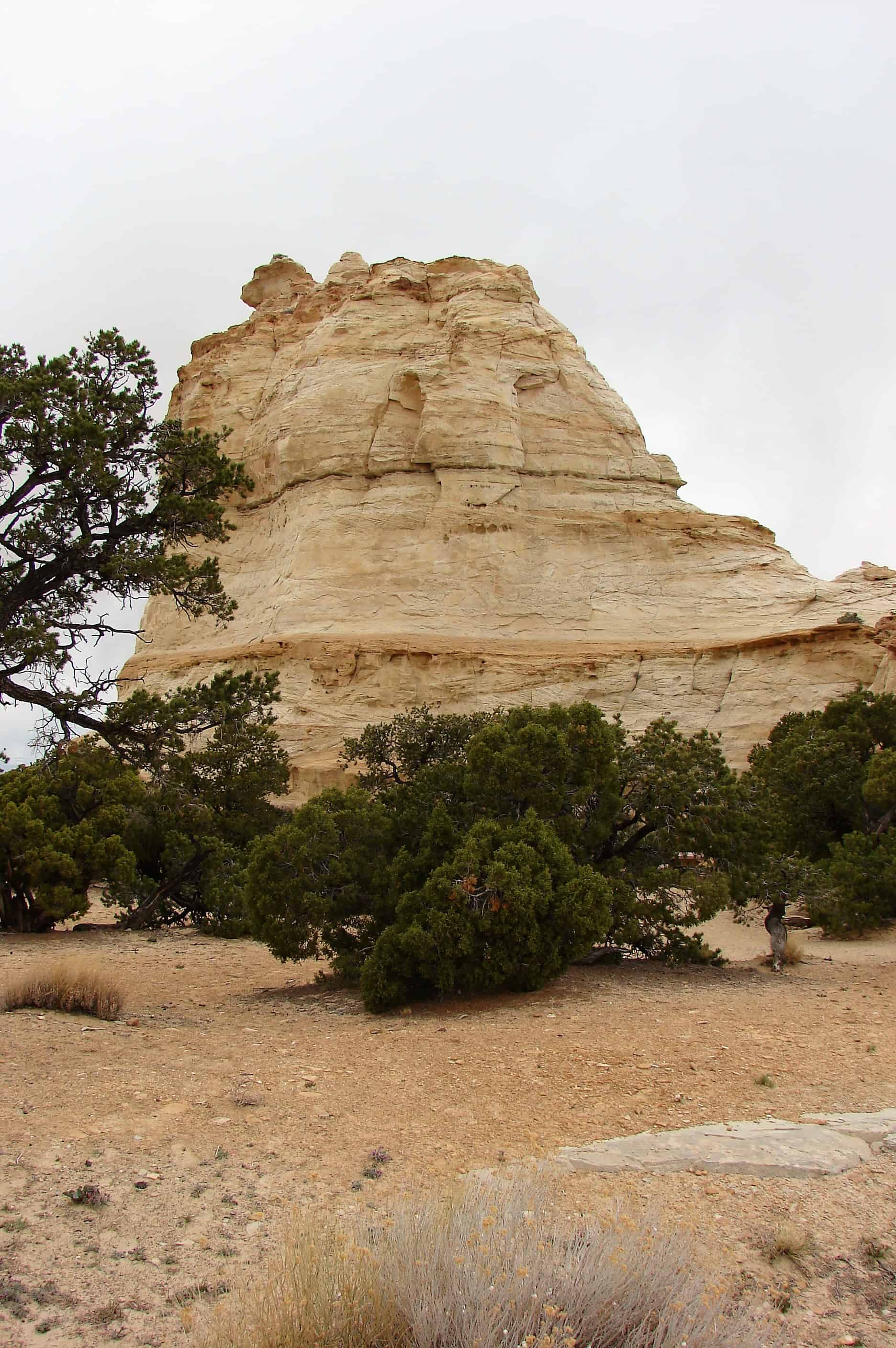
You have reached the top of the San Rafael Swell anticline, the remains of a done after millions of years of erosion. Bordered by huge blocks of the Navajo Sandstone formation, this area is called the Head of Sinbad. The stone “ghosts” here and across the highway show the power of wind and water. As wind shifted massive sand dunes, the sands were deposited in a whirl of laters. Buried over eons of geologic time, the sands ceased their movement and turned to stone. Although wind had everything to do with the deposition of the Navajo Sandstone, it had little to do with its erosion. The cliffs and canyons you have been driving through were cut by flowing water. From this area, water flows four different directions and into two different rivers. What little water has flowed here has done a lot of work. The action of rainstorms and snowmelts over ten million years can move mountains.
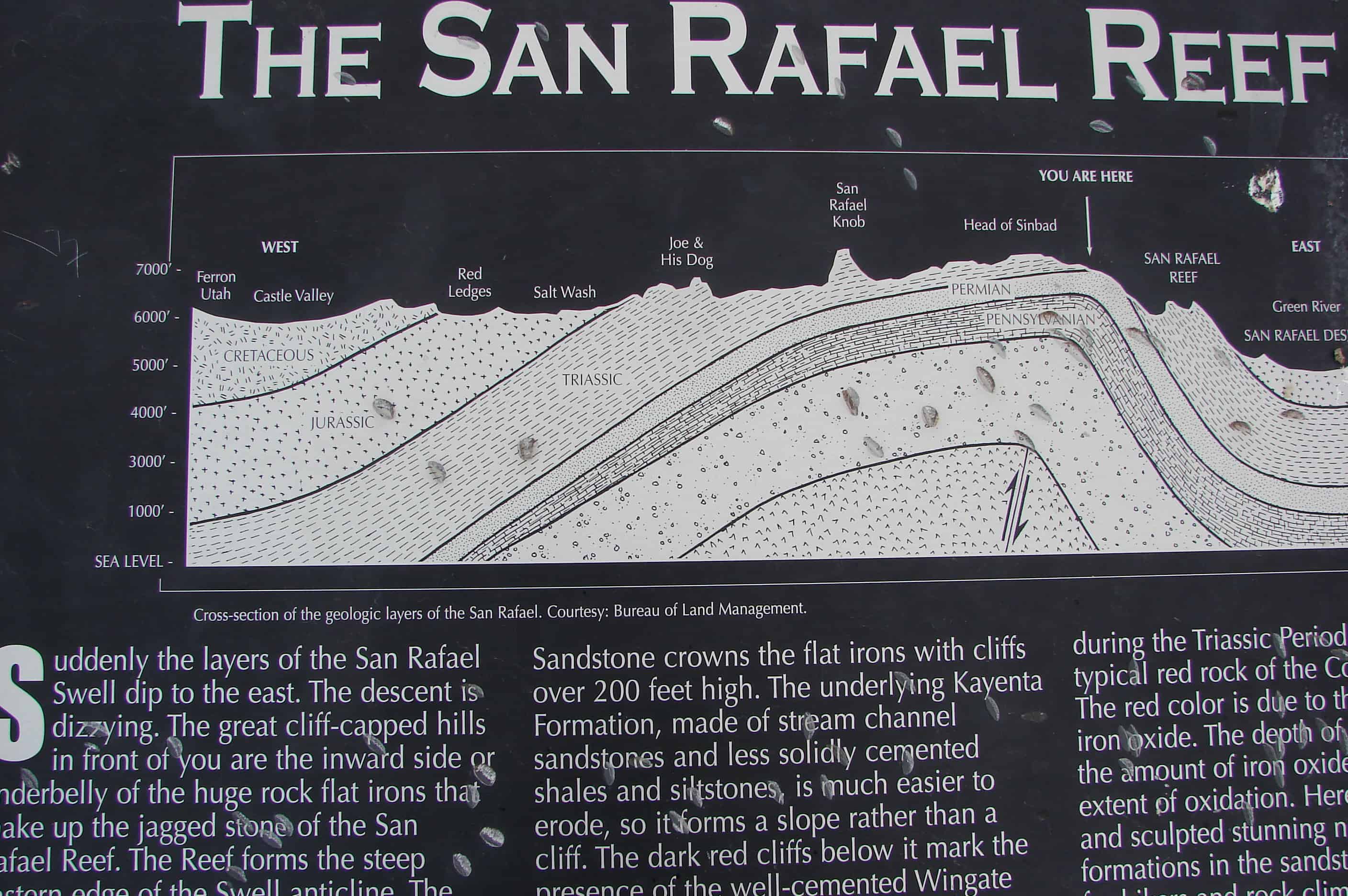
The San Rafael Reef
Suddenly the layers of the San Rafael Swell dip to the east. The descent is dizzying. The great cliff-capped hills in front of you are the inward side or underbelly of the huge rock flat irons that make up the jagged stone of the San Rafael Reef. The Reef forms the steep eastern edge of the Swell anticline. The solidly cemented, hard-to-erode Navajo Sandstone crowns the flat irons with cliffs over 200 feet high. The underlying Kayenta Formation, made of stream channel sandstones and less solidly cemented shales and siltstones, is much easier to erode, so it forms a slope rather than a cliff. The dark red cliffs below it mark the presence of the well-cemented Wingate Sandstone. These layers were deposited during the Triassic Period. This is the typical red rock of the Colorado Plateau. The red color is due to the presence of iron oxide. The depth of color depends on the amount of iron oxide in the sands and extent of oxidation. Here water has sliced and sculpted stunning narrow canyons and formations in the sandstone – a paradise for hikers and rock climbers.
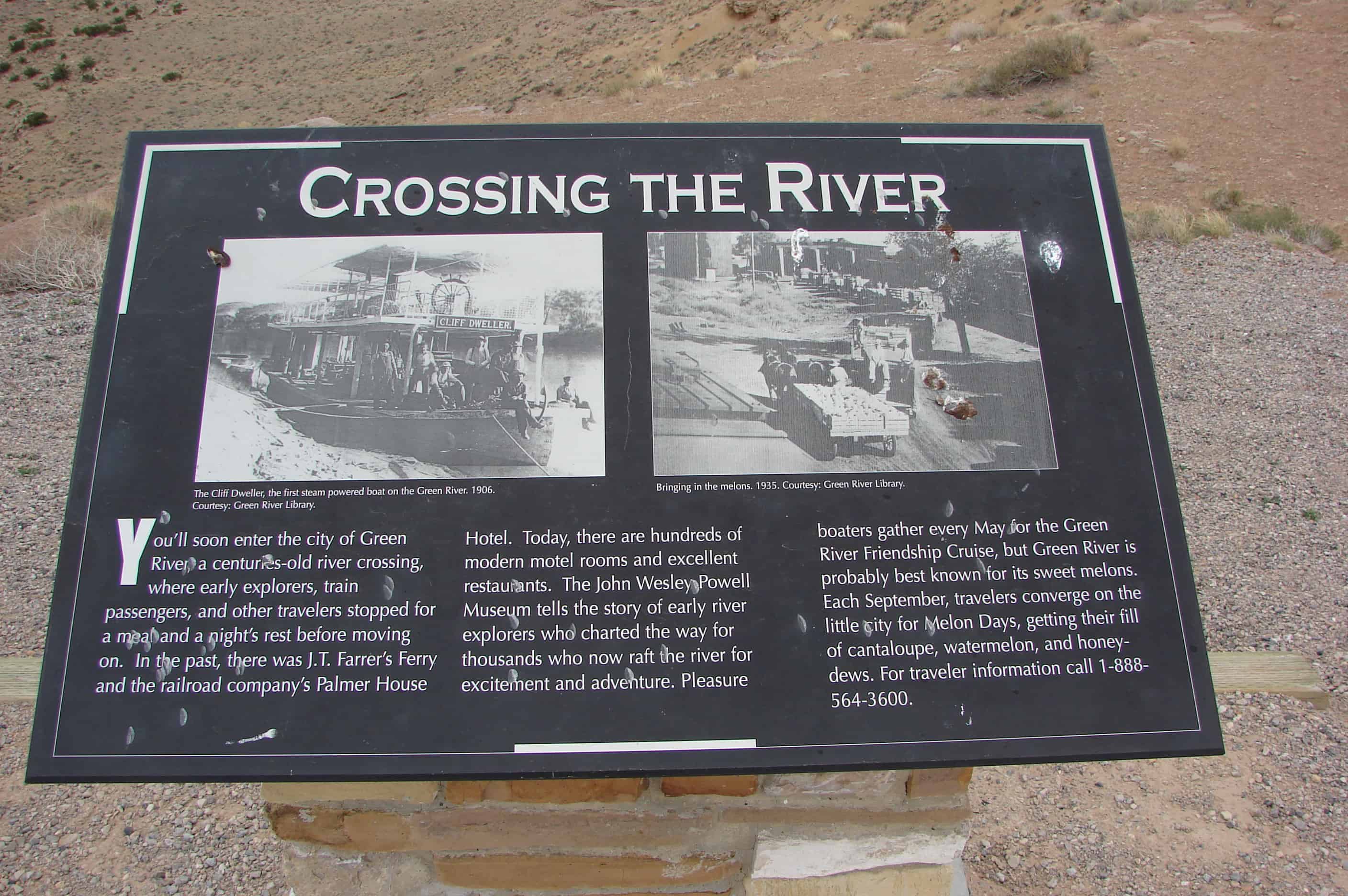
Crossing the River
You’ll soon enter the city of Green River, a centuries-old river crossing, where early explorers, train passengers, and other travelers stopped for a meal and a night’s rest before moving on. In the past, there was J.T. Farrer’s Ferry and the railroad company’s Palmer House Hotel. Today, there are hundreds of modern motel rooms and excellent restaurants. The John Wesley Powell Museum tells the story of early river explorers who charted the way for thousands who now raft the river excitement and adventure. Pleasure boaters gather every May for the Green River Friendship Cruise, but Green River is probably best known for its sweet melons. Each September, travelers converge on the little city for Melon Days, getting their fill of cantaloupe, watermelon, and honeydews.
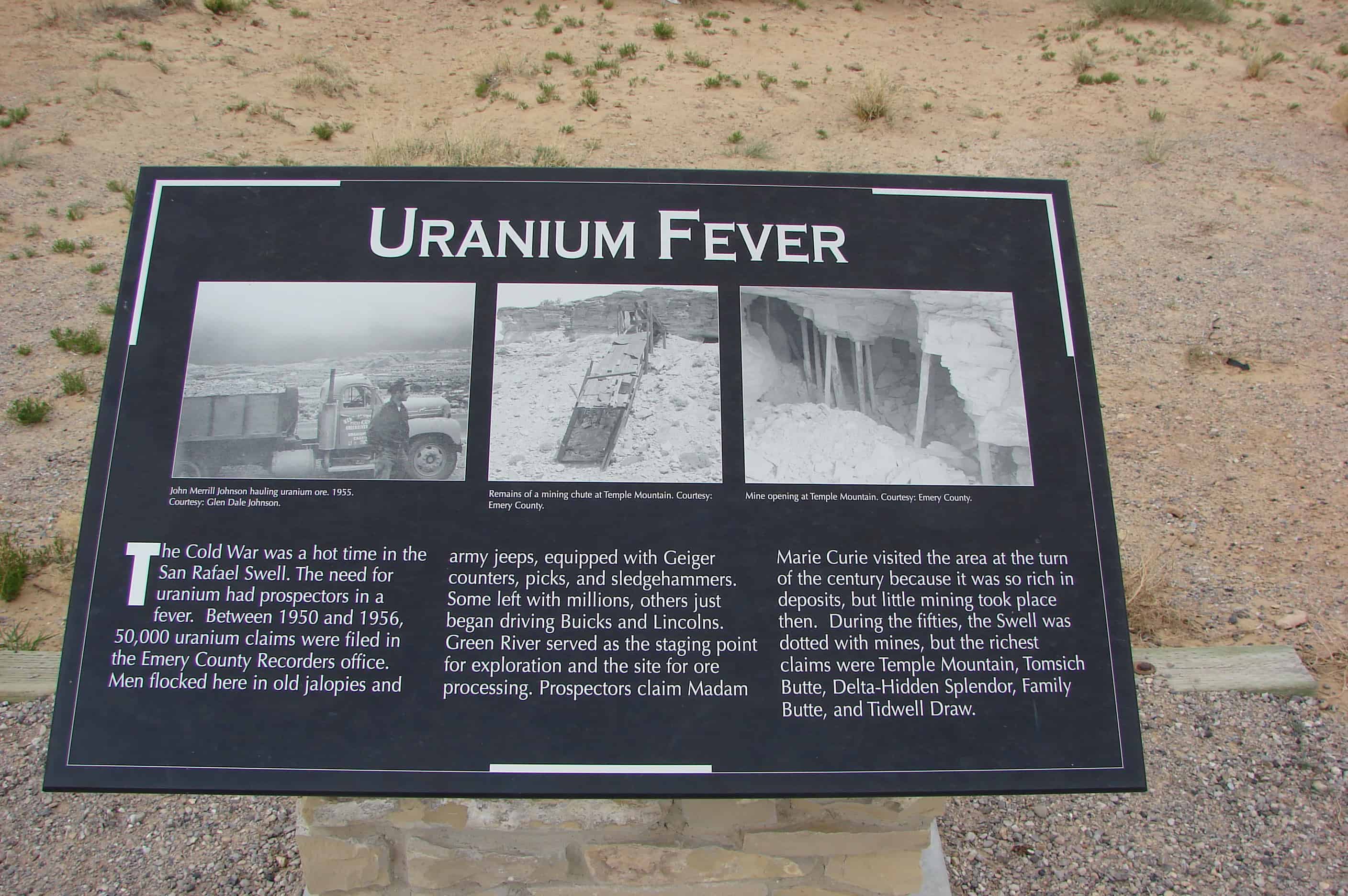
Uranium Fever
The Cold War was a hot time in the San Rafael Swell. The need for uranium had prospectors in a fever. Between 1950 and 1956, 50,000 uranium claims were filed in the Emery County Recorders office. Men flocked here in old jalopies and army jeeps, equipped with Geiger counters, picks, and sledgehammers. Some left with millions, others just began driving Buicks and Lincolns. Green River served as the staging point for exploration and the site for ore processing. Prospectors claim Madam Marie Curie visited the area at the turn of the century because it was so rich in deposits, but little mining took place then. During the fifties, the Swell was dotted with mines, but the richest claims were Temple Mountain, Tomsich Butte, Delta-Hidden Splendor, Family Butte, and Tidwell Draw.
The Silent City
The people of Green River call this the Silent City, a jagged cityscape formed by a great rock wall, the San Rafael Reef. You are about to enter and cross the San Rafael Swell, a large anticline where the earth’s crust has been heaved from below to form a great down of rock layers. Erosion, over millions of years, has erased the top of the dome. Imagine a rainbow with a rough and ragged flat top where every band of color is revealed. Here, at the eastern edge of the anticline, erosion has sliced and sculpted the steeply tiled layers of hard sandstone. Slot canyons, spectacular pour-offs, sheer cliffs, and miles of desert varnish remain. Exploring the San Rafael Swell off I-70 can be fascinating but dangerous to the novice. Be sure you have plenty of water, gasoline, good, and a reliable map.
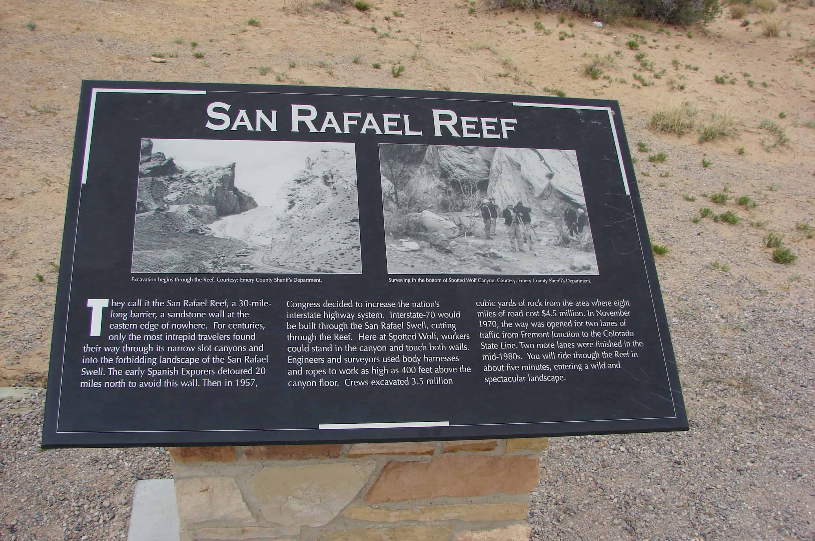
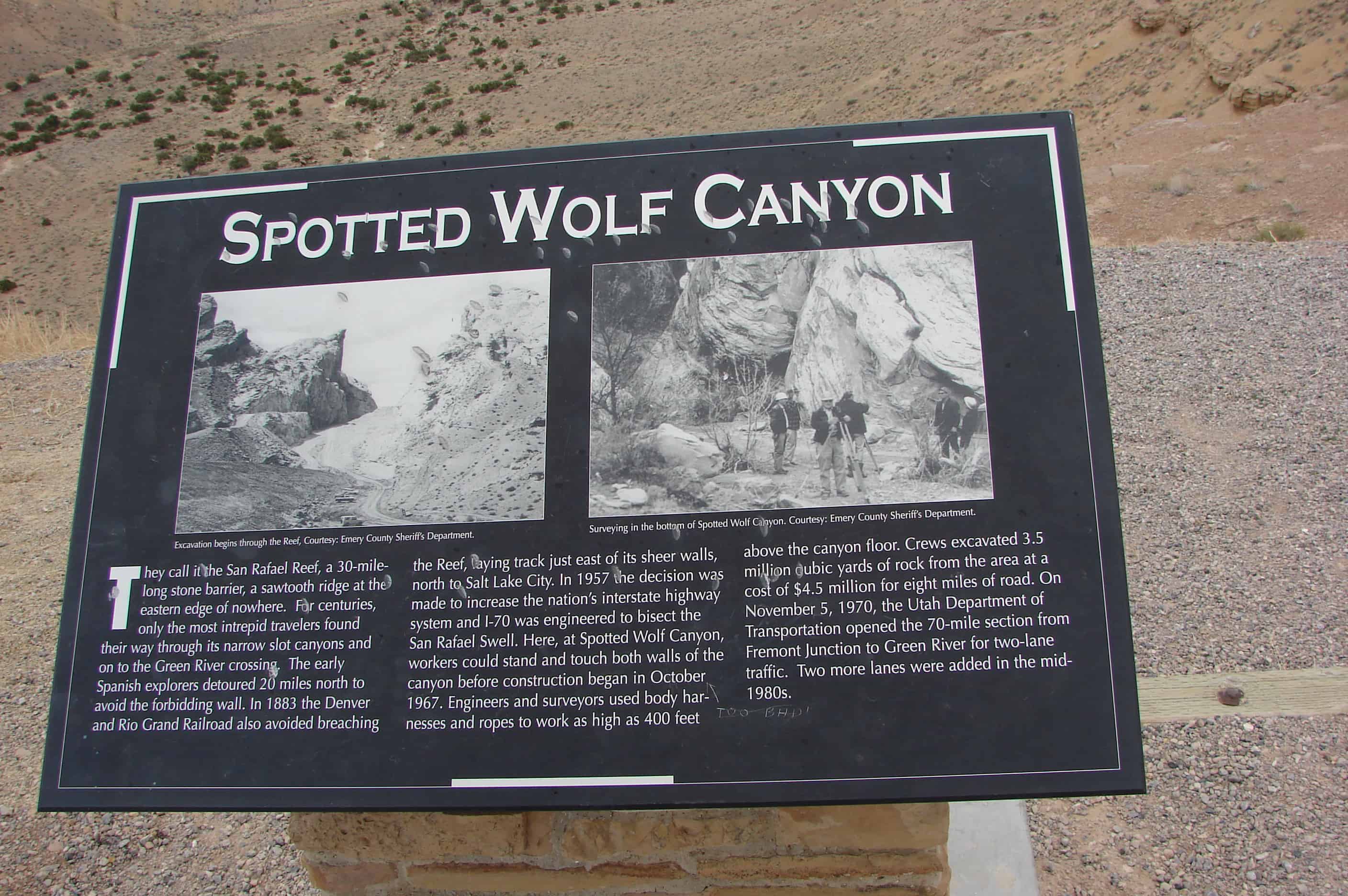
San Rafael Reef / Spotted Wolf Canyon
They call it the San Rafael Reef, a 30-mile-long barrier, a sandstone wall at the eastern edge of nowhere. For centuries, only the most intrepid travelers found their way through its narrow slot canyons and into the forbidding landscape of the San Rafael Swell. The early Spanish Explorers detoured 20 miles north to avoid this wall. Then in 1957, Congress decided to increase the nation’s interstate highway system. Interstate-70 would be built through the San Rafael Swell, cutting through the Reef. Here at Spotted Wolf, workers could stand in the canyon and touch both wall. Engineers and surveyors used body harnesses and ropes to work as high as 400 feet above the canyon floor. Crews excavated 3.5 million cubic yards of rock from the area where eight miles of road cost $4.5 million. In November 1970, the way was opened for two lanes of traffic from Fremont Junction to the Colorado State Line. Two more lanes were finished in the mid-1980s. You will ride through the Reef in about give minutes, entering a wild and spectacular landscape.
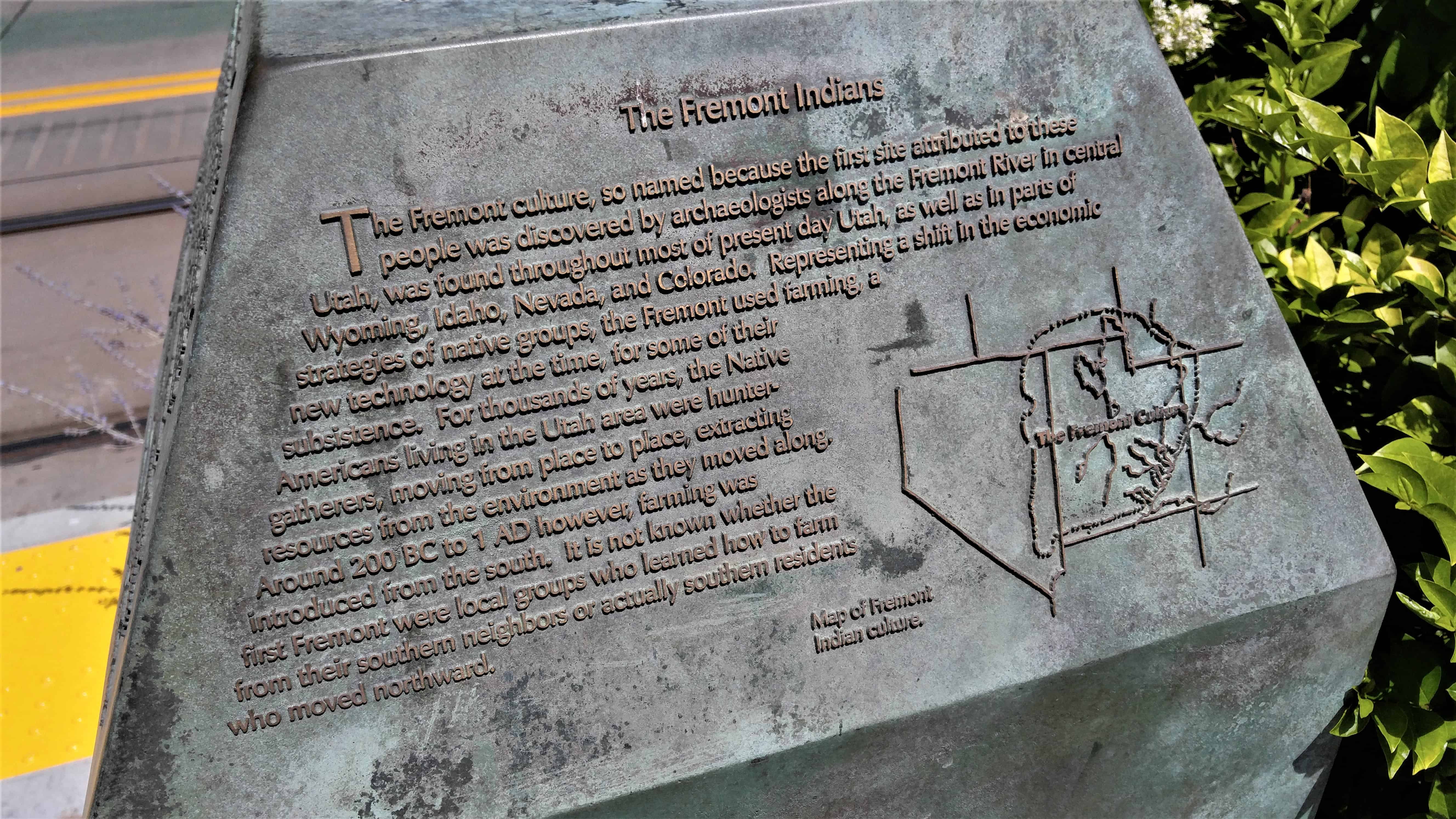
The Fremont culture, so named because the first site attributed to these people was discovered by archaeologists along the Fremont River in central Utah, was found throughout most of present day Utah, as well as in parts of Wyoming, Idaho, Nevada, and Colorado. representing a shift in the economic strategies of native groups, the Fremont used farming, a new technology at the time, for some of their subsistence. For thousands of years, the Native Americans living in the Utah area were hunter-gatherers, moving from place to place, extracting resources from the environment as they moved along. Around 200 BC to 1 AD however, farming was introduced from the south. It is not known whether the first Fremont were local groups who learned how to farm from their southern neighbors or actually southern residents who moved northward.
A Remarkable Discovery
When TRAX light rail construction along South Temple Street near Third West uncovered bones in a backhoe trench on June 8th, 1998, archaeologists from the State Antiquities Section investigated and determined that an archaeological site had been encountered. Excavation of the site by the Antiquities Section and the Office of Public Archaeology at Brigham Young University revealed houses, storage areas, work areas and artifacts related to the ancient Fremont culture. Occupied approximately 700 years ago, the site may represent the edge of a large village where people fished, hunted, gathered wild plants, and farmed corn, beans and squash. The archaeological endeavors at this and other sites have taught archaeologists much about the architecture, tools, and food of the Fremont people. Their language, religion, stories or myths however, remain a mystery. Perhaps taking a moment to learn a little about this ancient culture and reflect on the lives of those who dwelt on this land before will help us gain a greater understanding of ourselves and our own relationship to this land.
The South Temple Site
As farmers, the Fremont left much different archaeological remains than the hunter-gatherers before them. They moved around, but also built more permanent architecture such as pit houses and other features associated with longer-term occupation.
The South Temple discovery is one of the few Fremont sites in the Salt Lake area that has been excavated. Development such as farming and construction have destroyed many sites. Evidence gathered from other sites located near the shores of the Great Salt Lake shows that this area was heavily populated 1000 years ago. The Fremont probably used this area for extracting important resources such as waterfowl and other marsh animals, gathering wild plants and fruit, and processing those resources for use. There is evidence at the site of trade with Fremont groups in the Southern San Rafael area and possibly with groups in what is now southern Idaho and southwestern Utah.
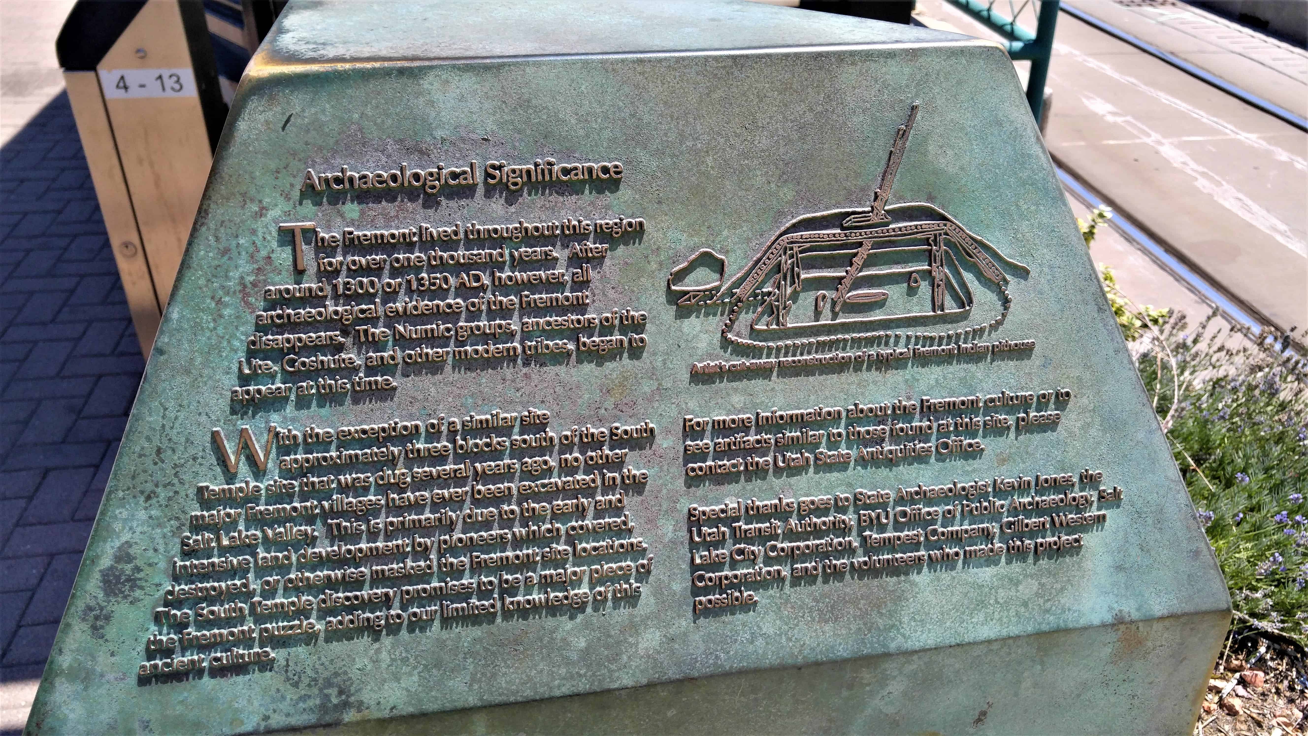
Archaeological Significance
The Fremont lived throughout this region for over one thousand years. After around 1300 or 1350 AD, however, all archaeological evidence of the Fremont disappears. The Numic groups, ancestors of the Ute, Goshute, and other modern tribes, began to appear at this time.
With the exception of a similar site approximately three blocks south of the South Temple site that was dug several years ago, no other major Fremont villages have ever been excavated in the Salt Lake Valley. This is primarily due to the early and intensive land development by pioneers which covered, destroyed, or otherwise masked the Fremont site locations. The South Temple discovery promises to be a major piece of the Fremont puzzle, adding to our limited knowledge of this ancient culture.
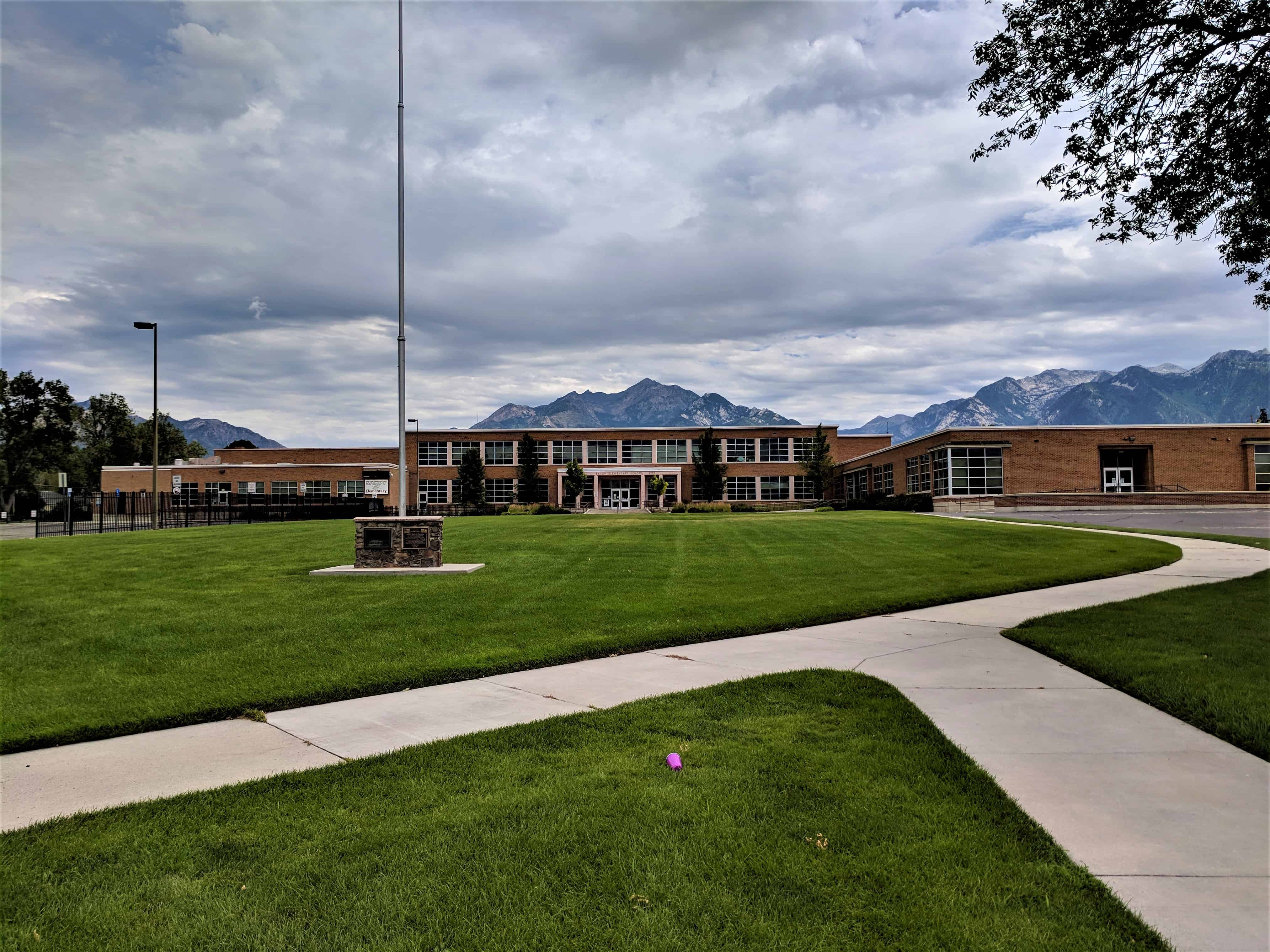
The flagpole is the site of the original Sandy School, built in 1908.
Today’s building was erected in 1951 with a major addition in 1972.
A complete renovation of the school took place in 2005 because of a fire in 2004.
As a result of an automobile accident in 2006 the rock masonry suffered extensive damage to the historic marker.
The flagpole monument was restored in honor of the veteran’s memorial of 1953.
The people of the Sandy community dedicate this monument to those of her brave and loyal sons and daughters who answered their country’s call when the freedoms we cherish were in jeopardy. In this memorial we express our deep gratitude for their contribution toward preserving our democratic way of life.
Most humbly we pay tribute to those noble patriots who paid the supreme sacrifice for God and Country in the service of their native land.
The above text is from the plaques at the flagpole. The school is located at 8725 South 280 East in the historic sandy area of Sandy, Utah
The Audubon House & Tropical Gardens offer a relaxing, educational environment for families and visitors of all ages. Slated for demolition in 1958, the house was saved by the Mitchell Wolfson Family Foundation. The Foundation is a nonprofit educational institution. This was the first restoration project in Key West, and is still considered the gem of the island’s restoration movement.
A visit to the Audubon House & Tropical Gardens is an exploration into local history and folklore, while the gardens offer a lush one-acre view of tropical foliage. You will enjoy viewing the works of John James Audubon, world renown ornithologist. There are 28 first edition Audubon works in the house.
Audubon visited the Florida Keys and Dry Tortugas in 1832. Audubon left Key West having sighted and drawn 18 new birds for his “Birds of America” folio. It is believed that many of those drawings were conceived in the Audubon House garden. Audubon’s painting of the white-crowned pigeon features the Geiger tree found in the front yard of the house.
The 19th-century home was built by Captain John H. Geiger, a harborJohn James Audubon Photo pilot and master wrecker, who lived in the house with his wife and nine children. It was an era when shipwrecks occurred daily on the off-shore reef. It was a time of pirates and yellow fever, slave ships and Indian wars.
Antique enthusiasts will appreciate the unique quality of the furnishings purchased for the Audubon House at estate sales and auctions in Europe. Typical of the sort of furnishings to be found in a prosperous Key West home during the 1800’s the furnishings reflect the elegance and comfortable living enjoyed in Key West during its prime.
You will continue your tour by wandering through the gardens along the brick paths shared with skittering geckos. Varieties of orchids emerge from the foliage and trees to surprise you with their vibrant blooms. Bromeliads and other tropical plants and trees abound. The herb garden and 1840-style nursery provide an historic look at gardening, while native plants and exotics provide an environment that is reminiscent of old Key West. This is the finest tropical garden in the Florida Keys. Please linger as long as you like.
Audio tours of the House and Gardens. The recreated voices of Mr. and Mrs. John Gieger, and some of their children, take you back to historic life in Key West. The audio tours are in English and Spanish. Written tours are available in German, Japanese, French, and Italian for your convenience.
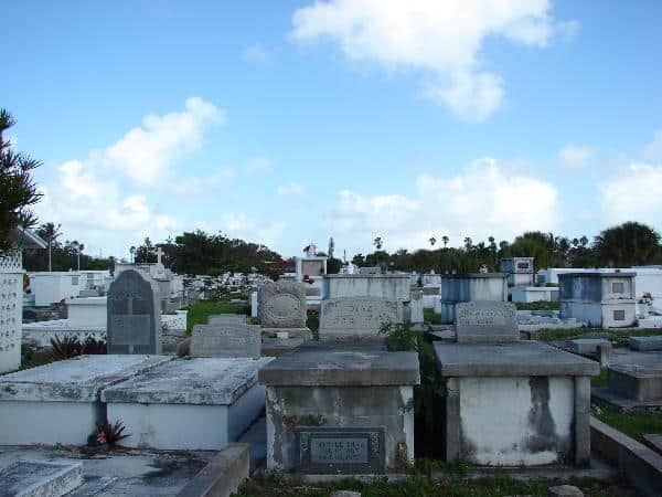
Key West Cemetery was founded in 1847 following a hurricane the previous year that destroyed the earlier cemetery located near present day Higgs Beach. To protect from future flooding, the 19-acre cemetery was located here on Solares Hill, the highest natural elevation in Key West. An estimated 75,000 people are Interred here, divided among parcels that reflect the cultural diversity that continues to characterize the city of Key West today. The cemetaery contains a historic Catholic section, Jewish section, the USS Marine Plot dedicated in 1900, and the Los Martires de Cuba, a memorial for those who fought in the 1868 Cuban revolution. In addition to these defined areas, African Americans, Cubans and Americans, rich and poor, are interred throughout. In-ground and crypt style graves range from simple concrete copings filled with soil to elaborate monuments. Plot enclosures of wrought iron, wood, or concrete were often used to mark family plots.