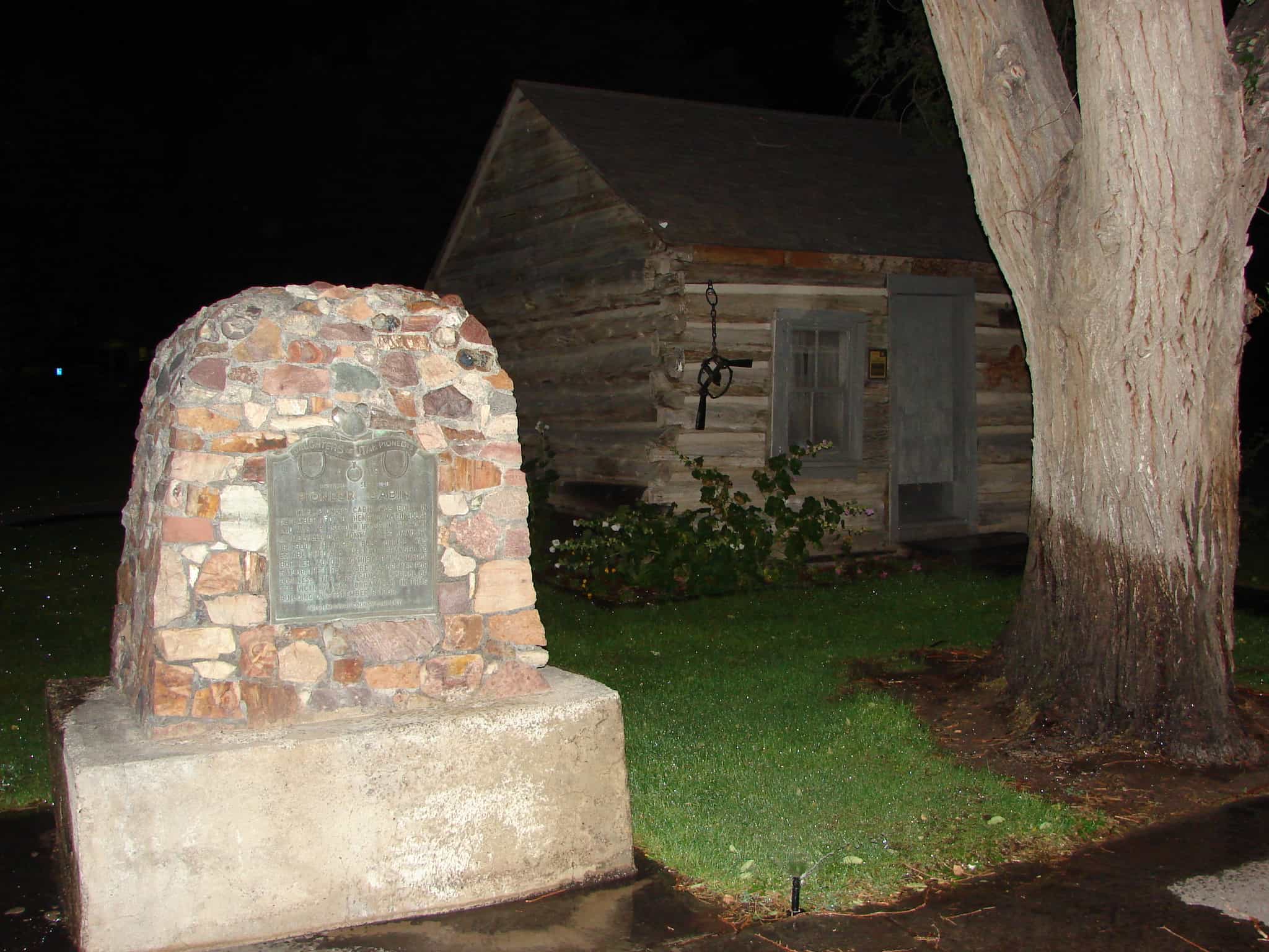
This pioneer cabin was built in December 1907 by Henry J. McCullough and was the second house in the town of Melville. One month later January 18, 1908, the first Post Office was established and the name changed to Burtner. Adjoining this cabin, on March 5, 1908, the first store was opened for business. The first Sunday School of the vicinity was organized in this building on September 8, 1908.
This historic marker is #119 of the Daughters of Utah Pioneers markers and is located at the city park in Delta, Utah
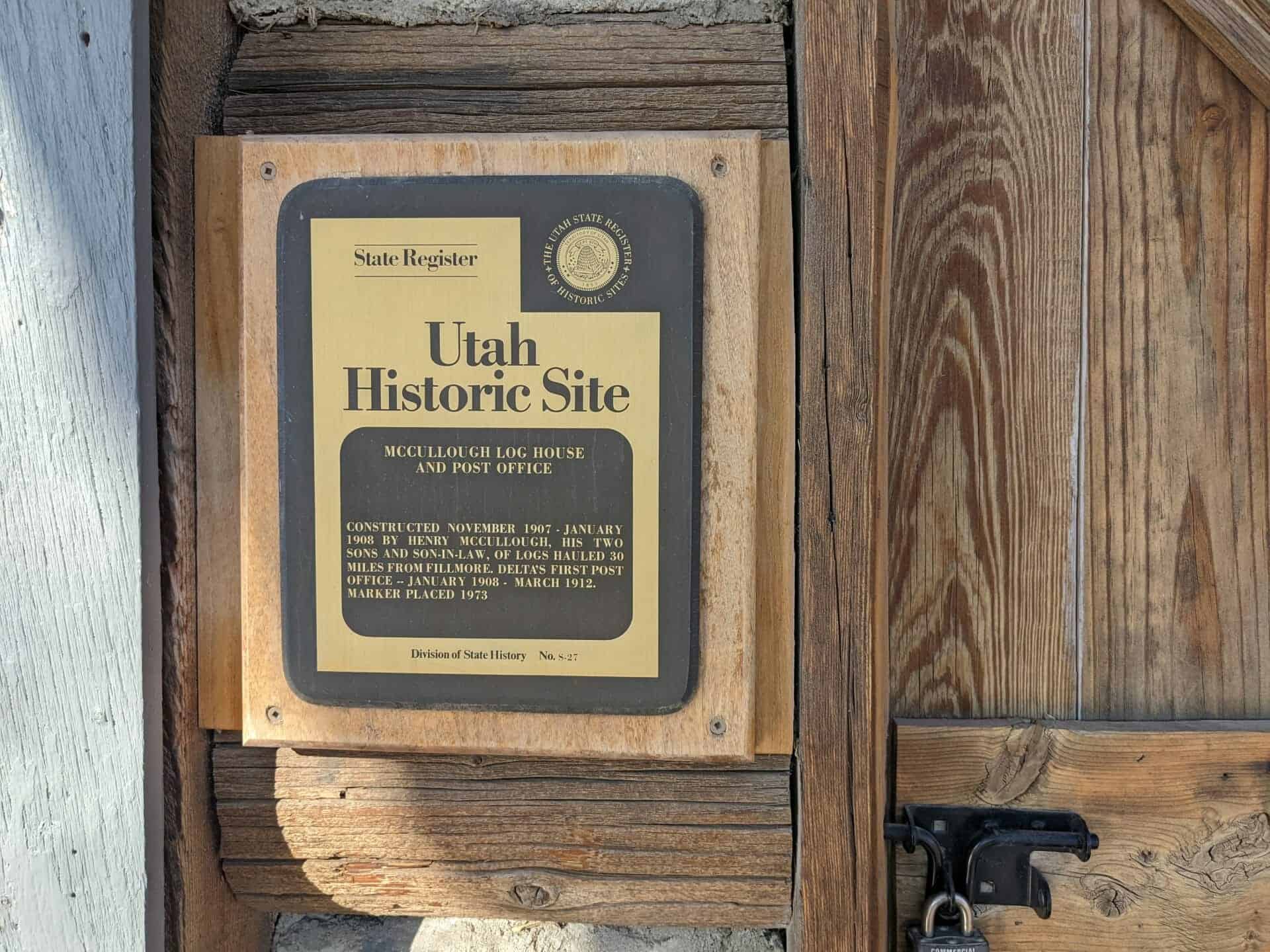
Constructed November 1907 – January 1908 by Henry McCullough, his two sons and son-in-law, of logs hauled 30 miles from Fillmore. Delta’s first Post Office – January 1908 – March 1912.
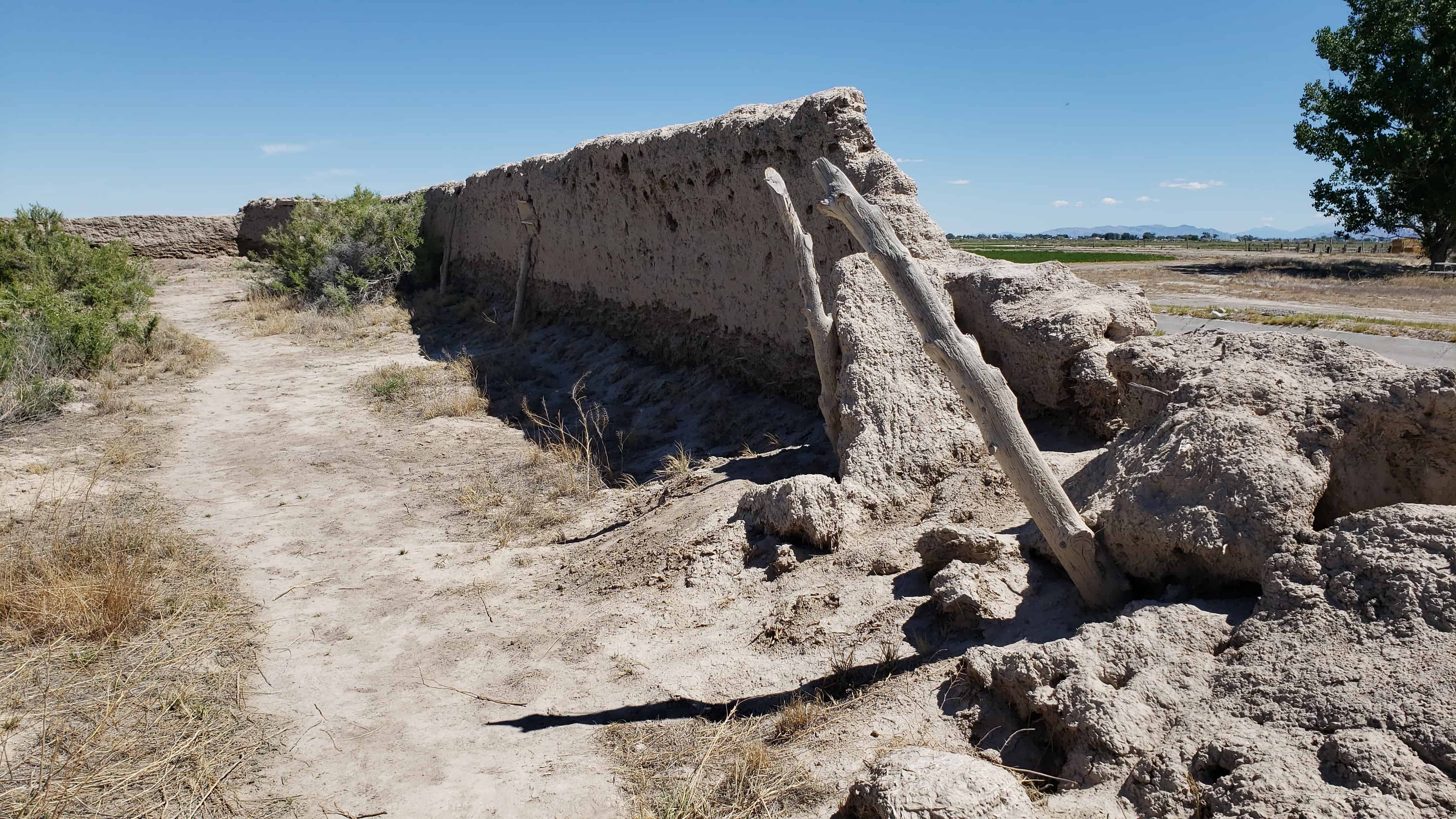
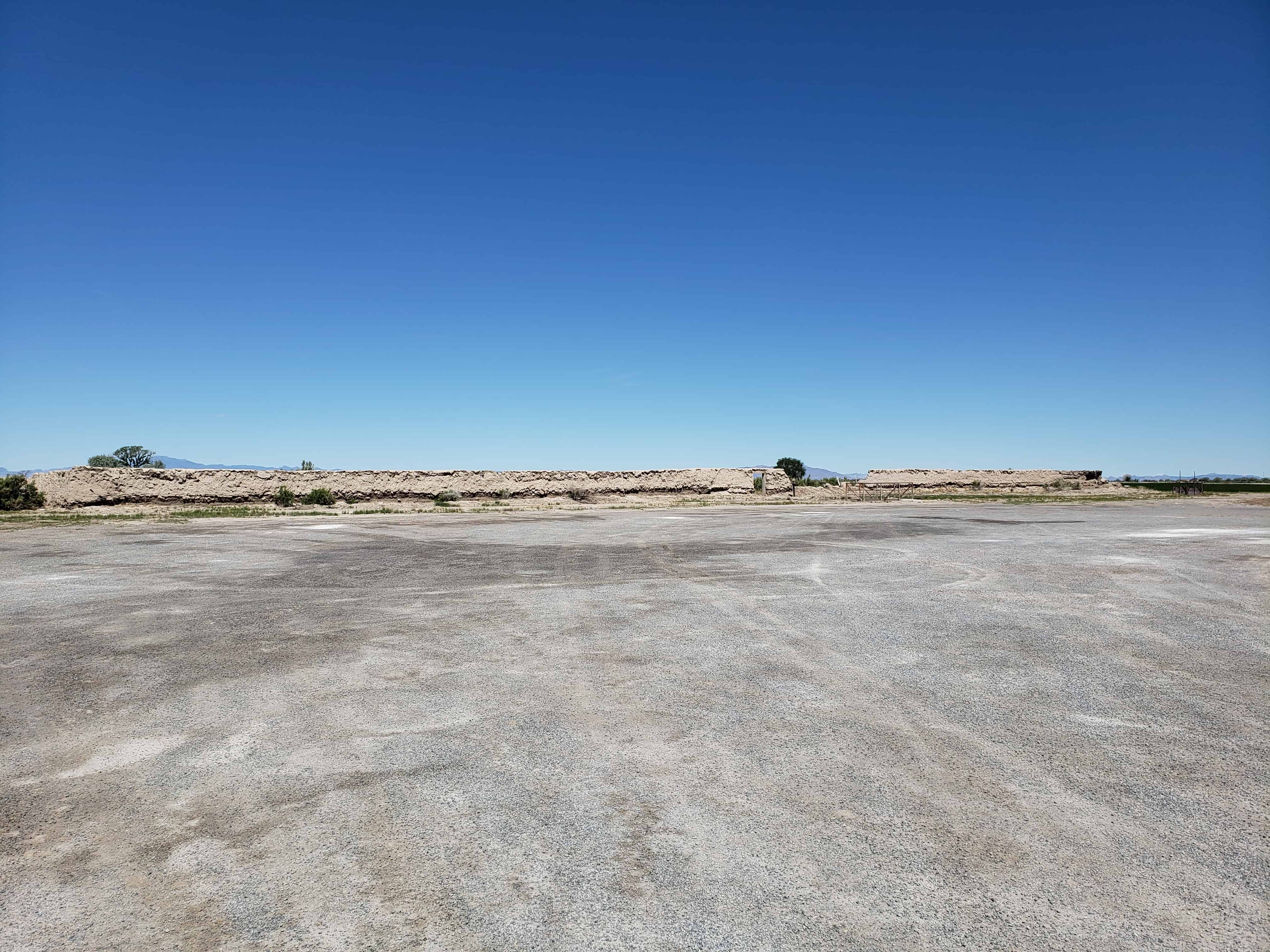
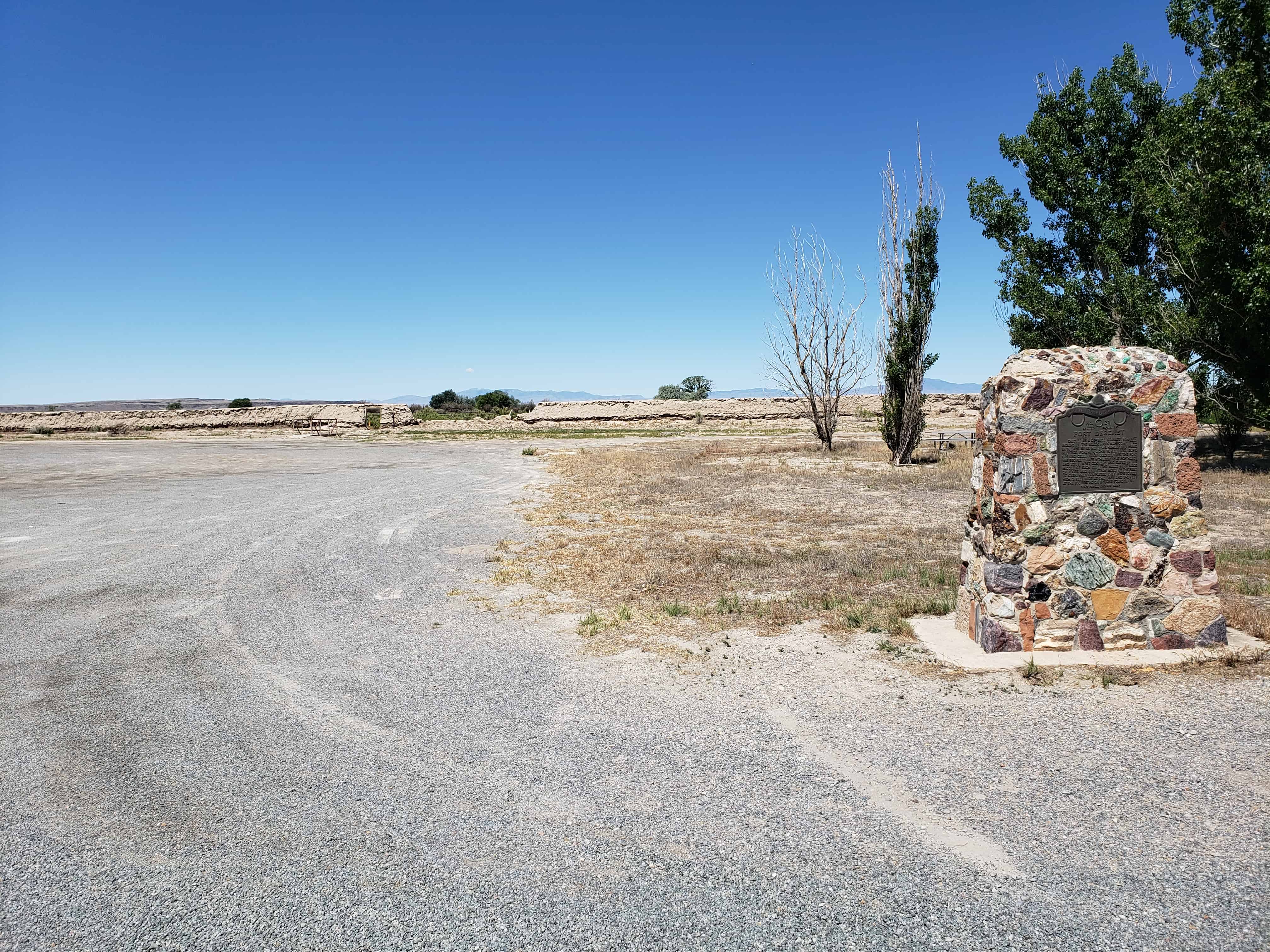
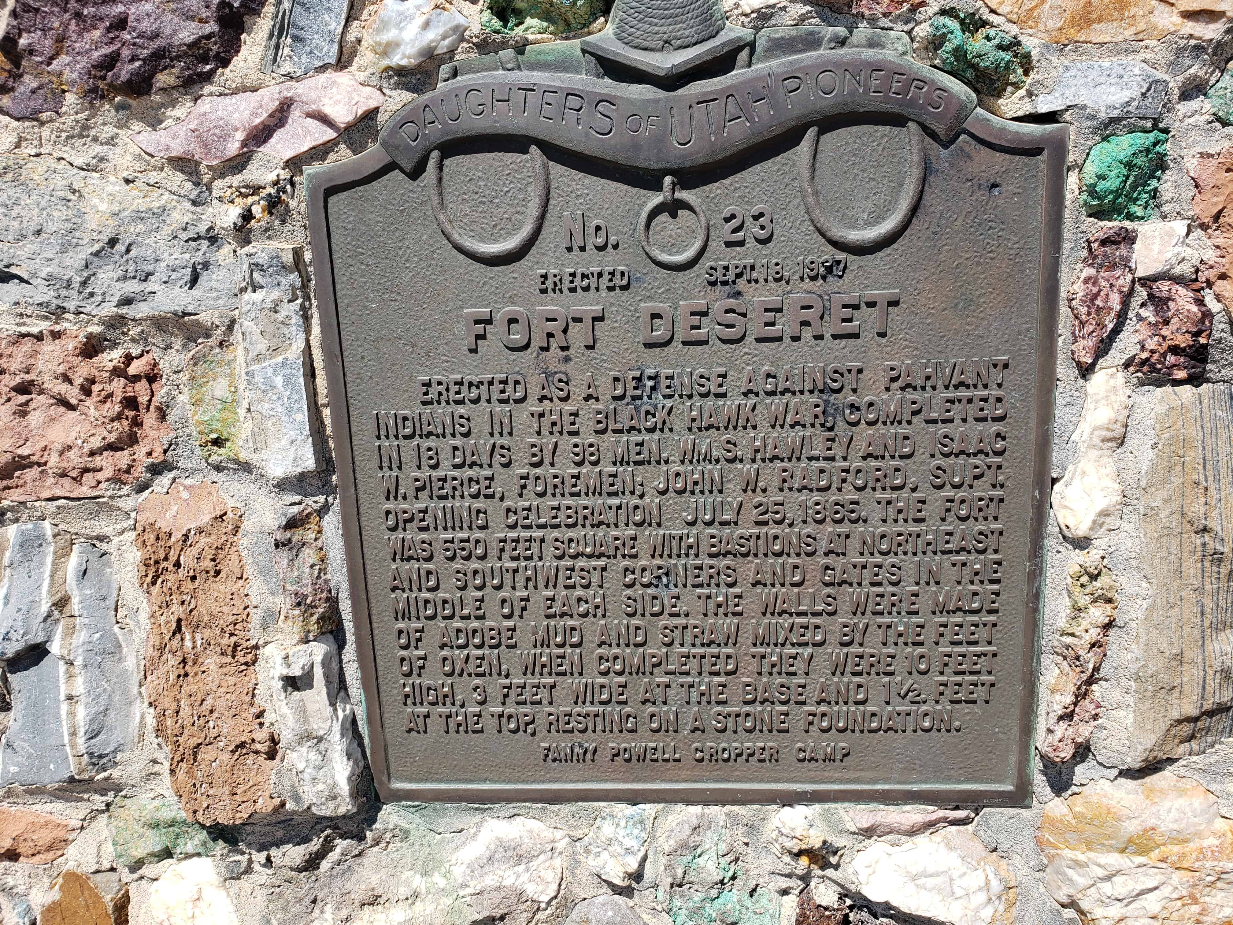
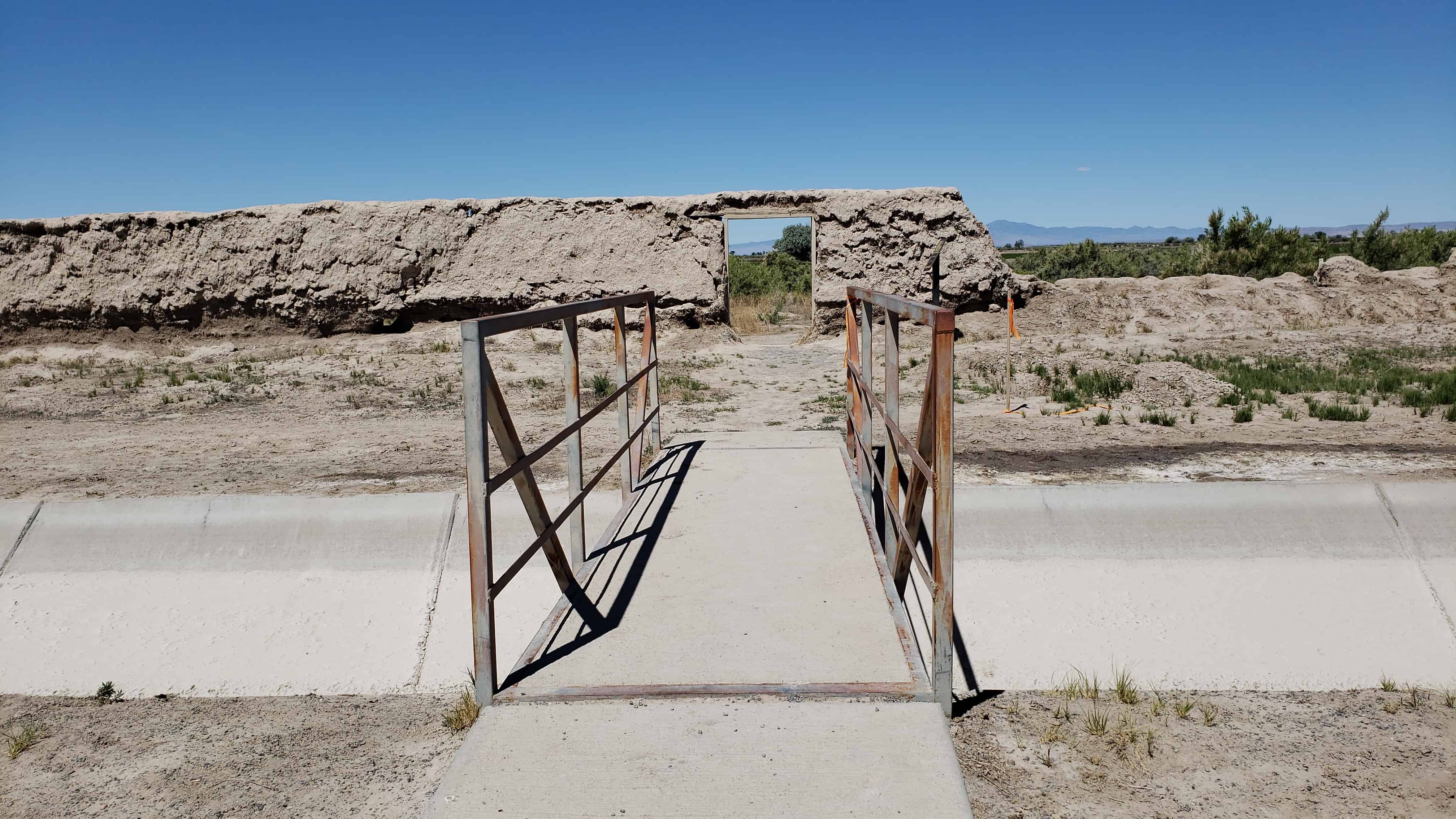
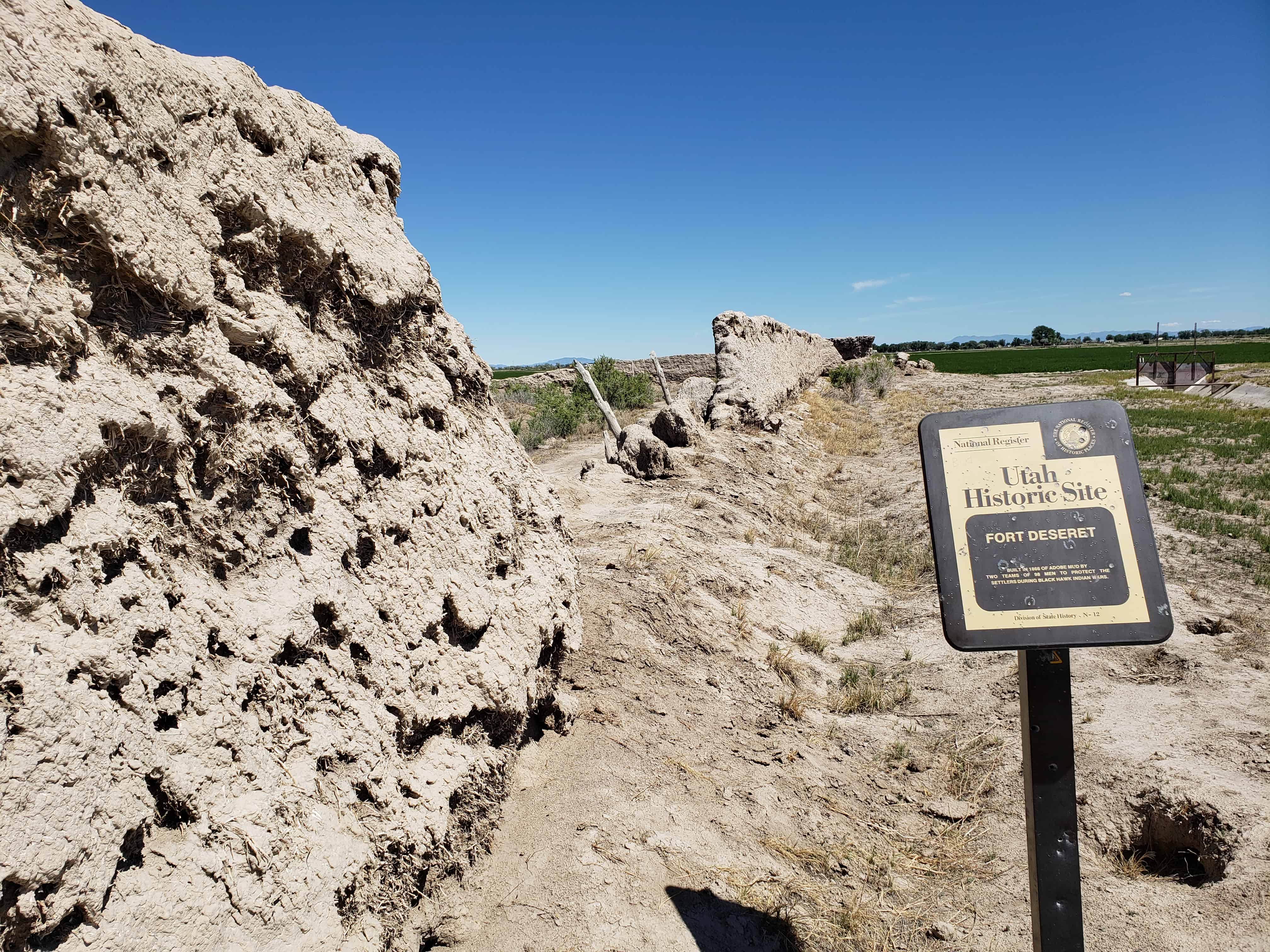
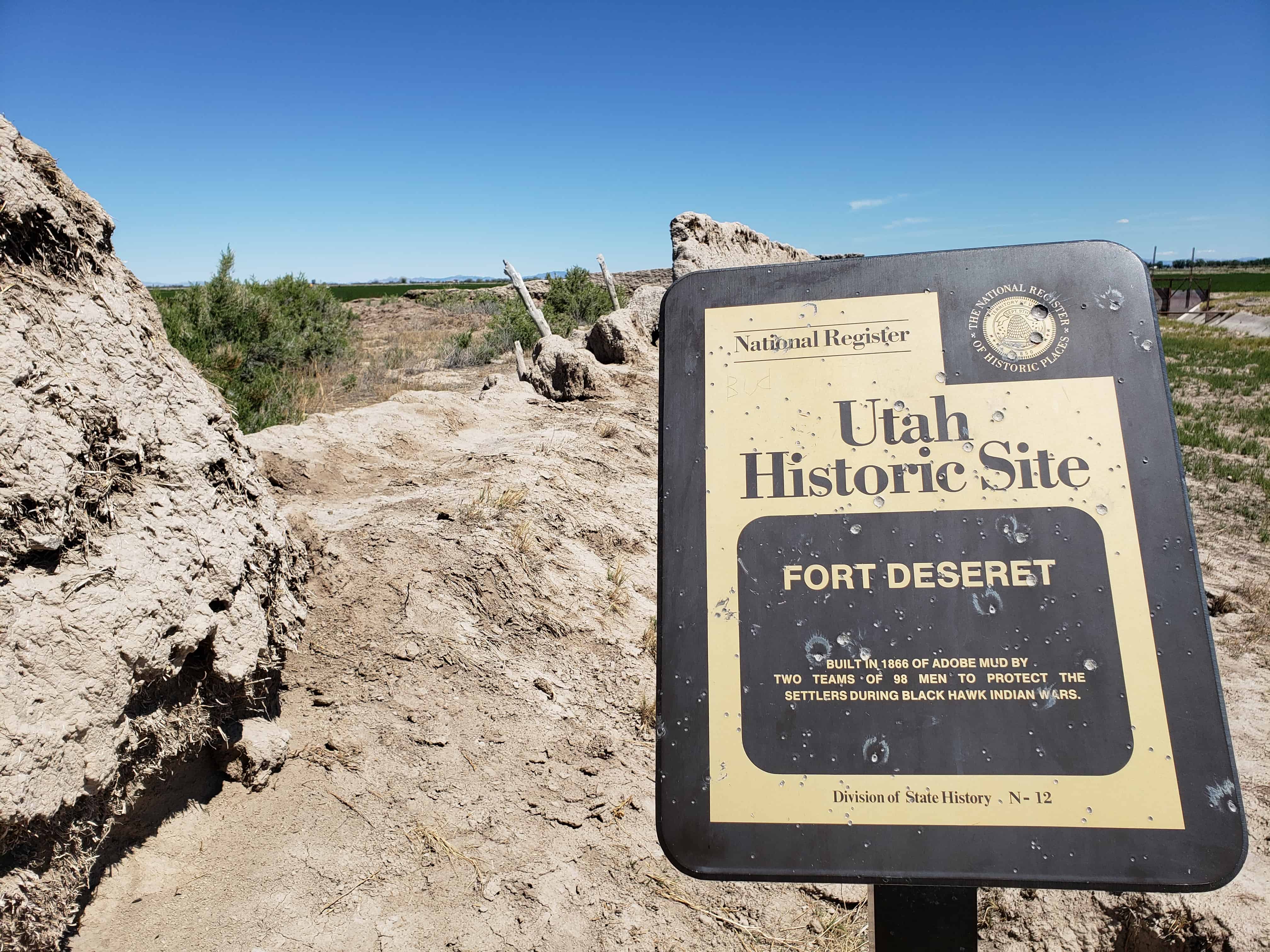
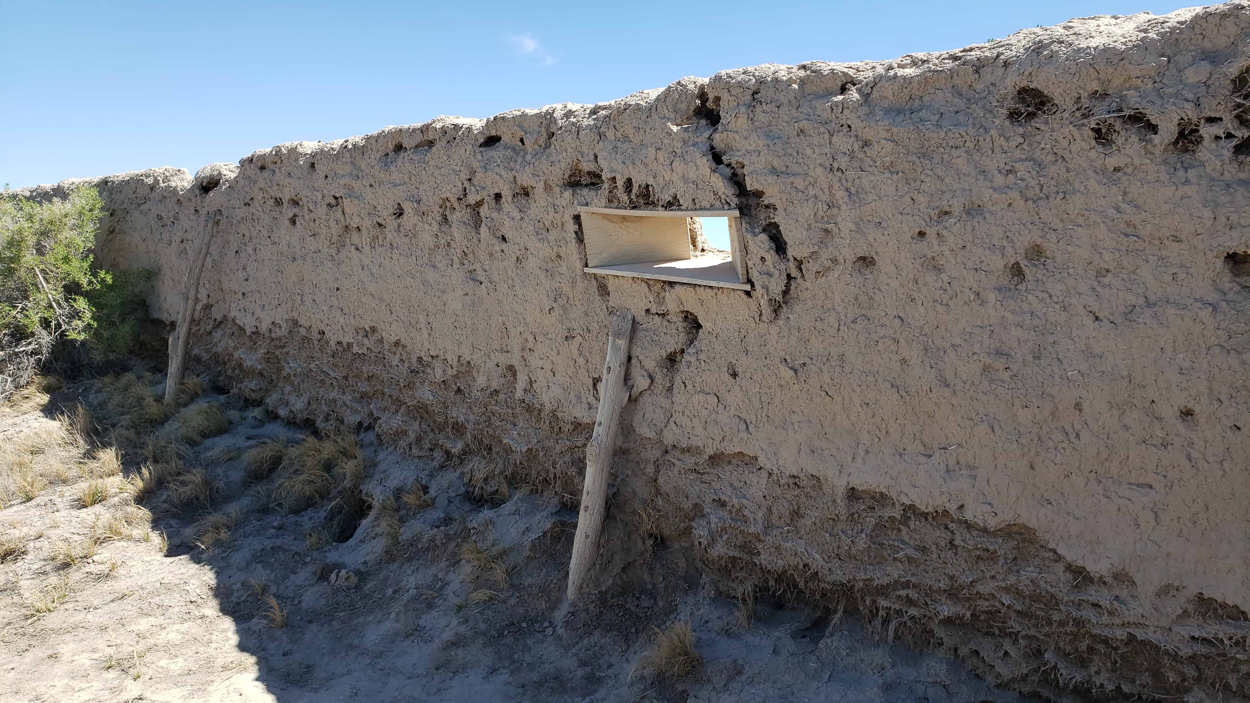
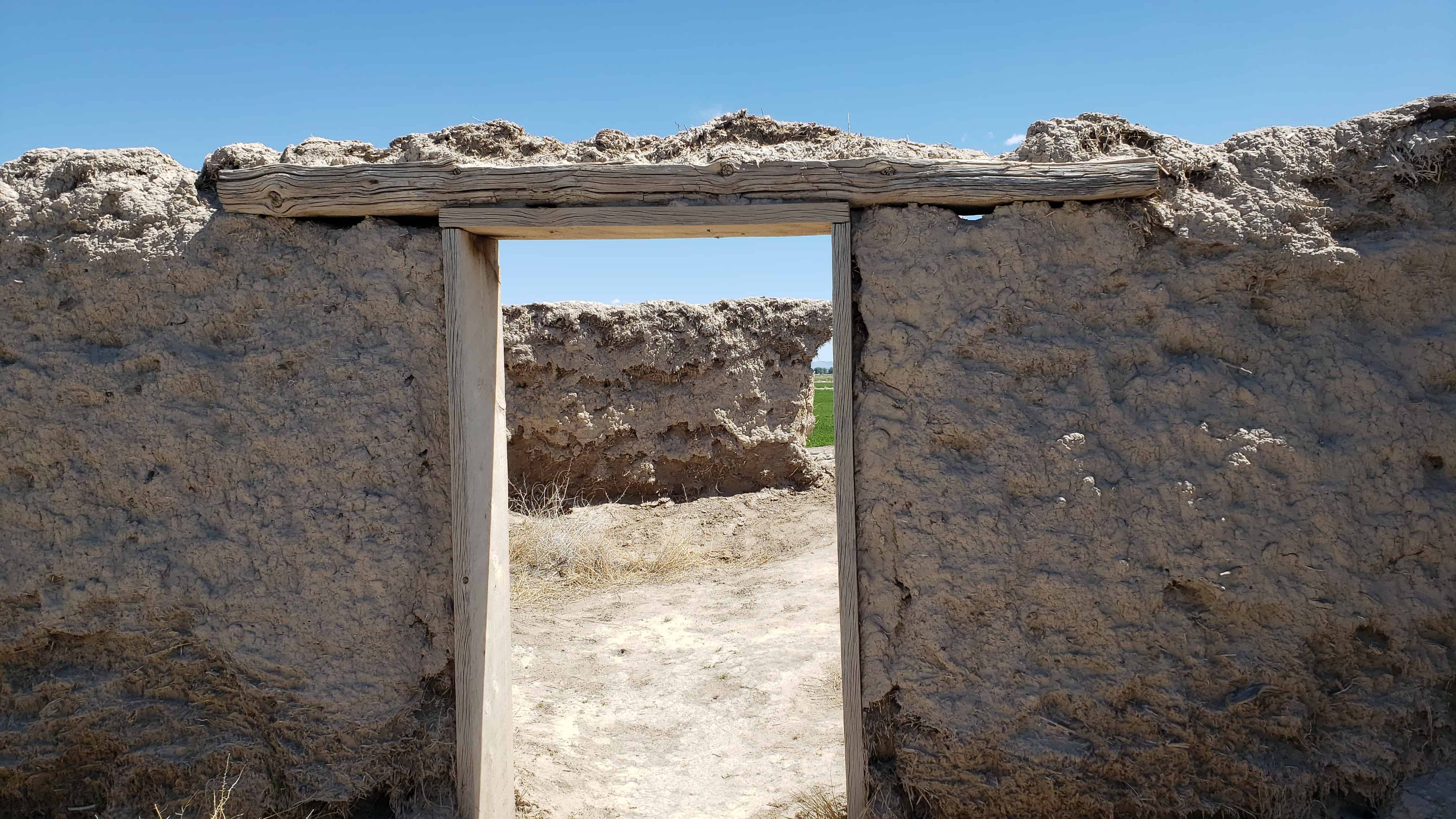
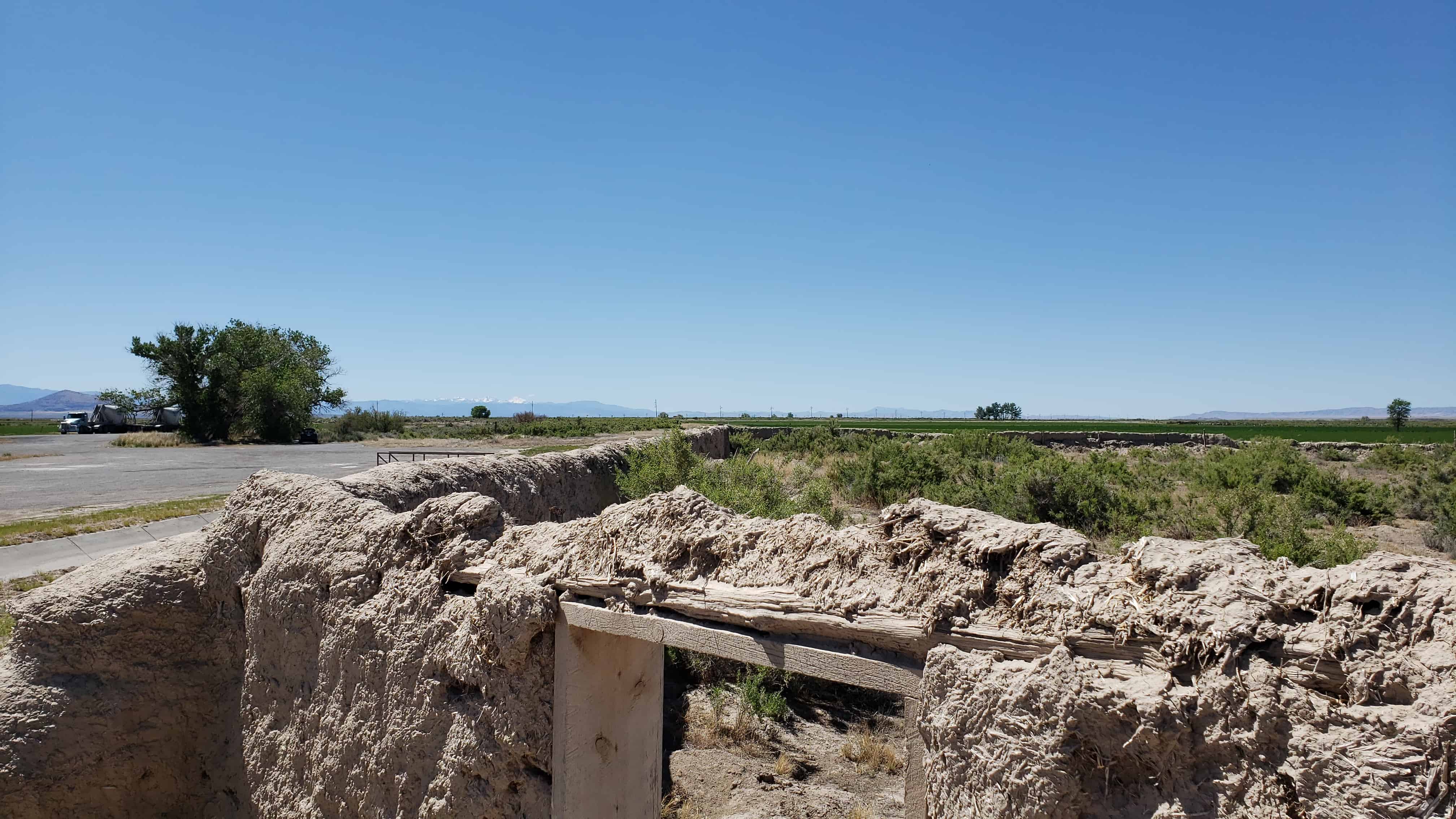
Erected as a defense against Pahvant Indians in the Black Hawk War, completed in 18 days by 98 men. Wm. S. Hawley and Isaac W. Pierce, foremen; John W. Radford, Supt. Opening celebration July 25, 1865. The fort was 550 feet square, bastions at Northeast and Southwest corners and gates in the middle of each wall. Made of adobe mud and straw mixed by the feet of oxen, when completed were 10 feet high, 3 feet wide at base and 1 1/2 feet at top, resting only on a stone foundation.
The below text is from the nomination form from when the fort was added to the National Historic Register (#70000624) on October 9, 1970.
The first white settlers reached the lower drainages of the Sevier River, Pahvant Valley, in 1860, and established the community of Deseret, By 1865 they were fairly well established. With the Indian unrest of the Blackhawk war, Brigham Young advised all outlying Mormon settlements to “fort up.” His mandate was reinforced by the early summer visit of Bishop Thomas Callister and Apostle Amasa M. Lyman, Immediately the community set about building a fort, with John W. Radford in charge.
Men with teams were organized to haul lava rock from across the valley to the west and lay the four-foot wide footings. To build the walls themselves, the men divided into two groups, led by William S. Hawley and Isaac W. Pierce, Each team was to build half the wall, with the winning team to be given a party by the losers.
The walls were constructed of adobe mud made by running water into trenches into which dirt and straw were thrown and then mixed by having oxen tromp it. The mud mixture was then stacked up in ten-foot walls three feet wide at the base, tapering to one-and-one-half feet at its top. The center of the walls were high to cause the rain water to drain outward.
The race to construct the fort took the 98 men 18-1/2 days –9- 1/2 days for Pierce’s group and 9 days for Hawley’s; however, as a portion of Hawley’s wall fell, a tie was declared, A big celebration was held July 24, 1866, to commemorate the fort’s completion. It had cost about $3,706 in materials and labor.
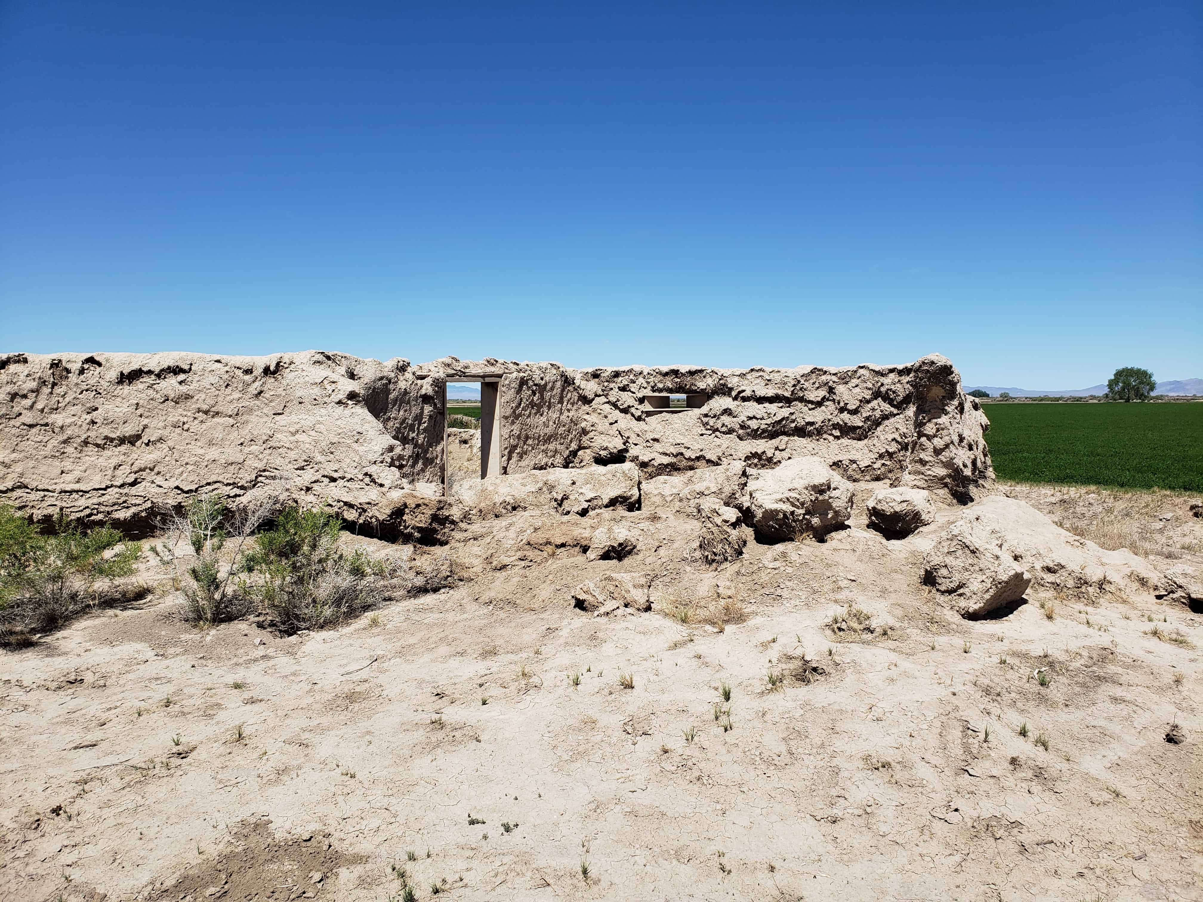
Actually the fort was never used to defend against the Indians, although it did offer security to the small isolated colony during a crucial period of Indian unrest; and cattle from the settlement were frequently corralled in the fort to avoid their being stolen by the Indians. In fact in later years the Indians themselves often used the abandoned fort. The community of Deseret was abandoned in 1868 because of water difficulties and was not reoccupied until 1874. The old mud fort remained a landmark but has slowly eroded during its more than one-hundred-year existence. Today less than half its walls remain standing.
Not only does Fort Deseret remain as a landmark in Mormon pioneering history, but it is the only remaining example of an “adobe mud” fort in Utah. Further, it was built entirely as a community project of materials at hand, thus typifying the cooperative nature of Mormon settlement. Its preservation needs are acute.
Description:
Fort Deseret was laid out in a square 550* x_55.p l . The foundations for the walls were made with 3-foot wide lava rock footings. Adobe mud for the walls was made by turning water into a big trench, then adding clay and straw which was mixed by foot of both humans and oxen. The mud was stacked on the footings to form walls 10′ high, 3′ wide at the base, and 1-1/2′ wide at the top. The center of the wall was the highest, to allow drainage outward.
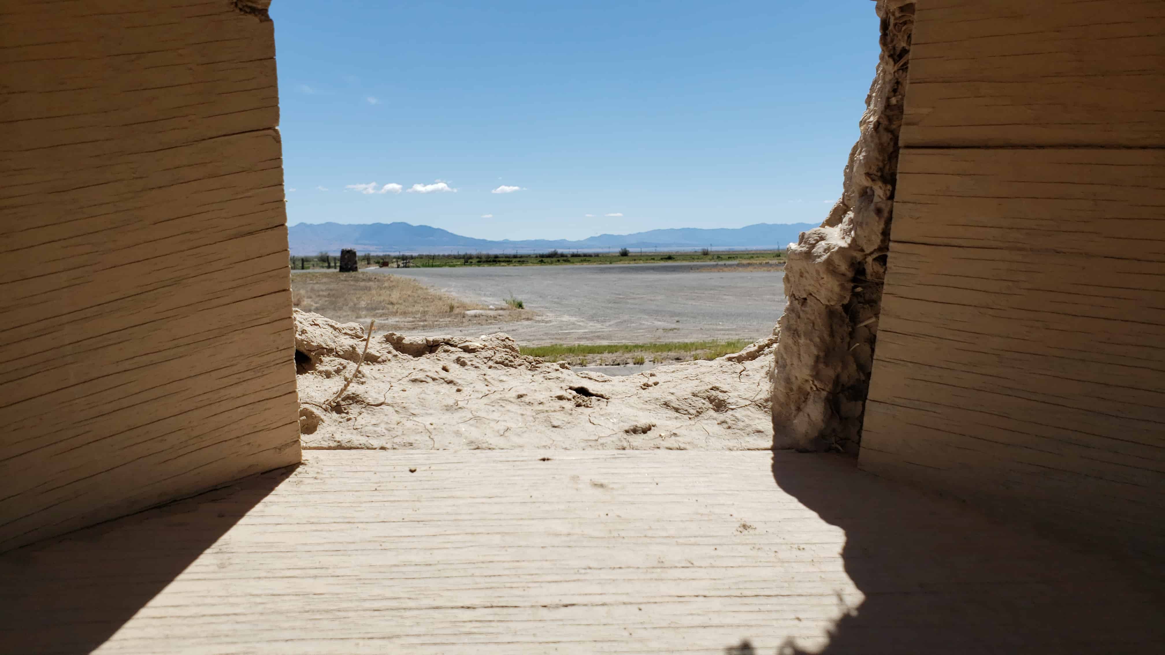
Taller bastions were constructed in the northeast and southwest corners extending beyond the walls. Rough hewn lumber was used to make the portals through which guns could be fired with a minimum of exposure to the defenders. Three portals were placed in each bastion, several on each side. The main gates were in the north and south walls, with small gates in the east and west walls.
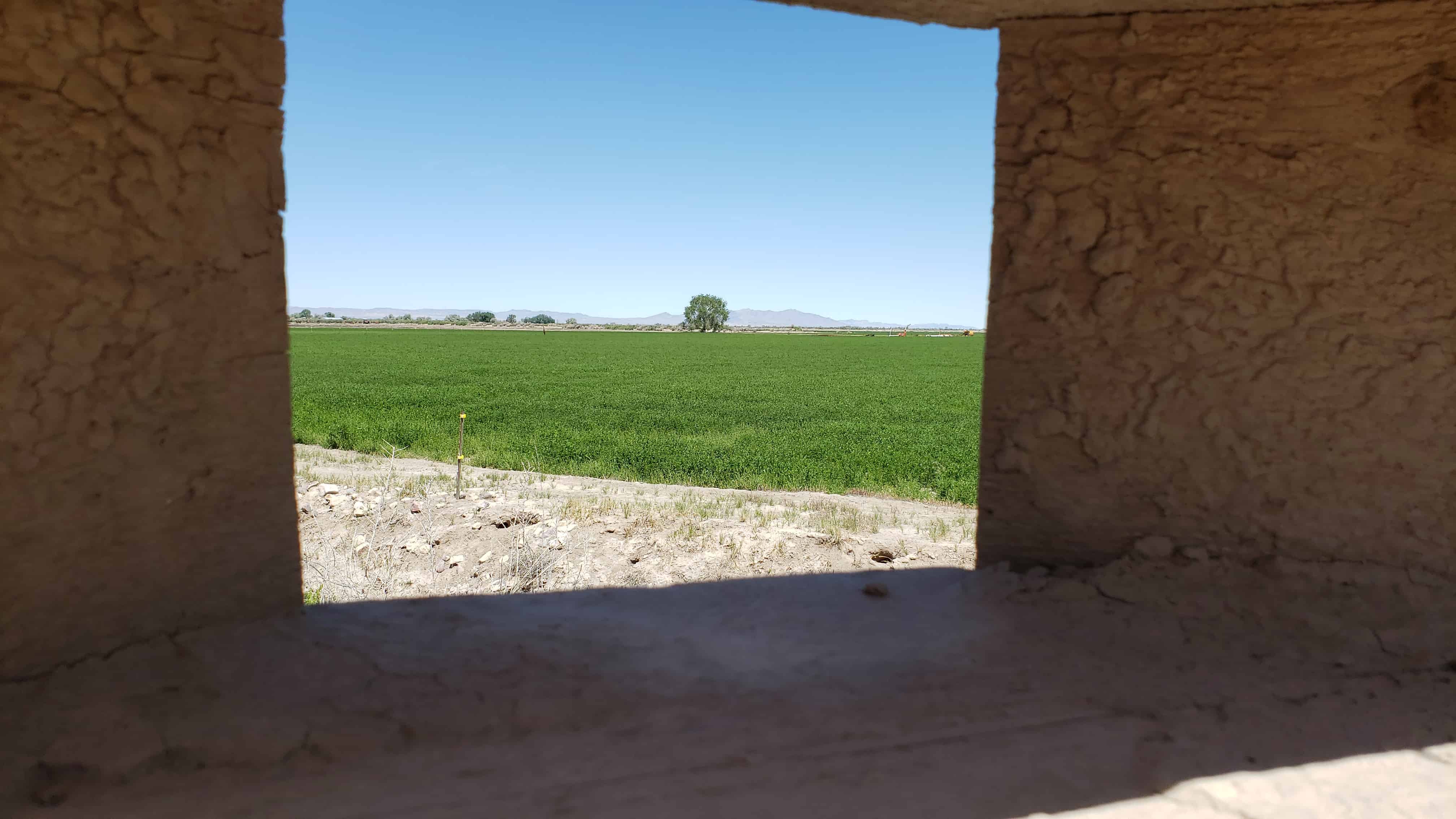
Rain and wind erosion has reduced the walls severely. Only portions remain, mainly on the east wall, the bastions and corners. One can see in the fallen portions of the wall the kind of adobe construction a layer of mud, a layer of straw. The remaining walls are from 6 to 7 feet high and badly eroded.
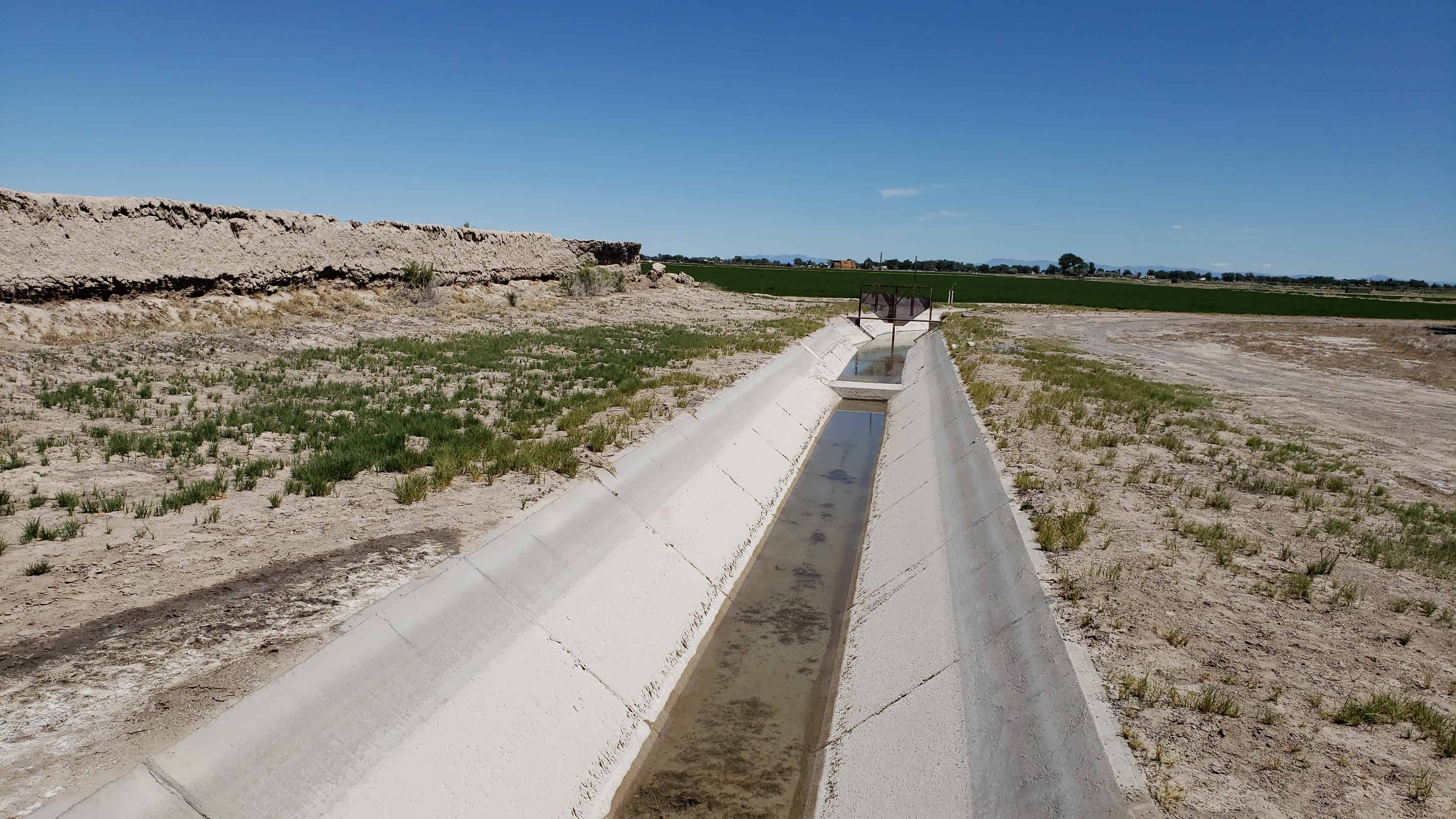
Greasewood and other brush have grown up around the walls. A ditch runs near the north wall and a large lateral in front of the east wall.
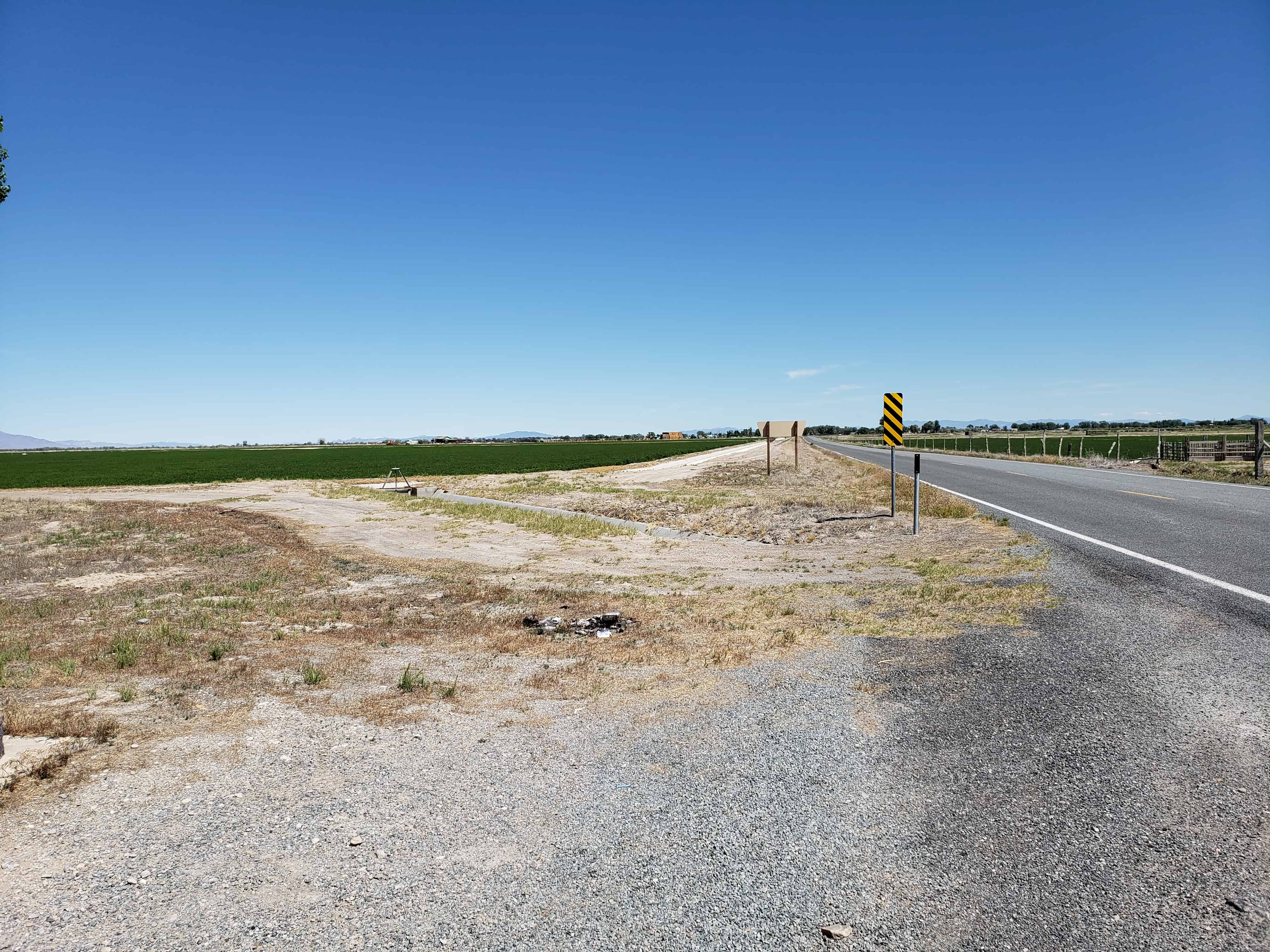
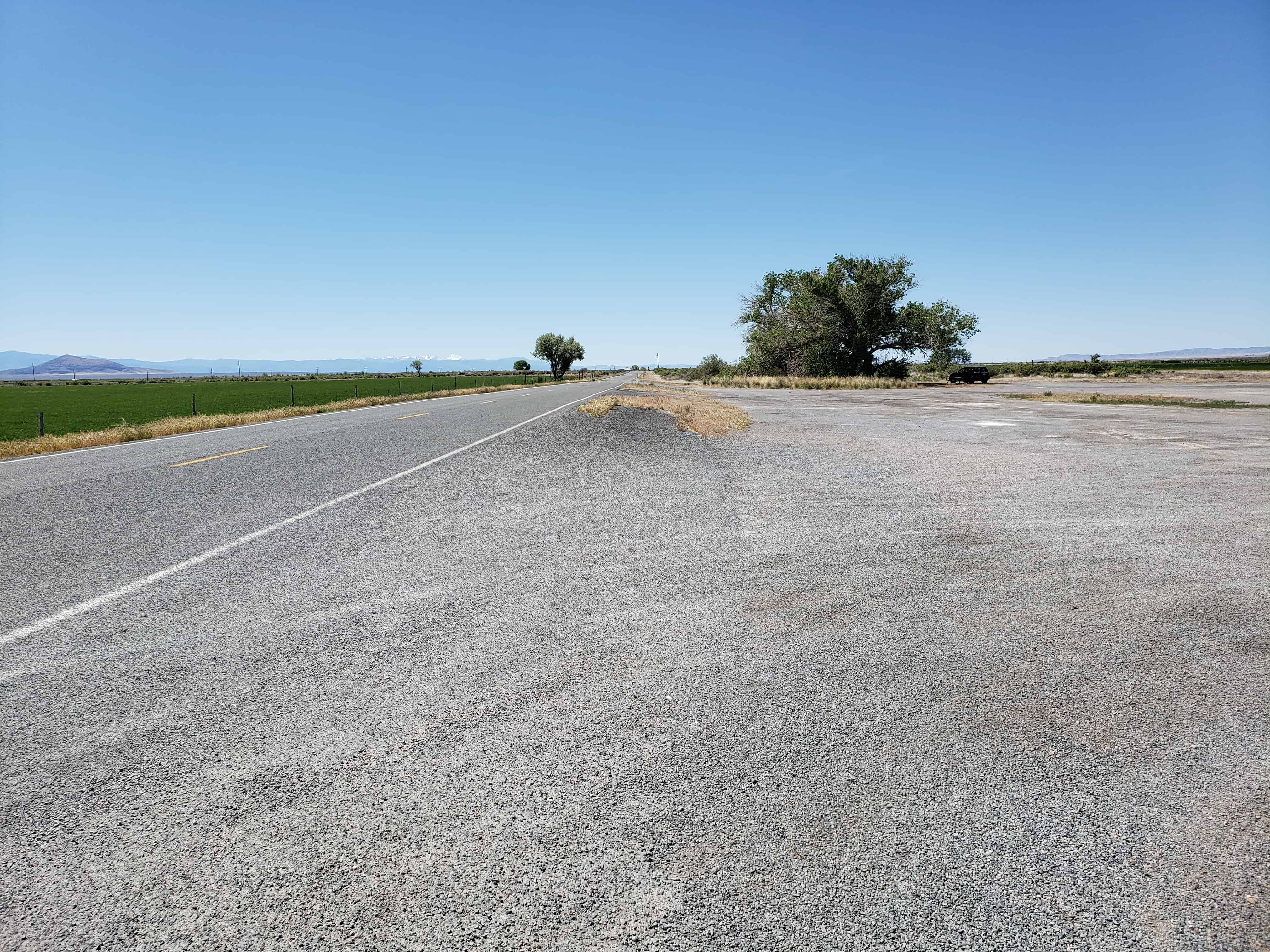
The site is near the old Sevier River channel, long since changed by man’s needs. Now owned by Utah State Parks and Recreation, both its preservation and development are being planned.
Established by Mormon Pioneers in 1855, as Fort Cedar Springs. Church President Brigham Young gave permit for the families of William Stevens Sr. and Richard Johnson to start a settlement near these grassy, spring-fed cedar hills.
Joined that fall by eight more families. The small colony began construction of an adobe walled fort to serve as a home for the people and protection from Piute Indians. In use until 1867, it was a place of refuge for the weary frontier traveler. It came to be known as “Buttermilk Fort” because of its dairying industry and its refreshing drink.
In 1858 a Post Office was established and the name changed to honor the memory of Elijah Holden. He had perished in 1857 on the Scipio Pass (nine miles to the north) in a snowstorm, while attempting to save a small boy’s life.
Residents of Holden still radiate the enduring qualities bequeathed them by their hardy pioneering ancestors…thrift, perseverance, and a strong abiding love of God.
Until 1851 Mormon Settlement in Utah was confined mostly to the western slopes of the Wasatch Mountains. When Utah became a territory through the Organic Act of 1850 settlement patterns began to change. Since the new boundaries of the territory enclosed a smaller land area than expansive Mormon hopes had included in the proposed state of Deseret, LDS leaders anticipated settlement of the entire territory.
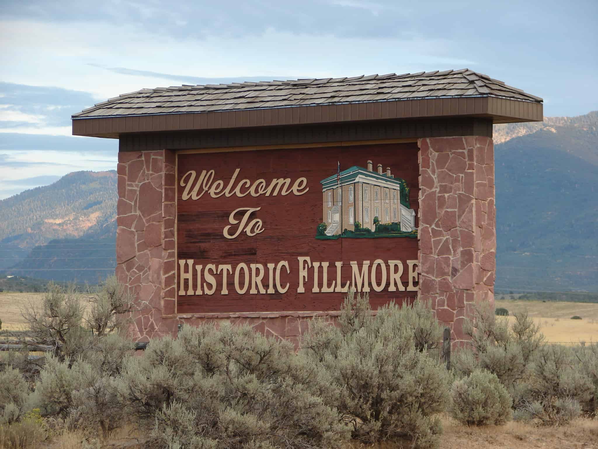
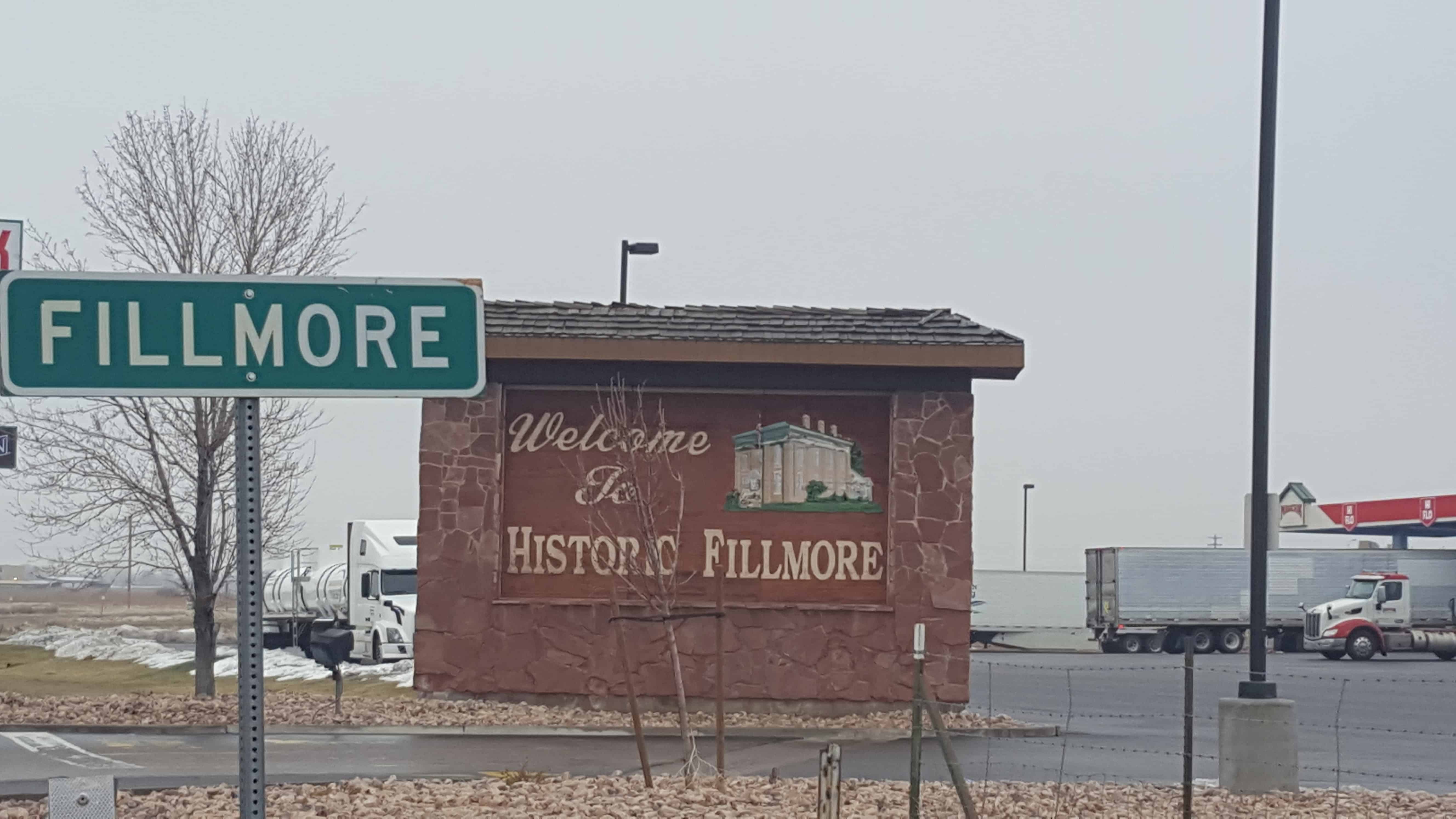
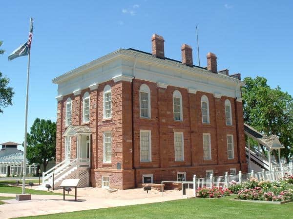
Planning for the eventual settlement of Utah, the Legislative Assembly decided to locate the territorial capital at the geographic center of Utah. Pauvan Valley was chosen because of its location midway between the Sierra and Colorado Rockies and in the center of Utah. On October 4, 1851, the remote Pauvan Valley was designated as the site of the territorial seat of government. On the same day, the Assembly named the surrounding area Millard County and planned to create a capital city called Fillmore. A committee of four men was appointed to survey the area and determine the exact location of the city and the capitol building site.
The party, led by Orson Pratt, left Salt Lake City for Pauvan Valley on October 21, 1851. When they arrived at the uninhabited region, Jesse W. Fox laid out the boundaries for the capital city. Streets were outlined for future construction. The site of the territorial capital was located. Orson Pratt later wrote a letter to Brigham Young describing the city boundaries as square blocks of ten acres. The letter noted that a law was established that no trees were to be cut in the city or for two miles out.
Anson Call and a company of several families arrived in Fillmore at the same time as the Pratt party. The group had been asked by church leaders to settle the area. Before he left for Salt Lake City, Pratt instructed Call to construct the city as it had been outlined. Streets, houses, public buildings, and, most important, the territorial capitol had to be built. During the next year the Fillmore settlers worked to create a city out of a wasteland. The immediate need of building homes and public buildings took up most of the time and energy of the workmen. Because of this, construction of the capitol was delayed until the following spring.
In 1854, three years after the selection of the site, the walls of the capitol were finally completed. But construction was further delayed because of a shortage of funds. Though Congress had awarded the territory $20,000 to begin the project, no further funds were given to continue construction. After months of hard work and limited supplies, local workmen finally completed the roof on the east wing of the capitol in the summer of 1855. The interior was rushed to completion in preparation for the Utah Territorial Legislature to convene in Fillmore. On December 10 the fifth annual legislative session was held in the new territorial capitol–the only complete session held there. Tradition says that the next day Brigham Young officially dedicated the building.
The legislature convened in Fillmore again in December 1856, after organizing, the assembly returned to Salt Lake City to complete its session. Legislators complained about the lack of housing and adequate facilities in Fillmore. Rather than being the thriving capital city that many had imagined, Fillmore remained a small rural community with little outside communication or industrial development. Realizing that Utah’s population had not centralized as anticipated, the territorial leaders quickly lost interest in Fillmore. In December 1856 Salt Lake City was officially designated as the capital of territorial Utah. Until the completion of the State Capitol in 1916, the legislature met in five different buildings in the city–the Council House, Social Hall, old Salt Lake City Hall, Salt Lake City and County Building and the Women’s Industrial Christian Home.
Meanwhile, the completed east wing of the Fillmore capitol building took on many different functions. In 1872 title to the building was passed to Fillmore City. It was used on different occasions as a jail, school, church, meeting house, and office building by local residents of Fillmore. Today, the site has been converted into a state park and museum of pioneer relics.
Although Fillmore never became the capital city envisioned by early Mormon leaders, the uncompleted capitol is a reminder of an era in which the settlement of Utah was new and its patterns undetermined.(*)
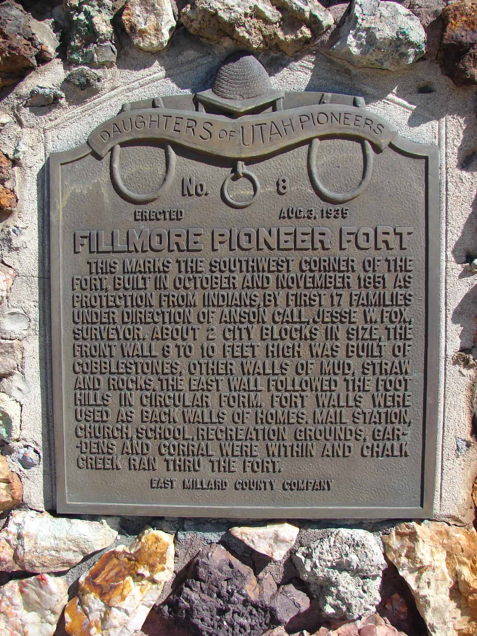
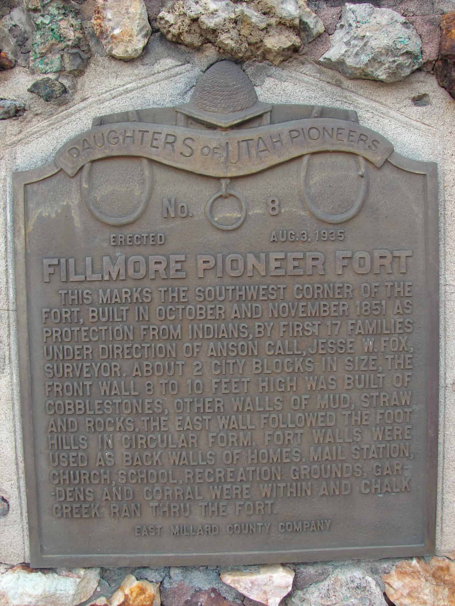
Fillmore Pioneer Fort This marks the Southwest corner of the Fort, built in October and November 1851 as protection from the Indians, by first 17 families under direction of Anson Call, Jesse W. Fox, surveyor. About 2 city blocks in size, the front wall 8 to 10 feet high was built of cobblestones, other walls of mud, straw and rocks. The East wall followed the foot hills in circular form. Fort walls were used as back walls of homes. Mail station, Church, School, recreation grounds, gardens, and corral were within and Chalk Creek ran through the Fort.
Check out all of the historic markers placed by the Daughters of Utah Pioneers at JacobBarlow.com/dup
Utah’s First Capitol Creating Fillmore City and Millard County the Territorial Legislature of Utah selected Pahvant Valley, as Capitol site October 29, 1851. This spot was selected by Governor Brigham Young. Construction work began in 1852. Truman O. Angell, architect and Anson Call, supervisor. This south wing was used by the fifth Territorial Legislature October 10, 1855. In 1856 the seat of Government was moved to Salt Lake City. Later used as Court House and County Headquarters. Restored in 1928 and dedicated as State Museum July 24, 1930.
Cove Fort, completed April 12, 1867, by direction of Brigham Young, with L.D.S. Church funds, as a travelers way station and refuge from Indians. Ira N. Hinckley built and maintained it as a hostelry and residence until 1877. A well within the fort provided culinary water. Cove Creek supplied irrigation. One of its 12 original room s was used as a telegraph station. Early in 1861 Charles Willden built 3 rooms and a dugout, known as Willden’s Fort. This was a convenient campsite for President Young and other travelers.
Check out all of the historic markers placed by the Daughters of Utah Pioneers at JacobBarlow.com/dup
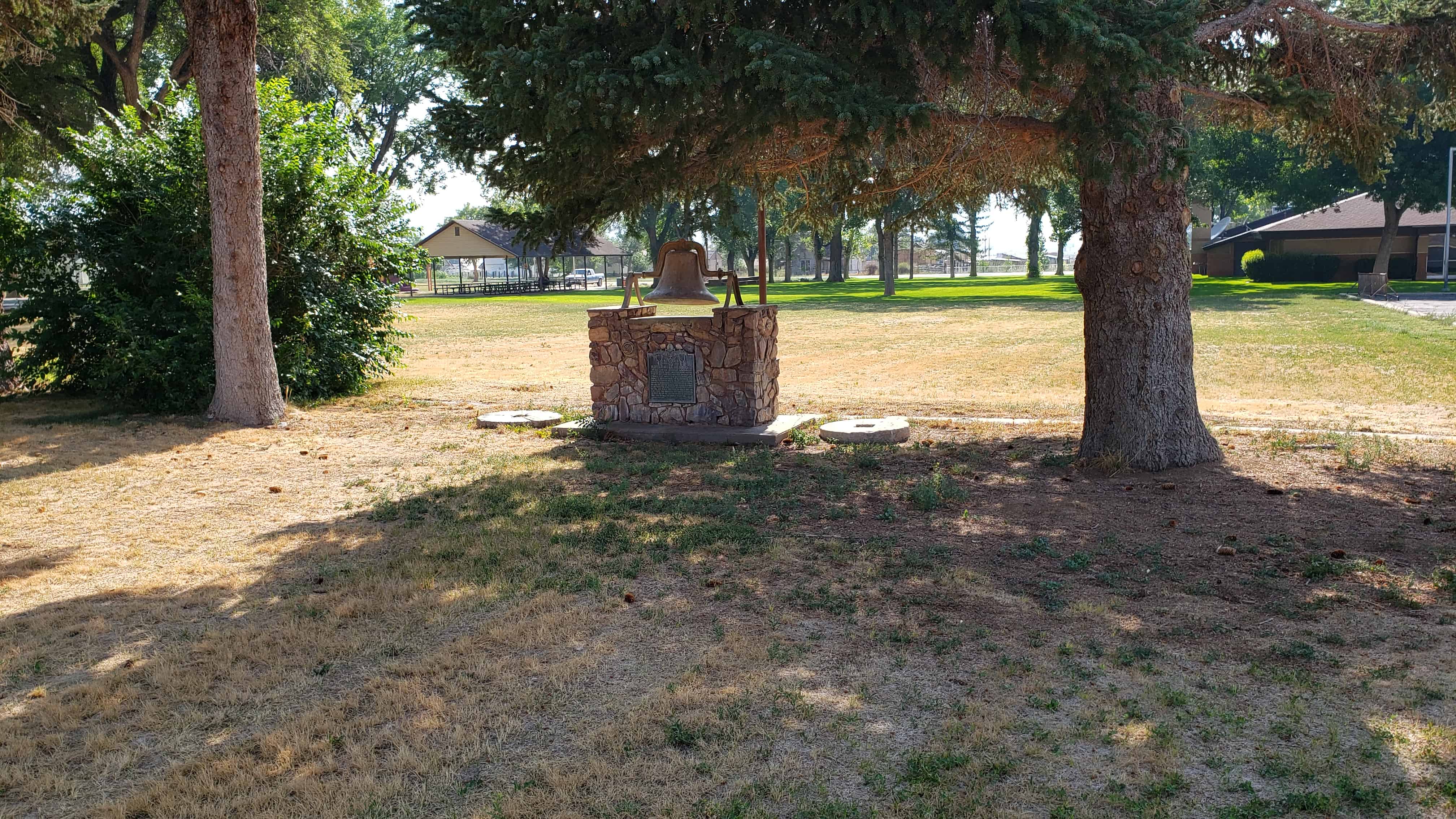
In 1860 thirteen Latter-day Saint families settled Round Valley. Brigham Young visited them in May, 1863, and advised, because of Indians, they move their settlement away from the mountain area. He accompanied the men to the center of the valley, laid out the townsite, designated the location for a public square and center of town, and named it Scipio. A log room was built, which served for church, school, and public meetings. In 1869 an L.D.S. ward was organized with Daniel Thompson as first Bishop. The bell on top of this monument was used to call the people together.
Cedar Springs Fort (Buttermilk Fort) Erected 1855-56, was 150 feet long north and south by 75 feet wide. Facing each other and standing 30 feet apart were two rows of adobe houses. The gateways were in the north and south walls.
Richard Johnson and William Stevens, Sr. and families were the pioneers who came in the spring of 1855, five other families from Fillmore followed in the autumn and assisted in constructing the fort, which was completed in the spring of 1856.
The townsite was surveyed in 1867 by Edwin King and the name Holden adopted in 1869.
This is Daughters of Utah Pioneers historic marker #3 located at 102 North 100 East in Holden, Utah
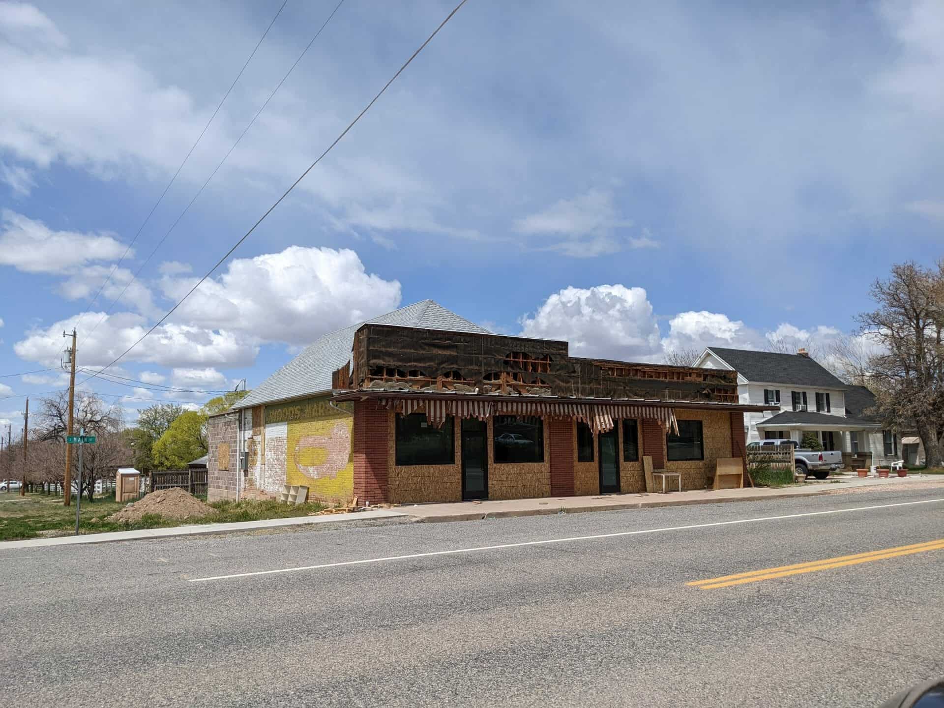
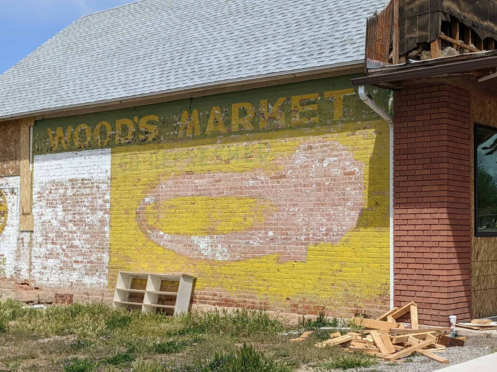
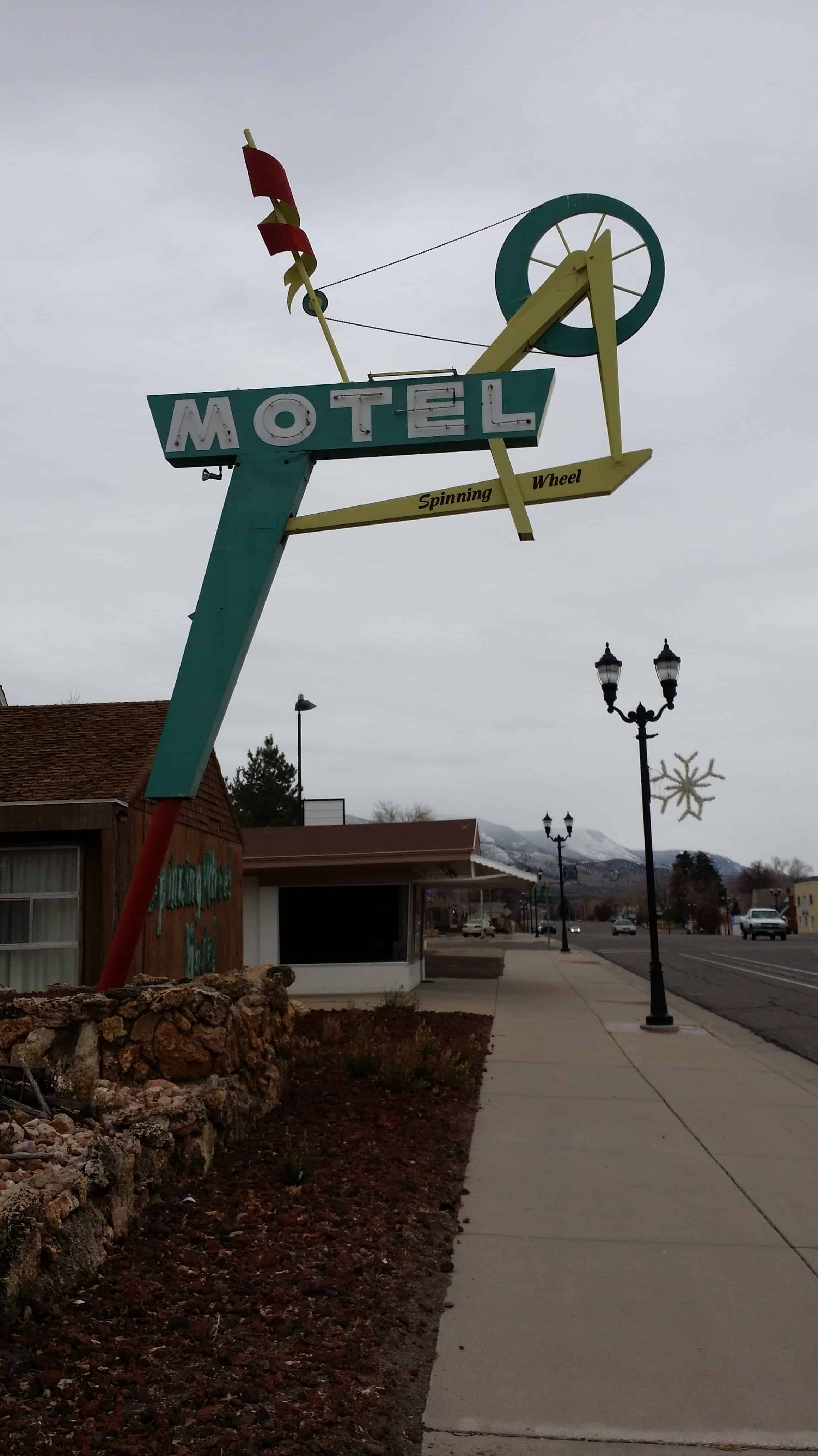
Lynndyl City is a small isolated community located in Millard County and is home to 106 residents, according to the 2010 US Census. Lynndyl was first established as an unnamed junction for the Los Angeles and Salt Lake Railroad around 1904. With a depot being constructed and a telegraph line being completed also in 1904, railroad employees began moving into the area around 1907. The name Lynndyl was created in 1904 when the first telegraph operator tried out her new system by sending a message to the next telegraph station. The operator at the other end asked the telegraph woman for her location, she quickly looked at her shoe, which was made in Lynn, Massachusetts, and responded, “This is Lynn.” Lynn Junction was then established and later it was changed to Lynndyl, to distinguish the community from another town in Utah named Lynn (Ekins 551).
According to a May 27, 1993, article in the Millard County Chronicle, the history of Lynndyl’s existence is tied directly to the railroad. The first train tracks within the city were laid in 1879 for the purpose of sending trains to the silver mining town of Frisco, to the south. In 1906 the first section house and round house with 18 stalls was constructed, and each were filled with workman repairing and maintaining locomotives. With the rail industry growing, Lynndyl was one of the largest railroad terminals between Omaha, Nebraska, and Los Angeles, California.
Lynndyl was a rough town full of working men, gambling and bootlegging. Yet, the railroad also kept the town alive and brought work to many of its residents (Hellenbrand). With the coming of water in 1912, farmers began settling the area in 1913. Yet, many became discouraged with turning the barren land into fertile fields and left Lynndyl after a short time. During the years of the Great Depression, the town saw decline, yet still had numerous buildings dedicated to the rail industry and still had hundreds of employees. During World War II, the rail yards saw a boost of activity with soldiers and military equipment coming through the community for supplies. However, this soon changed when the technology of the locomotive was altered. New diesel locomotives were able to run faster and longer without being required to have numerous stops. The need to resupply in Lynndyl was no longer required and the back shops were moved to Provo. By 1950, only 8 passenger trains and 6 freight trains rode through the town on a daily basses. With the loss of jobs, many people moved out of the community to find work elsewhere. As time progressed many structures were abandoned and eventually demolished. In the late 1970s and early 1980s new hope was brought to the small town, when the coal-fired Intermountain Power Project plant was constructed nearby. Other than farming, this is the only industry, and population has not increased.