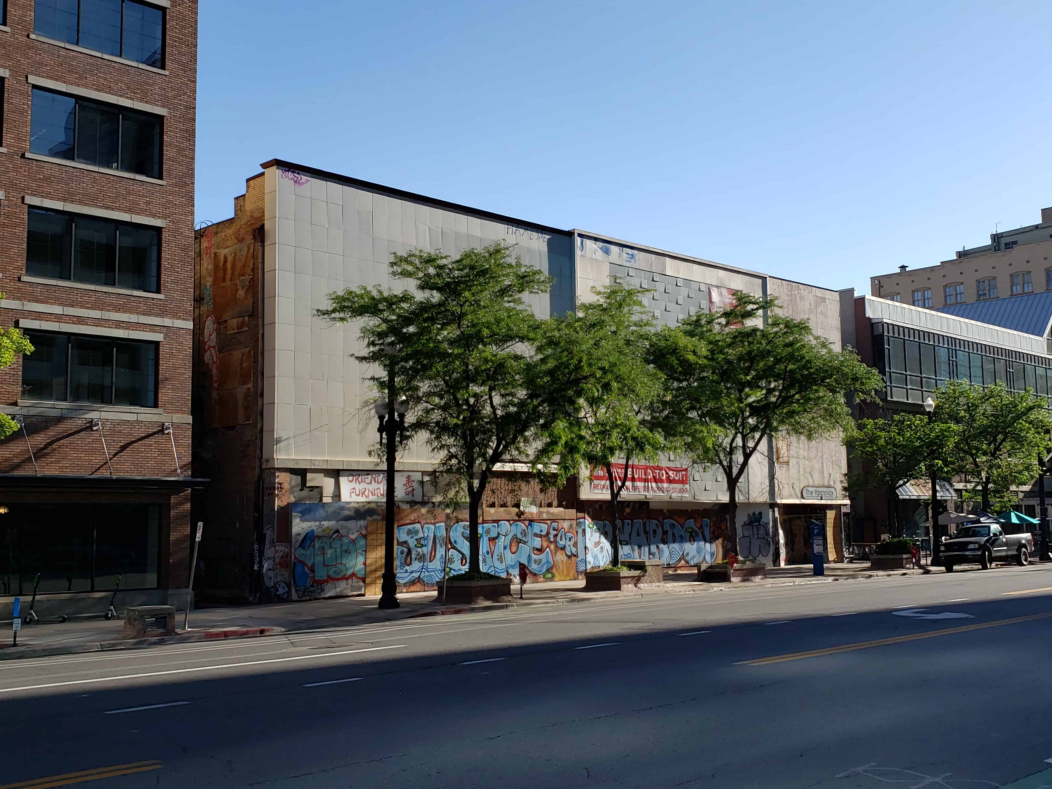
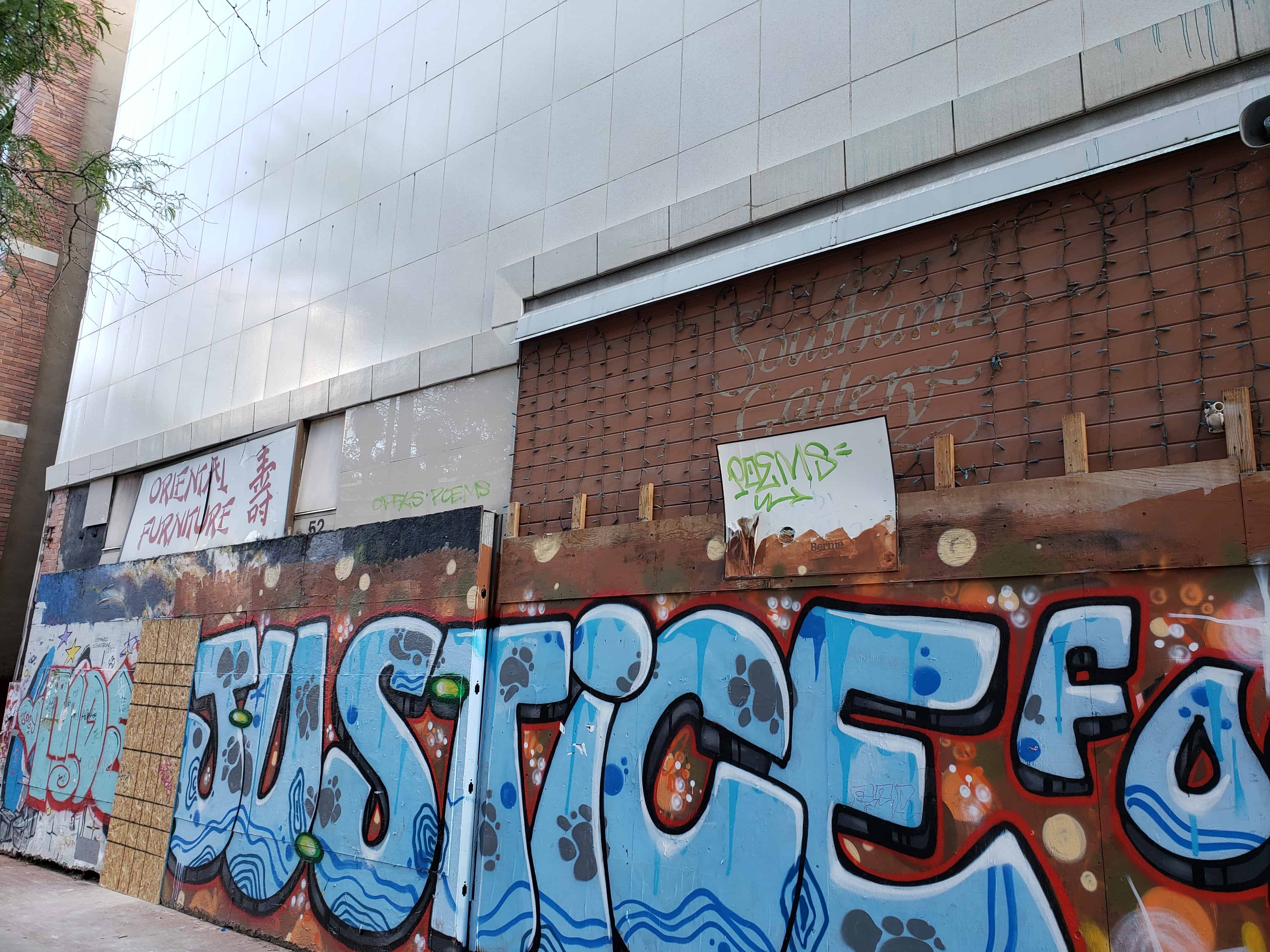
The Victory Theater was first known as the Colonial Theater in 1908 and then the Pantages, not to be confused with this one on Main Street, after that is was the Casino Theater and finally the Victory Theater. It later burned in May of 1943 and in 2020 it is sitting in poor shape wit talks of it being demolished.
The parcel is at 40 East 300 South in Salt Lake City and it is now one large boarded up building, the theater was the east half and the address was 48 East 300 South or 48 E Broadway. The west half was the Paris Millinery at 40 E Broadway.
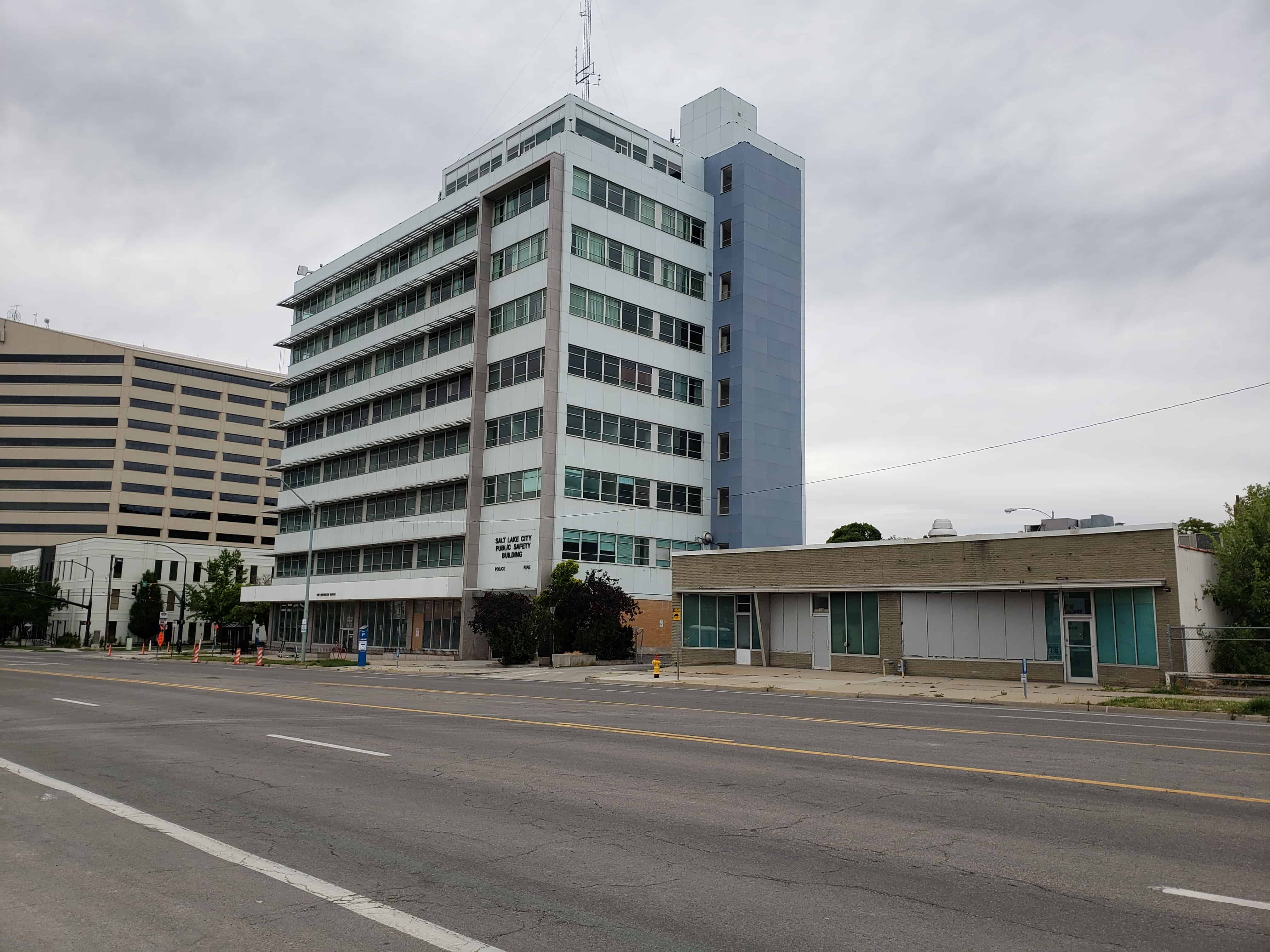
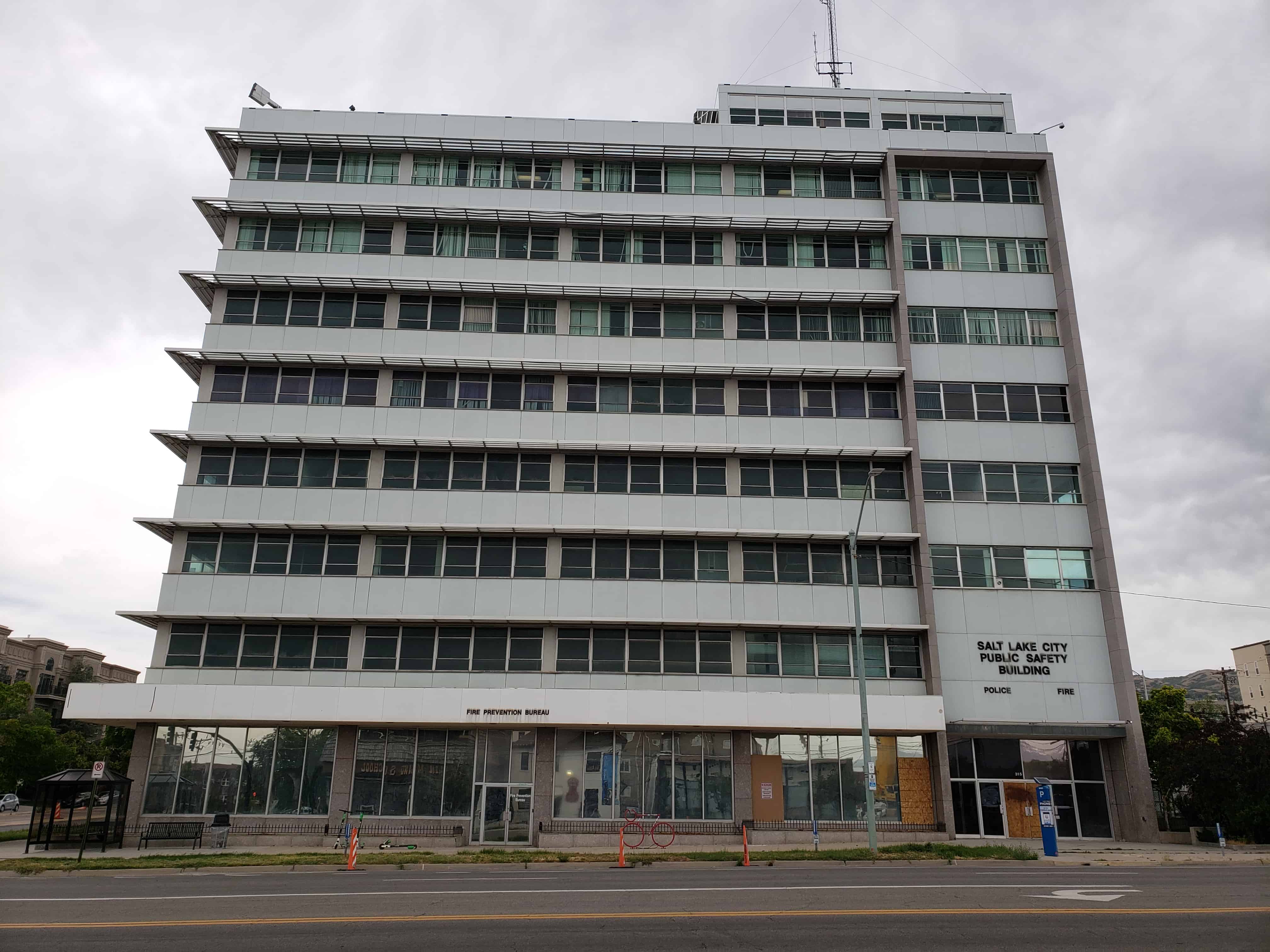
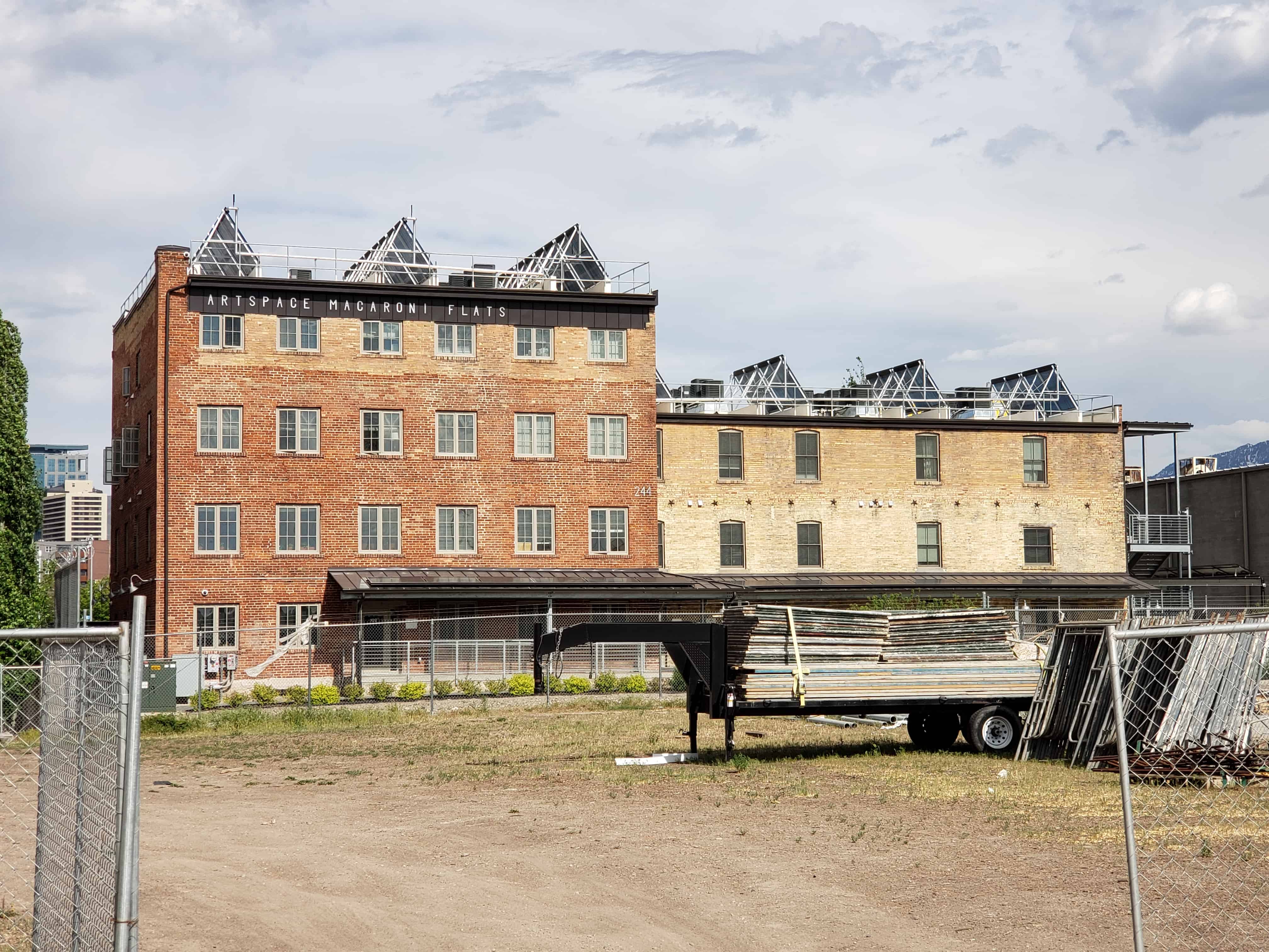
Built in 1958 in International Style, it was the Salt Lake City Public Safety Building from 1979 to 2013.
The Public Safety Building was originally built as the Pacific Northwest Pipeline Company headquarters and it was expected to have 275 employees work in the building. Architects for the structure were the local father and son team Slack and David Winburn, with contractors Del Webb Construction Company of Phoenix, Arizona. The 95,000 square-foot building opened to great newspaper fanfare in May 1958 with Salt Lake Tribune headlines. The $2.5 million structure included an upper story that featured a penthouse conference room; heat resistant glass and aluminum louvers to shade windows on the south and west for energy efficiency; interior steel from the Geneva Steel Company in Lehi, Utah County; and an exterior of porcelainized steel, the same material pioneered on the First Security Bank building.(*)
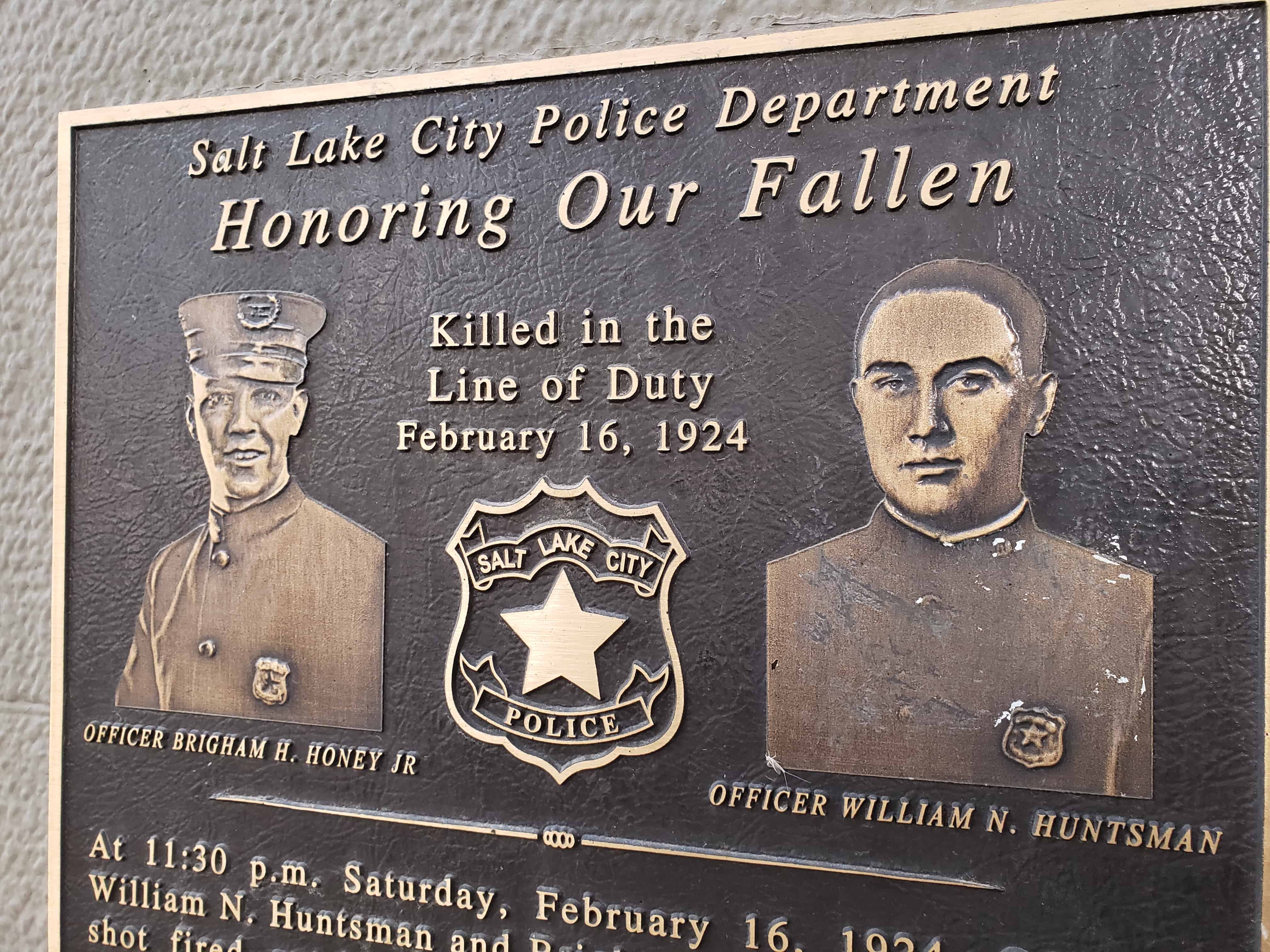
At 11:30 p.m. Saturday, February 16, 1924, Officers William N. Huntsman and Brigham H. Honey Jr. heard a shot fired outside the State Cafe, 46 W. Broadway, which was being robbed. Both officers pursued the suspect to this location (315 S Main St) and a gun battle ensued. Huntsman, 26, was killed immediately, while Honey, 34, died several hours later. They are buried near each other in the Salt Lake City Cemetery.
To learn more about the fallen officers of Salt Lake City, visit slcpd.com
Erected by Police History Project and the PMAA, May 2011.
The Capitol Hill District is significant as the oldest surviving residential area in Salt Lake City. Its streets and houses document over one hundred thirty years of residential construction and neighborhood development. The scale and irregularity of the streets and blocks are not typical of the rest of Salt Lake, either today or in the past. Rather they were a product of the steep hillside which made the area unattractive for redevelopment and ensured its survival. The District preserves a representative cross section of the City’s arid the State’s architectural .and historical resources, ranging from the high style mansions of Arsenal Hill to the tightly packed workmen’s cottages of Reed Street. The buildings and patterns of neighborhood life on the Hill are representative of other early neighborhoods of the City now broken or vanished.
The Capitol Hill Historic District was added to the National Historic Register (#82004135) on August 2, 1982.
During the initial period of settlement, roughly 1850 to 1880, traditional vernacular/folk architectural designs predominated in the Marmalade district of Capitol Hill. House plans conformed to the rigid geometric categories found in most parts of the United States during the middle years of the 19th Century. The square cabin type (Richard Collett, 328 Almond St, c. 1875); Alonzo Raleigh, main brick section, 640 Wall St., c. 1860; and John Makauna , 249 Reed St., c. 1885) represented the basic building unit for early Utah builders. Placing two, square rooms side by side yielded the “double pen” type (Henry Arnold, main stone section, 640 Wall St., c. 1860; Daniel Cross, 467 Center St., c. 1865; William Southam, 540 West Capitol St,, c. 1880) A center passage inserted between the two square rooms characterized the “central hall” type (Ebenezer Beesley, 80 W. 300 N., c. 1860; Ricbard V. Morris, 314 Quince St., c, 1865; John Irvine, 521 Center St, c. 1880). The “hall and parlor” house, a larger rectangular plan internally divided into two rooms of unequal size, was another popular house plan (Anders W. Winberg, 560 N. 200 W., c. 1855; John Platts, 364 Quince St., c. 1860). Stylistically, these early homes reflected the controlled symmetry of the Federal and Greek Revival periods. By the early 1870s and 1880s however, the Gothic Revival was emerging as an important influence in Utah architecture and several of the Marmalade houses are fine local renderings of this important style (August Carlson, 378 Quince St., c. 1872; Swen J. Jonasson, 390 Center St., c. 1872; Thomas Quayle, 355 Quince St., c. 1881).
Capitol Hill Significant Sites (Address, Original Owner, Construction Date)
The advance party of Mormon settlers arrived in Salt Lake Valley on July 24, 1847. The following day Great Salt Lake City was platted. In accordance with Joseph Smith’s precepts for the City of Zion, many of the Twelve Apostles chose their inheritances to be shared among their family, friends, and followers. Land north and west of Temple Square fell to Heber C. Kimball, First Counselor to President Brigham Young. This land rose in a gentle slope to the north, leveled in a beach terrace left by receding ancient seas, and then rose more sharply to a rounded summit later named Ensign Peak. To the west the hillside fell away sharply along a major fault line. To the east, City Creek cut a steep canyon through the bench. The remaining peninsula of high ground pushed out from the hills toward Temple Square. In 1888 the City government set aside twenty acres on the broad, level top of the hill for the capitol to be built when Utah should become a state.
In the first decades of settlement, the water of City Creek supplied the center of the city with culinary and irrigation water and powered a string of mills that sprawled down the canyon and followed the creek to the west around the south slope of the Hill. Above the mills, close to Temple Square and the city center and looking southwest across the valley to the Oquirrh Mountains, rose the houses of the Kimball family and their friends. From midway up the slope the hill was bare, pocked with gravel pits. At a distance stood the City powder magazine and arsenal which gave its name to the south slope, Arsenal Hill. Farther north the City Wall ran from the hot springs baths diagonally to the southeast, crossed the open top of the Hill, plunged into City Creek Canyon, mounted the other side and continued to the east. Begun in 1853, the rock and adobe wall served more as a public works project than as a practical defense. The wall soon fell into disrepair and eventually disappeared entirely, its location remembered in the diagonal line of Wall Street.
Citizens of the City of Zion were ideally to be farmer-craftsmen, each family supplying many of its own needs in a walled city of small garden farms. Settlers preferred the soil of the flat valley floor. Its soil was richer than the land on the Hill, and more easily cultivated and watered by ditches from the mouths of the “wet” canyons. The regular grid of the city plats thrust tentatively onto the lower slopes of the Hill but then quickly disappeared in gravel and brush. From the earliest years of settlement, however, settlers of more modest means were attracted to this less desirable land located within an easy walk of the center of the city. Most were emigrants from the British Isles and Scandinavia, their originally slender resources strained by the cost of the Atlantic passage. Like August Winberg, a blacksmith, (560 North 200 West, c. 1854-1855) or John Platts, a mason, (364 Quince Street, c. 1856), they were craftsmen who relied on their trades for their livelihood and often built their simple houses themselves.
Most of these early residents on the Hill probably managed by some contrivance to supply enough water for small gardens as well as their household needs. John Platts is reported to have grown prize peaches on his high sloping lot. Brick and stone cisterns appear on fire insurance maps of the nineteenth century, small ponds appear in early photographs, wells are known to have existed on the lower slopes, and a few sections of irrigation ditches survive. The difficulty of bringing water to the hillside, however, was probably the single most important factor in confining early settlement to the lower margin of the Hill.
Water was probably first brought to the Hill by extending the system of ditches and flumes that supplied the mills in City Creek Canyon. By the late 1880s City Creek had been tapped in three places by a system of cast iron mains that brought the water to distributing reservoirs located on high points around the city. One line served a cement-lined reservoir located just north and east of the present Capitol Building. A second line, interconnected with the first, ran from a holding reservoir in the canyon down the east edge of the Hill and turned west on 300 North, then angled northwest and downhill along Center Street. Wooden stave pipe, some in use until the 1930s, distributed the water to users, many of whom must first have been served by public taps. The head of this gravity system was sufficient to supply all of Capitol Hill.
Dependable water accelerated the development of the upper slopes of the Hill. When the area was finally platted in the 1860s, some of the wandering lanes that crossed the face of the hill, such as Vine and Crooked Street -later straightened and renamed Almond, were surveyed and recorded as city streets. In place of the north-south streets of the regular city plats were diagonal streets that more or less paralleled the old City Wall. The eastwest streets of the city grid, however, were uncompromisingly projected up the slope, producing some “streets” that are still impassable. The eight-rod streets laid out in the rest of the city, “wide enough to turn a team of oxen,” were simply inconceivable on the hillside. The result was the west slope’s most distinctive feature – the layout of its streets and blocks. Streets of varying width and grade cross each other at unpredictable angles defining small blocks of varying shape and size. In the early 1880s the west slope became a more fashionable place to live and the original street names -Bird, Cross, Locust – were replaced uniformly with names of fruits. This stylish scheme of names gave the area a name of its own, the Marmalade District, or more usually simply the Marmalade.
In the 1880s and 1890s substantial mansions appeared at the corners of blocks low on the south and west slopes of the Hill. John R. Park, (166 North State St., c. 1875, demolished), Charles P. Brooks, (204 N State St., 1890), Robert N. Baskin, (200 N. State St., c. 1876, demolished), William S. McCornick, (199 N. State St., c. 1886, demolished), and William A. Hooper, (348 N.200 West, c. 1880?, demolished) placed their homes away from the smells and dust of the city but within an easy walk or a pleasant drive and with fine views of the valley. The comfortable houses of the upper middle class – successful craftsmen and contractors, small manufacturers and merchants, professional men and secondary officials of government and the Church – were more characteristic of the west slope of the Hill. Their homes appeared on the corners of blocks all over the Hill and clustered on the broader and more imposing diagonal streets, especially Quince and Center Streets. E. L. T. Harrison, an architect, (10 West 300 North, c. 1870), Henry Arnold, businessman (640 Wall St., c. 1860 et seq.), James Watson, stone contractor, (335 Quince, c. 1866), William J. Silver, ironmaster, (518 Center St., c. 1860 and 1897), and William Asper, lumberman and contractor, (325 Quince St., 1870’s), found sites on the Hill for the houses that expressed their success and substantial position in the community.
The middle and lower classes found lots between the corners, on the narrower east-west streets, and occasionally behind the first rank of houses and in the interiors of blocks. These clerks, (William Henry Perkes, 92 Apricot St., 1873), craftsmen, (William Southam, 540 West Capitol St., c. 1880), and factory workers built smaller, simpler homes. Laborers bought or rented small cottages like the tightly packed row that survives on Reed Street at the north end of thd district. Tenements (136-146 W. 600 N. , James J. Wyatt, c. 1885), and boarding houses (318 Center St., Engbert Olsen, 1873) were less common. More commonly, even the poorest houses were occupied by their owners.
Residents of the Hill found their neighborhood conveniently close to the varied activities of the city. They found work in the business district of the central city and in a variety of manufacturing and retail establishments such as the Z. C.M.I. Tannery, 244 W. 500 N. , Davis, Howe, § Co., hardware, 115-127 N. West Temple, the Utah Soap Manufacturing Co., 245 W. 500 N. , and Silver’s Iron Works, 149 W. North Temple – all located within a half hour’s walk of any part of the Hill. The University of Deseret, the L.D.S. Church University, the city’s only public high school, a private academy, the Keeley Institute for the Cure of Addiction, and the Keogh-Wright Hospital were all located within a few blocks of Capitol Hill. By the 1890s streetcar lines up 300 West and down the diagonal of Center Street tied the Hill even more closely to the city.
As the properties were repeatedly divided into smaller lots and the population grew, small groceries, meat markets, and occasional general merchandise stores appeared every few blocks to meet the needs of their immediate neighborhood. The number of these small establishments peaked in the 1920s before the automobile made possible the re-centralization of retail sales. With the exception of the Z.C.M.I. Shoe Factory and the J. W. Summerhays Tannery, later operated by the United Order of the Nineteenth Ward, no manufacturing enterprises of any size or permanence took root in the district. Occasional family enterprises -a blacksmith shop or shops producing soap or sausage or paper boxes -appeared, but overall the Hill remained an area of modest houses and the stores and churches that met their needs.
The population of the Hill appears to have retained its predominantly Mormon character longer than other central neighborhoods of the city. The small, sometimes awkward hillside lots may have found buyers among the continuing flow of new foreign converts of slender means more readily than among newcomers from “the States.” The latter were more likely to be gentiles and of more substantial means. The original Nineteenth Ward of the L.D.S. Church stretched away to the Jordan River on the west and the Warm Springs on the north. As the city grew this original jurisdiction was repeatedly subdivided into new wards so that the district at one time was represented in four wards and contained three functioning ward chapels (19th Ward Chapel, 168 West 500 North, 1890-1892; 24th Ward Chapel, 700 North 200 West, 1906; Capitol Hill Ward Chapel, 400 North West Capitol, 1928-1929). But the Hill was most strongly associated with the Nineteenth Ward (168 West 500 North, 1892). There was no ready division between the residential neighborhood that spread down the west slope and the residential blocks to the west. A Pugsley from west of 300 West was as likely to sit on the ward building committee as an Asper from Quince Street. Three Hundred West had more shops but was essentially another residential street.
In the 1880s, however, the number of gentiles on the Hill began to rise. The Denver and Rio Grande Western Railroad shops were conveniently close and many engineers and other railroad men chose the Marmalade and the blocks immediately to the West to settle their families. “Mining men” – engineers, managers, promoters, surveyors – initially almost invariably gentiles, chose houses on the Hill, apparently accepting the necessity for travel and frequent, prolonged absences. Men trained in the new trades -telegraph and telephone men and electricians such as Stephen D. Greenwood, telegraph lineman (642 Center St., 1909) – found the Hill attractive and within their means. The establishment of the Plymouth Congregational Church, (354 W. 400 N., c. 1893, demolished) reflects the new gentile presence. A modest amount of religious diversity was thereby added to the economic and social diversity that had characterized the Hill from the earliest days of settlement.
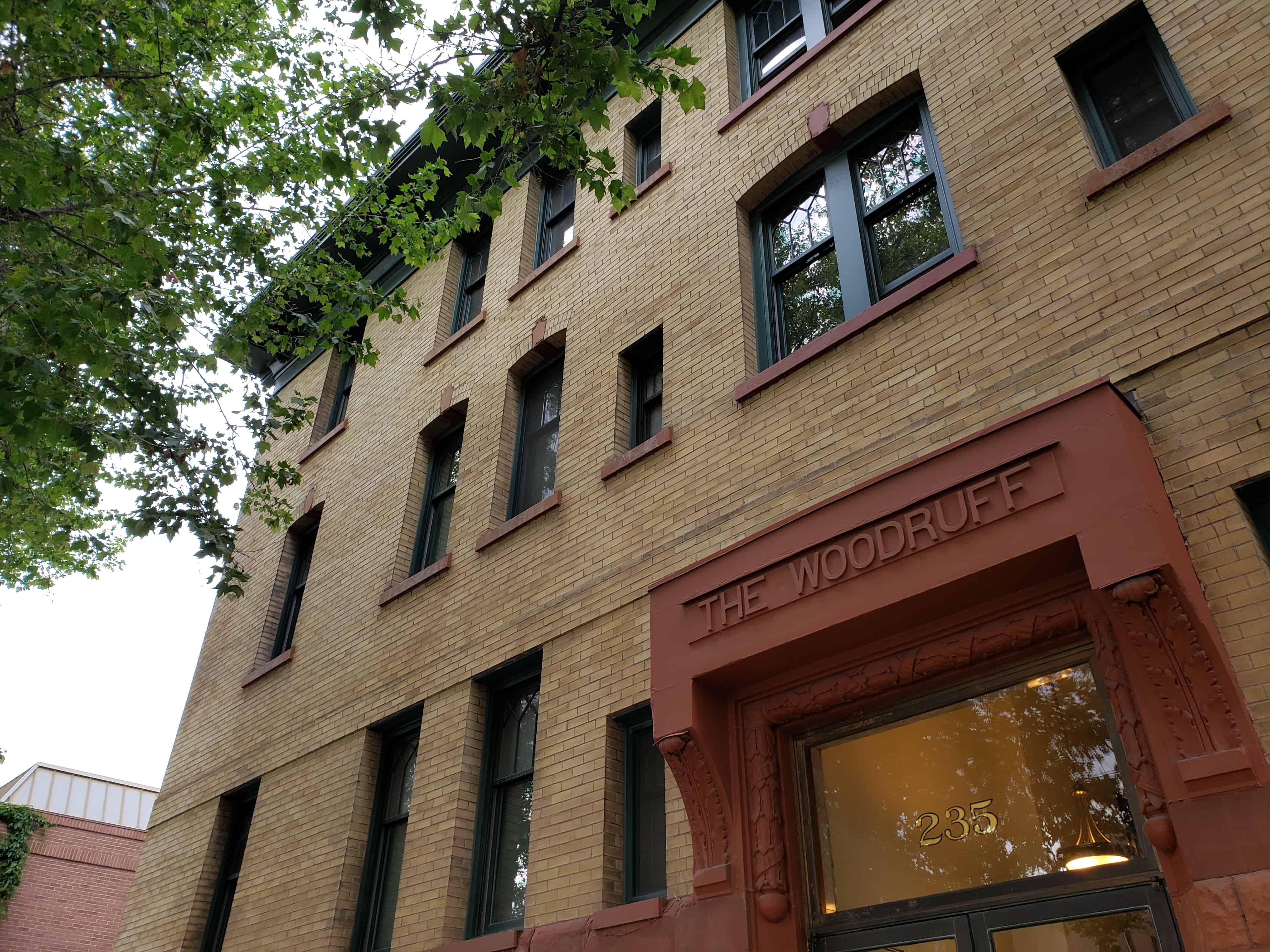
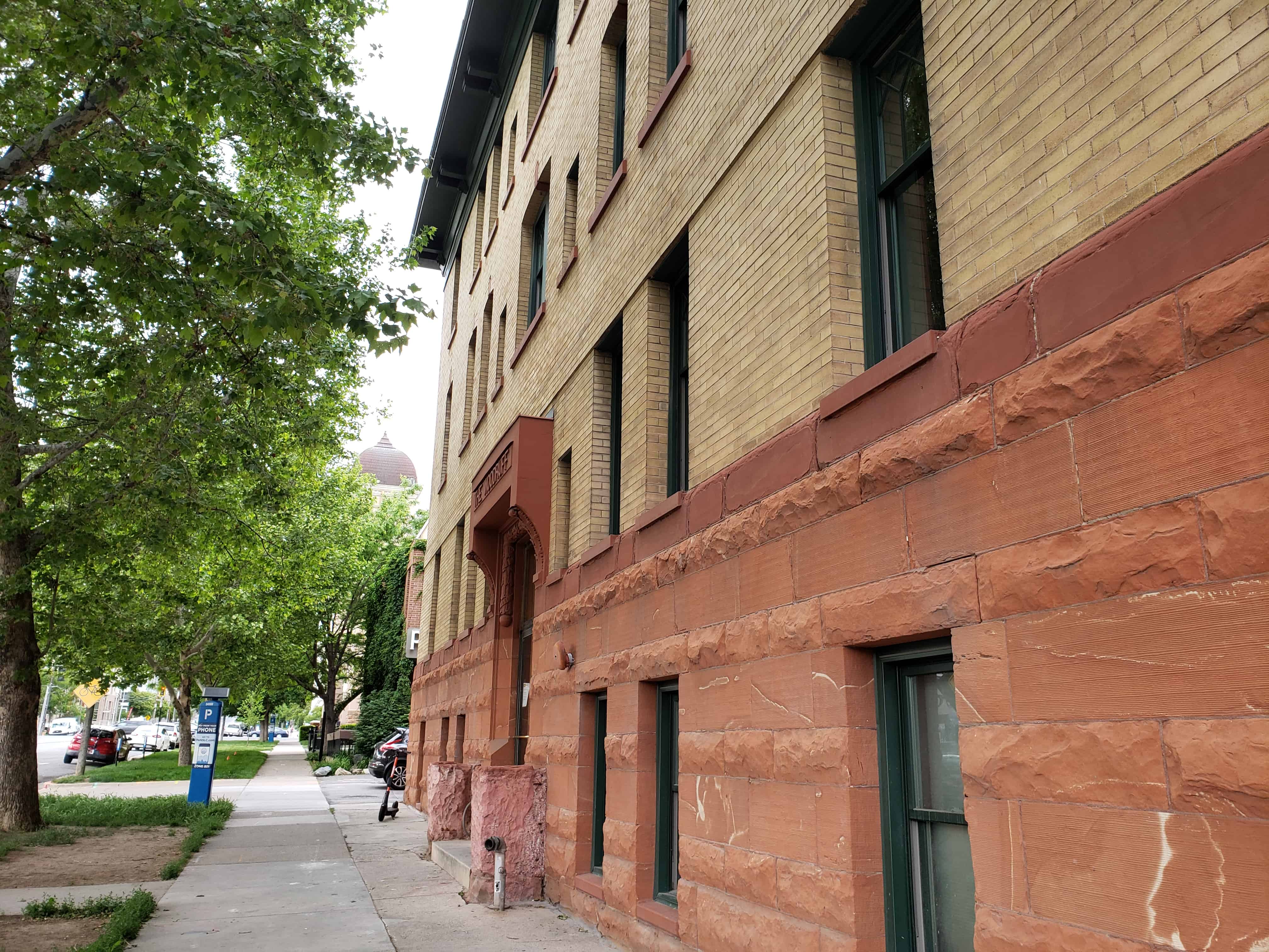
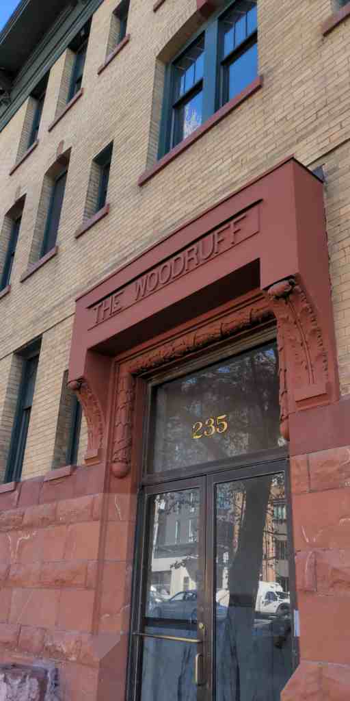
After 1900 residential construction was concentrated on the upper parts of the west and south slopes of the hill. Unattractive when water and transportation were difficult, this land was never built upon or had been bought cheaply and built up with insubstantial houses that were razed for new construction. The Alfred McCune (200 N. State St., 1901) and Edward D. Woodruff (95 E. 200 N, 1906) mansions replaced earlier construction on Arsenal Hill where the John R. Park house yielded to three substantial houses in the first two decades of the twentieth century. The upper reaches of Arsenal Hill had remained bare since the explosion in 1876 of the forty tons of powder then stored there. Although the arsenal land was sold off by the city shortly after 1900, the top of the slope showed only scattered buildings as late as the 1930s.
The completion of the Capitol Building in 1916 and the planting of its grounds made the crest of the hill an attractive residential area, however, and new houses appeared to flank the Capitol on the south and west. The present grounds incorporate additional land initially platted into residential streets upon which several houses were built and subsequently razed. The houses built by men such as George S. Ashton (404 Wall St., 1920), first Bishop of the Capitol Hill Ward (400 West Capitol, 1928-1929) and the contractor for the stone in the Capitol Building, appear modest because of the subsequent inflation of popular conceptions of the space necessary in a house. Indeed the social-economic status of many Hill residents will be underestimated unless this inflation is remembered.
Although residential construction in the upper areas of the Hill remained active in the late 1920s and even recovered from the depression slump in the late 1930s, prestigious house sites were no longer being sought on the Hill. After World War II the aging housing stock on the Hill and the exodus to the suburbs began to take their toll as they did on other central residential neighborhoods. New construction of single family homes continued on the upper slopes of Arsenal Hill but in the Marmalade such new construction as occurred was two, three, and four unit rental housing of a plain, unornamented character. Conversion into rental units of single family houses, both smaller and larger, which had begun in the 1930’s accelerated in the 1950s.
Much of the housing on the Hill slumped from modest to marginal and the area acquired a questionable reputation. It housed a mixture of long-time residents, low-income tenants, transients, and university students. The most deteriorated sections were generally believed to harbor prostitutes and drug dealers. The restoration of Capitol Hill began in the 1960s with long-term residents determined to preserve their neighborhood, acquired impetus from the surge of interest in preservation, and was well underway by the time shortages of gasoline prompted a return to inner city neighborhoods. Many houses in the district are undergoing renovation or restoration. Some of the new construction of multiple-unit structures has been sympathetic, but the area is under increasing pressure from developments whose massing and scale would irreparably damage the character of Capitol Hill.
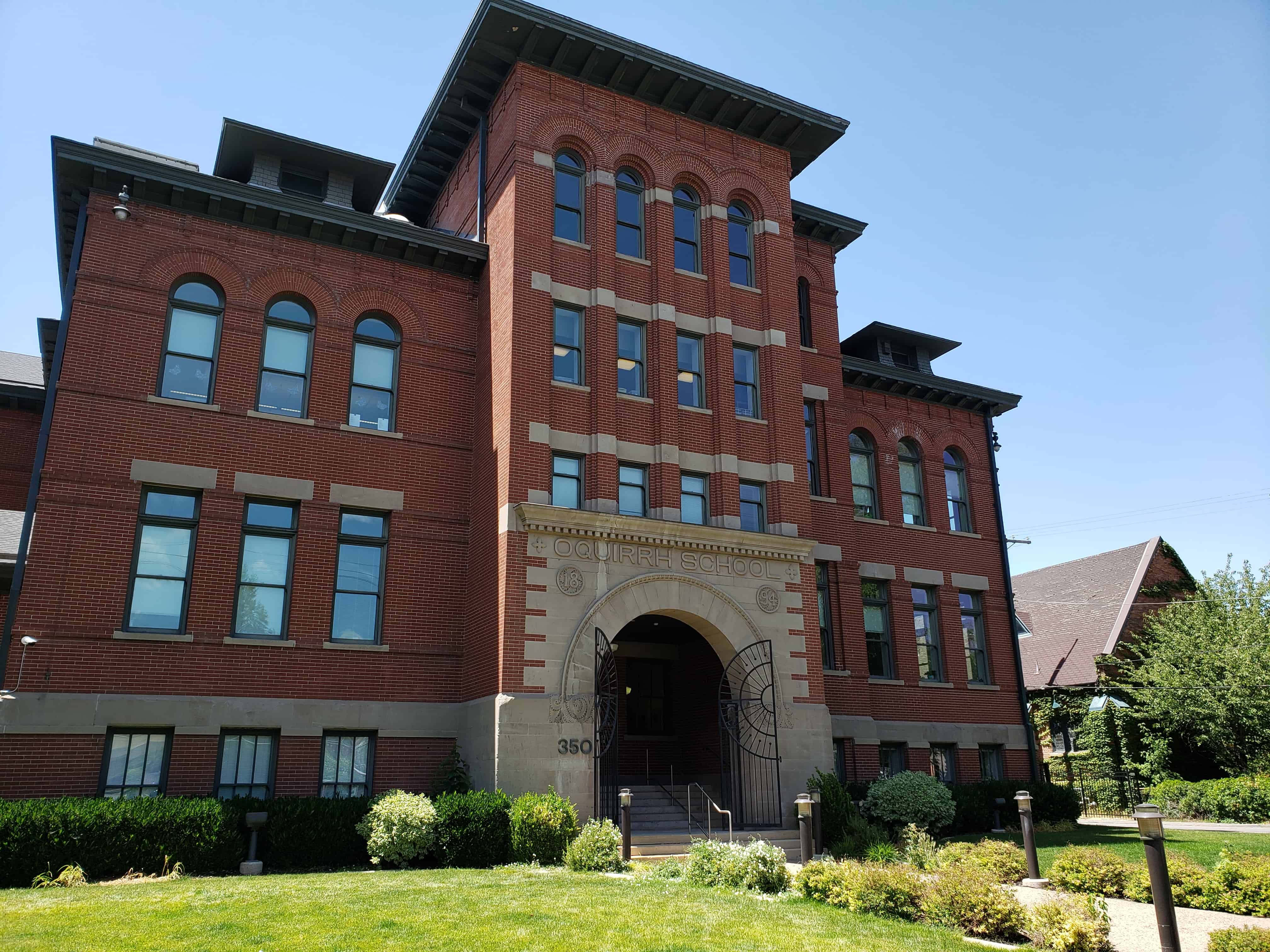
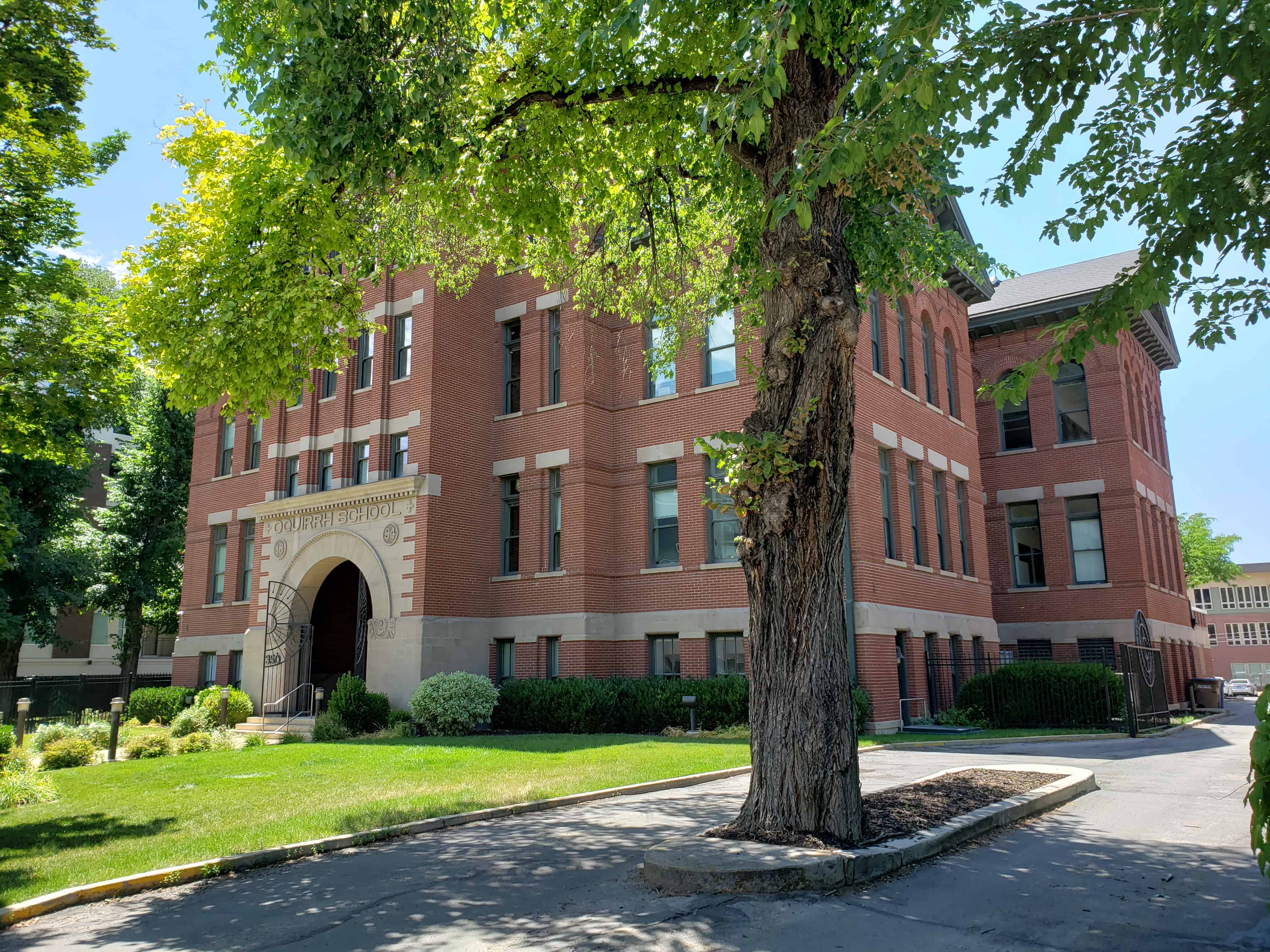
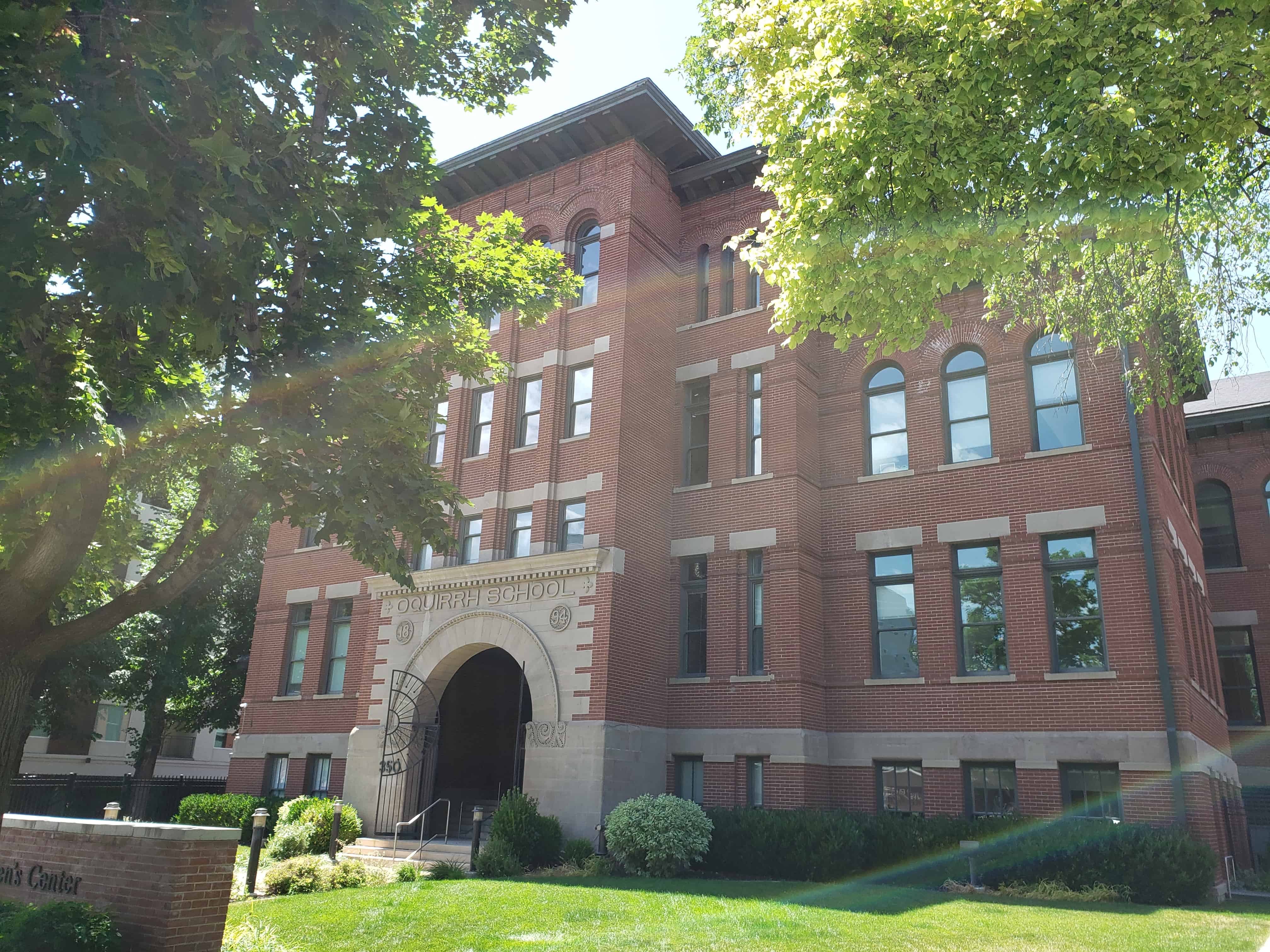
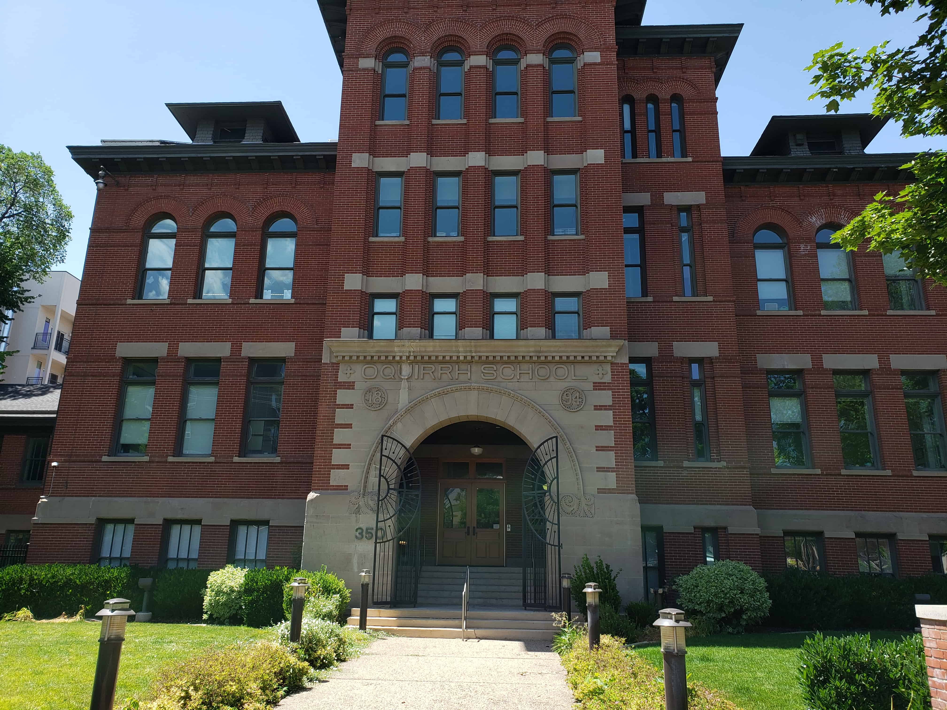
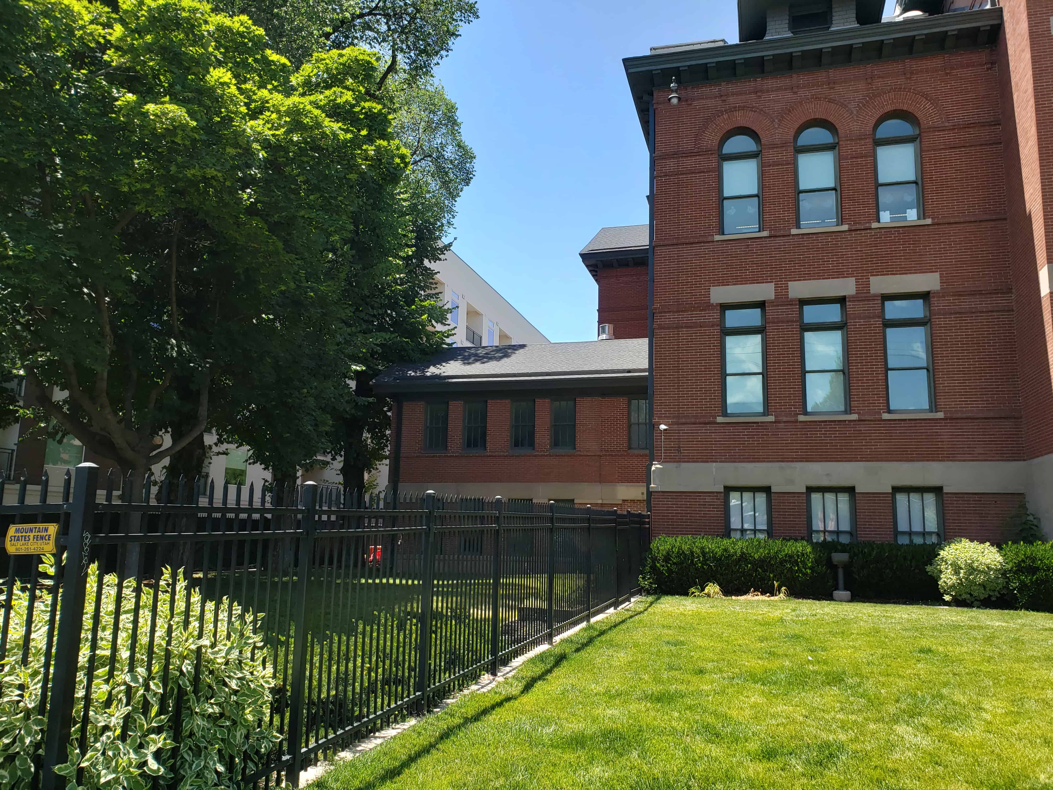
The Oquirrh School, constructed in 1894, is significant as a representational example of the schoolhouses constructed as a result of the education reforms and development of the public school system that accompanied Utah’s campaign for statehood in the 1890s. Reforms include the consolidation of school districts, the adoption of a statewide curriculum and and the construction of numerous unified schoolhouses. The Oquirrh School was one of the first to be built and as such embodies the earliest ideologies and practices of public education in Utah. The Oquirrh School is also architecturally significant because it was one of the first public schools built in Salt Lake City and is an excellent example of late Victorian institutional architecture implementing a combination of the Romanesque and Second Renaissance Revival styles. The school can also be considered the work of a master, namely the regionally prominent architect Richard K. A. Kletting*, who also designed several emblematic Utah buildings.
This is located at 350 South 400 East in Salt Lake City, Utah – the text above is from the plaque on site from the National Register of Historic Places.
Built in 1892 as the Holy Trinity “English” Lutheran Church, the time I spend there (2010-ish) was when it was Ichiban Sushi and now (2020) it has sat abandoned for a while.
Located at 336 South 400 East in Salt Lake, 324 South is also on the parcel and is the parking lot ( in 2020).
The Zion’s Co-operative Mercantile Institution was organized in December 1868 under the direction of Brigham Young, the president of the Church of Jesus Christ of Latter-day Saints (LDS or Mormon Church). Since the initial settlement in 1847, the Mormon pioneers had lived for the most part as an isolated community. The discovery of valuable ores in the canyons near Salt Lake City in the early 1860s and the arrival of the transcontinental railroad were perceived as a threat to the peace and prosperity of the Mormon settlers. Despite a number of self-sufficiency polices, such as encouraging “home manufactures,” the number of non-Mormon merchants grew. By the 1860s, most merchandizing was in the hands of non-Mormons because of the stigma attached to “profiteering Saints” and the inability of Mormon merchants to refuse credit or collect debt from fellow Mormons. Following the example of successful cooperatives in Brigham City and other settlements, Brigham Young and a group of church leaders organized the ZCMI in order “to bring goods here and sell them as low as they can possibly be sold and let the profits be divided with the people at large.”
The ZCMI eventually became a chain of mercantile cooperatives that included approximately 150 retail co-ops. Salt Lake City was chosen to be the location of the wholesale distribution center. The center would develop an integrated marketing and distribution system, which had the responsibility to supply and distribute products to the outlying settlements. ZCMI stocked a variety of goods, including wagons, machinery, furniture, carpets, clothing, shoes, sewing machines, household items, dry goods and groceries all available to member co-ops for the same price as they were in Salt Lake City.
ZCMI, the “Parent Store,” was an immediate success. Within a few years, it had a near-monopoly on the wholesale trade in the territory and much of the retail trade in Salt Lake City. The company built a grand retail store for its consolidated departments at 13-31 South Main Street in 1876. The building, often considered “America’s First Department Store,” was expanded and doubled in size in 1880. ZCMI also built a tannery, a boot and shoe factory, and a clothing factory, the products of which were distributed through its retail and wholesale outlets.
ZCMI, itself, was never a true cooperative, and though it retained a strong presence in Salt Lake City, as the population of outlying settlements grew, the cooperative movement became less popular. A secularization of mercantilism and trade took place in the 1880s and 1890s with many of the local co-ops closing. Many Mormon-owned stores throughout Utah continued to call themselves co-ops and did much of their wholesale purchasing through ZCMI, but from-the-pulpit church-sponsored support of the company gradually diminished. Traditional loyalties continued to bring church members into the store, but in the twentieth century, ZCMI became increasingly more commercialized with an aggressive advertising budget and an obligation to its stockholders, rather than the “community of Saints” at large. 5 On September 30, 1895, the Zion’s Cooperative Mercantile Institution was reorganized as a million-dollar corporation. The ZCMI General Warehouse was built during this period of secularization and commercialization.
In 1902, ZCMI purchased Lot 7, Block 63, of Salt Lake’s Plat A from Elizabeth Davis Ayrton. Elizabeth was born in Wales in 1837 and married William Ayrton in Salt Lake in 1868. The couple built an adobe house in the center of Lot 7. William Ayrton died September 15, 1902 and Elizabeth sold the lot to ZCMI on October 8, 1902, ZCMI granted Elizabeth Ayrton a “term of life” lease and built a brick cottage at the northeast corner (222 South 500 West) of the lot to replace the adobe home demolished to build the warehouse. The brick cottage was demolished sometime between Elizabeth’s death on February 5,1915 and 1925. The lease was terminated on January 15, 1929.
The 1898 Sanborn map shows the neighborhood as still mostly residential with a number of adobe, frame and brick homes. A few small stores and a couple of modest hotels were nearby. However, the map also shows the neighborhood in transition. The Utah Central Railroad had a line down the center of 500 West (formerly known as 4th West) and the Rio Grande had spurs on 600 West (formerly 5th West). One spur curved from 600 West into the center Lot 4 stopping at the west end of the Ayrton property. This spur was labeled “track not used” on the 1898 map. By the time of the 1911 map, the spur was servicing three brick warehouses: the rear dock of the J. L. Case Implement Warehouse on 600 West, the north elevation of the Security General Storage Warehouse, and the interior of the ZCMI General Warehouse.
There was no building permit found for the ZCMI General Warehouse. Salt Lake County tax records give the construction date as 1904. Historian Martha S. Bradley, in her history of ZCMI, describes one of the company’s warehouses on Salt Lake’s west side: “The warehouse for the wholesale grocery department had three acres of floor space. The noise of the trains pulling out of the neighboring Denver & Rio Grande depot shook the upper windows of this new structure, which had been built for $35,000 in April 1905.”6 While “three acres” may be a small exaggeration, the rest of the description fits the ZCMI General Warehouse, which was a stone’s throw from the Denver & Rio Grande Western Railway Depot, built in 1910. The ZCMI warehouse was photographed on December 18, 1907. The photograph shows the west elevation with a fleet of horsedrawn wagons at the loading docks and a boxcar on each set of rails. Twenty-two men, probably the warehouse’s entire workforce, also posed for the photograph.
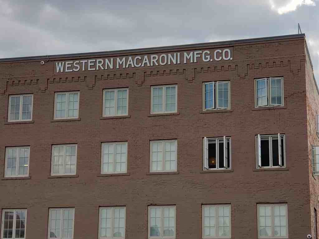
The warehouse does not appear in the Salt Lake City directories until 1925 when residences and businesses were cross-referenced by address. The building is listed at 230 South Fourth West simply as “ZCMI warehouse”. In 1927, the listing changed to “Zion’s Wholesale Grocery”, possibly a subsidiary of ZCMI since the company retained ownership of the property. The difference may have been mainly a movement of administrative services to the warehouse site as indicated by the construction of the 1926 addition and a new listing for the property as both office and warehouse for the company. A Salt Lake City building permit issued on May 28, 1926, for the construction of the two-story brick addition gave an estimated cost of $10,000 and listed the builder as the Jacobsen Construction Company, a firm still in business today. An advertisement for Zion’s Wholesale Grocery noted the business had branches in Provo (Utah), Pocatello and Idaho Falls (Idaho). The products available were “Staple and Fancy Groceries, Stationery and School Supplies, Office and Store Supplies, Paper Bags, Wrapping Paper, Store Display Fixtures, Etc.”
Zion’s Wholesale Grocery only stayed at that location two years. The Security Storage and Commission Company had moved from a nearby warehouse to the west (236 S. Woodbine [earlier Storage] Avenue) to the ZMCI property by the 1929 directory printing. ZCMFs sale of the property to the Security Storage and Commission Company was finalized on January 3, 1930. The same day ZCMI was granted a mortgage on the property worth $59,583. The Zion’s Wholesale Grocery moved to 40 S. 300 West (demolished 1980s?). A furniture factory took over the storage company’s former warehouse.
The sale of the warehouse may have been a response to the economic downturn that followed the stock market crash in October 1929. In an annual report submitted to stockholders in April 1931, ZCMI president, Heber J. Grant, acknowledged “The severe business depression, which has affected practically all types of industries, naturally, has seriously affected the business of your company during the [previous] year.” Grant continues by stating “The operations of the company were carried on at considerably less expense than for the previous year, but this reduction did not compensate for inventory losses and reduction in earning from reduced volume.” He concludes by saying “Conditions within the company are improving . . . Expenses are being reduced.” The sale of the warehouse on 500 West may have been one of the reductions to which Grant was referring.
Another reason for the sale may have been the transition from horse-drawn wagons to trucks that most industries, including ZCMI, experienced during the 1920s and 1930s. ZCMI had a compound of stables near 400 South and 500 West, just south of the General Warehouse. By the early 1920s, the compound was converted to a garage for the company’s fleet of delivery trucks. The General Warehouse was designed specifically for rail and wagon freight operations, and ZCMI officers may have felt the building could not be adapted.
ZCMI remained in the grocery business until the 1950s. In January 1960, the company discontinued all of its wholesale divisions completely to concentrate on the retail market. During the 1960s and 1970s, the company built a new store in downtown Salt Lake; a new service center to consolidate all office, warehouse and service departments under one roof; two stores in Salt Lake suburban malls; and stores in Orem, Ogden and Logan. During this time, the LDS Church retained fifty-one percent of stock in the company until December 1999 when the department store chain was sold to Meier and Frank.
The Security Storage and Commission Company was one of twelve commercial storage companies operating in Salt Lake City in the 1930s. Nine were located west of the downtown commercial district. The Security Storage and Commission Company owned the property until 1985. The company was the sole user of the building through the 1930s and 1940s. Beginning in the 1950s, there were a variety of tenants in addition to the Security Storage and Commission Company. There has also been some storage space in the building, but the names have changed. Security operated until the 1960s when it became the Watson Warehouse and Storage Company. Examples of co-tenants include wax manufacturers and machinists (1950s); food brokers and window distributors (1960s); food brokers and roofing equipment (1970s); computer installation and playground equipment (1980s). In the 1980s, the building was known as the City Center Plaza and City Center Storage. The City Center Plaza Association, who bought the building in 1985, sold it to Bridges LP in 1997.
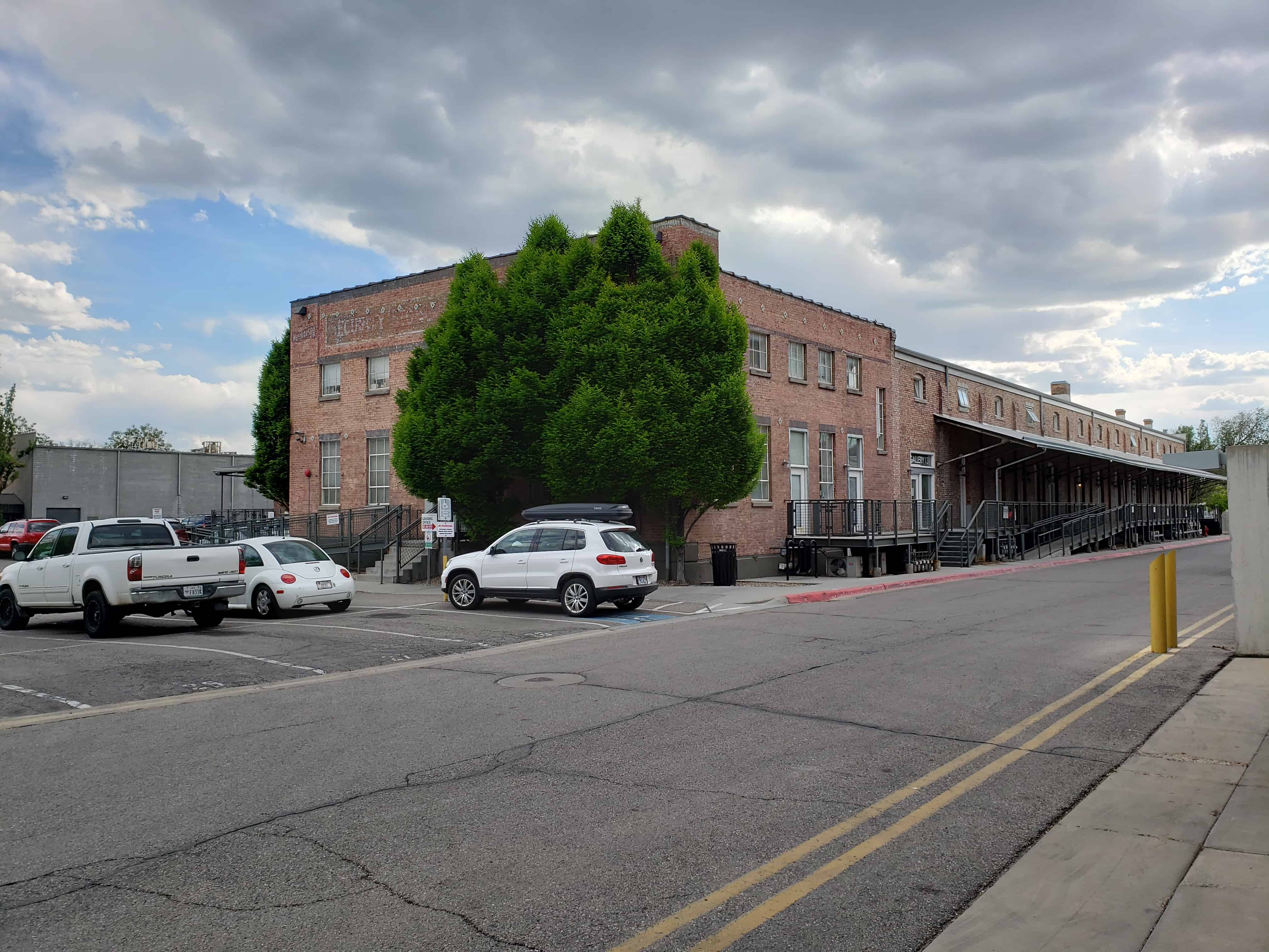
The ZCMI General Warehouse, built in 1905, is two-story warehouse constructed of brick masonry and heavy timbers. There is a two-story brick addition, built in 1926, on the north side of the east elevation. The warehouse is located at 230 S. 500 West in Salt Lake City’s west side industrial district. The 1905 building is set on a raised concrete foundation. The roof is has a fairly flat slope and has built-up roofing with existing historic skylights or visible historic locations. The primary architectural features of the building are the stepped parapets on the east and west elevation, brick pilasters dividing the thirteen bays of the north and south elevations, and the large opening for a former rail spur into the interior of the building on the west elevation. The 1926 office addition features multi-light metal sash windows and a decorative cast concrete surround for the front entrance. A rehabilitation of the building began in July 2005 as a federal and state rehabilitation tax credit project and is expected to be completed by Summer 2006. The former ZCMI General Warehouse is part of the Bridges redevelopment project and will be adapted for use as office space and artist studio-residences.
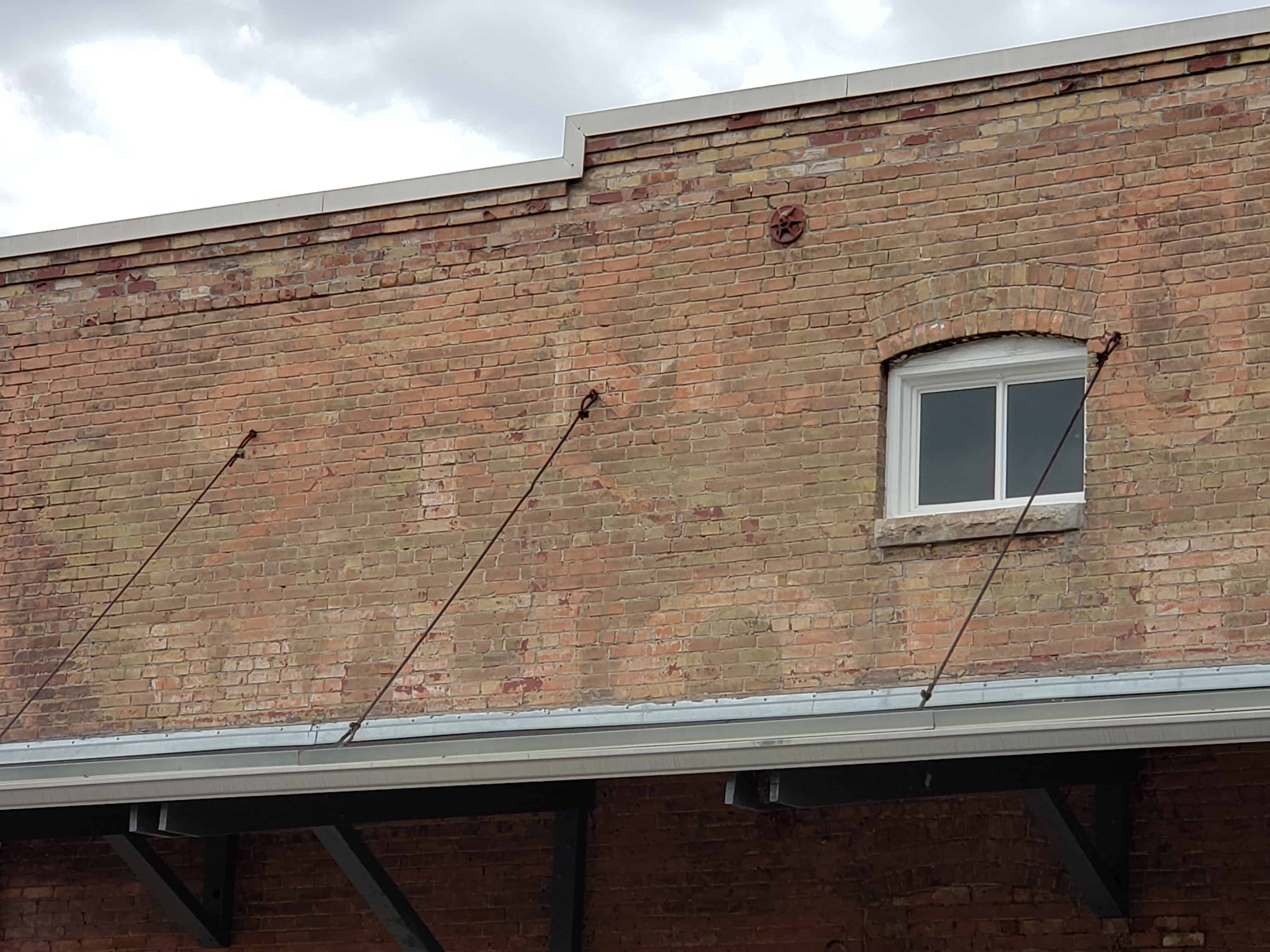
According to Martha S. Bradley, who wrote a history of the Zion’s Co-operative Mercantile Institution (commonly known as ZCMI), the warehouse was completed in April 1905 at a cost of $35,000. The Salt Lake County tax assessor’s card gives the year of construction as 1904 and the building was in use when photographed on December 18,1907. The brick addition can be dated to a Salt Lake City building permit for a “$10,000 two-story brick addition” issued on May 28, 1926 and construction was probably completed later that year. The original warehouse was constructed of commercial grade yellow-pink brick laid in American (common) bond with headers at every sixth course. The addition was also constructed of brick masonry laid in a common bond. The warehouse and addition have been painted red, probably at the same time the addition was built. A portion of the dock area (west bays of north elevation) under a canopy was never painted. The historic photograph indicates the building had three tall brick chimneys, but all have been shortened (date unknown, probably after 1970). There are two short chimneys with corbelled caps on the north and south elevations. Physical evidence suggests the building had several skylights. Only one is currently intact, and is pyramidal in shape with iron or steel sash.
The ZCMI General Warehouse is a wide rectangular building measuring 120 feet x 148 feet. The addition at the northeast corner measures 53 feet by 41 feet. The east and west elevations of the original building were similar with the exception of the rail spur opening. Both elevations feature a symmetrical corbelled parapet that steps to the north and south corners of the building. There is a metal penthouse for the freight elevator located in the center of the roof. On the main level of both elevations are several large openings that resemble windows, but are used as loading dock doorways. The floor level above the raised basement allowed wagons to be loaded directly from each opening. The openings each have a divided transom in a wood or metal sash and a three-course rowlock-brick relieving arch. The openings have been filled in by various materials (e.g., concrete block, metal and wood) over the years. The second level features smaller metal or metal-clad wood windows with relieving arches and a divided sash. The sills are sandstone. There are also basement windows in the scored concrete foundation with relieving arches of brick. There are six courses of projecting brick at the water table line. Most of the basement windows have security grilles. The most prominent feature of the west elevation is the two-story rail car opening just north of the building’s center. The opening featured a wide relieving arch of brick, but it appears the double-rail opening was narrowed for one rail, probably in the 1940s, when two storage structures were built on either side of the west elevation. These two structures, built in 1942 and 1946, were demolished circa 1980s. A newer overhead industrial-type door replaced the original “iron rolling curtain” noted on the 1911 Sanborn map. There is a circa 1940s historic paneled door just north of the rail door opening. There are no existing docks on the west elevation.
The east elevation is the most altered. With the exception of the second level windows to south, the majority of windows on the east elevation were obscured by the addition of the 1926 office and the addition of a loading dock (circa 1960). The dock has a concrete deck and an awning of wood. Though the original windows in the dock area have been bricked-in, the extant relieving arches indicate they were narrower than the openings on the west elevation and not used for a loading area. Two square openings and a door were cut in the wall when the dock was built. Modern signage was added, including the words “City Center Self Storage” in blue foam lettering on a white background in the upper portion of the east elevation (circa 1980s). The 1926 addition, a two-story office block, is north of the dock area. The addition has a flat built-up roof and a metal coping on a short parapet. The addition is built on a raised concrete foundation with a scored line in the center. The main entrance faces east with a set of concrete steps and a circa 1960s metal rail. The main entrance is under the round arch of a cast concrete door surround with a keystone in the center. The surround is a modest Jacobethan Revival detail, but is the building’s only definable stylistic element. The door is a later replacement. There is a secondary door from the dock area to the south (circa 1960). The windows on both levels are metal-sash, multipane windows with brick lintels and concrete sills. The main-level windows have been painted or filled in at the top where a modern dropped ceiling intersected the historic windows (circa 1960s). The lintels of the upper windows are part of a stringcourse of brick (painted white). The foundation, door surround, lintels and sills are also painted white. Modern signage for the “City Center Plaza” is located in a sign space (blue on white) at the top of the east elevation.
The south elevation is located along the south property line and is simply detailed. The south elevation is divided into thirteen bays by colossal brick pilasters, which taper at the top about a foot below the eave line. The south elevation has no doors but features rows of windows on all three levels. The small windows are similar to those found on the upper levels of the east and west elevations. Inexplicably, some of the bays do not have windows and some windows have no relieving arches. The visible foundation increases as the site slopes gently to the west. All the basement windows have security grilles, and a few of the upper windows are damaged or filled in.
The north elevation was the primary dock area and is divided into bays by pilasters similar to the south elevation. There was originally a dock along three-quarters of the elevation, but only a small section of the wooden platform is extant and is severely deteriorated. The dock is sheltered by the original sheet metal awning on brackets. The first bay on the east side appears to have multi-pane replacement window (circa 1930s). The next three bays have metal doors (possibly original). The remaining bays to the west have an individual “window” loading opening similar to those on the west elevation. A few of the openings appear to have original metal sliding doors; others have been altered or blocked. Most of the bays also have smaller windows on the second level. Each bay has a basement window as well. The east elevation of the 1926 addition has basement windows in addition to main and upper level windows similar to those on the east elevation and north elevations. In the northwest corner is a tall window for lighting the stairwell.
On the interior, the 1905 warehouse has approximately 23,000 square feet of space, not counting the interior rail dock, which is open from the rail bed to the roof structure. The rails were removed at an unknown date (probably 1970s). The two-story interior space is arranged U-shaped around the interior rail dock with brick firewalls separating each section. The walls are between three and five wythes thick, depending on the location.
The brick is laid in a common bond with headers varying from every fourth to every ninth course. Openings between the sections feature brick arches. The interior of the structure is supported on heavy timber posts, each with a heavy timber shearhead or capital with tapering ends to support the beams. The beams are mock timbers, which consist of six 2 x 12s bolted together. The interior rail dock is below the main floor level with a wood deck on the north side. Newer and wider openings with steel lintels were cut at an unknown date (probably after 1970) into the walls to augment the original arched openings from the rail dock to adjoining spaces.
The space on the south side of the rail dock is nearly twice as deep as that on the north side, and was used for storage. The space on the north side of the rail dock was probably designed to facilitate the movement of goods directly from the rail cars to the wagon docks. An original freight elevator, still operable but substandard, is located in the center of the building south of the rail dock. The modest stair with its original wood handrail and baluster is located to the east. The most extensive modification to the interior has been the addition of over 300 individual storage cubicles of plywood and chicken wire (recently removed). Other than these and other utilitarian modifications, most of the original interior of the warehouse is intact. An early office partition by the freight elevator and bead board ceilings on the north side corner suggests there was finished office space in the original warehouse but any office walls, doors, etc. are no longer present. There may have been some original finished space in the northeast corner of the warehouse, but most of the finishing occurred after the corner became the connecting point to the 1926 addition. There was also some later remodeling in the addition (circa 1960s-1980s). The basement is fully excavated and unfinished.
The 1926 addition has 2,173 square divided between the two floors. The interior features a lobby accessed from the southwest door, so probably added during the 1966 remodeling. The east entrance enters into a hallway with offices on either side. There appear to be some historic moldings on the main floor. The stair is located on the north side and features a metal handrail and baluster. The several offices on the second floor are completely covered in 1960s paneling. Most of the other finishes, including lowered ceilings, date from that period.
Recent removal of lay-in ceilings, modern partitions, etc. has revealed interior timber columns with modestly detailed timber shearheads. There is little other detailed interior historic material.
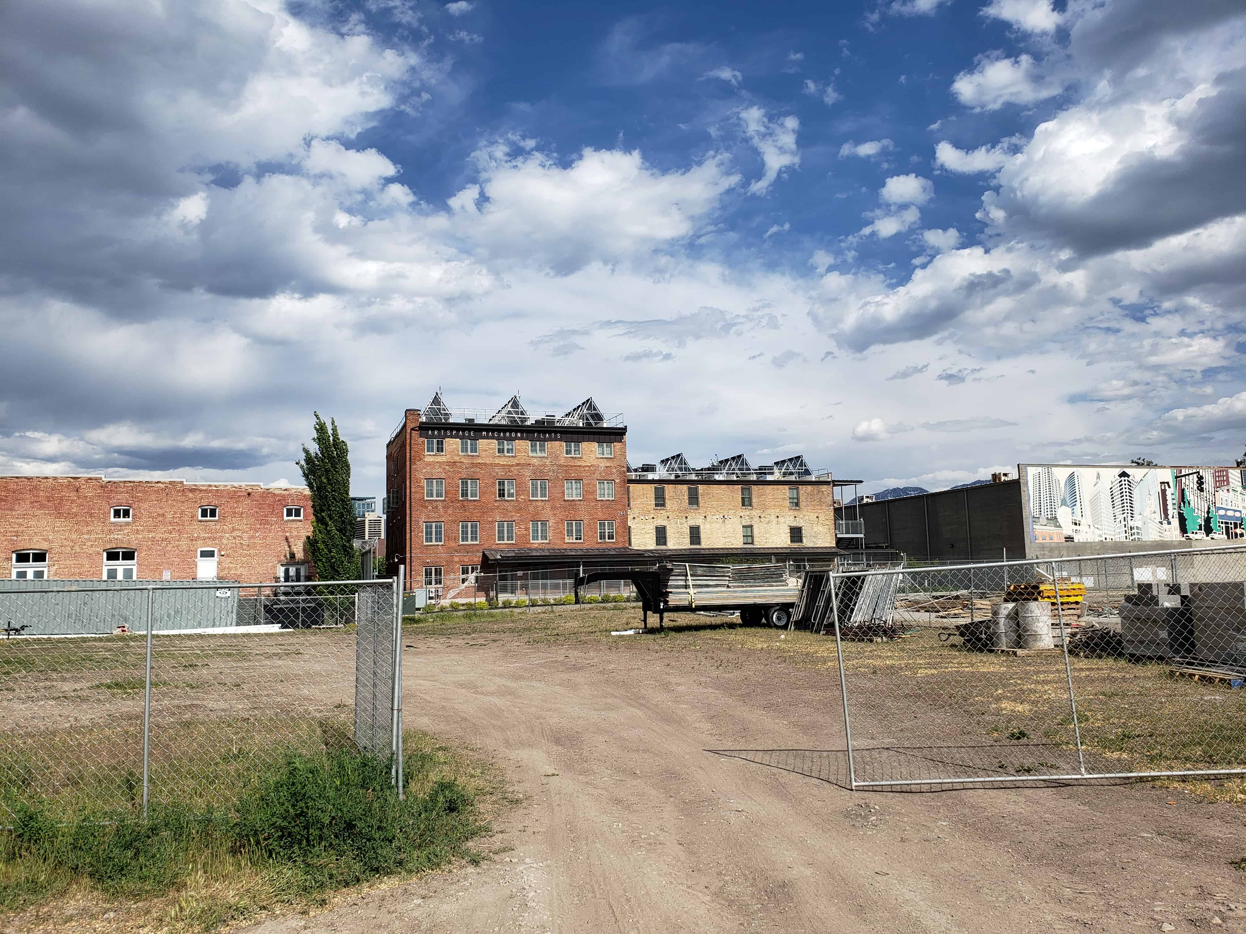
The site is a 1.25-acre rectangular parcel. The ZCMI General Warehouse partially abuts the property lines to the south. There are asphalt-covered parking areas on the east and west sides. A chain link fence encloses portions of the property. Two modern gates are located on 500 West. The driveway runs along the north side of the property. Another contemporary warehouse, which is within 43 feet of the rear elevation, may have been associated with the ZCMI Warehouse in some capacity since they shared a loading platform (now demolished), but that building is on a separate parcel. There is no landscaping. The site slopes down gently from east to west. There are several late-nineteenth and mid-twentieth century warehouses in the immediate neighborhood. There are also some recently constructed buildings in the area; particularly the modern four-story “Bridges” project built on the neighboring parcel at the corner of 200 South and 500 West. The neighborhood was once residential, but evolved as the city’s industrial and warehouse district after numerous rail lines were developed in the area in the late nineteenth century.
The adaptive reuse of the historic ZCMI General Warehouse is following the Secretary of the Interior’s Standards for Rehabilitation and the proposed rehabilitation has received preliminary approval from the National Park Service. The project will include cleaning, repairing and repainting the exterior brick masonry. Extant original doors, windows and skylights will be refurbished or replaced with elements similar to the originals. The individual loading and storage bays and the 1926 addition will be divided into multi-level artist living areas and studios. Each apartment will have an entrance though existing openings. The interior rail dock will be retained and used as an atrium space for the residents. Office space will be designed for the large southern portion of the building. The non-historic east loading dock will be simplified and the missing historic north dock reconstructed. The freight elevator cannot be updated and will be replaced with a passenger elevator in the same location. Some historic features, such as the exposed interior masonry walls, metal-clad fire doors and the simple, decoratively detailed timber capital blocks in the 1926 addition will be retained and refurbished.
The rehabilitation is scheduled for completion in 2006 and the building documentation for this nomination will be revised once these changes have occurred. The ZCMI General Warehouse is an important contributing historic resource in Salt Lake’s industrial west side downtown neighborhood.
The ZCMI General Warehouse, built in 1905 with a two-story brick addition built in 1926, is historically significant under Criterion A for its long association with the Zion’s Co-operative Mercantile Institution, commonly known as ZCMI. Labeled “America’s first department store” by most Utah historians, ZCMI was founded in 1868 by Brigham Young, and within a few years, spawned a regional system of local co-operatives. In Salt Lake City, the ZCMI department store was one of the most successful retail establishments in the city’s first 150 years. The ZCMI General Warehouse provided a vital link between Salt Lake’s railroad district and the ZCMI store on Main Street in the heart of the downtown business. The warehouse was also significant as a wholesale processing center for merchandise bound for ZCMI branches throughout the Great Basin and the Intermountain West. The warehouse reflects the twentieth-century development of Salt Lake City’s railroad and warehouse district. The building is also significant under Criterion C as both a representative and an innovative warehouse. Though the building is one of many early industrial and warehouse buildings remaining on Salt Lake City’s west side, it is one of only two known turn-of-the-twentieth-century industrial buildings to incorporate an interior dock for loading and unloading rail cars. The warehouse also features an innovative interior layout that facilitated the movement and storage of goods. The ZCMI General Warehouse is being nominated under the Salt Lake City Business District Multiple Resource Area context. The building will be rehabilitated as an adaptive reuse project in 2005-2006 and remains a contributing resource in one of Salt Lake’s historic west side neighborhoods.