• About JacobBarlow.com
  • Cemeteries in Utah
  • D.U.P. Markers
  • Doors
  • Exploring Utah Email List
  • Geocaching
  • Historic Marker Map
  • Links
  • Movie/TV Show Filming Locations
  • Oldest in Utah
  • Other Travels
  • Photos Then and Now
  • S.U.P. Markers
  • U.P.T.L.A. Markers
  • Utah Cities and Places.
  • Utah Homes for Sale
  • Utah Treasure Hunt

JacobBarlow.com

~ Exploring with Jacob Barlow

JacobBarlow.com

Tag Archives: utah

Fort Utah Marker

30 Sunday Aug 2015

Posted by Jacob Barlow in Uncategorized

≈ 10 Comments

Tags

Forts, Hiistoric, Provo, utah, utah county

  • 2017-09-23 14.26.50

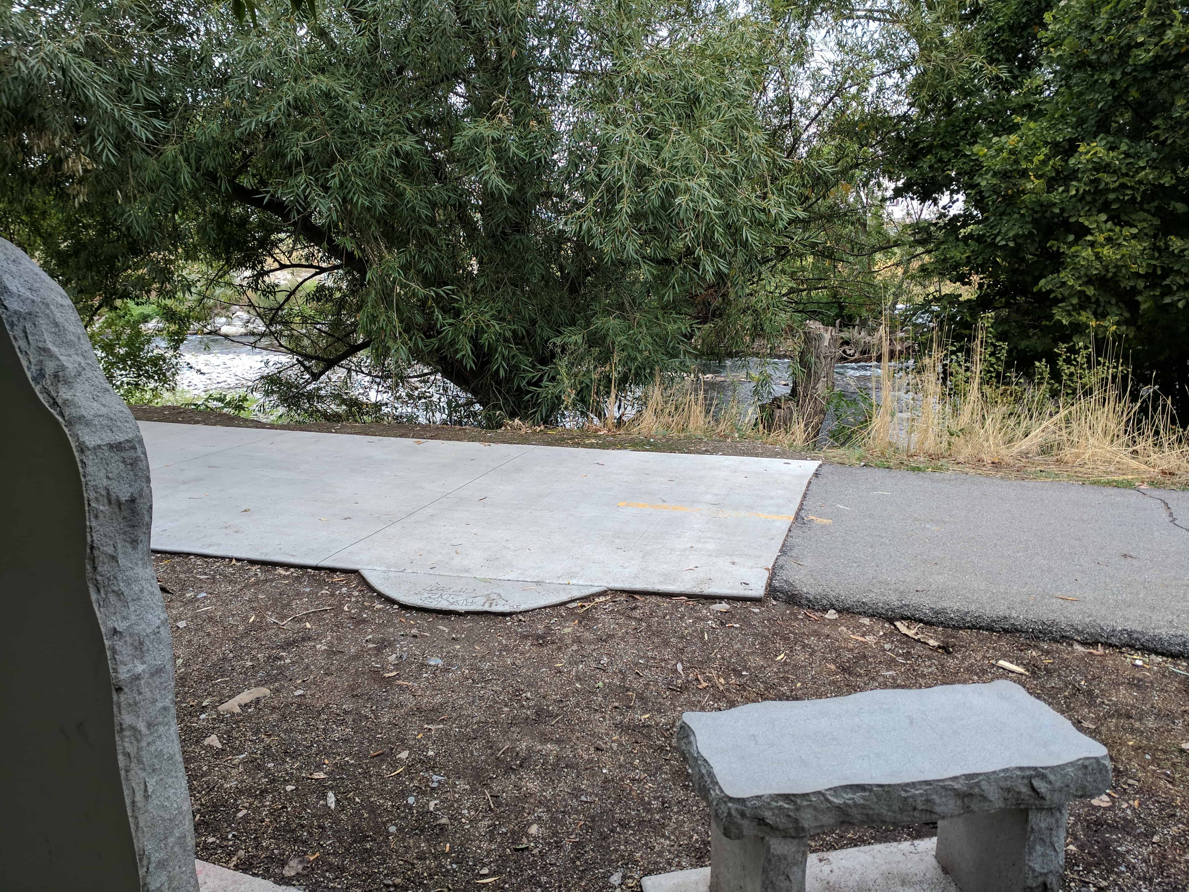
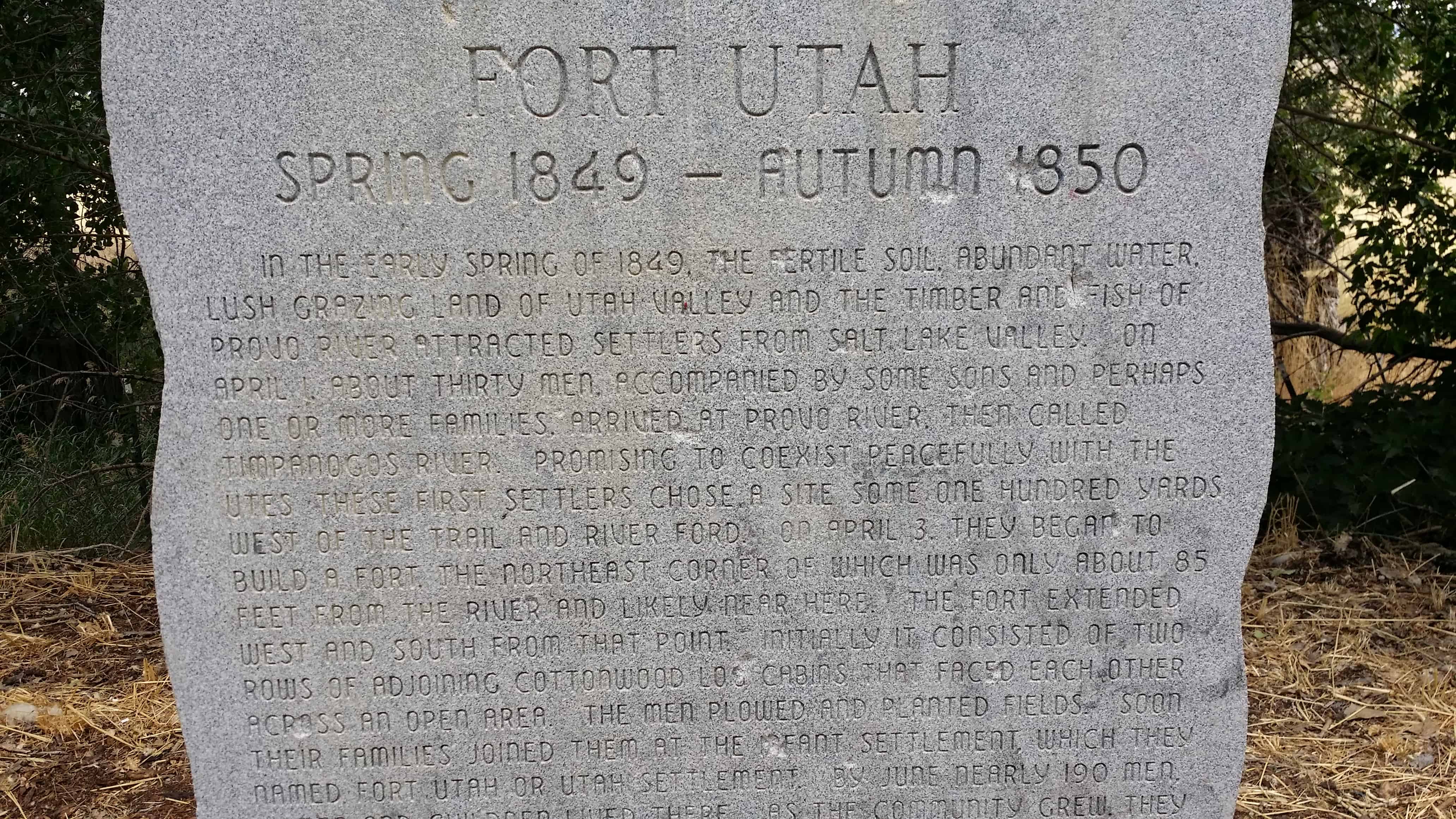
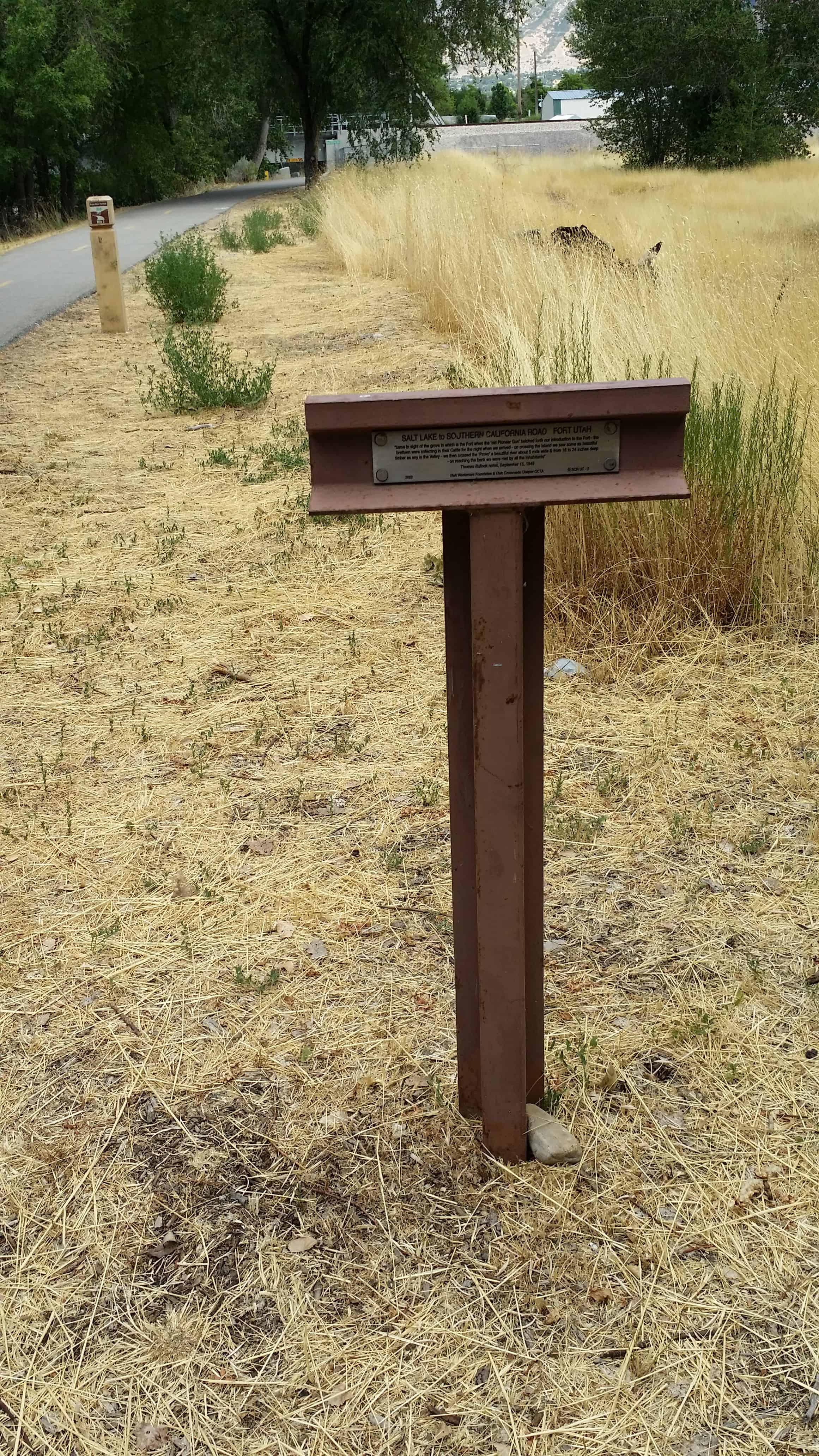
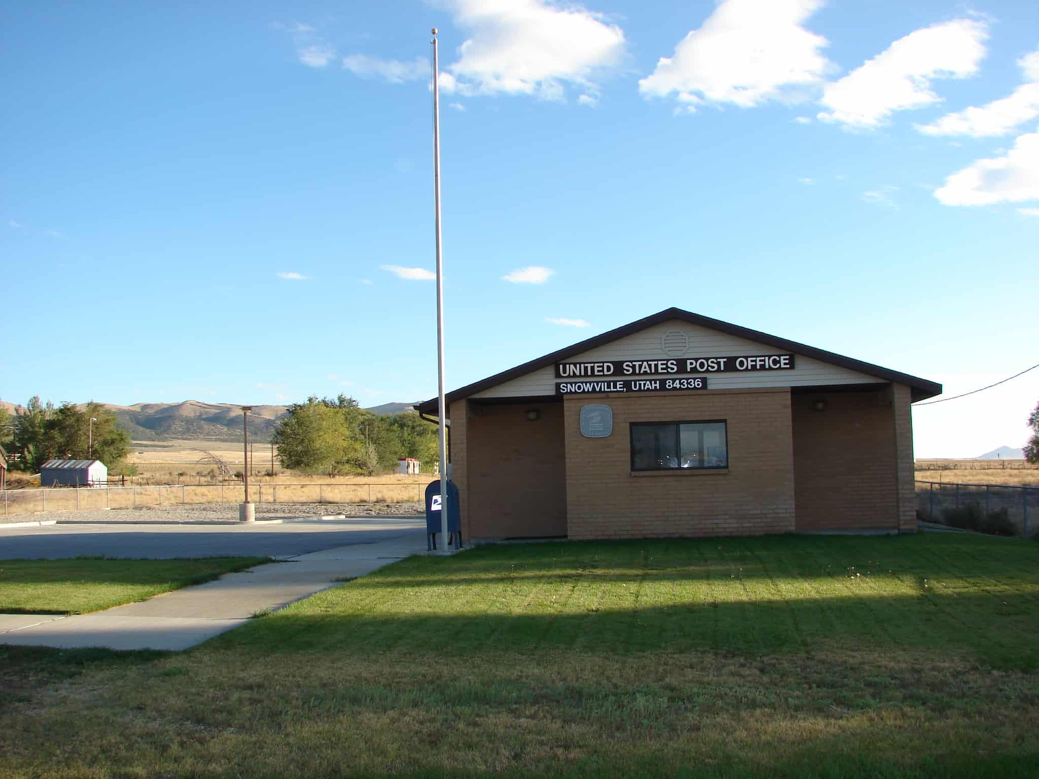
In the early spring of 1849, the fertile soil , abundant water, lush grazing land of Utah Valley and the timber and fish of Provo River attracted settlers from Salt Lake Valley. On April 1, about thirty men, accompanied by some sons and perhaps one or more families, arrived at Provo River, then called Timpanogos River. Promising to coexist peacefully with the Utes, these first settlers chose a site some one hundred yards west of the trail and rover ford. On April 3, they began to build a fort, the Northeast corner of which was only about 85 feet from the river and likely near here.
The fort extended west and south from that point, initially it consisted of two rows of adjoining cottonwood log cabins that faced each other across an open area. The men plowed and planted fields. Soon their families joined them at the infant settlement, which they named Fort Utah or Utah Settlement. By June nearly 190 men, women and children loved there. As the community grew, they built cabins across the north and south ends. By late fall of 1849 57 cabins enclosed a 1.5-acre central square. Fort Utah eventually measured about 330 feet by 500 feet. The colonists build a bastion in the middle of the fort on which to mount their cannon. The space beneath the bastion served as a meeting place for the community. As relationships with the Timpanogos Utes deteriorated the settlers surrounded the cabins with a 12-foot-tall log picket stockade for safety. In the spring of 1850 the residents chose a better fort site about 1.5 miles to the North-east. Most relocated there by late fall nearly abandoning the original Fort Utah. For a while the old fort temporarily housed travelers , then it fell into disuse and virtually disappeared.

See also:

  • Fort Utah DUP Marker
  • SLC to SoCal – Fort Utah
  • 2017-09-23 14.26.53
  • 2017-09-23 14.26.57
  • 2017-09-23 14.27.20
  • 2014-07-24 14.48.43
  • 2014-07-24 14.48.50
  • 2014-07-24 14.48.54
  • 2014-07-24 14.48.57
  • 2014-07-24 14.49.32
  • 2014-07-24 14.49.38

Snowville, Utah

29 Saturday Aug 2015

Posted by Jacob Barlow in Uncategorized

≈ 6 Comments

Tags

Box Elder County, Snowville, utah

picture04oct07-017

Curlew Valley, named after the curlew snipe that nests there, extends from Snowville, Utah, to the Idaho towns of Stone and Holbrook. The first recorded white men were Peter Skene Ogden‘s large party of trappers that camped on Deep Creek December 27, 1828.

Some of the discharged members of the Mormon Battalion, on their way home from California to Salt Lake City on September 18, 1848, camped on Deep Creek and also in a cave one mile (1.6 km) east called Hollow Rock.

The beginning of Deep Creek is a large spring at Holbrook which runs through the center of the valley and has never varied even in dry years. About one mile (1.6 km) southwest is Rocky Ford, where the pioneers were able to pass on solid rock.

In 1869 William Robbins, Thomas Showell, and William M. Harris settled at the Curlew Sinks, ten miles west of here, where Deep Creek sinks into the ground. The old pioneer trail and the stage line went through their ranch.

The first townsite in the Curlew Valley was Snowville. Settled at the direction of Brigham Young and named in honor of Lorenzo Snow an apostle at the time but later to become the President of The Church of Jesus Christ of Latter-day Saints 1898–1901. Snowville was laid out August 14, 1878.

Related:

  • Curlew Valley (historic marker)
  • Snowville posts sorted by address
2015-08-12 10.12.39
2015-08-12 10.12.48
2015-08-12 10.12.54
2015-08-12 10.13.01
2015-08-12 10.13.07
2015-08-12 10.14.57
picture04oct07-018

Coyote Pass

10 Monday Aug 2015

Posted by Jacob Barlow in Uncategorized

≈ Leave a comment

Tags

Elberta, Mosida, utah, utah county

66d6a32f-6d8d-4ef0-8870-b8520b400ee8 Screenshot 2015-08-10 15.45.00

Coyote Pass, just west of Mosida, Utah

Arches National Park

06 Thursday Aug 2015

Posted by Jacob Barlow in Uncategorized

≈ 2 Comments

Tags

Arches National Park, Grand County, Moab, National Parks, utah

IMG_20140717_090819

Photos from a hiking trip to Arches National Park with Olga Zubova de Rubio and Chris Mosbacker, we drove down from Salt Lake, hiked all the trails and drove back all in one day.

picture12oct08-030
picture12oct08-031
picture12oct08-032
picture12oct08-033
picture12oct08-034
picture12oct08-035
picture12oct08-036
picture12oct08-037
picture12oct08-038
picture12oct08-039
picture12oct08-040
picture12oct08-041
picture12oct08-042
picture12oct08-043
picture12oct08-044
picture12oct08-045
picture12oct08-046
picture12oct08-047
picture12oct08-048
picture12oct08-049
picture12oct08-050
picture12oct08-051
picture12oct08-052
picture12oct08-053
picture12oct08-054
picture12oct08-055
picture12oct08-056
picture12oct08-057
picture12oct08-058
picture12oct08-059
picture12oct08-060
picture12oct08-062
picture12oct08-063
picture12oct08-064
picture12oct08-065
picture12oct08-066
picture12oct08-067
picture12oct08-068
picture12oct08-069
picture12oct08-070
picture12oct08-071
picture12oct08-072
picture12oct08-073
picture12oct08-074
picture12oct08-075
picture12oct08-076
picture12oct08-077
picture12oct08-078

Orpheus Hall/High School Gymnasium

02 Sunday Aug 2015

Posted by Jacob Barlow in Uncategorized

≈ 1 Comment

Tags

Historic Buildings, NRHP, Pleasant Grove, utah, utah county

Orpheus Hall/High School Gymnasium

Joseph Clark built this dance hall during 1908-9 with a spring floor. Alpine School District purchased the building in 1920, building onto the back and remodeling the inside front for a high school gymnasium, Pleasant Grove City purchased the building in 1965 for the recreation department.

An anonymous comment sheds a little more light, ” Jacob, the old high school and gymnasium in PG, which I attended, was still owned and operated by Alpine School District as late as 1975 as I remember. My last year in that school was 1973 and I know of two other classes younger than myself also went there. It would be nice to see some accurate dates if you could and update your information. Once again this is only my recollection of the time period.“

2015-03-07 12.23.31
2015-03-07 12.25.17
2017
2018
2019

Built in 1909, this one and one-half story brick masonry building has the classical characteristics of arched pediments displayed in Beaux Arts Classicism. During the first decade of the century this decorative styling was used on public and commercial buildings with spacious interiors. In 1921, dressing rooms were added to the front interior of the building and a smaller addition was built to the rear of the building some time later.*

Rock Canyon Campground

02 Sunday Aug 2015

Posted by Jacob Barlow in Uncategorized

≈ Leave a comment

Tags

Campgrounds, Rock Canyon, utah, utah county

24c1af2f-38fb-4e0b-b1b0-4286f40f49dd

Knightsville, Utah

02 Sunday Aug 2015

Posted by Jacob Barlow in Uncategorized

≈ 1 Comment

Tags

Juab County, Knightville, utah, utah county

  • a1753a86-a9e7-4f37-a281-442c34a805a4

Knightsville was at the north end of Godiva Mountains, one-half mile east of Eureka. Jesse Knight was a well-known mining man, financier, and benefactor. He developed Knightsville in 1897 to house his mining employees and their families. When the mines were closed, Knightsville was abandoned. During the town’s peak it was only one of two mining camps in Utah without saloons or red-light districts. Today it is a ghost town site.(*)

  • 6e964b5e-7a4c-4410-923d-d56479345fed

Topliff, Utah

23 Thursday Jul 2015

Posted by Jacob Barlow in Uncategorized

≈ 1 Comment

Tags

Ghost Towns, Ruins, Tooele County, Topliff, utah, West Desert

1

2

The town was built about 1875 around the mining of Lime Rock which was used by area smelters. The town died in 1937. (These Photos were taken May 16 1990). No one lives here.
Submitted by Bob Bezzant.

Topliff began in 1875 as a joint venture between the local smelters to find a source of Limestone. After the rock was found, a rail line was run down to haul out the crused limestone, a trainload/day. When the quarry was shut down in 1937 all of the homes and rail lines were torn up and hauled up north to Fairfield.
Submitted by Ed Topliff. – (source)

Topliff

Pleasant View, Utah

13 Monday Jul 2015

Posted by Jacob Barlow in Uncategorized

≈ 2 Comments

Tags

North Ogden, Ogden, Pleasant View, utah, Weber County

1a44adda-fb8b-41b5-9568-a5ae0627c46a

Considered part of North Ogden for its first 30 years, Pleasant View was known during its early days by several names, including West District, Hot Springs District, Stringtown, or simply Out West. The city was officially named Pleasant View in 1882 by Wilford Cragun, one of the first white children born in the area. Mary Lake, daughter of William Bailey Lake and Sarah Jane Marler was born in North Ogden, 15 December 1851. Other early settlers were Thomas Dunn, John Mower, and Simeon Cragun families.

Related Posts:

  • Peter Skene Ogden
  • Stage Coach Station
  • Pleasant View Posts Sorted By Address

Wallsburg, Utah

13 Monday Jul 2015

Posted by Jacob Barlow in Uncategorized

≈ 2 Comments

Tags

Heber City, Provo Canyon, utah, Wallsburg, Wasatch County

148d5486-900a-4869-8470-60f99b043a5c

Related Posts:

  • Wallsburg Bell
  • Wallsburg Cemetery
  • Wallsburg Fort
  • Wallsburg Park
  • Wallsburg School
  • Z.C.M.I.

Wallsburg is a small agricultural community on four miles southeast of Deer Creek Reservoir. The early Indian name for the settlement was Little Warm Valley or Round Valley. It was finally named for William Madison Wall a native of North Carolina, who helped build the road through Provo Canyon. He was an explorer, colonizer, military officer, and church leader.(*)

l2nhbwvyysb1cgxvywrzl3rvigrvl2phy29icybwag90b3mvmjawocbub3zl%0abwjlci9wawn0dxjlmdfub3ywocawmdeuanbn
← Older posts
Newer posts →

Follow Jacob

Follow Jacob

Come wander with me on Youtube.

Blog Stats

  • 2,101,214 hits

Social and Other Links

BarlowLinks.com

Recent Posts

  • Scout Monument
  • Provo High School Seminary Building
  • 821 E 100 S
  • 820 E 100 S
  • 817-819 E 100 S

Archives

Loading Comments...