In 1861, Joseph Bartholomew, James Mellor and others settled here and diverted the warm creek for irrigation purposes. A branch of the Church of Jesus Christ of Latter-day Saints was organized in 1862 with Branch Young president. The name of the settlement was changed from Warm Creek to Fayette, honoring the town in New York where the church was first organized. In 1863, John E. Metcalf built the first grist mill on the stream flowing from the warm spring one mile east of this marker. He fashioned and used these mill stones. Fayette Ward was organized July -1877.
In 1855 this valley was discovered by Isaac Riddle an Indian Missionary, while searching for a lost cow. The first sawmill south of the rim of the Great Basin was built on this site in 1855-1856 by Robert Richey, Jehu Blackburn and Isaac Riddle.
The first homes in the valley were erected around the mill. Pine Valley became the source of much of the lumber used in early towns of southern Utah and Nevada.
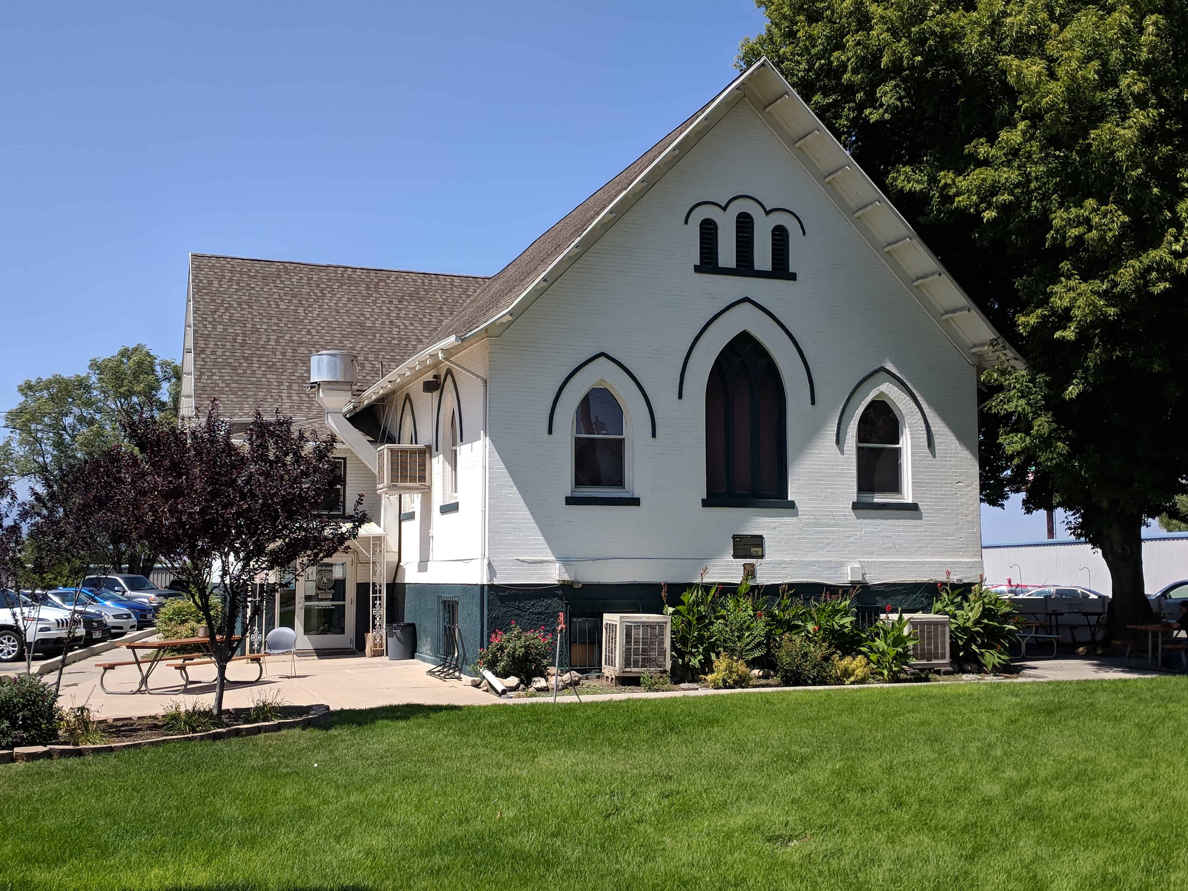
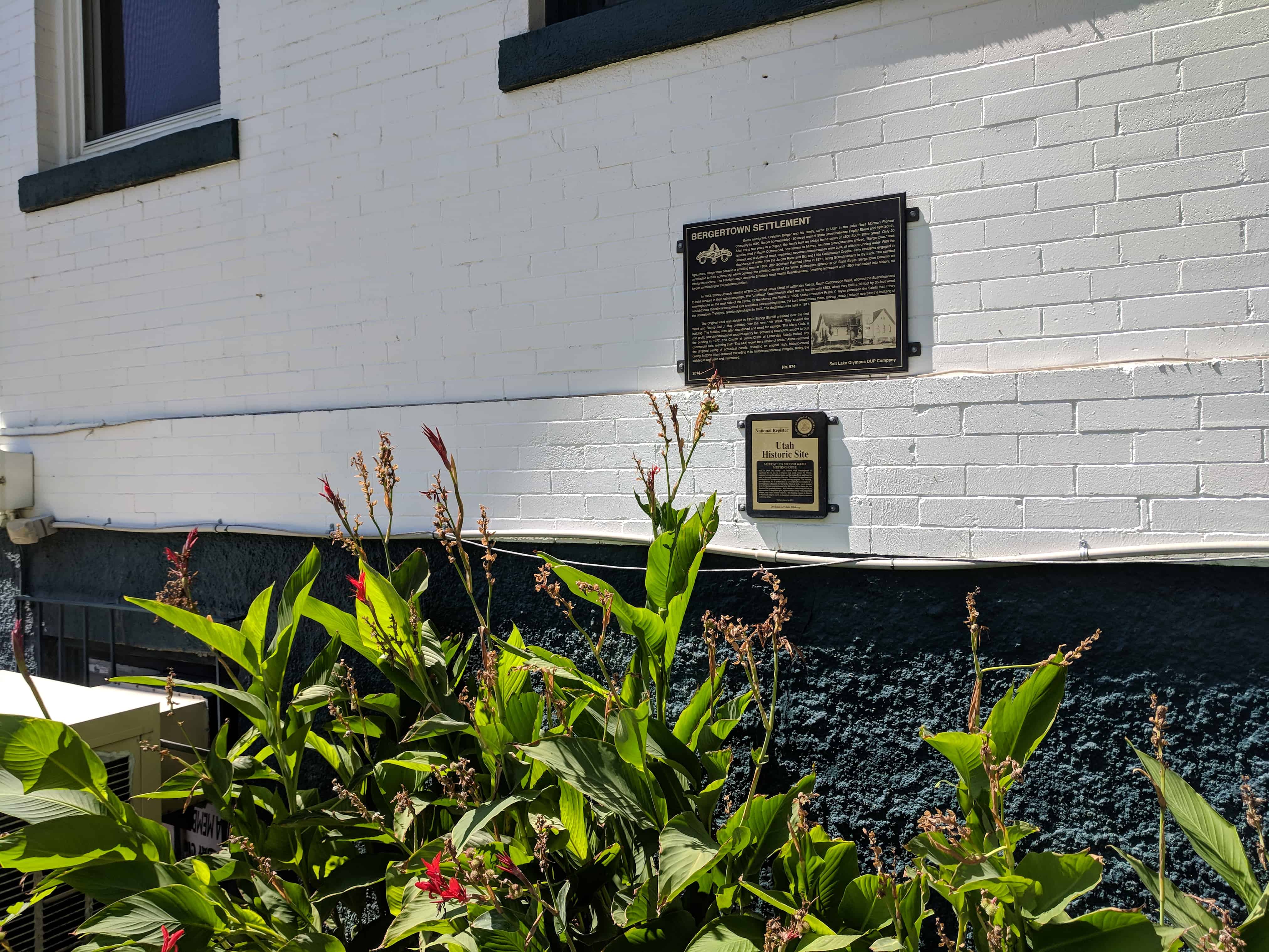
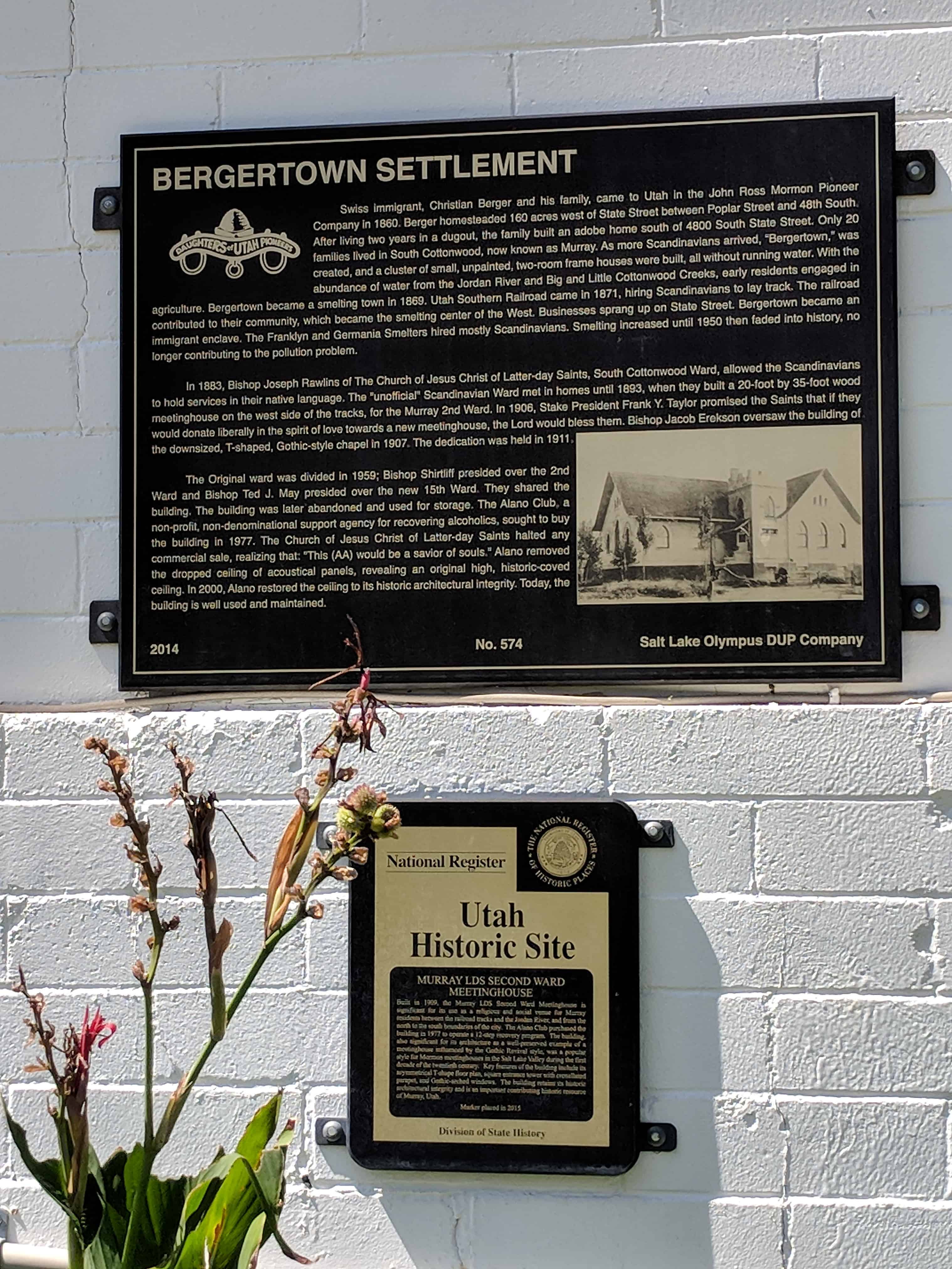
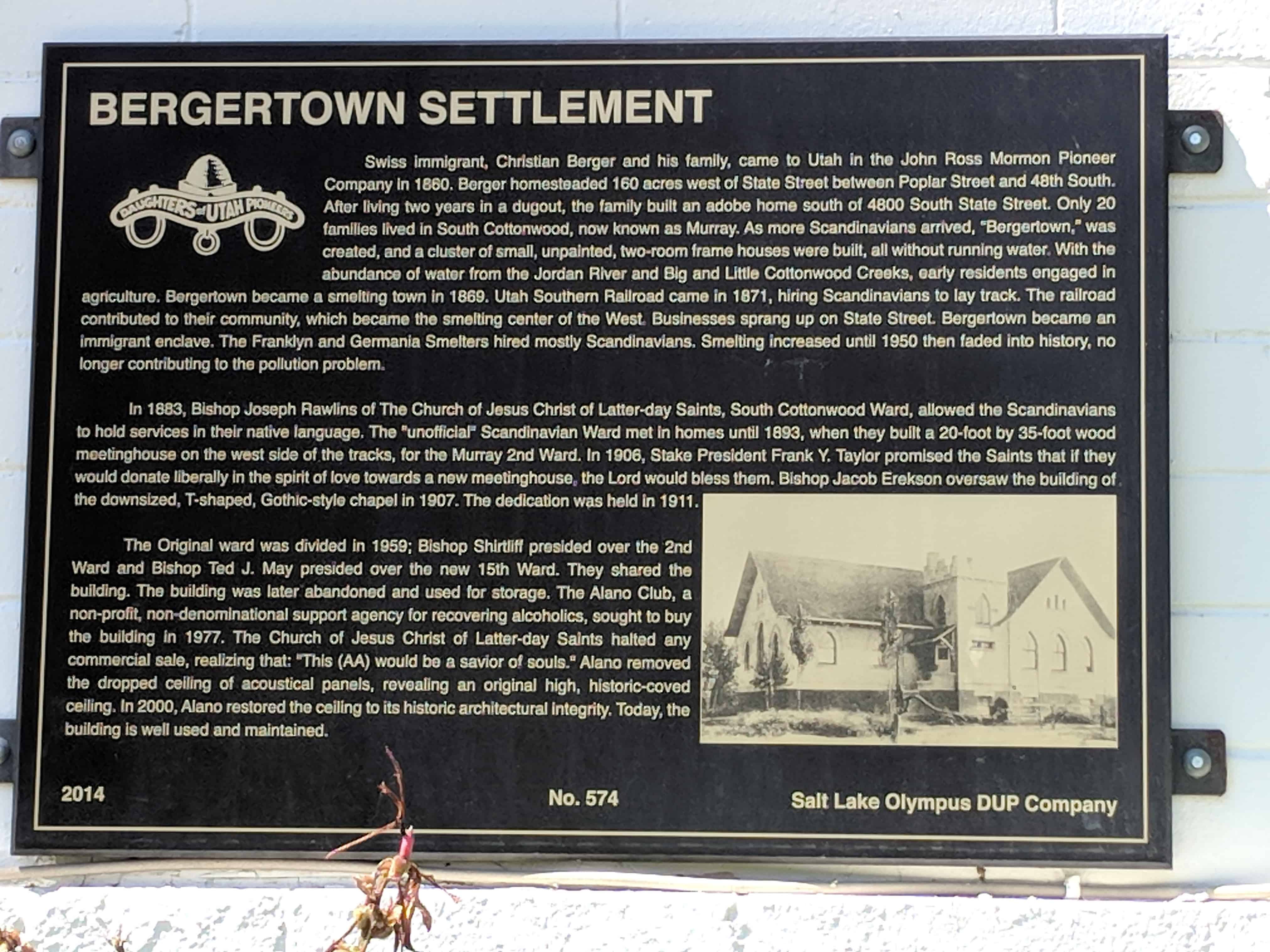
Swiss immigrant, Christian Berger and his family, came to Utah in the John Ross Mormon Pioneer Company in 1860. Berger homesteaded 160 acres west of State Street between Poplar Street and 48th South. After living two years in a dugout, the family built an adobe home south of 4800 South State Street. Only 20 families lived in South Cottonwood, now known as Murray. As more Scandinavians arrived, “Bergertown,” was created, and a cluster of small, unpainted, two-room frame houses were built, all without running water. With the abundance of water from the Jordan River and Big and Little Cottonwood Creeks, early residents engaged in agriculture. Bergertown became a smelting town in 1869. Utah Southern Railroad came in 1871, hiring Scandinavians to lay track. The railroad contributed to their community, which became the smelting center of the West. Businesses sprang up on State Street. Bergertown became an immigrant enclave. The Franklyn and Germania Smelters increased until 1950 then faded into history, no longer contributing to the pollution problem.
In 1883, Bishop Joseph Rawlins of The Church of Jesus Christ of Latter-day Saints, South Cottonwood Ward, allowed the Scandinavians to hold services in their native language. The “unofficial” Scandinavian Ward met in homes until 1893, when they built a 20-food by 35-foot wood meetinghouse on the west side of the tracks, for the Murray 2nd Ward. In 1906, Stake President Frank Y. Taylor promised the Saints that if they would donate liberally in the spirit of love towards a new meetinghouse, the Lord would bless them. Bishop Jacob Erekson oversaw the building of the downsized, T-shaped, Gothic-style chapel in 1907. The dedication was held in 1911.
The Original ward was divided in 1959; Bishop Shirtliff presided over the 2nd Ward and Bishop Ted J. May presided over the new 15th Ward. They shared the building. The building was later abandoned and used for storage. The Alano Club, a non-profit, non-denominational support agency for the recovering alcoholics, sought to buy the building in 1977. The Church of Jesus Christ of Latter-day Saints halted any commercial sale, realizing that: “This (AA) would be a savior of souls.” Alano removed the dropped ceiling of acoustical panels, revealing an original high, historic-coved ceiling. In 2000, Alano restored the ceiling to its historic architectural integrity. Today, the building is well used and maintained.
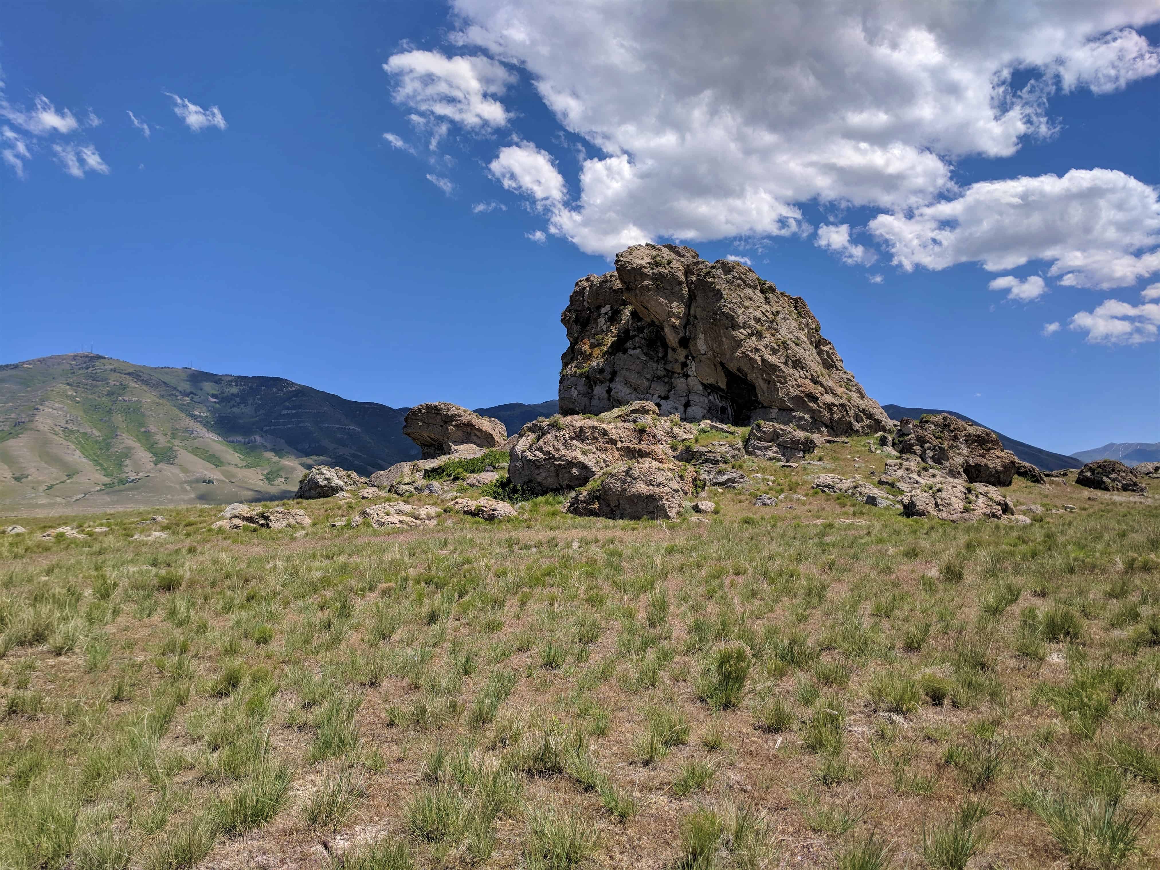
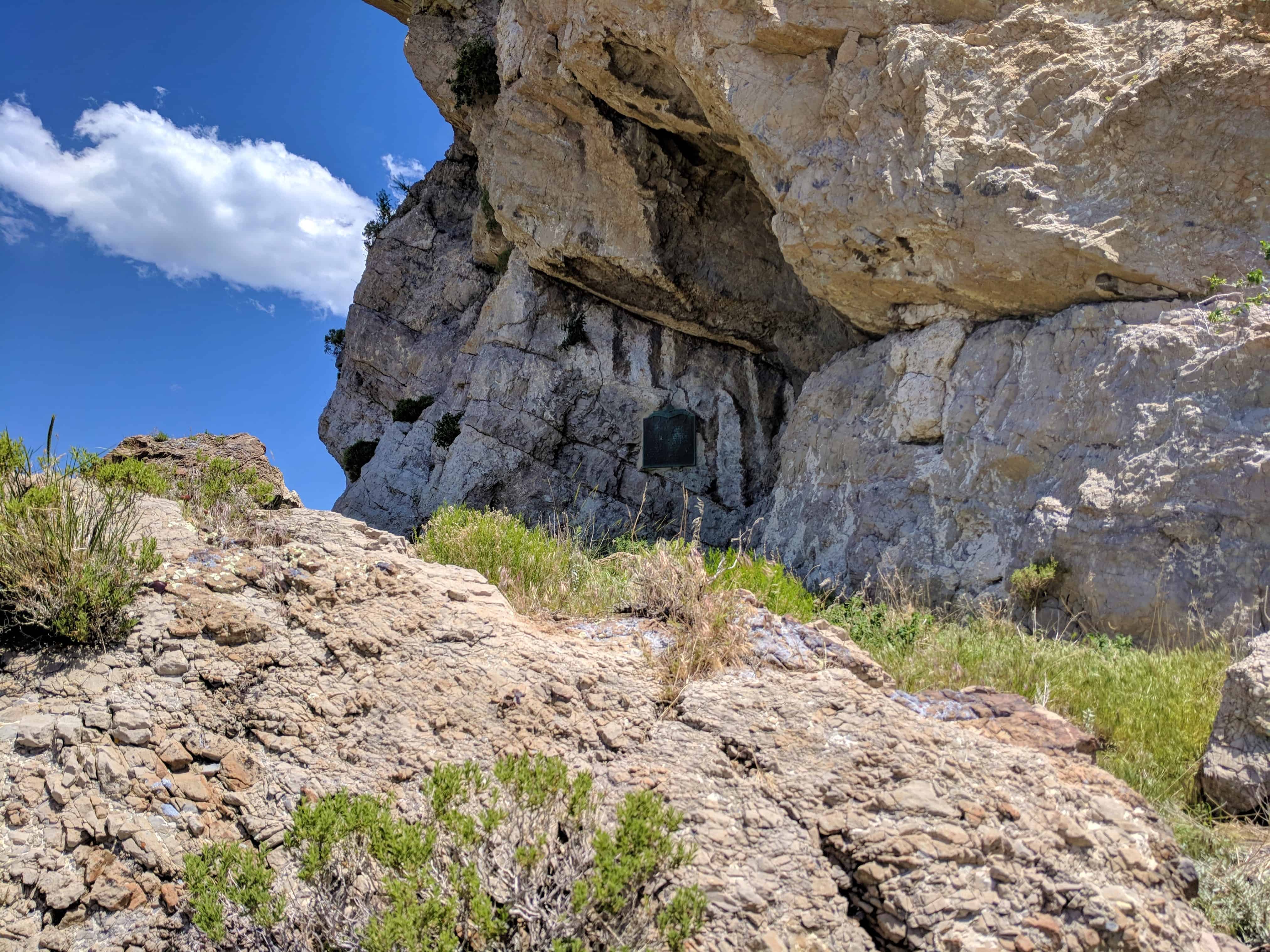
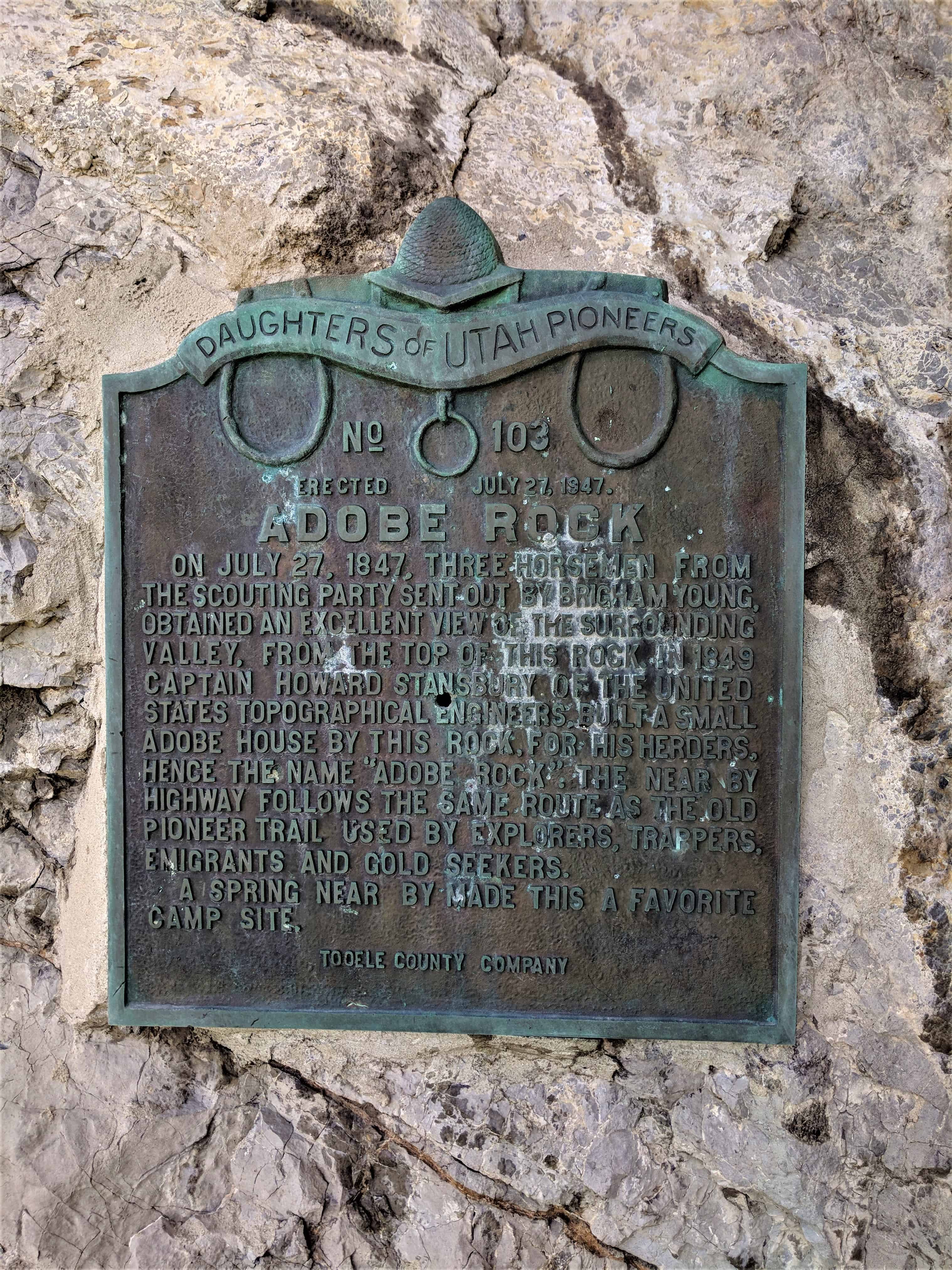
On July 27, 1847, three horsemen from the scouting party sent out by Brigham Young, obtained an excellent view of the surrounding valley, from the top of this rock. In 1849, Captain Howard Stansbury of the United States Topographical Engineers built a small adobe house by this rock, for his herders, hence the name “Adobe Rock”. The near by highway follows the same route as the old pioneer trail used by explorers, trappers, emigrants and gold seekers.
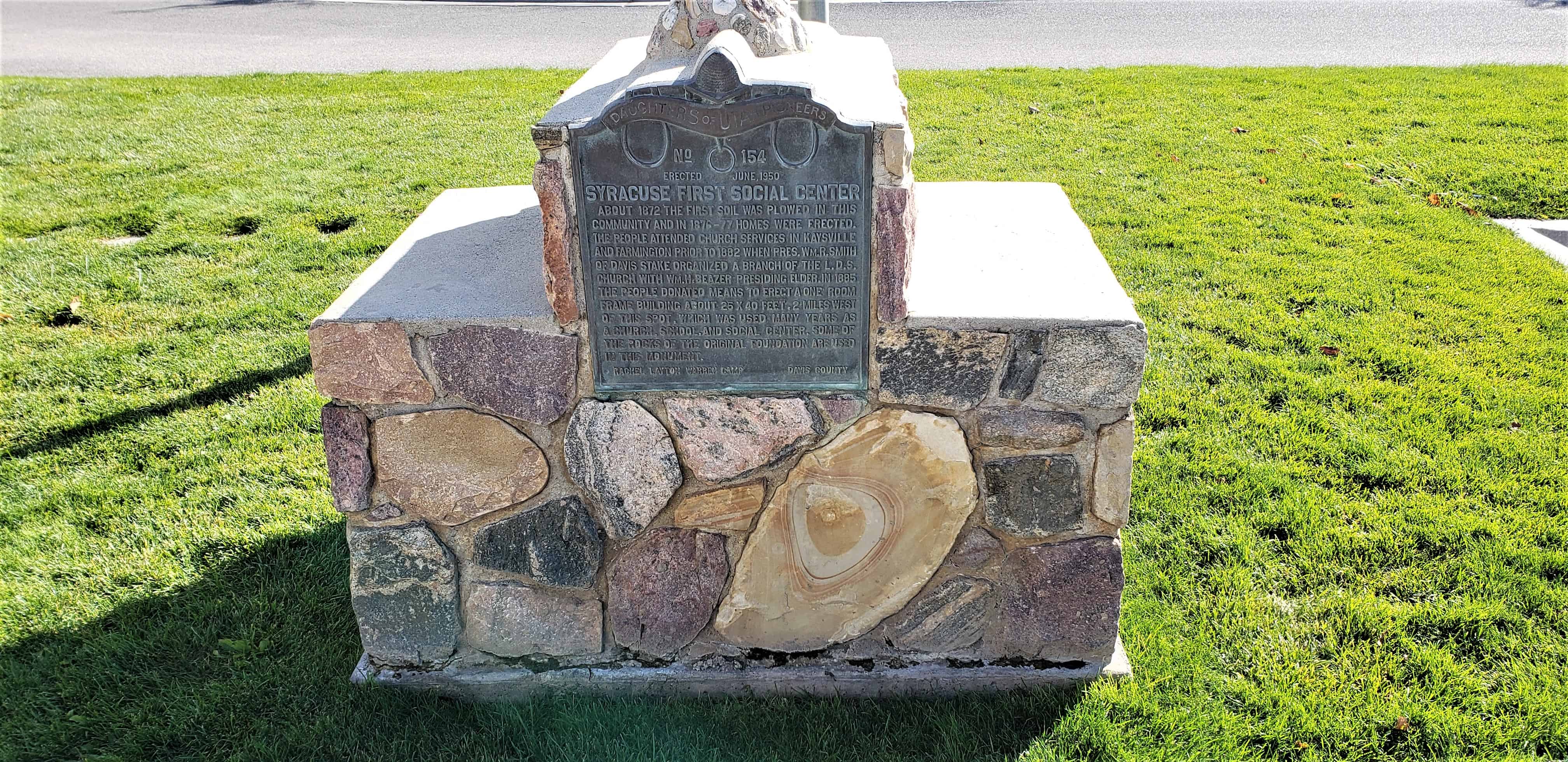
About 1872 the first soil was plowed in this community and in 1876-77 homes were erected. The people attended church services in Kaysville and Farmington prior to 1882 when Pres. Wm. R. Smith of Davis stake organized a branch of the L.D.S. church with Wm. H. Beazer presiding elder. In 1885 the people donated means to erect a one room frame building about 25 X 40 feet 2 miles west of this spot, which was used many years as a church, school, and social center. Some of the rocks of the original foundation are used in this monument.
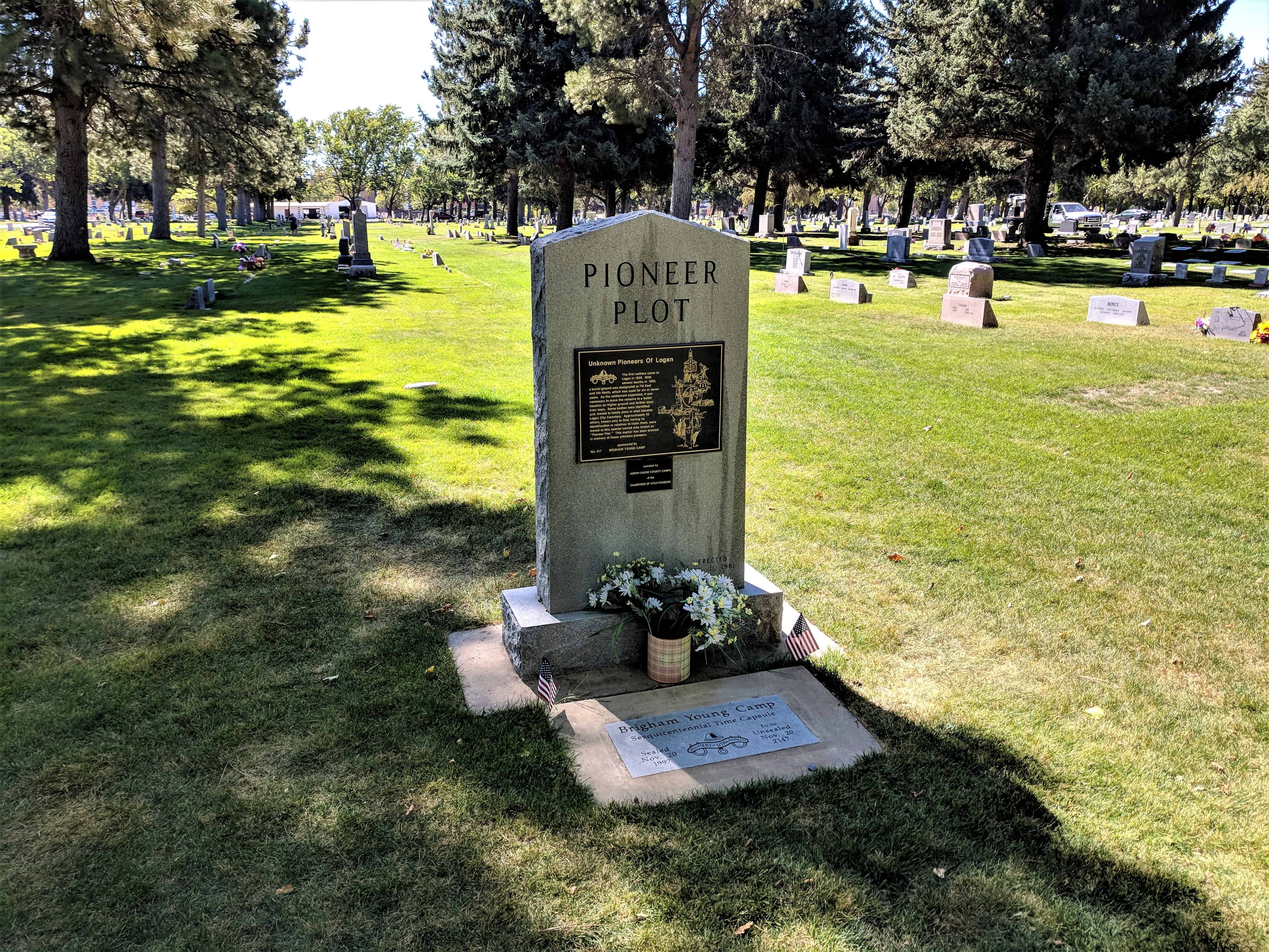
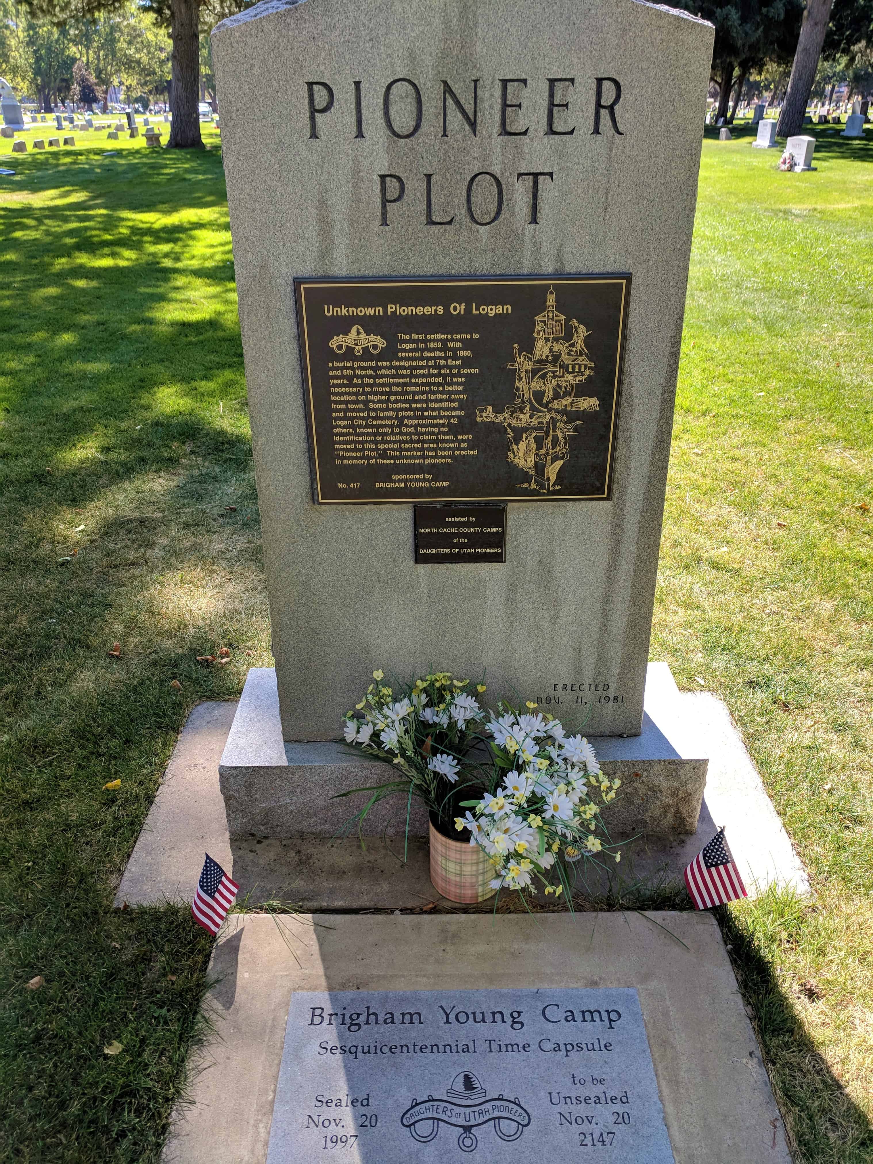
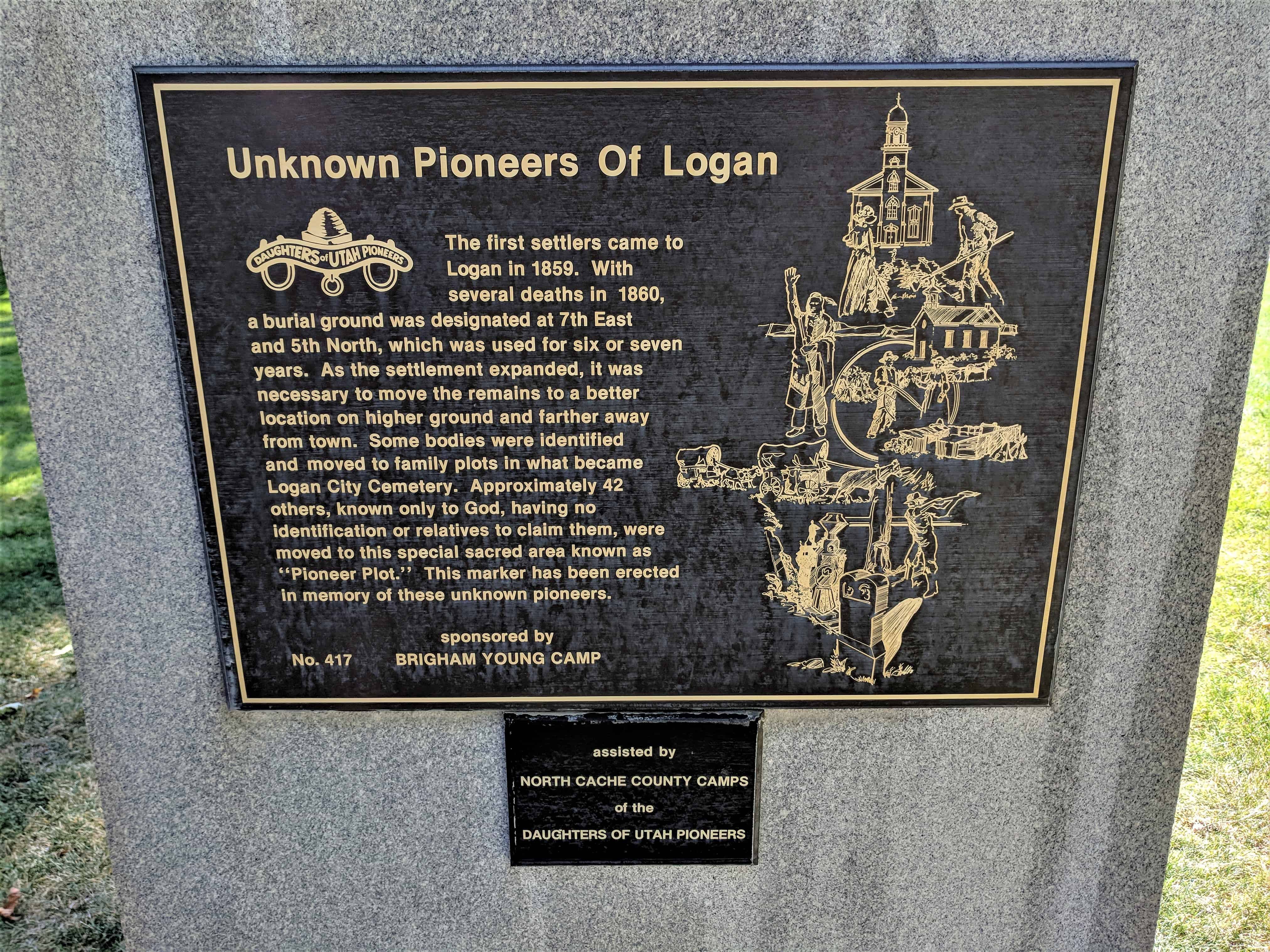
The first settlers came to Logan in 1859. With several deaths in 1860, a burial ground was designated at 7th East and 5th North, which was used for six or seven years. As the settlement expanded it was necessary to move the remains to a better location on higher ground and farther away from town. Some bodies were identified and moved to family plots in what became Logan Cemetery. Approximately 42 others, known only to God, having no identification or relatives to claim them, were moved to this special sacred area known as “Pioneer Plot.” This marker has been erected in memory of these unknown pioneers.
This is D.U.P. Marker #417 located in the Logan Cemetery in Logan, Utah. For other D.U.P. Markers visit this page.
Numerous petroglyphs are the only record of the original settlers of this area, the Anasazi and Paiute Indians. In January 1858 a small Mormon pioneer group was sent south from Salt Lake City to raise cotton. The pioneers settled the east side of the Virgin River calling it Heberville; it was later changed to Price City.
New settlers coming in 1861 built homes on the west side of the river. This settlement was called Bloomington because of the wealth of wild flowers. It became the larger community (centered in the lower Manzanita Street area). There was a school building used also for socials and church, a post office, library, and the Union and Village Echo newspaper building. There were productive farms of vegetables, grains, and broom corn. Orchards consisted of nut and fruit trees. Peaches were shipped as far as Chicago. Silkworms were raised, barrels for processed molasses were made, and the best brooms throughout the area were produced in a broom factory. Bloomington was always a favorite spot for parties, picnics, and moonlight rides.
The undrinkable Virgin River water was a problem; therefore water had to be hauled from St. George. The river had to be crossed on horseback for school and church. It flooded often, ruining farms, dams, and ditches which were built and rebuilt with great effort.
By the late 1930s, the area was almost deserted with only a few farms remaining. Modern Bloomington began to be developed in 1966, largely as a residential community. The river is still a problem with flooding occurring in 1979 and 1988. This monument was erected as a reminder to future generations to keep their heritage alive and appreciate the efforts of those who settled and tamed what was once a hostile environment.
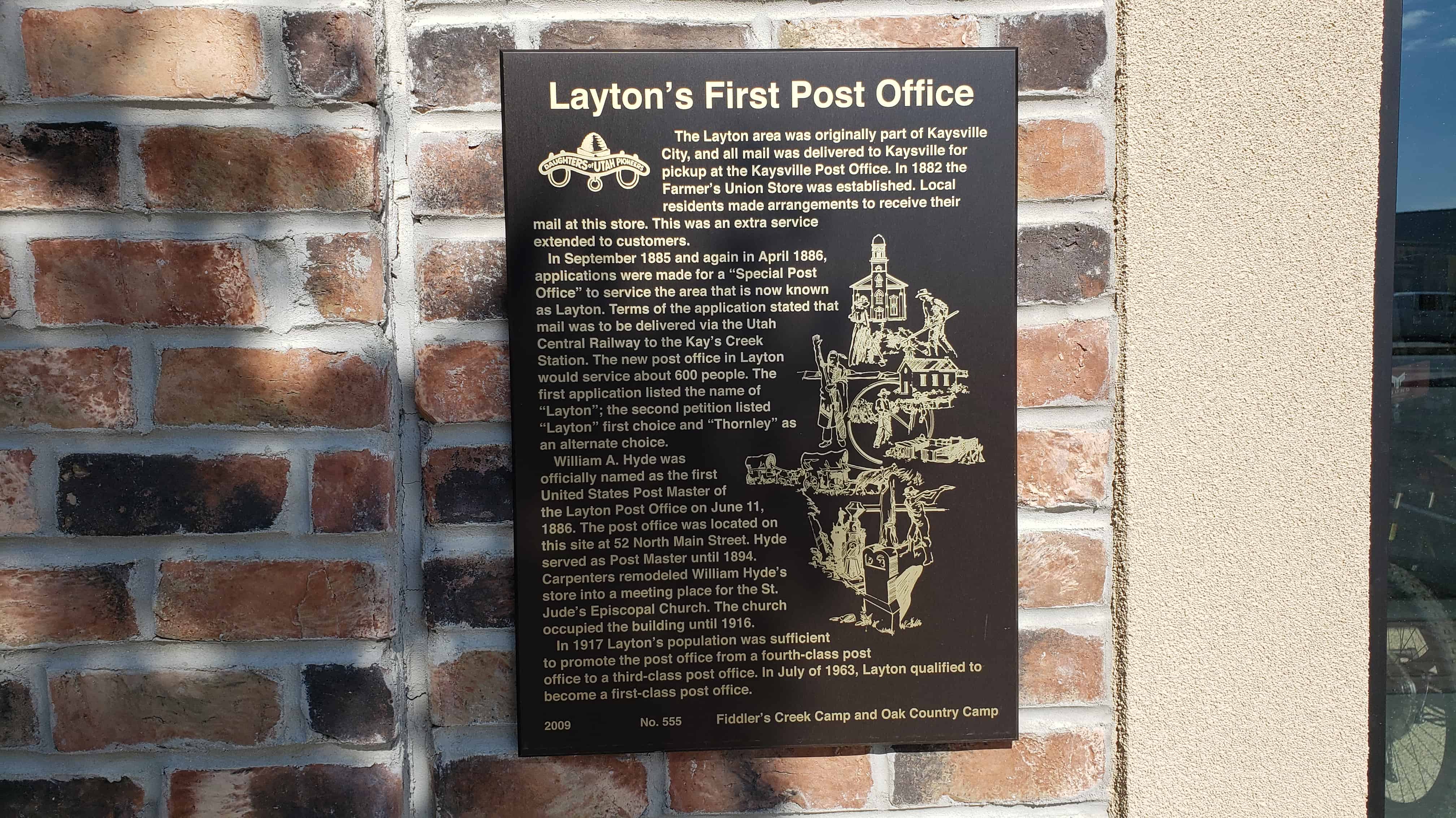
The Layton area was originally part of Kaysville City, and all mail was delivered to Kaysville for pickup at the Kaysville Post Office. In 1882 the Farmer’s Union Store was established. Local residents made arrangements to receive their mail at this store. This was an extra service extended to customers.
In September 1885 and again in April 1886, applications for a “Special Post Office” to service the area that is now known as Layton. Terms of the application stated that mail was to be delivered via the Utah Central Railway to the Kay’s Creek Station. The new post office in Layton would service about 600 people. The first application listed the name of “Layton”; the second petition listed “Layton” first choice and “Thornley” as an alternate choice.
William A. Hyde was officially named as the first United States Post Master of the Layton Post Office on June 11, 1886. The post office was located on this site at 52 North Main Street. Hyde served as Post Master until 1894. Carpenters remodeled William Hyde’s store into a meeting place for the St. Jude’s Episcopal Church. The church occupied the building until 1916.
In 1917 Layton’s population was sufficient to promote the post office from a fourth-class post office to a third-class post office. In July of 1963, Layton qualified to become a first-class post office.
DUP Marker # 555, located at 52 North Main Street in Layton, for other DUP Markers visit this page.