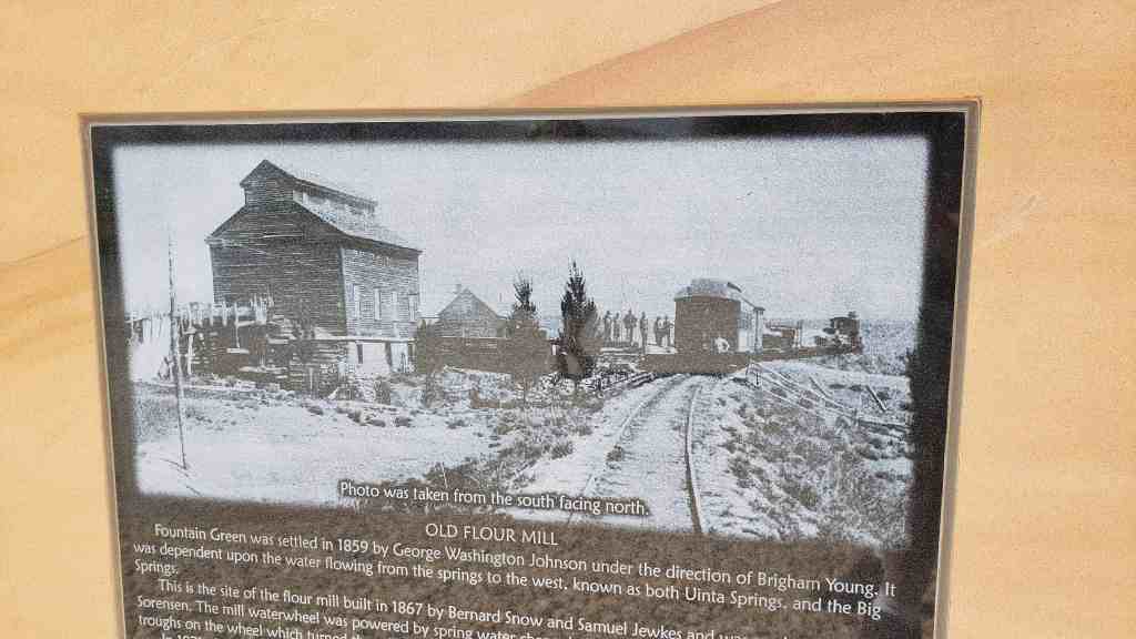
Fountain Green was settled in 1859 by George Washington Johnson under the direction of Brigham Young. It was dependent upon the water flowing from the springs to the west, known as both Uinta Springs, and the Big Springs.
This is the site of the flour mill built in 1867 by Bernard Snow and Samuel Jewkes and was run by Miller Ole Sorensen. The mill waterwheel was powered by spring water channeled through a flume that filled small wooden throughs on the wheel which turned the millstones inside the mill.
In 1871, the mill was destroyed by fire and replaced by a larger mill built in 1872. People brought wheat or a grist to the mill in exchange for bran, shorts, germade and flour. Fountain Green flour, Phoenix Rolling Mill brand, was of the highest quality and established Sanpete County as the “Breadbasket of Utah.”
1875 brought the addition of a narrow gauge railroad that stopped in Wales, Fountain Green, and Nephi. The railroad berm located to the southeast of the mill formed a commerce hub. The train transported flour and grist, coal from Wales, adobe brick made at the brickyard northeast of the flour mill, livestock, mail and passengers. Ole Sorensen served as the express agent and had the first telephone in Fountain Green.
In 1889, the mill burned again and was rebuilt with an up-grade to produce 40 barrels a day. The new company owners were Charles Foote, Lewis Anderson, A.J. Aagard and Ole Sorensen. Ole Sorensen continued to supervise the mill operations. The mill converted to electrical power in 1903.
Niels Hansen purchased the mill in 1904 and continued operations until 1918. It was then managed by Lawrence Hermansen and others. In the 1930s the mill closed and the lumber and machinery were moved to Gunnison.
This monument is D.U.P. Marker #589 (see others on this page) and was dedicated June 19th, 2021.
Related:
See this page for details on the dedication of this historic marker.
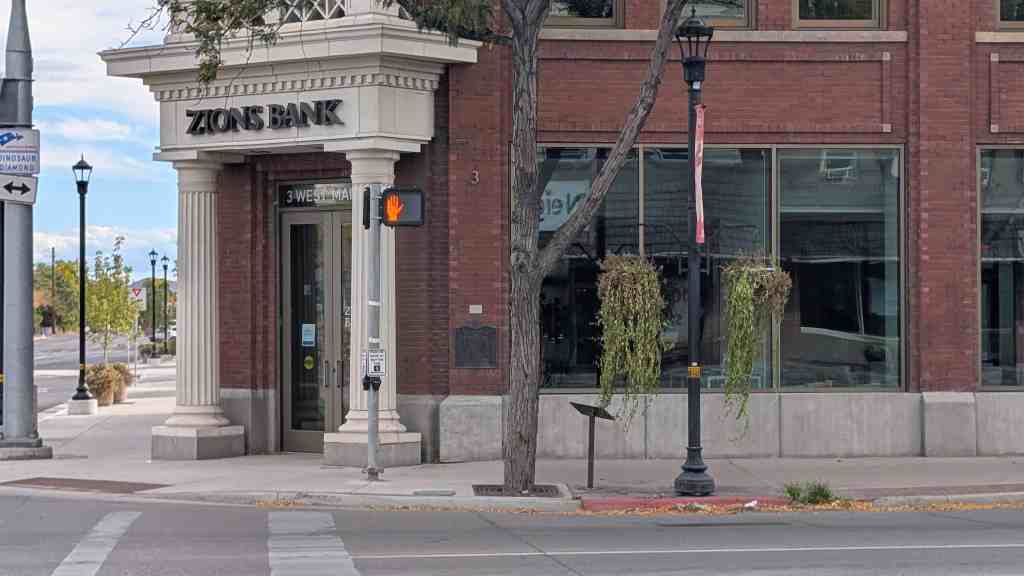
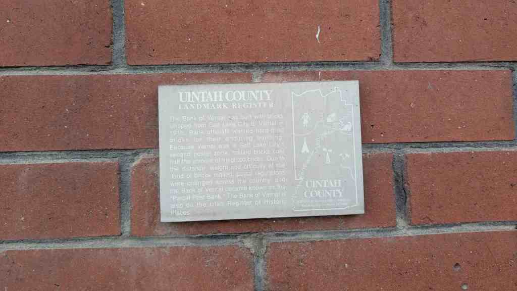
September 1886 Samuel R. Bennion was sent here to establish a banking institution called the ‘Ashley Co-op.’ In 1903 the first pioneer bank was opened for business. In 1916 W.H. Coltharp erected this building with Salt Lake City brick. A full car load of brick was used, each wrapped separately and sent Parcel Post U.S. Mail to Watson, Utah by train. From there they were hauled to Vernal by freight wagon and teams. It is known as the ‘Parcel Post Bank of the World,’ with N.J. Meagher, Sr. cashier, this bank has been a great factor in the development of Uintah Basin.
Daughters of Utah Pioneers historic marker #247, located at 3 W Main in Vernal, Utah.
The Uintah County Landmark Register plaque on the building says:
The Bank of Vernal was built with bricks shipped from Salt Lake City to Vernal in 1916. Bank officials wanted hard-fired bricks for their enduring building.
Because Vernal was in Salt Lake City’s second postal zone, mailed bricks cost half the amount of freighted bricks. Due to the distance, weight and difficulty of the flood of bricks mailed, postal regulations were changed across the country, and the Bank of Vernal became known as the “Parcel Post Bank.”
The Bank of Vernal is also on the Utah Register of Historic Places.
The White Meeting House Daughters of Utah Pioneers Marker #587
The White Meeting House stood on this site from 1856-1927. It was built just six years after the settlement of Springville, constructed of adobe, and first used as a school. Once the city was divided into four wards, the school was remodeled and expanded into a beautiful Latter-day Saint meetinghouse.
The White Meeting House was a cherished landmark used primarily for religious services. The addition of a stage and three upper seating galleries increased the seating capacity to 500, making it the location of many social and community functions as well. Notable speakers addressed the audience from its pulpit, including Brigham Young and other presidents of The Church of Jesus Christ of Latter-day Saints up to Heber J. Grant.
The White Meeting House stood as a monument to pioneer skill, craftsmanship and good taste for over 70 years, undergoing several major remodeling efforts until it was finally demolished in 1927.
On September 18, 1937 a marker was installed which read: “Site of the First L.D.S. Meeting House, A.D. 1856. This Marker Erected by Sons & Daughters of Springville Pioneers.” The marker was removed in 2010 when the Springville Public Library was built.
This marker was dedicated September 19, 2020, on Springville’s 170th birthday by the Springville/Mapleton Company of the Daughters of Utah Pioneers.
The Relief Society in Deseret was first organized in September of 1877. This group of women met in each other’s homes until 1878, when they had a large, one-room adobe hall built. In 1894 the members of the Relief Society decided they should construct a new Relief Society Hall. They began raising money for this building by donating and saving what they could. The Church of Jesus Christ of Latter-day Saint’s General Relief Society Board called for contributions to the building of the new General Relief Society Hall located in Salt Lake City, Utah. The Deseret Relief Society sent all of their funds, thus delaying their own building project.
The Deseret Relief Society ladies began again to plan for a hall. They sold their adobe building, land was donated, fund raised, and labor was volunteered by the men of the LDS Ward.
Construction costs for the building were $743.65 and $21.00 for the outhouse. Relief Society meetings, socials, dances, and plays were held in the hall from 1906 until 1934, when the new chapel was completed.
The Hall is the oldest remaining LDS Church building in the community. It has served many functions over the years. After the chapel burned in 1929, this hall was again used for church services. Public school classes were also held when the A.C. Nelson School burned. Boy Scouts used the hall for their meetings for several years. The Deseret Irrigation Company bought this building and used it for meetings and storage. They deeded the building to the Daughters of Utah Pioneers, Fanny Powell Cropper Camp, on February 7, 1995. It is now used for DUP meetings and for the display of pioneer memorabilia.
Beginning in late 1853, Union Fort was erected as protection for pioneers who had been homesteading along Little Cottonwood Creek since April 1849. Skirmishes erupted from Sanpete to Salt Lake Counties between warriors of Timpanogos Ute Chief Walkara and settlers. Walkara had become upset by Mormon efforts to stifle Indian slave trading and the increased intrusion of settlers into traditional Indian hunting grounds.
Brigham Young, president of The Church of Jesus Christ of Latter-day Saints and Utah territorial governor, ordered every community to “fort up” and the people to move into the enclosures as quickly as possible for protection.
Jehu Cox, one of the first settlers, was appointed to a committee to select the fort site. Cox offered to donate ten acres of land surrounding his 1849 two-story adobe home. His offer was accepted and construction began immediately.
Each family was assigned a section of the wall to build. Foundations were dug 4 feet deep and filled with rock and clay. The 12-foot-high walls were constructed of rock and adobe and were 6 feet thick at the bottom, tapering on the inside to 2 feet thick at the top. The outside walls were vertical. Gun portholes were placed in the walls every few yards, and bastions were built on the northwest and southwest corners. Only three walls were completed by late 1854 because the north side of the fort was protected by a large irrigation canal and steep embankment that provided adequate protection.
The fort had two, 33-foot-wide roads dividing the interior into three east-west rectangular blocks which were further subdivided into 24 building lots each. The roads ended at huge gates that were kept locked at night. Another 15-foot-wide road was laid out along the inside of the fort walls for movement of military supplies and men. A gravel path, running north and south, gave the citizens a walkway through the middle of the fort.
Twenty-three log and adobe homes were finished by 1854. Some built new two-story adobe dwellings while others living along the creek tore down their log cabins or small adobe brick houses and reassembled them inside the fort. Each family was also allocated a lot outside the fort to corral their livestock. Armed men stood guard as the farming continued in nearby fields.
Other structures were built within the fort. A two-story schoolhouse, 20 feet by 36 feet, was constructed in the middle section and also served as a church and community center. Wooden pegs were used instead of expensive nails. James McMinds was the first teacher.
A community granary was built southwest of the school and was never locked. It was constructed so a team and wagon could be driven through, and it allowed each family access to their ground-floor grain storage and produce stored in the loft. A boarding house was provided for teamsters who hauled daily loads of ore and granite out of Little Cottonwood Canyon for the Salt Lake Temple.
Military-trained citizens provided defense for Union Fort. Every male between the ages of 18 and 45 belonged to the territorial militia. They drilled and practiced often and rotated standing guard.
The Union Fort settlers had immigrated from different countries, spoke many languages, and followed their traditional customs. Often they could not understand each other, but they all labored together in united effort for their common good. As a result, the name of the settlement was changed from Little Cottonwood to Union.
Union Fort was never attacked. Brigham Young signed a peace treaty with Chief Walkara in 1854, and Indian difficulties ceased late in the 1850s. The settlers began moving back into their homesteads. The fort walls were gradually dismantled and the land used for farms and gardens. The fort served the pioneer settlers well and provided sanctuary and security, uniting them during insecure times.
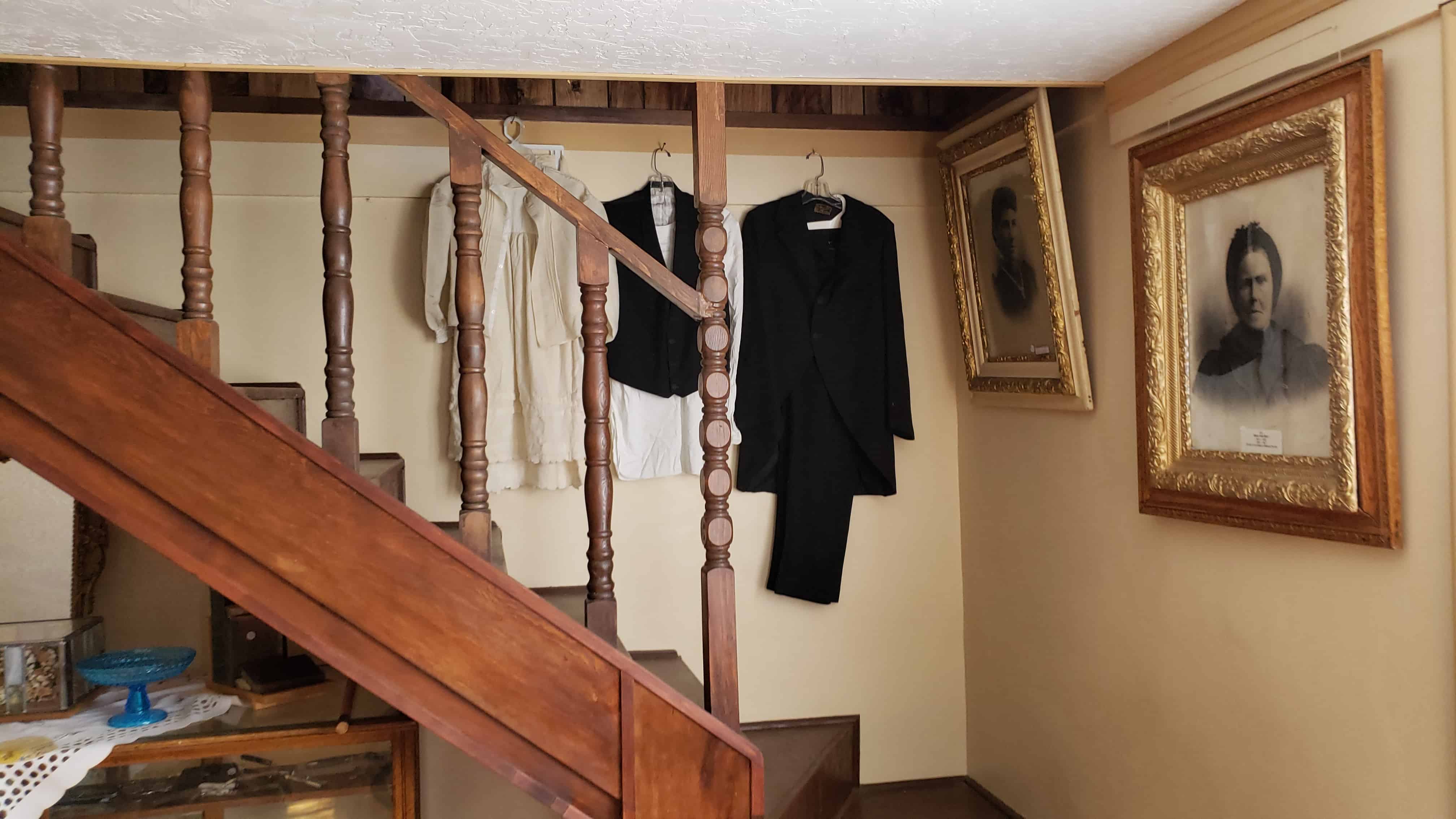
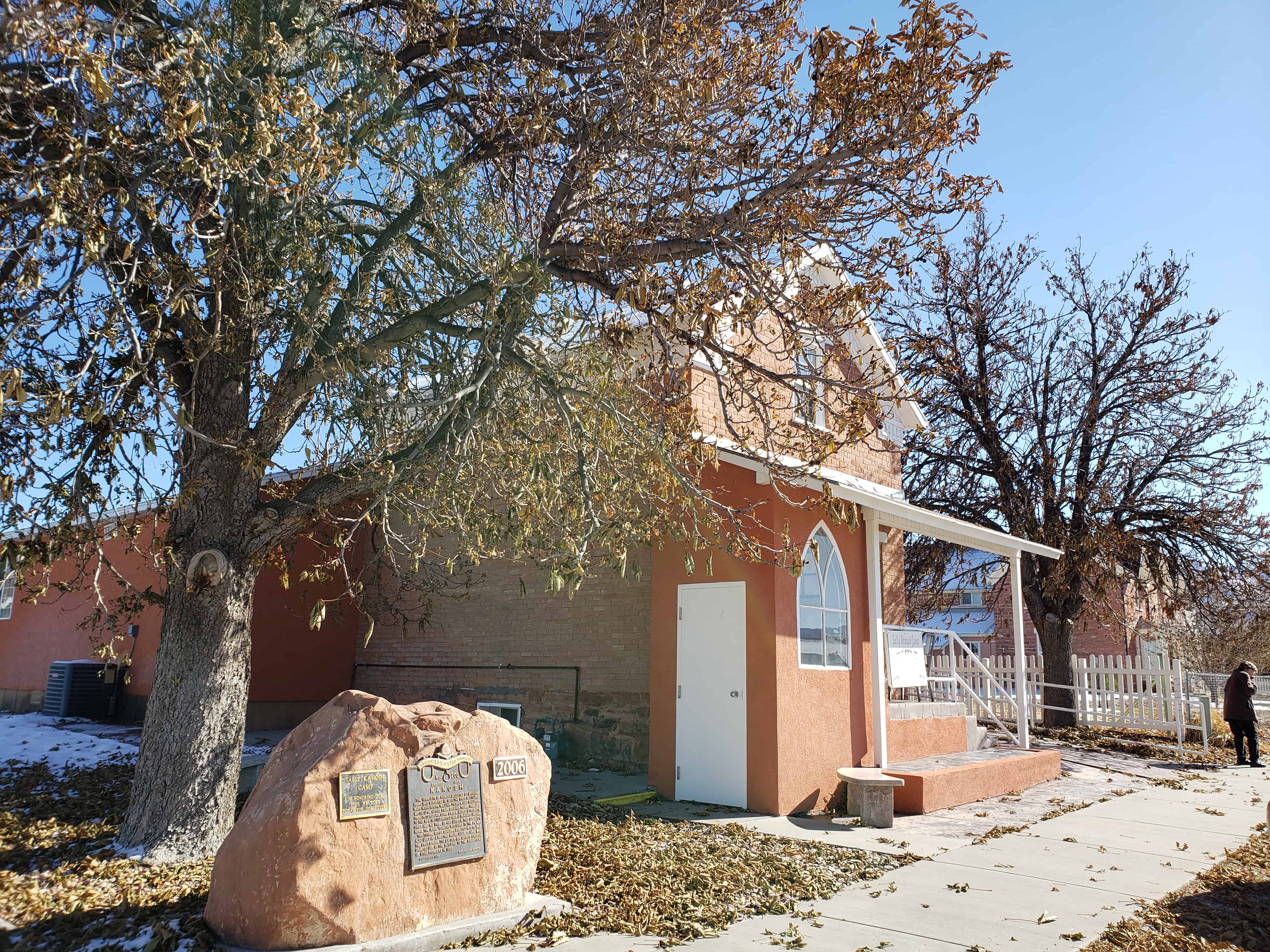
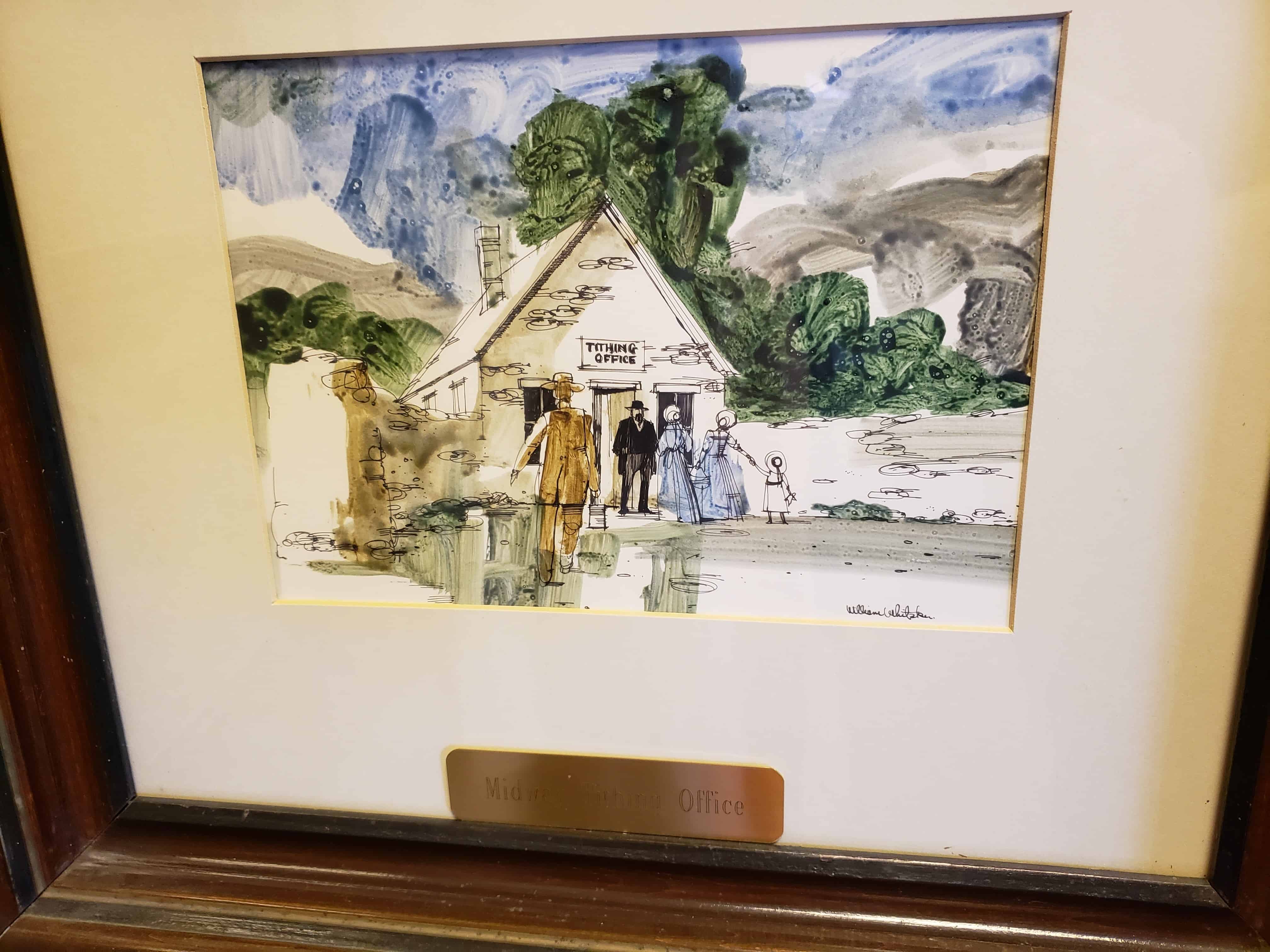
Built in 1870, the Kanosh Tithing Office is historically significant as one of 28 well preserved tithing buildings in Utah that were part of the successful tithing system of The Church of Jesus Christ of Latter-day Saints (LDS or Mormon church) between the 1850s and about 1910. Tithing lots, which usually included an office and several auxiliary structures, were facilities for collecting, storing, and distributing the farm products that were donated as tithing by church members in the cash-poor agricultural communities throughout the state. Tithing offices were a vital part of almost every Mormon community, serving as local centers of trade, welfare assistance, and economic activity. They were also important as the basic units of the church-wide tithing network that was centered in Salt Lake City. In addition, the Kanosh Tithing Office is architecturally significant as one of eight extant examples of Utah’s tithing offices which were designed in the Greek Revival style. It is one of seven of those buildings which is a temple-form building. Of those seven temple-form buildings, it is one of the three best preserved examples of the type. The other two examples include the tithing offices at Escalante and Paradise. The temple-form building originated in the Greek Revival period of American building,’ and typically has its short end to the street and a pedimented gable end in imitation of monumental classical buildings. The temple-form building was the preferred building type for early religious buildings in Utah, having been brought to the area by members of The Church of Jesus Christ of Latter-day Saints after 1847. 3 Very few unaltered, well preserved examples of this building type are presently extant in Utah.
Under the direction of Culbert King, bishop of the Kanosh Ward, the Kanosh Tithing Office was built in 1870 to serve as the center for the collection and distribution of “in kind” tithing contributions from members of the Kanosh Ward of the LDS church. Typical of most other Utah towns during the nineteenth and early twentieth centuries, Kanosh was a cash-poor agricultural community, therefore tithing contributions were usually farm products, such as crops, dairy products, and livestock. By at least the 1920s, however, cash was much more plentiful and was used for tithing donations instead of the “in kind” commodities. Since the building was no longer needed for its original use, it was either left vacant or used as a meeting place by auxiliary organizations of the church for a number of years. Even when serving as a tithing office, the building was used as the first meeting place of the ward’s Mutual Improvement Association, the organization for the teenagers.
In 1952, the church granted the building to the local chapter of the Daughters of Utah Pioneers, which has used it as a meeting place and relic hall up to the present.
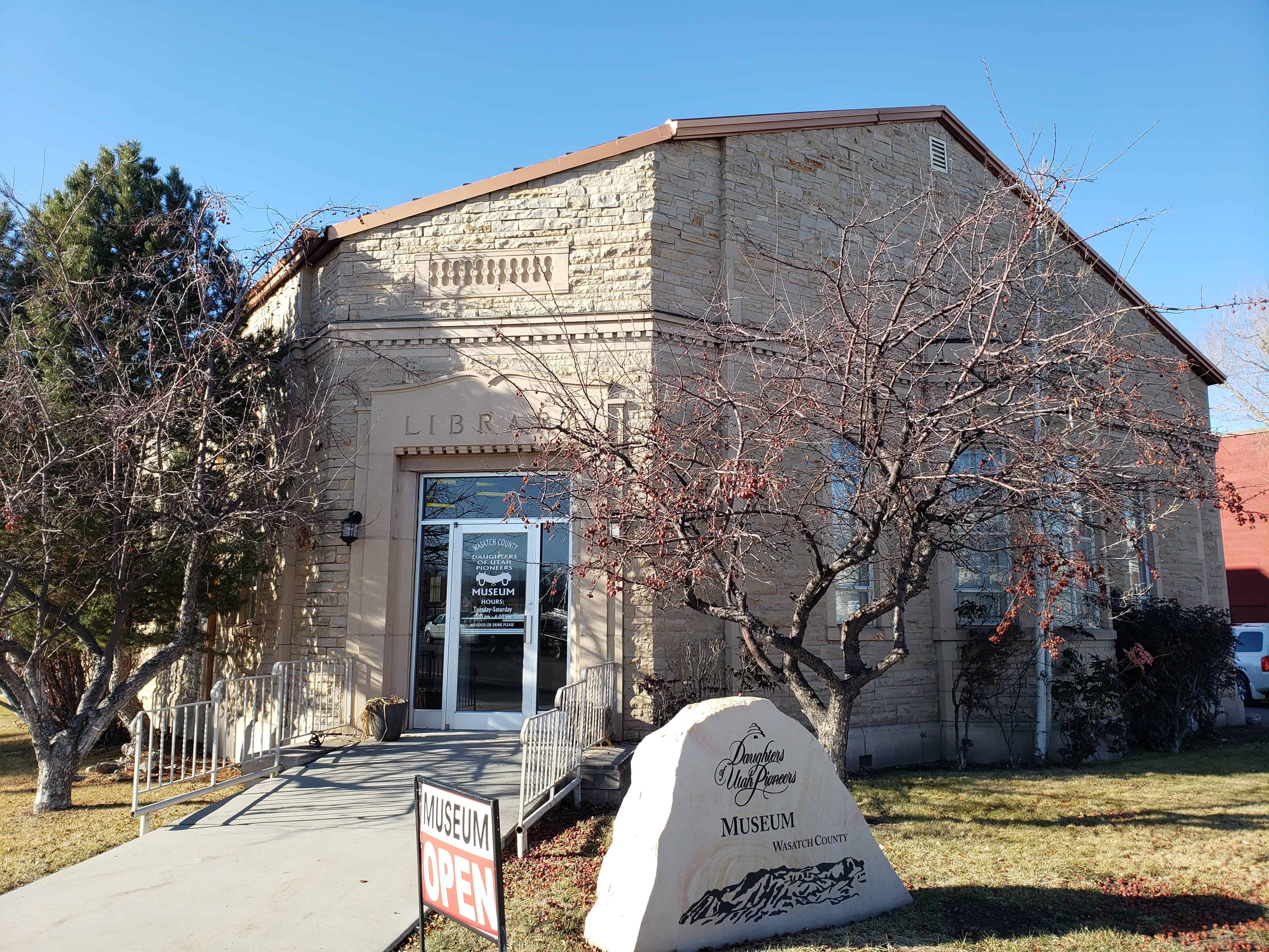
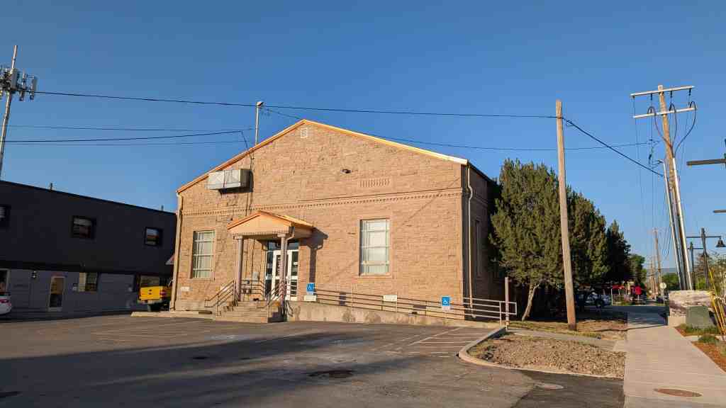
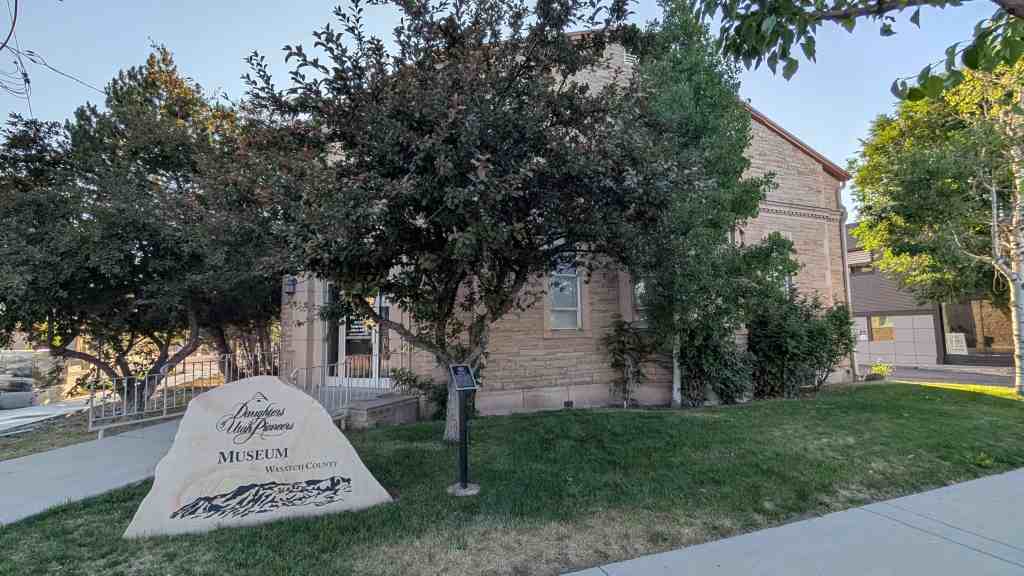
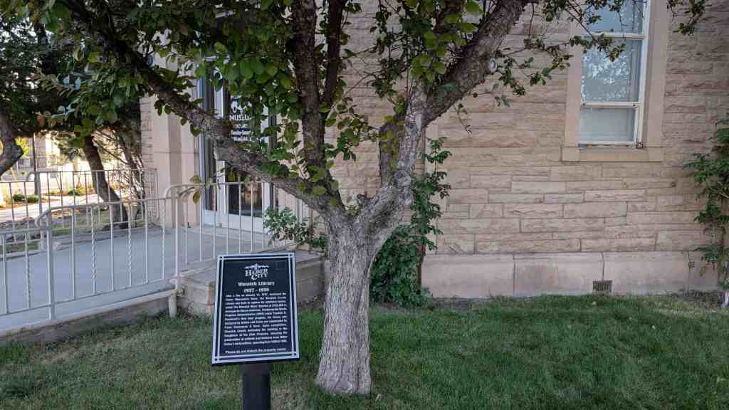
The historic former Heber City library was constructed as a federal Public Works Administration (PWA) project during the latter years of the Great Depression.
Construction occurred between Aug. 1938 and May 1939. The PWA supplied a grant of $13,275 toward the project, whose total cost was $27,529.
The building served as the community’s library until construction of the new Wasatch County Library, completed 2004.
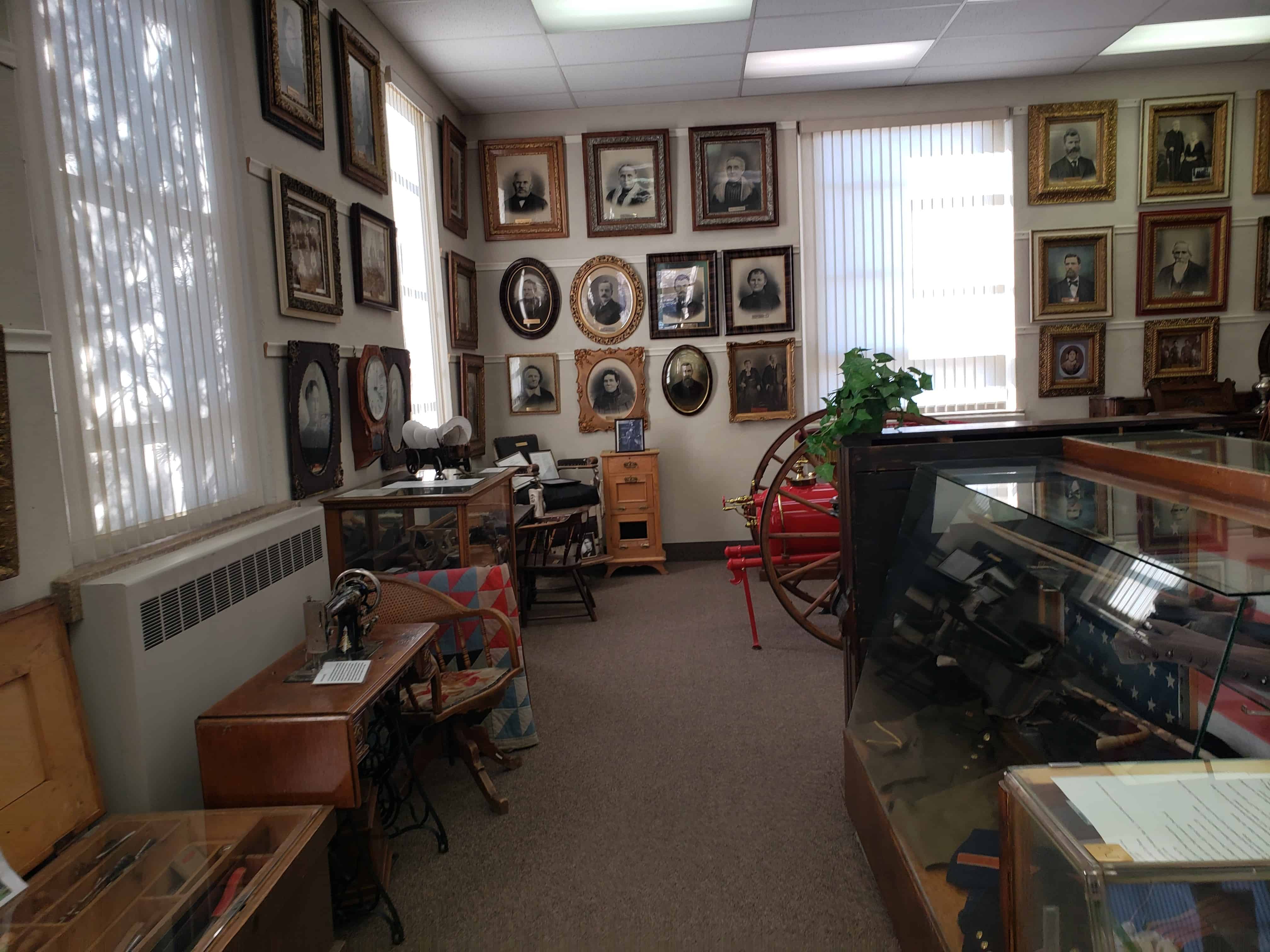
The New Deal facility now houses the Daughters of Utah Pioneers Museum.
After a fire on January 13, 1937, destroyed the Heber Mercantile Store, the Wasatch County Library was built to replace the extensive losses, which The Wasatch Wave reported at $125,000 in damages to library materials. Funded by the Works Progress Administration (WPA) under Franklin D. Roosevelt’s New Deal program, the library was designed by Ashton and Evans and constructed by Peter Groneman & Sons. Upon completion, Wasatch County dedicated the building to the Daughters of the Utah Pioneers, ensuring the preservation of artifacts and histories from Heber Valley’s early settlers, spanning from 1830 to 1900.
In 1875, John E. Forsgren, assisted by others from Santaquin, attempted to establish a community after “The Order of Enoch” on the west side of Sevier River, but failed in their scheme. Under leadership of William Robinson, in 1877, the area was resettled and called Dover. At its peak there were 50 homes, a store and a community building. River floods ruined crops and swarms of mosquitoes brought diphtheria epidemics. The death rate was very high. By 1900, all the town people had left, leaving only the dead behind. Zina Pickett bought the cemetery land and gave the deed to The Church of Jesus Christ of Latter-day Saints.
Elder George A. Smith called several strong families to travel south of Salt Lake City to settle Palmyra. He counseled them to build a fort for protection to ensure their safety from the local Indians. These stalwart pioneers enclosed a 10-acre square with 10-foot walls. The task of cutting mud blocks, making adobe bricks and building the fort was great. Each family had a small house made with the bricks, which formed the outer walls of the fort; the doors faced the center. Inside, the corral stockade kept the livestock safe. Some families moved into the fort upon completion in 1852. Other families arrived after the Walker War broke out one year later. The meetinghouse was used for church and school. During the winter of 1853-1854, having been joined by settlers from the Upper Settlement (now known as Spanish Fork), the population at Fort Palmyra numbered 404.
A peaceful resolution brought the Walker War to a close in August 1854. Brigham Young counseled the pioneers to move to the Upper Settlement, where there was better farmland. Fort Palmyra was dismantled and the adobe bricks were taken with them to rebuild the buildings they would need to survive. These brave, stalwart pioneer men, women and children built, then totally dismantled their homes and fort in the space of three years and rebuilt new homes in the second settlement.
In January 1855, the Territorial Legislature granted Fort Palmyra/Fort St. Luke, a city charter, allowing the government to rename the city ‘Spanish Fork.’ In 1880, many settlers moved back to Palmyra and built a new meetinghouse that served as a church and a school.