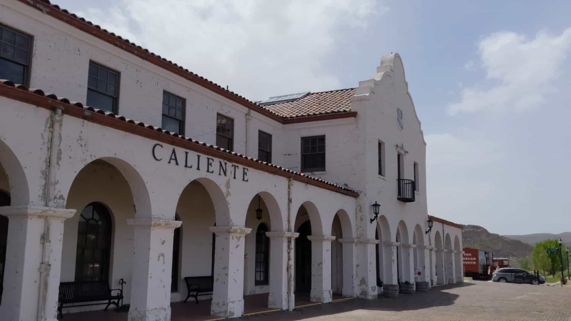
A large Neo-Mission type depot built in 1923, serving not only as Division Offices of the Union Pacific Railroad, but also as a hotel as well as a civic Center. Today it remains the most imposing structure in Caliente. The City of Caliente has taken it over in order to prevent its destruction In order to justify its cost, a City Hall complex and civic center is being constructed within the building. The exterior of the building is being left in its original form. Wherever possible the original wood, etc. is being left in the interior.
Caliente was founded by a railroad whose operations were based on steam motive power. It became U.P.’s best equipped steam facility between Salt Lake City and Los Angeles. For many years Caliente was a division point between Las Vegas and Milford, Utah. Engine and trail crews changed here. in the days of steam locomotives, Caliente also was the center of a helper district – the terminal for locomotives and crews that assisted trails upgrade between Carp and Caliente, Caliente and Crestline, and Modena and Crestline. During World War II, 17 helper crews were assigned here and about 150 were employed in the locomotive, car, and agents departments.
The interior has extensive oak paneling, ornate doors, vaulted ceilings, and tile floors. The City is retaining all original paneling and tile and interior changes are being kept to a minimum.
video
Located at 100 Depot Avenue in Caliente, Nevada and added to the National Register of Historic Places (#74001146) March 5, 1974.
The building is 54 feet by 341 feet (18,414 sq. ft.), white, with a red tile roof. Railroad tracks immediately adjacent to the depot have been removed and the City plans to landscape a portion of the 2.2 acres now under lease. A few years ago the rows of Lombardy poplars in the lawn on the south end of the building were cut.
The architectural style, generally known as the Mission Revival or the neo-Mission was used on the Union Pacific stations between Salt Lake City and Los Angeles. The Caliente depot is the only station of its type left in Nevada It was designed by the Los Angeles firm of John and Donald Parkinson, Architects. They also designed the Los Angeles depot. A styling note is the full arched openings on the lower floor, with a rectangular pattern around all openings on the second floor. Wrought iron guard rails protect upstairs door openings (fire escapes).
The second floor was originally used as a hotel for the overnight accommodation of train travelers and railroad officers. A separate adjacent dormitory (now removed) served layover train crews in the last years of the Age of Steam. The second floor facilities have been removed and there are no current plans for the use of the area although access has been maintained.
“Following the war Caliente’s importance as a railroad center began to decline. The diesel locomotives, which replaced the steam engines in the late 1940’s and early 1950’s, could be run in multiples with one crew eliminating the need for helpers, nor did they require fuel, water, and servicing as frequently. Forces and facilities were gradually reduced as diesel power gained prominence.
Shop facilities were moved to Las Vegas in 1948. The roundhouse, water tank, and excess yard tracks were removed and the depot turned over to the City of Caliente on a long-term lease (10 years for $1) in 1970.” – Allen Krieg, Union Pacific Railroad
Built in 1936, the airport’s hangar was funded by the Works Progress Administration (WPA), which provided jobs for unemployed Americans during the Great Depression. WPA funding required matching work contributions from local communities, so local county commissioners designed the hangar and supervised construction. Built of native ponderosa pine, the hanger is listed on the National Register of Historic Places. Each year, thousands of tourists arrive by air at this historic airport to see Bryce Canyon National Park.
Fires are a natural part of life here on the Paunsaugunt Plateau. When fires start in the region – whether by lightning, accident, or prescribed burn – the airport serves as a staging area for fire monitoring and management, as it did in 2002 during the 78,000-acre Sanford fire in Dixie National Forest.
Bryce Airport’s Vital Role
In this remote region, with major hospitals and airfields hundreds of miles away, Bryce Airport provides critical emergency support. built in 1936 as an emergency landing strip for commercial airlines, the airport has served that purpose twice since then. In 2005, American Airlines Flight 28, with more than 50 passengers on board, lost all engine power and safely landed here. Bryce Airport is also the main staging area for local search-and-rescue operations and fire management.
At 7,400 feet long, Bryce Airport’s runway is unusually long for a small airport. That’s both because it is designed to receive commercial aircraft and because of the high elevation of the runway (7,586 feet). Air is thinner at higher altitudes, providing less lift for airplanes. Heat further thins the air, forcing some small planes to avoid mid-day take-offs here during the summer.
Plaque located near the Bryce Canyon Airport in Bryce Canyon, Utah
The Washakie LDS Ward Chapel, constructed in 1939, represents the zenith of the Washakie community, an American Indian farming settlement established in 1880 by the Church of Jesus Christ of Latter-day Saints (LDS or Mormon church) for a group of about 200 Shoshoni Mormons. Washakie was both a religious and social experiment. The Mormon church, by providing farmland, training in agriculture, and religious instruction, hoped to bolster the faith and the economic self-sufficiency of this group of Northwestern Shoshoni. Implicit in this plan was their adoption of “white” ways. The Shoshoni viewed Washakie as a haven where they could live together and practice their adopted religion. Washakie provided them a lifestyle preferable to reservation life, ongoing conflict with whites, or assimilation with the larger society. Coinciding with the completion of this new chapel in January 1939 was the appointment by Mormon church leaders of an all-Native American bishopric to lead the Washakie Ward-the first in the history of the church. This was the culmination of almost 60 years of effort to help Washakie residents achieve ecclesiastical and economic self-sufficiency. For the Shoshoni, it also symbolized their acceptance as equals by their Anglo Mormon neighbors. Church officials and residents alike viewed the events of 1939 as the beginning of a new era for the community. The success was short-lived however. The onset of World War II in 1941 drew away many Washakie residents to jobs related to the war effort. By 1945 the Washakie Ward once again had a non-Indian bishop, and by the late 1960s, after years of out-migration and a shift of emphasis by the Mormon church, the congregation was discontinued, the community virtually abandoned, and the property sold.
On Sunday, January 22,1939, two significant events occurred in the small, northern Utah community of Washakie. First, the newly finished LDS ward chapel was dedicated by authorities from church headquarters in Salt Lake City. The older frame chapel it replaced was converted to a gymnasium (it has since been demolished). Construction of the new building had begun June 26,1937. Typical of the period, ward members with construction skills may have helped with some of the work. The completed building features “a commodious auditorium and class rooms for the holding of all Church services.” The residential-scale building is much smaller than typical ward houses, containing only 1,343 square feet of floor space. This is probably due to the small size of the potential congregation (approximately 125 at the time). The building was probably designed by Edward O. Anderson, who was listed as “Church engineer and architect” among the dignitaries at the dedication. George Albert Smith, a member of the church’s governing body the Council of the Twelve, was on hand to preside over the dedication services.
The second event that day was the appointment of four “full blood Indians” to the bishopric (leadership) of the ward (congregation). From 1880 to 1939, the ward had been led by non-Indian men. Under the reorganization, Moroni Timbimboo was named bishop, Nephi Perdash and Jim John Neaman were appointed counselors, and Henry Woonsook was sustained as ward clerk. The local newspaper noted, “This was the first time in the [109-year] history of the L.D.S. church that an entire Indian bishopric will preside over a ward.” Bishop Timbimboo not only served as head of the ward, but was also responsible for keeping up the condition of the meeting house.
These events marked the culmination of over 90 years of Mormon/American Indian relations in Utah, and, more specifically, efforts by the Mormon church to convert American Indians and foster them in the faith. When members of the Church of Jesus Christ of Latter-day Saints (Mormon or LDS church) relocated to Utah in 1847 under the direction of church president Brigham Young, they found the territory inhabited by various Indian tribes: Ute, Shoshoni, Goshute, Paiute, and so forth. Brigham Young encouraged his followers to feed the Indians rather than fight them, though at the same time he directed the establishment of over 300 permanent settlements on land previously used or occupied by the local Indians.
The Northwestern Shoshoni have been residents of what is now northern Utah and southern Idaho since at least A.D. 1300. As hunter/gatherers, they moved around the area frequently, often favoring locations near the Bear River and its tributaries which flow from the north into the Great Salt Lake. The arrival of Mormon pioneers in 1847 brought the first permanent Anglo settlements to the area. Tens of thousands of other emigrants passed directly through Shoshoni country along the California and Oregon trails, and the completion of the transcontinental railroad north of the Great Salt Lake in 1869 attracted ever more people and enterprises.
Though the Mormons practiced their “feed rather than fight” policy, conflicts between the Shoshoni and both their Mormon and non-Mormon neighbors were inevitable. The most notable altercation occurred in January 1863, when U.S. Army troops led by Col. Patrick E. Connor attacked a band of Shoshoni camped along the Bear River just across the Utah/Idaho border. Approximately 200-250 Shoshoni were killed, including most of the male population of this particular band. The entire population of the Northwestern Shoshoni numbered only about 1,500 at the time, divided among ten bands, so the loss of life was especially devastating. Though Col. Connor and his troops from Fort Douglas in Salt Lake City received praise at the time, history has since deemed their attack an unwarranted massacre-one of the most severe in U.S. history.6 One of about 20 Shoshoni males to survive the Bear River massacre was Chief Sagwitch Timbimboo, who, in the 1870s, led the conversion of large numbers of Shoshoni to Mormonism. His grandson, Moroni Timbimboo, would become bishop of the Washakie Ward in 1939.
The Treaty of Box Elder in July 1863 brought an end to Shoshoni warfare, but did little to help them establish a stable lifestyle. Government assistance was inadequate, and without land of their own they became a “lost tribe,” wandering the Utah/Idaho border and relying heavily on Mormon communities in the area for their subsistence.
The Mormon church felt a special affinity toward American Indians, viewing them as a lost and benighted branch of the biblical “Twelve Tribes of Israel.” According to Mormon scripture, The Book of Mormon, American Indians are descended from Israelites who fled the Old World and settled in the Americas beginning around 600 B.C. Internecine warfare wiped out the last of the “believers” around 400 A.D., leaving only the non-believers-the ancestors of the American Indian–on the American continents.
One method used by the Mormon church in working with American Indians was to teach them “white” agriculture techniques and try to convert them to Mormonism. The church established “Indian farms” at various locations in Utah and assigned missionaries to help teach the Indians to farm, raise livestock, construct buildings, and so forth. In 1873, the church assigned missionaries to the Northwestern Shoshoni for this dual purpose.7 After moving the location of the farm a couple of times, they finally settled on a site in 1880 in northern Utah near the Idaho border for a group of over 200 members of the Shoshoni tribe. The farm community was called Washakie, in honor of a respected Shoshoni chief.
Within a few years the community seemed well on its way to fulfilling the church’s long-range program of helping the Shoshoni become self-sustaining members of Mormon and American society. The 1,800 acre farm boasted 1,500 sheep, 150 acres of irrigated land, 450 acres of dry farm, a cooperative store, a school, a church, and a 14-mile canal to provide water to the farms. In addition, some of the Indians started filing homestead claims for themselves. A newspaper correspondent in 1886 noted that the 250 Indians at Washakie owned their property in common, stayed on their farms year around, and were “a temperate and industrious people.” Over 25 years later, the community was still receiving positive reviews. A 1912 report filed by an agent with the federal government’s Office of Indian Affairs noted that the Washakie residents were “indeed well off” in comparison with groups at other locations in Utah.
However, “All was not perfect in the little Zion,” notes historian Brigham D. Madsen. “The missionaries met a lot of frustrations in their attempt to make the Indians into carbon copies of themselves.” Indian agents were also concerned that the Washakie Shoshoni were not performing entirely as they saw fit. Problems noted by the Indian agents during the 1920s and ’30s included the lack of tribal organization (church organization had taken precedence), the need for home management training to the women, inadequate school facilities, and the need for local courts to take responsibility “to preserve proper order in this community.” Despite these minor problems, Washakie continued to prosper.
By the 1920s, the population of Washakie had stabilized at about 125, less than half the number that had started with the community 40 years earlier. In addition to attrition from death, some had moved to the reservation at Fort Hall, Idaho, and some had merged into the white culture. Those who remained were, with few exceptions, active Mormons.
As the twentieth century progressed, the Mormon church continued to direct the community. It still assigned a non-Indian bishop to head the ward, though by at least 1923 two Indian counselors (Moroni Timbimboo and Quegembitch) were assisting him. In 1935, two Indian men were called to serve as short-term missionaries to the Fort Peck Reservation in Montana to gain converts. The church also continued to own the 1,800 acres of farmland and the community itself. The issue of property ownership would become a substantial problem after the 1940s, when families who thought they owned their homes were displaced. Most of the homesteads (29 of 40)filed on surrounding land by Washakie residents were lost either because of nonpayment of taxes or “through fraud or other irregular means” to white men. This left the community almost entirely dependent on the church-owned lands.
Beginning in the late 1930s, the church renewed its efforts to improve the viability of the Washakie farm so it would better fulfill the needs of the town’s residents. They improved the irrigation system, purchased new machinery, upgraded and expanded the livestock herd, and experimented with various crops to find the most productive use of the land. For example, raising wheat proved quite profitable around World war II. According to one ecclesiastical leader at the time, these efforts “proved to be very beneficial and very helpful for the whole of the property.”
The completion of the new brick ward house and appointment of the all-Indian bishopric in 1939 were a culmination of these renewed efforts at Washakie. They also marked “the beginning of a new era for these Indians,” according to the Mormon-church published Deseret News. The community had apparently reached a point of religious self-sufficiency, having already achieved a level of economic stability. The occasion also launched the beginning of a new initiative in the community: the improvement of living and sanitary conditions. The newspaper noted that “this Indian community has made great forward strides intellectually and spiritually, but their temporal advancement, noted by their homes and living conditions, has not kept in step.
The Washakie Project Committee, comprised, ironically, entirely of non-Indian Mormon men, was appointed by church leaders to direct the effort. By 1942, improvements were already being noted: “Many things have been accomplished in the past two years. Electricity has been brought to the homes. The new chapel has been built. Three new homes were constructed…. A large barn has been rebuilt and fences erected….” While the Washakie project “presents many varied problems and discouragements,” the article noted that it “gives promise of a happy completion in the years to come.”
Whatever momentum the Washakie Ward and community had gained during this new era was lost during World War II. Better-paying war related jobs in nearby Brigham City and in the Ogden and Salt Lake City areas drew away many. In addition, a number of young men who returned from the war decided to take advantage of the schooling they were entitled to through their military service. According to Samuel Hendricks, stake president at the time, “It seemed that the things that we were trying to do [at Washakie] was in competition with the government and with the schools.” Eventually, Hendricks noted, “it got so the old ladies, the young folks’ grandmothers or somebody who were taking care of babies was about all that was left in Washakie.” By 1945 a white man was once again bishop of the Washakie Ward. The ward was downgraded to a branch in 1960, and in 1966 was discontinued. The few remaining members were transferred to the ward in the nearby town of Portage.
At some point during this decline, the LDS church apparently decided to abandon the Washakie project. According to property records, the church was the owner of all the property; the residents of the town were simply tenants. Clearing the land for other purposes became the church’s new priority. Accordingly, many of the vacant homes were burned, much to the shock and chagrin of their former occupants when they returned. Some received compensation from the church for personal property that had been destroyed. Those who refused to leave their houses received eviction notices. The church helped relocate some of those who remained, but it was a sad and confusing time for many. Some felt betrayed by the church. Though most of the residents had moved elsewhere, their roots and sentiments were in Washakie. The identity of the band was also tied to the community. Eventually 184 acres of property, including their burial site located west of town, were returned to the tribe by the church. The remainder of the property was sold to a private party and is currently operated as a ranch.
Washakie’s success was mixed. Its longevity, over 80 years of existence, indicates the community achieved a substantial measure of stability and viability. This is countered by the dwindling population into the 20th century and, of course, the eventual demise of the town. Samuel Hendricks, offering his opinion as a white Mormon church official on Washakie’s success, observed that “there were times when it was good and times when it wasn’t.” While the community enjoyed some success as a segregated Indian community, he felt “that the integration and the mixing in and the training for the amalgamation process [with the larger society] is the way to go…, but I think you have got to give a certain amount of respect for their history, for their culture and their beliefs, their ideals…. We haven’t done too good a job on that.”
The small brick chapel is the most notable of the few structures remaining from Washakie’s historic period. The Craftsman bungalow style school, located south of the church, is still standing, but has been altered on the exterior. At least one of the c.1940 concrete-block houses is also extant; it is located on the north side of the road into town. A canal, apparently the historic canal, is located directly west of the church property. Other historic features of the community probably exist as well, including cultural landscape features (fields, ditches, cemetery, etc.). These features may be dealt with in the future as part of a more comprehensive study, but for now only the church is being considered for National Register designation.
Constructed in 1939, the Washakie LDS Ward Chapel is a one-story brick church with a concrete foundation and modest Colonial Revival stylistic features. It is located on a fenced lot in the heart of the small, unincorporated, mostly abandoned northern Utah town of Washakie. Though currently vacant and in disrepair, the building retains its historic integrity.
The primary façade of the building faces east, despite the fact that the road runs to the north. The east façade is dominated by a gable end wall with a tall, narrow, round-arched panel centered under the gable. The panel is slightly recessed and features a basket-weave brick pattern. The double-door entrance is set to the side of the gable under a lean-to like extension of the roof. It is slightly recessed from the plane of the gable end wall, allowing for clear definition of the south corner of the symmetrical gable end wall.
The brick exterior walls are laid in a common bond pattern, with every seventh course being a header course. A row of soldier bricks accents the bottom of the walls. Colonial Revival style features include multi-pane windows, symmetrical placement of windows, and a flared cornice effect on the gable ends created by corbeled brickwork. The roof consists of an east/west running gable over the chapel area on the north, intersected by a cross-gable that extends south over the classroom section.
The interior features a central hallway with a rectangular chapel area to the right and three classrooms/offices and a closet to the left (see enclosed floor plan sketch). At the west end of the hall is a steep stairway down to the furnace room in the basement. Most of the stairs in that stairway have been removed. The walls and ceiling appear to be plaster over metal lath (visible in deteriorated sections). The original stained wood trim and doors are still in place. The floors are covered primarily with what appears to be asbestos tile. Carpet (a later installation) covers the front (east) of the chapel and the raised platform or “stand” where church leaders conducted services. Leaks in the roof have caused water damage to several parts of the building, evidenced by stains, peeling paint, and even holes in a few areas of the ceiling.
The building sits near the middle of a large, fenced lot, and is accessed by a concrete sidewalk from the road on the north. Behind the church (to the west) is a grove of trees arranged in rows approximately 18 trees aligned in three rows. There are no other structures on the property.
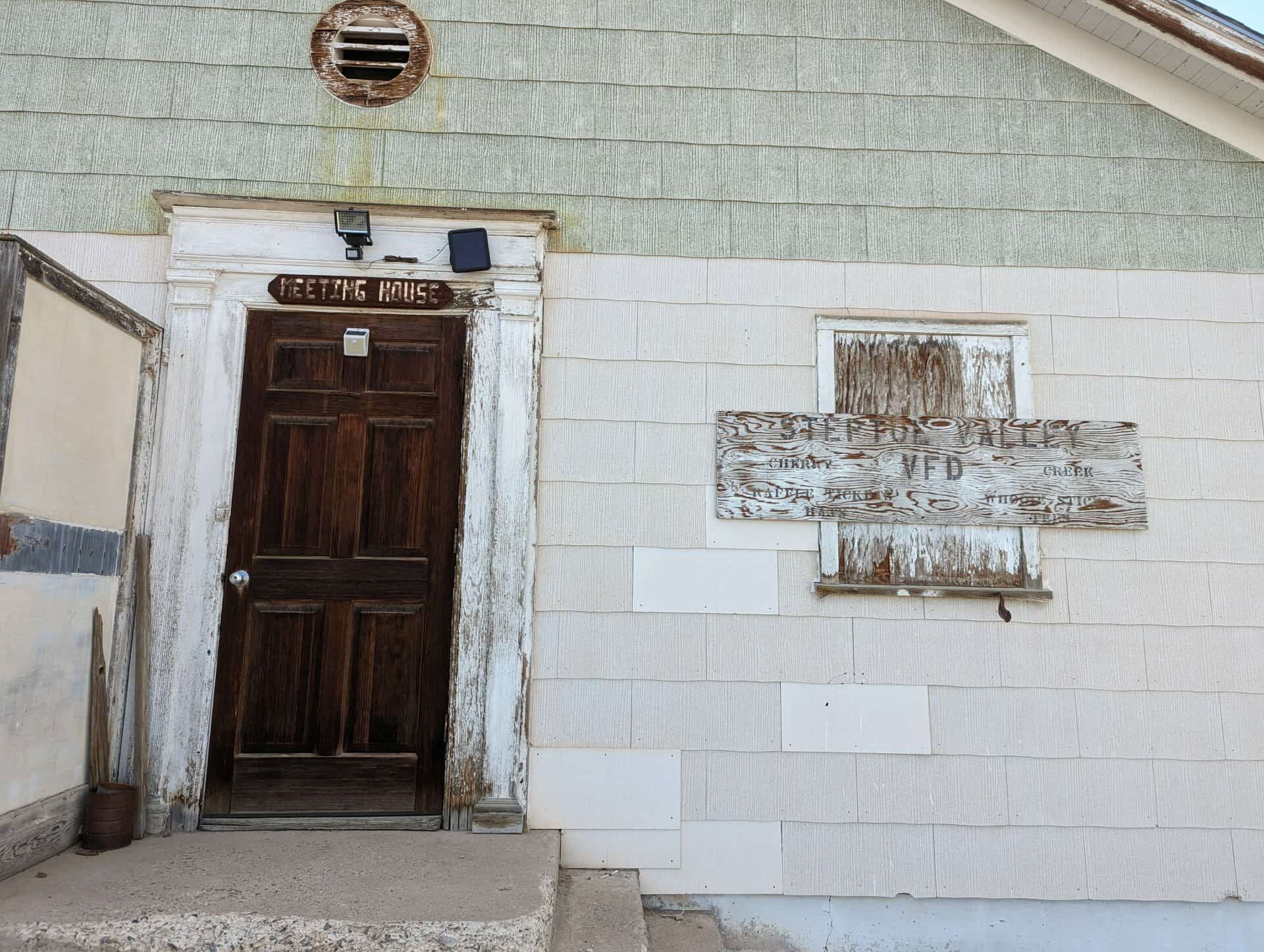
Built when Cherry Creek was founded in 1872, it is one of the two oldest standing Nevada schoolhouses. In November 1894 a dispute between Pat Green and Pat Dolan over the building’s location turned violent with Dolan killing Green in a gunfight. With successful mining operations the area population grew to 6000 people and a peak enrollment of 56 students. In 1901 a lantern was fueled with gasoline and exploded. The fire burned several buildings nearly destroying the schoolhouse. After the last class in 1941, the building was used as a post office until 1971. Acquired by Walter Campbell in 1994, the schoolhouse has been converted into a museum.
This historic marker was dedicated June 12, 1999 by the Lucinda Jane Saunders chapter 1881 of E Clampus Vitus.
The Fillmore Armory, located at 35 West Center Street in Fillmore, Utah was constructed in 1937-1938 and is associated with the second generation of Utah National Guard (UTNG) armory construction. Even in times of peace, training was essential for soldier to be effective and prepared for active service during state and national emergencies. Due to the need for a space to perform drills and store equipment, the armory became a significant property type of the UTNG. During the early 1900s, few existing facilities could accommodate National Guard training, drilling, and storage for arms and equipment. Beginning in 1928, construction began on a second generation of armories in Utah meant to specifically address these needs.
Construction of the Fillmore Armory began with New Deal era funding as part of the Works Progress Administration (WPA) during the Great Depression. Initial construction employed mostly unskilled laborers. Local men supervised the project and used locally purchased building materials. Fillmore residents also donated funds and materials to install a hardwood floor in the building.
The Fillmore Armory was primarily constructed to house Utah National Guard artillery units, including batteries of the 213th Field Artillery Battalion (disbanded in 1967) as well as the 222nd Field Artillery Battalion. Members of these units would train in Fillmore and go on to serve overseas during the Second World War and the Korean War. Later, the 222nd would complete two deployment tours during the Iraq War. In addition to its use in military defense, the building has also served as a community recreation center and dance hall. Ownership of the armory was transferred from the Utah National Guard to the City of Fillmore in 2019 for continued public use.
Located at 35 West Center Street in Fillmore, Utah and added to the National Historic Register on (#100006003) January 4, 2021.
The Elite Hall dance hall, designed by architect K.C. Schaub and constructed in 1917, is significant for its association with community events in the city of Hyrum. Financed by the Hyrum Amusement Company, Elite Hall became the primary dancing and social events center in Hyrum, after replacing the 1889 Opera Hall, which was destroyed by fire in 1914. The building is also significant because it is one of only a couple of known remaining dance halls in the state with a spring-loaded dance floor. The springs provided extra bounce for the hundreds of dancers who would crowd the floor. Because Elite Hall had the only spring-loaded floor in northern Utah, the building attracted dancers from all over Cache County and northern Utah.
At the time of Elite Hall’s construction, commercial-type buildings typically displayed little ornamentation. However, modest Prairie School-style detailing adds character to this large structure. Prairie School elements are found in the large frieze that encircles the top of the building with bracket-like ornamentation. They are also found in the long vertical inset panels on the primary façade, which counter the frieze and add an element of height to the building. Elite Hall’s imposing presence on Main Street, its Prairie School-style detailing, and historical integrity combine to make it one of the most prominent buildings in town.
Located at 98 West Main Street in Hyrum, Utah and listed on the National Register of Historic Places (#03000736) on August 4, 2003.
The Elite Hall dance hall, constructed in 1917, is significant under Criteria A and C. Under Criterion A it is significant for its association with community events in the small town of Hyrum, Utah. After replacing the opera hall (which was destroyed by fire in 1914), Elite Hall became the primary dancing and social events center in Hyrum. Also, because it had the only spring-loaded dance floor in northern Utah, the hall attracted dancers from all over Cache County and northern Utah. Because it is one of only two known remaining dance halls in the state with a spring-loaded floor, Elite Hall is also significant under Criterion C. 1 The hall’s imposing presence on Main Street, along with its Prairie School-style detailing and historical integrity combine to make it one of the most prominent commercial buildings in town. Elite Hall greatly contributes to the historical fabric of Hyrum, Utah.
The Elite Hall dance hall, constructed in 1917, is a large, two-story, two-part commercial-block building constructed of brick with a fairly large 70′ x 122′ footprint on a raised concrete foundation. Although the building is basically commercial in design there are elements that hint at the Prairie School style. The building is painted a light grey color and sits on the corner of a city lot with virtually no setback from the sidewalk on either side. A single-story commercial building abuts it on the east, but the majority of historical commercial buildings that accompanied it on the block have been razed or altered.
The south facing primary façade of Elite Hall is organized in a bilaterally symmetrical, tripartite fashion with the center section slightly stepped back from the two side sections. The centrally place entry area features a large, hipped-roof canopy, supported on two square stuccoed columns, that extends out over the sidewalk. The canopy is not historic and replaces an arched canopy that is visible in a 1946 photograph. The two inset entryways are comprised of two flanking sets of double doors. The half-glass doors feature three stacked, horizontal panes. The inset doorways allow for a ticket booth at right angles of each doorway. Above the entry on the second floor are two flanking sets of coupled windows. The windows feature a tall top pane over a shorter one that has been replaced with sliding windows. All windows on the building are similar to this and feature heavy concrete sills. On this center section, the fenestration and entry are surrounded by a projecting brick framework that corbels out to a cornice at the top of the panel. A small circular element is found at the top corners just inside the framework. Also, below each second story window is a smaller rectangular brick enframed panel, the same width as each window.
The projecting sections on each end of this façade are identical and are comprised of two sets of coupled windows, vertically placed one above the other. These are also set in a projecting brick framework corbels out at the top and also has the circular design elements. The windows are similar to those on the rest of the building. Dividing the top set of windows from the bottom is a projecting rectangular brick framework, like that in the center section. A prominent design feature is also found on these two sections, a long, narrow vertical inset panel that reaches from the center of the first-floor window to the top of the window above. At the bottom is a projecting brick sill. These elements, and other similar elements, provide a reference to the Prairie School style. Above the window panel and running along the south fa9ade to the west fa9ade is a wide, corbelled frieze that projects above the roof as a parapet. The only other decorative treatment on the building is a patterned element of the frieze in the form of small, projecting I and [-] shaped designs, located between projecting brick stringcourses and running along the south and west facades. All of the architectural embellishments are painted a contrasting dark grey color.
The south (secondary façade) is also a bilaterally symmetrical, tripartite arrangement; however, this façade is much wider and has no entryway. As on the main façade, the center section is book-ended by two projecting sections. The center section is much wider than the two end sections and has four windows (similar to those on the front of the building) on each level. Each of the projecting end sections features a set of coupled windows on each level. Flanking each window is a narrow vertical inset panel, similar to the larger ones on the front, only each one is the height of the window. The coupled window opening on the right side of this façade has been filled in with brick.
The north (rear) façade is a blank wall with two centrally placed doorways, one on each floor with the bottom one being raised. Separate metal stairways provide access to each entrance. Also visible on the left of this elevation is a square, brick chimney projecting from the northeast corner of the building. The east façade is partially obscured on the main level by the adjacent commercial building that covers part of the wall. This building extends back about half the length of Elite Hall. The visible portion of this façade features two windows, one on each level, just right of center. There is also a similar window left of center on the second level. Another set of windows at the far right of this elevation was bricked in at an unknown time.
The interior of the building is open to the ceiling with a circular mezzanine surrounding the dance floor at the second story. Surrounding the mezzanine is a more recent metal balustrade; also, the mezzanine floor has been new carpet. An interior stairway accesses the mezzanine at the front of the building with restrooms and some office space located here as well. The floor of the hall is maple-typical of gymnasiums. But what is not typical is that it is actually supported on a network of springs resting on the main floor. The spring-loaded floor was unique to this hall and provided more bounce for dancers. The portion of the floor supported by the springs sits in from the walls approximately four feet and is raised up a few inches. The perimeter floor is solid with benches located along the walls.
The building is surrounded by a concrete sidewalk on the south and west sides and has a large asphalt parking area behind and to the east. There is no landscaping or any natural feature on the property. However, because of its location in the commercial center of the city, there probably was no landscaping historically. The building retains its architectural integrity and is a prominent contributing historical resource in Hyrum, Utah.
In 1889 Soren Hansen began construction of an opera house in Hyrum. The opera house was to act as both a musical and theatrical venue as well as a dance hall on the upper level; general merchandise stores would occupy the lower level. The opera house became so popular that young people traveled from all over Cache Valley to attend dances there. Unfortunately, the building was destroyed by a fire in 1914, but almost immediately plans were made to build a new dance hall on the same site.
The Hyrum Amusement Company was formed in 1915 and purchased two parcels of land, the first in January of 1915 and the second in February of the same year. The company took a mortgage of $8,000 from the Deseret Saving Bank on November 11, 1915. Stock was then sold to roughly thirty different members of the community to help with the construction costs of the hall – the remaining $12,000 of the estimated $20,000 required to build hall was raised by selling these shares at $100 a piece. C.A Nielsen was elected president; CJ. Christiansen was elected vice-president, and Alfred Fallows elected secretary and treasurer of the company.
The construction of Elite Hall began in 1916 with AJ. Peterson as the construction supervisor; he was also responsible for design of the floor plan.5 K.C. Schaub, a well-known Utah architect who also designed the McCune School of music (Alfred & Elizabeth McCune Mansion, National Register listed in 1974) and the Thomas Kearns Mansion (National Register listed in 1970), was the architect.6 Elite Hall was one of only a two known spring-loaded dance floors in Utah. The dance floor is actually a separate platform elevated off the main floor a few inches by springs. This causes the floor to move beneath ones feet giving the dancers an actual spring to their step. The building itself is constructed of a steel frame with brick veneer and has a footprint measuring 70 x 122 feet, making Elite Hall one of the largest dance halls in Utah. The size of the hall along with the spring floor made the hall even more popular than its predecessor had been.
Elite Hall opened on July 24, 1917, to a crowd estimated at 1400; 412 tickets were sold for the dance that was held that evening. Although the hall was popular and boasted great success, the Hyrum Amusement Company never turned a profit on the hall as they had initially hoped. After a few years the company found itself in financial trouble and eventually on the brink of bankruptcy. In 1924 Willard and Eugene Petersen (Willard already being a share holder) stepped in and offered to purchase the hall from the majority of the remaining shareholders. Willard and Eugene offered those shareholders who wished to remain to do so and possibly recoup some of their losses. Only two shareholders are known to have stayed, H.R. Adams and a Mr. Hanson. With Willard as the major stockholder the Hyrum Amusement Company ceased to exist anywhere except on paper, therefore there are no minutes recorded after August 16, 1916.
Willard then took on the task of managing Elite Hall full time. He booked bands to play and had the hall opened two to three nights a week for dancing, as well as roller-skating. Willard continued to run the hall until his wife, Kate, who was not fond of dancing, objected to the time he spent at the hall and insisted that he hire a different manager. Over time Willard became less and less involved in the management of the hall until he and his brother sold it. The Peterson’s sold Elite Hall to the city of Hyrum on December 29, 1934, for $5,000. The city has remained the owner and proprietor of the hall ever since. It now functions as a basketball court and still occasionally a dance hall.
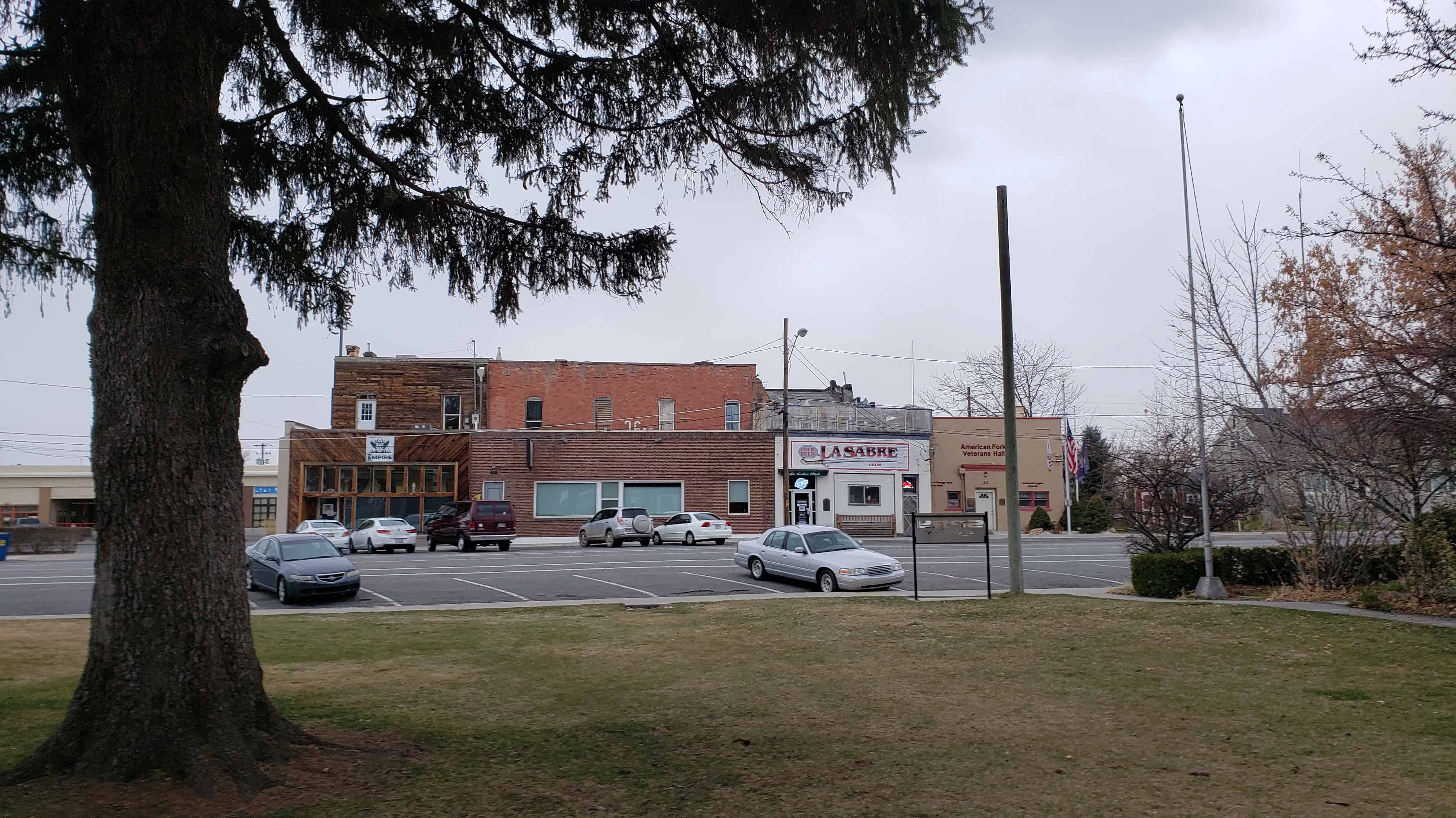
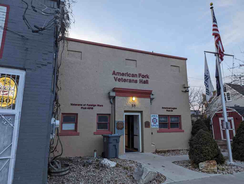
The Veterans Memorial Building, also known as the Legion Hall, was originally constructed as a commercial building sometime before 1932. In 1934 it was extensively remodeled as an early Public Works Project funded by three sources: A Civil Works Administration Grant (part of the New Deal Era Legislation), American Fork City, and the American Legion Post 49. American Fork Veterans, wanting to bolster public remembrance of their comrades who served and died in WW1, organized a small group of men and women who worked for years to establish a suitable memorial. Their efforts resulted in the remodeling of this structure to honor WW1 servicemen. As a result of their support and its use as a Legion Post it was commonly known as the Legion Hall.
The Building is a well-preserved local example of the “PWA” Moderne Style of architecture, which was used extensively during the 1930’s on government-funded buildings. It features smooth wall surfaces, flat roof, plain, narrow cornice, framed entrance, and metal sash windows. The interior maintains much of its original fabric such as wainscoting, staircases, crown molding, wall sconces, and 1930’s kitchen with elaborate cabinets, glass cupboard doors, and chrome plated hardware.
Located at 53 North Center Street in American Fork, Utah