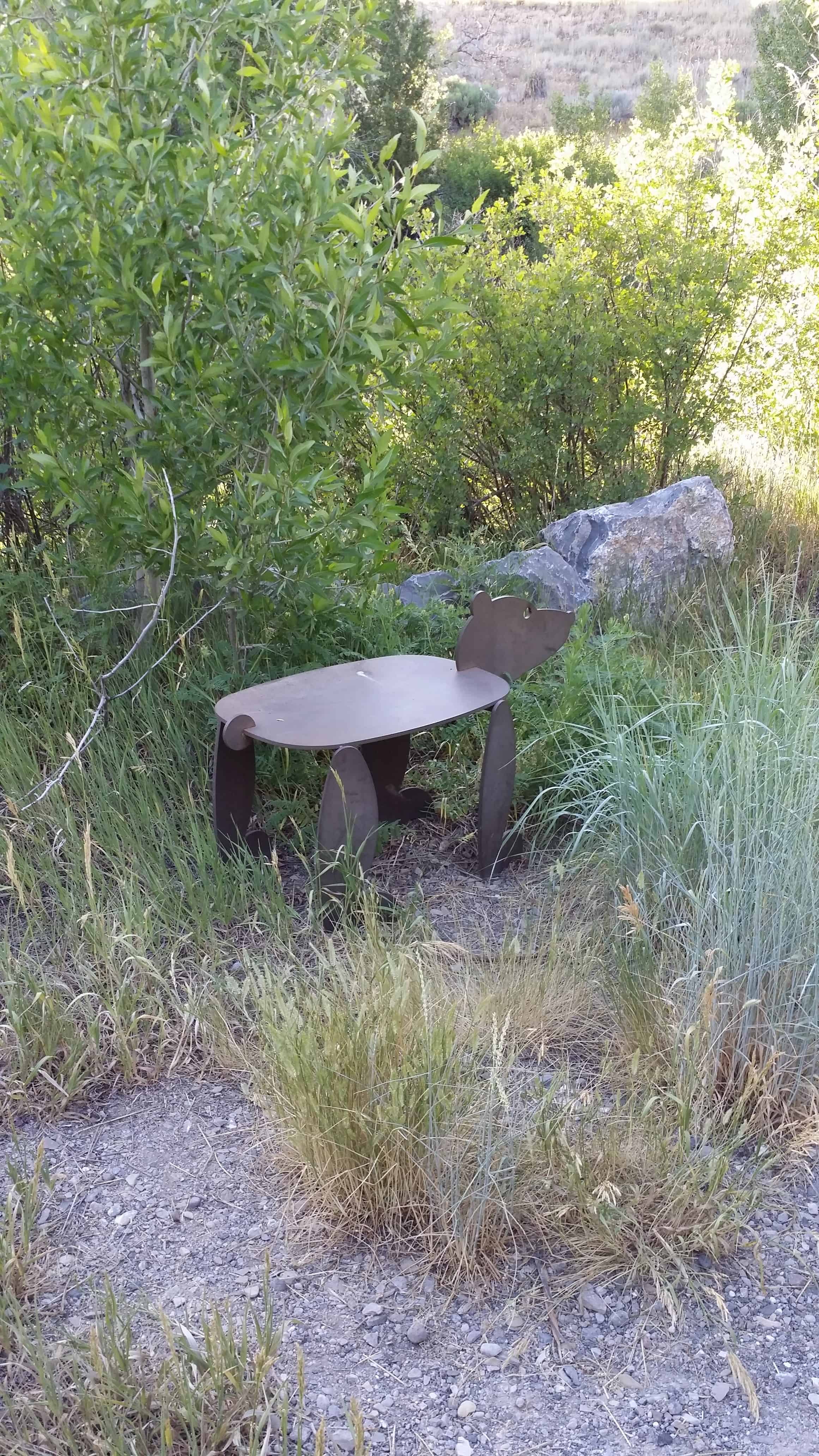
Diamond Campground
19 Sunday Apr 2015
Posted in Uncategorized

19 Sunday Apr 2015
Posted in Uncategorized
22 Sunday Mar 2015
Posted in Uncategorized
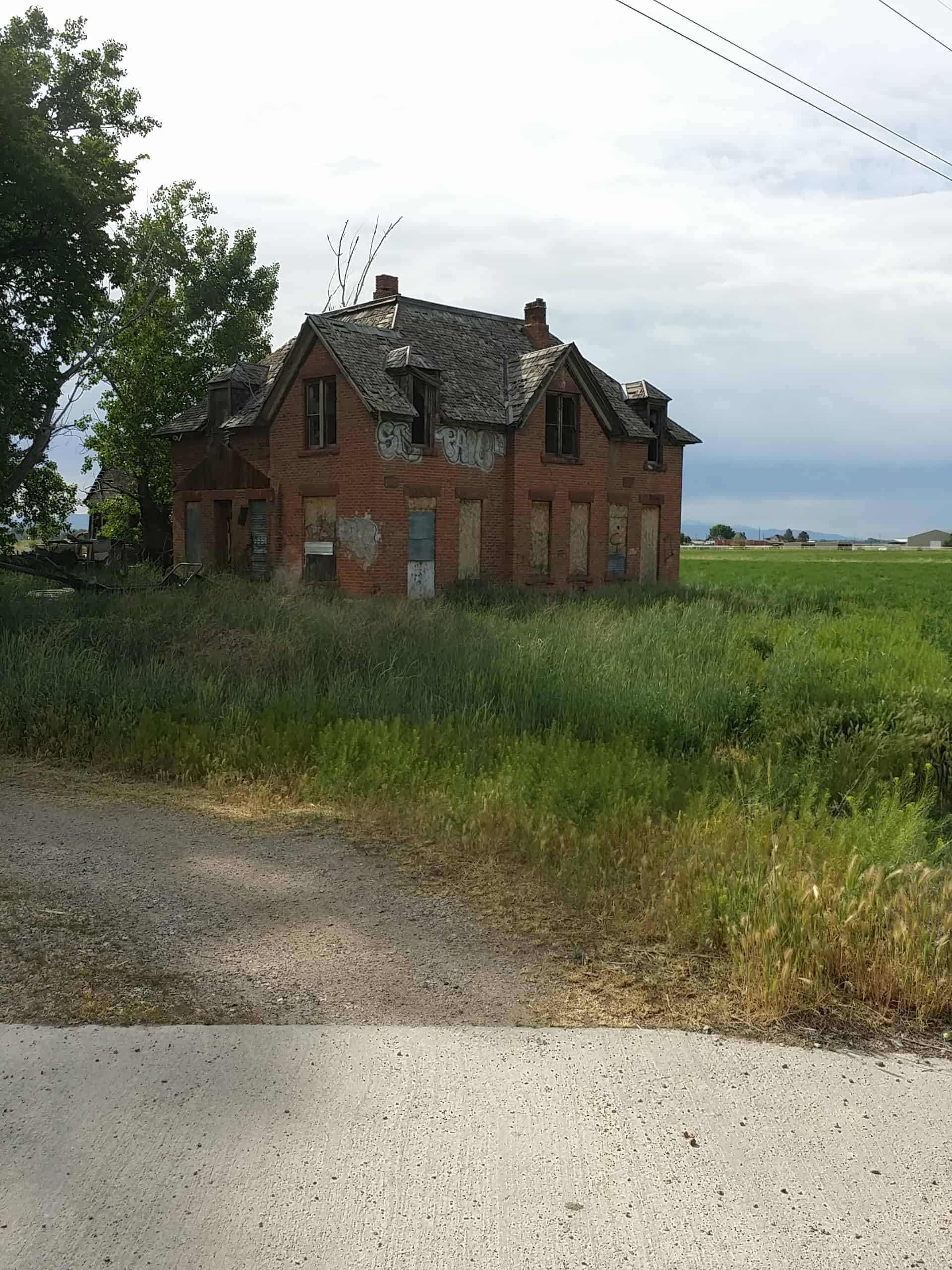
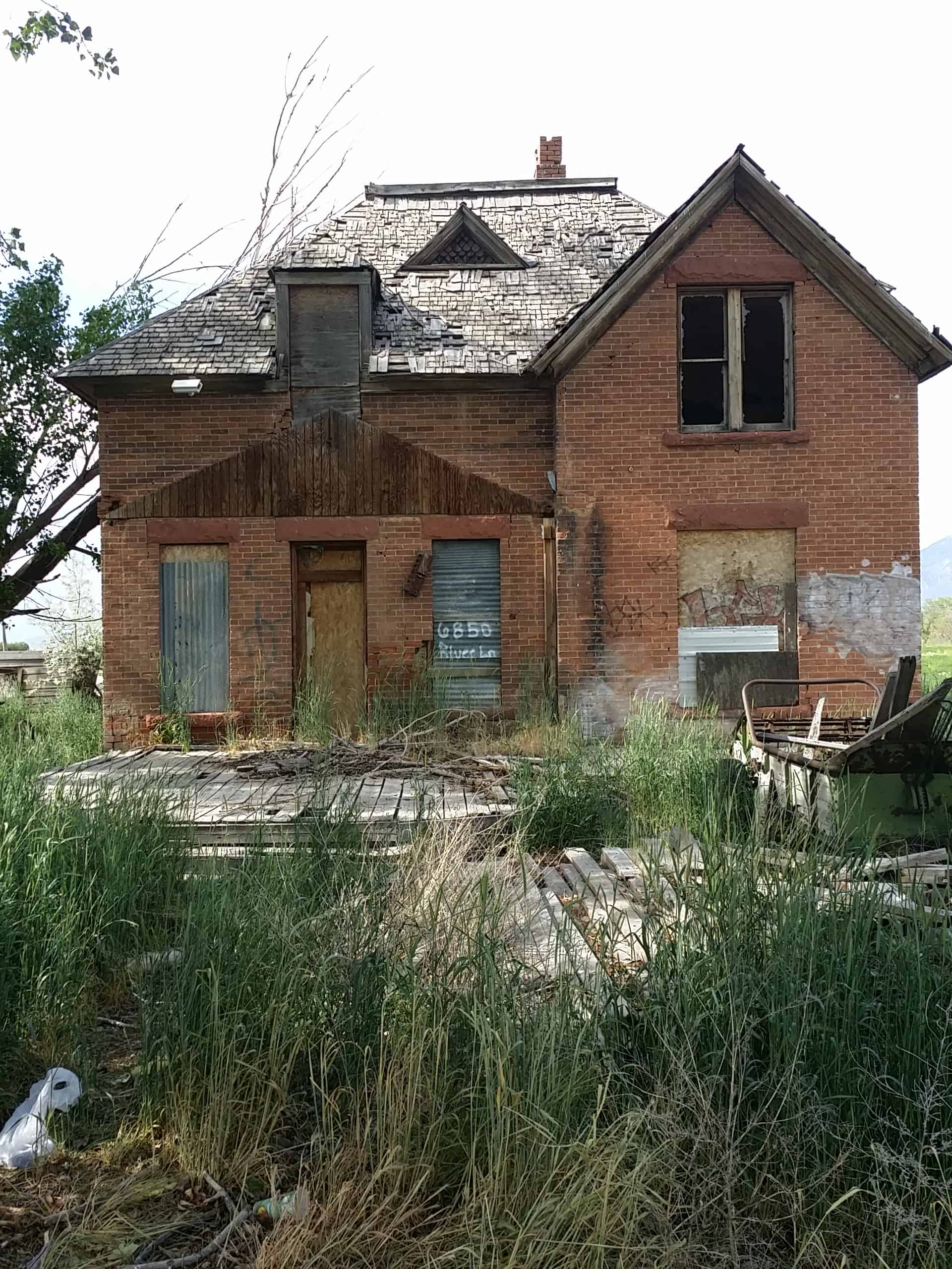
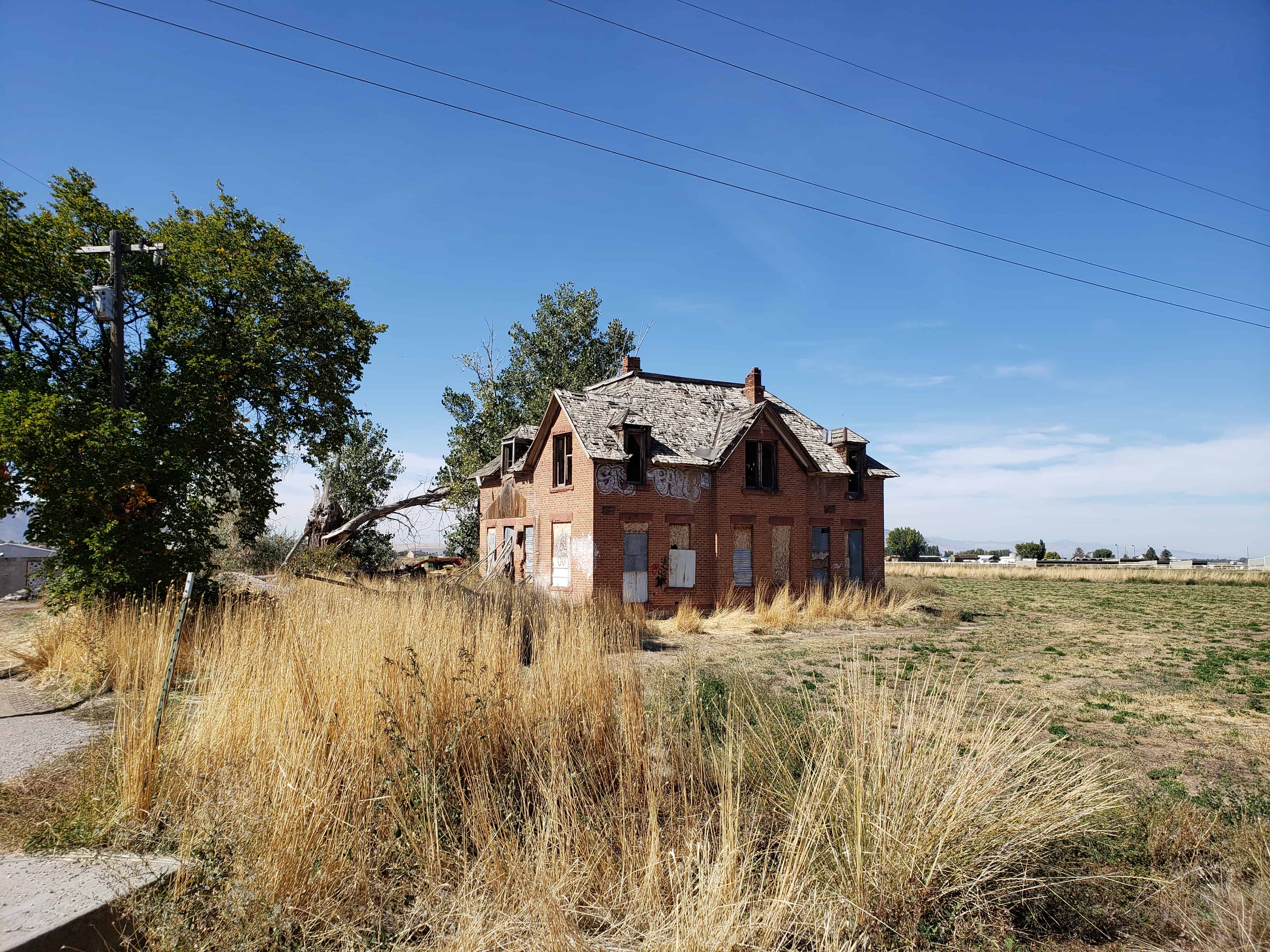
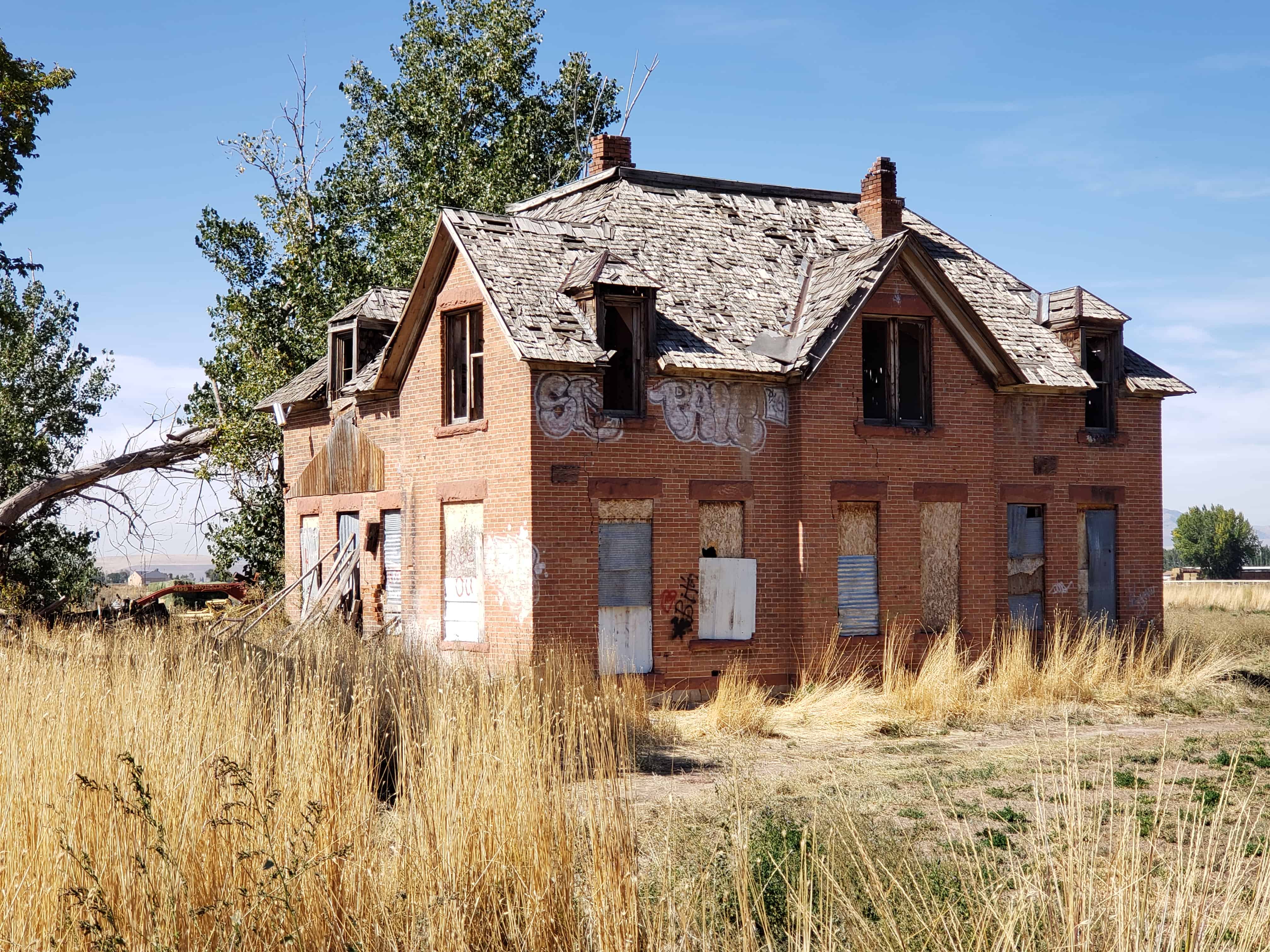
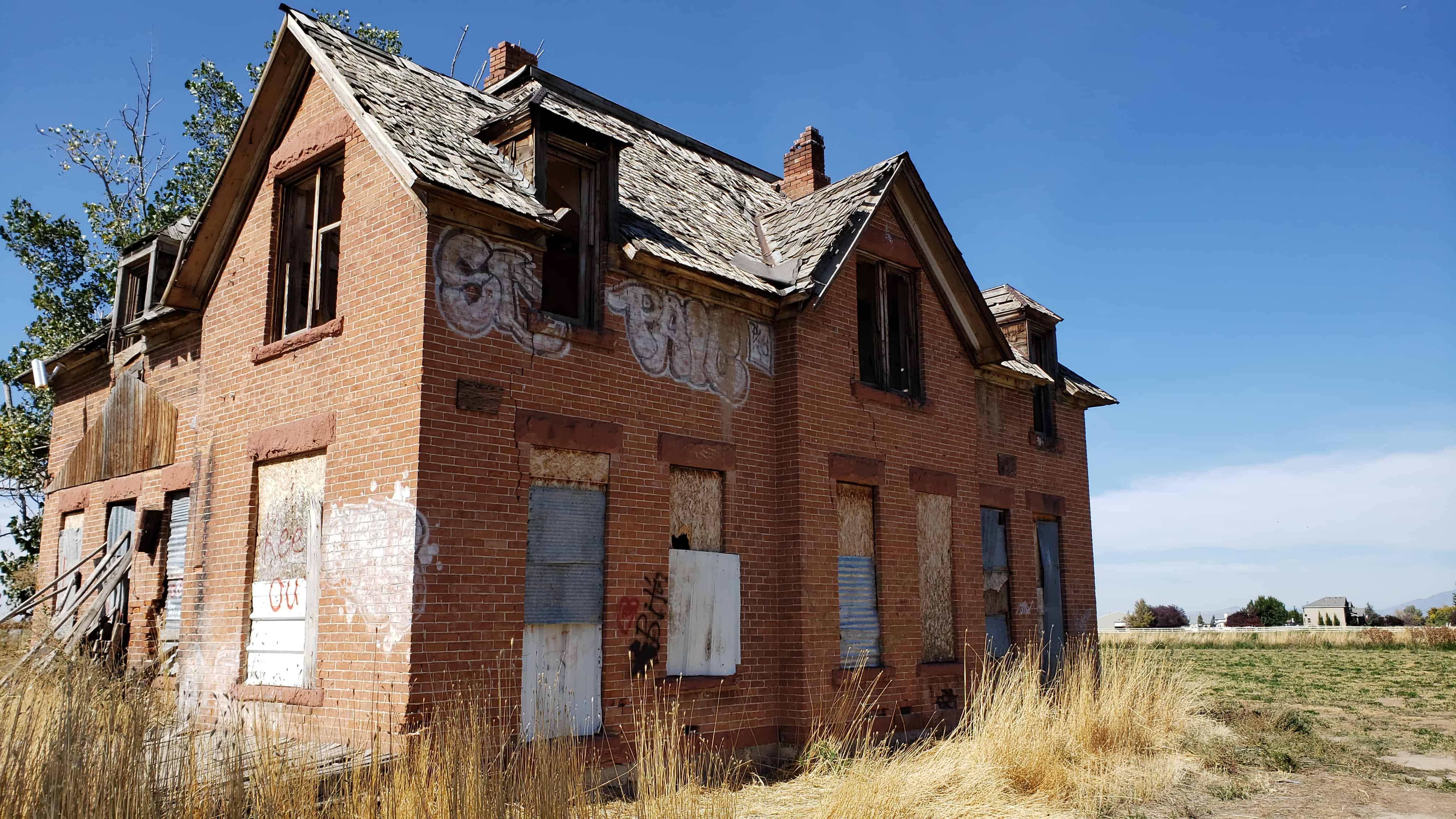
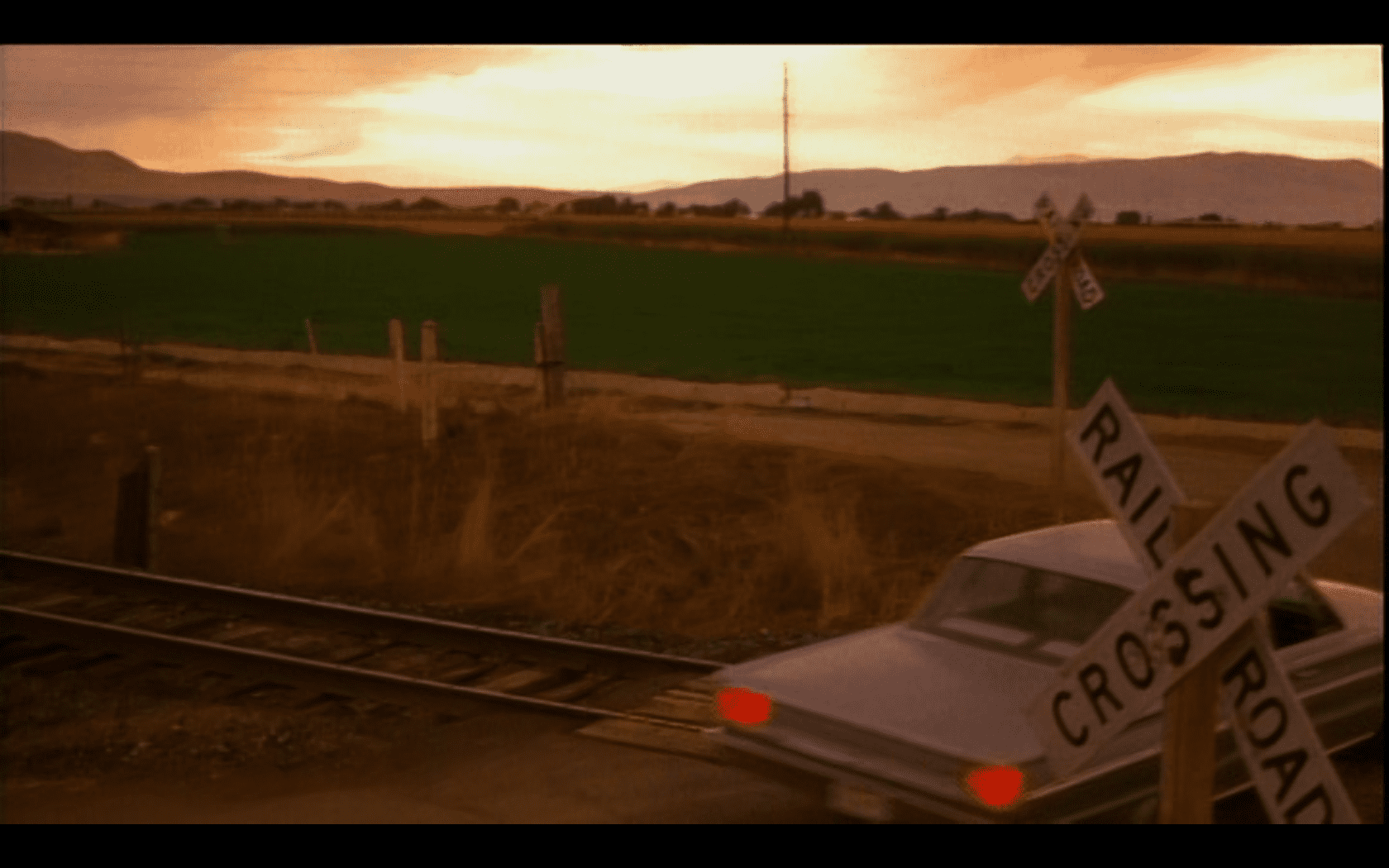
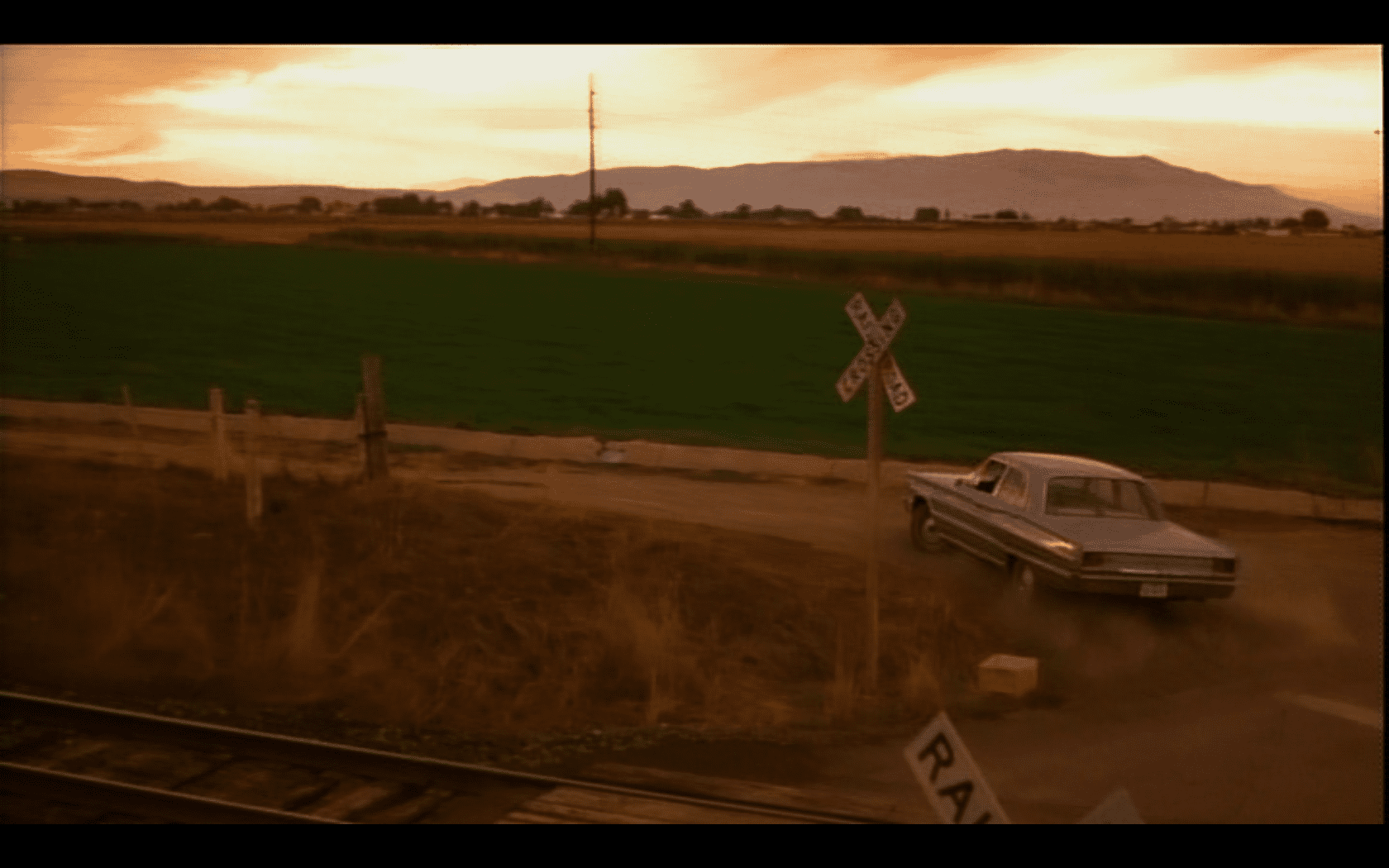
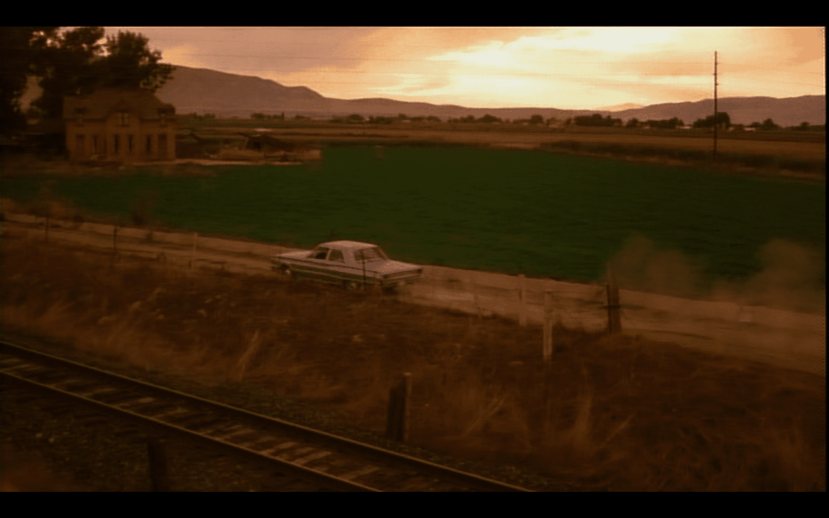
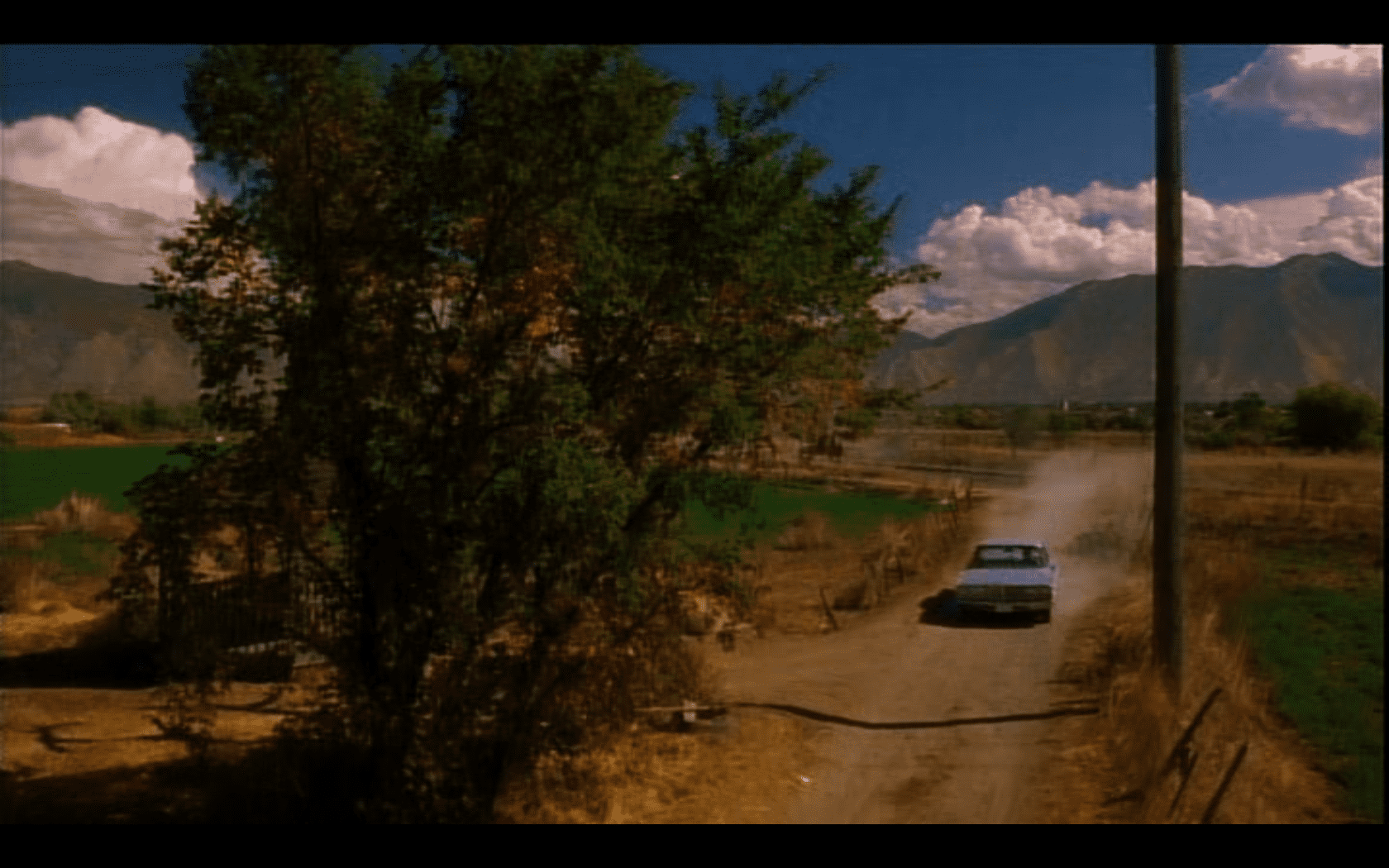
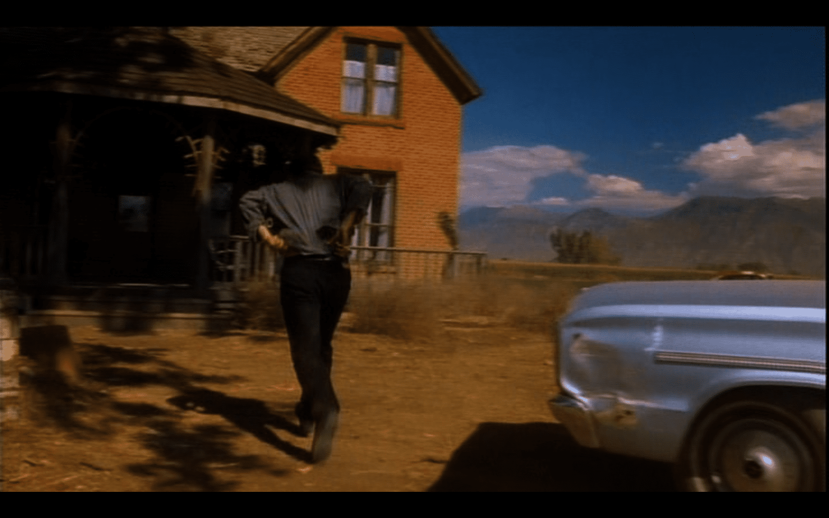
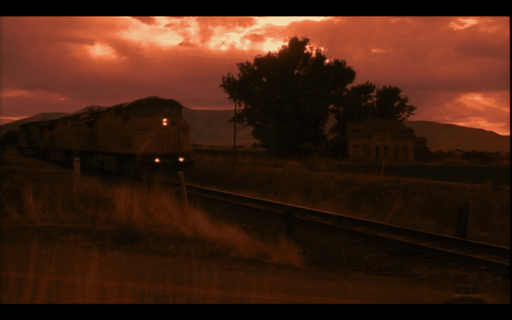
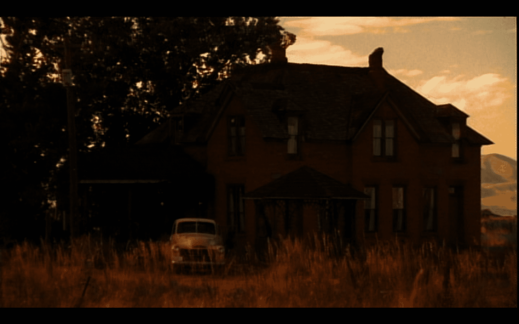
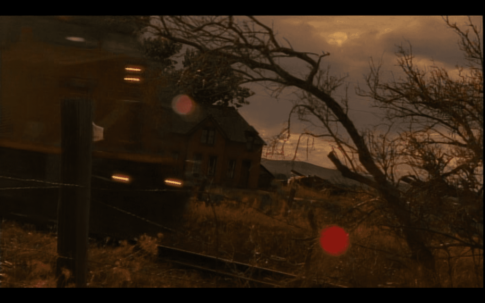
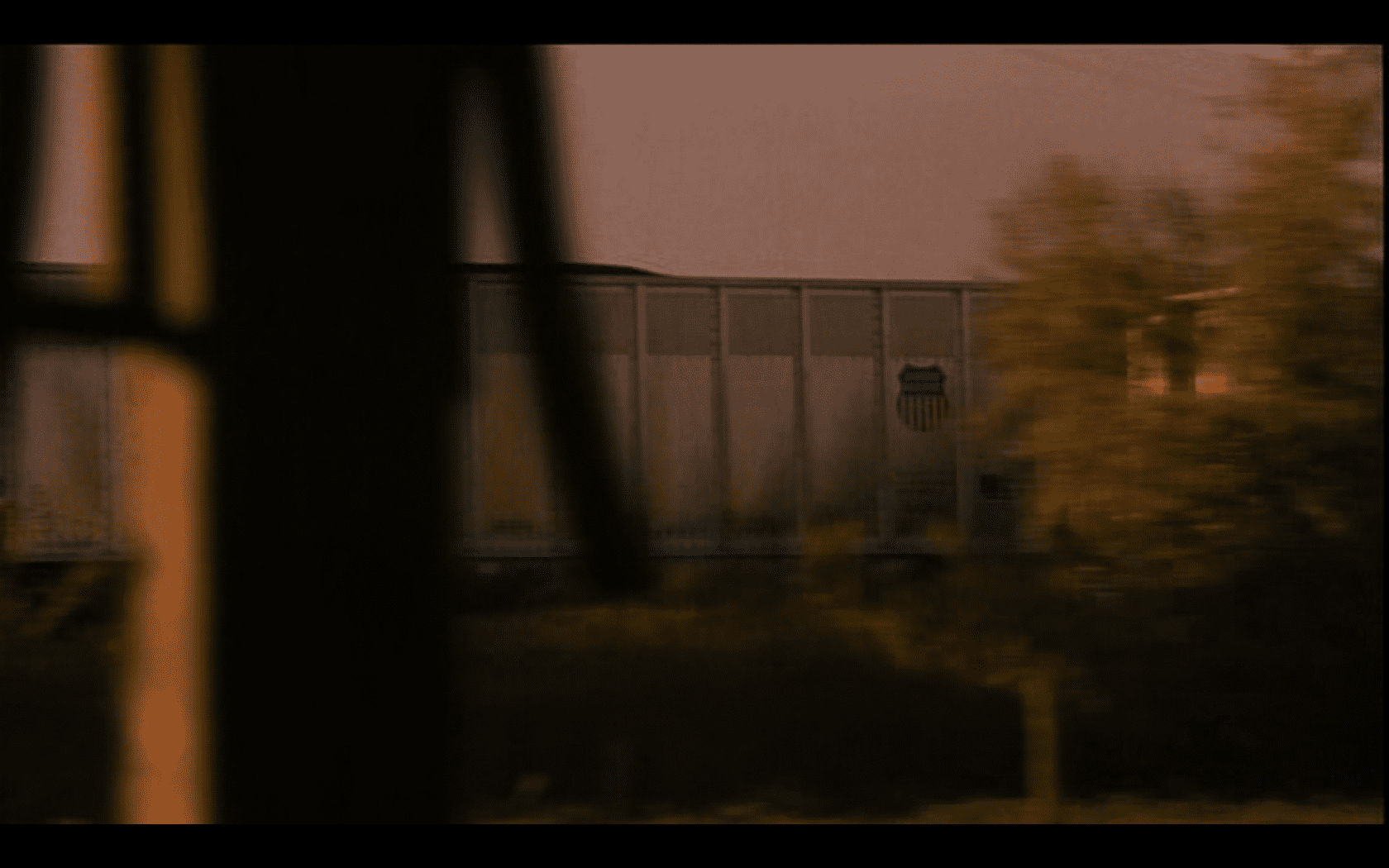
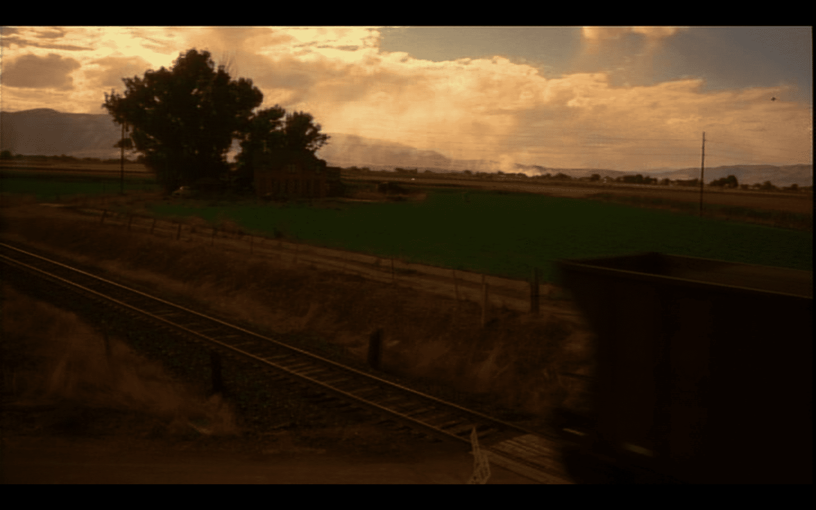
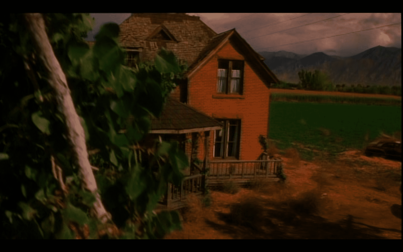
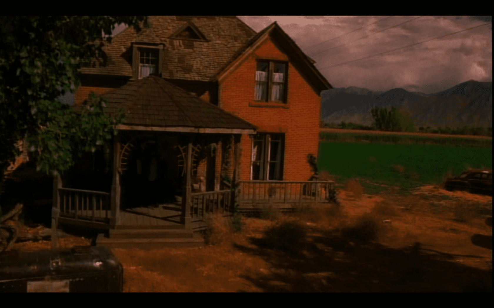
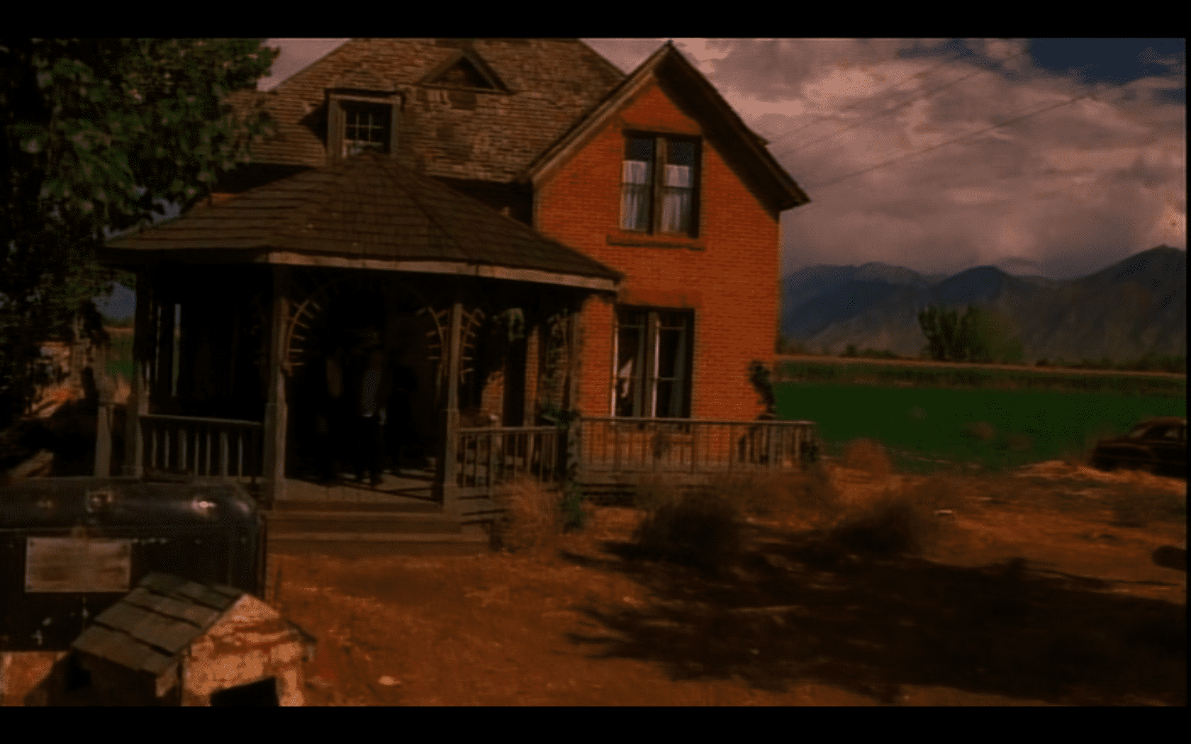
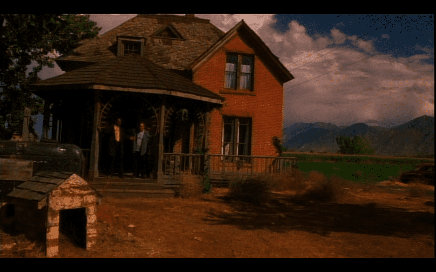
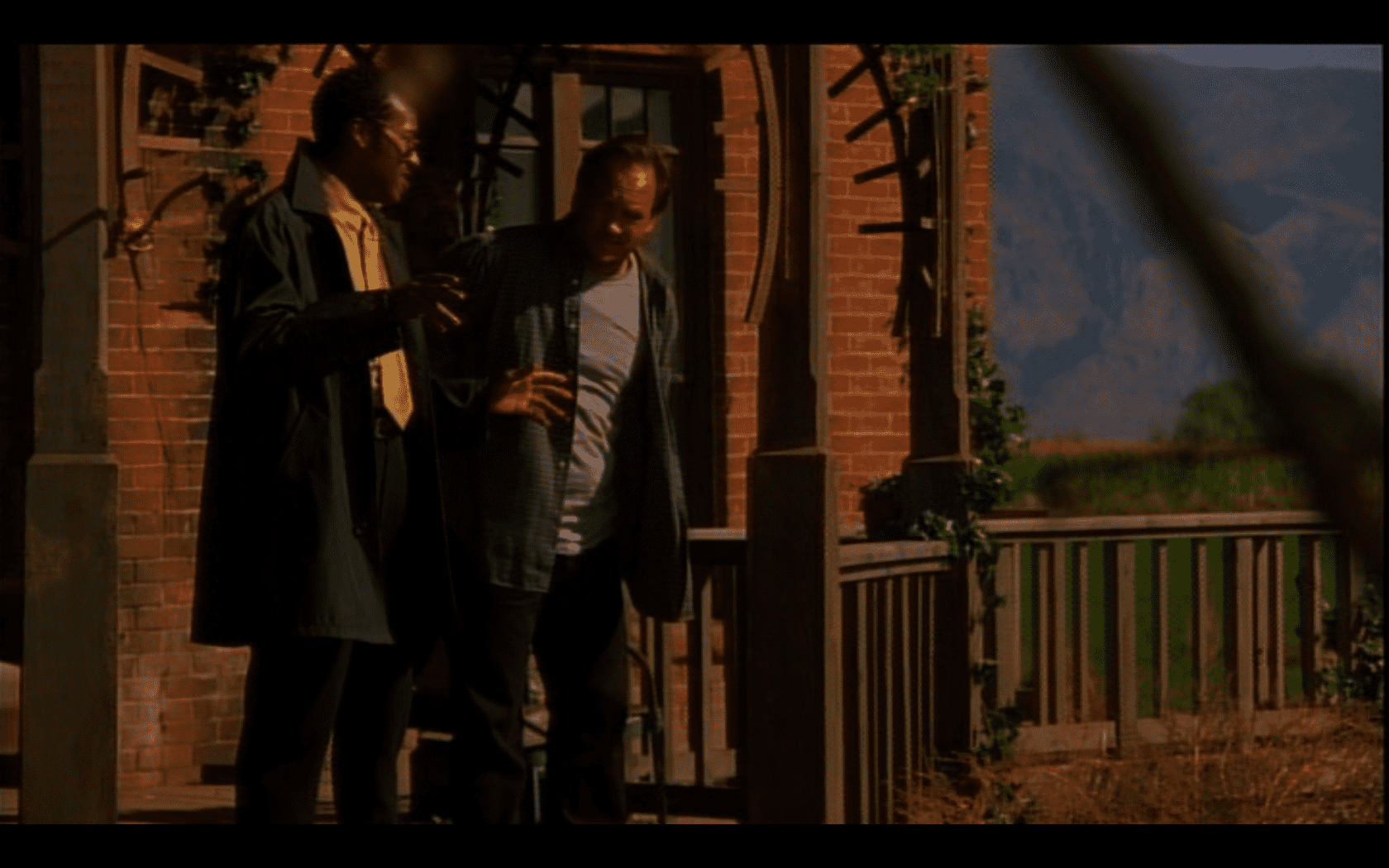
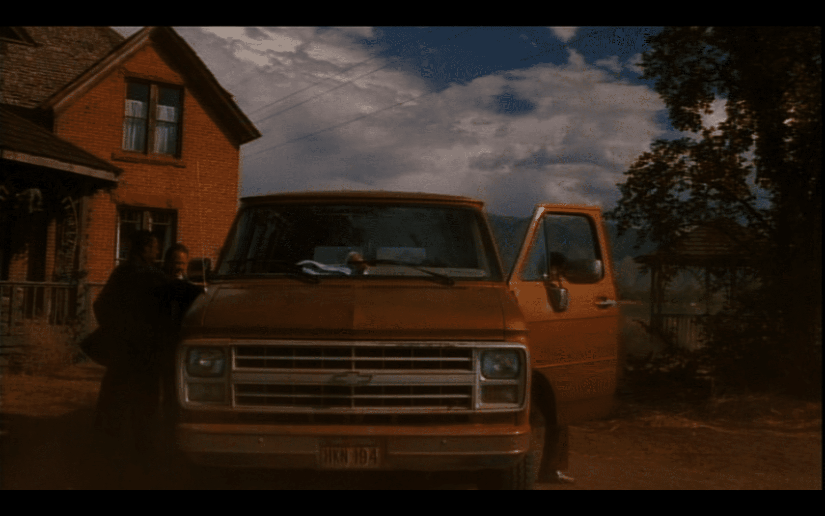
This is the house that was used for the movie Made Men (1999). It is the old Larsen/Moran house at 6850 South River Road in Benjamin / Lake Shore, Utah
Related Posts:
06 Friday Feb 2015
Posted in Uncategorized
Tags
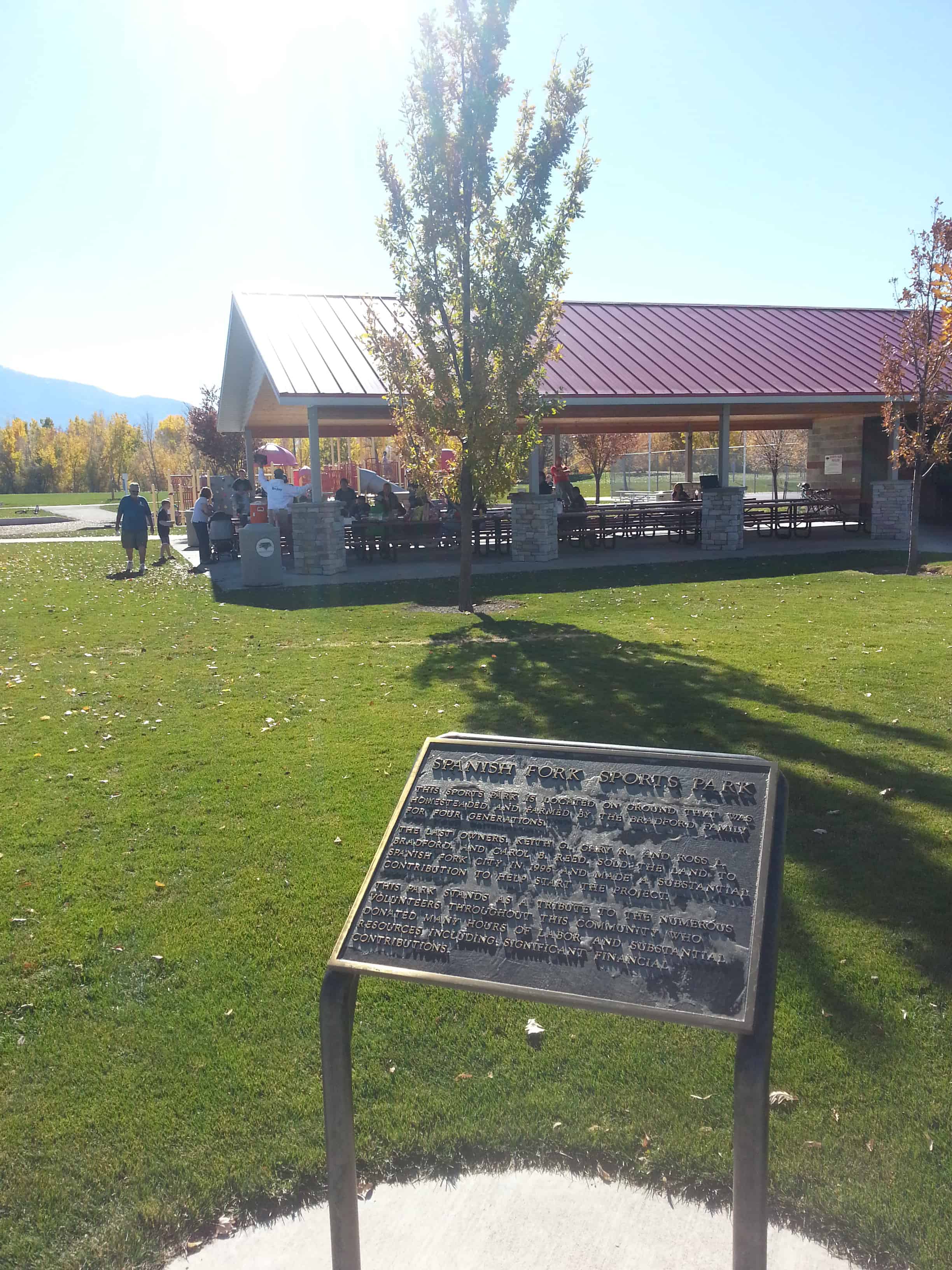
Spanish Fork Sports Park
This sports park is located on ground that was homesteaded and farmed by the Bradford family for four generations.
The last owners, Keith G., Gary R., and Ross L. Bradford, and Carol B. Reed, sold the land to Spanish Fork City in 1996 and made a substantial contribution to help start the project.
This park stands as a tribute to the numerous volunteers throughout this community who donated many hours of labor and substantial resources including significant financial contributions.


04 Wednesday Feb 2015
Posted in Uncategorized

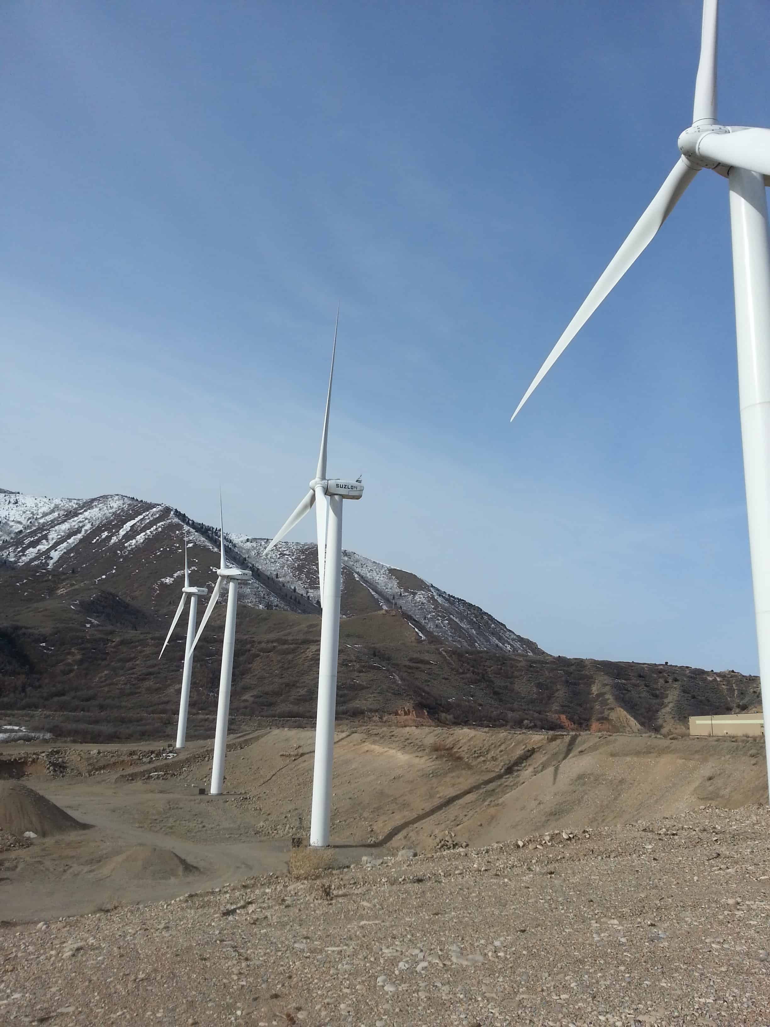
The huge windmills at the mouth of Spanish Fork Canyon are quite a sight and well known to travelers of the area and generate electricity as they rotate.
How is electricity generated?
The wind’s kinetic energy is converted into rotation by turbine rotor blades, which rotate at speeds between 17-24 rpm (revolutions per minute). The rotor hub is connected to the main shaft which leads into the gear box where a set of gears increases the rotational speed to approximately 120 times the rotor speed. The gear box output shaft is connected to the generator where, using magnetic fields, the rotation is converted into electricity. This electricity is transported down the tower through a set of large copper cables to the transformer. The transformer boosts the voltage to feed the wind generated electricity into the transmission grid and on to homes and businesses.
The 18.9 megawatt (MW) wind park uses canyon winds to generate approximately 55 million kilowatt hours of electricity each year, providing enough energy to meet the needs of about 6,000 households.
Electricity generated by this project is delivered to Rocky Mountain Power customers. The project also creates Renewable Energy Credits (RECs). PacifiCorp’s Blue Sky program participants were the first to purchase these credits. Wasatch Wind of Park City, Utah developed the project. Spanish Fork Wind Park is a subsidiary of Edison Mission Energy of Irvine, California, one of the nation’s largest owners of wind projects.
What is a Renewable Energy Credit?
A Renewable Energy Credit (REC), also known as a green tag, is a trad-able commodity denoting that 1 megawatt hour of electricity has been generated from a qualifying renewable source, such as wind, solar, geothermal, biomass or small hydro. These RECs are purchased by utilities, power marketers and retailers, corporations, governments, and individual power users who want to demonstrate a commitment to sustainability.
What is wind energy?
Wind energy is created by unequal heating of the earth by the sun. Temperature differences create air pressure differences, which cause air to move from high to low pressure. Air is nearly always in motion; wind parks like Spanish Fork take advantage of places where winds blow strongly and consistently.
Why are the Spanish Fork turbines usually working at night and not during the day?
The sun warms the ground during the day causing the air to warm and rise. The wind actually moves upslope, but weakens as it disperses through the canyon. In the evening, air near the ground cools quickly, especially in high mountains where the air is thin. The cool air rushes to the bottom of these canyons, and gravity accelerates it into a river of downslope flow (called nocturnal drainage flow.) This “river of wind” empties out of Spanish Fork Canyon throughout the night with maximum force at the wind park location. These nocturnal drainage winds typically taper off in the morning. This is why uou will see the turbines turning more in the evening, through the night and in the early morning, rather than during the day.
How large is the airshed?
The Spanish Fork airshed is 1,650 square miles (see map), the largest in the Wasatch Mountains. This its winds are stronger than all other canyons from Provo north to Brigham City, which is why is was chosen as the location for the wind park.


12 Friday Dec 2014
Posted in Uncategorized
I hiked up to the Escalante Cross again today, for more information check out this link.
I always enjoy that hike and just wanted to share the pictures this time.


I found the following online:
Recent accounts have reported sightings of a ”shadowy wolf-like figure” near the foothills of Mt. Loafer. Sightings have been reported in the same general area as the Escalante Cross. The 37 foot cross towers over the small town of Spanish Fork on Dominguez hill. The cross is said to be a landmark planted in honor of the Dominguez and Esclante expedition. However, this is not the original cross planted by Silvestre Vlez de Escalante and Francisco Atanasio Domnguez in 1776. It is said that a similar cross, like the one we see today, was originally planted by the two Franciscan Friars. Journal entries found, written by these Christian explorers, tell us the cross was planted to warn off an ”evil entity” which was said to have haunted the travelers in their sleep. Tormented by howling, and sightings of this ”creature”, the explorers left abruptly, without explanation. The cross we see today was planted in 1981, in place of the original. Little do most Spanish Fork residents know, the terrifying history behind the so-called ”Escalante Cross.”
11 Monday Aug 2014
Posted in Uncategorized


On July 29, 1776, Fathers Dominguez and Escalante with their party of 10 left Santa Fe, New Mexico, to find a new route to Monterey, California. After nearly 1000 miles they and their two native guides reached the mouth of Spanish Fork Canyon on Sept. 23, 1776. They climbed a hill and caught sight of the lake and spreading valley rimmed by Yuta Timpanogotzis Indian villages. They named it the Valley And Lake Of Our Lady Of Mercy Of The Timpanogotzis. They stayed in the valley four days meeting with the Indians and teaching them about Christianity and their salvation.
The hill the Padres climbed to see the valley was dedicated as Dominguez Hill 200 years later in 1976. A 37 Ft. high cross was erected on that hill and dedicated In 1981. The hill and cross can be seen by looking in a S-SW direction or by using the viewer. The cross is on private property and is not accessible.
There is a historic Marker and some pipes set to look through and see the cross set up in 1981.


09 Saturday Aug 2014
Posted in Uncategorized
Tags
historic, Lake Shore, Palmyra, spanish fork, utah, utah county

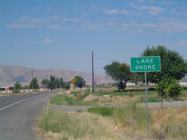
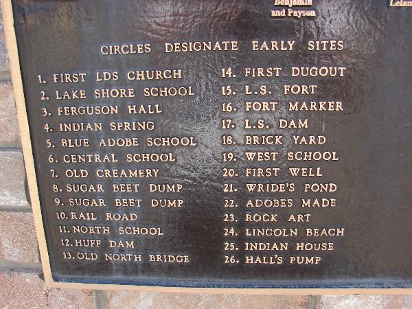
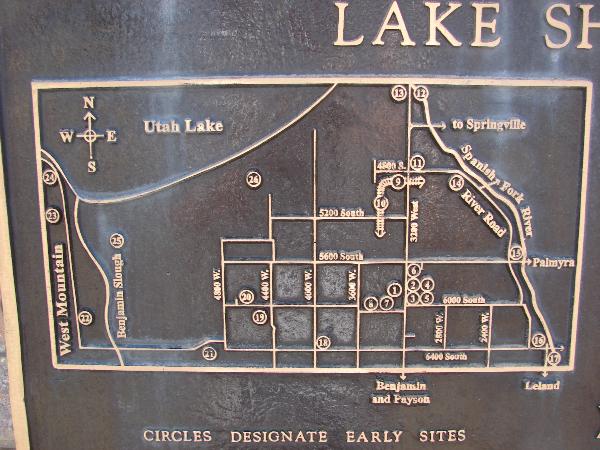
Lake Shore was part of the Spanish Fork Indian Farm from 1854 to 1865. A few settlers were here in the early 1860s and many came from 1870 to 1900 who have descendants living here today.
In 1880 the Spanish Fork West Branch was formed with about 25 families. On June 12, 1886 a ward was organized and our town was named Lake Shore. The boundaries are West Mountain, Utah Lake, Spanish Fork River and 1/4 mile South of 6400 South. The first church dedicated in 1892, was where the chapel is today.
Related:
In 1881 the 60 owners of irrigation water were farmers who raised various crops, beef and dairy cattle. Wild grass was harvested on the many pastures.
In 1881 the first public building was the Blue Adobe School, three more buildings and also Furguson Hall were used as schools. The Lake Shore School was built on this spot and used for students up to 8th grade from 1922 to 1987. The original bell and sign from the Lake Shore School are on this monument.
In 1930 the population was 464. July 13, 1980 Lake Shore had 670 people and was divided into two wards. June 17, 2000 population was 861 when this monument was dedicated.

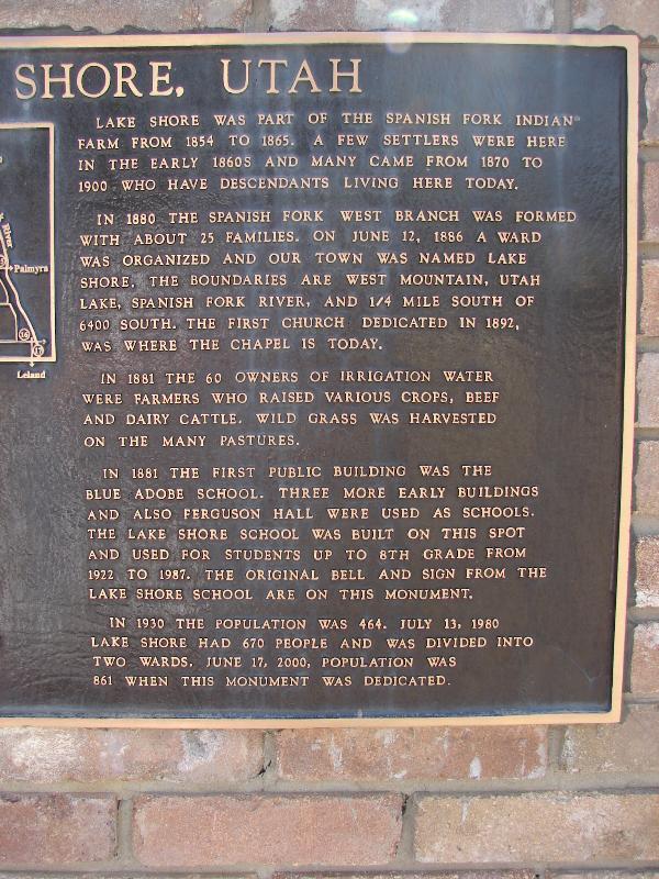
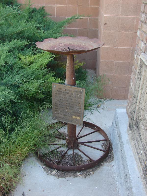
Next to the monument with the bell is a commemorative drinking fountain for the first artesian well driven in this part of the Country, the rig was fashioned by Joseph Francis and with the help of his brother, Samuel, the well was driven in 1877 on the Samuel Francis homestead one and three fourths miles west of this spot.


02 Wednesday Jul 2014
Posted in Uncategorized
Tags
DUP, Forts, historic, Palmyra, spanish fork, SUP, utah, utah county

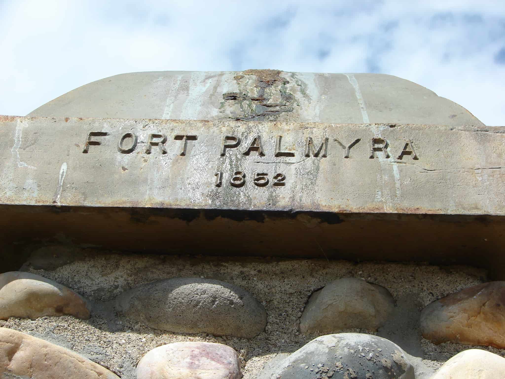
This Monument marks the South-West corner of Fort Palmyra. This Fort was built by the settlers for protection. Palmyra was selected in 1852 as a suitable place to build a city by Apostle Geo. A. Smith. The first home was built in August of that year. W.W. Willis was its first Mayor. The first bishop was Stephen Markam. Silas Hillman was the first school teacher. Upon advice from President Brigham Young, the settlers of Palmyra moved to Spanish Fork, in 1856.
This marker was placed in 1933 and the D.U.P. didn’t start numbering their historic markers until 1934 so it is not in the numbered list.
Related Posts:


01 Tuesday Jul 2014
Posted in Uncategorized
Tags
Back in 2006/2007 I was searching out the historic markers placed by the Daughters of Utah Pioneers, #83 (see information here) was at the Pioneer Heritage Cemetery in Spanish Fork, Utah.
Here are a few photos I took back then:


As you can see there wasn’t much to look at, a monument and an arch and a weed-filled field.
Well they have since really made it quite nice, plaques with stories, a nice lawn, headstones in rows. It’s a great place. Here are some more photos that I took the other day when I stopped by with the family.

Settlers to this area built some of their first homes directly below this pioneer cemetery. During warn weather they loved in tents or four foot wide wagon boxes. Many settlers dug into the ground or hillside for shelter during the winter. There were once so many dugouts built in the area that Spanish Fork was known as “Gopher Town.”
One family who came to this area was quite astonished to see the women coming out of the “holes,” along the hillside like gophers. During a very wet spring, one of the dugouts started to leak. More dirt was placed on the top of the roof. This extra weight caused the support beam of the family’s root to break killing the father. He is buried here not far from his home.


Early settlers often faced multiple deaths and burials in one family. On May 5th, 1851, John and Elizabeth Hancock Redd’s 17 year old daughter, Mary Catherine Redd, suddenly because ill and died within hours. She was buried on this bluff overlooking the River Bottoms. John and Elizabeth suffered another loss as their 15 year old son, John Holt Redd, was thrown from his horse on November 15, 1853. His heartsick mother died three days later. Then on June 15, 1858 John Hardison Redd died after being kicked by a horse. All four family members were buried in the Redd Cemetery, now known as the Heritage Pioneer Cemetery.
This Cemetery has also been called The Old Palmyra Graveyard, the East Bench Graveyard, and The Upper Cemetery.


In the spring of 1854, Mary Ann Boice took a Native American child, Alpharetta, into her home. Alpharetta was brought to her by the child’s father after his wife died in childbirth. She took care of the infant, along with her own infant son Alfred. Alpharetta soon died of measles and was buried here. Later, Mary Ann and her husband John were called to settle Kamas. While traveling to their new home, their wagon was surrounded by a band of angry Native Americans covered with war paint. A brave, Alpharetta’s father, recognized Mary Ann, got down from his horse and convinced the cheif to let them go in peace.


Helen Whytock McKell was born in Scotland. She married there, and her husband died leaving her with a son to raise. She then married Robert McKell and together with her son emigrated to Utah.
Brigham Young called Robert and Helen to enter into the practice of polygamy. Within days of the polygamist marriage, Helen became ill and died. Robert McKell’s journal said that she was “buried in the old cemetery on the brow of the bench land near the Vincent farm in the River Bottoms.”
When Robert died later, the family brought Helen’s broken headstone to the new cemetery and placed it beside Robert’s.

Early settlers in Spanish Fork took care of their family burials with the aid of friends and volunteers. The winters were severe and often the ground was frozen hard. Those assisting with burials had to clear snow and sagebrush, mark off the grave, then make and tend a fire that would burn all night to soften the ground.
The first burial in the Pioneer Cemetery was Mary Catherine Redd in 1851. Some of the people buried here were later moved to the Spanish Fork City Cemetery. In 1866 a sexton was appointed to start keeping records of burials which were already being made in the City Cemetery.


(This is DUP Marker #557, click here for more info)


01 Tuesday Jul 2014
Posted in Uncategorized
Tags
Payson, Salem, spanish fork, utah, utah county, Woodland Hills
Woodland Hills is a city in Utah County, The population was 1,344 at the 2010 census.
As of the 2000 census, Woodland Hills had the highest median income in the state of Utah.