• About JacobBarlow.com
  • Cemeteries in Utah
  • D.U.P. Markers
  • Doors
  • Exploring Utah Email List
  • Geocaching
  • Historic Marker Map
  • Links
  • Movie/TV Show Filming Locations
  • Oldest in Utah
  • Other Travels
  • Photos Then and Now
  • S.U.P. Markers
  • U.P.T.L.A. Markers
  • Utah Cities and Places.
  • Utah Homes for Sale
  • Utah Treasure Hunt

JacobBarlow.com

~ Exploring with Jacob Barlow

JacobBarlow.com

Tag Archives: utah

Kanosh Tithing Office

21 Friday Feb 2020

Posted by Jacob Barlow in Uncategorized

≈ Leave a comment

Tags

DUP, Kanosh, Millard County, museums, NRHP, Tithing Offices, utah

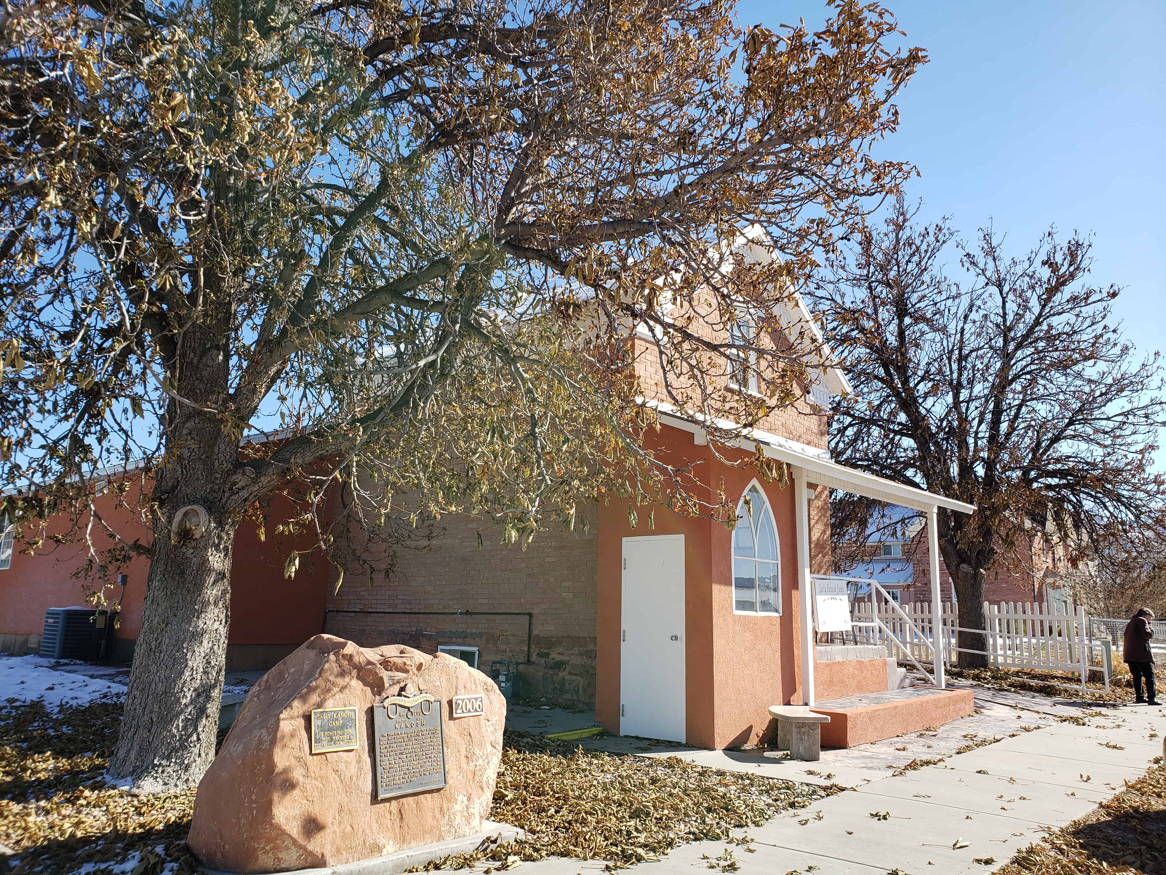
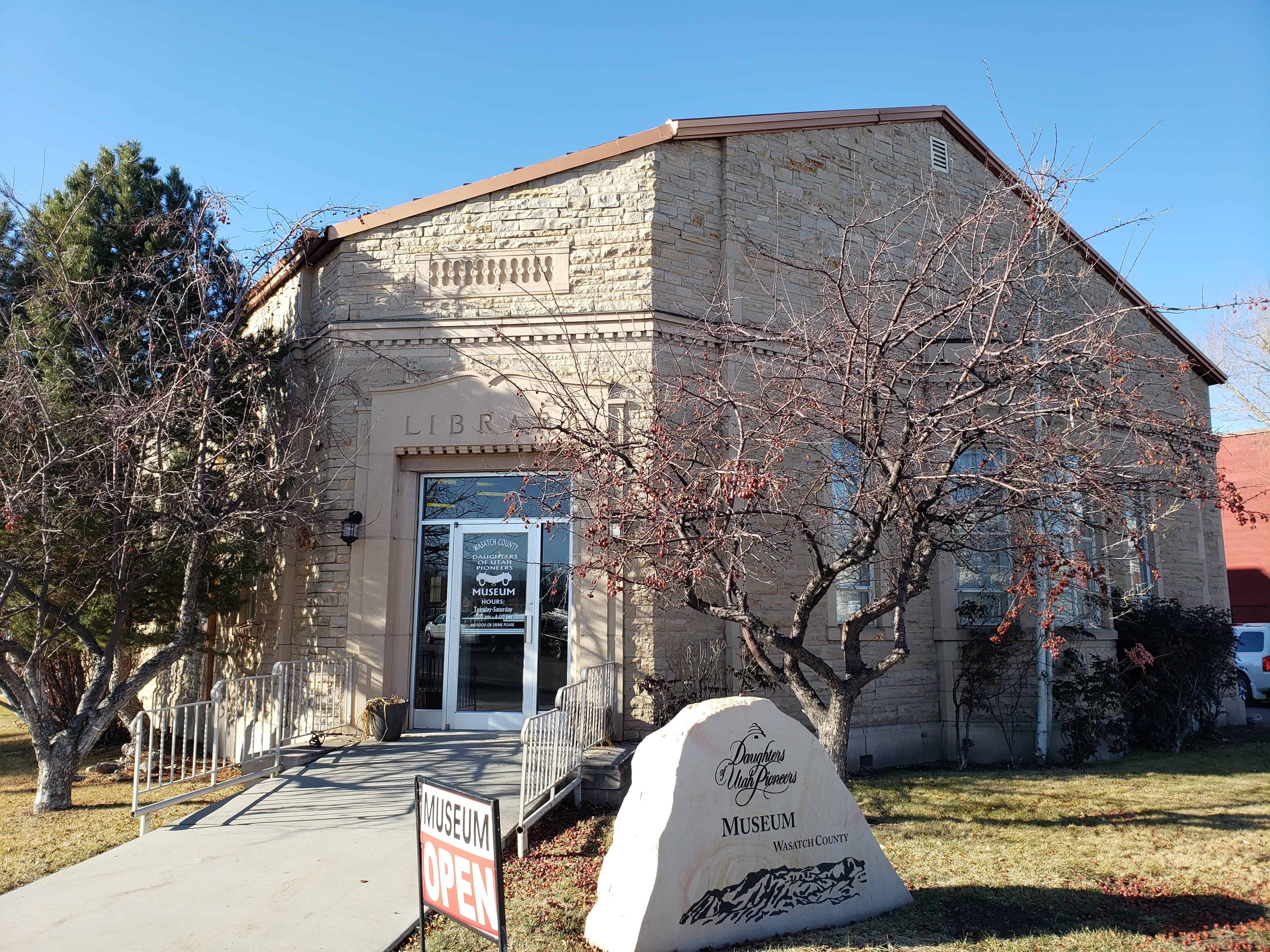
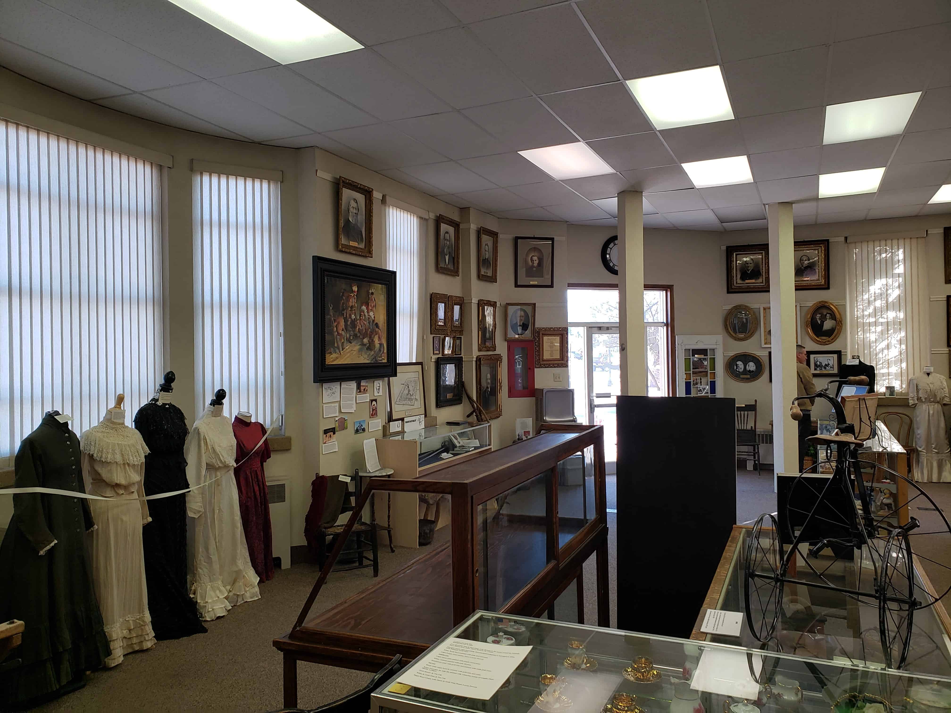
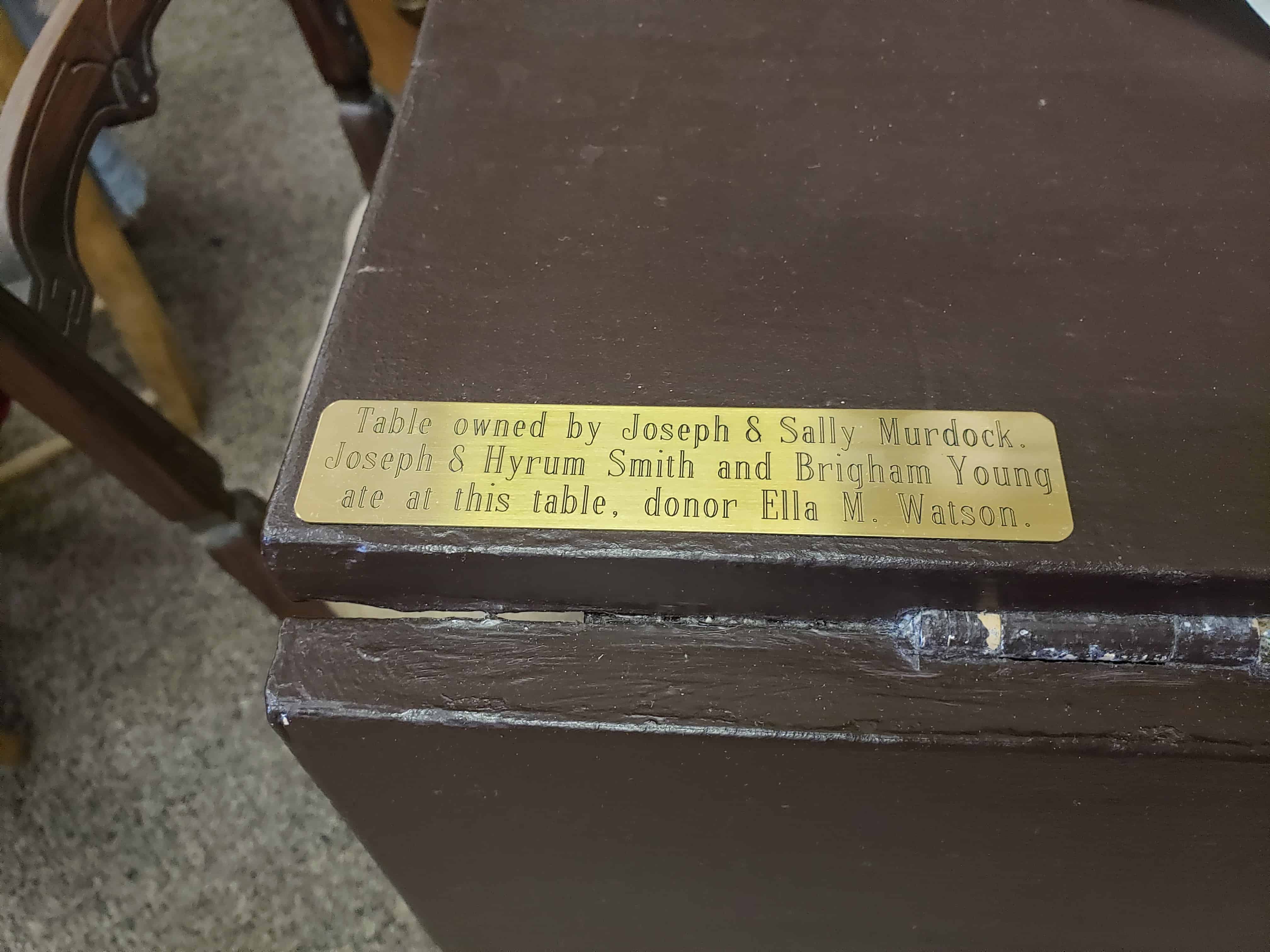
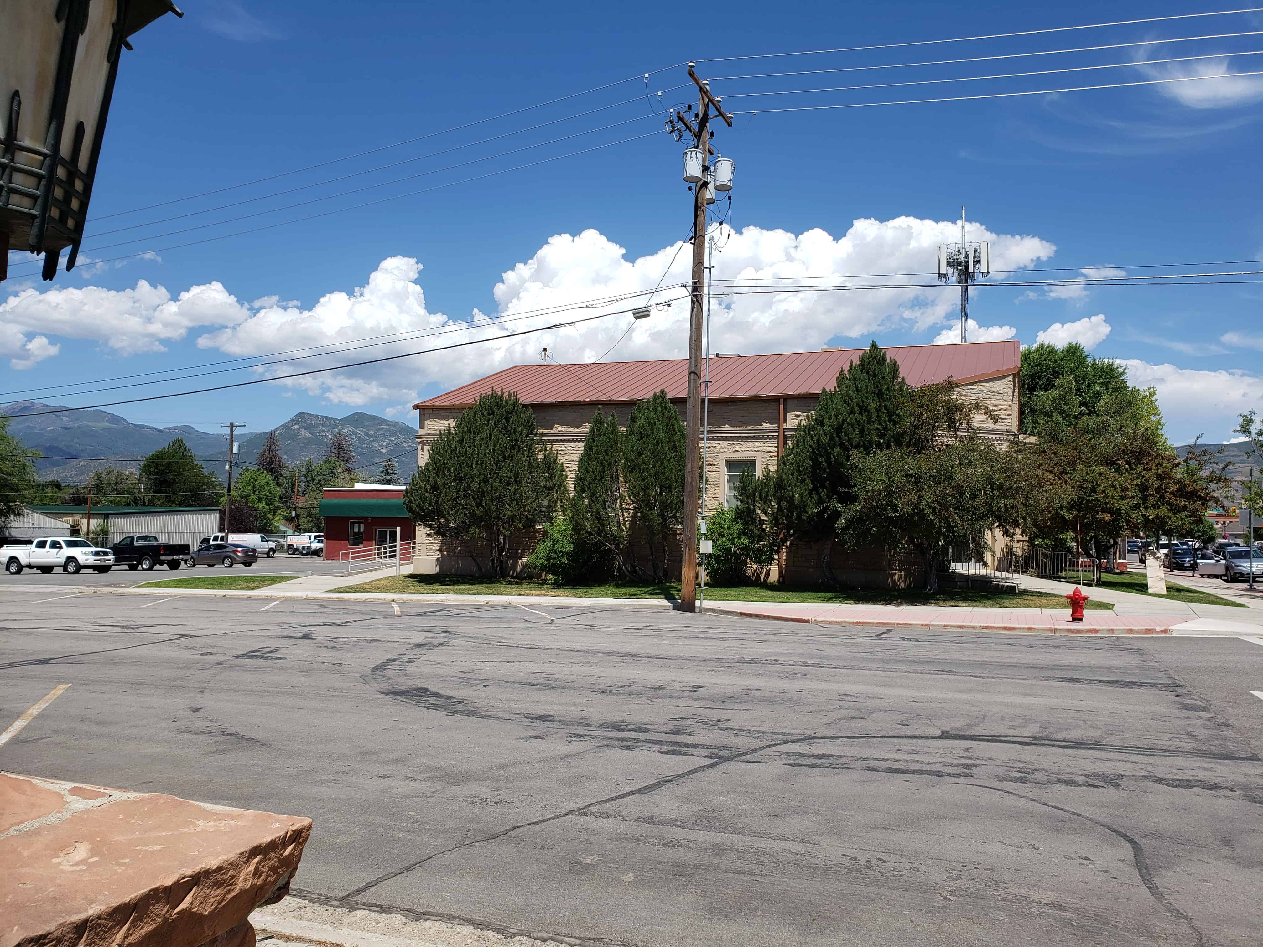
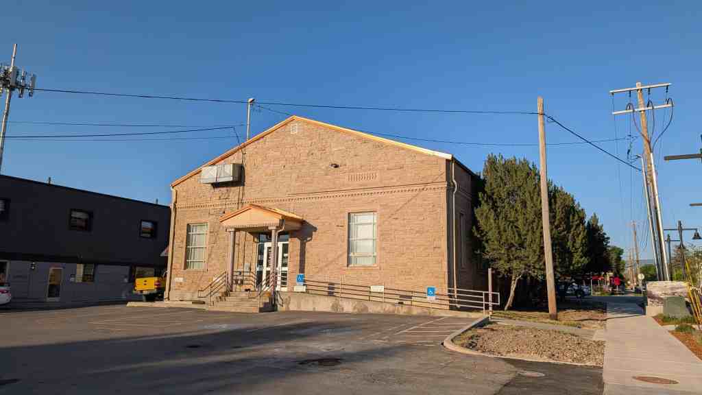
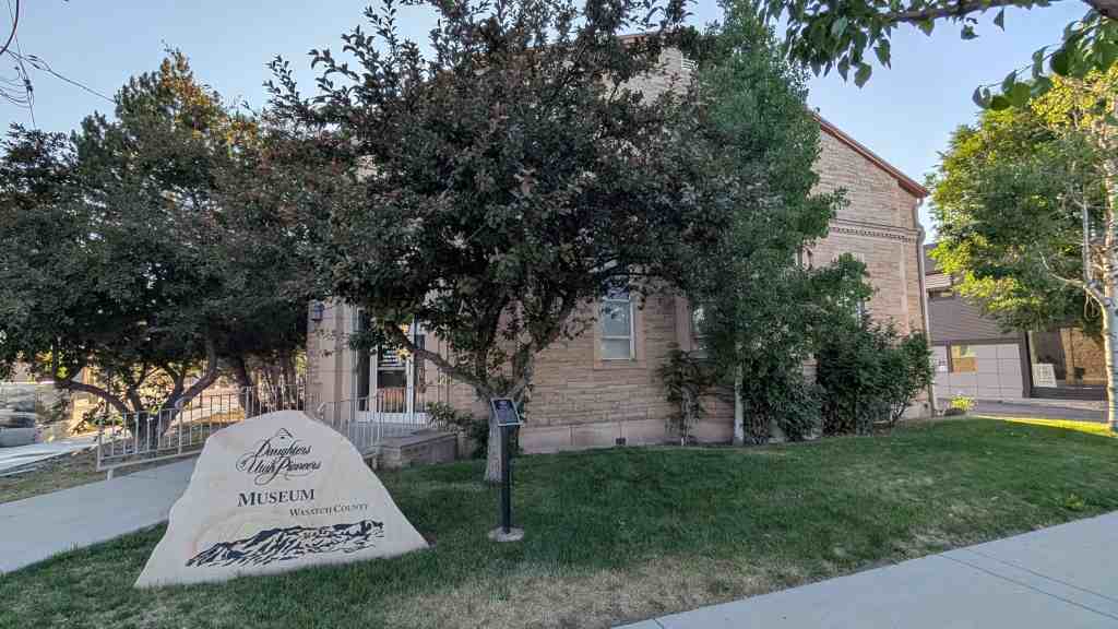
The Kanosh Tithing Office, now the Sally Kanosh Camp D.U.P. Museum.

40 North Main Street in Kanosh, Utah

Built in 1870, the Kanosh Tithing Office is historically significant as one of 28 well preserved tithing buildings in Utah that were part of the successful tithing system of The Church of Jesus Christ of Latter-day Saints (LDS or Mormon church) between the 1850s and about 1910. Tithing lots, which usually included an office and several auxiliary structures, were facilities for collecting, storing, and distributing the farm products that were donated as tithing by church members in the cash-poor agricultural communities throughout the state. Tithing offices were a vital part of almost every Mormon community, serving as local centers of trade, welfare assistance, and economic activity. They were also important as the basic units of the church-wide tithing network that was centered in Salt Lake City. In addition, the Kanosh Tithing Office is architecturally significant as one of eight extant examples of Utah’s tithing offices which were designed in the Greek Revival style. It is one of seven of those buildings which is a temple-form building. Of those seven temple-form buildings, it is one of the three best preserved examples of the type. The other two examples include the tithing offices at Escalante and Paradise. The temple-form building originated in the Greek Revival period of American building,’ and typically has its short end to the street and a pedimented gable end in imitation of monumental classical buildings. The temple-form building was the preferred building type for early religious buildings in Utah, having been brought to the area by members of The Church of Jesus Christ of Latter-day Saints after 1847. 3 Very few unaltered, well preserved examples of this building type are presently extant in Utah.

Under the direction of Culbert King, bishop of the Kanosh Ward, the Kanosh Tithing Office was built in 1870 to serve as the center for the collection and distribution of “in kind” tithing contributions from members of the Kanosh Ward of the LDS church. Typical of most other Utah towns during the nineteenth and early twentieth centuries, Kanosh was a cash-poor agricultural community, therefore tithing contributions were usually farm products, such as crops, dairy products, and livestock. By at least the 1920s, however, cash was much more plentiful and was used for tithing donations instead of the “in kind” commodities. Since the building was no longer needed for its original use, it was either left vacant or used as a meeting place by auxiliary organizations of the church for a number of years. Even when serving as a tithing office, the building was used as the first meeting place of the ward’s Mutual Improvement Association, the organization for the teenagers.

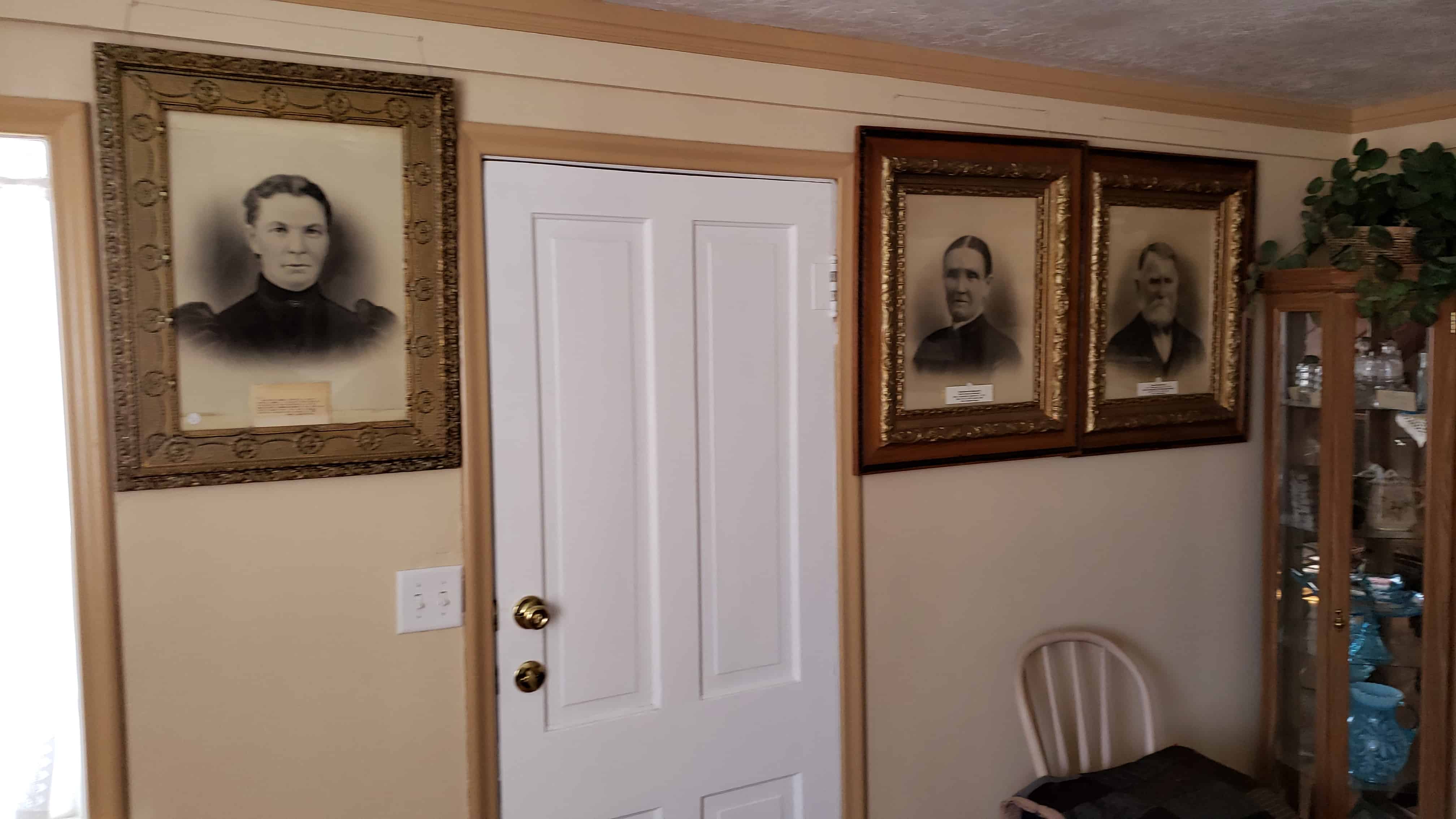
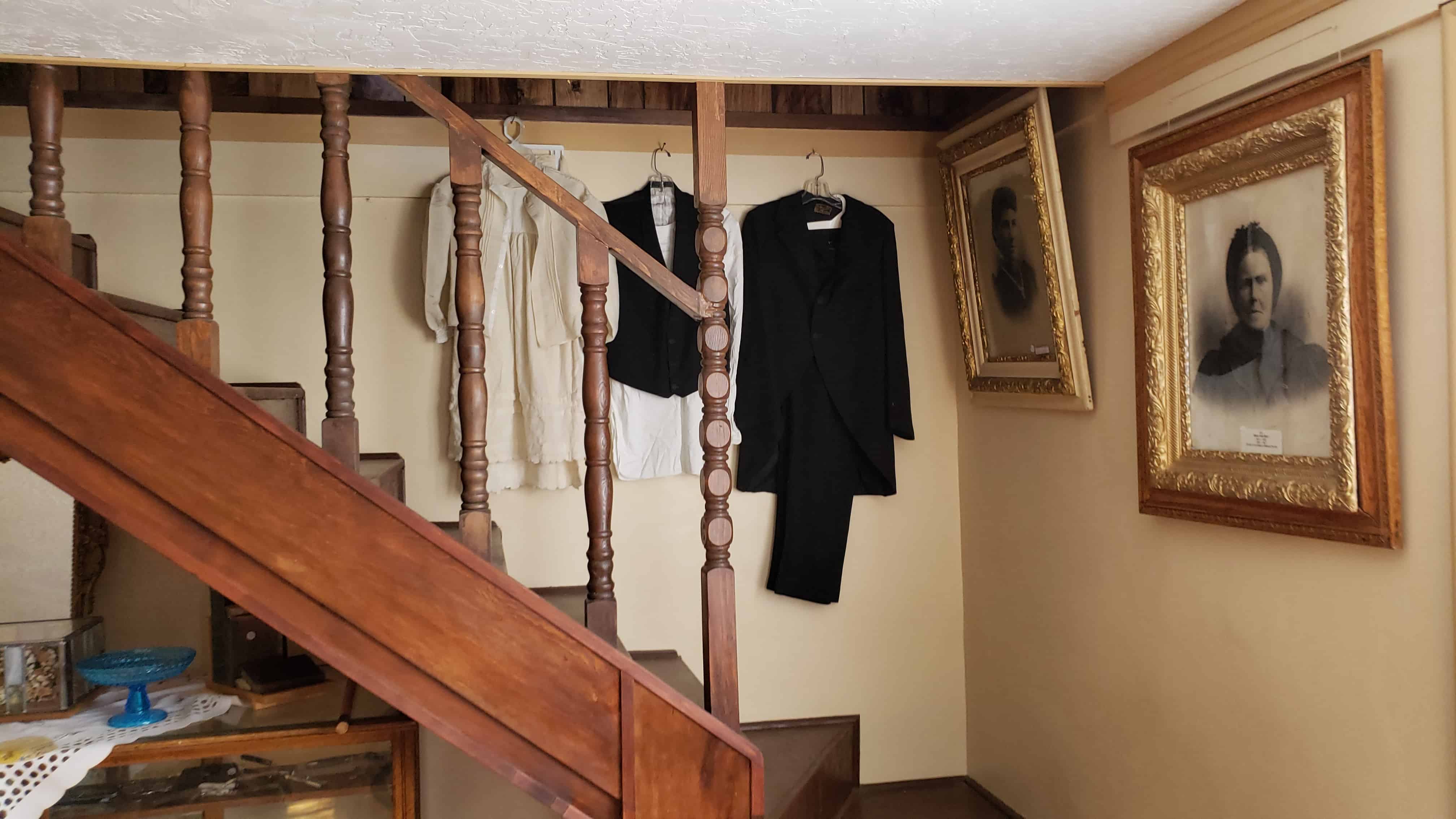
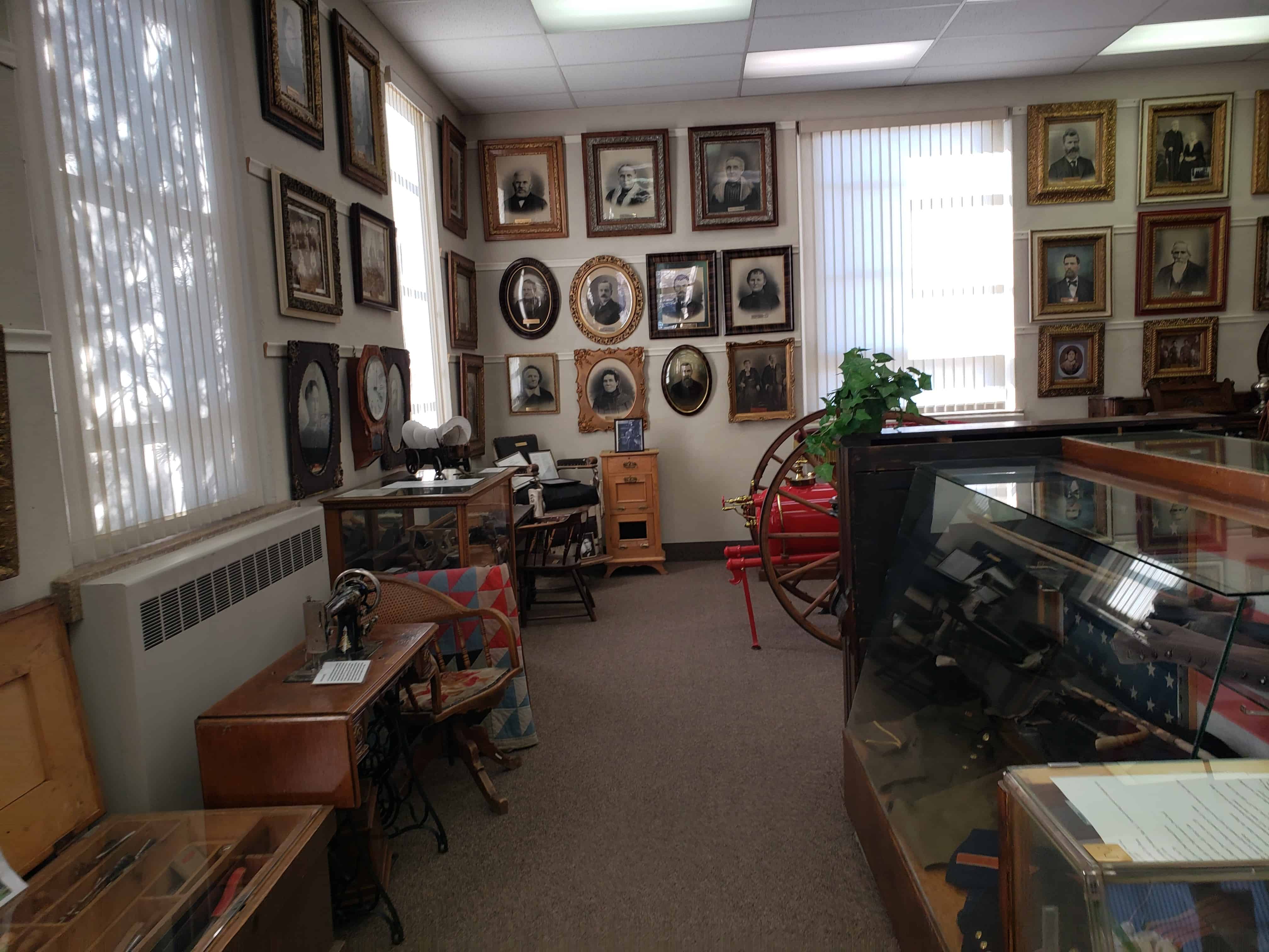
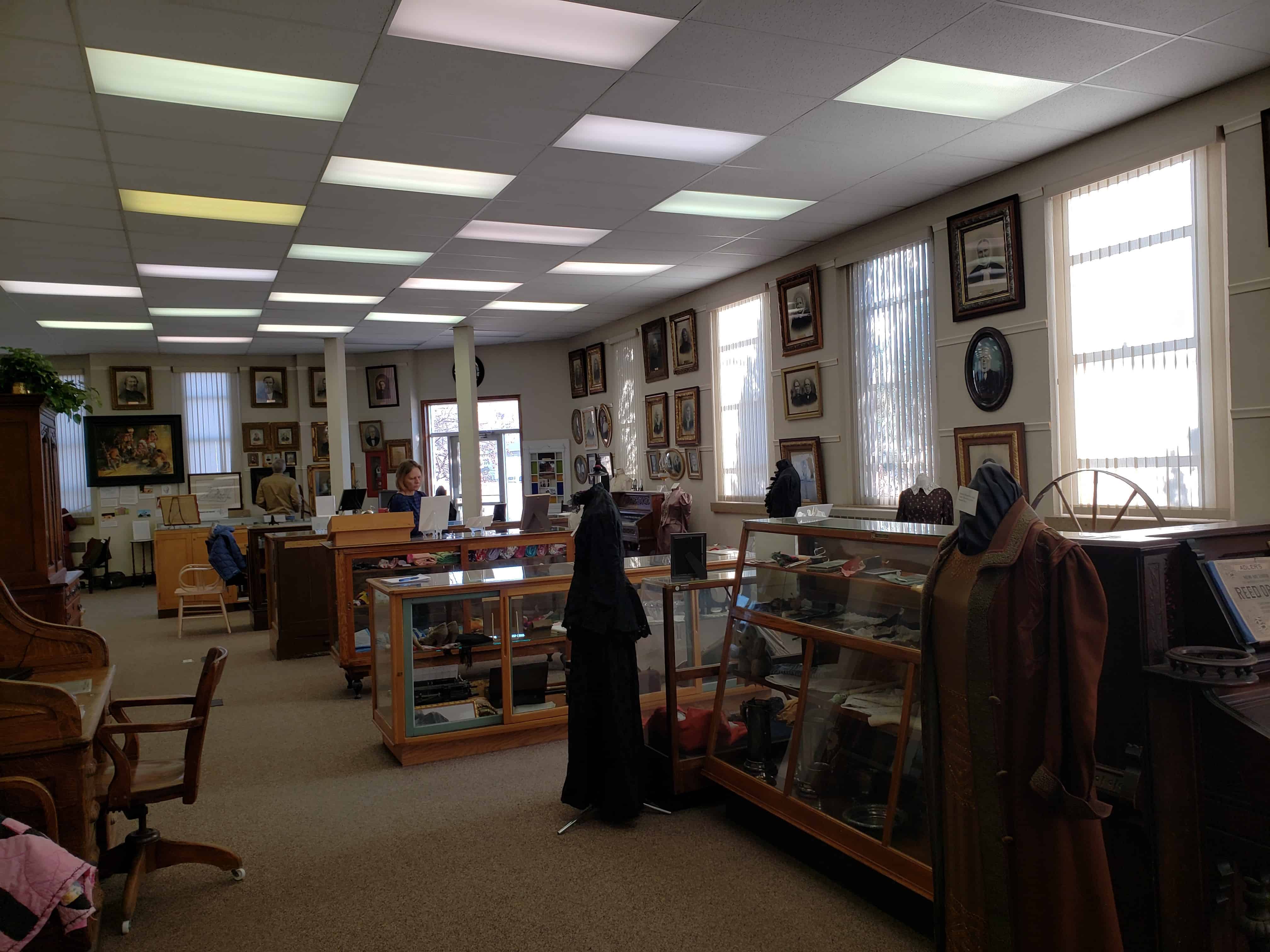
In 1952, the church granted the building to the local chapter of the Daughters of Utah Pioneers, which has used it as a meeting place and relic hall up to the present.

Related Posts:

  • Kanosh D.U.P. Marker (outside this building)
  • Kanosh, Utah
  • Tithing Offices

Survival in Utah’s Dixie

21 Friday Feb 2020

Posted by Jacob Barlow in Uncategorized

≈ Leave a comment

Tags

Historic Markers, Hurricane, utah, Washington County

Survival in Utah’s Dixie

The warm, comfortable, productive climate in the sheltered valleys along the meandering Rio Virgin and its lower tributaries in Washington County became known as “Utah’s Dixie”.

The rugged pioneer colonizers and their descendants are known as “Dixieites” and the stalwart men and women who took hundreds of covered wagon loads of “Dixie Sorghum”, “Dixie Fruit”, “Dixie Wine”, nuts, dried fruit, figs, pomegranates, etc. northwards to sell and barter in communities as far north as Salt Lake City became known as “Dixie Peddlers!”.

Cotton was grown in “Utah’s Dixie” in the late 1800’s. Fruit crops matured three weeks earlier in “Utah’s Dixie” than similar crops in the Provo area.

The perservering Pioneers of the communities of “Utah’s Dixie” were constantly having their integrity honed by the heart-breaking hardships of adversity. These rare qualities of integrity have been carried throughout the world by leaders throughout the world by leaders who have their family roots in “Utah’s Dixie!”.

This 1924 photo shows the east side of Main Street in Cedar City. Wagons loaded with sacks of wool from Gould’s Shearing Corral, near Hurricane, are being taken to the railroad for shipment in Lund, Utah.

This historic plaque sponsored by the family of Verl and Margaret Sanders, owners of Sanders Construction, Inc., Henderson, Nevada, in honor of Verl’s parents, Moroni and Mildred “Millie” Zabriskie Sanders.

Moroni was born Oct. 18, 1903 in LaVerkin, Utah. He was the first boy born in this pioneer community and later served 16 years as City Mayor. He was also a Dixie Peddler.

Moroni and his brothers Bill and Ervil were Pioneer turkey growers and hatchery owners for many years in Utah’s Dixie. Moroni’s father and mother, William and Sara Amelia Wilson Sanders, were Dixie Peddlers and Dixie Sorghum makers and members of the first LaVerkin L.D.S. Ward organized June 23, 1904.

Moroni’s wife, “Millie”, was a talented musician and Grand Daughter of James C. Snow who owned Snowfield and was the first School Teacher in Bellevue, a prominent camping spot for Dixie Peddlers, at the south end of the Black Ridge.

This historic marker is located in Hurricane Valley Pioneer Heritage Park in Hurricane, Utah.

Gateway Inn

20 Thursday Feb 2020

Posted by Jacob Barlow in Uncategorized

≈ Leave a comment

Tags

Motels, Salt Lake City, utah

The Gateway Inn in Salt Lake City, Utah.

Located at 819 W North Temple, the Gateway Inn has became a little less than pleasant, but I like documenting old buildings, motels, and more to be able to look back on them later and see how things have changed.

819 West North Temple in Salt Lake City, Utah.

Filming Locations:

  • The “Flamingo Hotel” in the movie The World’s Fastest Indian (2005)
  • Gateway Inn – American Murderer Filming Location

2024

Road Island Diner

20 Thursday Feb 2020

Posted by Jacob Barlow in Uncategorized

≈ Leave a comment

Tags

Diners, Historic Buildings, NRHP, Oakley, summit county, utah

The Road Island Diner in Oakley, Utah

This 1939 O’Mahony Dining Car # 1107 has been placed on the National Registry of Historic Places by the United States Department of the Interior.

This classic dining car was constructed and displayed at the World’s Fair in New York in 1939, towed to Massachusetts where it stayed 14 years before being moved to Rhode Island and finally to Oakley, Utah in 2007.

The Roads to Utah’s Dixie

20 Thursday Feb 2020

Posted by Jacob Barlow in Uncategorized

≈ Leave a comment

Tags

Historic Markers, Hurricane, utah, Washington County

The Roads to Utah’s Dixie

The Black Ridge

The toughest, heartbreaking barrier to the colonization of “Utah’s Dixie” was the Black Ridge between New Harmony and Pintura, north of Toquerville, Utah.

A deep, rough, lava flow clogged the valley from the base of the towering Hurricane cliffs on the east, to the foothills of Pine Valley Mountain on the west.

The jolting rocks subjected the pioneer wagons, animals, and human tempers to a terrific strain. There were broken axles, broken wheels and fellies, broken kingbolts and run-off rims, to try the patience of the weary travelers who were forced to resort to their own ingenuity in making repairs, being miles away from any possible relief.

Apostle George A. Smith, for whom St. George was named, proclaimed this road to be “The most desperate piece of road that I have ever traveled in my life, the whole ground being covered for miles with stones, volcanic rock, cobbleheads – and in places deep sand.”

This old pioneer trail and Peter’s Leap Road, were both used until 1869, when the winding road was constructed along the east side of Ash Creek. Many Dixie peddlers and freighters traveled this road daily with wagons.

Peter’s Leap

Peter’s Leap, two and and one-half miles north of Pintura, was no doubt the worst part of the route that ignited Apostle Smith’s ire.

The road followed a long-used Indian Trail, crossed Leap Creek Canyon, a 165 foot gorge cut in lava rock, at a point approximately one and one-half miles west of where Leap Creek joins Ash Creek.

Peter Shirts, a Cedar City pioneer, inspired the name. Shirts was paid $300.00 by the Washington County Commission, to build a road along the old Indian Trail on the west edge of the Black Ridge.

When asked how wagons would get across the deep canyon that barred the way, he replied, “We’ll Leap It!” The 165-foot canyon-crossing became “Peter’s Leap.” The stream became “Leap Creek.”

The road leading into the gorge from the south could be built at a somewhat reasonable grade of 15 percent. Down the north face, however, the dugway grade was a dizzying 30 percent grade.

A sturdy windlass was erected on top of the north canyon wall. The wagons coming from the north were stopped here. The cargo was lashed securely to the wagon box. The teams were unhitched and led down the winding trail to the canyon bottom. Then the wagons were eased down the canyon wall. The teams were then hitched to the wagons and they were pulled out of the canyon, up a gradual slope through a break in the south canyon wall. The distance between the top of the north canyon wall to the point where the road leveled out on the south, was 1000 feet.

Freighters and peddlers coming from the south, unhitched their teams in the bottom of the canyon and the windlass pulled their loaded wagons up the face of the cliff.

In 1869, the Territorial Legislature appropriated $1000.00 to build a good surveyed road along the skirt of the Hurricane Cliffs, east of Ash Creek. This road was well-graded and wound in and out of the ravines. It was a single track, with turnouts to let traffic pass.

This road was used as a main route from Salt Lake City to Utah’s Dixie, and to California from 1869 to 1925.

In 1925, a two-lane graveled road was built over the Black Ridge. Many years later this road was replaced by Interstate 15.

Peter’s Leap Indian Cave

The early pioneers discovered an Indian Cave, near the top of the canyon wall, at Peter’s Leap. It is accessible from the south rim, by following a narrow trail down the face of the cliff to an opening over 100 feet above Leap Creek.

Early settlers found woven yucca sandals, arrowheads, spearpoints, bone awls and other items in the Cave, as well as deposits of bat dung or guano.

In January of 1858, a group of workers went to Peter’s Leap Cave and excavated the bat droppings. Nitrate was leached out and combined with sulfur and sagebrush ashes. The result was saltpeter, the main ingredient of old-fashioned gunpowder. Production cost: twenty-five cents per keg.

This plaque was sponsored by the Sylvan Wittwer Family of Lansing, Michigan. (located at the Hurricane Valley Pioneer Heritage Park in Hurricane, Utah)

Sylvan was born in 1917 to Joseph and Ellen Wittwer, who were among the Early Settlers of this Valley. He graduated from Hurricane High School in 1935, from Utah State Agricultural College in 1939, received his Doctors Degree from the University of Missouri in 1943, and was Director of the Michigan State University Experiment Station from 1965 to 1983.

Sylvan is recognized as a world authority on Greenhouse Culture; has published books and scores of scientific papers in this field; and has been invited to participate in major food conferences all over the world.

He has served with distinction on the most prestigious national committees, appointed by the U.S. Congress, Secretary of Agriculture, and the National Academy of Science.

Probably no horticulturist in the past 50 years, has done as much to promote the cause of technological agriculture and agricultural research on a world-wide scale, than has Sylvan H. Wittwer. He has received countless world and national awards in the field of Agriculture. His fame and success has not altered his great dedication to God, church, and country. He is Patriarch, past Stake President and Bishop in Lansing Michigan L.D.S. Stake, and has actively served as a leader and supporter of the Boy Scouts of America.

We salute Sylvan as a noble native son with a rich heritage in Utah’s Dixie!

Historic Kolob Mountain

19 Wednesday Feb 2020

Posted by Jacob Barlow in Uncategorized

≈ Leave a comment

Tags

Historic Markers, Hurricane, utah, Washington County

Historic Kolob Mountain

Kolob
By Owen Sanders
When lassitude tugs at your body
And robs you of zest to exist
Come with me to Kolob
And walk through the mild morning mist.

Huddle at dawn on a hillside
And scan the green valley below;
Listen to snapping and crackle of twigs
And thumping of hooves on the go!

When shots re-echo at daybreak
Your pulse starts pounding anew
As you search to locate your quarry
And forget the breathtaking view.

Come back with me to Kolob
It’s fun to be with you up there
Sluff off the work-a-day worry
In the sparkling, clear mountain air!

Kolob is a majestic jewel in an awesome setting of rare scenic charm. It is one mile higher than Hurricane City and can be reached in a few minutes by driving constantly upward from plateau to plateau through spellbinding beauty at every turn in the road.

Pioneers who colonized Toquerville, Virgin City and Grafton, also ranched on Kolob. They hobbled and milked scores of half-wild cows, fresh from the lush, green pastures of Kolob and the desert rangeland far below. From the milk and cream, they made many crocks and barrels of butter and zesty cheese which was then hauled by wagon down the steep mountain road and sold or traded to merchants in Cedar City, St. George and the mining towns of Silver Reef, Frisco, Newhouse, Pioche and Delemar.

From Kolob Peak, Zion Canyon can be seen far below and the St. George Temple is visible 50 miles away and one mile below. For over fifty years, a pole gate swung between two giant ponderosa pines in Black Canyon on the road to Kolob. Until this gate was opened, livestock could not drift from the lower range onto Upper Kolob. Sheer sandstone cliffs formed a high natural barrier.

From the West and South, several massive pinnacles jut out from Kolob and rise several thousand feet from their base like fabulous “Islands in the Sky.” Some of these have a surface area of several hundred acres. By fencing across a narrow neck of connecting land, cattle and sheep could be held on this land.

Descendants of Kolob ranchers helped colonize The City of Hurricane in 1906. Now, Their descendants have homes and cabins on these ranches. Visiting Kolob is an exhilarating and unforgettable experience!

This Plaque sponsored by James Allen Ballard and his wife Joan Webb Ballard In honor of their pioneer progenitors, the Ballard and Webb Families, Who helped colonize the city of Hurricane!

This historic marker is located in Hurricane Valley Pioneer Heritage Park in Hurricane, Utah.

Historic Former Heber City Library

19 Wednesday Feb 2020

Posted by Jacob Barlow in Uncategorized

≈ Leave a comment

Tags

DUP, Heber City, Libraries, museums, New Deal Funded, PWA Projects, utah, Wasatch County

Historic Former Heber City Library

188 S Main Street, Heber City, Utah

The historic former Heber City library was constructed as a federal Public Works Administration (PWA) project during the latter years of the Great Depression.

Construction occurred between Aug. 1938 and May 1939. The PWA supplied a grant of $13,275 toward the project, whose total cost was $27,529.

The building served as the community’s library until construction of the new Wasatch County Library, completed 2004.

The New Deal facility now houses the Daughters of Utah Pioneers Museum.

Related Posts:

  • Heber City, Utah
  • New Deal Funded Projects in Utah

The plaque for the Historic Home Tour says:

Wasatch Library
1937-1939

After a fire on January 13, 1937, destroyed the Heber Mercantile Store, the Wasatch County Library was built to replace the extensive losses, which The Wasatch Wave reported at $125,000 in damages to library materials. Funded by the Works Progress Administration (WPA) under Franklin D. Roosevelt’s New Deal program, the library was designed by Ashton and Evans and constructed by Peter Groneman & Sons. Upon completion, Wasatch County dedicated the building to the Daughters of the Utah Pioneers, ensuring the preservation of artifacts and histories from Heber Valley’s early settlers, spanning from 1830 to 1900.

SLC to SoCal – Point of Mountain

18 Tuesday Feb 2020

Posted by Jacob Barlow in Uncategorized

≈ Leave a comment

Tags

California Trail, Salt Lake County, utah, utah county

Salt Lake to Southern California Road – Point of Mountain

“Took leave of my wife and Br. Brown drove ahead and found a very hard hill to ascend which is a divide between Utah and Salt Lake Valleys… Proceeding down the divide we came in sight of Utah Lake. This is a beautiful sheet of water some forty miles long and lies in a sort of triangle. It is surrounded by a large valley covered with a heavy growth of grass.”

-Addison Pratt, Oct. 5, 1849

Related posts:

  • Salt Lake to Southern California Road Historic Markers

Kanosh Old City Building

17 Monday Feb 2020

Posted by Jacob Barlow in Uncategorized

≈ Leave a comment

Tags

City Buildings, Kanosh, Millard County, utah

I was exploring in the area and thought this was a cool looking building, I wasn’t sure what it was and was taking some photos planning to research it later when I happened to see an old friend who grew up in the area – she told me it was the city building and she remembers going with her mom to pay the utility bill there as a kid.

Related posts:

  • Kanosh, Utah

The Merz Fountain in Mt Pleasant

17 Monday Feb 2020

Posted by Jacob Barlow in Uncategorized

≈ 1 Comment

Tags

Fountains, historic, Mt Pleasant, Sanpete County, utah

The Merz Fountain in Mt Pleasant

Adolph and Hyrum Merz learned how to carve stone monuments Switzerland and made the cemetery fountain for Mt Pleasant, Utah.

It was made to look like a tree stump and was very detailed. They did it free of charge for their community and it was admired by many. It was later moved from the cemetery to the front yard of the Relic Home.

The plaque on the fountain says:

This water fountain carved in stone from the hills north of Moroni, Utah was made by Hyrum and Adolph Merz and presented by them to the City of Mt. Pleasant, Utah in 1901.

← Older posts
Newer posts →

Follow Jacob

Follow Jacob

Come wander with me on Youtube.

Blog Stats

  • 2,106,058 hits

Social and Other Links

BarlowLinks.com

Recent Posts

  • Scout Monument
  • Provo High School Seminary Building
  • 821 E 100 S
  • 820 E 100 S
  • 817-819 E 100 S

Archives

Loading Comments...