Tags

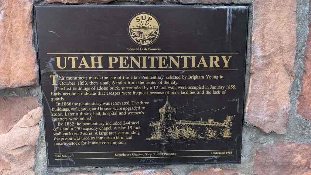
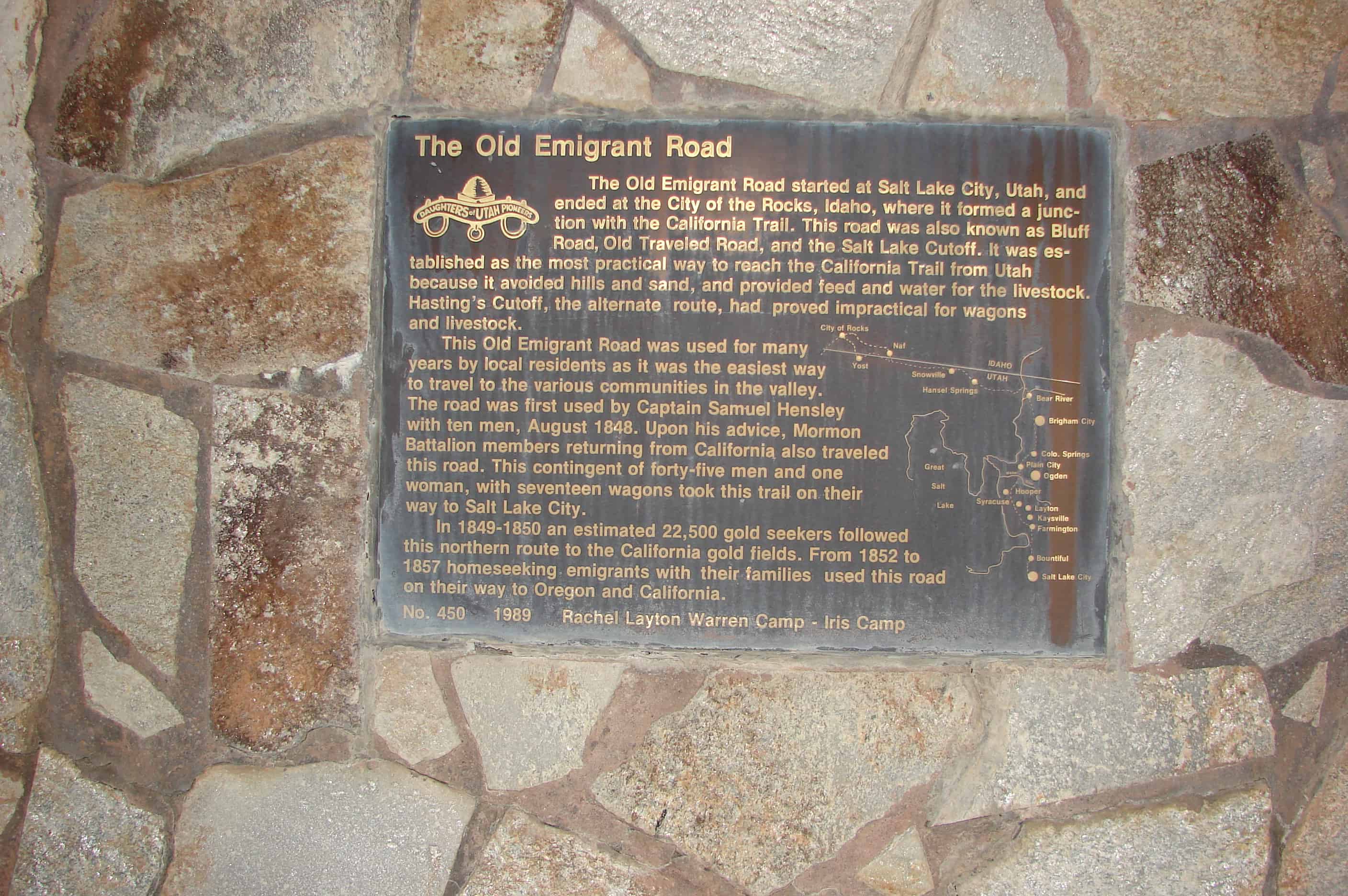
The Old Emigrant Road
The Old Emigrant Road started at Salt Lake City, Utah, and ended at the City of the Rocks, Idaho, where it formed a junction with the California Trail. This road was also known as Bluff Road, Old Traveled Road, and the Salt Lake Cutoff. It was established as the most practical way to reach the California Trail from Utah because it avoided hills and sand, and provided feed and water for the livestock. Hasting’s Cutoff, the alternate route, had proved impractical for wagons and livestock.
This Old Emigrant Road was used for many years by local residents as it was the easiest way to travel to the various communities in the valley. The road was first used by Captain Samuel Hensley with ten men, August 1848. Upon his advice, Mormon Battalion members returning from California also traveled this road. This contingent of forty-five men and one woman, with seventeen wagons took this trail on their way to Salt Lake City.
In 1849-1850 an estimated 22,500 gold seekers followed this northern route to the California gold fields. From 1852 to 1857 homeseeking emigrants with their families used the road on their way to Oregon and California.
Check out all of the historic markers placed by the Daughters of Utah Pioneers at JacobBarlow.com/dup