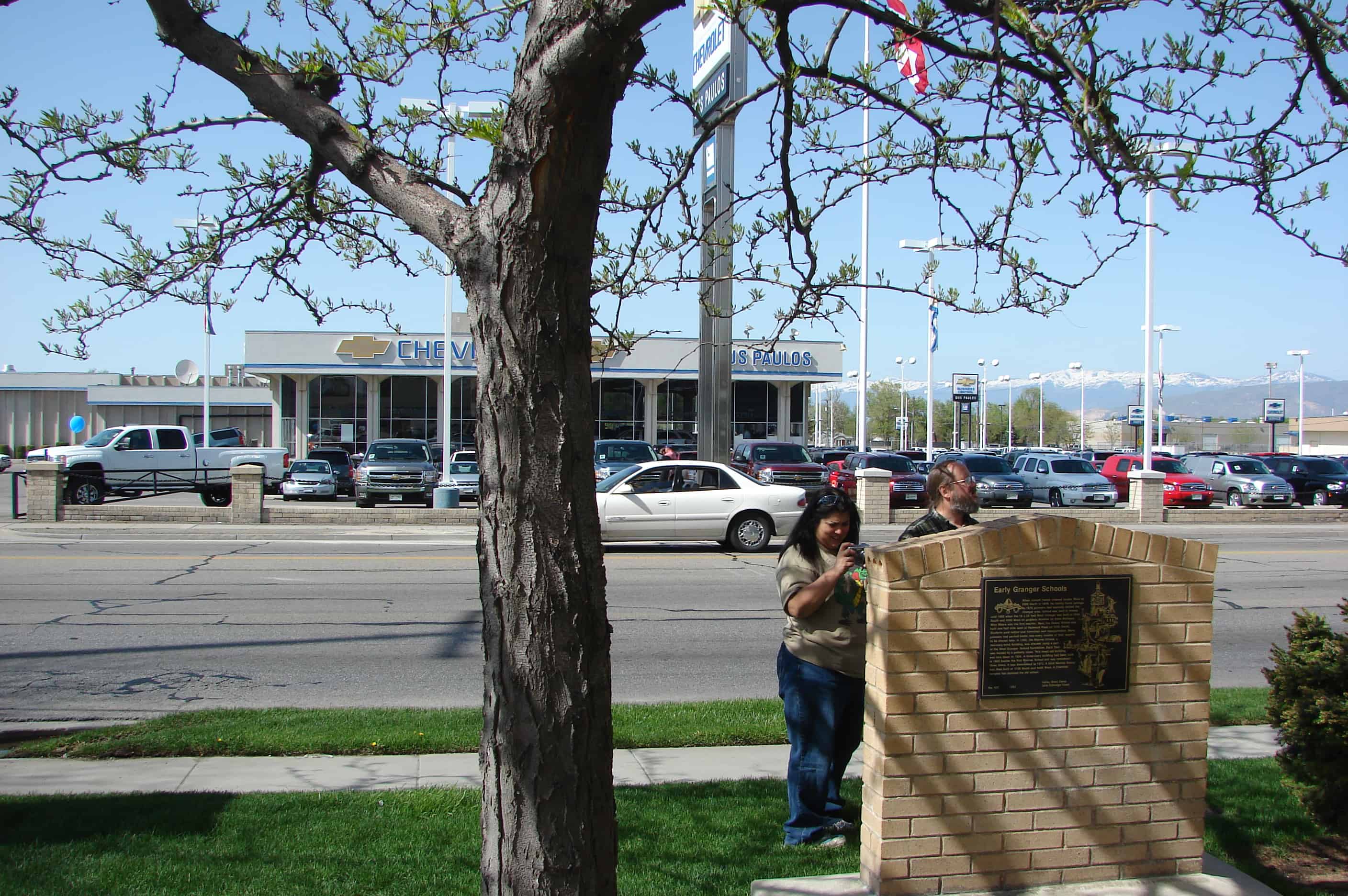
When Joseph Harker crossed Jordan River at 3300 South in 1848, he luckily found springs. By 1870 pioneers had sparsely settled the Granger area. School was held in homes until 1882 when the 16 x 24 foot West Granger School was built at 3500 South and 4000 West on property donated by Andrew Mathews. Miss Moore was the first teacher. Next, the Dewey School was built one-half mile west of Redwood Road on 3500 South. Students paid tuition and furnished own transportation. Many pioneers had packed books into every crevice of their wagons to be shared later. In 1893, the Monroe School, a two story brick building was erected, using a part of the West Granger School foundation. Each floor was heated by a potbelly stove. This loved old building was torn down in 1924. A three-story building had been built in 1903 beside the first Monroe School and was remodeled three times. It was demolished in 1972. A third Monroe School was built at 3100 South and 4400 West. A Chevrolet complex has replaced the old school.
Check out all of the historic markers placed by the Daughters of Utah Pioneers at JacobBarlow.com/dup
In 1860’s “Tim” B. Malan found a mountain basin containing a spring and timber. By 1868, he was selling logs, using his roller invention to get them safely down the cliff. July 1892, Tim and sons finished making a road with pick and shovel; later hewed a switch-back road, built a home and hotel. Guests came in spring wagons to enjoy Aunt Loui’s cooking, play various games or watch activities in town through a powerful telescope. Malan Heights is seen southeast of this marker.
Check out all of the historic markers placed by the Daughters of Utah Pioneers at JacobBarlow.com/dup
The Indian War years of 1865-72 brought bitter hardships to Sanpete and other central Utah areas. Different bands of Indians stealthily attacked settlers from their mountain hideouts, then fled to safety. Twenty-seven settlements were evacuated; two entire counties and portions of seven others were temporarily abandoned; seventy pioneers were slain and many wounded; hundreds of cattle and horses stolen. On Aug. 1, 1866, U.S. Indian Supt., Col. H.F. Head and Stake Pres. Orson Hyde obtained promise of peace from Chief Black Hawk. By Aug. 18, 1868, they had accomplished the hazardous feat of assembling a peace parley in Fort Ephraim on Hans Hansen’s lawn by a red cedar tree. Black Hawk calmed the defiant braves, a pipe of peace was passed, the treaty was signed and later ratified by U.S. Pres. Andrew Johnson. Black Hawk continued to help arrange peace parleys until other hostile chiefs had signed.
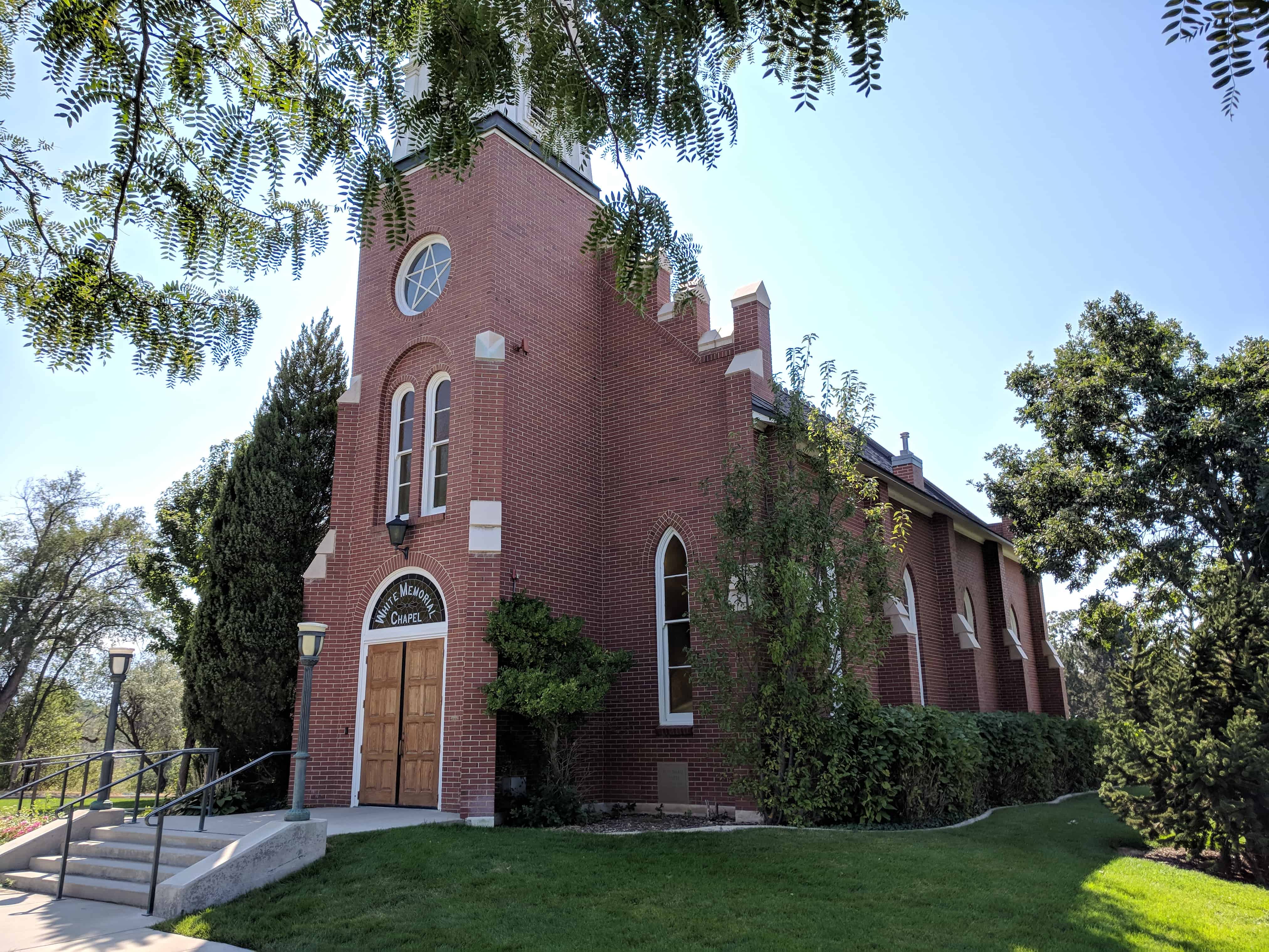
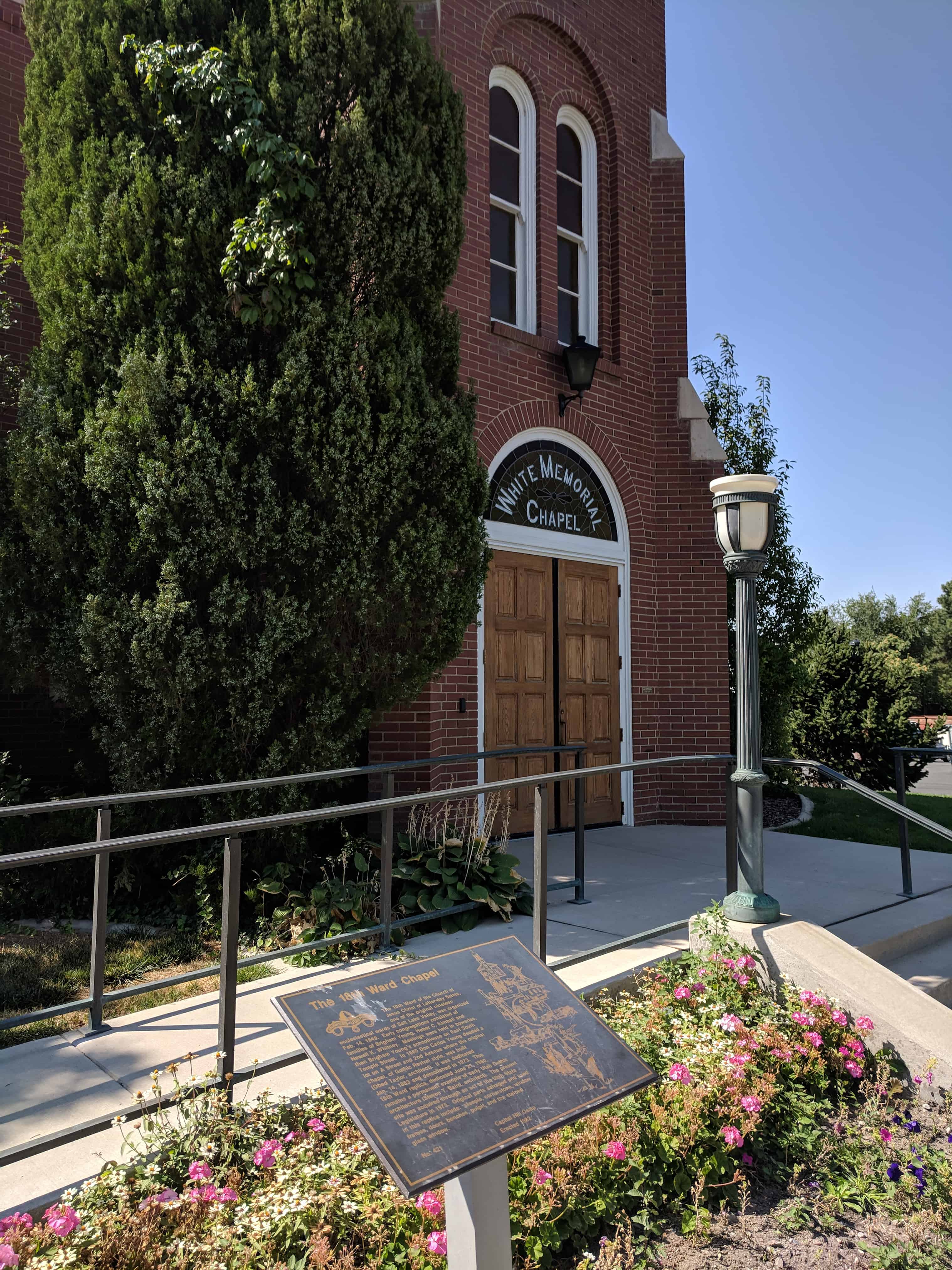
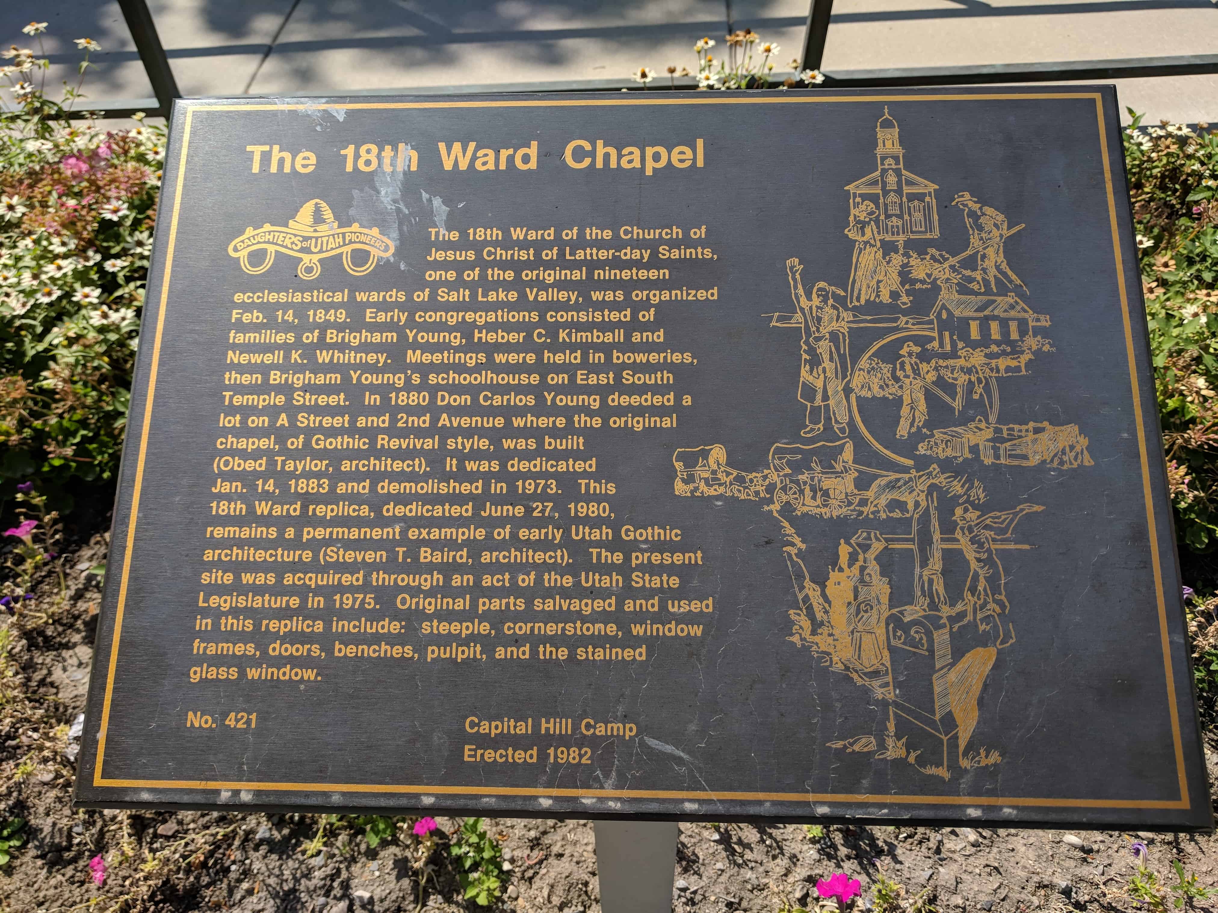
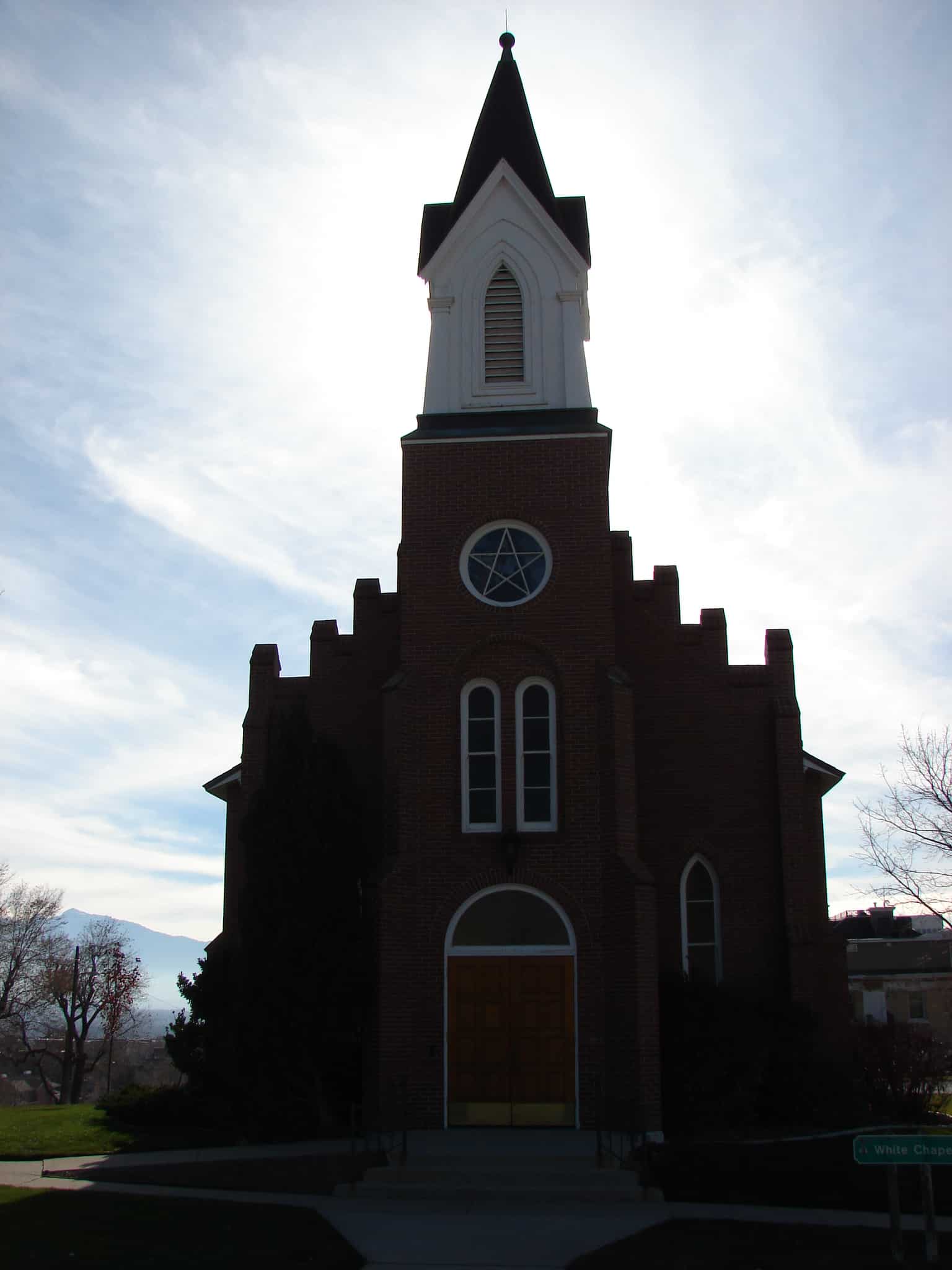
The 18th Ward of the Church of Jesus Christ of Latter-day Saints, one of the original 19 ecclesiastical wards of Salt Lake Valley, was organized Feb. 14, 1849. Early congregations consisted of families of Brigham Young, Heber C. Kimball and Newell K. Whitney. Meetings were held in boweries, then Brigham Young’s schoolhouse on East South Temple Street. In 1880 Don Carlos Young deeded a lot on A Street and 2nd Avenue where the original chapel, of Gothic Revival style, was built (Obed Taylor, architect) dedicated Jan. 14, 1883 demolished in 1973. This 18th Ward replica, dedicated June 27, 1980, remains a permanent example of early Utah Gothic architecture (Steven T. Baird, architect). The present site was acquired through an act of the Utah State Legislature in 1975. Original parts salvaged and used in the replica: steeple, cornerstone, window frames, doors, benches, pulpit, and the stained glass window.
On the north by 7th Ave. (or Ensign Ward), east by C St. (or the 20th Ward), south by South Temple St. (or the 12th-13th Ward), and west by Main St. (or the 17th Ward).
History timeline:
1849 – one of the original nineteen wards into which Salt Lake City was divided in February, 1849. At the time of its organization the ward extended northward and eastward to the mountains The first permanent settlers in the 18th Ward were Pres. Brigham Young and Elders Heber C. Kimball and Newel K. Whitney who, with their families, were the only residents of the ward for several years. 1856 – all that part of the 18th Ward lying east of Walnut St. (later A St.) was organized as the 20th Ward 1877 – boundary line was changed to Pine St. (C St.), its present boundary. 1904 – 18th Ward belonged to Salt Lake Stake, but when Salt Lake City was divided into four stakes in 1904, the ward became a part of Ensign Stake 1913 – The organization of Ensign Ward in 1913 diminished its northern boundary to 7th Ave.
The 18th ward is one of the original 19 wards in Salt Lake City in 1849, you can see the others on this page.
This is a gable roofed, gable facade chapel. The entrance pavilion has a frame cupola. There are buttresses between pointed arched windows. The building is symmetrically arranged with the roof cresting on the main gable. – D. Diana Johnson
The Eighteenth Ward was one of the original ecclesiastical divisions of Salt Lake City, for a few years inhabited only by President Brigham Young and Elders Heber C. Kimball and Newell K. Whitney. “In 1883 a fine brick chapel, erected by the Saints on A Street between 2nd and 3rd Avenues, was dedicated.” This structure was demolished about 1975 and a reconstruction, incorporating elements of the original building, was completed in 1979.
Homesteaders and settlers came in the 1870’s to the area 4700 South to 7200 West, north to the Great Salt Lake, northeast along it’s shore and the Davis County line to 4800 West and south to 4700 South. This area became Hunter Precinct in 1880 from the east part of Pleasant Green, and was named in honor of presiding Bishop Edward Hunter. The northern soil was too alkaline to farm. In 1881 the Utah Salt Lake Canal brought water to the central part. a 20′ x 30′ adobe chapel was erected in 1885 for religious meetings, 50th District School, and community activities. Hunter Branch became a ward in 1888. East of this site the 50th District School was built in 1891. The name was changed to Hunter School in 1906 and Whittier in 1908.
– – – – – –
The marker is located on the south face of a brick fence pillar along the fence line between Hunter Park and the LDS Hunter Chapel at 3665 S 6000 West. The pillar is the second pillar from the street and the fence is directly in line with Brook Hollow Drive where it intersects 6000 West.
Check out all of the historic markers placed by the Daughters of Utah Pioneers at JacobBarlow.com/dup
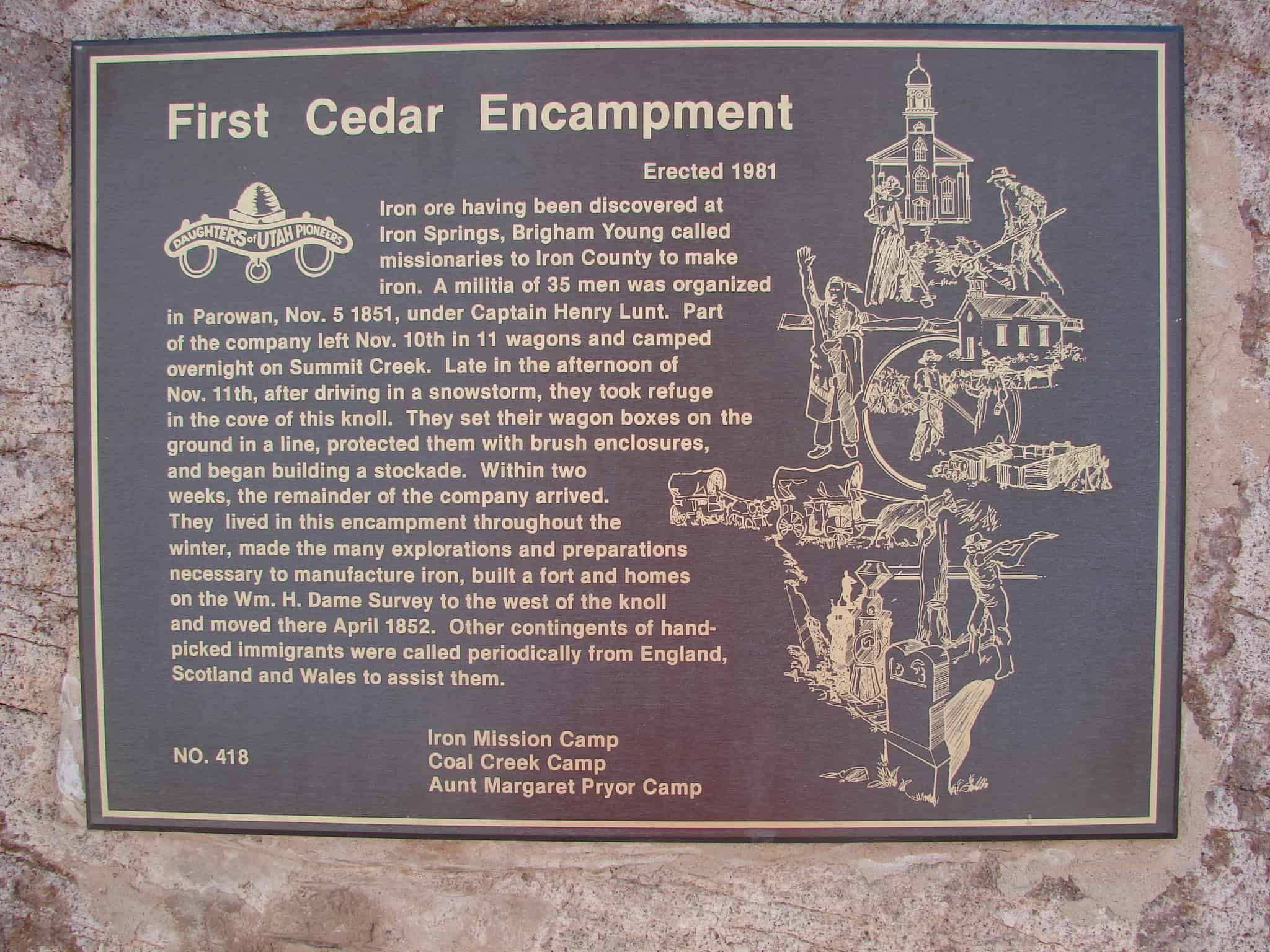
Iron ore having been discovered at Iron Springs, Brigham Young called missionaries to Iron County to make iron. A militia of 35 men was organized in Parowan, Nov. 5, 1851, under Captain Henry Lunt. Part of the company left Nov. 10th in 11 wagons and camped overnight in Summit Creek. Late in the afternoon of Nov. 11th, after driving in a snowstorm, they took refuge in the cove of this knoll. They set their wagon boxes on the ground in a line, protected them with brush enclosures, and began building a stockade. Within two weeks, the remainder of the company arrived. They lived in the encampment throughout the winter, made many explorations and preparations necessary to manufacture iron, built a fort and homes on the Wm. H. Dame survey to the west of the knoll and moved there April 1852. Other contingents of hand-picked immigrants were called periodically from England, Scotland and Wales to assist them.
Check out all of the historic markers placed by the Daughters of Utah Pioneers at JacobBarlow.com/dup
In 1854 Ogden pioneers built a rock and mud wall a mile square along 28th Street, Wall Avenue and 21st Street. Madison Avenue was not completed because the Indians became peaceful. The eight-foot wall had a six-foot base, a 31 inch top and four gates. The cost of $40,000 was raised by $40.00 tax on each city lot, also a $10.00 tax on every able-bodied man over 18 years. The project was erected by 500 working men. Wall Avenue was named after this wall.
Garfield Beach railroad junction was built in 1905. In 1908, its post office was named Welby in honor of Rio Grande Railroad superintendent. The R.G.R.R. company drilled water wells, built soft water treatment plant, a round house, dance hall, pool hall, hotel, grocery and mercantile store, over 200 homes, and a three room schoolhouse. The first teachers were Ann Phoenix, Bernice Nelson, and Miss Johnson. Harold Nielson was doctor. The railroad company lost its contract and Welby began to fade. The store and school were razed in 1948.
The old railroad roundhouse, at least the foundation for it is still visible just north of here at N 40.59291 W 111.99436.
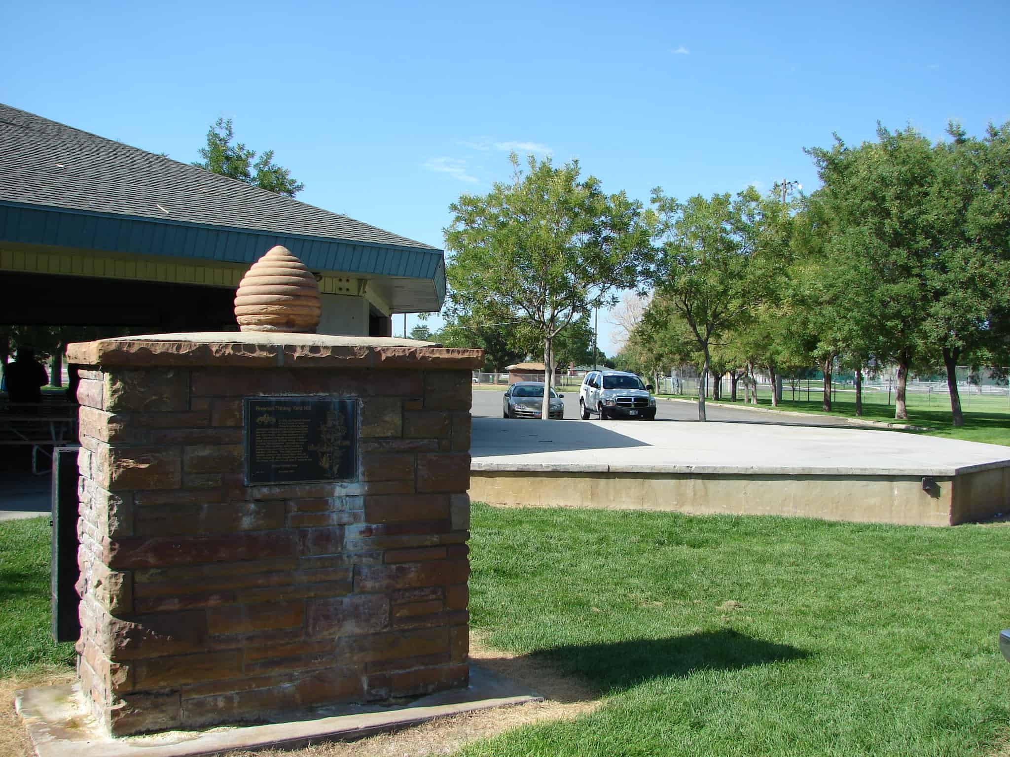
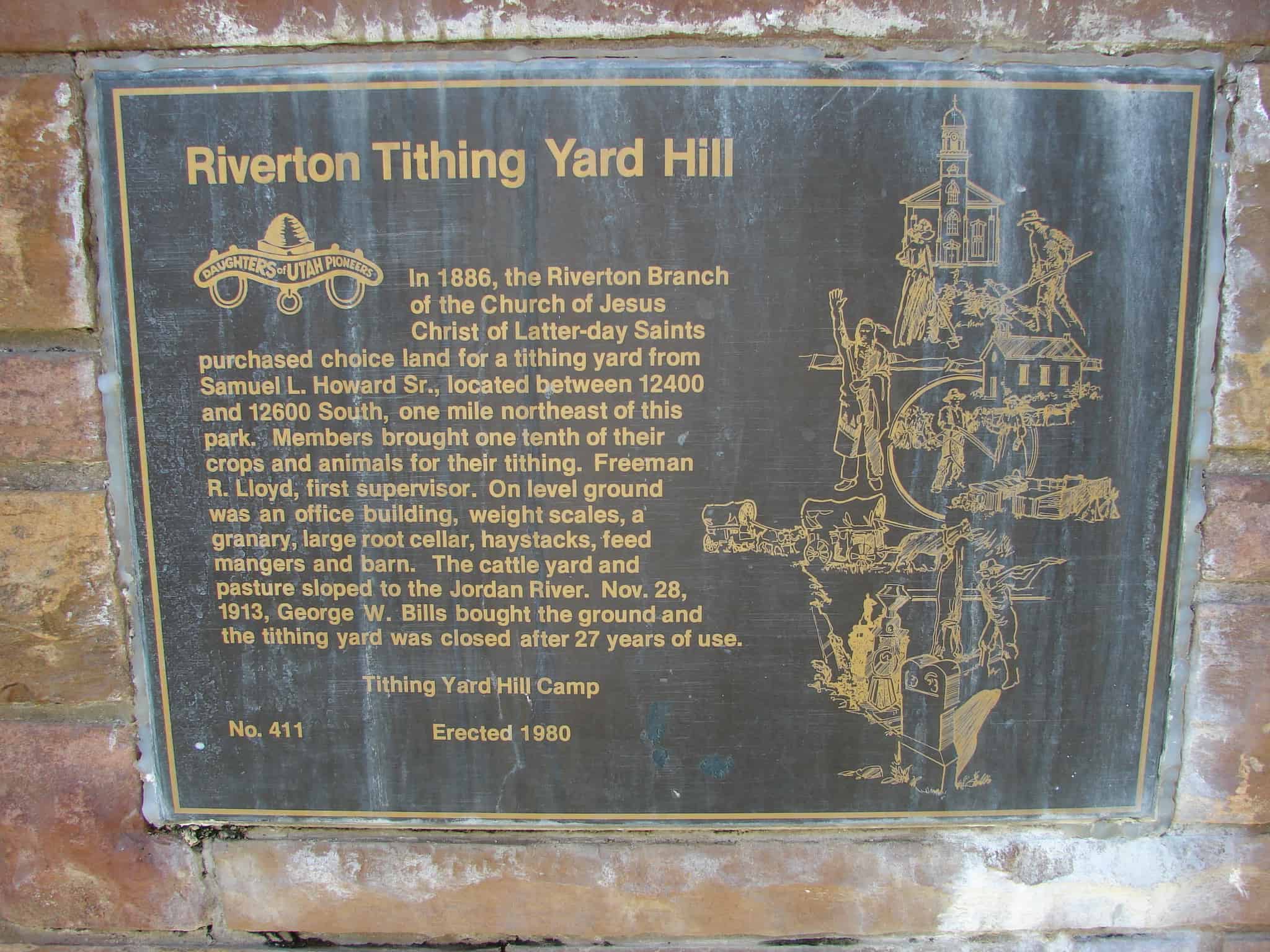
In 1886, the Riverton branch of the Church of Jesus Christ of Latter-day Saints purchased choice land for a tithing yard from Samuel L. Howard, Sr., located between 12400 and 12600 South, one mile northeast of this park. Members brought one tenth of their crops and animals for their tithing. Freeman R. Lloyd first supervisor. On level ground was an office building, weight scales, a granary, large root cellar, haystacks, feed mangers and barn. The cattle yard and pasture sloped to the Jordan River. Nov. 28, 1913, George W. Bills bought the ground and the tithing yard was closed after 27 years of use.
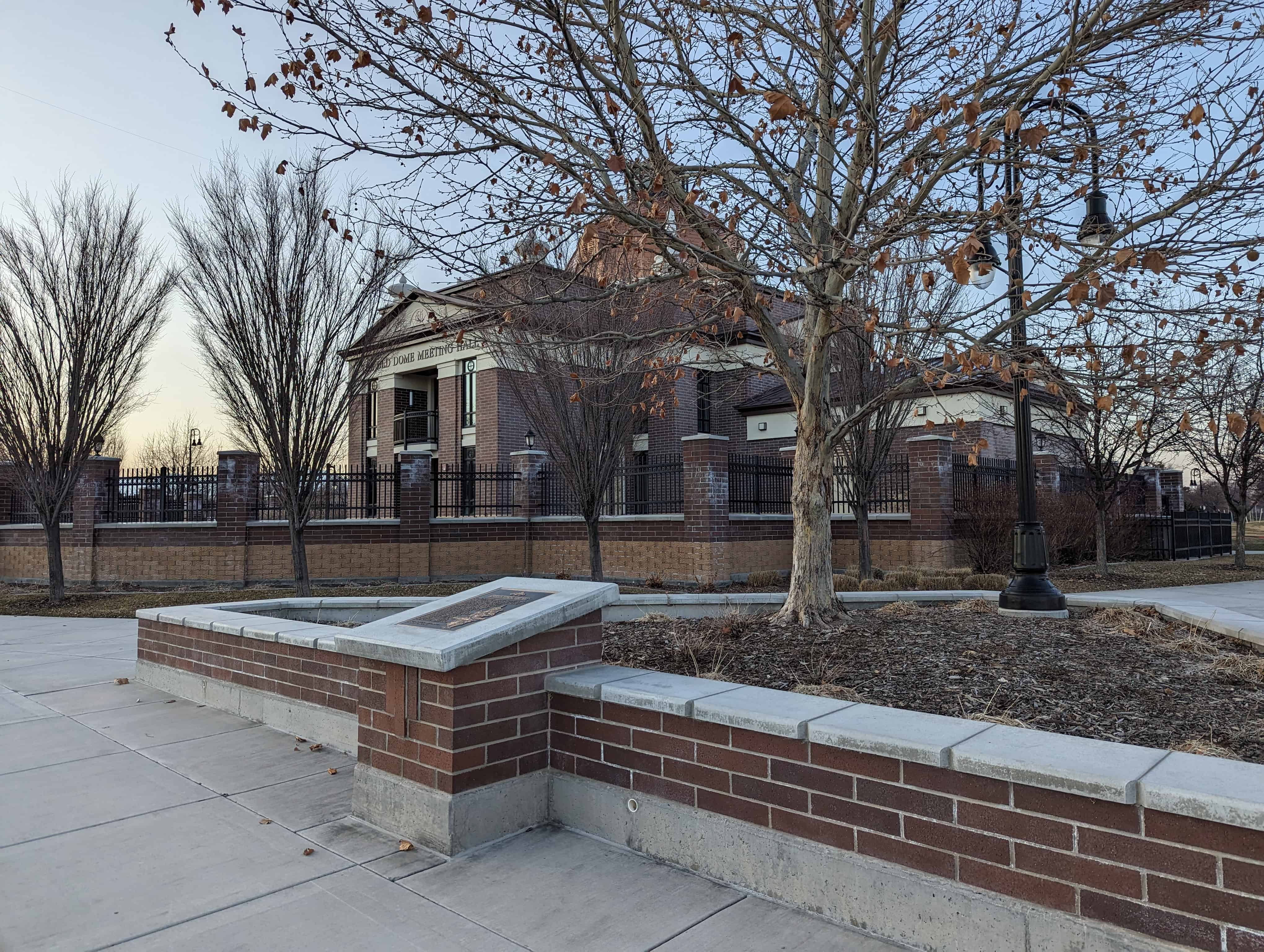
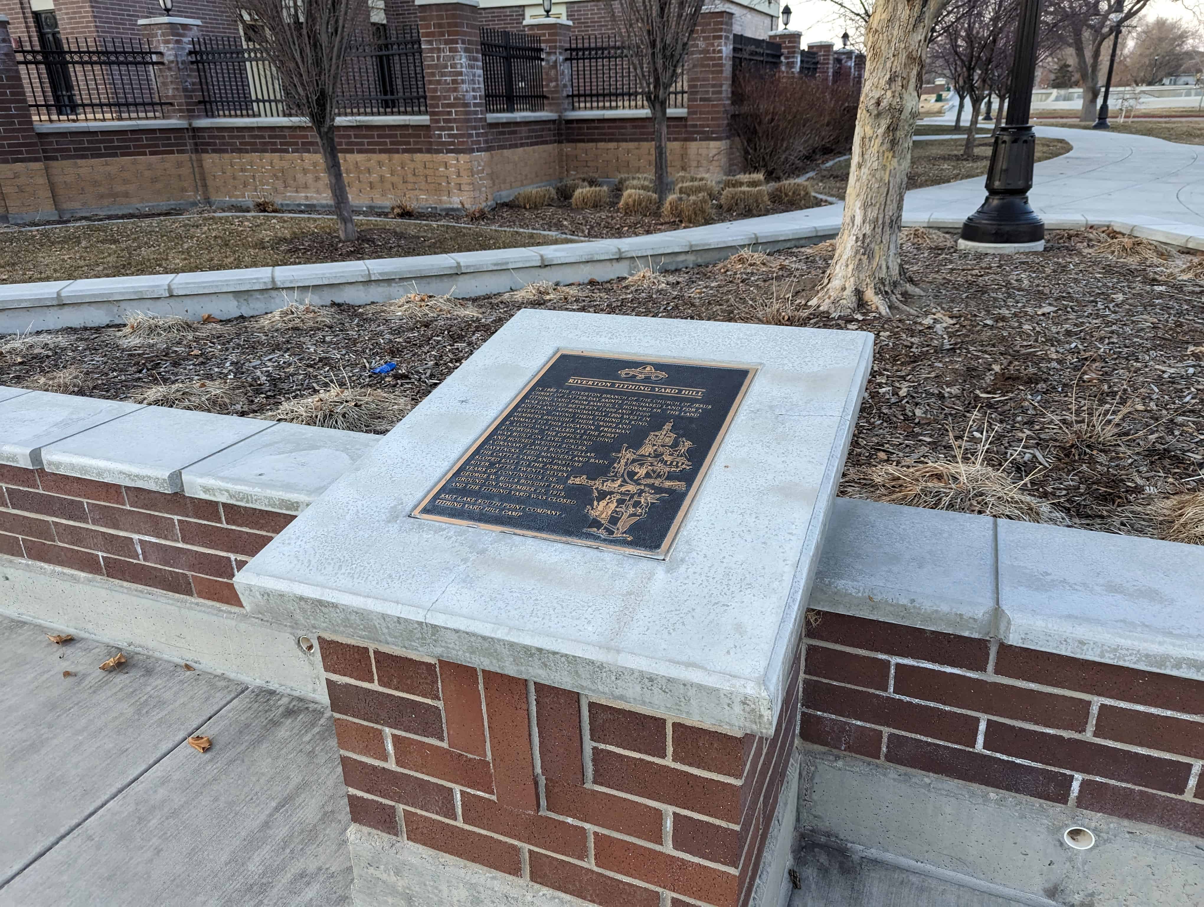
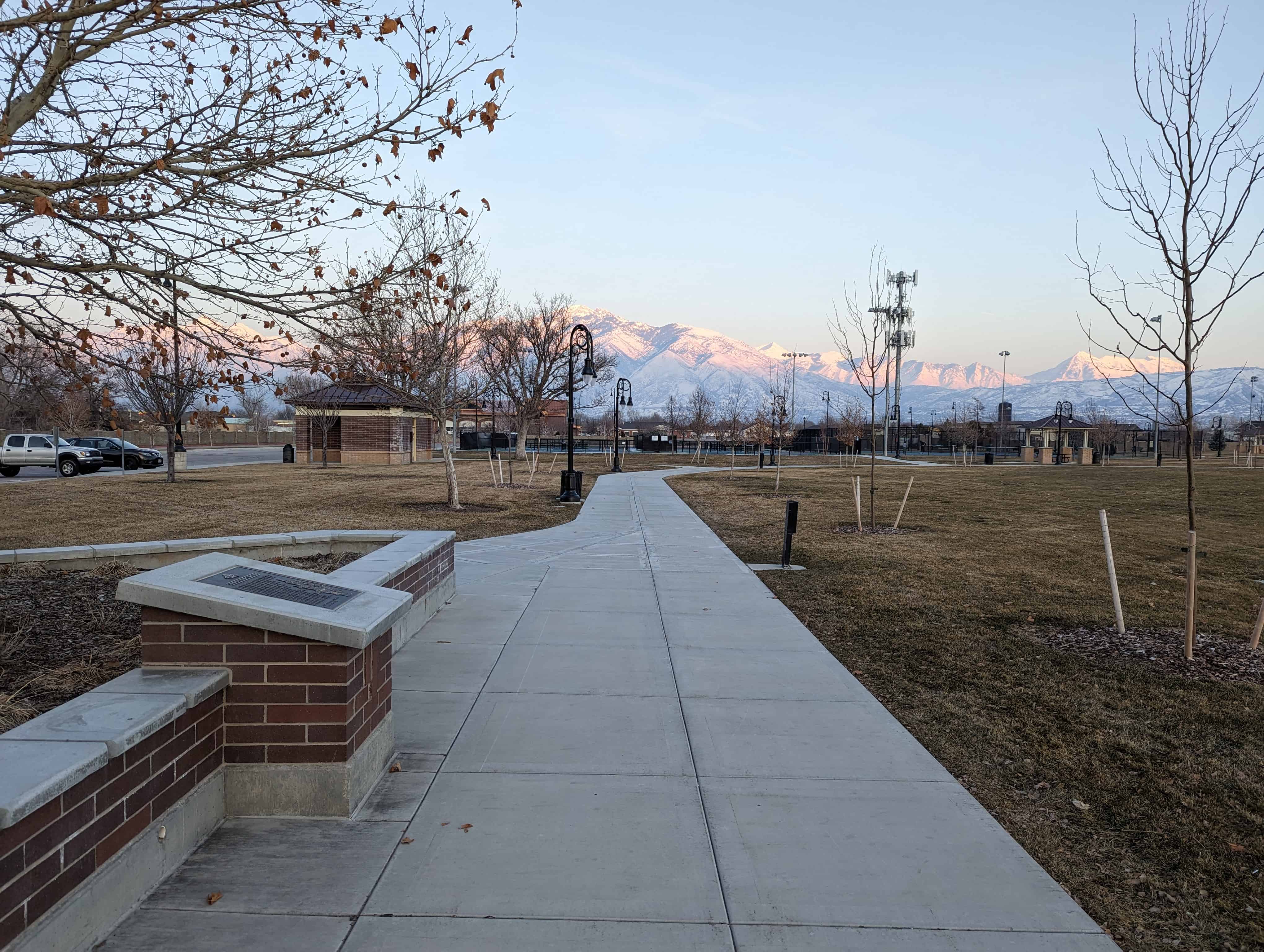
This is Daughters of Utah Pioneers historic marker #411 located at Riverton City Park (1452 W 12600 S in Riverton) – I took the above photos in 2007, the photos below are of the new monument (I took the photos in 2023 but I think the monument was re-done around 2015). The wording is very similar on the new plaque.
–
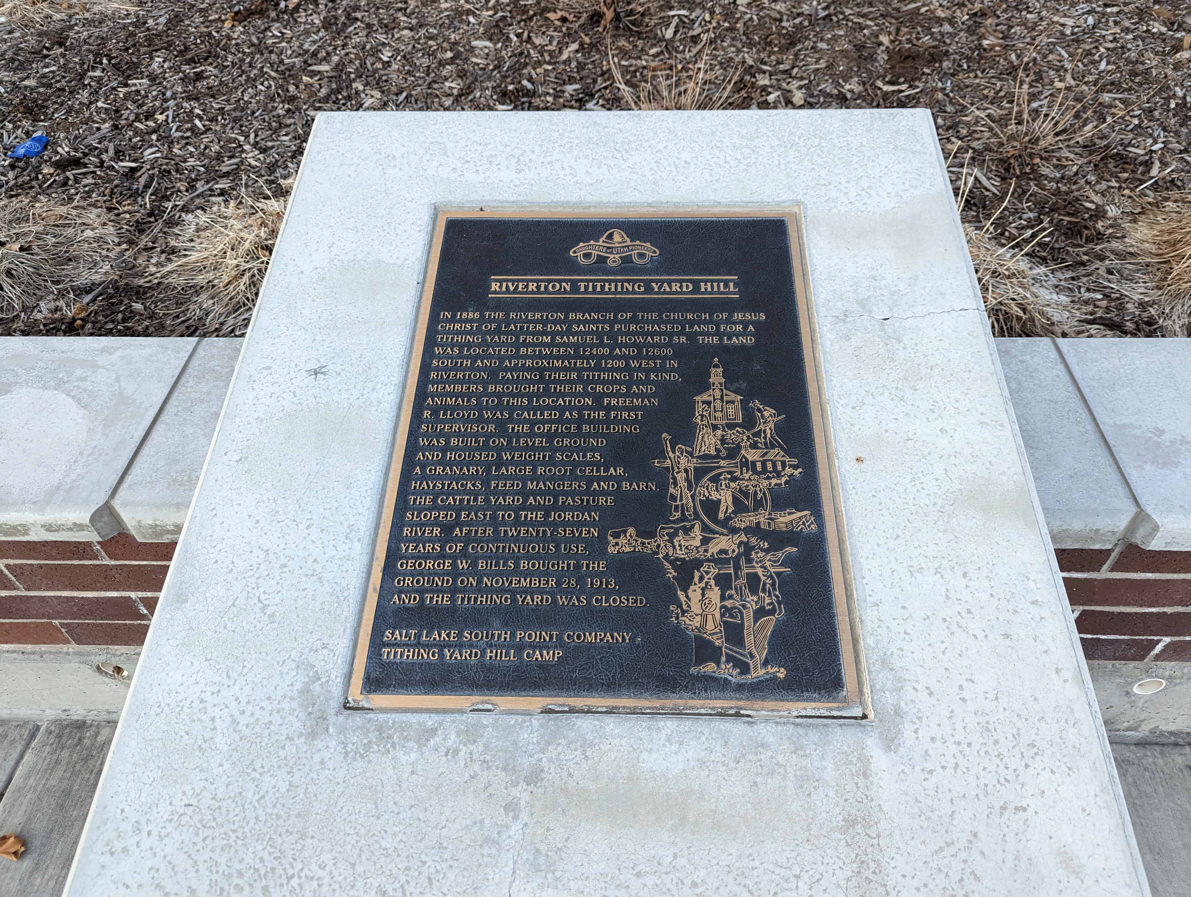
In 1886, the Riverton branch of the Church of Jesus Christ of Latter-day Saints purchased land for a tithing yard from Samuel L. Howard Sr. The land was located between 12400 and 12600 South and approximately 1200 West in Riverton. Paying their tithing in kind, members brought their crops and animals to this location. Freeman R. Lloyd was called as the first supervisor. The office building was built on level ground and housed weight scales, a granary, large root cellar, haystacks, feed mangers and barn. The cattle yard and pasture sloped East to the Jordan River. After twenty-seven years of continuous use, George W. Bills bought the ground on Nov. 28, 1913, and the tithing yard was closed.
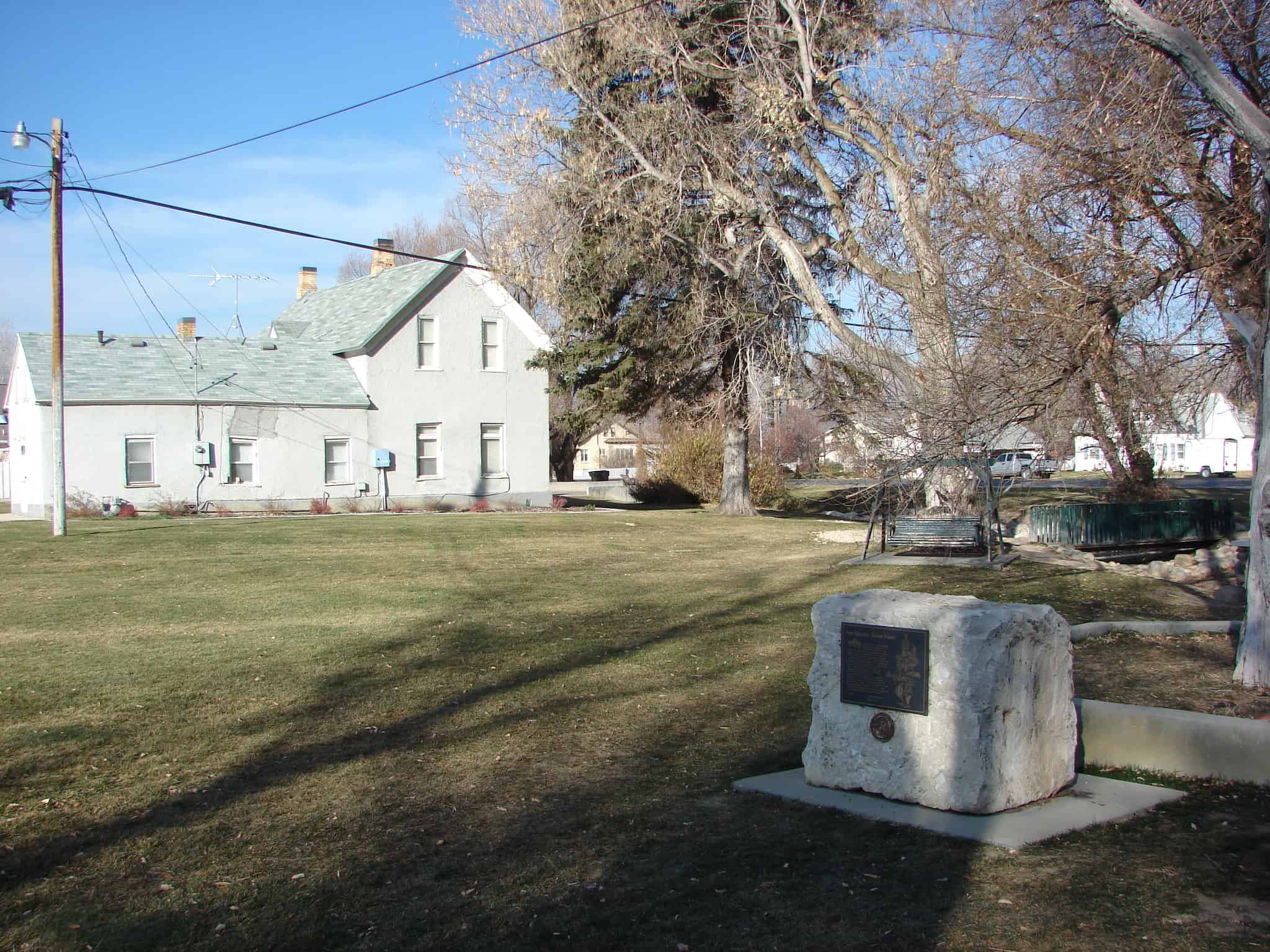
These stones, quarried in Chalk Creek and hauled by oxen in 1854, were used in the foundation of the two-storied 30 x 40 adobe church building located in the Pioneer Fort one half block east of Main Street. Remodeled into one 30 x 60 hall with oval ceiling, it was used for church and school until 1900, when it became the Relief Society home for nine years. It then served many different purposes. Sold to Roy and Mary A. Dame in 1915, whose family financed this monument and steps.


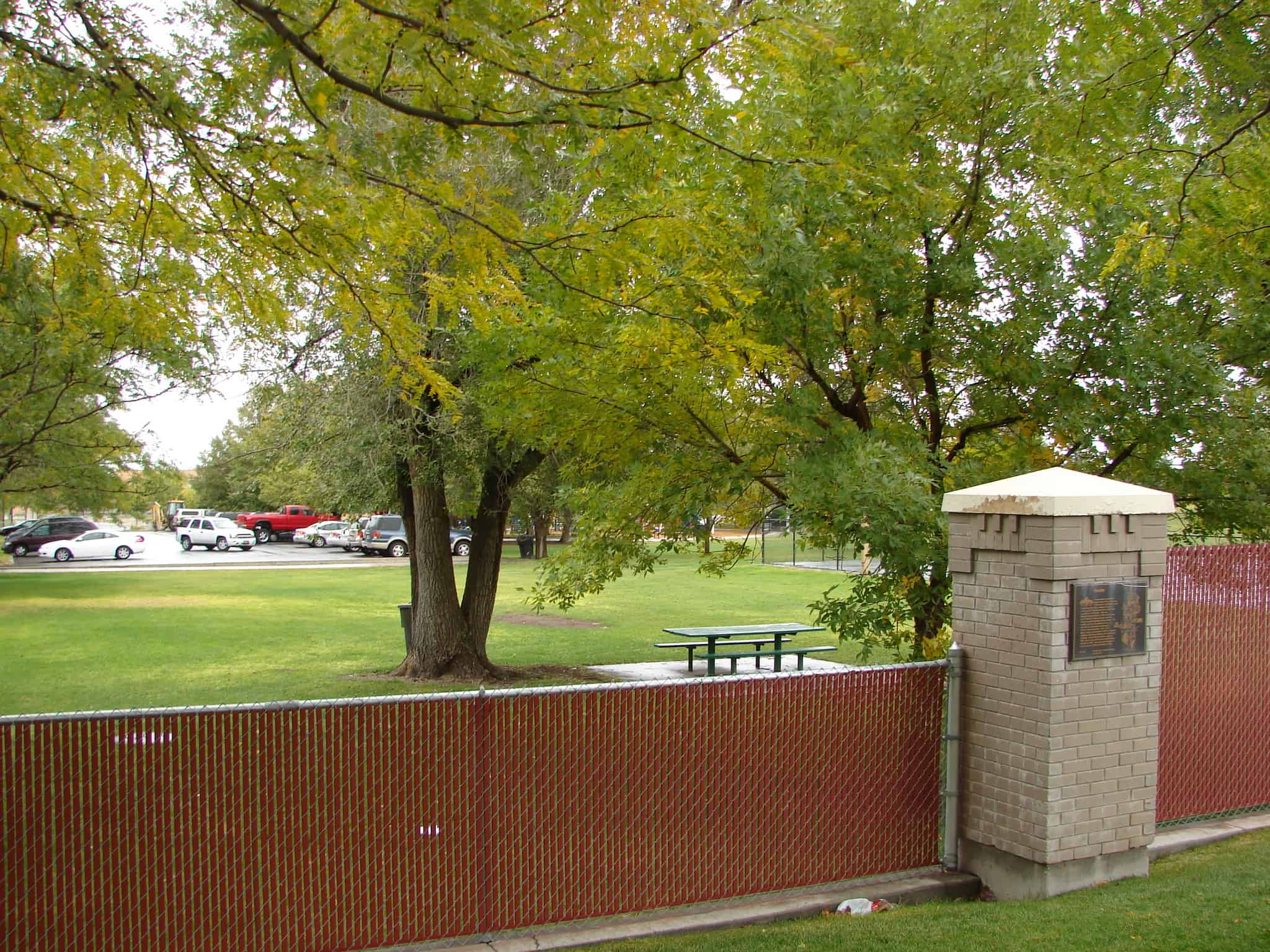 Homesteaders and settlers came in the 1870’s to the area 4700 South to 7200 West, north to the Great Salt Lake, northeast along it’s shore and the Davis County line to 4800 West and south to 4700 South. This area became Hunter Precinct in 1880 from the east part of Pleasant Green, and was named in honor of presiding Bishop Edward Hunter. The northern soil was too alkaline to farm. In 1881 the Utah Salt Lake Canal brought water to the central part. a 20′ x 30′ adobe chapel was erected in 1885 for religious meetings, 50th District School, and community activities. Hunter Branch became a ward in 1888. East of this site the 50th District School was built in 1891. The name was changed to Hunter School in 1906 and Whittier in 1908.