Tags
Faust, Historic Markers, Pony Express, SUP, Tooele County, UPTLA, utah, Vernon

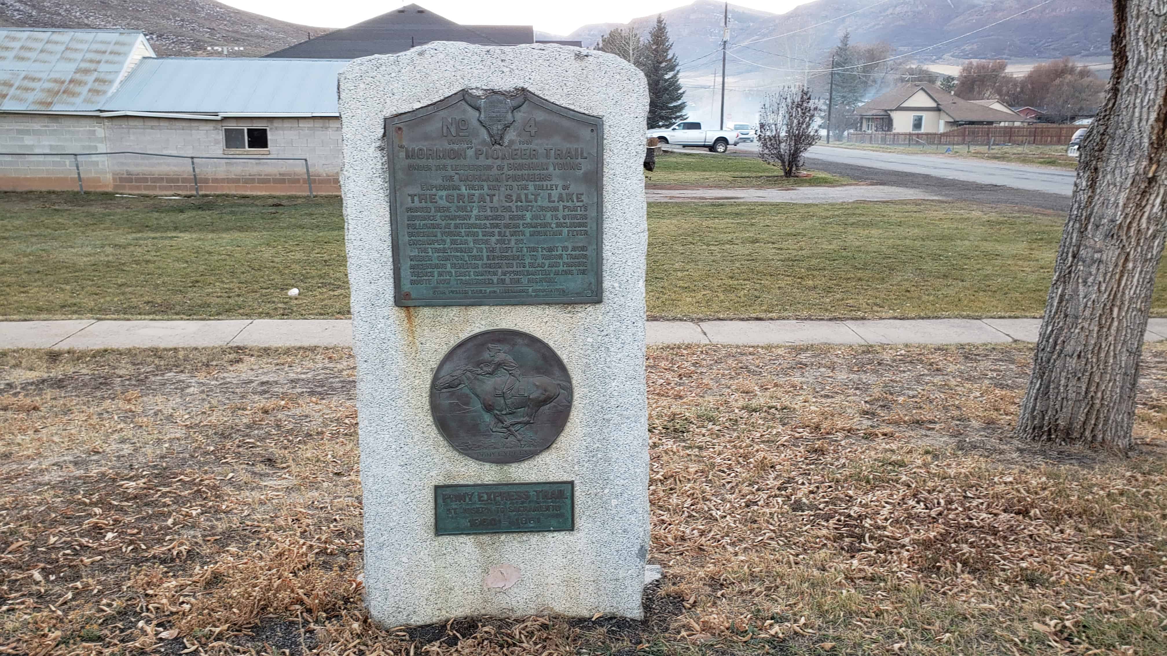
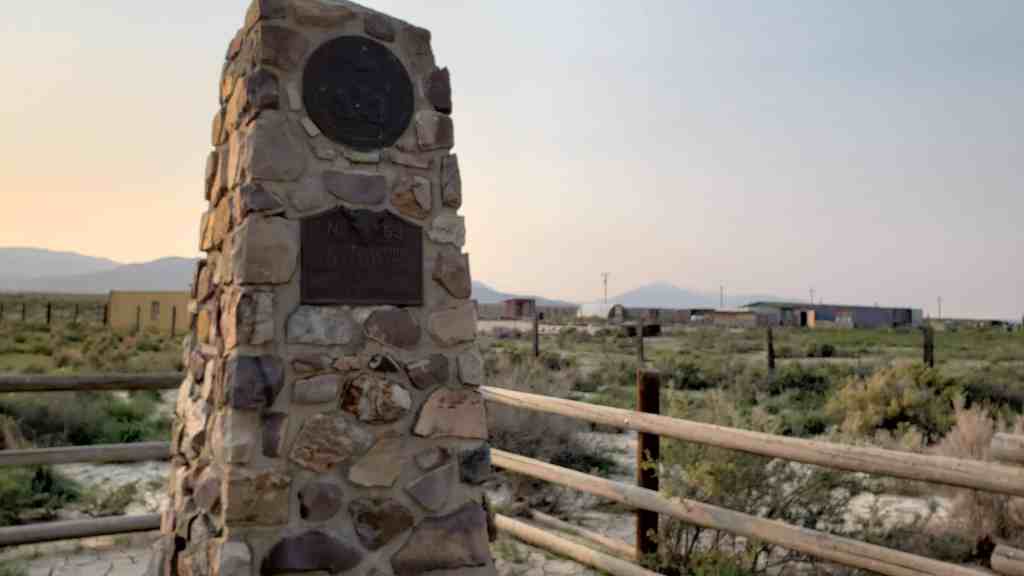
Faust Station Pony Express
St. Joseph, Mo. to Sacramento, Cal.
1860 – 1861


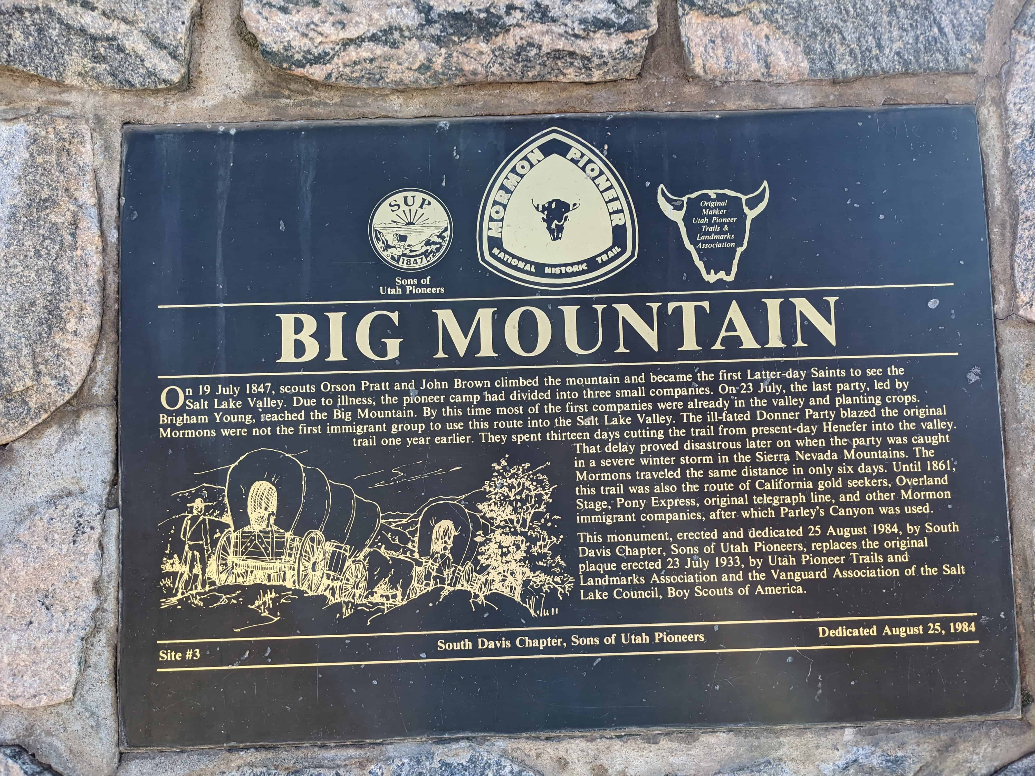
This historic marker was erected August 12, 1935 by the citizens of Vernon and Utah Pioneer Trails and Landmarks Association.
Related:
- Faust, Utah
- Other UPTLA Historic Markers and Sons of Utah Pioneer Markers
- Pony Express


The Crowds Cheered On…
In 1845, it took six months to get a message from the east coast of the United States to California. By the time it arrived, the news was old. In the late 1850s, a half million people had migrated west, and they wanted up-to-date news from home. Something had to be done to deliver mail faster and to improve communication in the expanding nation.
“The Central Overland California and Pikes Peak Express Company,” a subsidiary of Russell, Majors, and Waddell, announced the formation of the Pony Express on January 27, 1860. They planned to carry letter mail between St. Joseph, Missouri and Sacramento, California in only ten days. Although the Pony Express was a financially risky enterprise, the company hoped to attract a lucrative contract with the U.S. Postal Service.
Knowing that a healthy horse could run at a full gallop for only 10 to 12 miles, the Pony Express needed stations for its riders to change mounts. They utilized existing stage stations on the eastern end of the route, but needed to build many new station in remote areas across the Great Basin. Alexander Majors said that 400 to 500 mustang horses were purchased, 200 men were hired to manage the station, and 80 riders signed on to begin the run of the Pony Express.
Although the Pony Express captured the admiration, imagination, and hearts of people, it was a financial disaster for its founders. The Pony era, however, was not brought to an end by its financial failure, weather, or even problems with Indians – but by the completion of the Transcontinental Telegraph on October 26, 1861.
“Every neck is stretched, and every eye stained… Across the endless prairie a black spec appears… In a second or two it becomes a horse and rider, rising and falling, rising and falling – sweeping toward us – growing more and more distinct, and the flutter of hoofs comes faintly to the ear – another instant a whoop and a hurrah from our upper deck, a wave of the rider’s hand, but no reply, and man and horse burst past our excited faces, and go winging away like belated fragment of a storm.” – Mark Twain – Roughing It, 1872.

Expedient Delivery
The goal of the Pony Express was to provide speedy and dependable mail service between Missouri and California. Before the first ride, an important task was to develop a shorter route – especially across the wild open spaces between Utah and California. With only two months to prepare, the owners of the Pony Express needed to insure that the mail would get through in a timely manner. to do so meant finding a route that would be more expedient than the established California Trail.
Settlements and homesteads between Utah and California were rare prior to the Pony Express. Fortunately for Russell, Majors, and Waddell, recent explorations southwest of Salt Lake City and work already in progress by other private companies provided the means to shave nearly 300 miles off the Humboldt River Route.
In the mid-1850s, a Mormon settler named Howard Egan scouted and developed a trail across the Utah west desert to drive his cattle between Salt Lake City and the markets in California. Learning about Egan’s route, entrepreneur George Chorpenning, who had previously developed three different routes along the Humboldt River, quickly realized the value this new route would have for his mail and freight business. Together, Chorpenning and Egan began building the road and developing provisioned way stations for passenger stagecoaches, freight wagons, and transporting mail.
Learning about Chorpenning and Egan’s roadwork, U.S. Topographical Engineer Captain James H. Simpson spent a few weeks in the late fall of 1858 exploring the desert area southwest of the Great Salt Lake. The following spring the U.S. Army ordered Simpson to survey the entire route as a potential road for transporting supplies to its outpost at Camp Floyd. On Simpson’s recommendation, in 1859 and 1860, the Army made some route adjustments and vastly improved the road and the water holes located along it for use by military freight wagons.
When the Pony Express began its first run in early April of 1860, only a handful of way stations existed across the new Central Overland Route. These first stations were toughly 20 to 25 miles apart. Pony Express riders would have to push their mustangs 50 to 70 miles between stations at Salt Lake City, Faust, Willow Springs, and Deep Creek until the new 10-mile relay stations were in place. With only two months to prepare , those new replay stations often began with nothing more than a tent canopy for the station keeper and a makeshift corral for the horses.
When the Pony Express began its first run

Only The Finest Horsemen
Both speed and stamina were required of the horse and rider team as they relayed mail back and forth between Dt. Joseph, Missouri and Sacramento, California in 10 days or less.
Pony Express rider Thomas O. King recalled: “[the Express] required the best riders, [those] physically able to stand the strains of endurance by day or night and in all kinds of weather and other dangers.”
Eighty tough, experienced youths were hired to ride either active and nimble western mustangs or the best-blooded American racing horses money could buy. Upon seeing his first express rider while en route to Salt Lake City in 1860, British explorer Sir Richard Burton wrote: “They ride 100 miles at a time – about eight per hour – with four changes of horses, and return to their stations the next day.”
Express riders had to be able to stay in the saddle over grueling distances – with or without relief. Nick Wilson, who had ridden in Nevada and Utah, recalled: “Not many riders could stand the long, fast riding at first, but after about two weeks they would get hardened to it… When we started out, we were not to turn back no matter what happened, until we had delivered the mail at the next station… We must be ready to start back at half a minutes’ notice, day or night, rain or shine, Indians or no Indians.”
“Not only were they remarkable for lightness of weight and energy, but their service required continual vigilance, bravery, and agility. Among their number were skillful guides, scouts, and couriers, accustomed to adventures and hardships on the plains – men of strong wills and wonderful powers of endurance.” – Alexander Majors, 1893 memoirs.