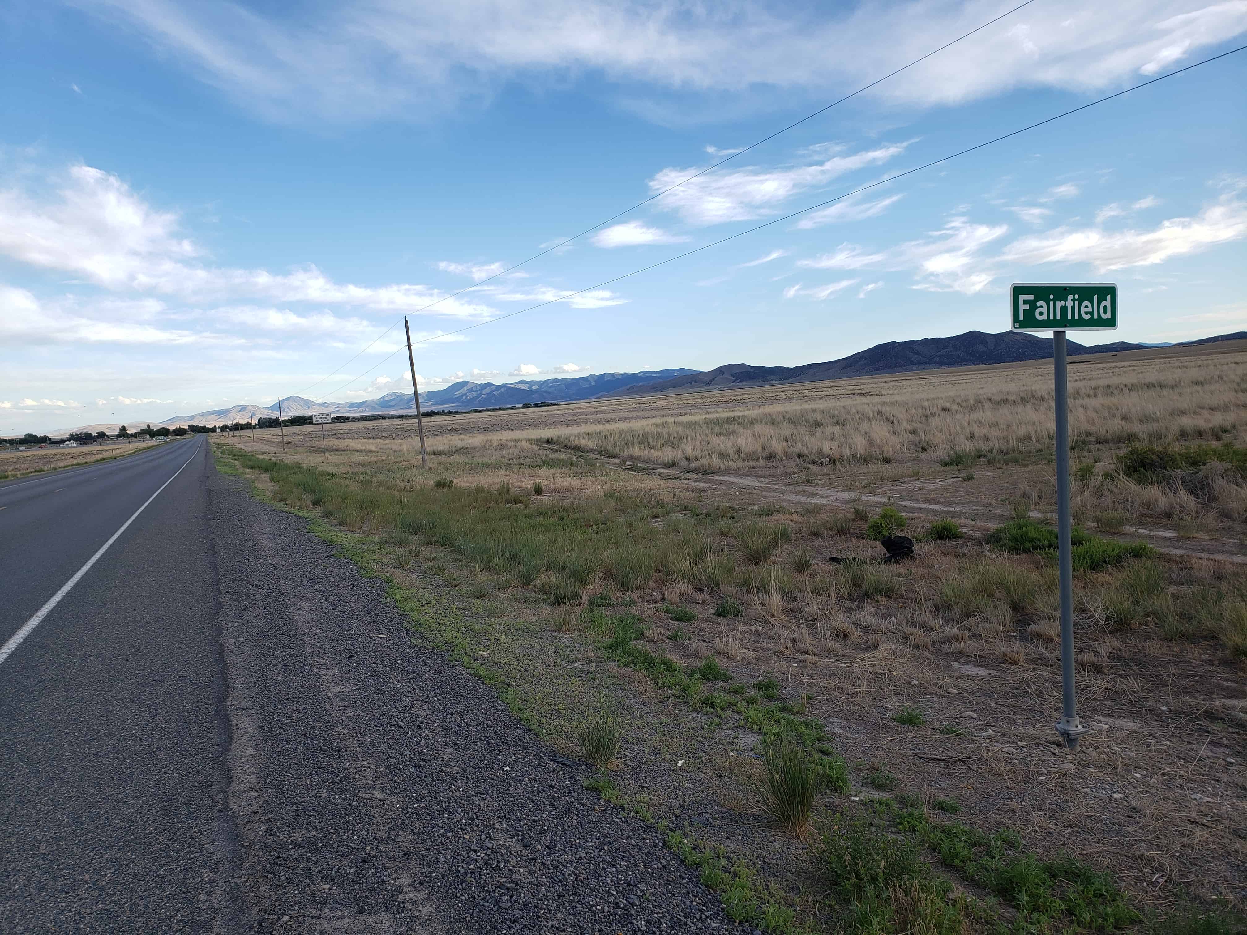
Fairfield has the highest average age of residents in the County at 49.5 years old. It was incorporated December 20, 2004. It was previously known as Frogtown.
The town was founded in 1855 when John Carson, his four brothers, and others settled in the Cedar Valley. The settlement was soon known as Frogtown. The population ballooned after the arrival of Johnston’s Army in 1858-59, sent to Utah to suppress the rumored rebellion there. The army established a nearby camp called Camp Floyd, and the population grew to over 7,000, including 3,500 troops (nearly one-third of the entire U.S. Army at that time), teamsters, gamblers, and camp followers of various persuasions. With no rebellion taking place, the troops were recalled in 1861, sent east to fight for the Union with the outbreak of the Civil War.
Frogtown became Fairfield in 1861, named after Amos Fielding, who had participated in establishing the community.
The Stagecoach Inn, located in Fairfield and now a museum, was used by travelers passing through via stage coach, military personnel, and riders on the Pony Express trail.
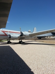
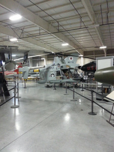
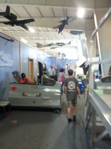
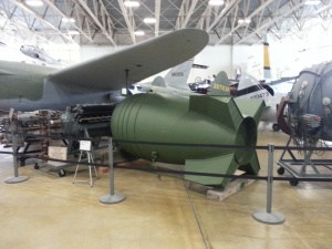
We went to the Hill Aerospace Museum (Hill Air Force Base Museum) the other day, I thought I’d post some photos here.
I was surprised there was no bus route to it, just for fun we decided not to drive and took the frontrunner train to clearfield and then bus 470 up to the corner of 5600 S and 1900 W where we walked across to the museum.
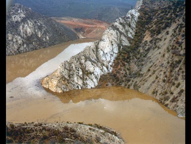
In April, 1983 a massive landslide dammed the Spanish Fork River. Residents evacuated as the valley filled with water backed up, flooding the town and destroying the town. It was the first presidentially declared disaster area in Utah.
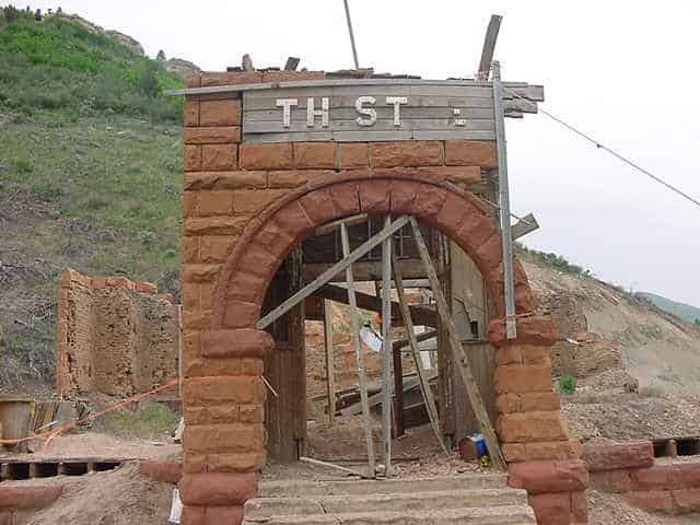
There are a few structures remaining, you can see a few in this video.
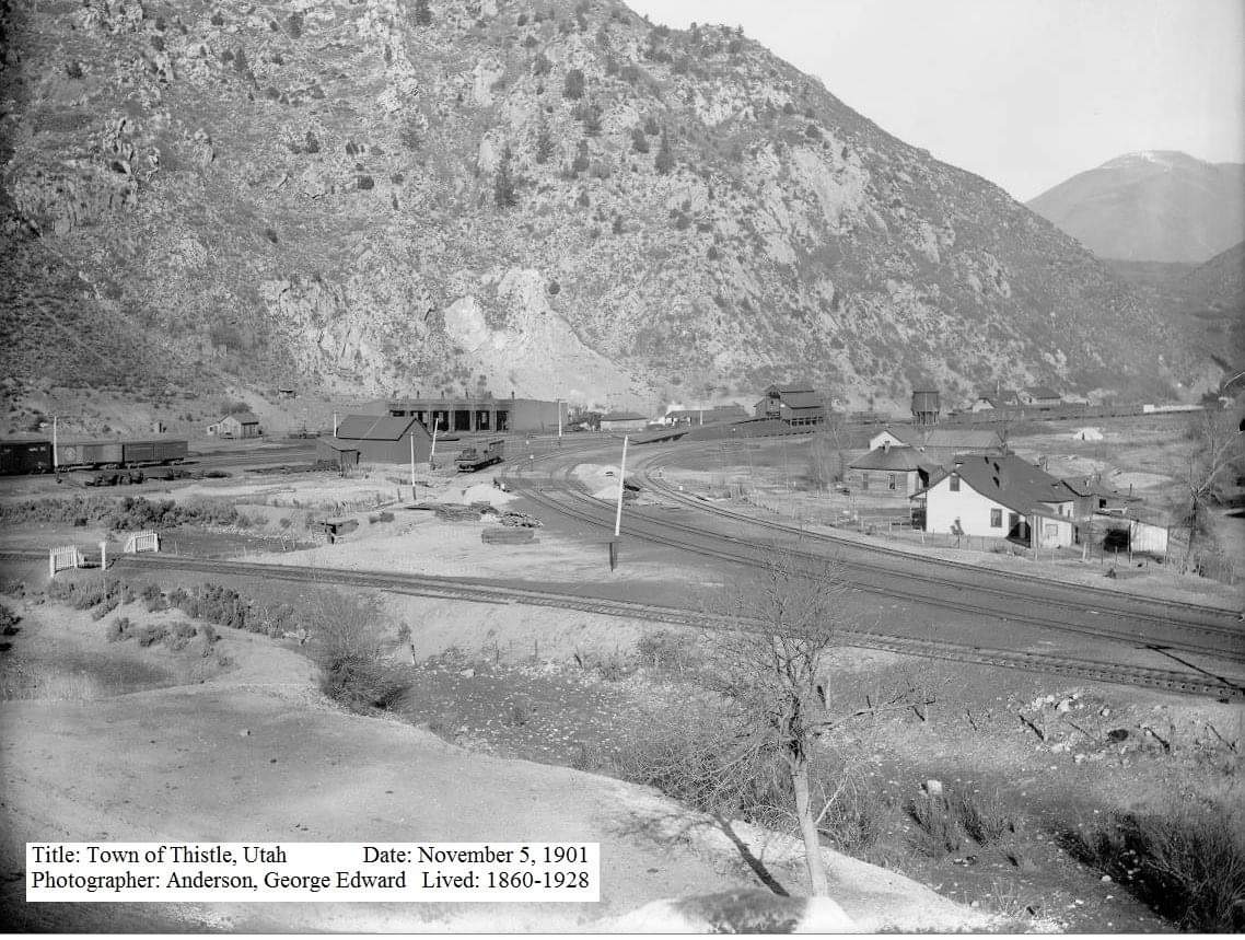
In 1983 the town of Thistle, Utah, known to many highway travelers as the small community where both the Spanish Fork River and nearby U.S. highways branch, was eliminated by the most costly landslide on record in the United States.
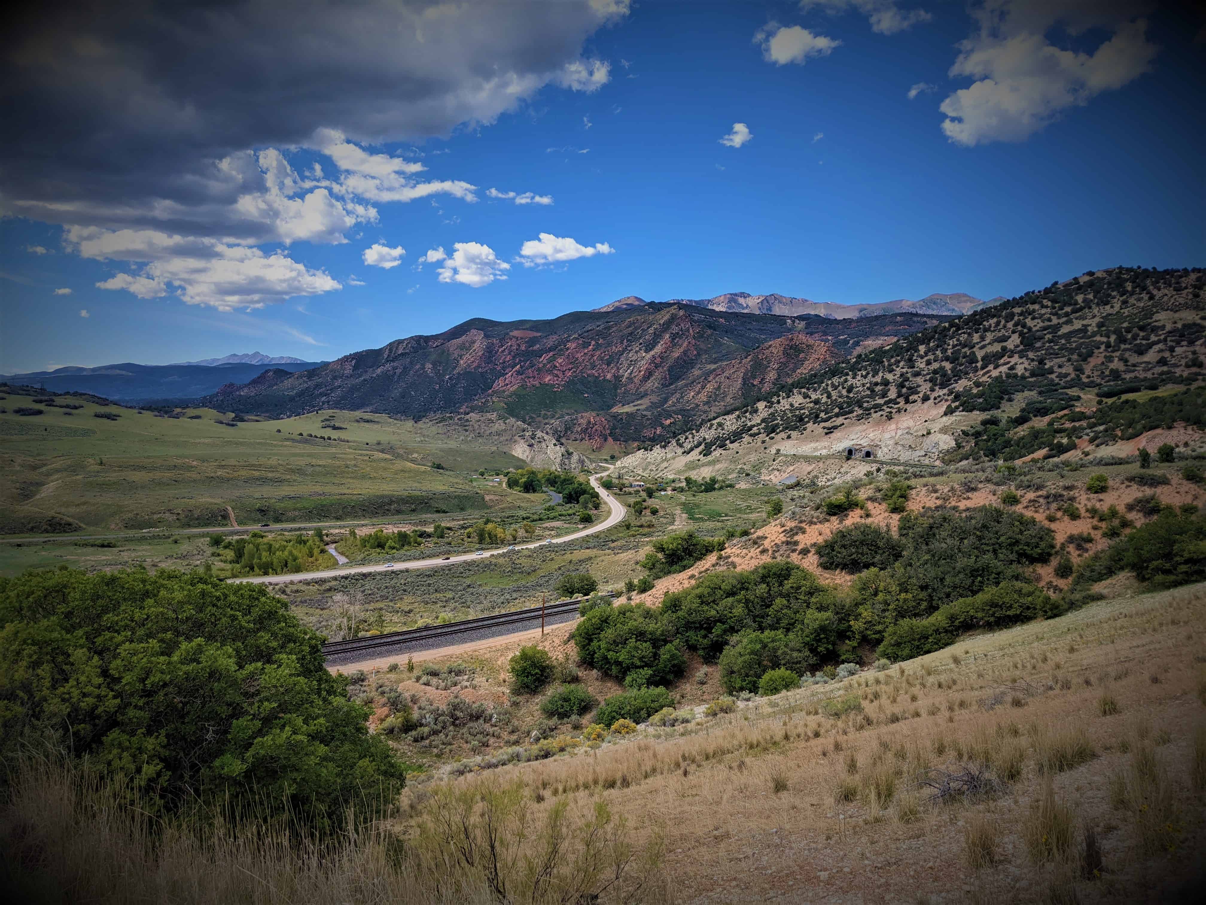
Thistle was located at the triple junction of transportation systems leading south to Sanpete County, east to the coal counties of Carbon and Emery and points beyond, and northwest to the Wasatch Front and Salt Lake City. Two major highways converged at Thistle (U.S. Highways 89 and 6). Until the landslide, two rail lines also converged at Thistle–the main line of the Denver and Rio Grande Western Railroad (D&RGW) joining Denver and Salt Lake City, and a branch line to Marysvale.
Ironically, the main line of the D&RGW railway from Denver to Salt Lake City follows the Soldier Creek and Spanish Fork drainages because of, rather than in spite of, landslides. Few corridors through the Rocky Mountains accommodate the gentle gradients required by railroads. Less stable landforms susceptible to landslides have eroded and formed the gentler terrain that allows modern rail passage. The advantages of this route had long been known. Undoubtedly the local Native Americans who guided the Spanish explorers traveled this route. Later trappers and pioneers used this natural corridor for their trade and transportation needs. The name “Spanish Fork” refers to the early exploration of the area by the Spanish, specifically Dominguez and Escalante in 1776 as they sought a trading route from Mexico to California. Soldier Creek is named for the route taken by federal troops as they moved through the area in the mid-1800s.
Thistle became an important junction on the railroad with the 1890 completion of a branch line south through Sanpete Valley. When the Utah Railway Company began to construct its own line in 1912, a second set of tracks up Spanish Fork Canyon to Helper, the D&RGW contracted to maintain the tracks for joint use and to maintain the Marysvale line. Ninety years later, because the Thistle landslide buried the exact junction and joint tracks, the two companies fought out legal responsibilities and insurance claims in the courts.
The town of Thistle expanded and contracted with the fortunes of the railroad. The town saw its heyday in the early 1900s. Six hundred residents lived in Thistle in 1917. Changing economics and technologies reduced the need for an active rail town with its large depot, water and coal supplies, roundhouse, and supporting stores, post office, schoolhouses, and saloon. The depot was torn down in 1972. Shops closed, and even the post office closed in 1974. A few families stayed; others moved in. In March 1983, fifty residents in a dozen houses claimed the town of Thistle as their home.
For a century, the D&RGW competed with the Union Pacific for traffic from Denver to Salt Lake City. Mineral, energy fuels, and manufacturing products dominated the railroad’s freight and revenues. Eastern Utah mines generated almost half of the freight tonnages. During the 1950s the railroad branch from the Sanpete-Sevier region carried manufactured wallboard, as well as mine and agricultural products. However, by 1983 trains to Marysvale were infrequent and the Thistle landslide provided the coup de grace for the D&RGW to obtain permission to close the unprofitable line. The landslide prematurely shut down the D&RGW Zephyr passenger service and delayed the start of Amtrack’s “California Zephyr” service on the D&RGW main line.
Storms heralding the 1982 to 1986 wet cycle kicked off the wettest month ever recorded at the Salt Lake City International Airport in September 1982, and saturated the ground before the winter snows. The winter was neither exceptionally wet nor cold. However, snows and cold nights continued late into April and May 1983, and resulted in an unusually late and sudden snowmelt when temperatures did warm up. May snowpacks of northern Utah averaged two to three times their normal. Utah’s landslide problems correlate with precipitation and snowmelt. Two large landslides in the early spring alerted geologic experts to the situation. The National Weather Service briefed local and national officials about the unusual conditions. Yet even with the geologic and climatic indicators, the events of April, May, and June caught the state by surprise.
Starting in January, the D&RGW watched the Thistle area as well as several other landslide-prone areas near Soldier Summit. Their geotechnical experts visited the area on April 12. Days later, when the Thistle landslide began to move visibly, no one recognized it as a major hazard. The railroad tracks went out of alignment on Wednesday, 13 April. The highway became bumpy, fractured, and became impassible on Friday, 15 April. The streambed and deposits on the canyon floor rose approximately one foot an hour as a huge tongue of earth piled up against the bedrock buttress of Billies Mountain, filled the canyon, and dammed the river. The waters of the Spanish Fork River rapidly created Thistle Lake upstream of the landslide dam.
The railroad company and the Utah Department of Transportation (UDOT) initially tried to keep the railroad tracks, highway, and river open. Sunday, 17 April the landslide defeated efforts to cut down through the rising toe of the landslide and allow passage of the river water. Efforts to siphon waters rising behind the landslide dam also failed. Rising lake waters drowned the community of Thistle. That very day, the president of the D&RGW announced at Thistle that the railroad would tunnel a new railroad course through Billies Mountain. To be successful, the tunnel had to be above Thistle Lake’s eventual highest water line. Railroad experts in consultation with the state decided to form the landslide into a dam and to construct an overflow spillway tunnel to control the uppermost rise of the lake. Having calculated how fast an overflow tunnel could be constructed, and how fast the lake would rise, they began drilling. The state took charge of public safety priorities. Armies of workers and heavy equipment shaped the landslide dam while it moved by transferring 500,000 cubic yards of earth from the middle area of the landslide onto its toe. This also provided a platform from which to construct the tunnels. The state constructed a third tunnel to drain the impounded water. UDOT decided to relocate the highway over Billies Mountain. The Army Corps of Engineers constructed a pumping system to keep Thistle Lake from rising to dangerously high levels.
The impounded water rose at approximately the rate predicted and the D&RGW contractors completed the overflow tunnel system with two days to spare. Trains passed through the new tunnel on 4 July, eighty-one days after the initiation of the project and eleven days before the contracted completion date. The new tunnel provided a permanent bypass for the Spanish Fork River around the landslide. The relocated highway encountered difficult geotechnical problems. The highway opened at the end of the year but was often closed due to major rockfalls and slope stability problems.
The town of Thistle was destroyed. The Marysvale branch line of the railroad was never reopened, leaving a large area of central Utah without rail service. Thistle resulted in Utah’s first presidential disaster declaration and became the most costly landslide the United States had experienced. The Utah Business and Economic and Research Bureau reported the following dramatic impacts of the landslide. The D&RGW and Utah Railway embargoed all shipment that normally went through Thistle. The rerouting surcharge of $10 per ton virtually stopped coal shipments. Two trucking companies laid off workers, cancelled contracts, and even suspended operations. Most of the area’s coal mines laid off miners, cancelled contracts, and experienced shut downs. Some miners’ commutes suddenly exceeded 100 miles. Some coal haulage commutes trebled. Due to market conditions and the Thistle landslide, coal production dropped nearly 30 percent in 1983. Uranium producers paid substantially more for supplies in an already soft market. At least one oil company became non-competitive due to increased travel costs. Tourism in the area, particularly in-state tourism, sagged in response to negative publicity and difficult access. To the south, the blockage of route 89 and the Marysvale line hurt coal companies, turkey and feed operations, and gypsum, cement, and clay shipments.
The Thistle landslide caused total estimated capital losses of $48 million and revenue losses of $87 million, plus associated losses in tax revenues. Direct costs of Thistle tally over $200 million, including relocating the railroad at a cost of $45 million, relocating the highway at a cost of $75 million, and lost revenue to the railroad of $1 million per day (which totaled $80 million, including $19 million in charges that the D&RGW paid the Union Pacific to use their rail lines).
This is what it looked like in 2001 when I first explored it:
Brookside is a nice little neighborhood in Springville, the homes were build in the 1940′s and it has always been a quiet, friendly community.
Brookside is comprised of Brookside Drive, a road that circles around back to itself. And “A Street”,”B Street” and “C Street” which cut through the circle.
Hobble Creek cuts along the south edge of Brookside.
Springville Bank Robbed. One Robber Killed, the Other Captured and Money Recovered. Captured Robber is a member of the Robbers Roost Band and Has a Price on His Head — One of the Posse Seriously Wounded.
Springville, May 30 — Springville has experienced the sensations of a bank robbery, a hard, but successful chase after the robbers, the surrounding of them in a patch of thick brush, the killing of one and the capture of the other. And to use ht expression of the live robber after he had been jailed, the old town is not as sleepy as it looks to be.
The robbery occurred at 10;05 a.m. Saturday. Two men walked into the Springville Bank and presented a check as follows:
Springville, Utah May 28, 1898. On sight pay to the order of T.S. Cerswell the sum of $200. C.H. Charter. By T.C. Burton.
They asked the bookkeeper, Mr. Packard, the only person there was in the bank at the time, if Mr. Carter had left any money there to pay the check with. He replied that he had not. Then turning to his books Mr. Packard was startled with, “Look here young man” in a commanding tone, and looking up found himself covered by two revolvers.
The robber who was afterward killed kept Packard covered while the other robber went behind the railing and began gathering up all the money he could find. While thus engaged he dropped a stack of twenties, and while picking them up Packard lowered his hand and touched an alarm button. The robber on guard noticed the movement and exclaimed: “G — d — you! put that hand up and keep it there!”
The alarm is connected with Mr. Reynolds’s store. On several previous occasions the alarm had been accidentally sounded and this was thought to have been the case again. So Mr. Reynolds stepped up to the telephone, and rung up the bank to ask if anything was wrong. Receiving no reply he realized this was no false alarm. He grabbed two Winchesters and rushed for the street, but the robbers were turning a street corner a block away. Messengers were started on bicycles, on horseback and on foot to raise the alarm, and in an incredibly short time a large posse was in pursuit.
The robbers after securing all the money in sight, $3020, jumped in a buggy they had near the bank and started on a dead run for Hobble Creek canyon. Near the outskirts of the city they met Mr. Snelson riding a fine horse. They took his horse from him and threw him $16. One of the robbers mounted the horse and the other continued by buggy. By this time Mr. Reynolds in his delivery wagon was within 150 yards of them, and fired two shots which were not noticed by the robbers. Soon afterward the robbers, seeing they were being overtaken left their buggy and took to the brush at the mouth of the canyon. In 20 minutes 100 horsemen were on the ground and had the robbers completely surrounded so that escape was impossible.
A consultation was held and Joseph W. Allen proposed they close in on the robbers. This was adopted. In a few minutes one of the robbers was found covered with leaves. He surrendered on demand and was handcuffed. He was unarmed, having lost his revolvers in the brush. The other man was seen by Mr. Allen who said to him: “Now don’t you move or I’ll get you.” “I’ll get you while you’re getting me,” the robber replied and fired, striking Allen in the left leg. Allen returned the fire killing his man instantly. It was five minutes before any of the posse came up, when the robber was found dead.
Allen was tenderly cared for and sent to a Salt Lake hospital where his leg was amputated. The thigh bone was shattered.
Most of the money was recovered on the robbers or found buried near their hiding place.
The live robber was landed in the county jail at Provo, where he has been positively identified as C.L. Maxwell, a member of the Robbers Roost band, for whom a reward was recently offered by Governor Wells. He refuses to give the name of the dead robber, but says he was a married man with a family.
It was a Robbers Roost raid, and from a remark dropped by the captured robber, it is believed men were waiting with horses at a point further up the canyon, but the robbers were too hard pressed to reach them. The pursuit was too swift.
The old Springville Bank, now Central Bank at 202 S Main Street in Springville, Utah. In 2026 a major renovation began, changing the look back to the original.
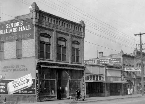
Photos of the stores on the West side of Springville‘s main Street, taken from about 300 South looking (North) up to 200 South.
We see “Senior’s Billiard Hall and Clothes Shop” “___ Child, Marble and Granite Works”, “Bakery and Candies”, The drug store, the Tailor, The “Herald Beacon”, “Columbia Cafe”, “Kodak’s Drugs”, an add for McDonalds and the Springville Bank.
(Photo Credit) The photo from 2013 at the top was taken by me.
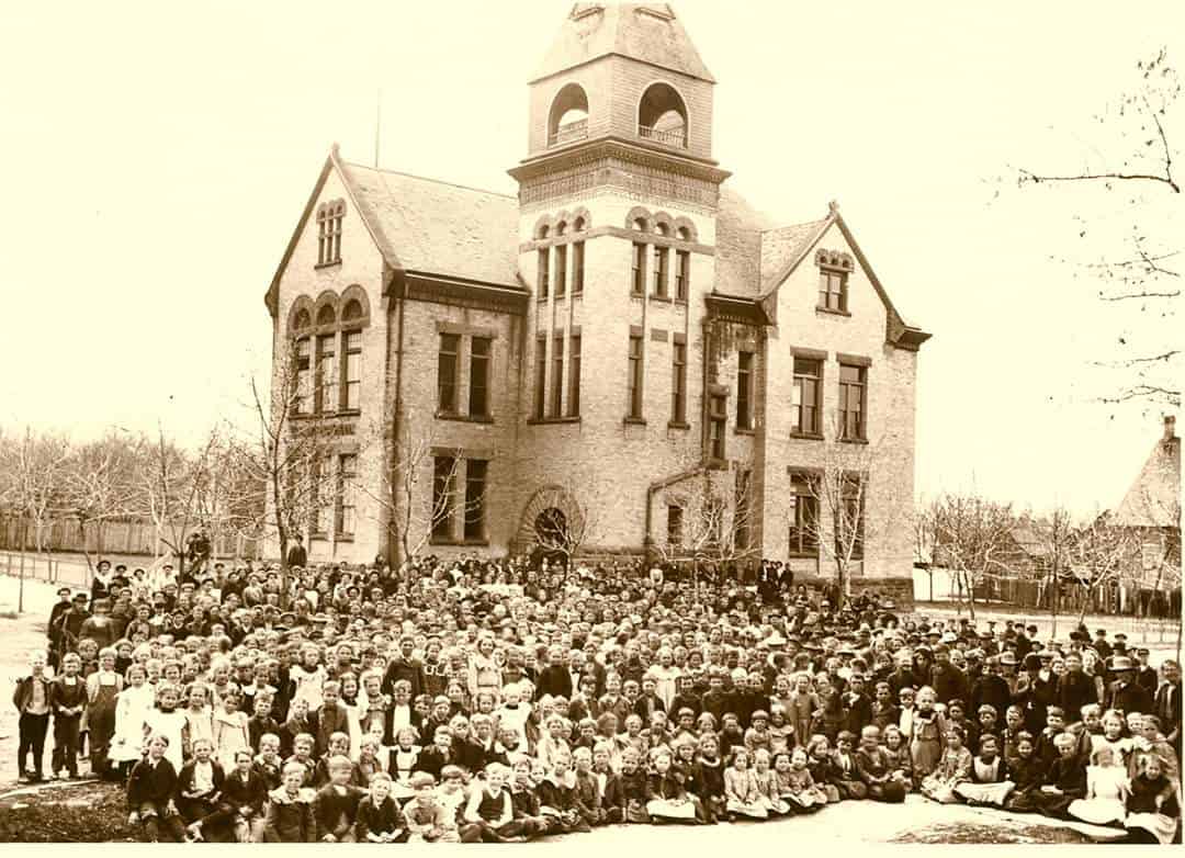
At the SW Corner of 200 E 300 S in Springville was the Washington School or Central School.
It stood from 1892 until 1937.
Originally built as the “Central School” in 1892, the name was later changed to the “Washington School”, and a belfry was added. The last classes were taught in this building in 1935, and it sat vacant for 2 years before being demolished in 1937. During demolition, materials were salvaged to be used in construction of the new Gymnasium at the Springville High School, which opened in 1939.
I heard the house at 160 E 300 S still has sandstone foundation blocks in the backyard. The school property would have been where that home was along with the homes at 310, 328 and 346 south on 200 east.