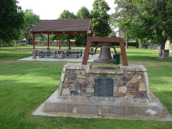
In 1882, on this site, a Relief Society building was erected under the leadership of Elizabeth J. Stickney, President. It was a one room structure, 20 x 30 feet in size, built of red clay brick made by Joseph Chatwin. The interior was furnished with homemade carpet, a pot belly stove, chairs and benches made of native lumber, an organ and a small table. At one end was a stage with curtains. July 10, 1942, the building was sold to the city for a public library and was later known as the civic center. It toppled to the ground in May, 1963. This old fort and school bell served the community until 1917. It rang for school, alarms, and special events.
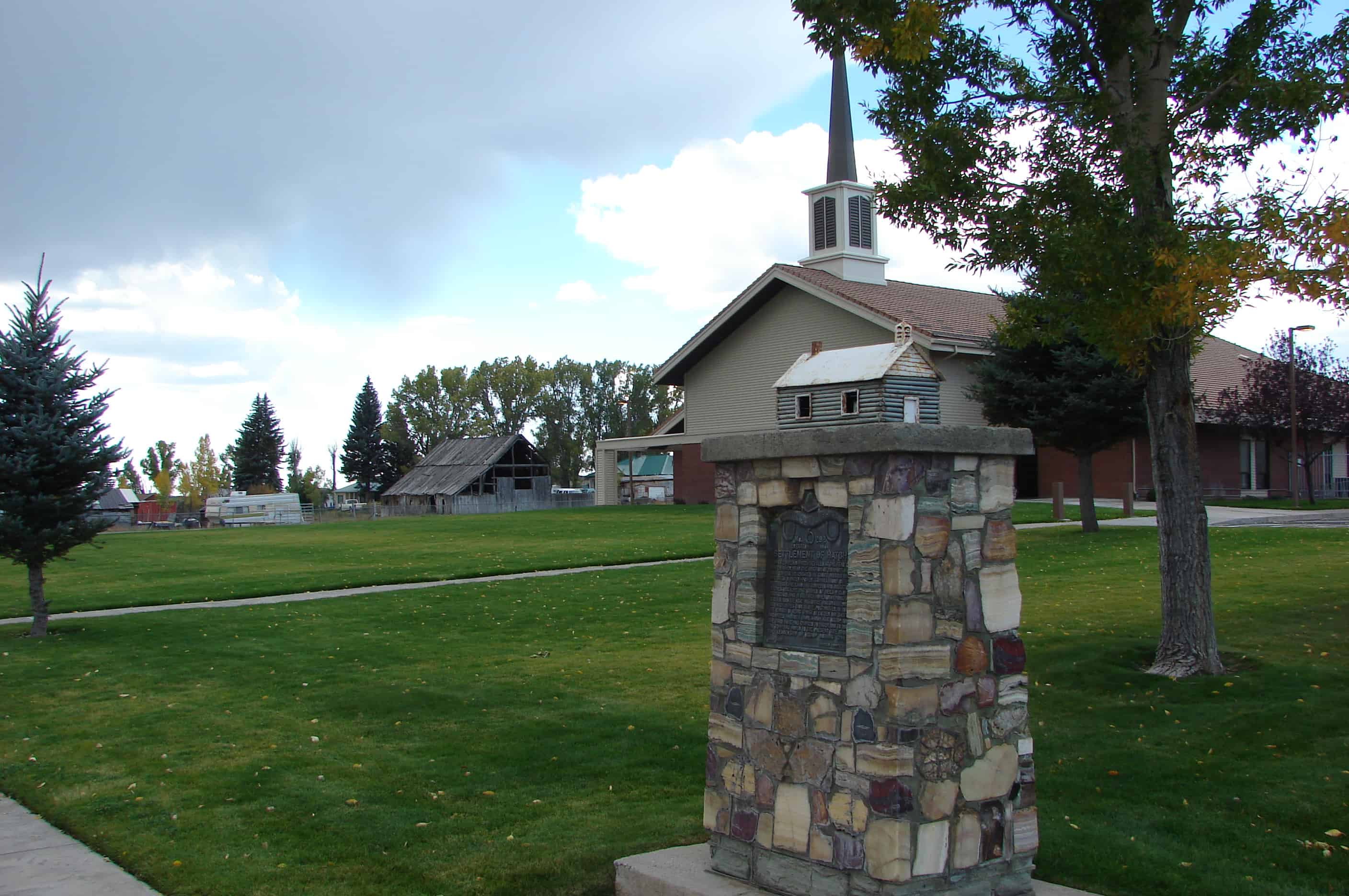
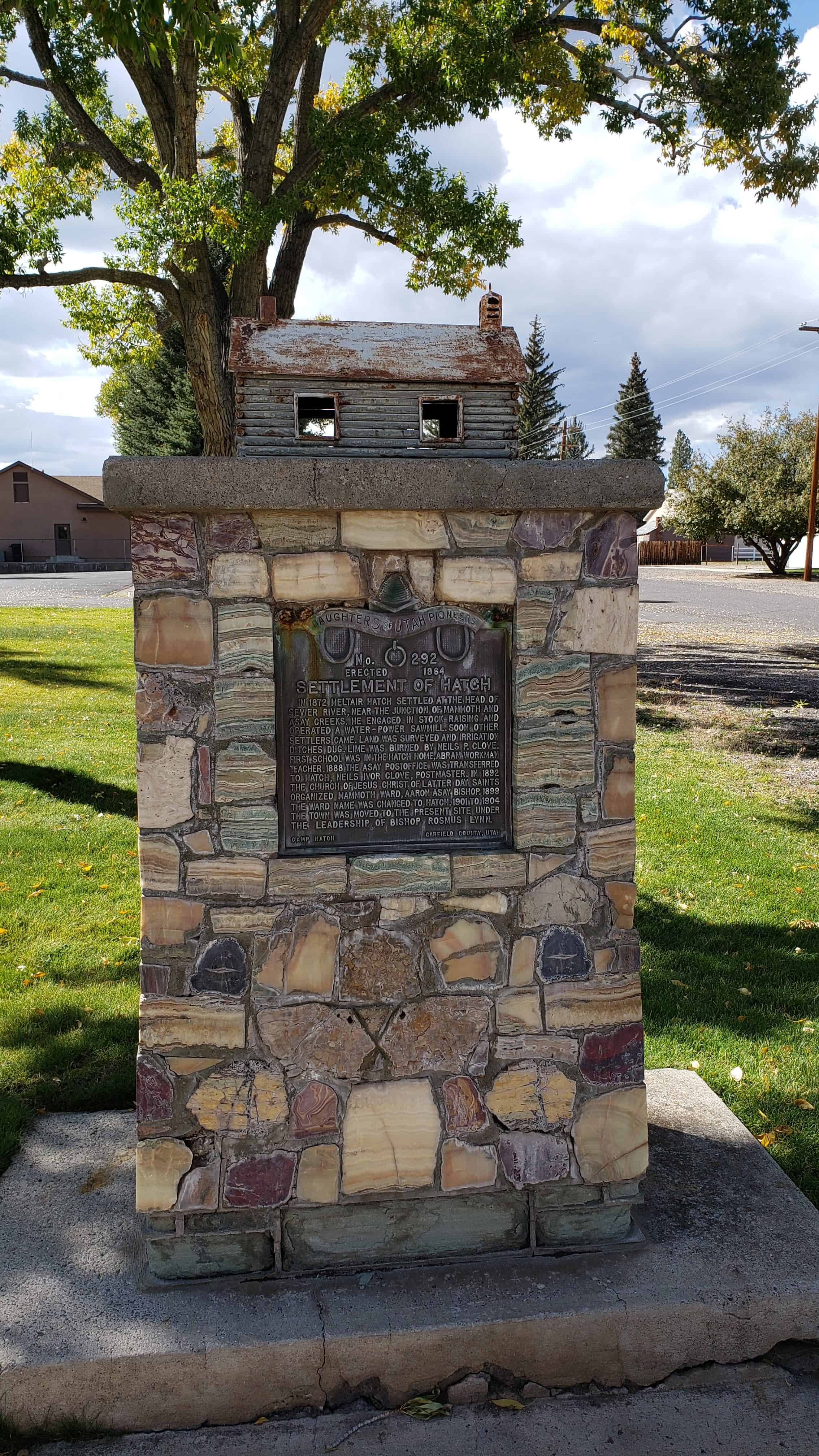
In 1872 Meltiar Hatch settled at the head of Sevier River, near the junction of Mammoth and Asay creeks. He engaged in stock raising and operated a water-power sawmill. Soon other settlers came. Land was surveyed and irrigation ditches dug. Lime was burned by Neils P. Clove. First school was in the Hatch home, Abram Workman teacher. 1888 the Asay post office was transferred to Hatch, Neils Ivor Clove, Postmaster. In 1892 the Church of Jesus Christ of Latter-day Saints organized Mammoth Ward, Aaron Asay, Bishop. 1899 the Ward name was changed to Hatch. 1901 to 1904 the town was moved to the present site under the leadership of Bishop Rosmus Lynn.
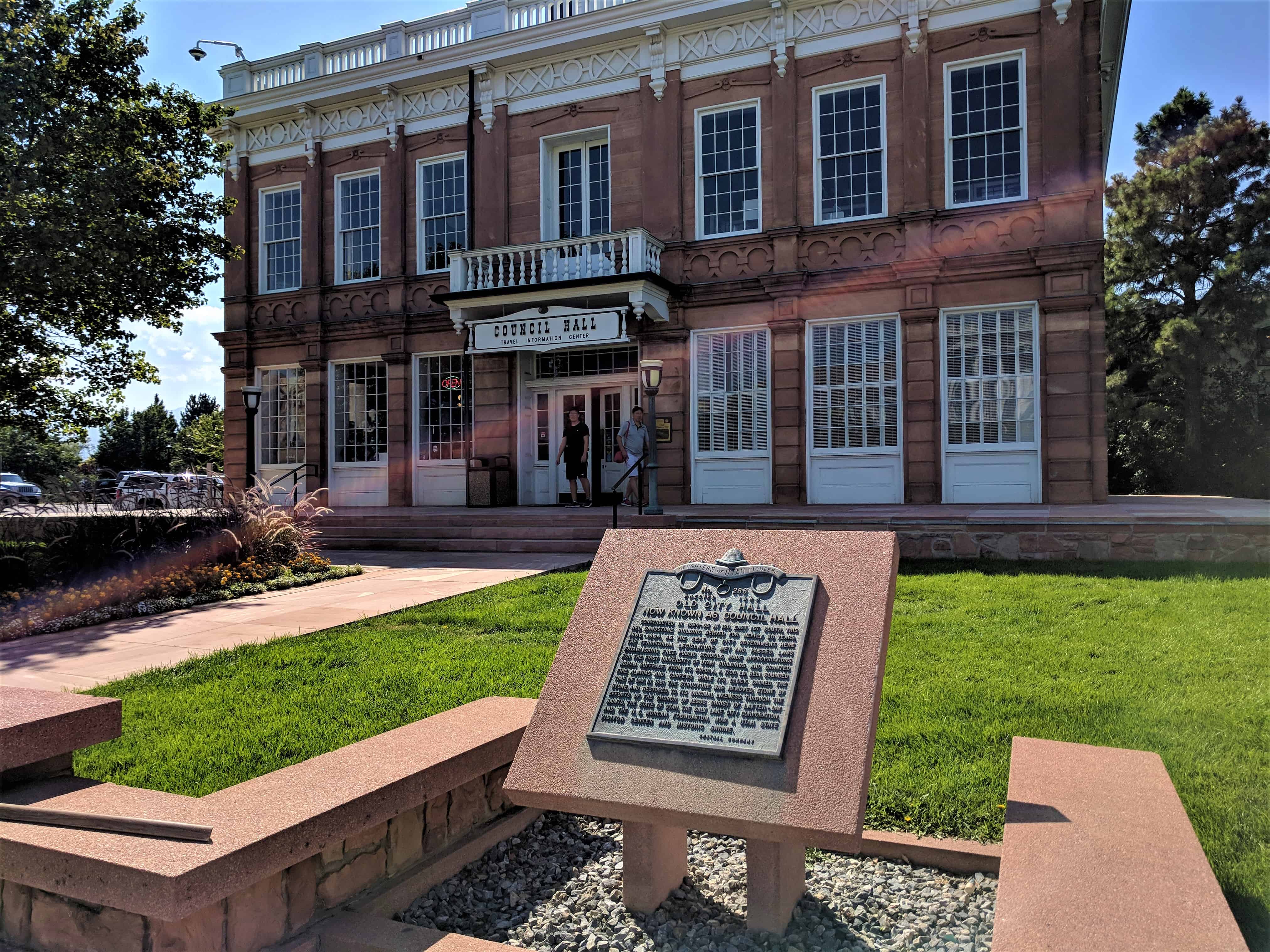
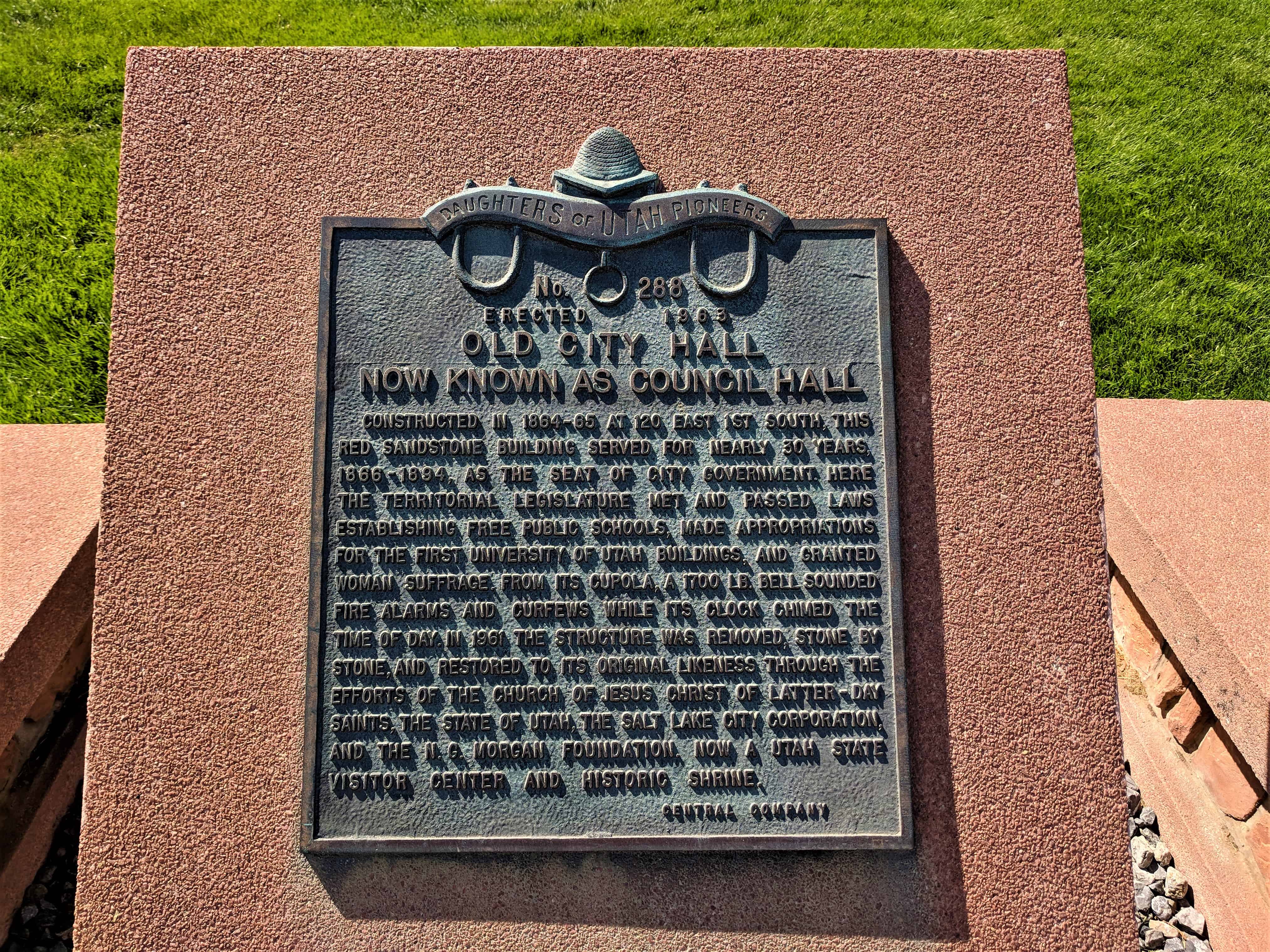
Constructed in 1864-65 at 120 East 1st South, this red sandstone building served for nearly 30 years, 1866-1894, as the seat of government. Here the Territorial Legislature met and passed laws establishing free public schools, made appropriations for the first University of Utah buildings, and granted woman suffrage. From its cupola, a 1700 lb. bell sounded fire alarms and curfews while its clock chimed the time of day. In 1961 the structure was removed, stone by stone, and restored to its original likeness through the efforts of the Church of Jesus Christ of Latter-day Saints, the State of Utah, the Salt Lake City Corporation, and the N.C. Morgan Foundation. Now a Utah State Visitor Center and historic shrine.
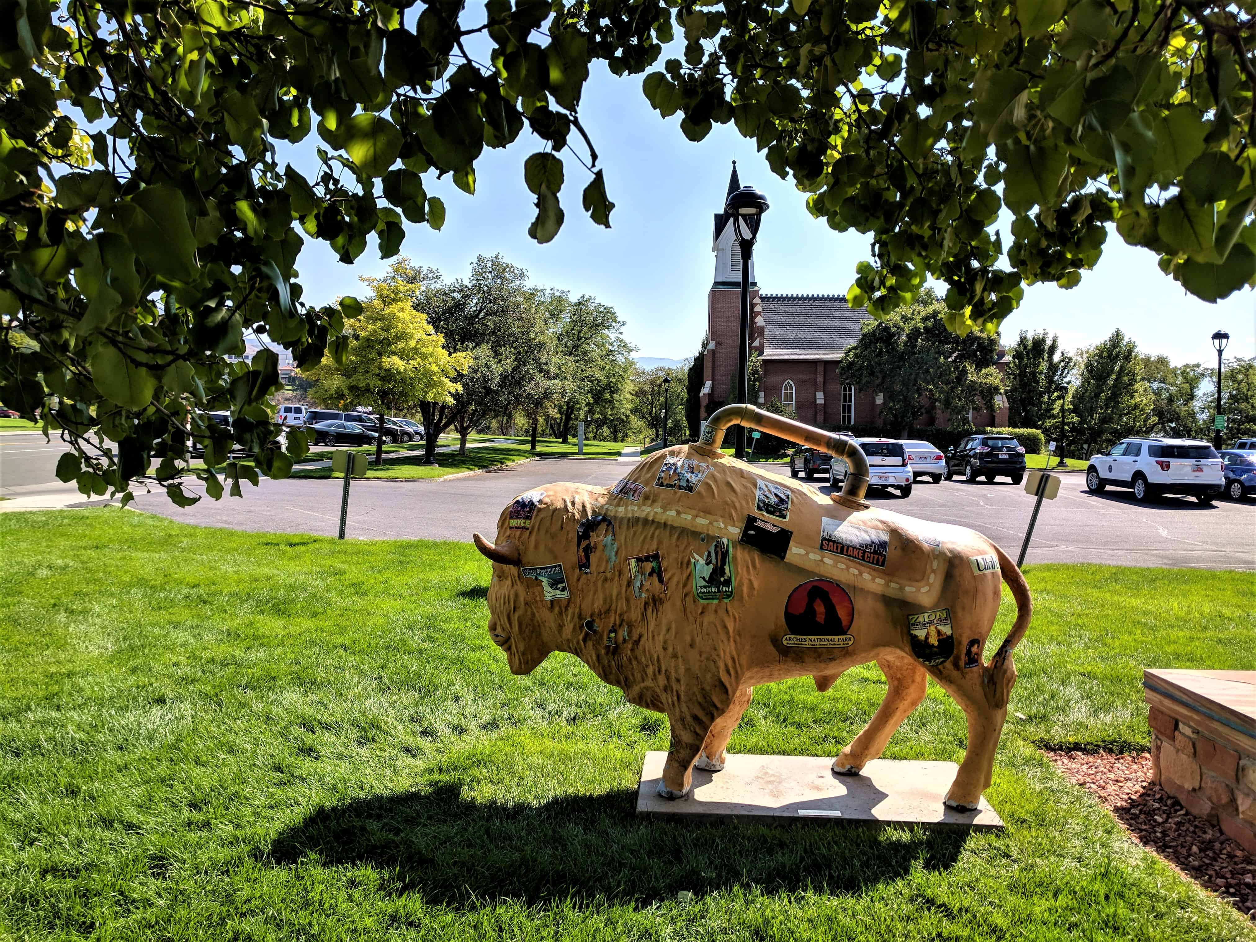
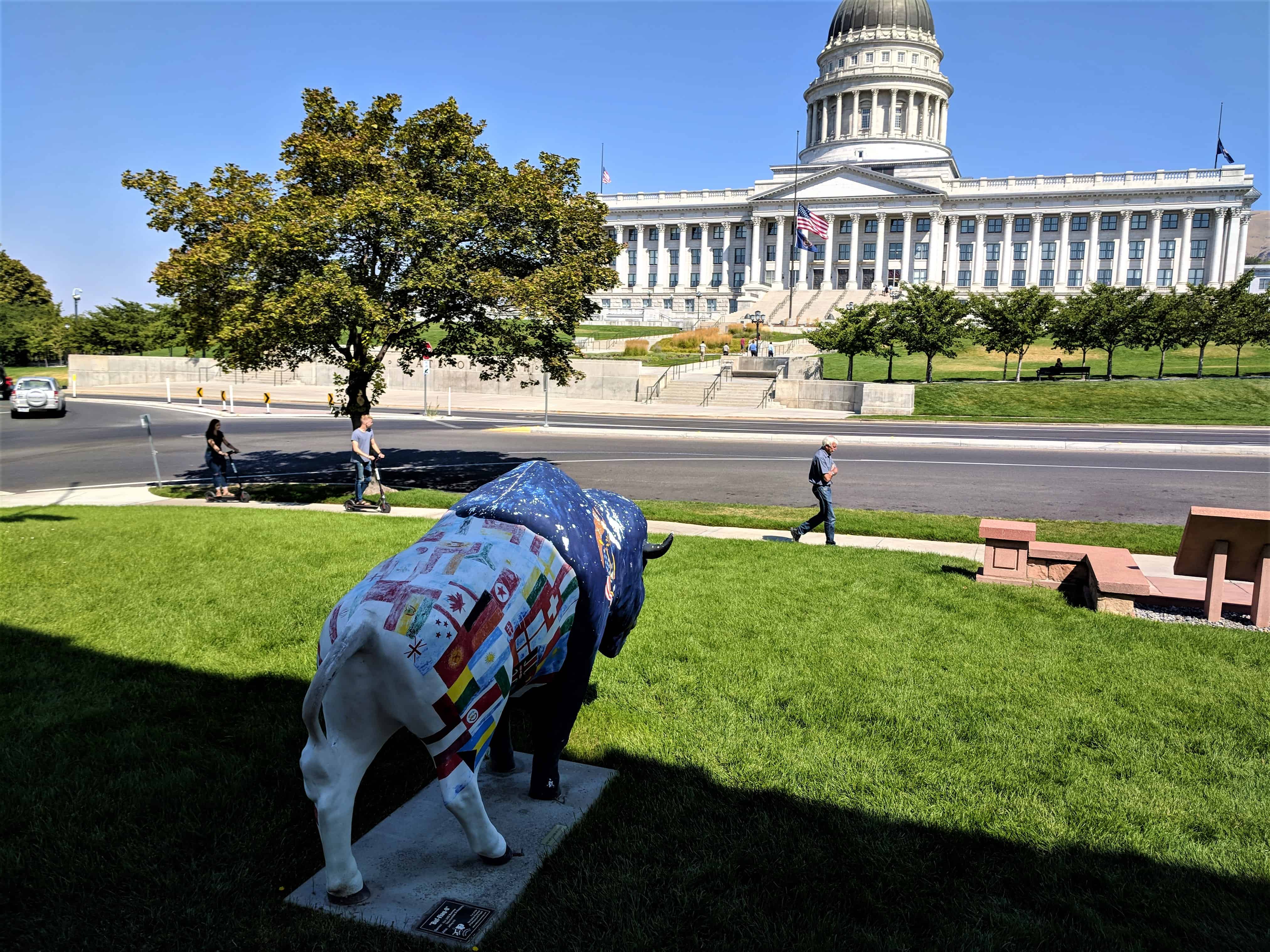
Its two most interesting features occupy the grounds at each front corner of the building. At the northwest corner is the “International” bison. This bison wears the flags of many of the different ethnic groups that contributed to the great economic growth of the area during the first 50 years after the initial emigration. At the northeast corner is the “Suitcase” bison, representing a piece of luggage bearing travel stickers from many of Utah’s top scenic attractions.
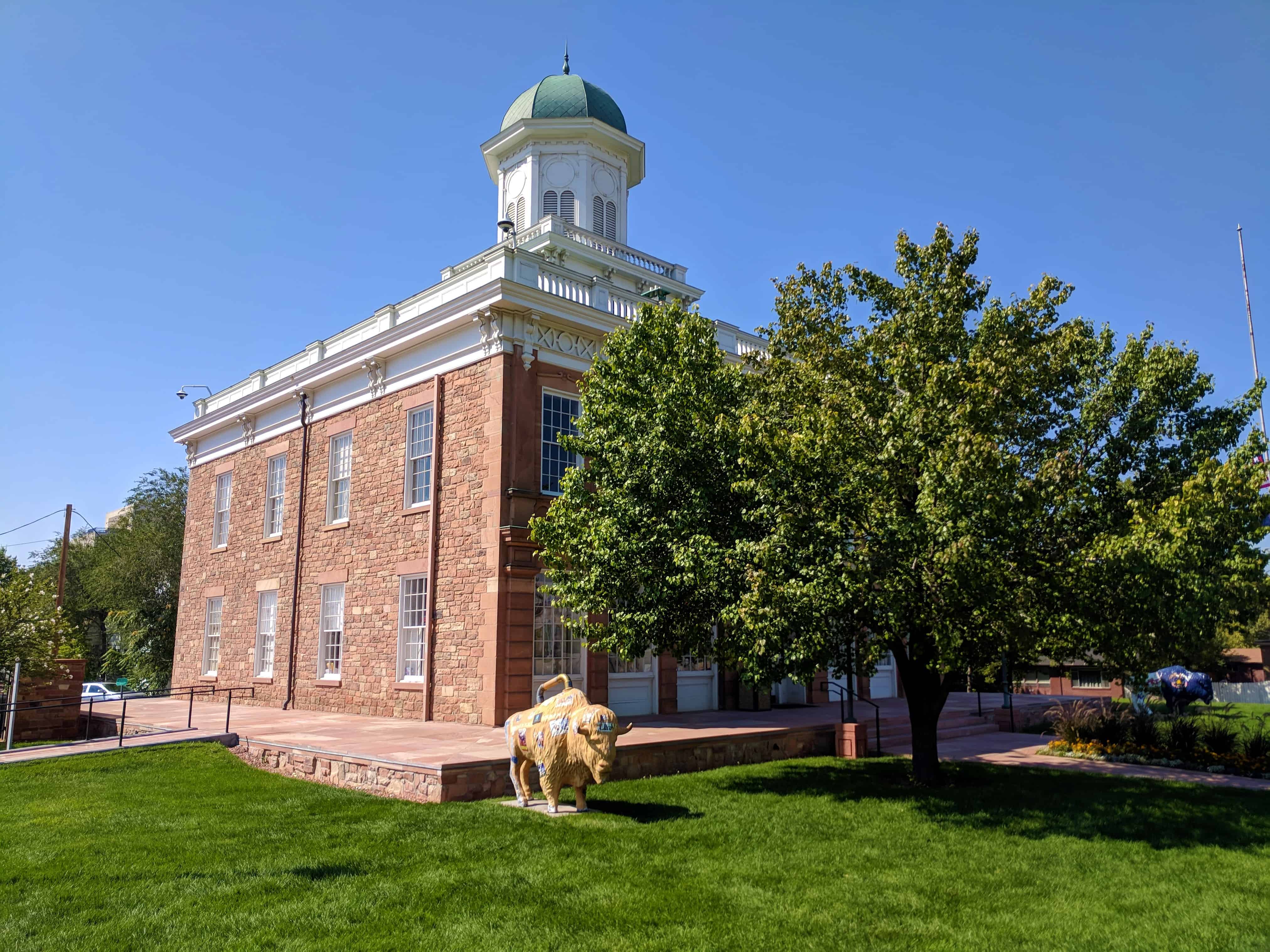
Erected between 1864 and 1866 to house Salt Lake City’s governmental offices, Council Hall served both as a municipal building an4 the Utah Territorial Capitol until 1894. Today it is an impressive reminder of what historian Howard Roberts Lamar has characterized appropriately as “perhaps the most turbulent and unusual” experience “in the history of the American territorial system.” Between 1850 and 1890 Utah exhibited few of the political, legal, and economic customs normally found in a developing frontier community. The theocratic territory rejected public schools, Federal land policy, the two-party system, parts of the common law, and the primacy of civil courts. Consequently the National Government departed from its usual territorial policy and adopted special measures to reconstruct Utah’s political and social institutions. In 1857-1,858 President James Buchanan sent a military expedition to the desert territory to force the Mormons to cooperate with Federal officials, and between 1862 and 1887, Congress enacted a series of laws banning polygamy, reforming Utah’s judicial system, dissolving the Nauvoo Legion, and establishing a commission to supervise Utah voter registration and elections. Only once before, in the defeated South after the Civil War, had the U.S. Government found it necessary to interfere so drastically in the local affairs of a community or region.
Because the Territorial Governor, the Mormon-dominated legislature, and Salt Lake City municipal officials shared Council Hall, much of the struggle for political control of Utah took place in the 60-foot-square, 2-story, red sandstone building. Originally it stood on the corner of First South and State Streets, but in 1961-1962, with funds supplied by the Church of Jesus Christ of Latter-Day Saints, the structure was dismantled and moved to the present location immediately south of the State capitol. Today the Utah Travel Council occupies the beautifully restored hall.
Architect William H. Folsom designed Council Hall for use as a municipal government building. Construction began at the corner of First South and State Streets in 1864 and reached completion in 1866. From then until 1894 the structure provided office space for Salt Lake City officials and served as Utah’s Territorial Capitol as well. City police enjoyed exclusive use of the hall from the mid 1890’s until 1915 , when it became the home of the municipal Board of Health.
In 1948 David O. McKay, President of the Church of Jesus Christ of Latter-Day Saints, guided development of plans to restore the building. The church secured land directly across from the State Capitol and furnished approximately $300,000 to finance movement of Council Hall about 1 mile to the new site. Architect Edward O. Anderson supervised the dismantling and restoration work in 1961-1962. Presently the building is the home of the Utah Travel Council.
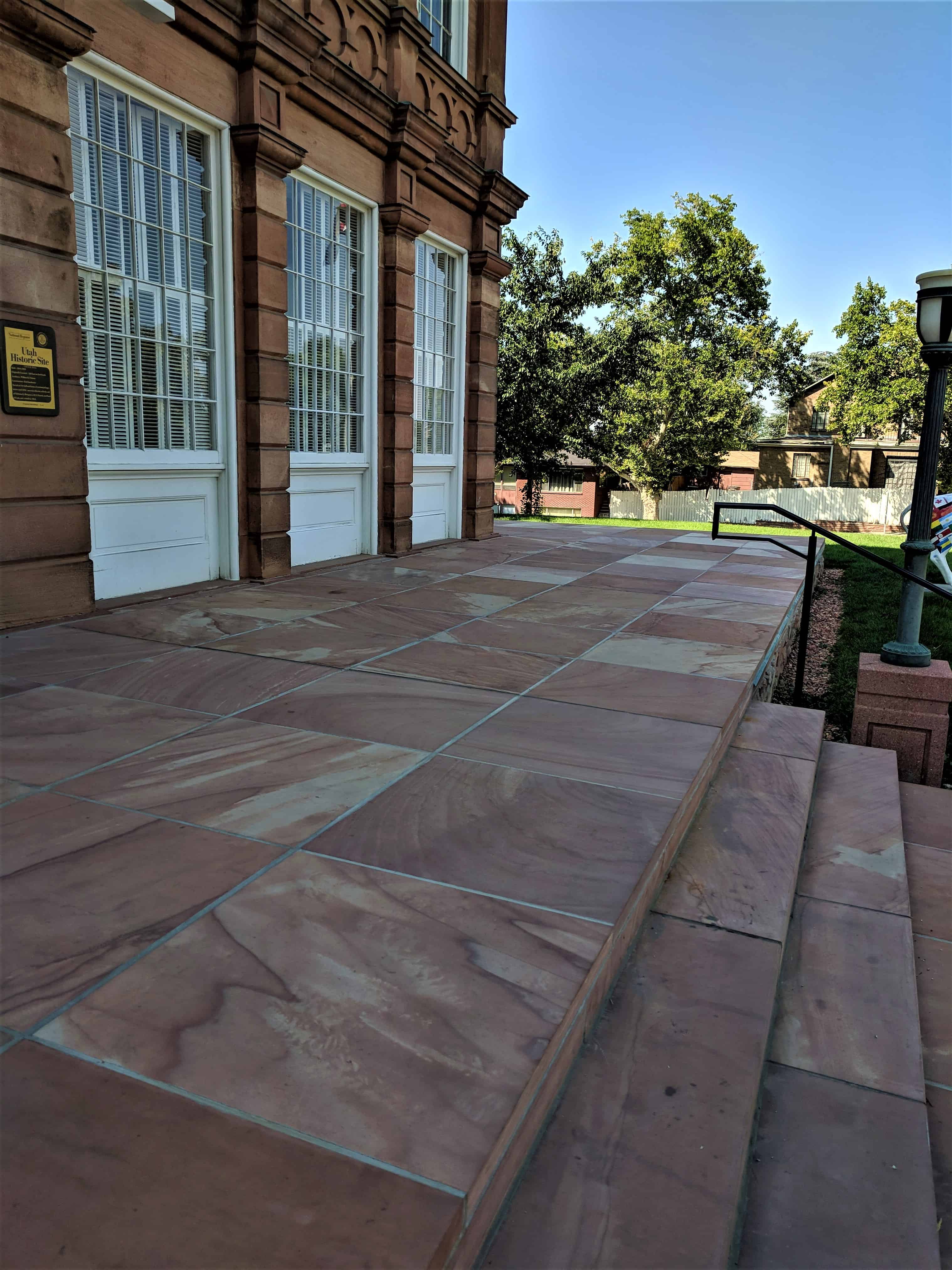
Elegantly designed, Council Hall is a 60-foot-square, 2-story structure of randomly laid red sandstone and contrasting white woodwork. It is seven bays wide and five bays deep. On the lower front façade, there are six stationary, 30-pane windows and a centrally located double door flanked by side lights. On the upper level, immediately above the main entrance, double glass doors open onto a small balustraded balcony, which is supported by pendant-ornamented brackets. The six upper level Windows are 12-over-12 sash, and each is topped by a broken pediment of stone. Side and rear windows are 12-over-12 sash too, but they are topped by smooth sandstone lintels.
A three-part wooden entablature extends around the top of Council Hall, and scroll brackets support the cornice and a railing. An octagon-shaped cupola with a square, balustraded base sits astride the copper-covered hip roof. The cupola dome and small spire are copper also. Two interior metal chimneys pierce the roof near the northeast and southwest corners.
length of the first story. Large paneled doors with transoms and shouldered architrave trim lead into a visitor information center and a storage room on the left and a period room and a conference area on the right. Four-inchwide oak planks with simulated wooden pegs cover the floors throughout. Walls and ceilings are finished in plaster and painted variously in white, yellow, green, blue, and pink.
A dog-leg stair with turned balusters leads from the corridor to the upper story, where there are two offices, a large courtroom, and the council room. The latter measures about 35 by 45 feet, contains period furniture, and features an elaborate plaster cornice. Adjacent to this room is the original mayor’s office, which is furnished with period pieces too.
Structurally the restored Council Hall differs from the initial building in only two major respects. A small basement has been added for additional storage space, and a sawed sandstone apron has been constructed around the exterior.
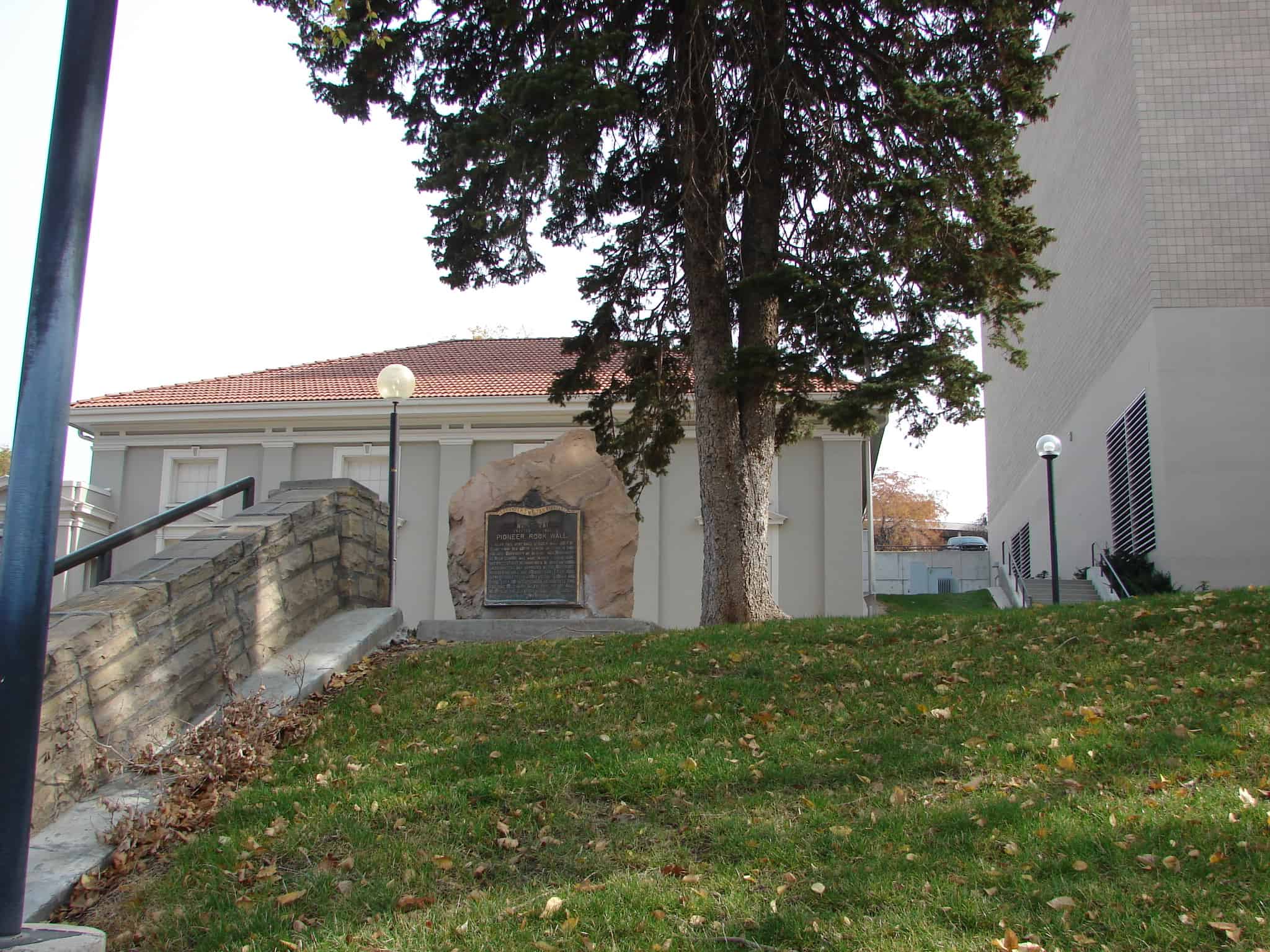
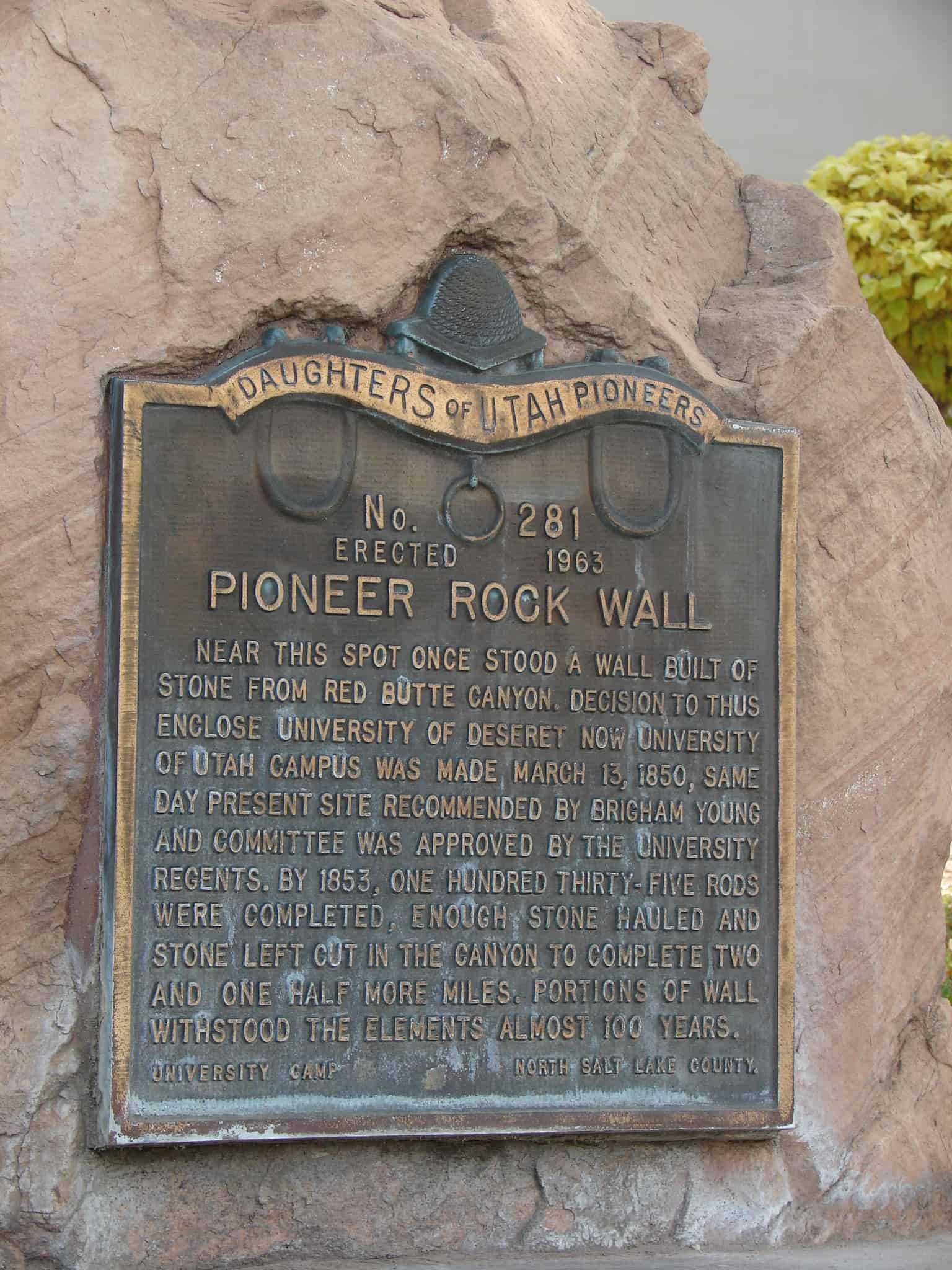
Near this spot once stood a wall built of stone from Red Butte Canyon. Decision to thus enclose University of Deseret, now University of Utah, campus was made March 13, 1850, same day present site recommended by Brigham Young and committee was approved by the university regents. By 1853, one hundred thirty-five rods were completed, enough stone hauled and stone left cut in canyon to complete two and one-half more miles. Portions of wall withstood the elements almost 100 years.
Lynne, named for a town in Scotland, was settled in 1849 by Edith Rice, George and Frederick Barker and Charles Burke. The following year Isaac Newton Goodale, Erastus Bingham and others came. In 1851 irrigation water was brought from Mill Creek under the supervision of I.N. Goodale. A log schoolhouse was erected in 1852 with widow Green the first school teacher. This building was also used for church and public gatherings. In 1866 a postoffice was established with Lewis Taft, postmaster. May 28, 1877 Daniel F. Thomas was made first bishop of the Lynne Ward, Church of Jesus Christ of Latter-day Saints.
Check out all of the historic markers placed by the Daughters of Utah Pioneers at JacobBarlow. com/dup
Thayne, formerly called Glencoe, was founded in 1888, at which time mail was brought into Star Valley by Team and Wagon and distributed to the people from a log cabin owned by Joseph Thayne. The building was one room, 12 x 15 feet with a dirt roof. Three years later it was moved to the center of town and Henry Thayne and his wife occupied it. This log cabin, located one and one half rods west of this site, became the first post office May 8, 1891 with Laura Thayne Post Mistress.
Check out all of the historic markers placed by the Daughters of Utah Pioneers at JacobBarlow. com/dup
In 1864 Brigham Young called for settlers to colonize the Muddy (now Moapa) Valley. On January 8, 1865, eleven men and three women arrived and began the first settlement at St. Thomas, now covered by the waters of Lake Mead. Later other settlements were made. In 1871, because of high taxes, Indian depredations, distance from markets, and other adverse conditions, some 600 people abandoned their hard-won homes. After 1880 other families came and settled the entire Moapa Valley – This time to stay.
November 1851 Hyrum and John Bybee with their families located below the mouth of Weber Canyon. Robert Watts, Robert Nelson Watts, Ebenezer C. Cherry, Levi Hammond, James Heath, Cyrus Canfield, George W. Hickerson, Mark Hall and others came in 1852. They erected cabins in fort style and called the area Kingston’s Fort, honoring Thomas Kingston, the first bishop of South Weber Ward. A log schoolhouse was erected, Cyrus Canfield the first teacher, and Sarah, wife of President Wilford Woodruff, taught in the primitive building. The Weber River was tapped for irrigation purposes.
Check out all of the historic markers placed by the Daughters of Utah Pioneers at JacobBarlow. com/dup
Early settlers in Whitmore Canyon, later called Sunnyside, were Jefferson Tidwell, his family and a brother John, who grazed cattle in the area prior to building their home in 1897. They located a vein of coal, sold it to the Utah Fuel Company for two hundred fifty dollars which was paid in ten and twenty dollar gold pieces. The first shipment of coke was in 1899. Columbia was settled in 1922. The Whitmore ranch area is now called Dragerton, thus making East Carbon the home of the largest coking coal deposits in the west.
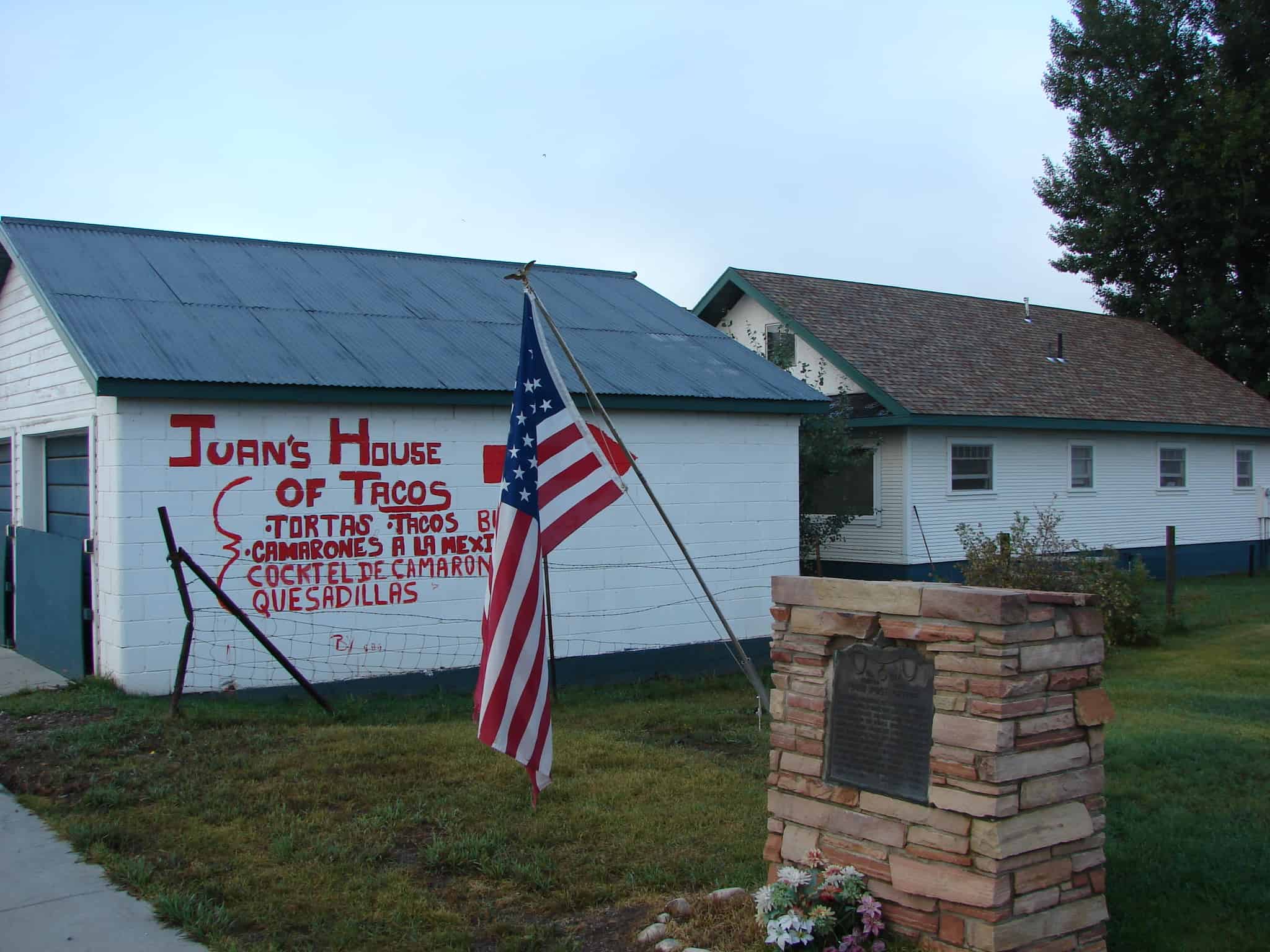
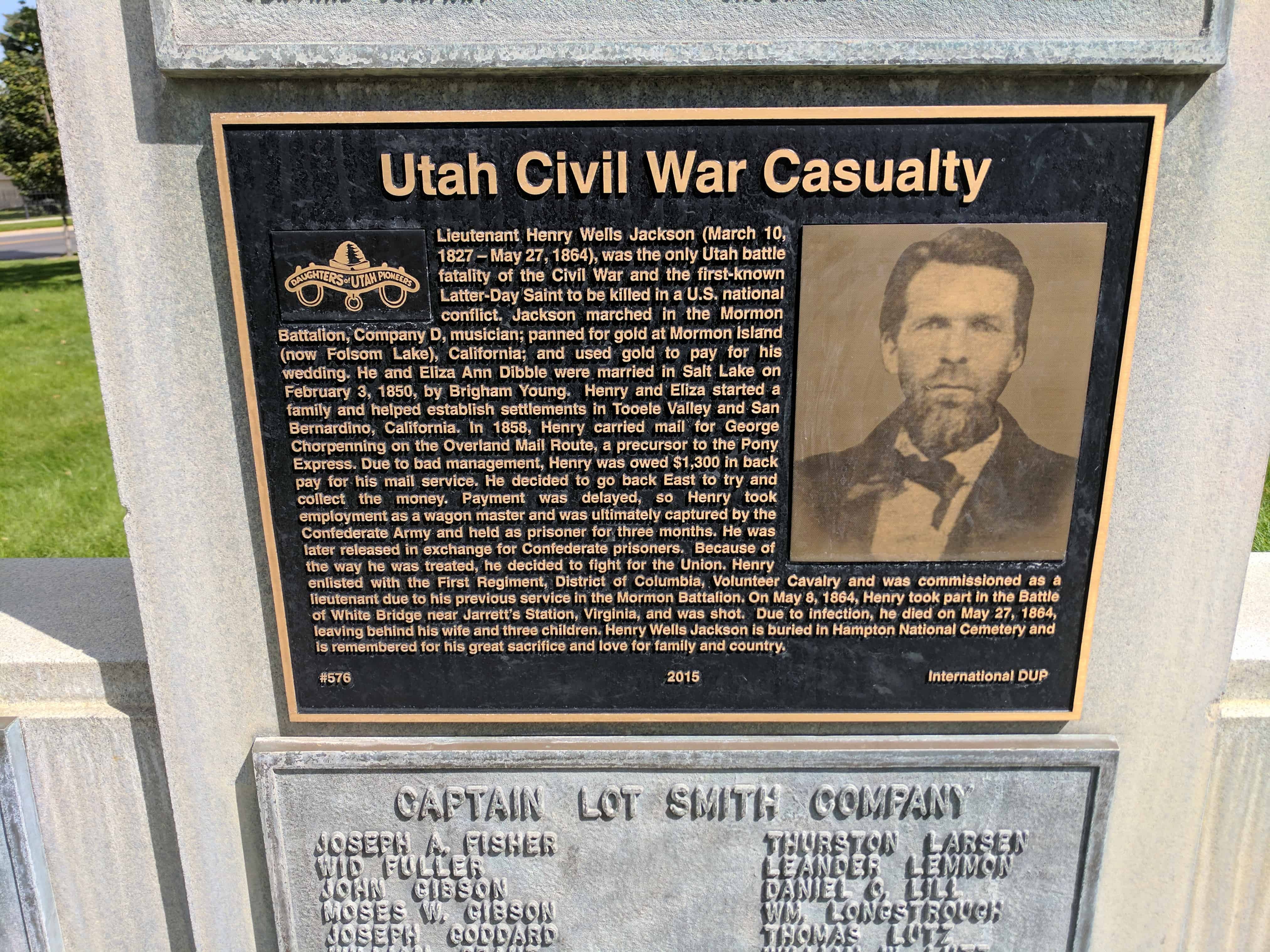
This monument honors the Utah men who answered the call to protect the mail and telegraph lines along the continental route during the Civil War. April 25, 1862 Acting Governor of Utah, Frank Fuller, called for volunteers from the Nauvoo Legion. The next day twenty-four men under Col. Robert T. Burton left for the assignment. Two days later Brigham Young received an authorization from President Abraham Lincoln, through Secretary of War Stanton, for a company of cavalry to serve ninety days protecting the same route. One hundred and six men responded for duty under Captain Lot Smith. Later some Utah men joined the 3rd Regiment, California Volunteers, stationed at Fort Douglas, October, 1862-July 1866. Other pioneers served in the Civil War before coming to Utah. Plaque B,C,D: (On base below) Each 1 1/2′ x 2′ Bronze Names of Utahns who served in Civil War
Check out all of the historic markers placed by the Daughters of Utah Pioneers at JacobBarlow. com/dup