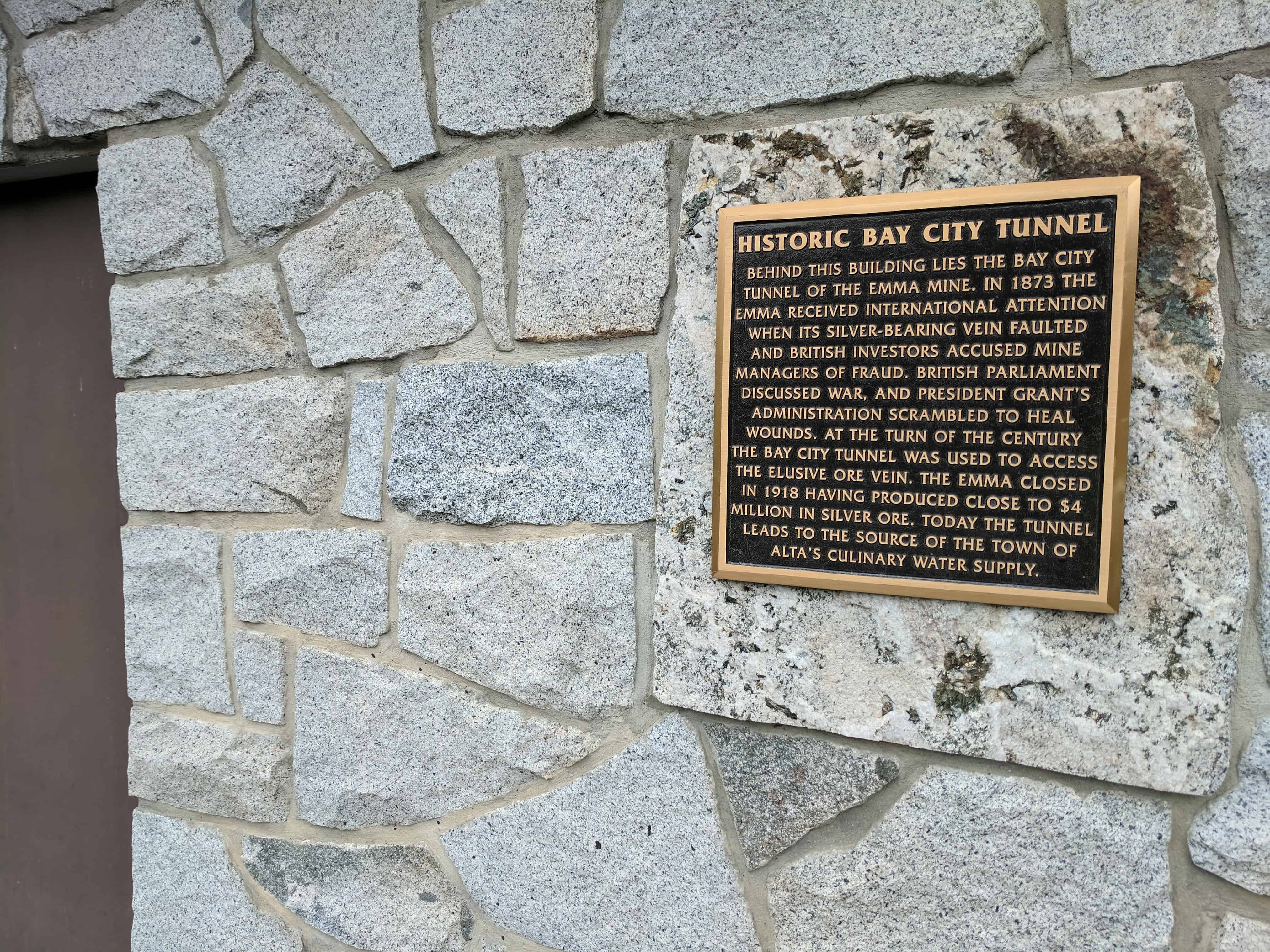
Behind this building lies the Bay City Tunnel of the Emma Mine. In 1873 the Emma received international attention when its silver-bearing vein faulted and British investors accused mine managers of fraud. British parliament discussed war, and President Grant’s administration scrambled to heal wounds. At the turn of the century the Bay City Tunnel was used to access the elusive ore vein. The Emma closed in 1918 having produced close to $4 million in silver ore. Today the tunnel leads to the source of the town of Alta’s culinary water supply.
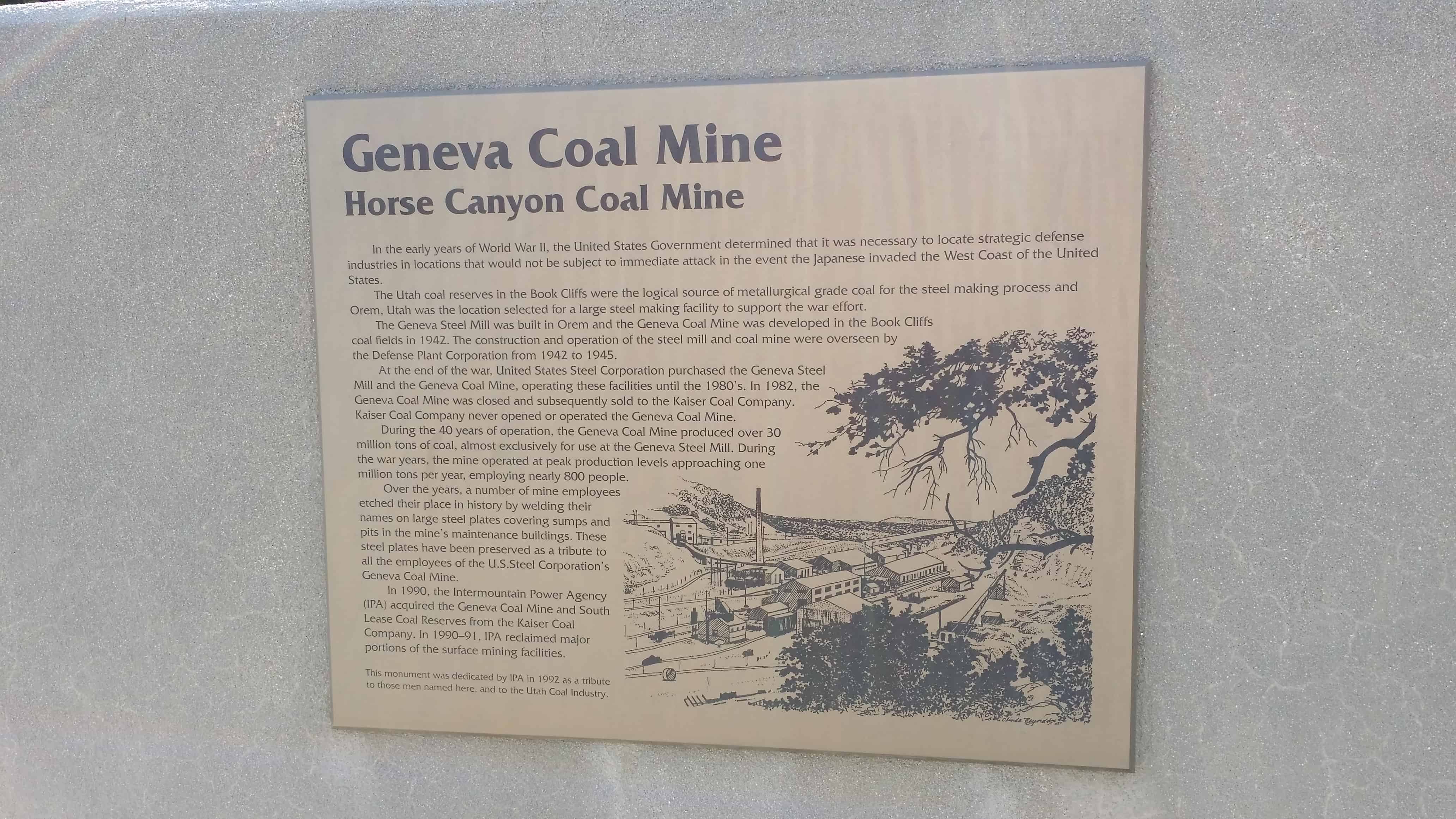
In the early years of World War II, the United States Government determined that it was necessary to locate strategic defense industries in locations that would not be subject to immediate attack in the event the Japanese invaded the West Coast of the United States.
The Utah coal reserves in the Book Cliffs were the logical source of metallurgical grade coal for the steel making process and Orem, Utah, was the location selected for a large steel making facility to support the war effort.
The Geneva Steel Mill was built in Orem and the Geneva Coal Mine was developed in the Book Cliffs coal fields in 1942. The construction and operation of the steel mill and coal mine were overseen by the Defense Plant Corporation from 1942 to 1945.
At the end of the war United States Steel Corporation purchased the Geneva Steel Mill and the Geneva Coal Mine, operating these facilities until the 1980’s. In 1982, the Geneva Coal Mine was closed and subsequently sold to the Kaiser Coal Company. Kaiser Coal Company never opened or operated the Geneva Coal Mine.
During the 40 years of operation the Geneva Coal Mine produced over 30 million tons of coal, almost exclusively for use at the Geneva Steel Mill. During the war years the mine operated at peak production levels approaching one million tons per year, employing nearly 800 people.
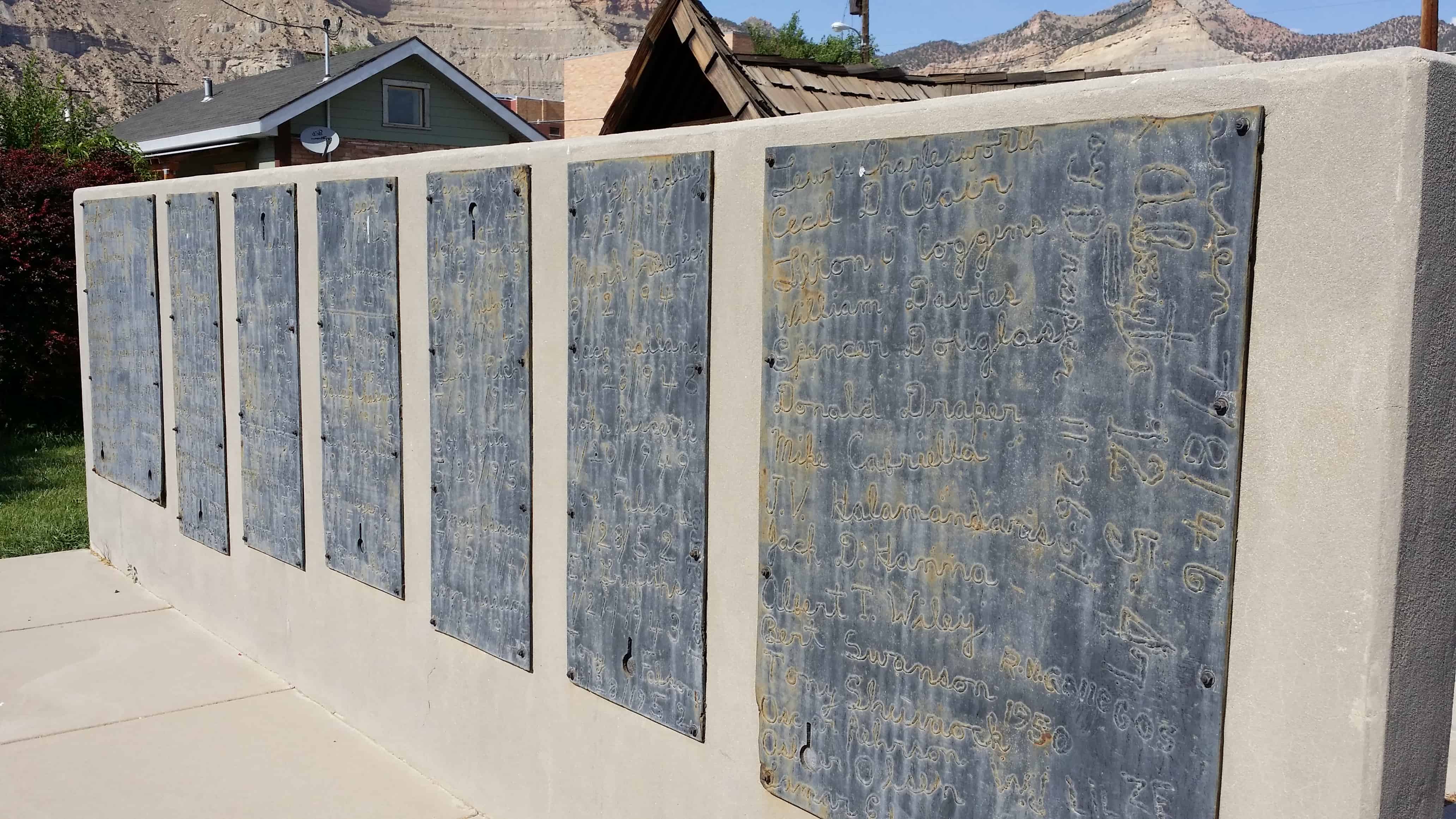
Over the years, a number of mine employees etched their place in history by welding their names on large steel plates covering sumps and pits in the mines maintenance buildings. These steel plates have been preserved as a tribute to all employees of the U.S. Steel Corporation’s Geneva Coal Mine
In 1990 the Intermountain Power Agency (IPA) acquired the Geneva Coal Mine and South Lease coal Reserves from the Kaiser Coal Company. In 1990-91 IPA reclaimed major portions of the surface mining facilities.
This monument dedicated by IPA in 1991 as a tribute to those men named here and to the Utah Coal Industry.
12 STEEL PLAQUES CONTAIN WELDED NAMES OF MINE EMPLOYEES
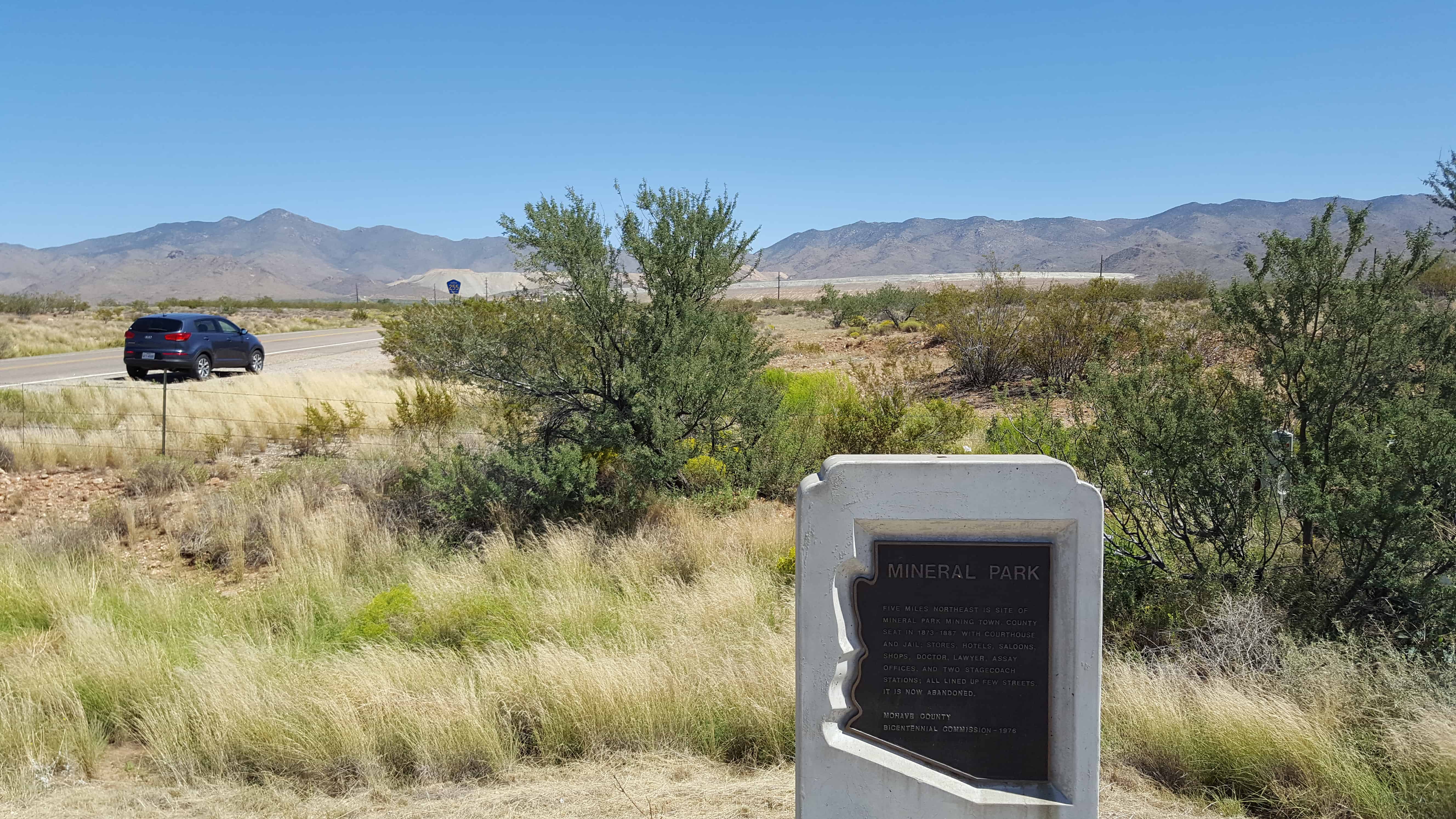
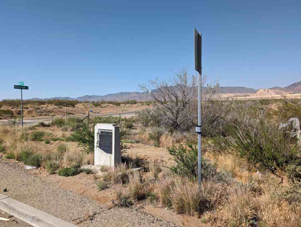
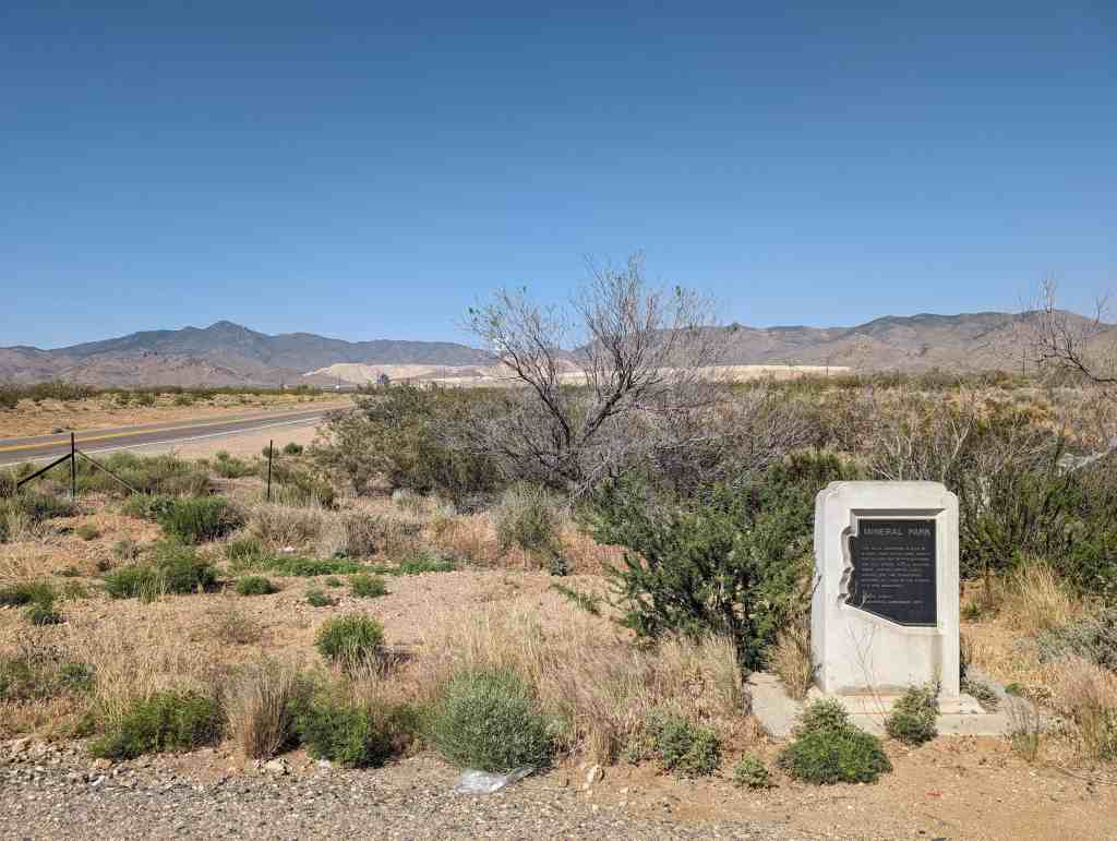
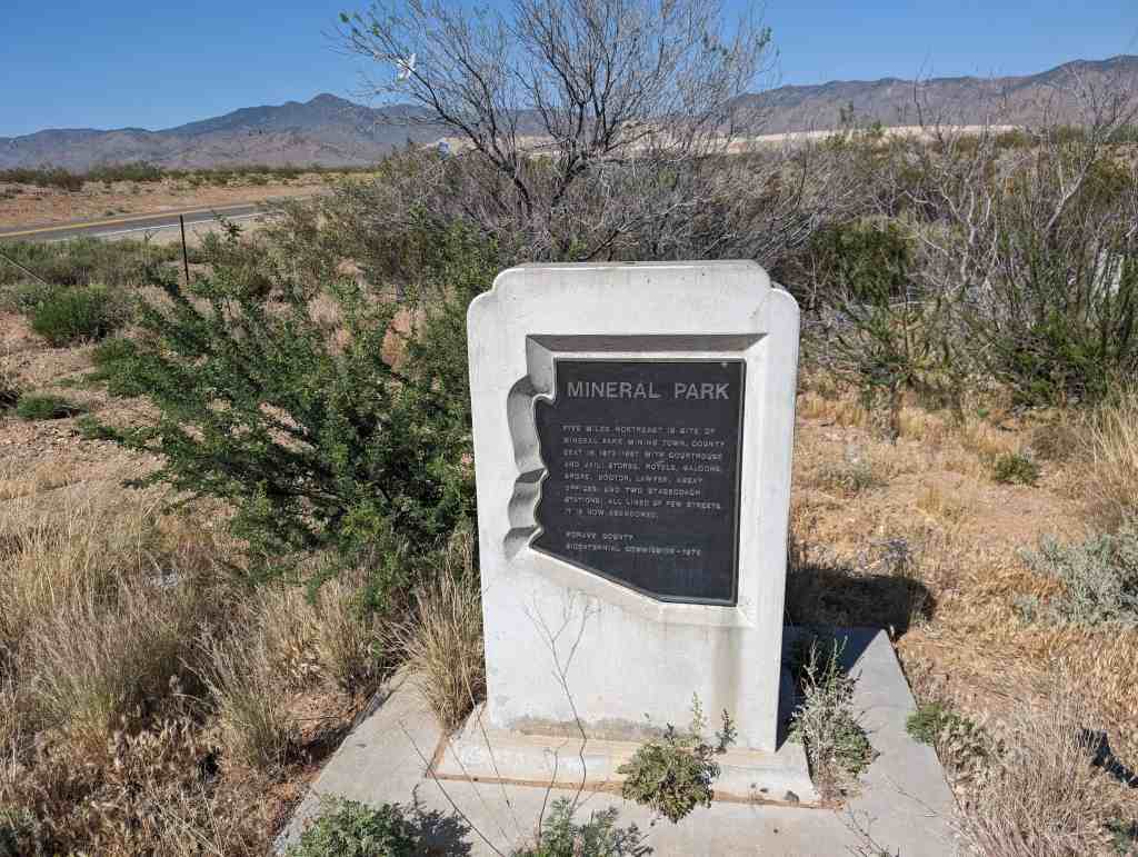
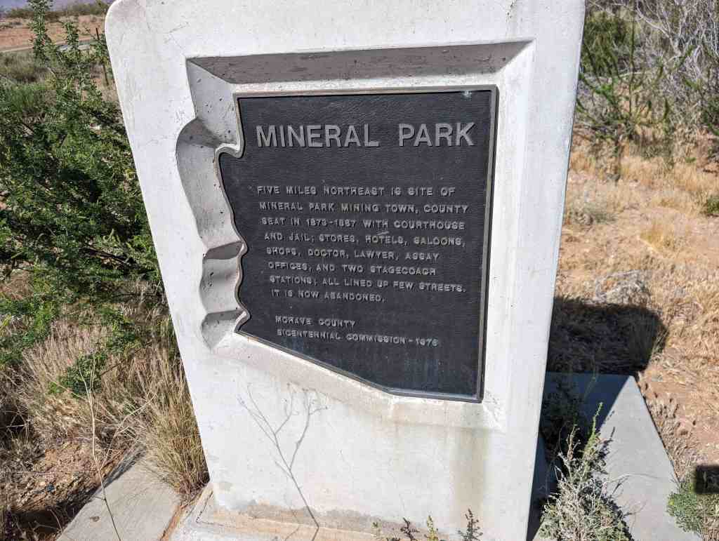
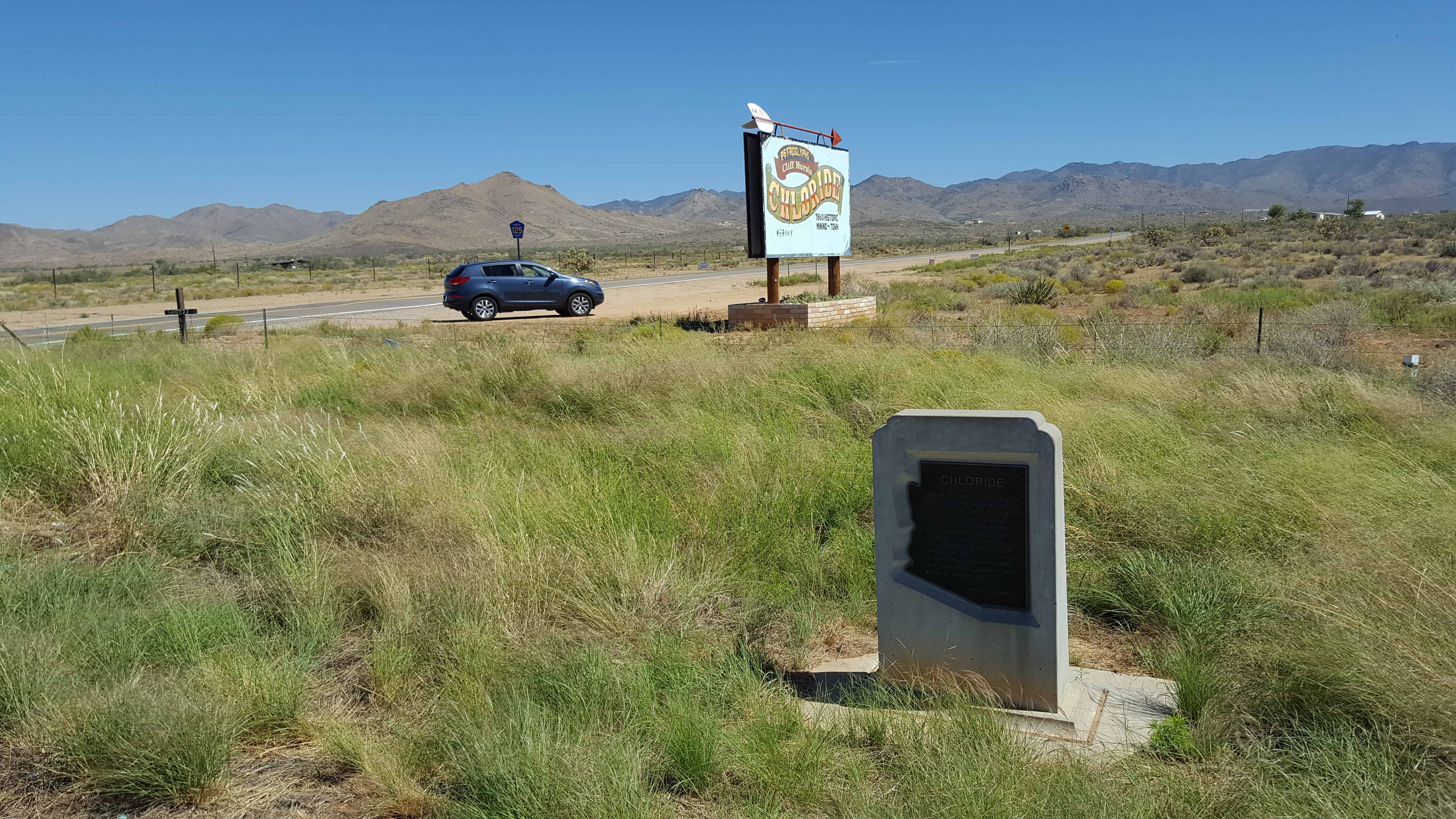
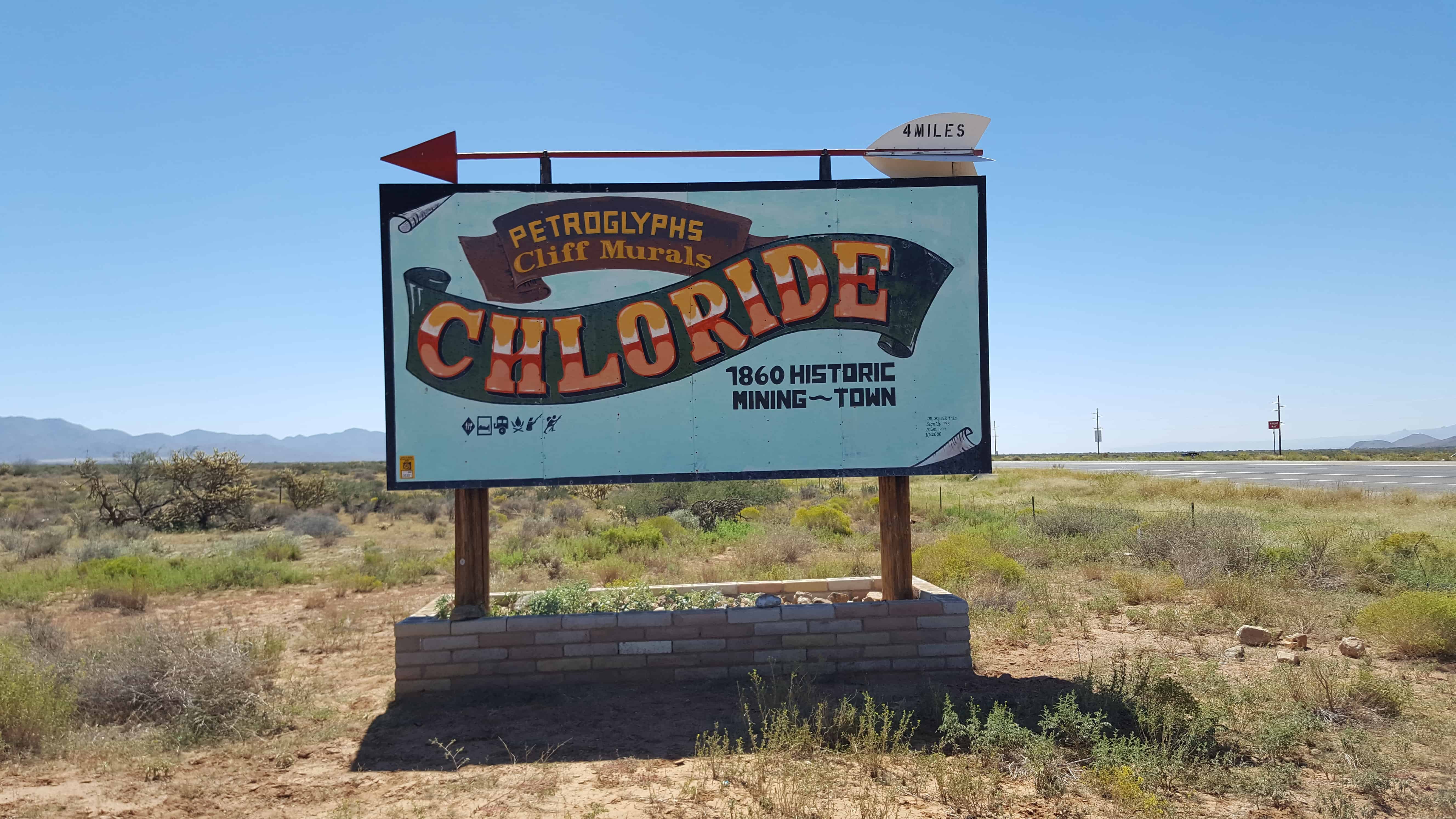
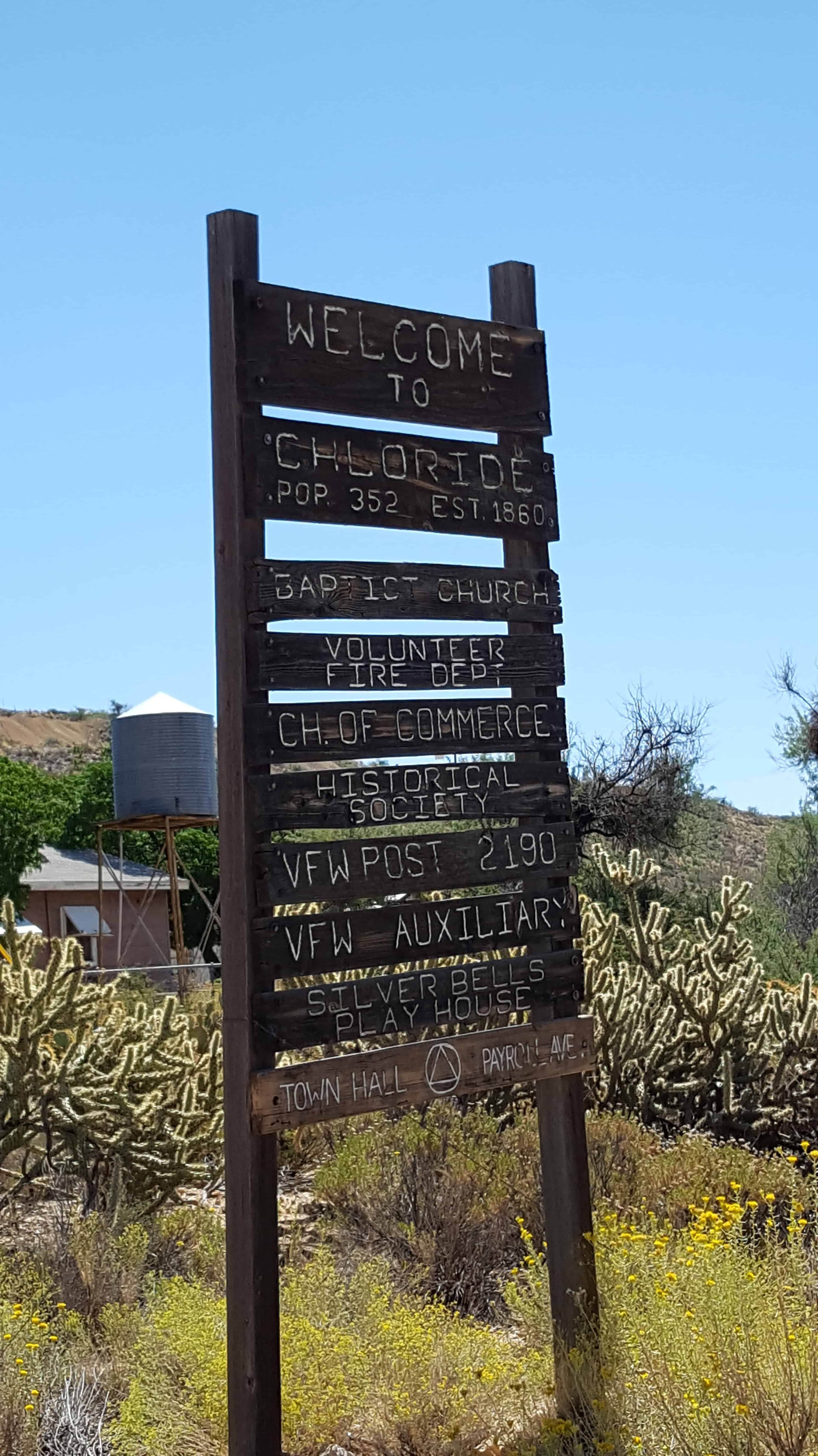
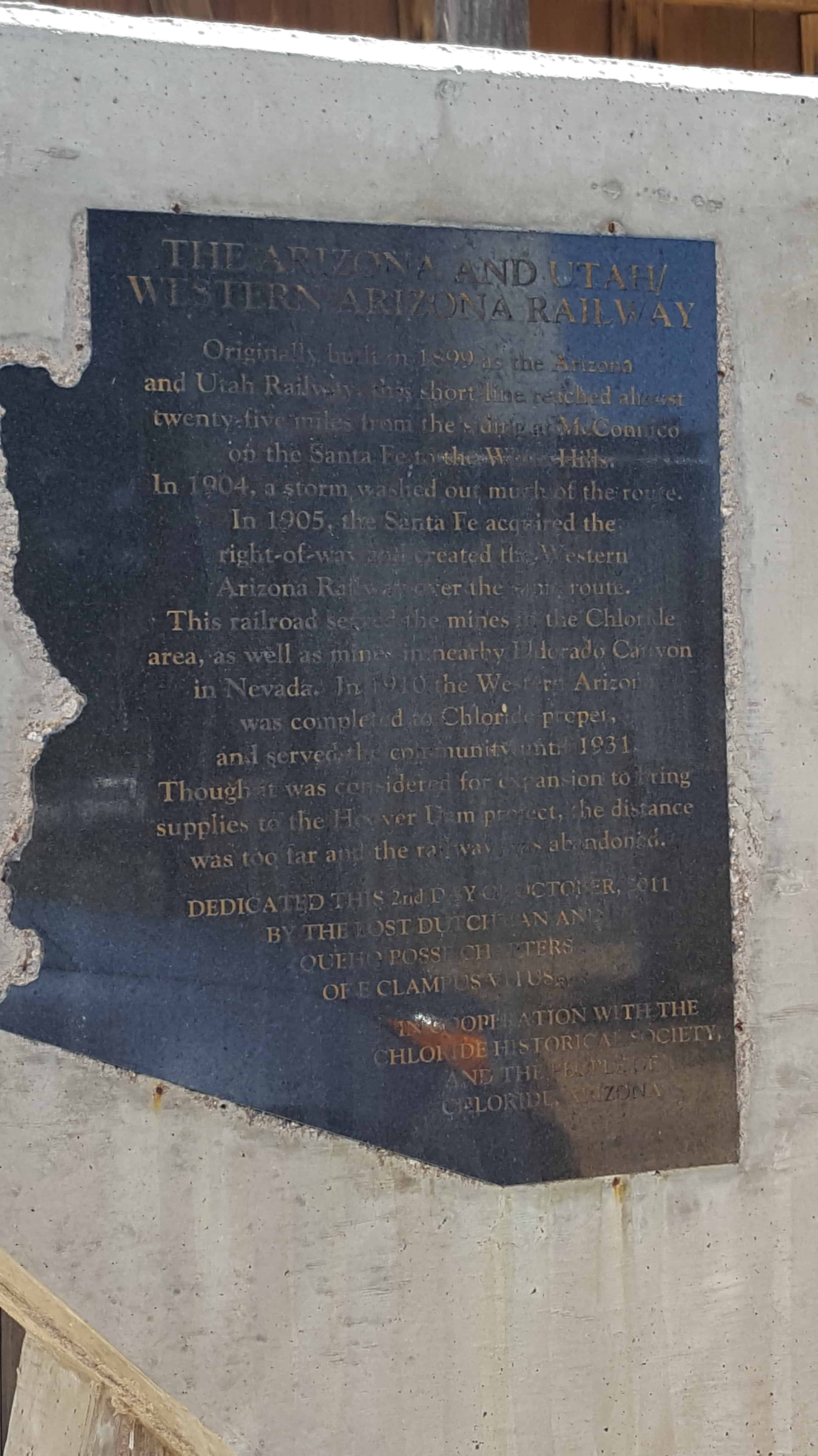
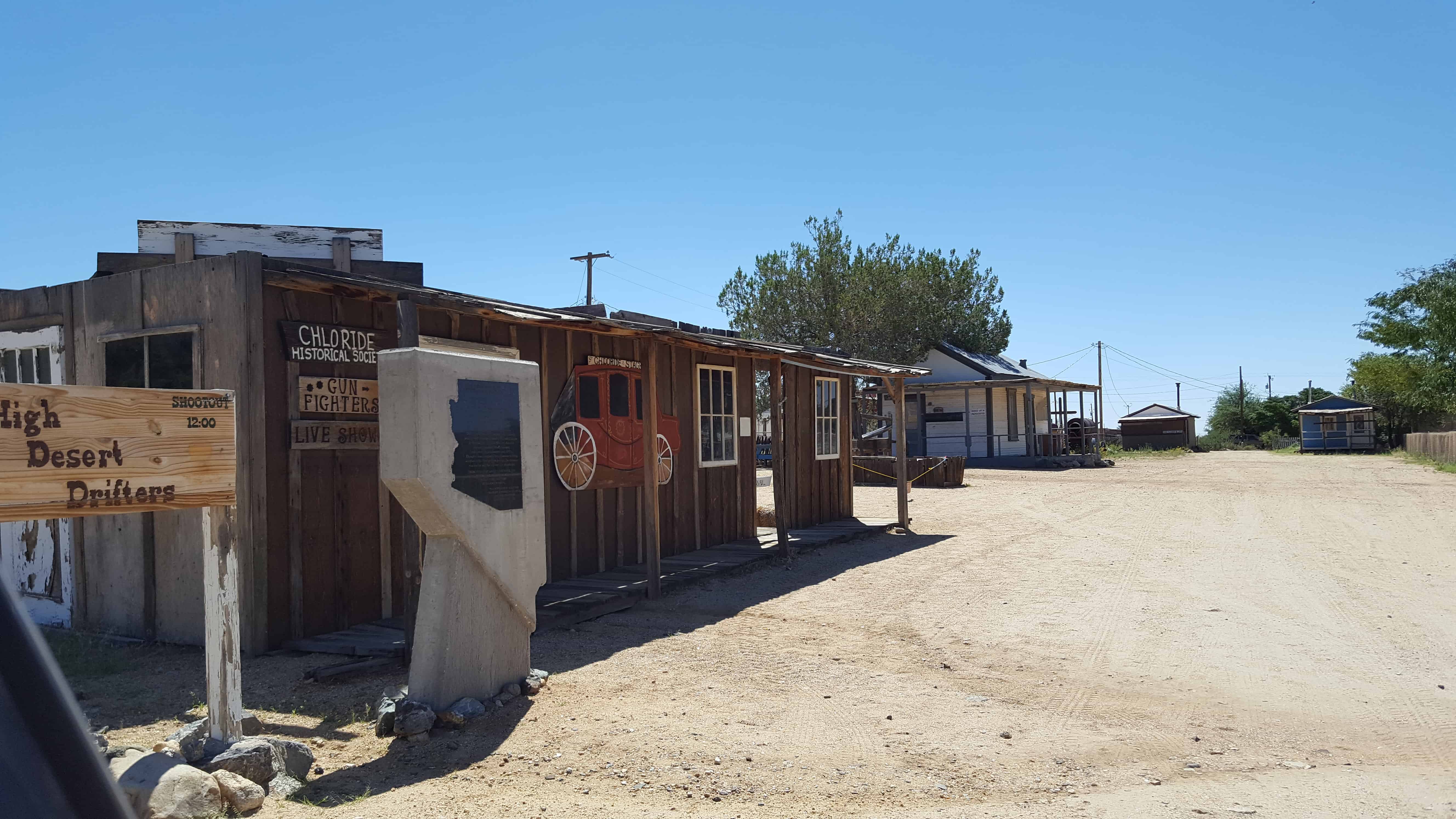
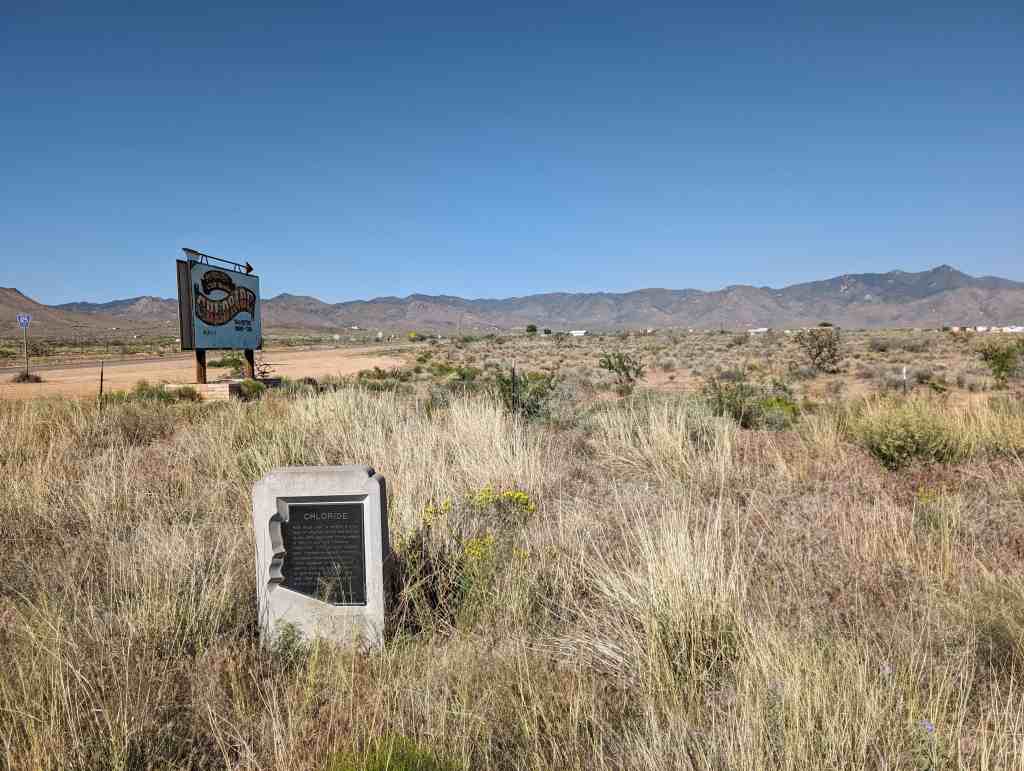
Mining in the area began in 1871 and a camp was established soon after. The mines produced primarily silver, gold, copper, lead and zinc. The post office was opened December 23, 1872. It grew to be the largest town in the county and became the county seat in 1873. It had the county courthouse and jail, stores, hotels, saloons, shops, doctors, lawyers, assay offices and two stagecoach stations. The town published a newspaper, the Mohave County Miner.
In 1887 it lost the county seat to the railroad town of Kingman in an election. Some of the population and the newspaper moved and mining began to slacken with the price of silver. The post office closed in April 30, 1893. It reopened in September 1894, but closed for the last time in 1912. Mining revived in the area since the 1960s, but the town never did.
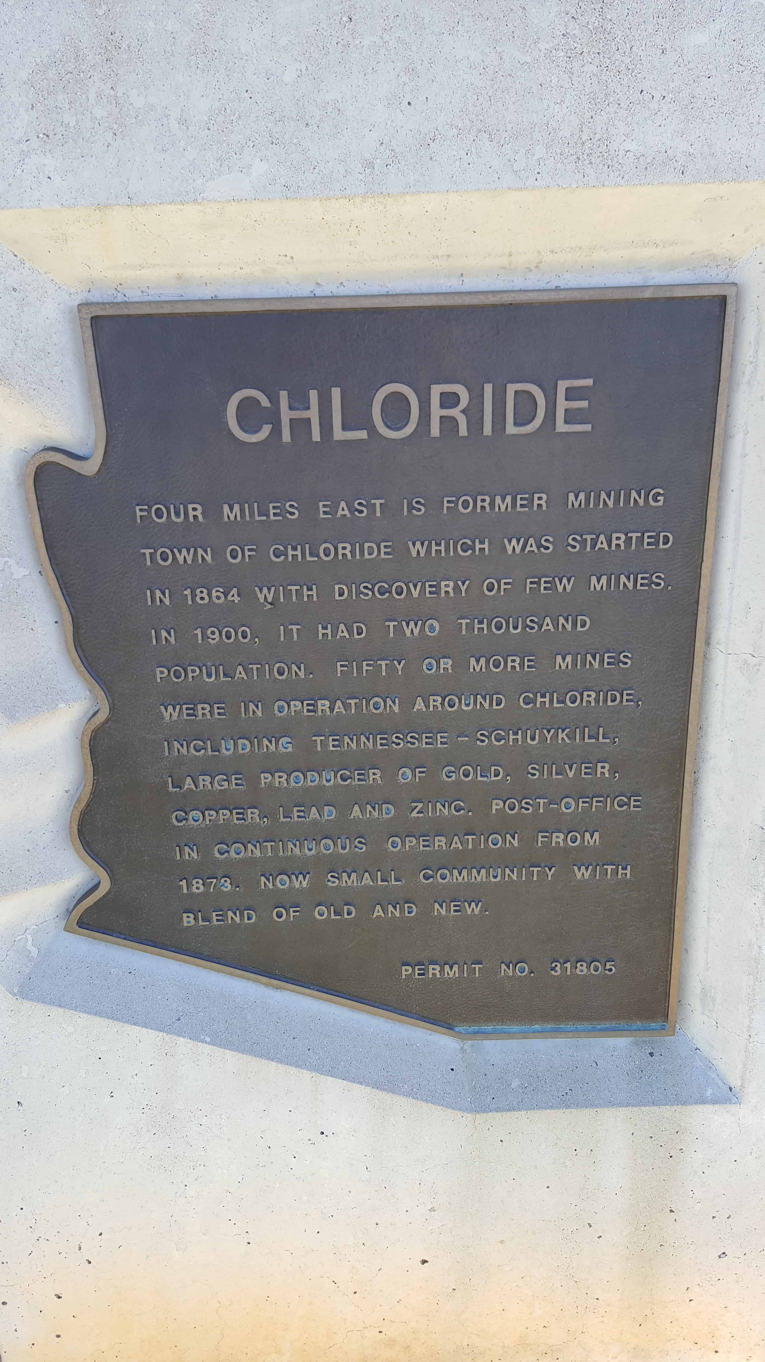
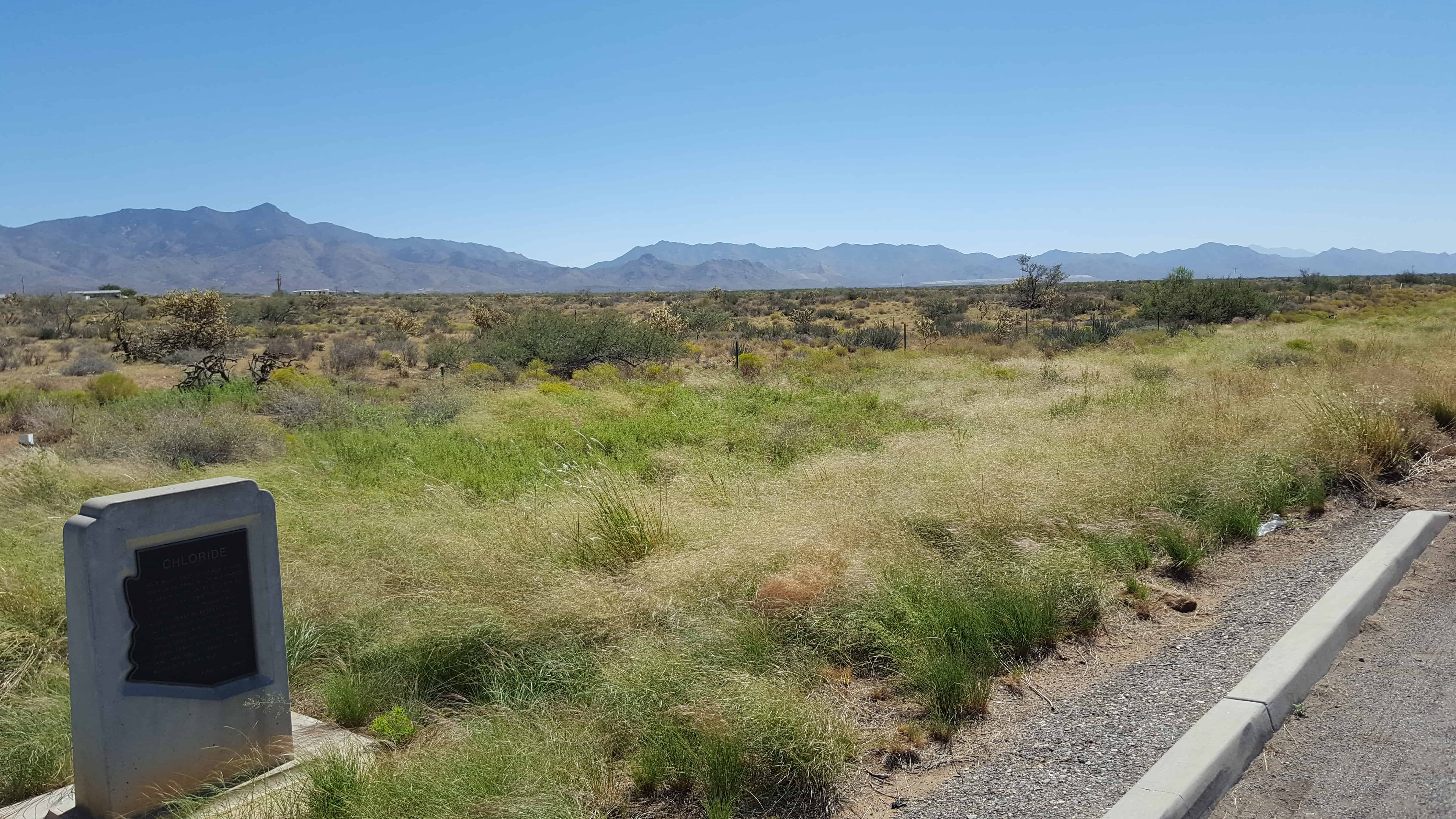
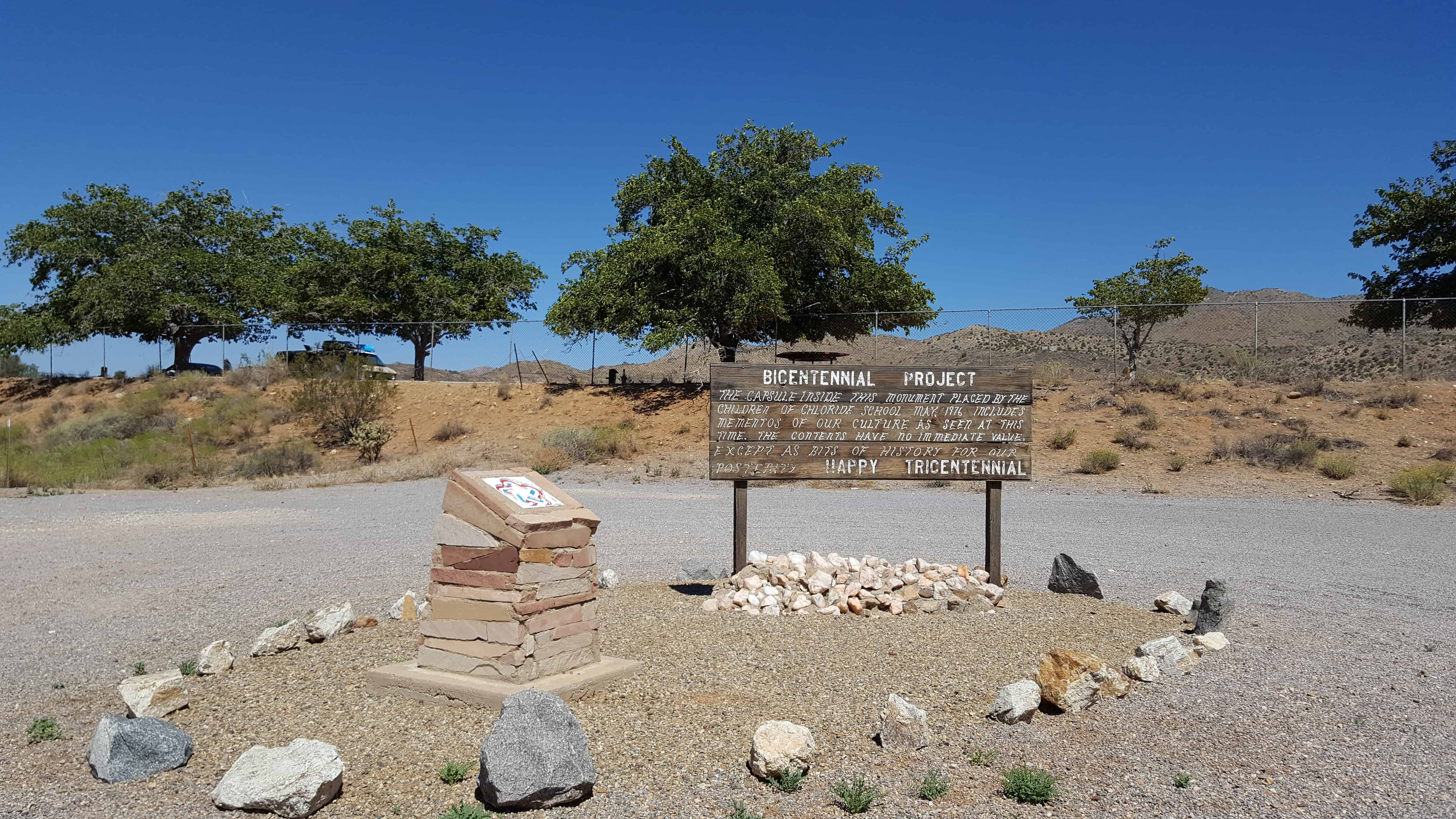
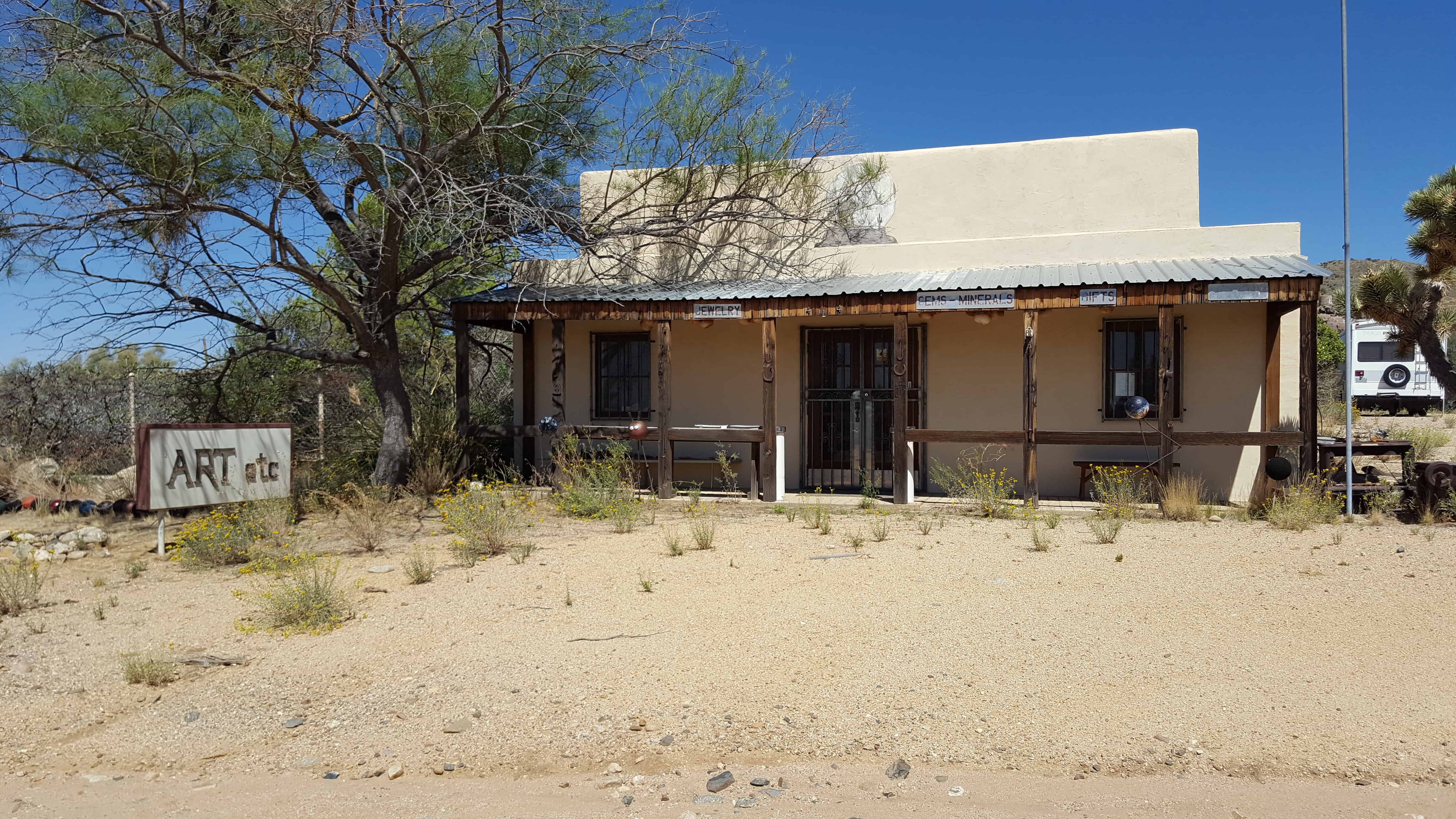
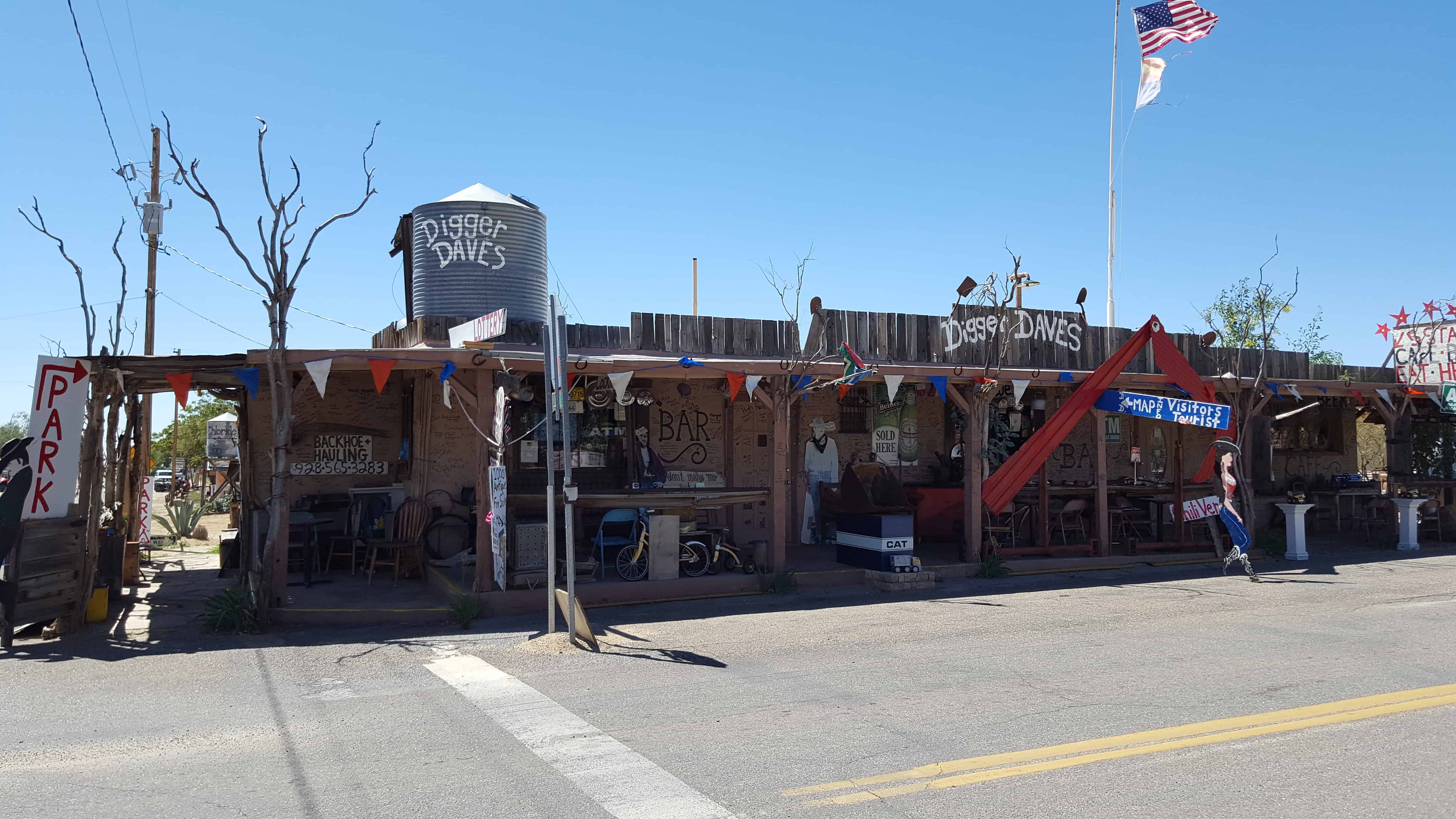
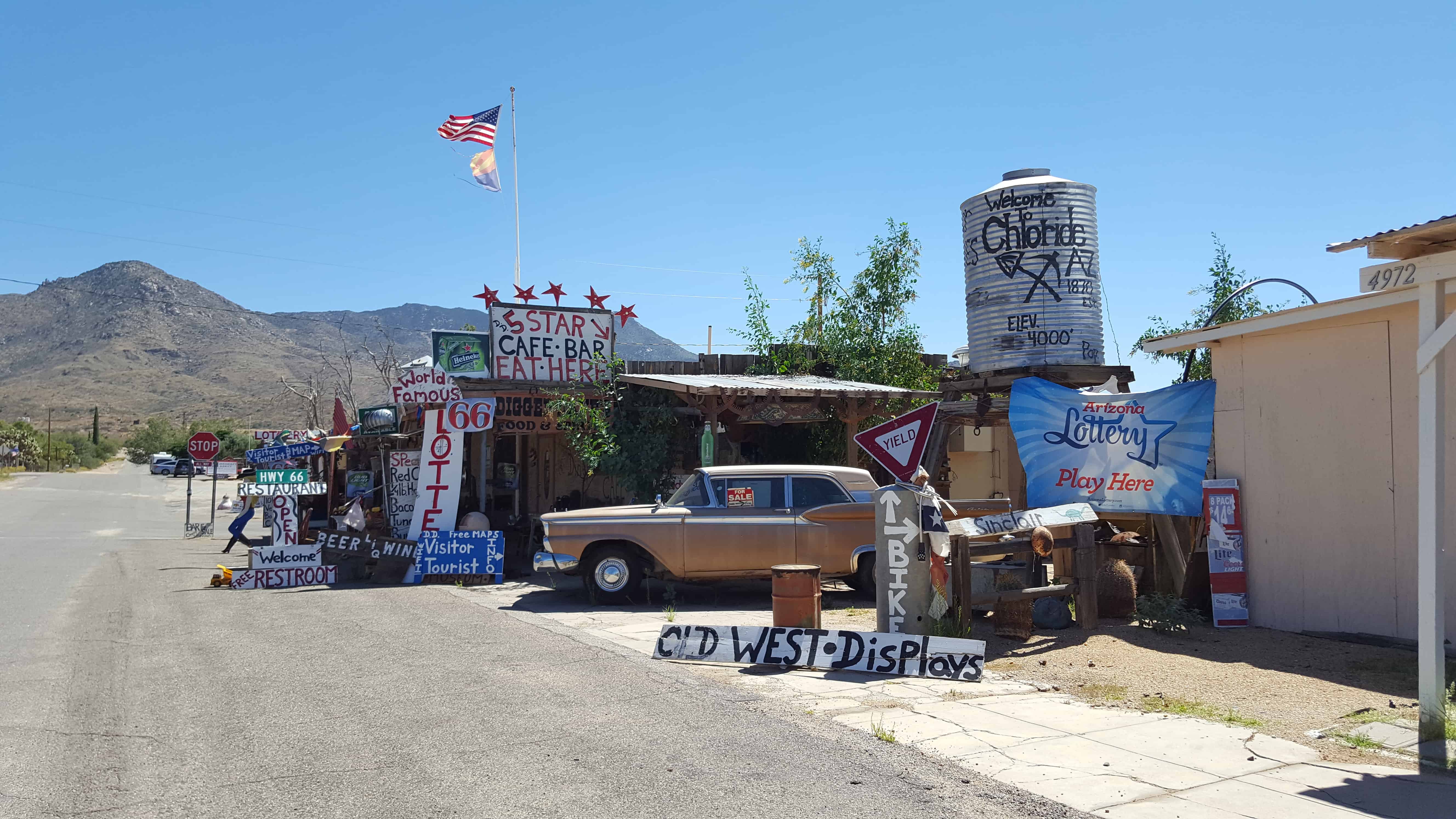
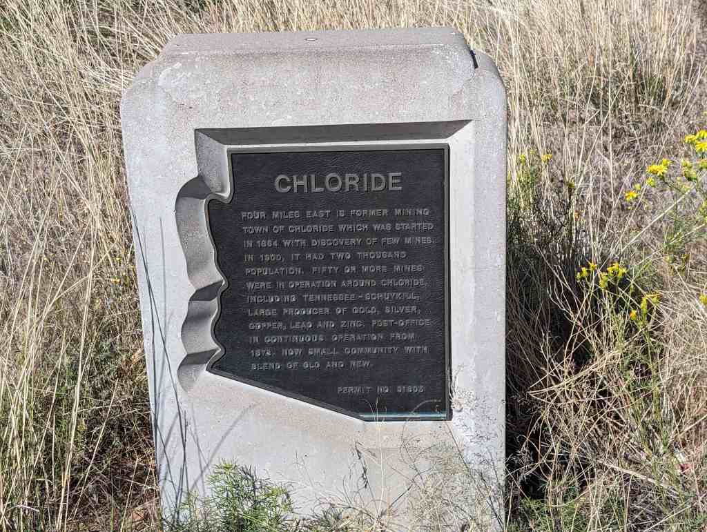
The former mining town of Chloride was started in 1864 with the discovery of few mines. In 1900, it had two thousand population. Fifty or more mines were in operation around Chloride, including Tennessee – Schuykill, large producer of gold, silver, copper, lead and zinc. Post Office in continuous operation from 1873. Now small community with blend of old and new.
This two-story, one-part commercial block building was constructed in 1889. The second story brick addition dates from c. 1890. Both were built during Sandy’s first major period of development known as the “Mining, Smelting, and Small Farm Era, 1871-c1910”. The “Sandy Co-op” sign panel was located below the corbelled brick cornice was alternating rows of dog tooth coursing. The relatively simple design and bilateral symmetry of the building is expressive of the aesthetics employed on commercial structures in Sandy. It is important as the only two-story commercial block building remaining from the City’s original commercial district.
The Sandy Co-op Mercantile and Manufacturing Co. occupied the building until 1908 when it changed hands several times before being purchased and used by the Knights of Pythias between 1912-1943. The main floor was reportedly used for the sale of general merchandise and the upper floor as a meeting and dance hall. The building was converted to serve as Sandy City’s fire station between 1949-1984. In 1988, it was restored to house the Sandy City Museum.
The text on this page is from the plaques on the building. The building is located at 8744 South Center Street in the historic sandy area of Sandy, Utah
The land was originally owned by La Grande Young and sold to Wells Clark in 1886. Sandy Co-op purchased it in 1888. The building was constructed in 1890 with a co-op merchantile store on the bottom floor and a social hall on the top floor. Dances and other social events were held weekly as the main social gatherings. The bottom level was used by a variety of occupants including Jenkins Funeral Parlor from 1908 until 1912. During this time period a huge advertisement for “Bull Durham” was painted on the outside south wall. Located across the street was a Utah Southern Railroad Station. The old building survived the vibration of a great many trains during Sandy’s coming of age. In 1912, Mingo Lodge No. 6 Knights of Pythias purchased the building to be used as a lodge hall and rental for other social functions. It was referred to as the “K.P. Lodge” during this time period. In 1939 Sandy City purchased the building as an interim fire station until a new facility was built in 1984 at another location. The building’s architecture dates from 1890 and is of a non-reinforced masonry construction “low fired brick on a quartzite-granite foundation”.
.
ZCMI Co-op Building 1890-1908 Official outlet of ZCMI (Zion’s Co-operative Mercantile Institution), “America’s First Department Store”. This building housed the “Sandy Co-op” which was part of the ZCMI co-operative system servicing more than 150 communities in the intermountain area with retail commodities and services beginning in 1868.
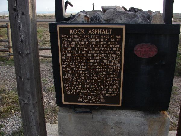
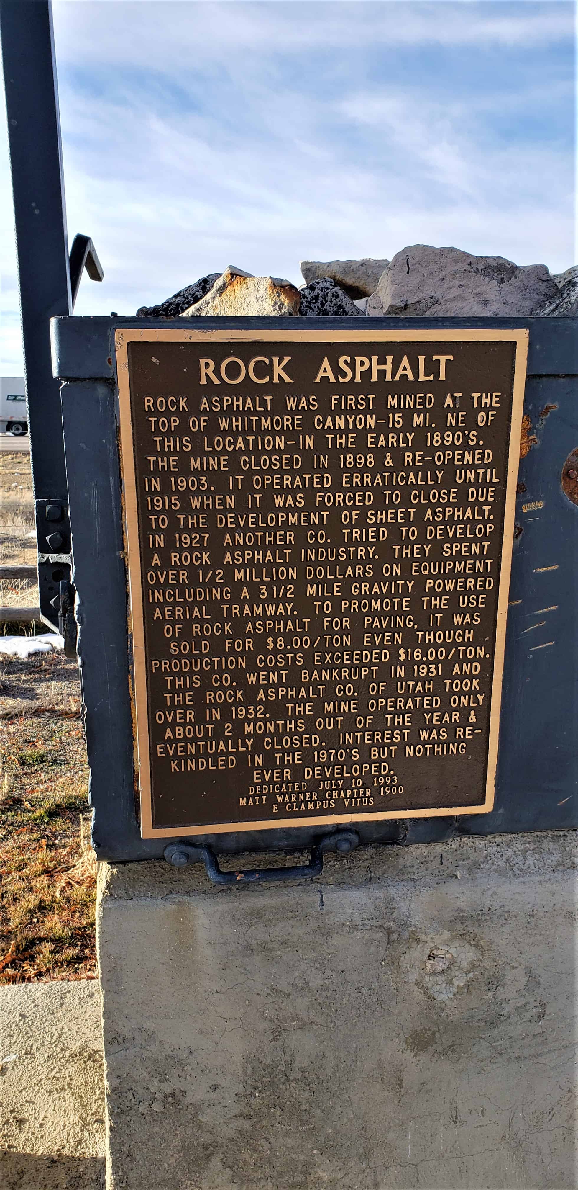
Rock asphalt was first mined at the top of Whitmore Canyon – 15 mi. NE of this location – in the early 1890’s. The mine closed in 1898 & re-opened in 1903. It operated erratically until 1915 when it was forced to close due to the development of sheet asphalt. In 1927 another Co. tried to develop a rock asphalt industry. They spent over 1/2 million dollars on equipment including a 3 1/2 mile gravity powered aerial tramway. To promote the use of rock asphalt for paving, it was sold for $8.00/ton even though production costs exceeded $16.00/ton. The Rock Asphalt Co. of Utah took over in 1932. The mine operated only about 2 months out of the year & eventually closed. Interest was rekindled in the 1970’s but nothing ever developed.
Utah’s Asphalt Production Process Is One of Country’s Most Interesting
Sun Advocate – October 9, 1947
Every story of western mining carries with it a hint of romanticism and the spirit of adventure that cannot be found in any other industry in the world. The history of brave men with visions of the good that can be derived from the hidden treasures of nature has always been and probably will continue to be a source of inspiration to those whose walks of life have carried them into the other fields of endeavor. There is something of a mystery about mining, whether underground or above, and one can’t help but wonder at the strength of those who planned the industry into what it is today. Utah’s position as one of the leading states in the production of minerals is well know. Within its borders are found nearly every mineral of commercial importance. They hydrocarbon deposits of eastern Utah are enormous. Gilsonite and elaterite mines have been developed to a large extent and the products have been shipped to many parts of the world. Some of these hydrocarbons are perculiar, in that Utah is the only place in the world known where they are found. Among the many natural resources Utah has within its borders is the deposit of rock asphalt found east of Sunnyside. This deposit is the largest and richest of natural rock asphalt in the United States and, perhaps, in the world. There are many deposits of rock asphalt within the United States and several plants are now processing large tonnage from those deposits for use in street and road constuction.
The Utah deposit which is owned by the Rock Asphalt company of Utah is estimated to contain some 800 million tons. It is estimated that the deposit contains enough rock asphalt to build three 64 foot roads completely encircling the globe. The Sunnyside quarry is probably one of the most interesting in the country. Located 9,040 feet above sea level, the mineral is scooped out of the side of the mountain by huge shovels and is transported to the crushers in the valley eight miles away by means of huge buckets suspended on cables. The mountain in which the deposit is located is 10,000 feet high thus placing the diggings almost to the top. A private road leads to the mine winding up the mountain side and from there continues to top where, incidentally, is a deer hunter’s paradise. To have transported all of the heavy machinery to the quarry on the narrow road is an engineering fete within itself and is a source of wonder to the visitor.
Approximately 200 tons of rock asphalt are produced each nine hour working day from the present opening which ranges in thickness from 40 to 70 feet. Work is now going on to open a new face which is located several feet higher than the present working and which will open a vein ranging in thickness for 70 to 200 feet. The new section will also provide a much richer product. Initial tests have shown it to run at a minimum of 13 per cent bitumen. State specifications call for from 10 to 13 per cent bitumen with less than five per cent moisture content. To obtain the asphalt, holes are drilled in the face and powder is used to blast the mineral loose. It is then loaded into trucks for transportation to the dump where it is picked up by the buckets which carry it down the canyon. The cable carrying the buckets is approximately 14 miles in length, seven miles of carrying cable and seven miles of track cable. Sixty three buckets are in use with the loaded buckets pulling the empties back to the mine. Each bucket carries 1200 pounds of asphalt and the round trip for each bucket takes 1 1/2 hours. The mineral goes through a primary crusher before entering the buckets and is dumped into a storage bin at the bottom of the canyon. From here it is transported by trucks to the crusher at Sunnyside there it goes through two different sets of rolling mills before going through the final crushing process in a hammer mill. When the process has been completed the asphalt comes out of the mill in the form of powder as fine as flour. At this point it is loaded into railroad cars and trucks for distribution throughout the country. Each shipment is tested prior to distribution.
According to Eugene Pressett, superintendent of the Sunnyside operations, experiments are now being carried on by adding an oil emulsion to the crushed asphalt to develop a product that will withstand the lowest temperatures. Rock asphalt, or bituminous sandstone as it is commercially known, is a mixture of asphalt and sand compressed by nature into hard rock which was formed by liquid oil, with an asphalt base, accumulating underground in some kind of geological trap. The sand which was originally laid down as a marine sand of fine and uniform texture was then covered in this manner by a pool of asphaltic base oil, which, due to extreme underground heat and pressure, allowed the bolatile matter to escape leaving a residue of pure asphaltum permeating this stratum of marine sand. This was followed by additional natural formative pressure which caused the sand to be completely permeated by and coated with asphalt to an average of about 10 per cent asphaltum and 90 percent pure silics sand. These sand particles are not merely suspended in the asphalt but every void and pore of the sand is permeated with asphaltum so that a complete breakdown of one grain of sand would give an assay comparable to a larger or average piece of rock asphalt. Rock asphalt roads have been in use for many years. In fact, the first paved roads built in the world were of rock asphalt. History reports Paris built its first paved road of this material in 1854. The first paved street in the United States was built in 1872 in Union Square, New York City, of rock asphalt brought from Switzerland. The first street paved in Utah was old Commercial street in Salt Lake City and this was built in 1891 with rock asphalt brought from Santa Cruz, California. This started the development of the Utah deposits and in 1892 Richard street in Salt Lake City was paved with Utah rock asphalt and has been in continuous use for 17 years. The history of rock asphalt shows that it is the oldest known paving material and has been in continuous use since 1854. At the present time, work is being completed on the laying of asphalt on every street in Dragerton including the driveways into every yard. Approximately 8000 tons of the material has been used on this project.
A couple cool mines I was checking out in Diamond Fork Canyon, they are across the canyon from each other, the one on the south side of the canyon is across the river from the road and the other is above the road – both are easy to miss if you aren’t watching.
These are some pictures from exploring around the Revenue Mine in Pine Grove Canyon in the Wah Wah Mountains.
The Pine Grove Mining District was organized in 1873, this mine produced gold, silver and lead. The buildings in the photos housed the miners for the Revenue Mine in this little visited canyon.
I was very impressed with the lush green valley, the springs running water all over, the old buildings and mines dotting the area.
Miners Basin, also known as simply Basin, was a mining town at over 10,000 feet elevation on Mt. Waas in the La Sal Mountains. With a peak population of about 75 or 80, the town flourished for about 20 years after gold was discovered there in the late 1880s. The first claims were staked in the area around 1888, and a formal mining district was organized 10 years later. Silver and copper were also mined in limited quantities, in addition to gold. At its heyday, the town boasted a hotel, a store, two restaurants, a blacksmith shop, a post office, and two saloons. However, the mines were closed in 1907 as a result of a nationwide financial panic, and the town died shortly thereafter. Even so, a few diehard miners remained on the mountain for decades afterward. A few log cabins and other structures still remain in the area.(*)


 .
.