Tags


29 Tuesday Nov 2016
Posted in Uncategorized
Tags
25 Sunday Sep 2016
Posted in Uncategorized
Tags

Olivers is another “map dot” or a place that used to be something and is now swallowed up in other towns. It is in what is now Bluffdale.
13 Saturday Aug 2016
Posted in Uncategorized
Tags
Draper, Riverton, Salt Lake County, Sandy, South Jordan, utah, West Jordan

On July 22, 1847, an advanced party of the first Mormon pioneers entered the valley and immediately began to irrigate land and explore the area with a view to establishing new settlements. Alexander Beckstead, a blacksmith from Ontario, Canada, moved his family to the West Jordan area in 1849, and became the first of his trade in the south Salt Lake Valley. He helped dig the first ditch to divert water from the Jordan River, powering Archibald Gardner‘s flour mill. In 1859, Beckstead became the first settler of South Jordan by moving his family along the Jordan River where they lived in a dugout cut into the west bluffs above the river. The flood plain of the Jordan was level, and could be cleared for farming if a ditch was constructed to divert river water along the base of the west bluff. Beckstead and others created the 2.5-mile “Beckstead Ditch”, parts of which are still in use as of 2010.
South Jordan Posts:
21 Tuesday Jun 2016
Posted in Uncategorized
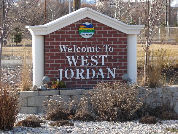
West Jordan Posts:
West Jordan received its name from Mormon settlers who entered the Salt Lake Valley in 1847 under the leadership of their prophet, Brigham Young. These first European-Americans thought of the area to be their Zion, or Holy Land, and thus named the river flowing west of their first settlement, Salt Lake City, the Western Jordan, a reference to the River Jordan in Israel. The name was later simplified to “Jordan River”. Like its Middle Eastern namesake, the Jordan River flows from a fresh water lake (Utah Lake) to an inland salt sea (Great Salt Lake). West Jordan was founded around 1849 on the western banks of the Jordan River.
One of the first sawmills in the area was built in 1850 in the city by Archibald Gardner. Gardner was a devout Mormon whose legacy can still be seen in modern West Jordan. His collection of mills and houses, now historic, have been renovated into a specialty shopping district known as Gardner Village.
Early West Jordan relied primarily on agriculture, mills, and mining activity to form the base of its economy. The first leather tannery west of the Mississippi River was constructed in the city in 1851.
17 Friday Oct 2014
Posted in Uncategorized
Tags
Riverton Posts:
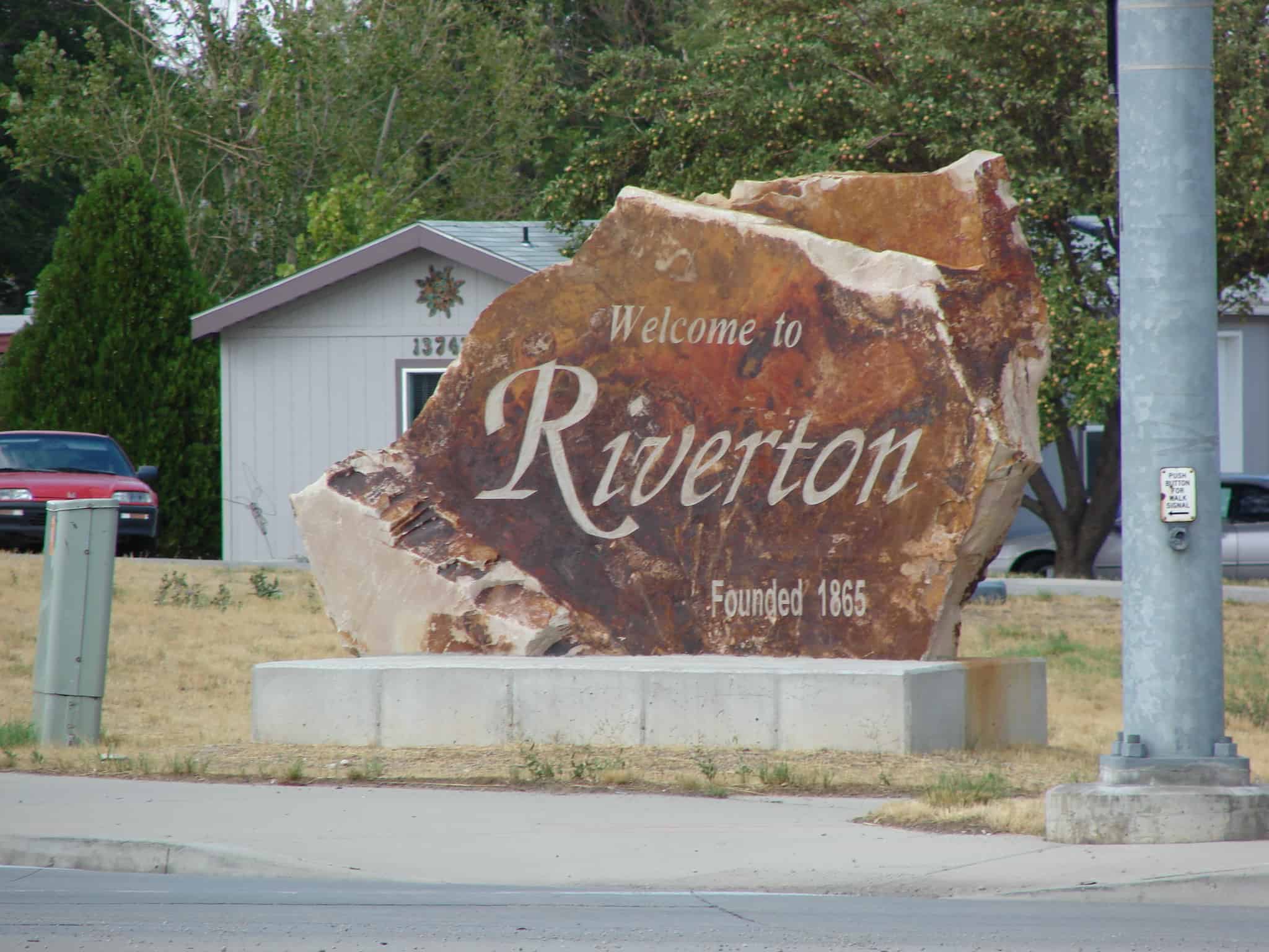
Situated near the southern end of the Salt Lake Valley, Riverton is located on a low plateau west of the Jordan River approximately twenty miles south of Salt Lake City. For most of its history Riverton was an agricultural community, but widespread residential development that began in the late 1960s has largely transformed it into a bedroom community.
The earliest area settlers lived in scattered dugouts and primitive log houses bordering the river on the bottomlands. Archibald Gardner was the first person to live in Riverton, and early settlers paid tribute to his pioneering efforts in the mid-1850s by calling the area Gardnersville. The size of the settlement long remained small because water was available for the bottomlands only near the river. Begun in 1870 as a local cooperative undertaking, the South Jordan Canal, when completed in 1876, opened up the benchland to farming and settlement. The community expanded again when the larger Utah and Salt Lake Canal, financed wholly by Salt Lake County, was finished in 1881. Construction of these canals, which are still in use, was undertaken with only basic tools and contracted manual labor.
Riverton came under the jurisdiction of the West Jordan Precinct in its early years. In 1867 the settlement politically became part of the South Jordan Precinct. A judicial precinct was established locally in 1879, and the name of the small settlement, boasting little more than a hundred people, was officially changed from Gardnersville to Riverton.
Riverton’s residents reflected the predominant religious affiliation characteristic of most rural Utah towns. Much of the cultural, educational, and community life revolved around activities sponsored by the local wards of the Mormon Church. In the early years, Mormons met in the dugouts and log homes of members, often in the home of Nicholas Thomas Silcock, the community’s first branch president (called in 1870). Many of the activities and traditions in the community were initiated in a church setting during years when it was principally an agricultural community. As in other predominantly Mormon Utah communities, there was an overlapping and mixing of ecclesiastical and civic roles and actions. In 1886, with 233 members in thirty-five families, Riverton was organized as a ward with Orrin Porter Miller as its first bishop. Members met in a combination meetinghouse/schoolhouse which had been built in 1879. By 1900 there were 517 members (ninety-two families) and construction was begun on a new meetinghouse. Completed in 1908, this domed structure in the Romanesque style was designed by Richard Kletting and was generally recognized as one of the finest LDS meetinghouses in a rural setting. It was demolished in 1940.
Public schools in the community had their beginnings in private homes and in a one-room schoolhouse which was built in 1879. A two-story brick school was built in 1892 on Redwood Road; it served students through the eighth grade. In the mid-1920s a new elementary school and junior high school were constructed on this site. As population increased in the 1970s and 1980s, the Jordan School District constructed additional elementary schools and a middle school within the boundaries of the community.
In the decade of the 1890s, farming in Riverton underwent a transformation, shifting from simple farms supplying family needs to commercial farming. This paralleled a similar development in Utah agriculture. Although the farmer normally still owned his land, he specialized in what he grew or raised and used his cash profits to buy most of the things he needed. The local agricultural economy was severely tested during two extended periods of drought–one at the turn of the century and another in the early 1930s. Crops that were grown by commercial farmers in Riverton included alfalfa, sugar beets, tomatoes, and wheat. The livestock industry in Riverton was represented by sheep, dairy cows, and poultry. Commercial production and marketing of these agricultural and livestock products was accomplished through the establishment of various businesses, including an alfalfa feed mill, a canning factory, an egg-processing plant, and a dairy cooperative.
A central business district developed which was centered at the intersection of Redwood Road and “Herriman Road” (12,600 South). On the northeast corner of this intersection, a two-story commercial building was constructed by sheepman/developer Daniel Densley in 1893. Several businesses were accommodated on the first level of this building and the upper floor was used for dances, plays, and large community gatherings. Another sizable business was a retail store built by Thomas P. Page about the turn of the century. It was regarded for many years as the largest concern of its kind in the county outside Salt Lake City. The Page-Pixton (later Page-Hansen) store sold everything from building materials, coal, and dry goods to groceries, grain, and housewares. The Jordan Valley Bank was started in 1905 as a community bank. This bank was a casualty of the Great Depression, and many people suffered financially when it closed its doors. For a time, the town also housed many automobile dealerships.
Although the move was controversial, in 1946 Riverton incorporated, operating under a town board form of government. The most pressing problems which city officials have dealt with in the latter part of the twentieth century have been those associated with the rapid increase in the city’s population. To illustrate, in 1970 the city had a population of 2,820, a figure which expanded to 11,700 in 1992. This has made a tremendous difference in land use as farmland has been converted to residential use. This change is great in view of the fact that approximately 94 percent of Riverton’s land was agricultural in 1960. Riverton has increasingly become a popular country-style suburb, an inevitable development as a consequence of the Salt Lake Valley’s expanding population.
05 Tuesday Aug 2014
Posted in Uncategorized
Tags
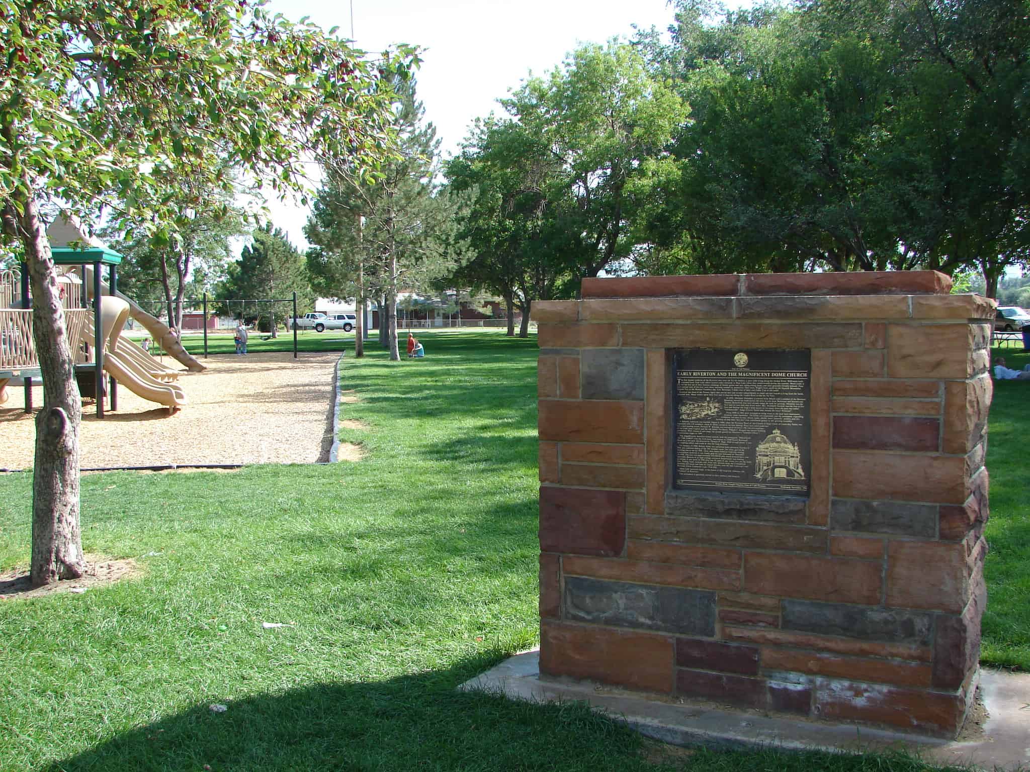
Early Riverton and the Magnificent Dome Church
The first known residents of the Riverton area were the Yo No Indians, a poor tribe living along the Jordan River. Well-worn trails extended from Utah Lake where various tribes wintered, to Bear Lake where they rendezvoused during the summer. Much credit is due for the free use of their byways, exchange of leather goods and furs, relinquishing land, and their general friendly attitude. Four forts erected west of the river were never seriously needed for protection. They were: Wight’s Fort, north by the Oquirrh Mountains; English Fort at the Bennion Cemetery site; Fort Herriman, 5 miles west of here; and Cedar Fort to the south.
Riverton was born of the Pioneer Spirit that moved men and women independently to reach out and wrestle a living from the harsh, untamed land. Many settlers spent their first year in dug-outs along the Jordan River as did the Yo No’s.
In 1855, Abraham Hunsaker, a convert from Illinois and a member of the Mormon Battalion, moved his herds across the river to join Jesse Beckstead and Samuel and Thomas Butterfield who were already using the land for grazing. Abraham was the first man to own land and divert water. But Archibald Gardner was the first to live here and become the largest land owner; so for many years the area was called “Gardnersville.” Judge Charles Smith later named the town “Riverton”.
From 1850 to 1881 most attempts to bring water to the land were inadequate, however, some succeeded. The fertile soil responded, and the permanent expanding settlement was here to stay. Sheep, cattle, alfalfa, beets, minerals, poultry, and dry farming all had their “hey day” and contributed greatly to the growing economy.
A maturity milestone was reached August 8, 1886, when the Riverton Ward of the Church of Jesus Christ of Latter-day Saints was organized with 138 members. Orrin P. Miller served as the first Bishop. Plans were soon underway for a new meeting house. Richard W. Kletting was selected as architect. (He was also architect of the Utah State Capitol and the old Saltair Pavillion). Willard C. Burgon was named building contractor. With visions of new hope, the people geared for Riverton’s “Grandest Effort.” Construction began in 1899.
This magnificently beautiful domed church, with the inscription “HOLINESS TO THE LORD” over the front door was erected at 12800 South Redwood Road on a two-acre site donated by Thomas P. Page. With its high dome, it was an inspiring edifice and could be seen for long distances.
On January 21, 1900, Bishop Miller was sustained stake president, Gordon S. Bills was ordained bishop of the 346 member ward. The lower part of the building was in use by 1908. There were many financial hardships during construction, however, it was finally paid for and dedicated on December 20, 1920. The cost was approximately $25,000.00 plus much donated labor and materials. Because of its high ceilings, excessive maintenance and heating problems, it was razed in 1940 after just 30 years of use. Gone, too, are the brick kiln, Tithing Yard, molasses mill, flour mill, harness shop, the Commercial Building and dance hall built by Daniel Densley, and the Salt Lake and Utah Railroad (Orem Commuter Line) 1914-1945.
Many fond memories linger in the hearts of the long-time residents, the “Pioneers” of Riverton. This monument is gratefully erected to their memory and integrity.
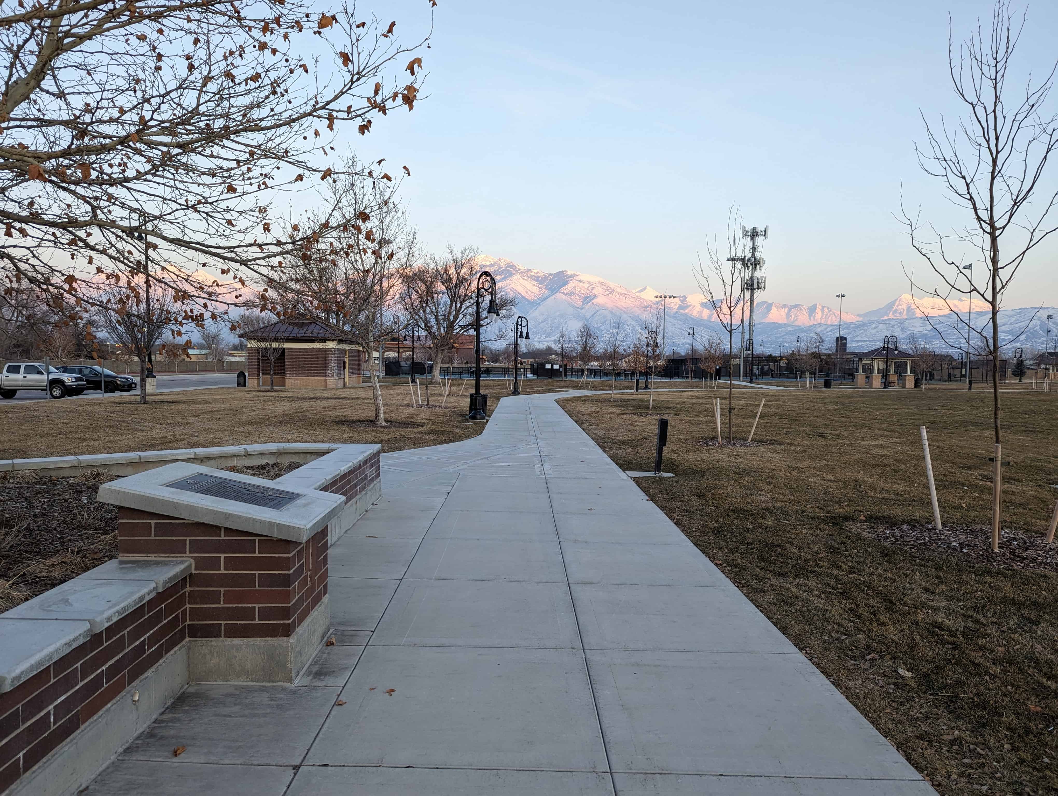
Sons of Utah Pioneers historic marker #7 was located here at Riverton City Park (1452 W 12600 S in Riverton) – this is the original monument before it was later split into two separate monuments, “Early Riverton” and “The Magnificent Dome Church,” both still located here at the park.

06 Friday Jun 2014
Posted in Uncategorized
Tags
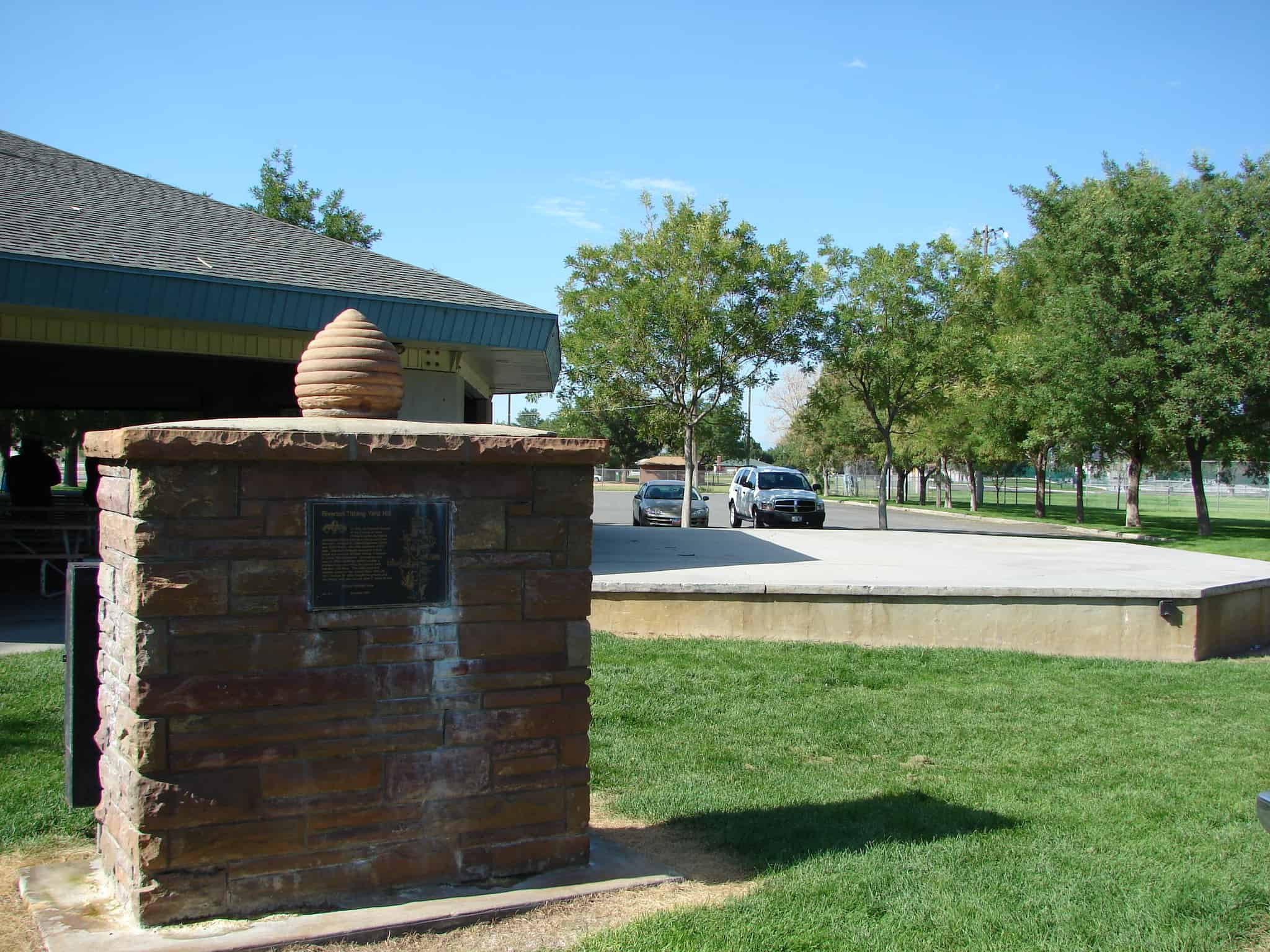
In 1886, the Riverton branch of the Church of Jesus Christ of Latter-day Saints purchased choice land for a tithing yard from Samuel L. Howard, Sr., located between 12400 and 12600 South, one mile northeast of this park. Members brought one tenth of their crops and animals for their tithing. Freeman R. Lloyd first supervisor. On level ground was an office building, weight scales, a granary, large root cellar, haystacks, feed mangers and barn. The cattle yard and pasture sloped to the Jordan River. Nov. 28, 1913, George W. Bills bought the ground and the tithing yard was closed after 27 years of use.
See also:
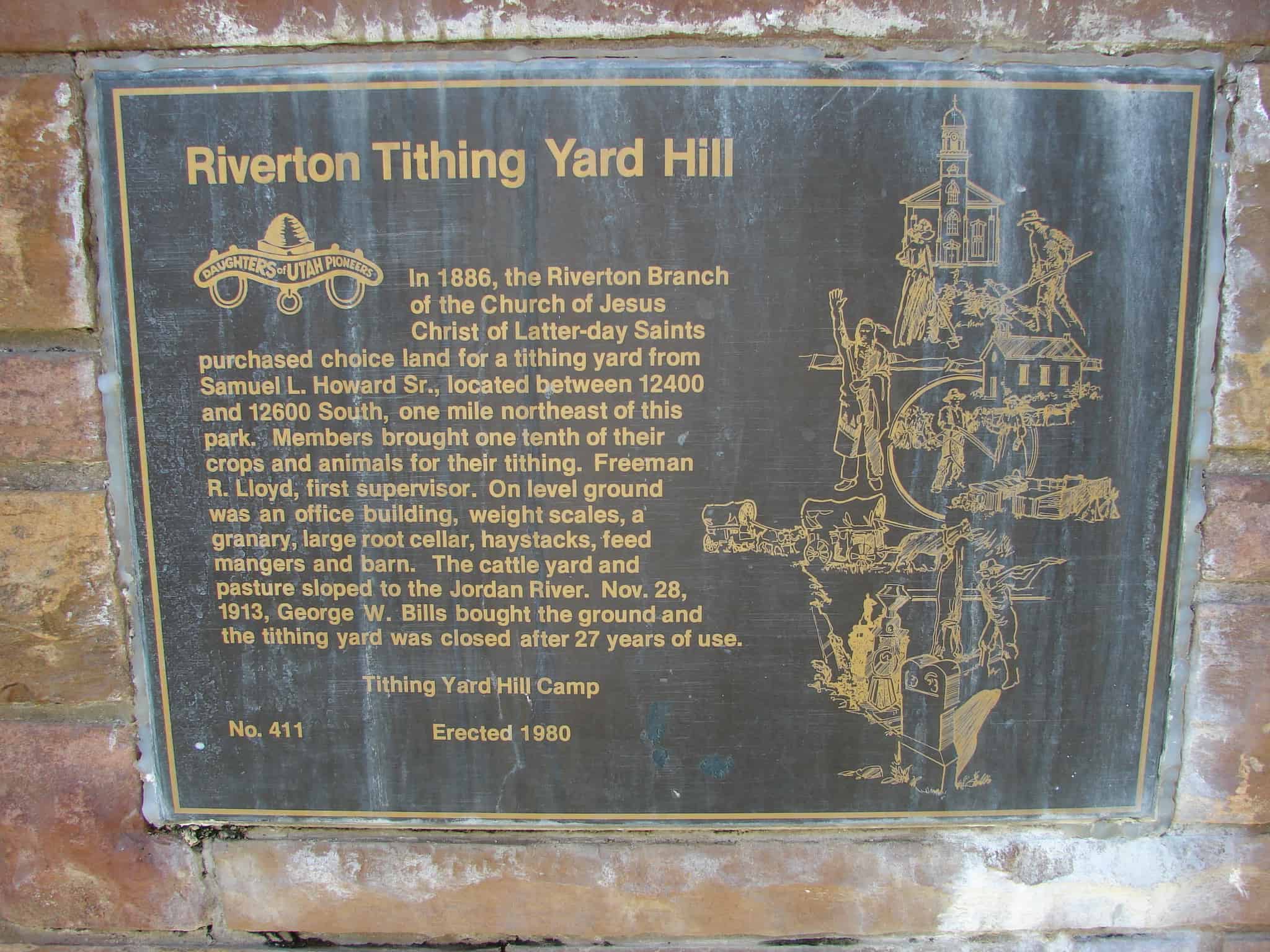
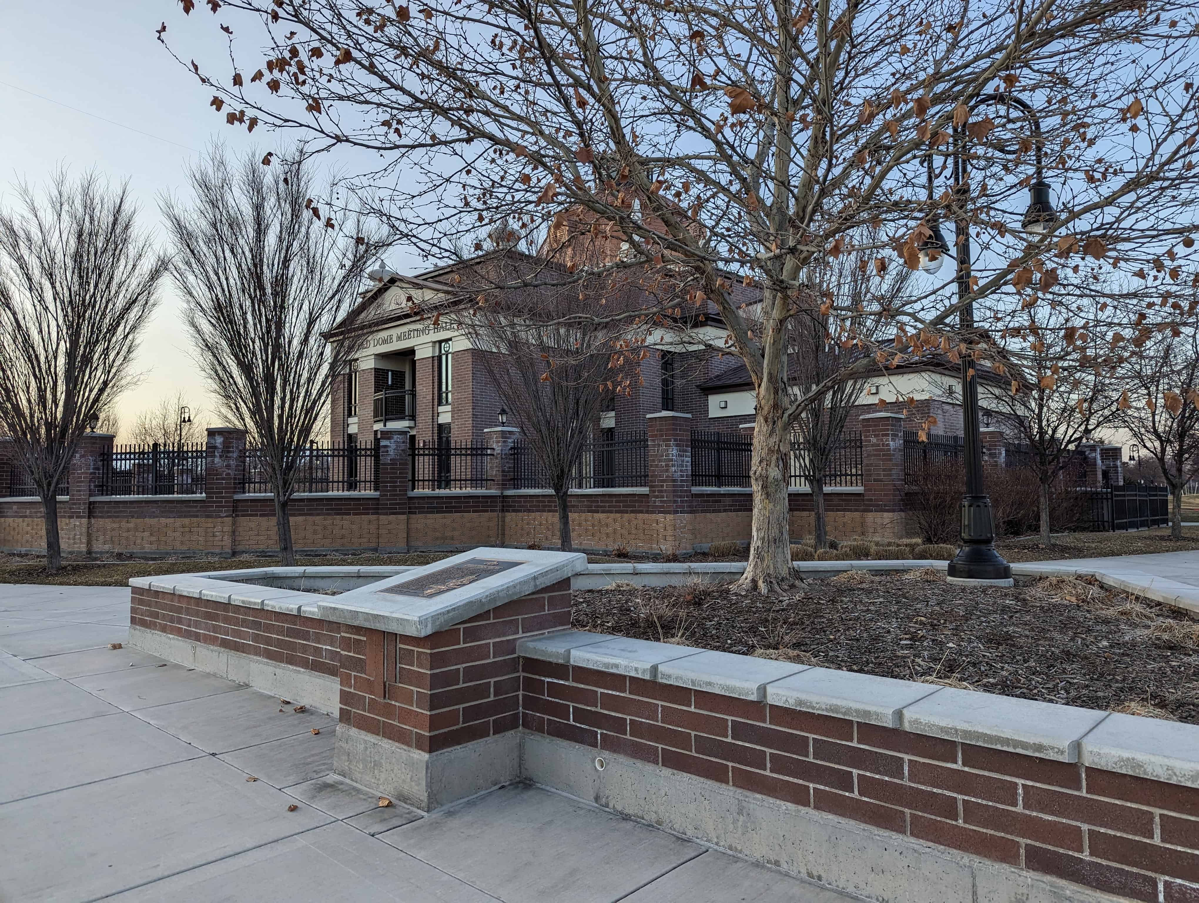
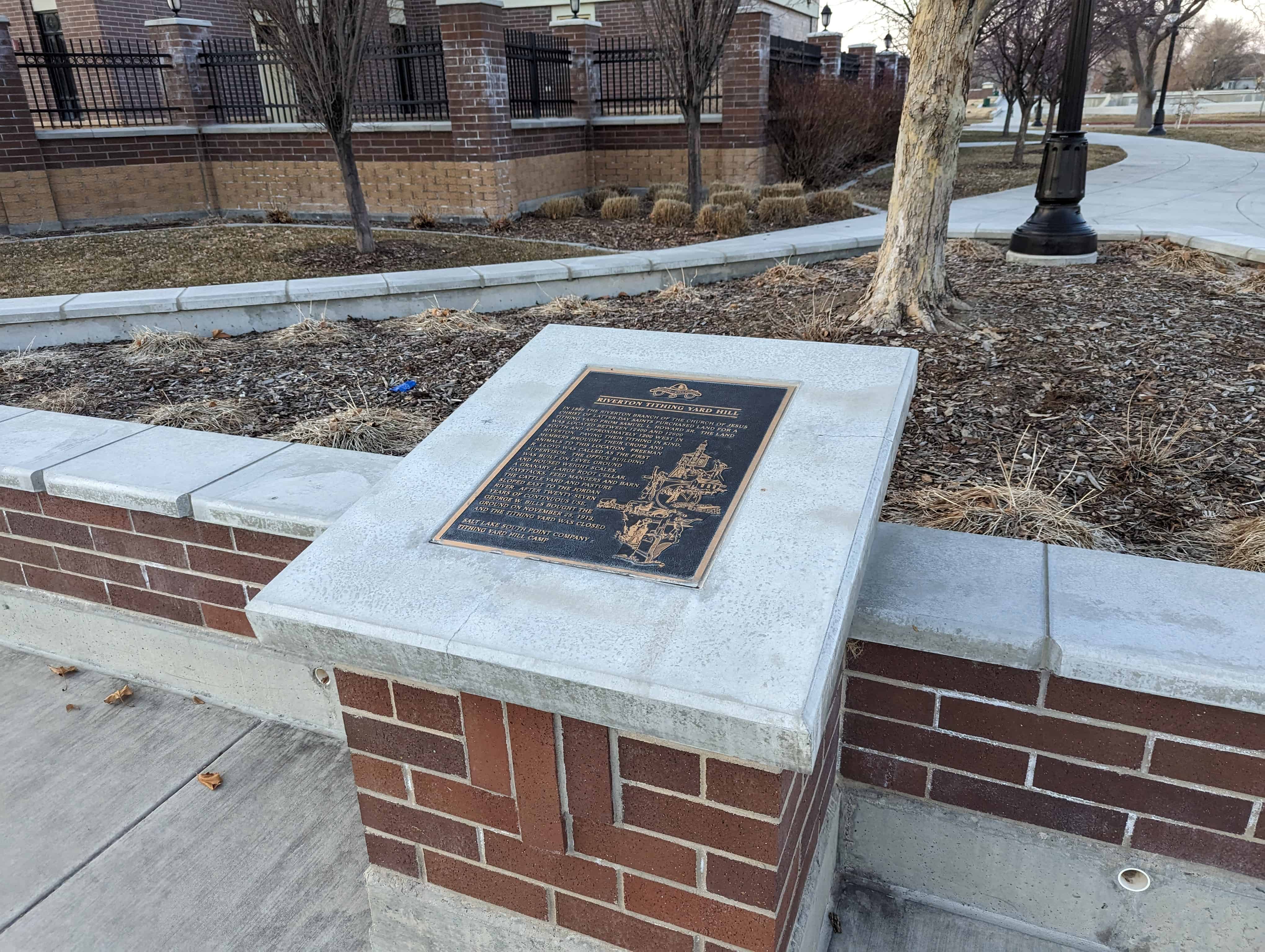
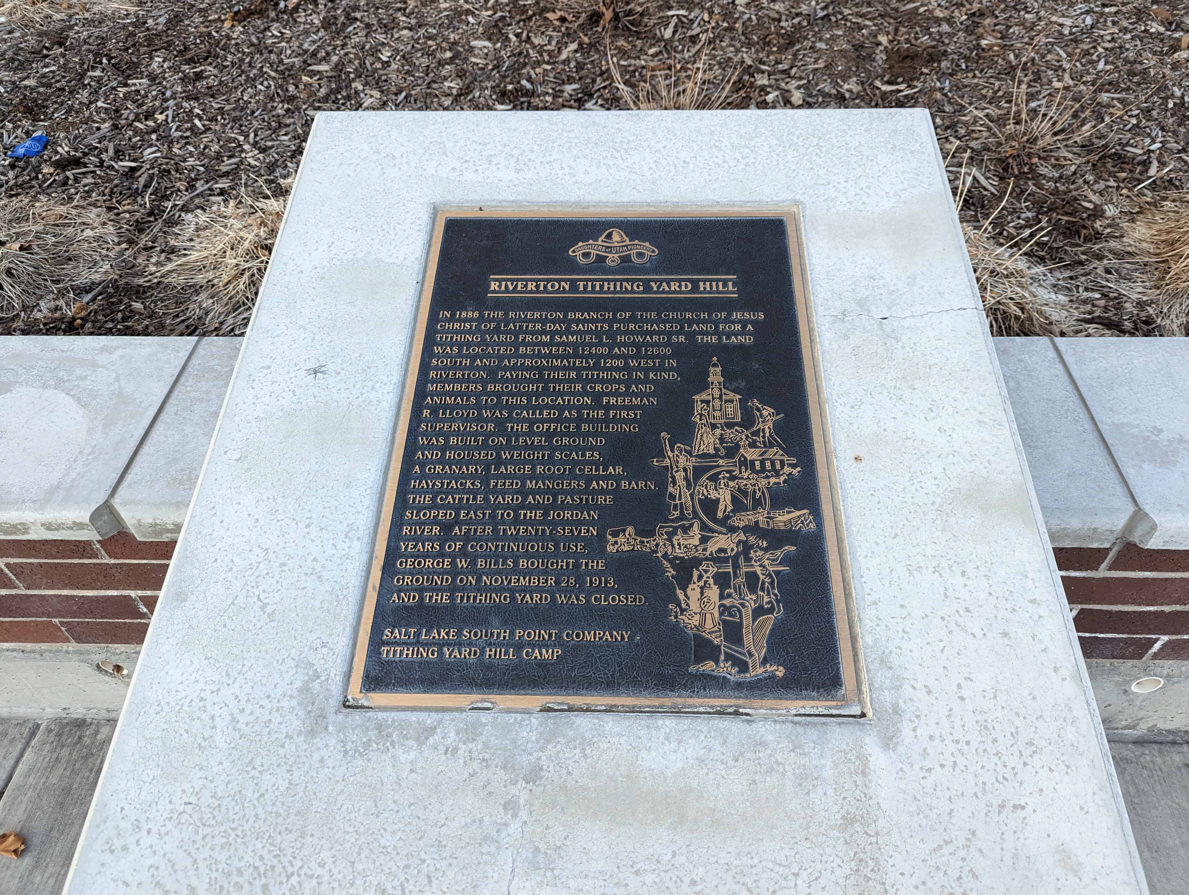
This is Daughters of Utah Pioneers historic marker #411 located at Riverton City Park (1452 W 12600 S in Riverton) – I took the above photos in 2007, the photos below are of the new monument (I took the photos in 2023 but I think the monument was re-done around 2015). The wording is very similar on the new plaque.
–
In 1886, the Riverton branch of the Church of Jesus Christ of Latter-day Saints purchased land for a tithing yard from Samuel L. Howard Sr. The land was located between 12400 and 12600 South and approximately 1200 West in Riverton. Paying their tithing in kind, members brought their crops and animals to this location. Freeman R. Lloyd was called as the first supervisor. The office building was built on level ground and housed weight scales, a granary, large root cellar, haystacks, feed mangers and barn. The cattle yard and pasture sloped East to the Jordan River. After twenty-seven years of continuous use, George W. Bills bought the ground on Nov. 28, 1913, and the tithing yard was closed.
06 Wednesday Nov 2013
Posted in Uncategorized
Tags
Herriman is in the far South-west corner of Salt Lake Valley.
Herriman is growing fast, it grew from 1,523 people in the year 2000 to 21,785 in 2010.
Related posts:

01 Friday Nov 2013
Posted in Uncategorized
Tags
Bluffdale, Draper, Point of the Mountain, Riverton, Salt Lake County, Salt Lake Valley, Sandy, Sivogah, South Jordan, Traverse Mountain, utah

Draper Posts:
Draper is in the south-east corner of Salt Lake Valley, near Bluffdale, Sandy, South Jordan and others. Draper is located just north of “Point of the Mountain,” officially “Traverse Mountain,” a popular hang-gliding spot.
Draper was originally called Sivogah, meaning Willows. The town was then known as Willow Creek for the creek the settlers used. They also used the region as a grazing area for their cattle. The town name was then changed to Brownsville for Ebenezer Brown and family who arrived in 1849. Later, the name was again changed to honor William Draper, the town’s first Mormon bishop. The Draper family settled in the area in 1850.
31 Thursday Oct 2013
Posted in Uncategorized

Bluffdale Posts:
Bluffdale, named for its twenty-five square miles of bluffs and dales, extends from Herriman on the west to Riverton on the north, Draper on the east and the Utah County line on the south. Originally it was part of West Jordan, first settled in 1848-1849. On July 29, 1858, Orrin Porter Rockwell paid five-hundred dollars to Evan M. Green for sixteen acres of land near the Crystal Hot Lakes (adjacent to the present Utah State Prison). This land included a hotel with dining facilities, stable, brewery, and pony express station. As the community expanded, the Bluffdale area became part of South Jordan, then Riverton. In 1883 the Bluffdale School Precinct was formed from parts of Herriman, South Jordan and Draper. On August 1, 1886, the Bluffdale Ward of The Church of Jesus Christ of Latter-day Saints was organized with Lewis H. Mousley as Bishop. For a short time the town was called Mousley. There are seven irrigation canals that originate at the Jordan Narrows in the Bluffdale area and serve the Salt Lake Valley. One of the earliest was the Utah and Salt Lake Canal started in 1862. Some of the early buildings included an adobe church, built in 1887-1888, a tithing house, and a three-room schoolhouse constructed in 1893.


Visit my list of places in Utah.