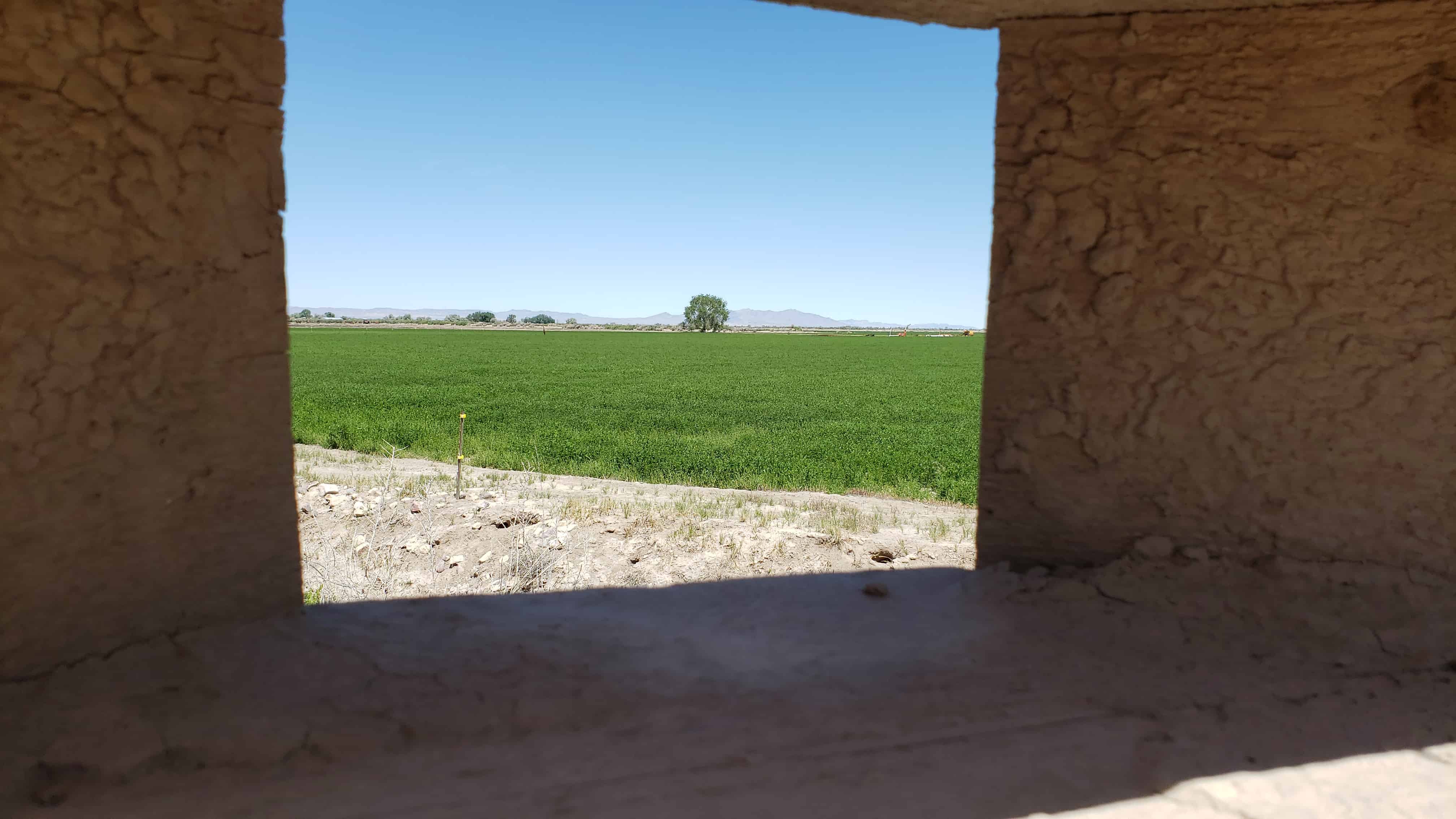
Anasazi State Park Museum (formerly Anasazi Indian State Park) is a state park and museum in Southern Utah, United States, featuring the ruins of an ancient Anasazi village referred to as the Coombs Village Site.
The Coombs Site is the site of one of the largest Anasazi communities known to have existed west of the Colorado River. The name Anasazi, Navajo for “Ancient Enemies,” or “Enemies of Our Ancestors” describes the Pueblo culture that existed in the Four Corners area from about 1 AD to 1300 AD. This village is believed to have been occupied from 1160 AD to 1235 AD. As many as 250 people lived there.
The village is largely unexcavated, though there was a brief excavation during 1958 and 1959, conducted by the University of Utah as part of the Glen Canyon Dam Project. During that excavation, archaeologists uncovered thousands of artifacts, and discovered a community of about 90 rooms divided into two separate one-story apartment complexes. An L-shaped building has been reconstructed and can be entered into by visitors. The cluster featured open shelters for working in the shade, storage pits, and adobe pit houses large enough for five or six residents. All together, about 100 structures have been found.
The Coombs Village Site is part of Anasazi State Park Museum at 460 North Highway 12 in Boulder, Utah and was listed on the National Historic Register on (#76001815) on January 1, 1976
Tiny 70 acre Palisade Reservoir draws swimmers to its sandy beach and anglers year-round. The carefully landscaped park is very well maintained. Canoes and paddle boats can be rented. There is also an 18-hole golf course.
Palisade State Park & Reservoir draws swimmers, year-round anglers and non-motorized watercraft enthusiasts. There is also an 18-hole golf course, practice range, professional golf shop and snack bar. Hiking areas abound and Six-Mile Canyon provides excellent off-highway vehicle riding just outside the park.
Palisade State Park is southeast of Manti and is landscaped with trees and grass. Park facilities include 53 individual campsites, sandy beach, modern rest rooms with hot showers, group camping area and covered group-use pavilion. Canoe and paddle boat rentals are available.
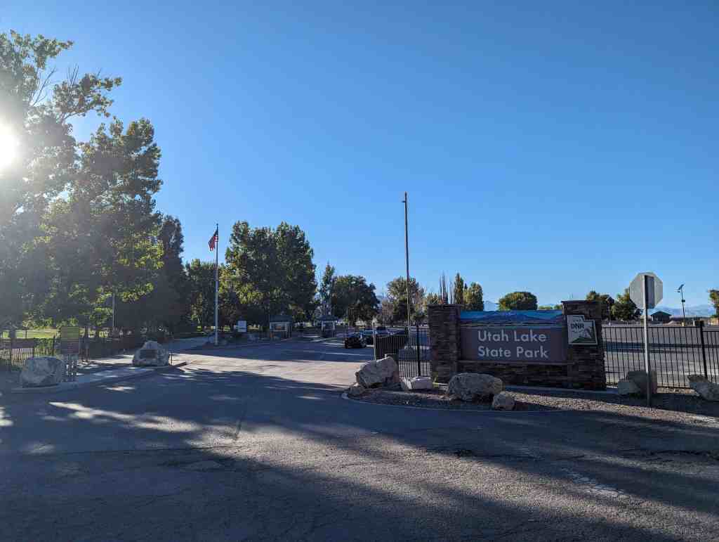
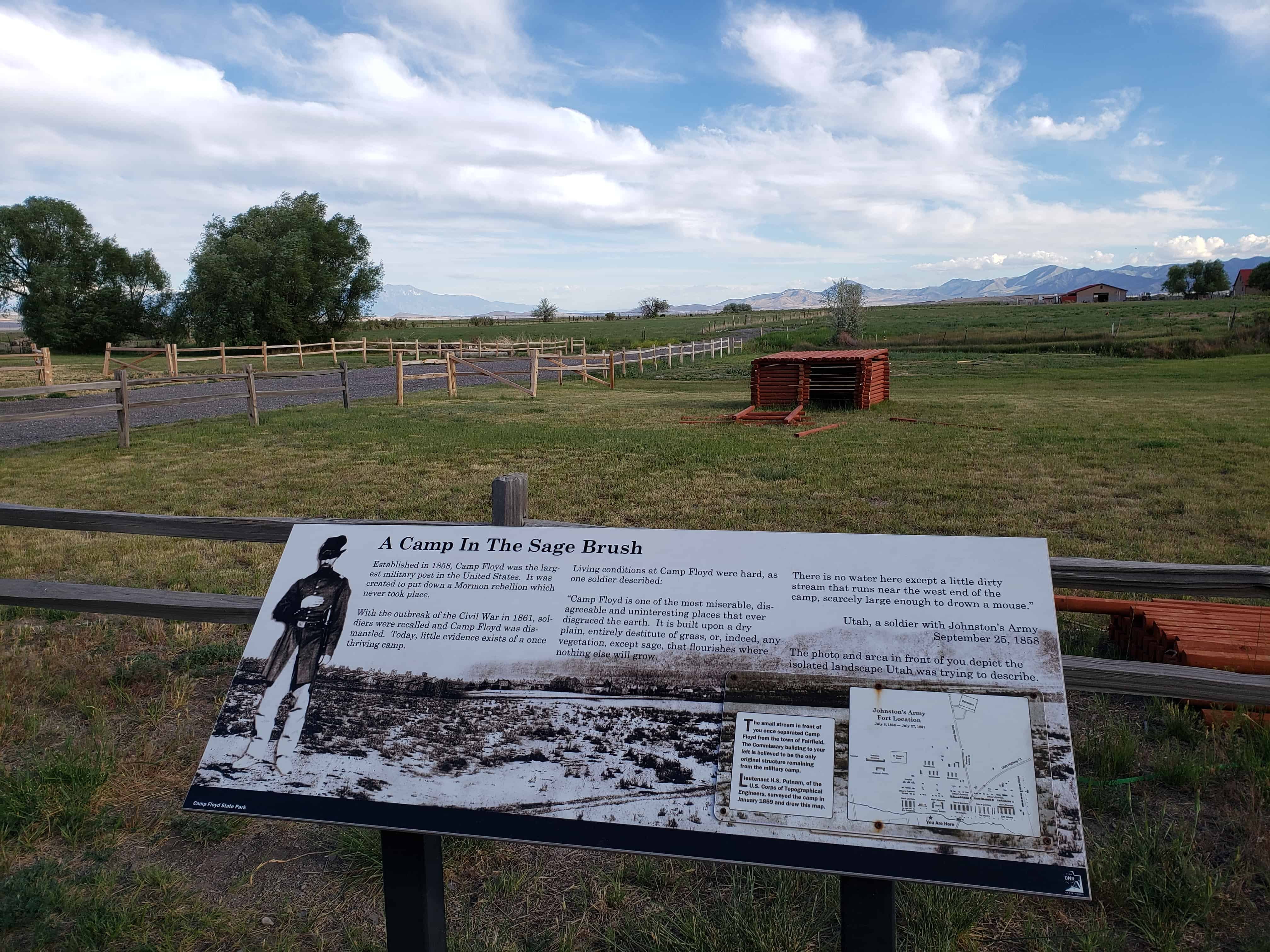
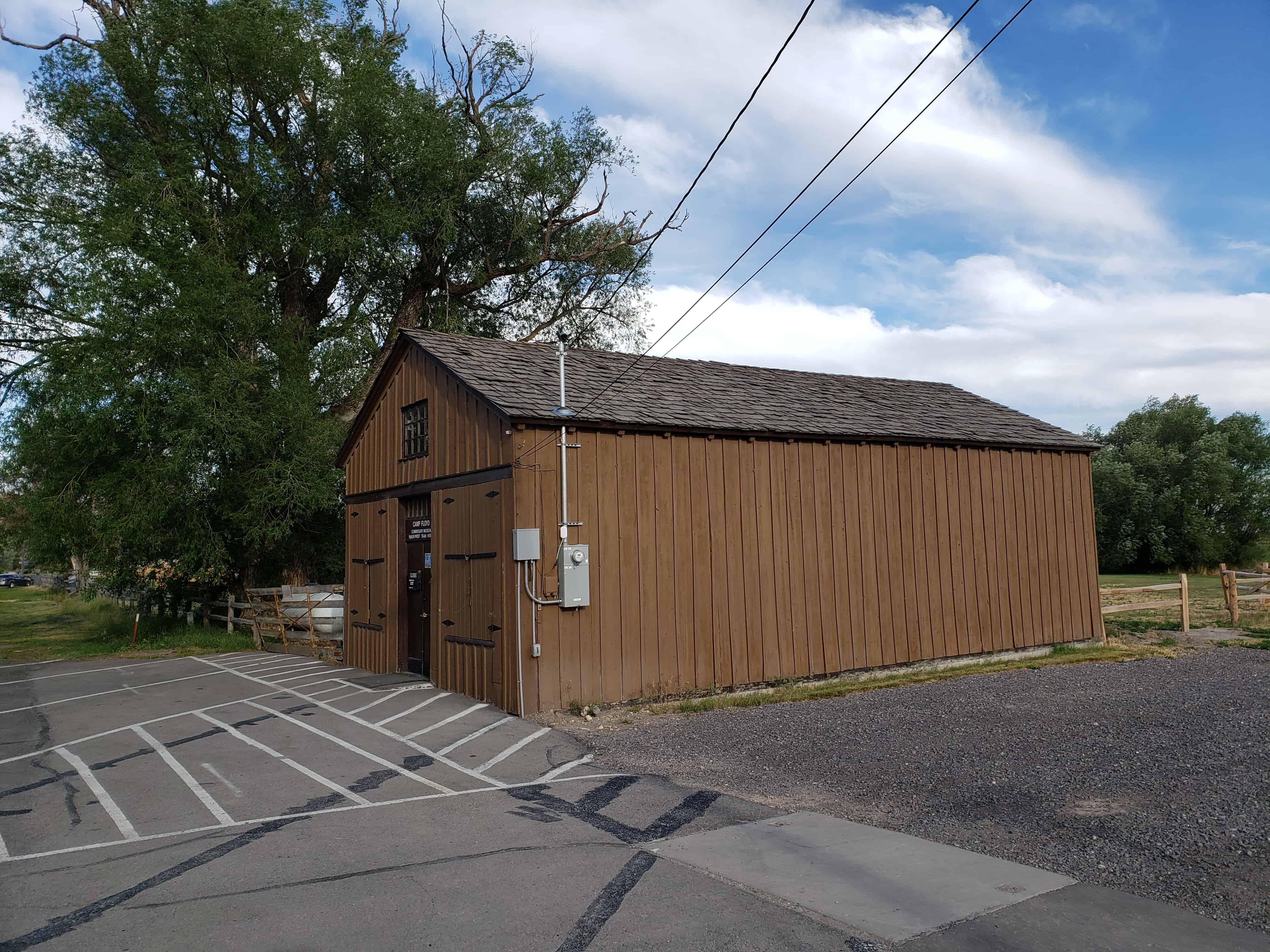
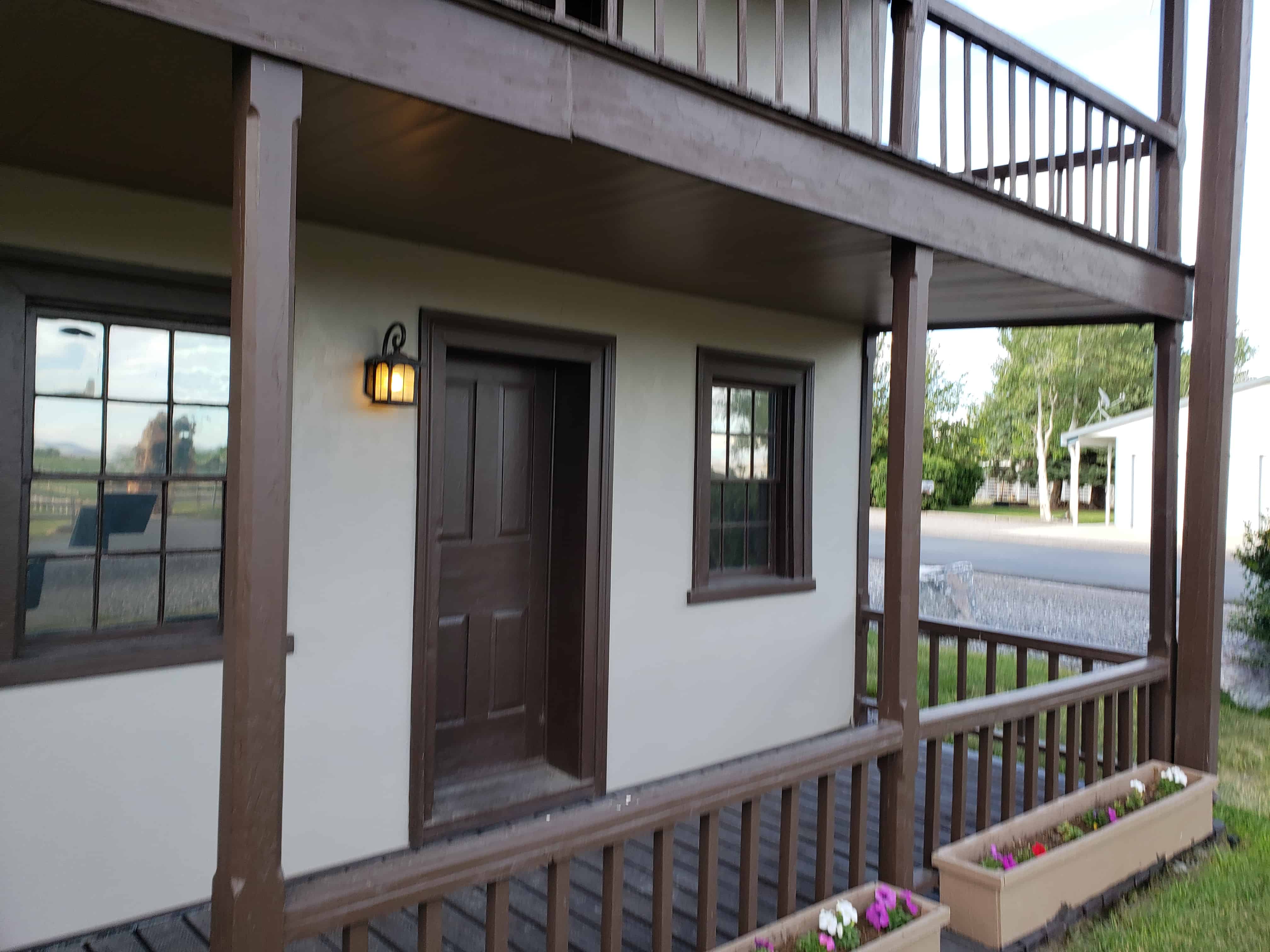
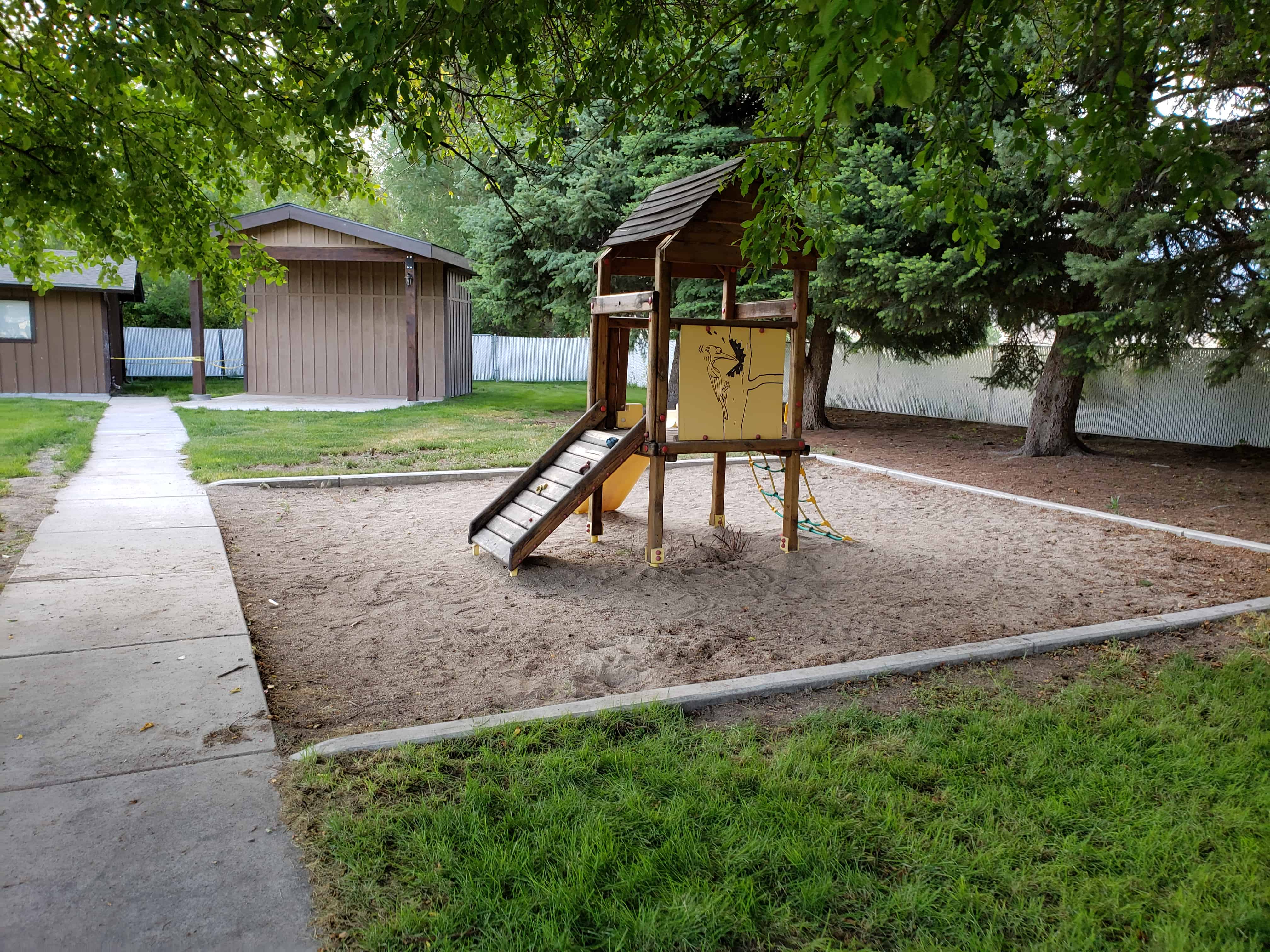
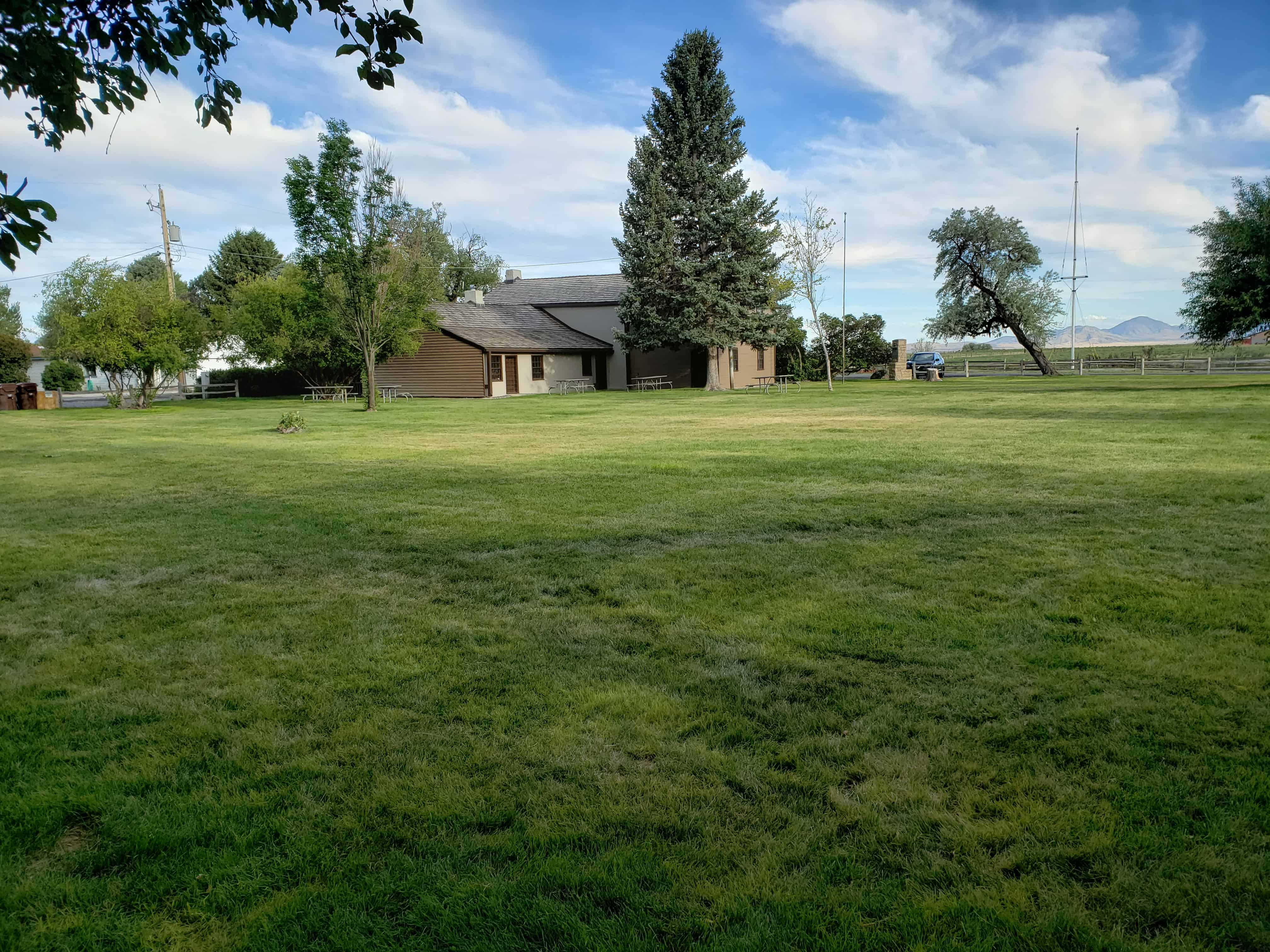
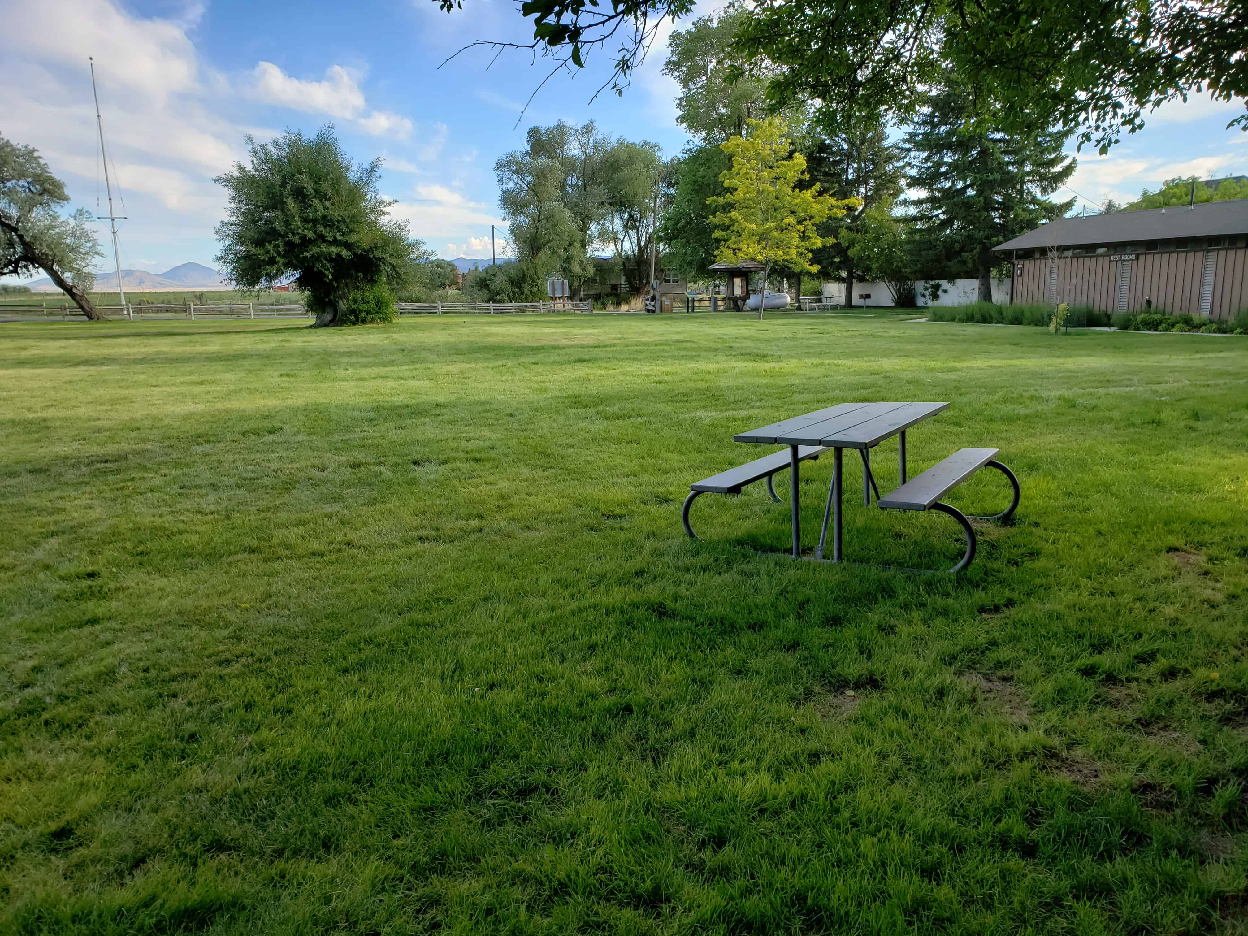
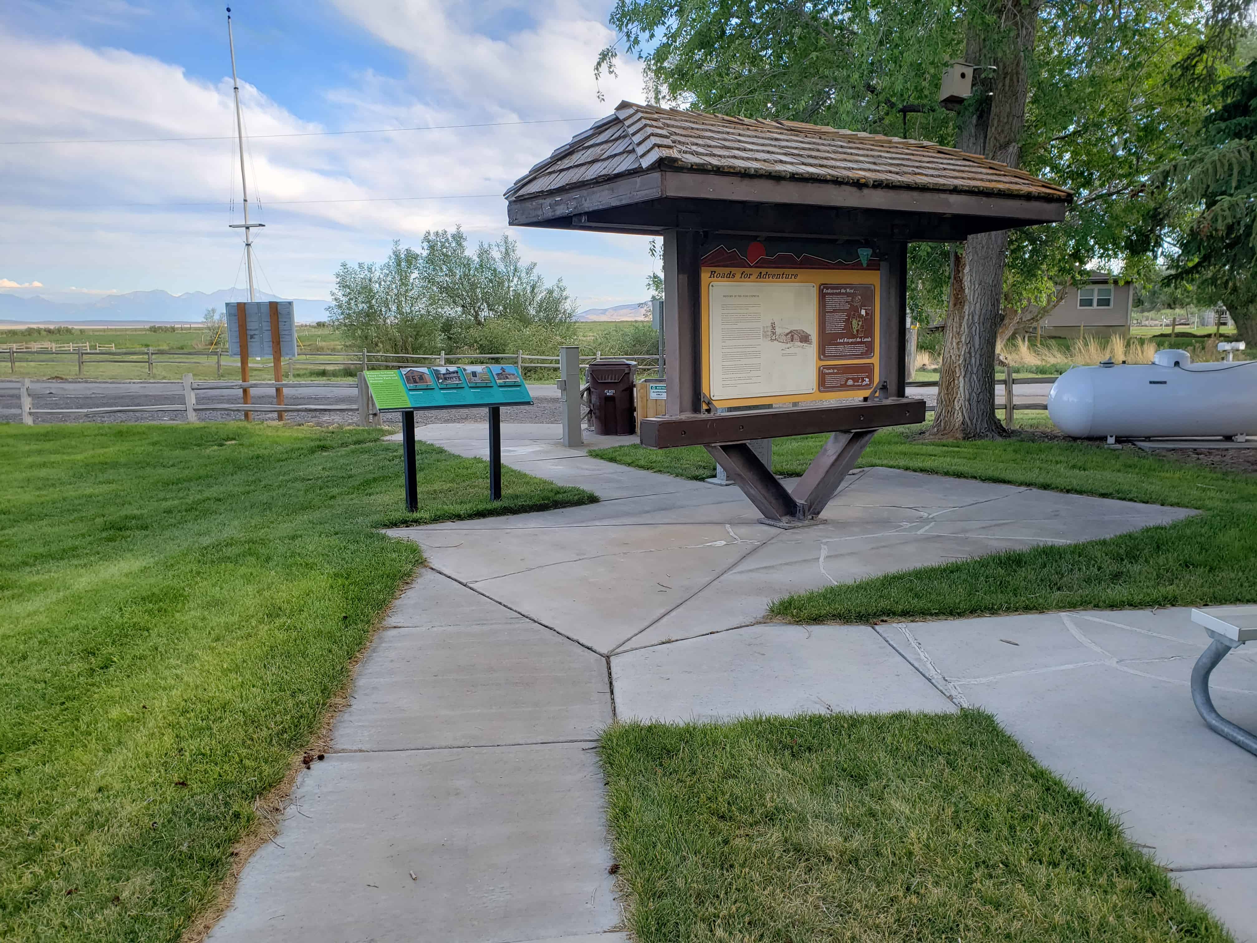
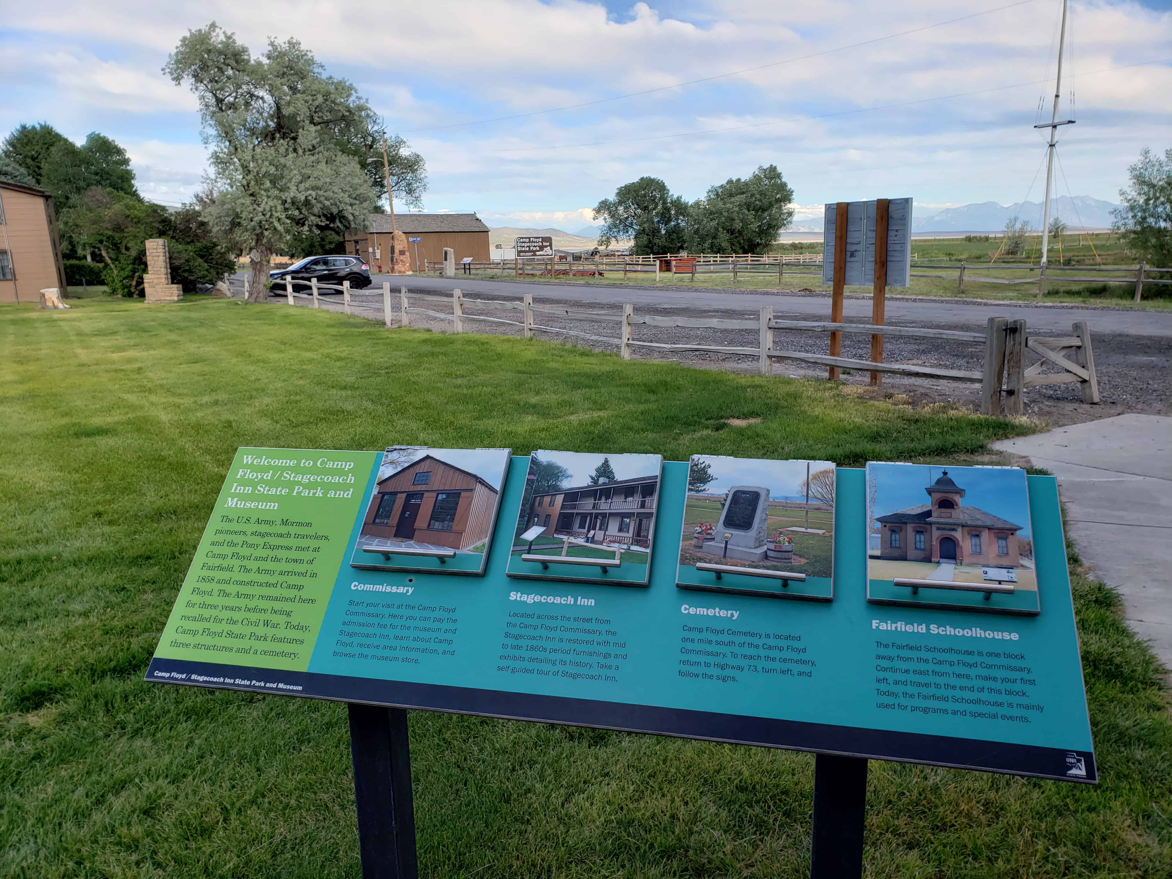
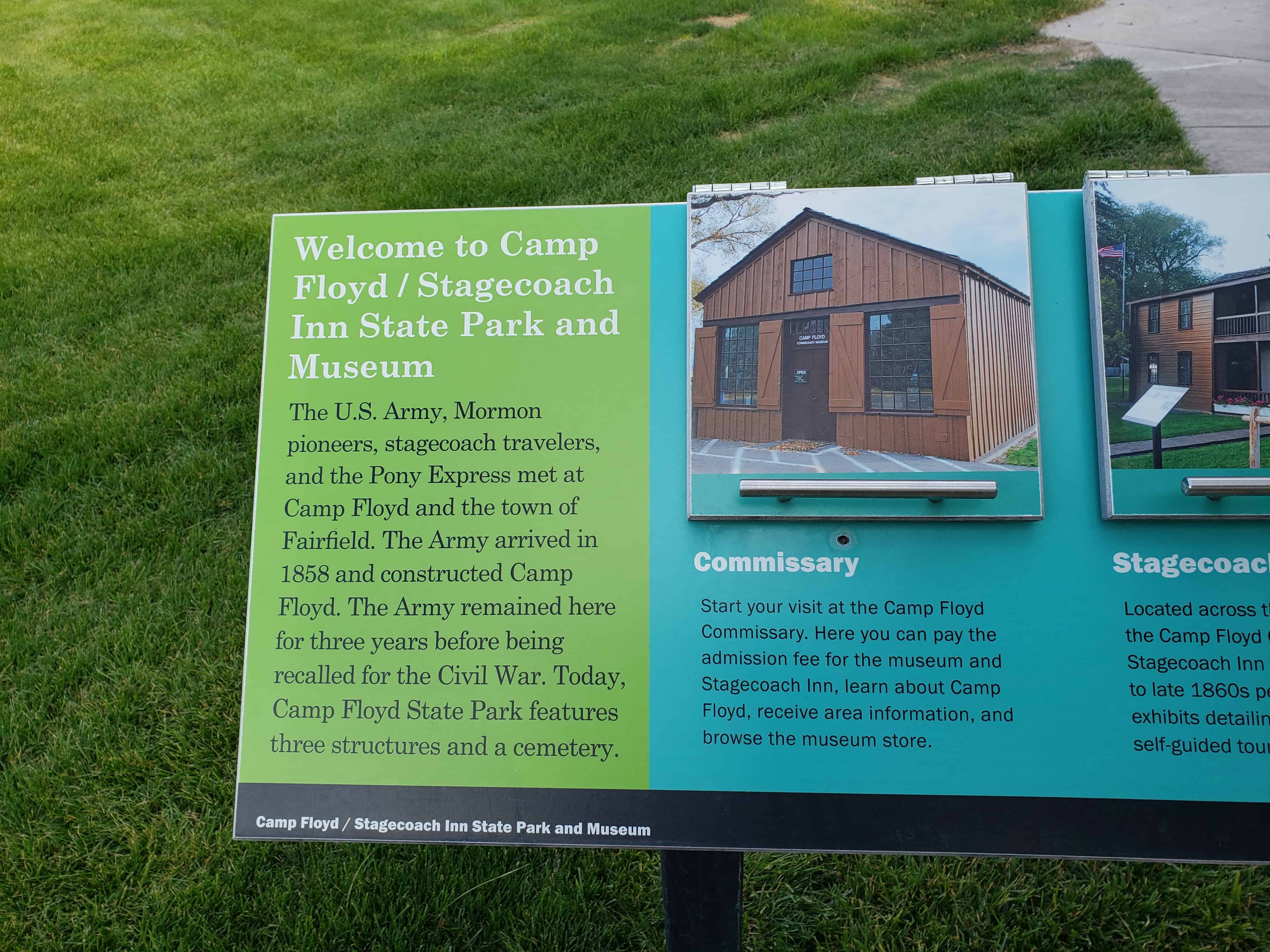
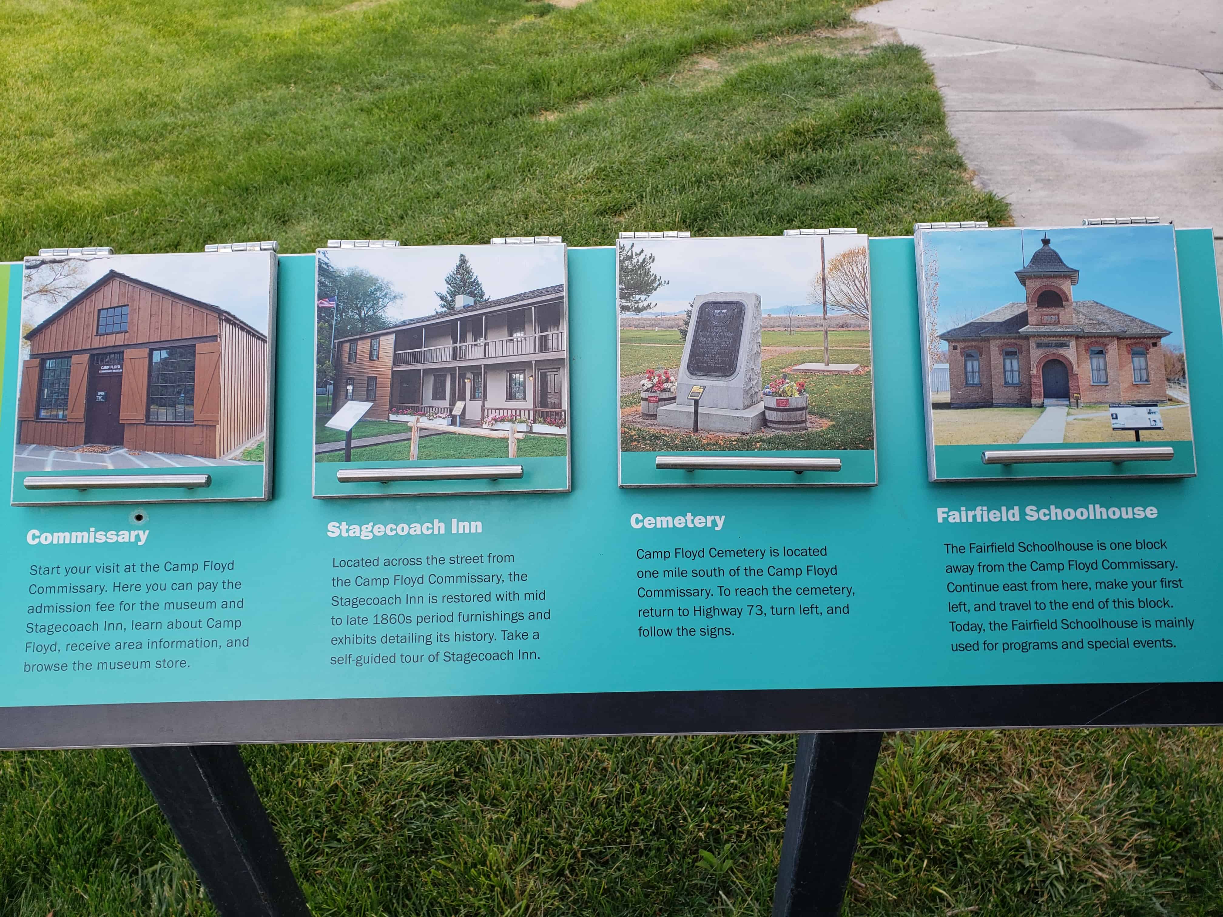
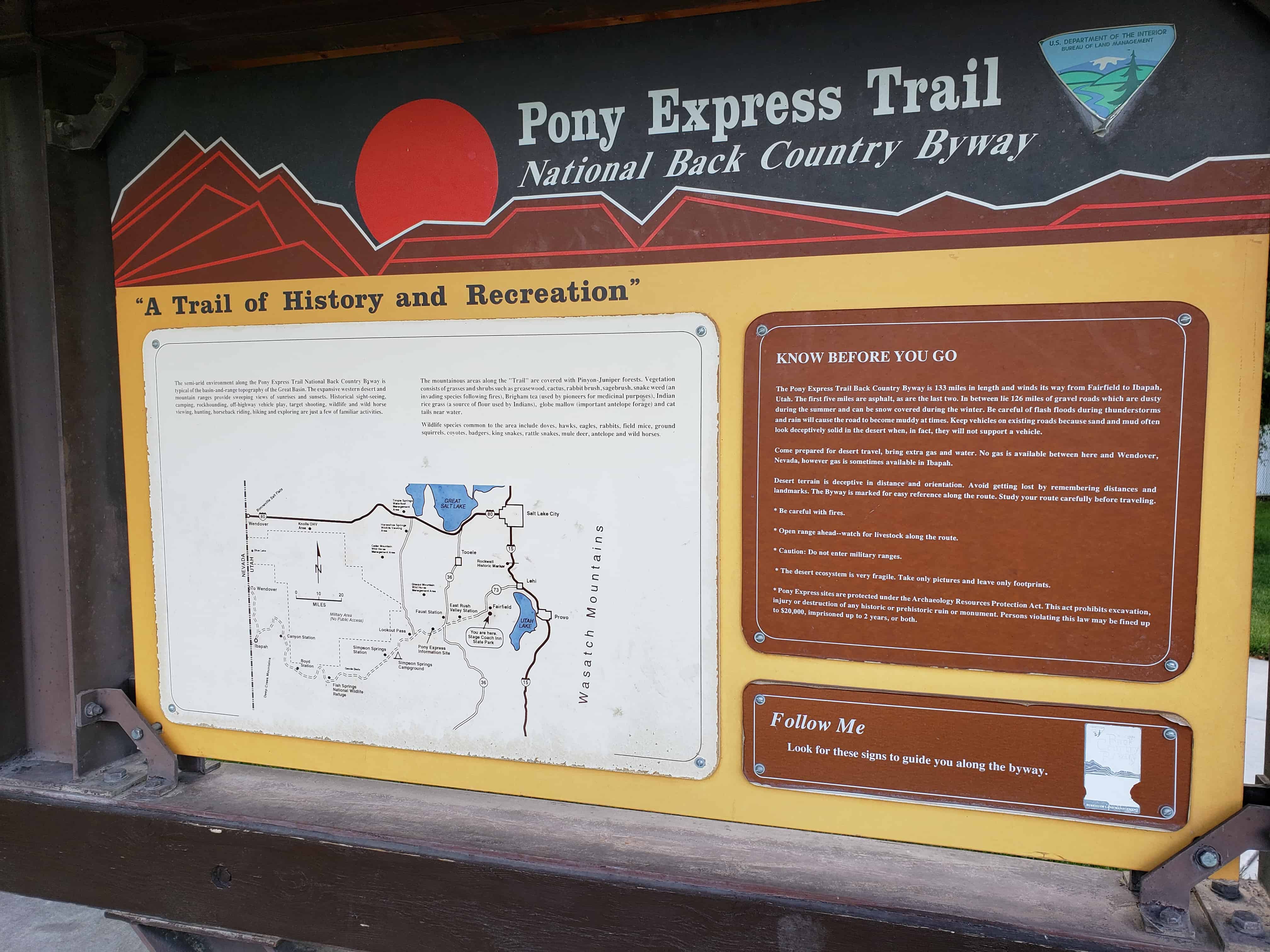
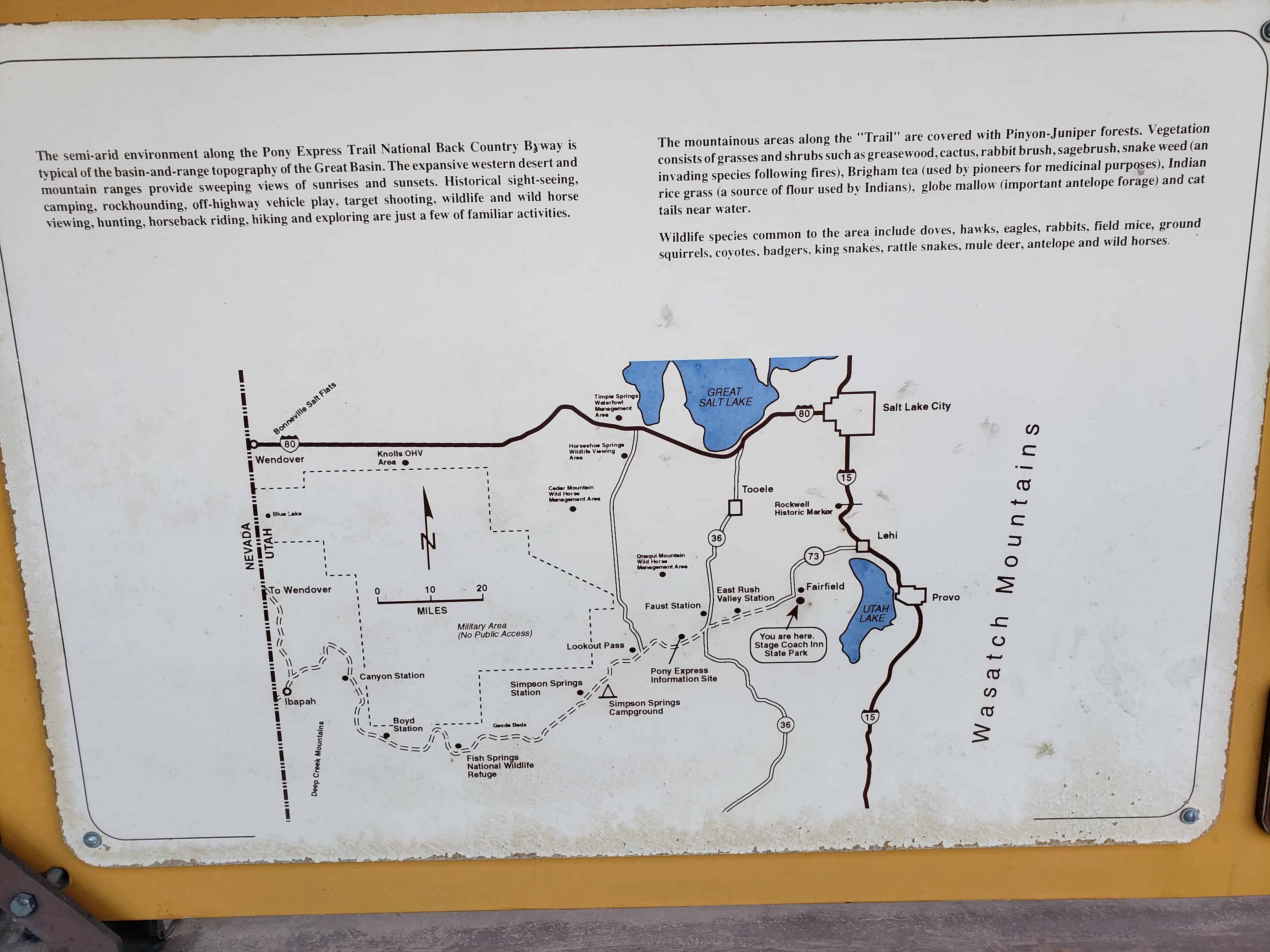
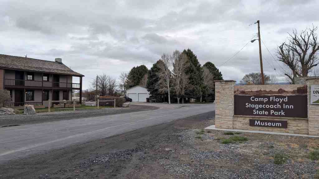
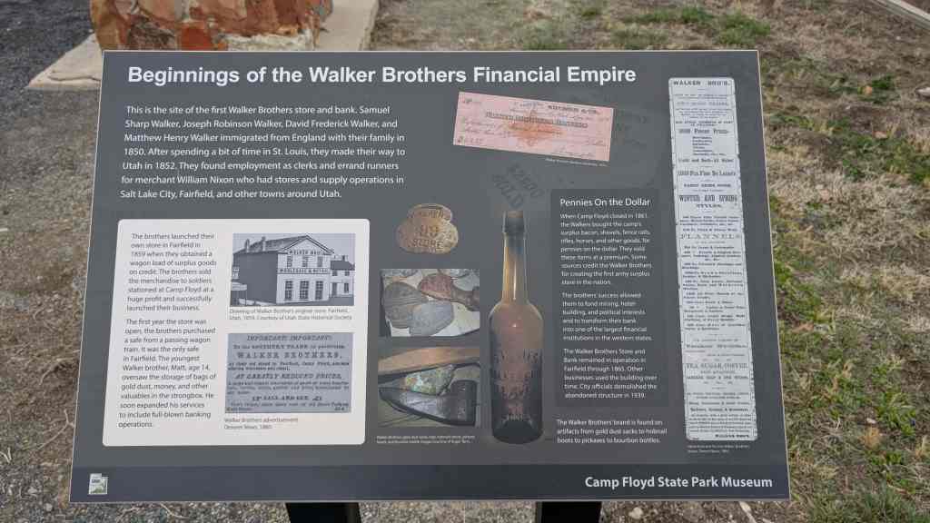
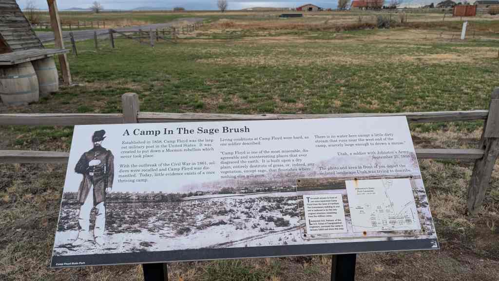
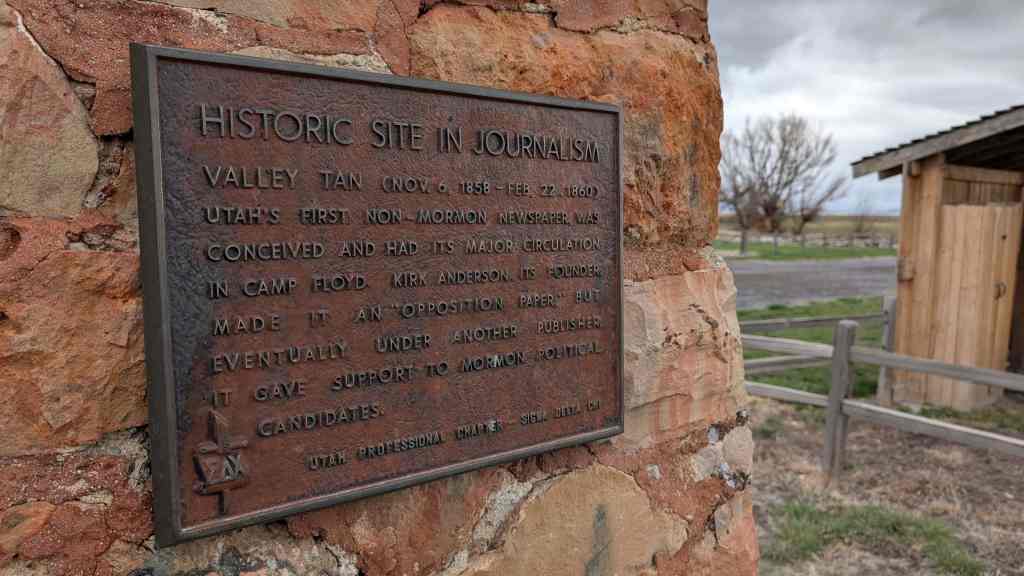
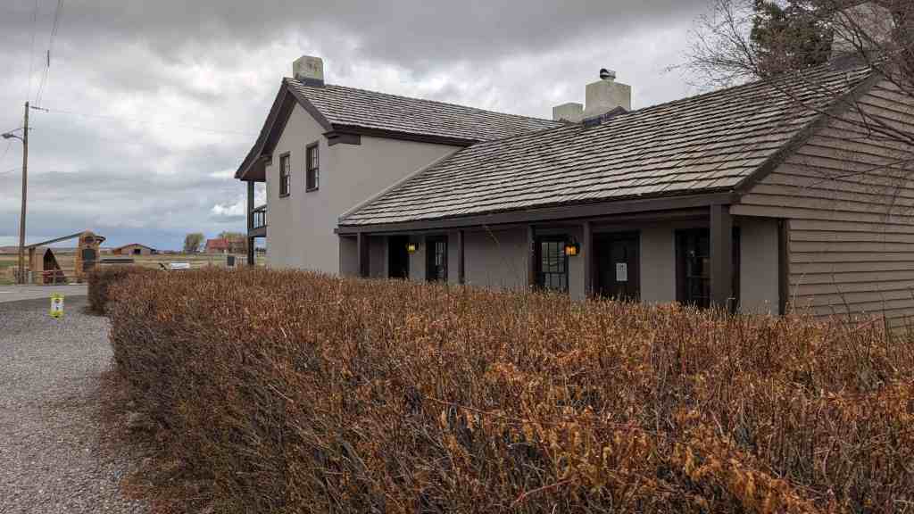
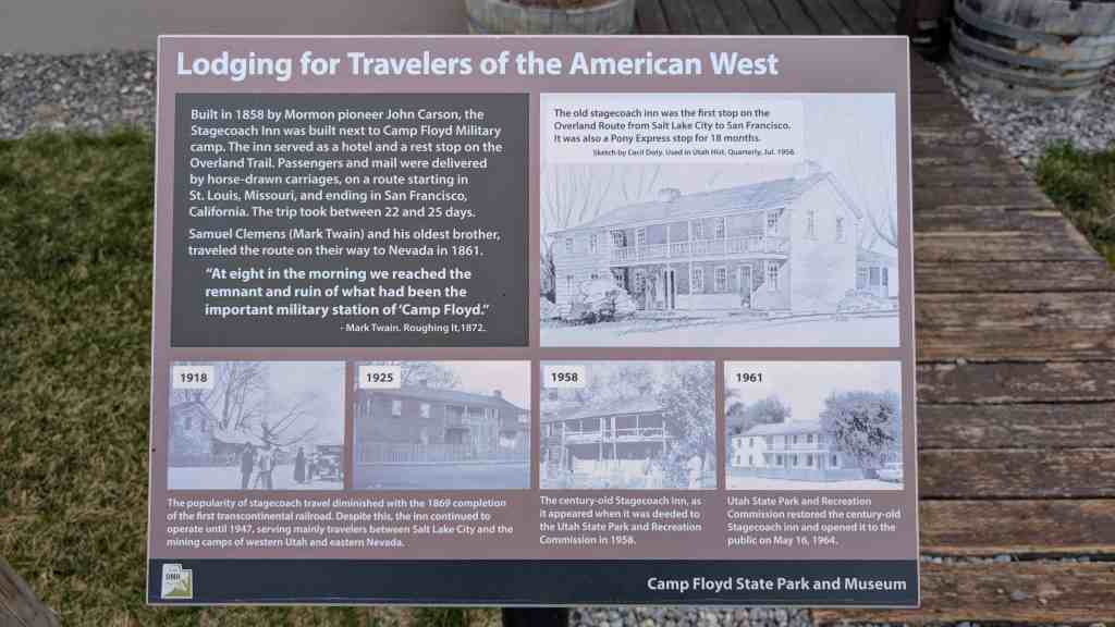
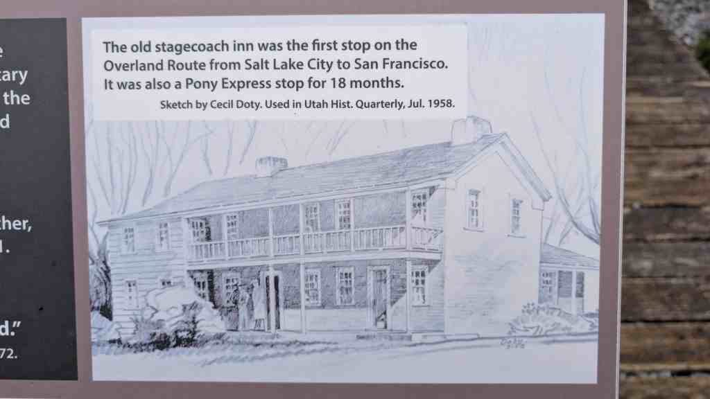
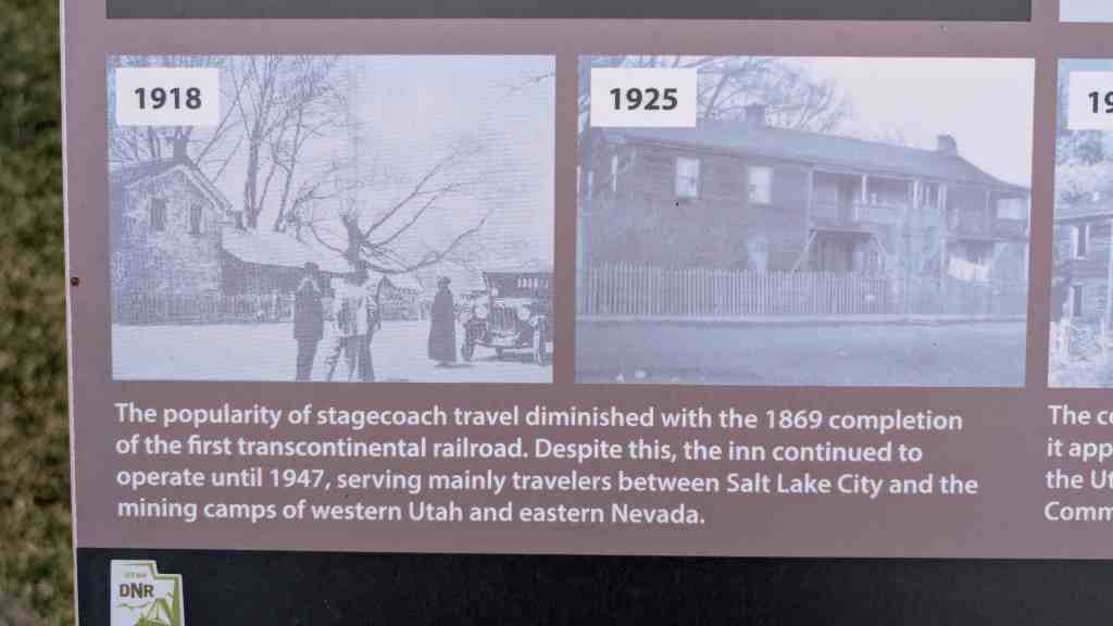
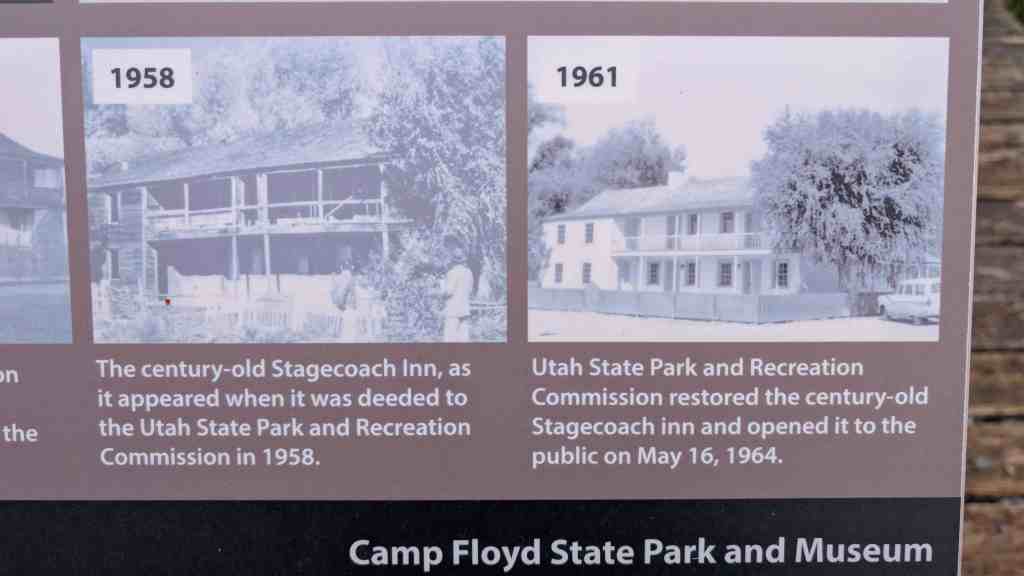
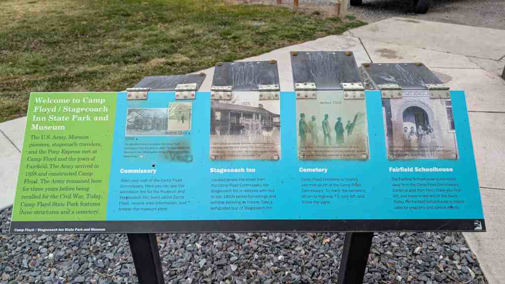
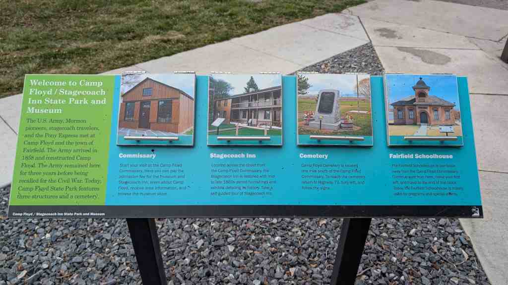
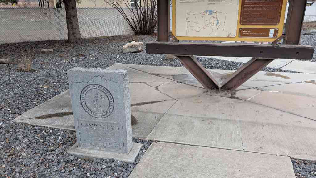
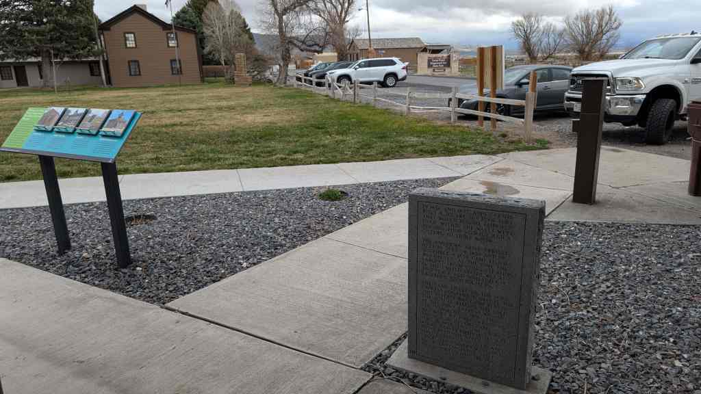
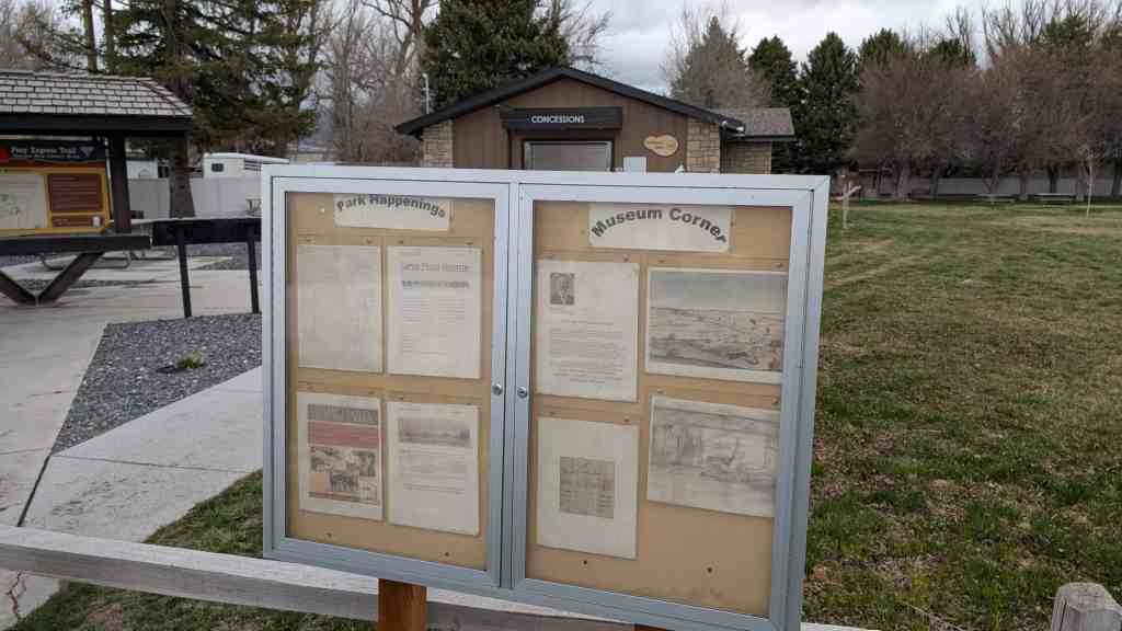
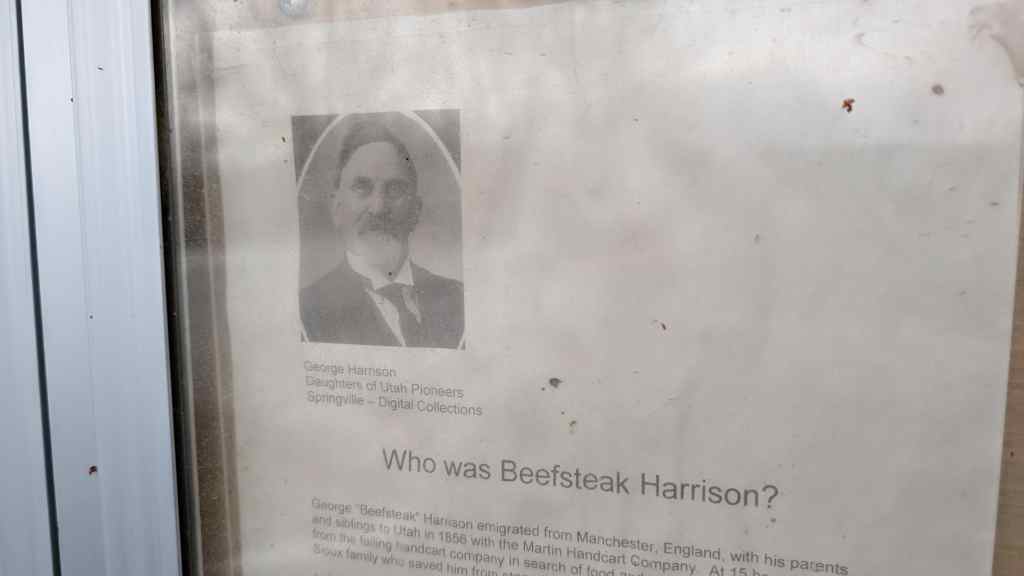
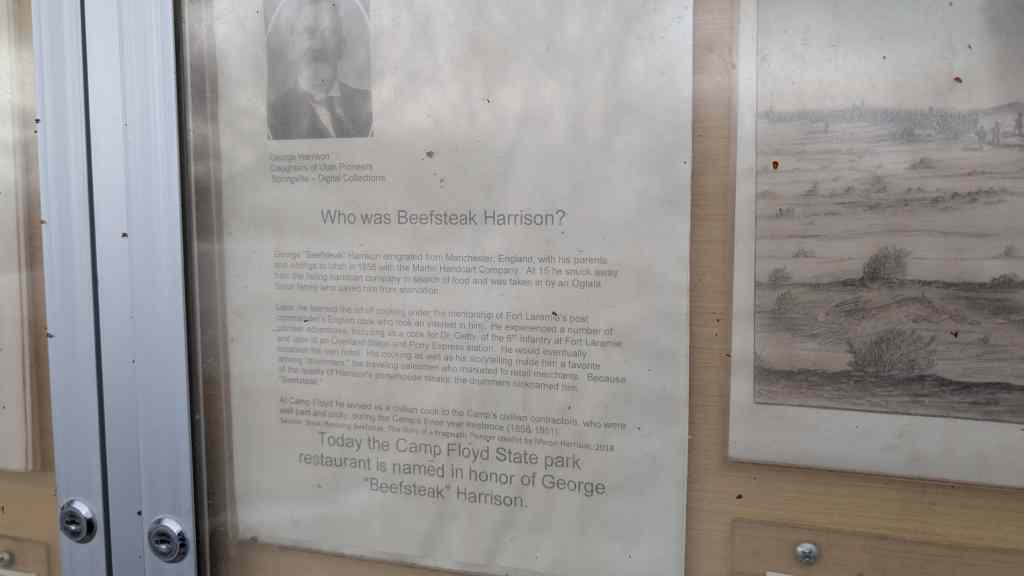
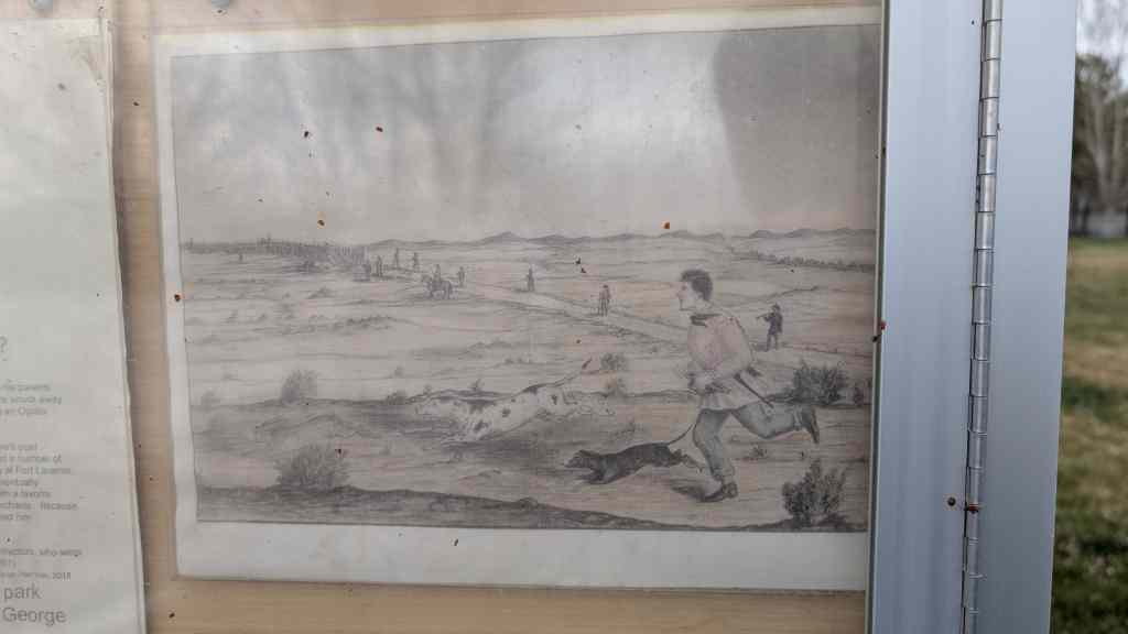
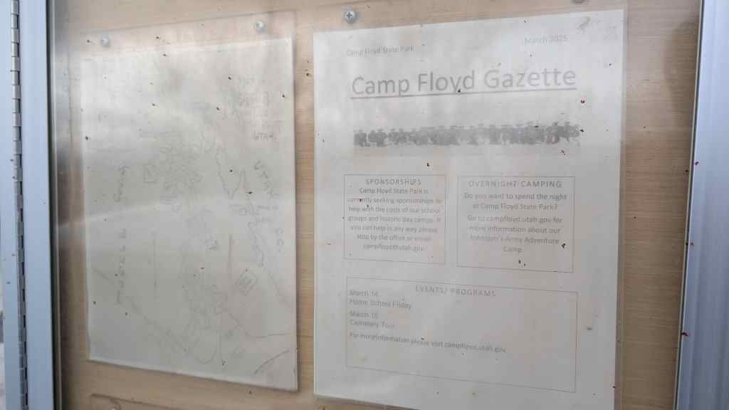
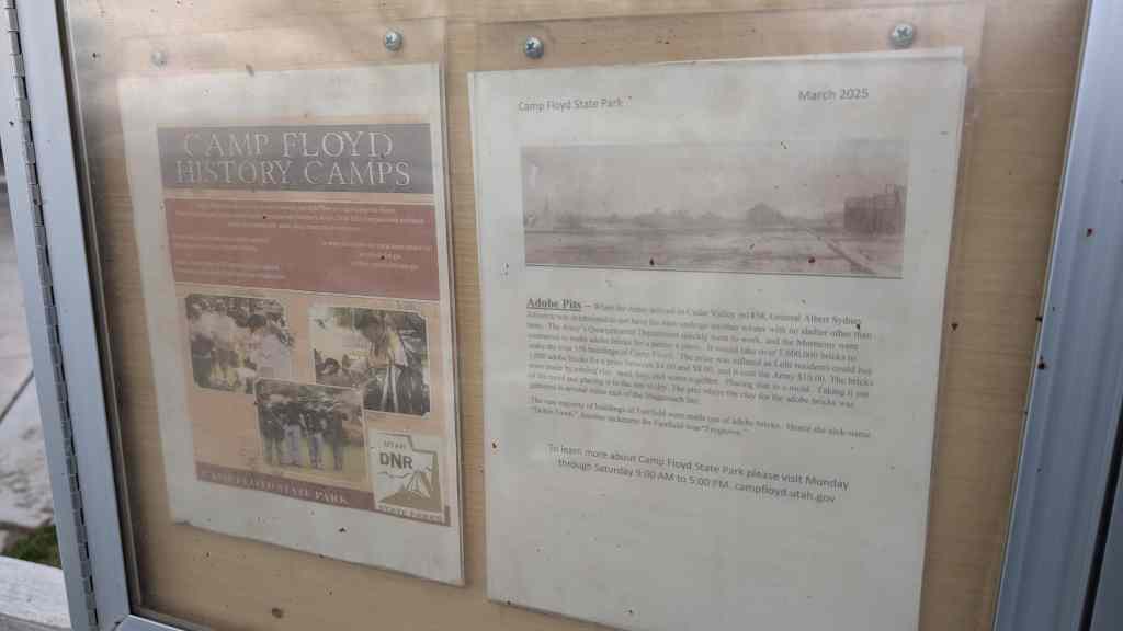
Camp Floyd / Stagecoach Inn State Park in Fairfield, Utah.
In 1855 Fairfield was settled by John Carson, William Carson, David Carson, William Beardshall and John Clegg. A rock fort 4 rods square was erected in 1856-57. In 1860 the population, including soldiers, was 7,000, this being Utah’s third largest city.
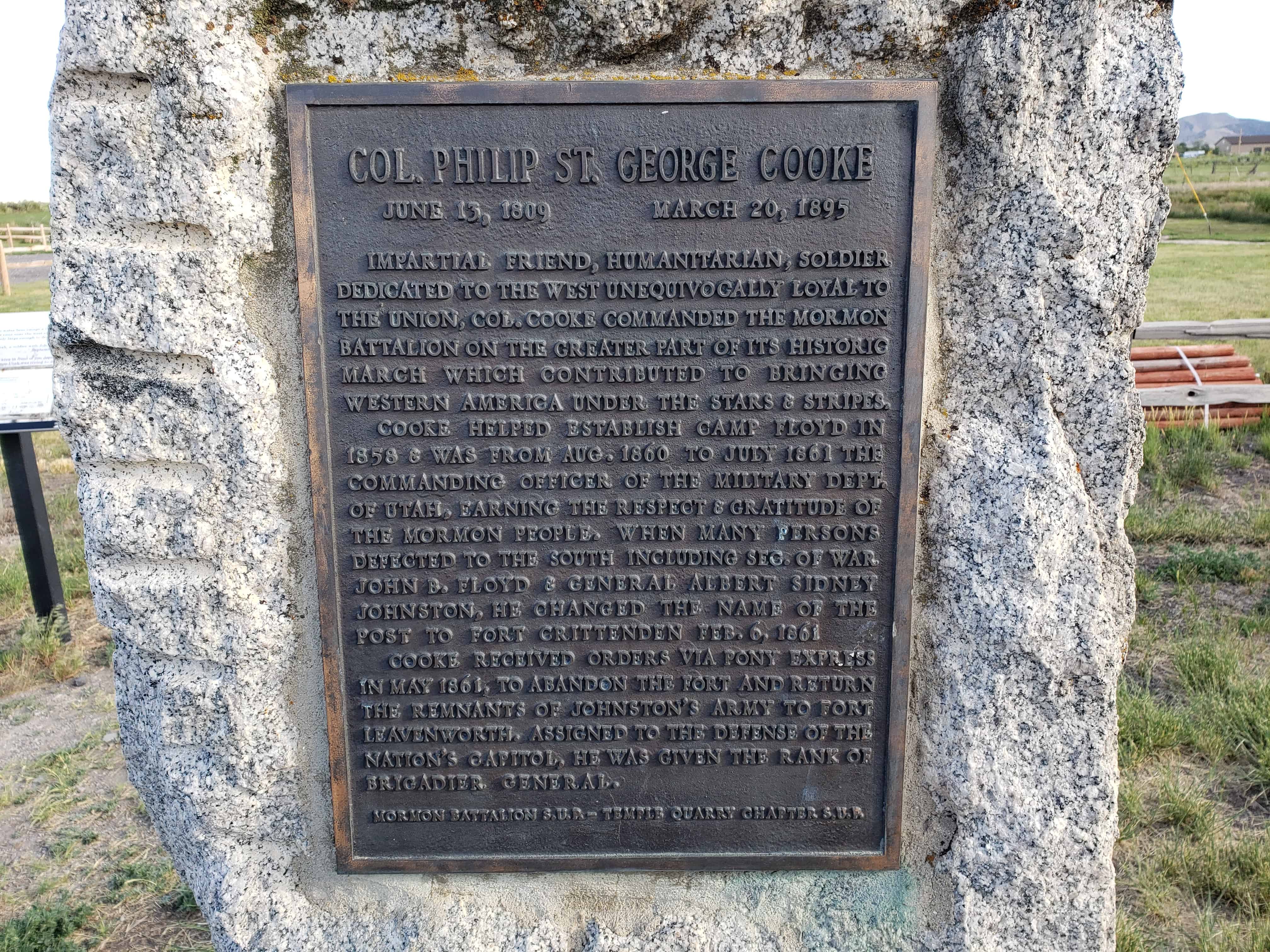
Camp Floyd, adjoining Fairfield on the South and West, was established July 4, 1858 by BVT. Brig. Gen. Albert Sidney Johnston and the Utah Expeditionary Forces numbering about 3,000 men. Col. Phillip St. George Cooke succeeded in command March 1, 1860, changing the name to Ft. Crittenden February 6, 1861. It was abandoned July 1861.
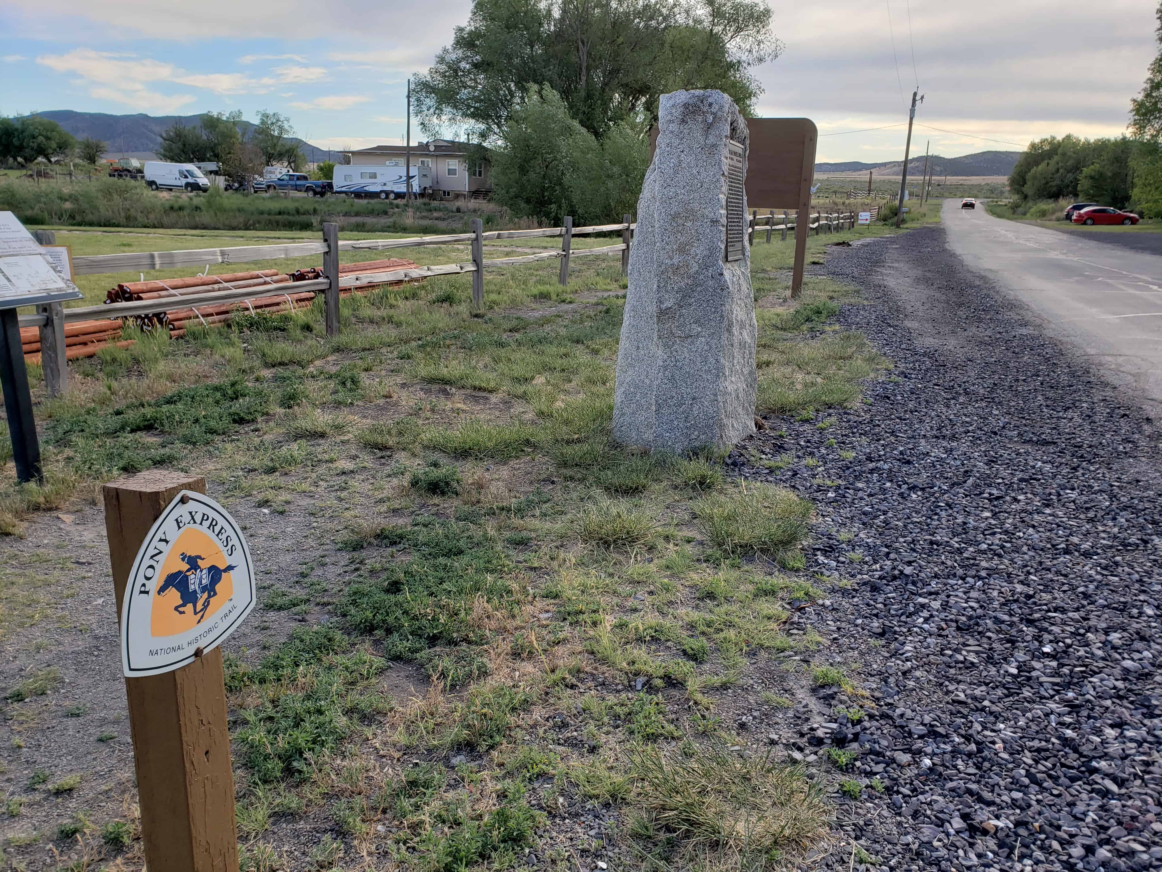
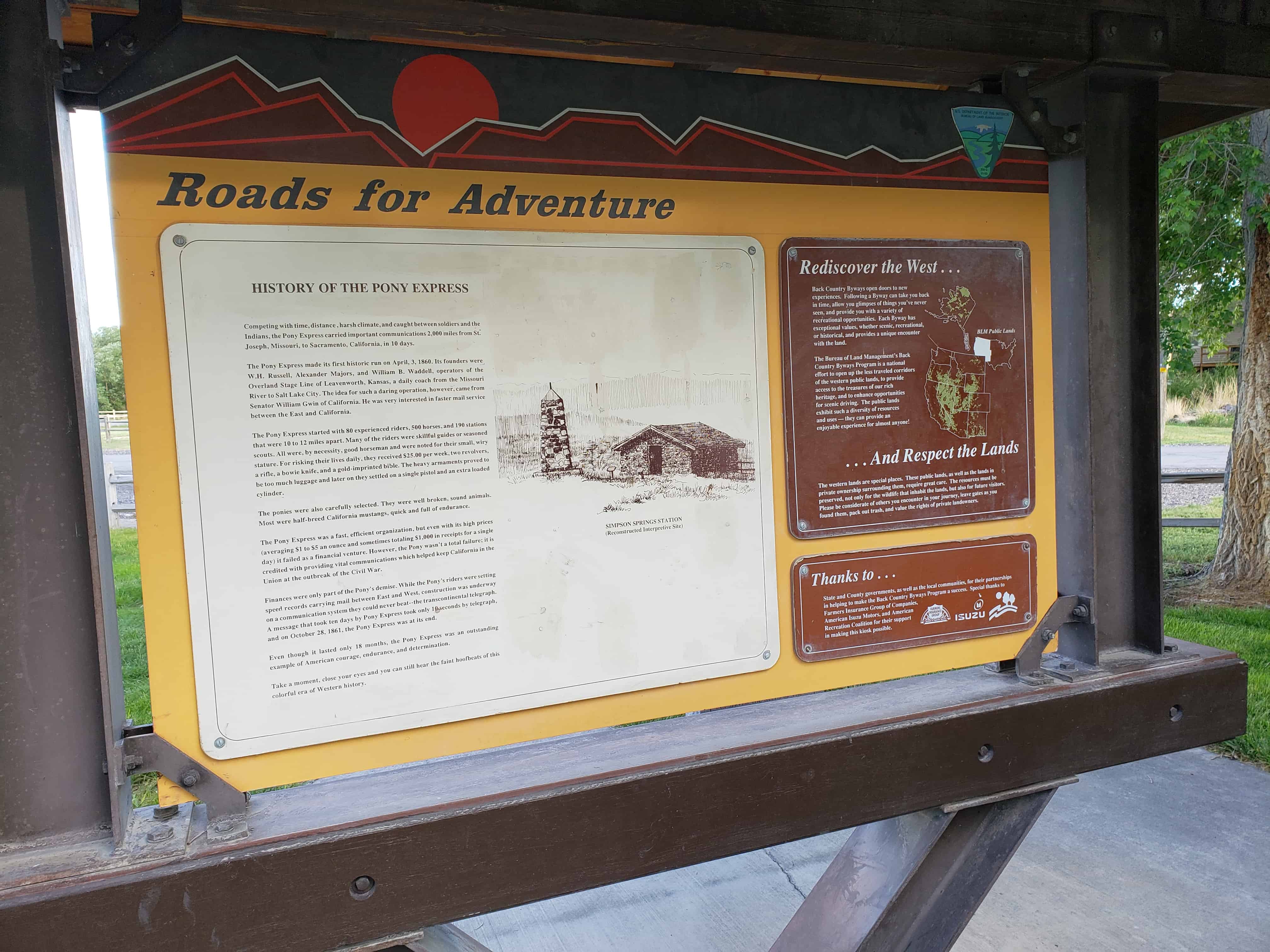
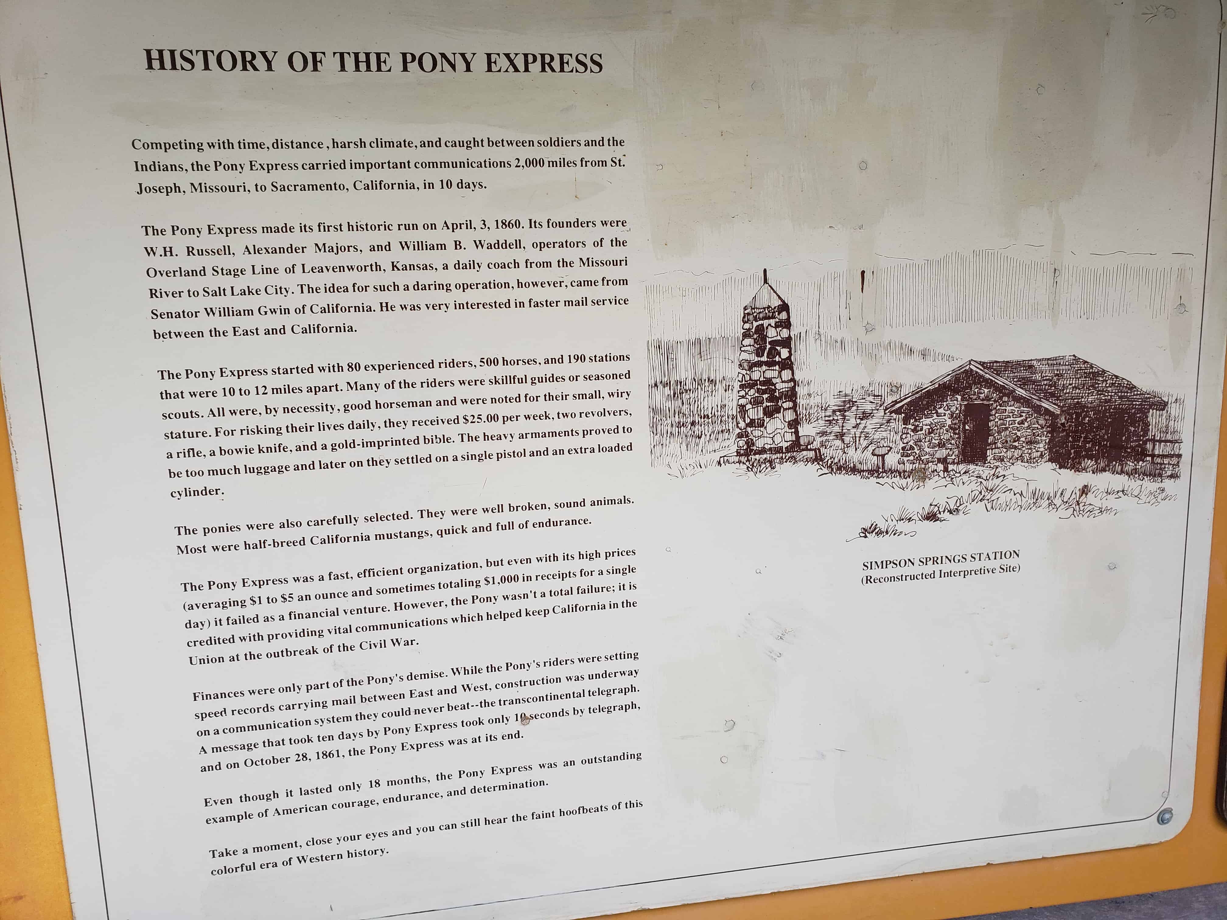
An Overland stage station established in 1859 was operated until 1868 and a Pony Express Station from April 3, 1860 to October 26, 1861. The station was 539 feet East and 210 feet North of this point.
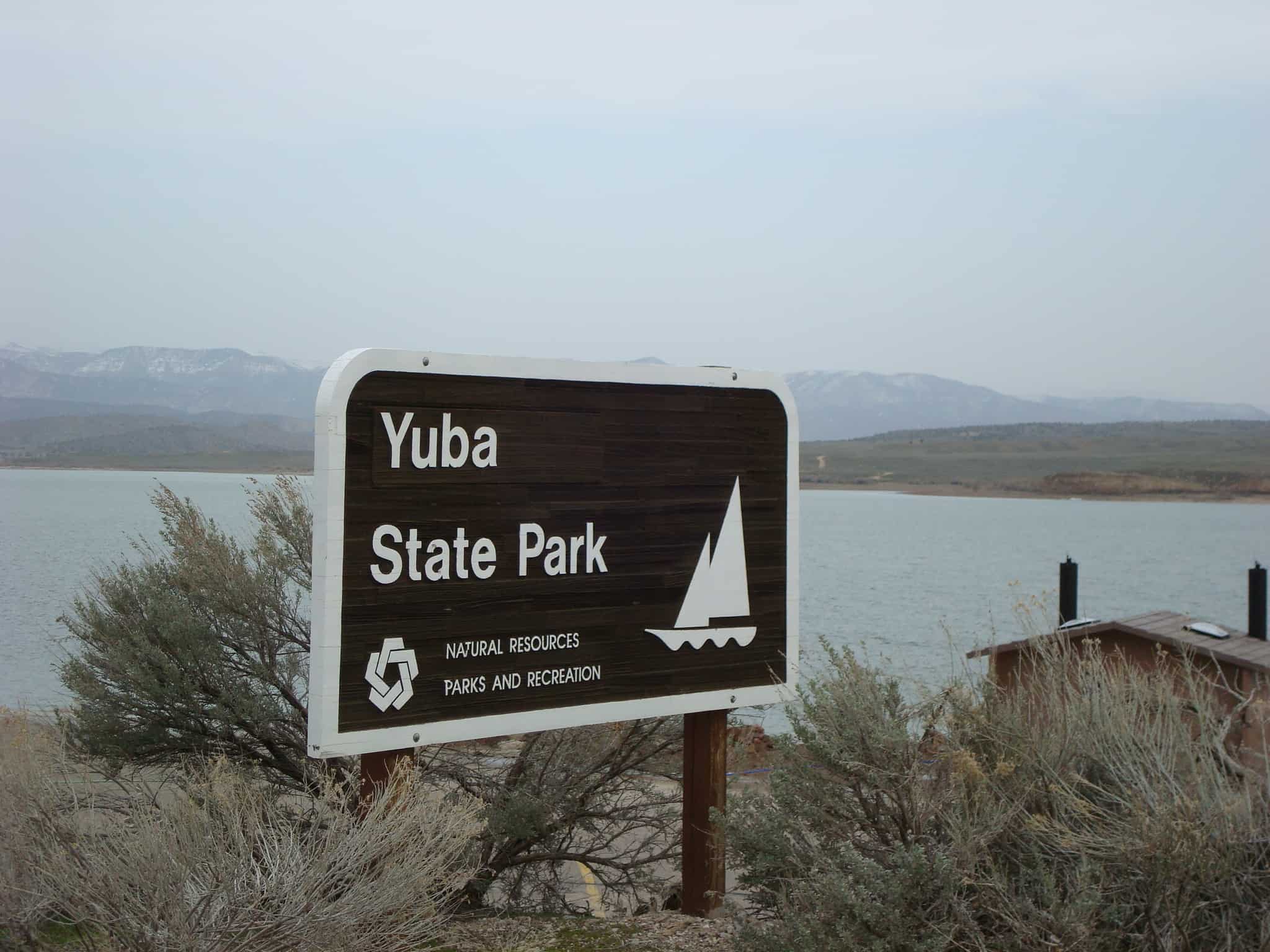
Yuba Lake (technically Yuba Reservoir) is in Yuba State Park and is popular for boating, fishing and all types of watersports.
Yuba State Park got its name from the individuals who built the dam. Local farmers and ranchers had to build the dam themselves or risk losing their water rights. The men working on the structure called it the U.B. Dam. As they worked they sang a song that stated they were damned if they worked and damned if they didn’t. The phonetic sound of the reservoir’s name was eventually spelled Yuba.
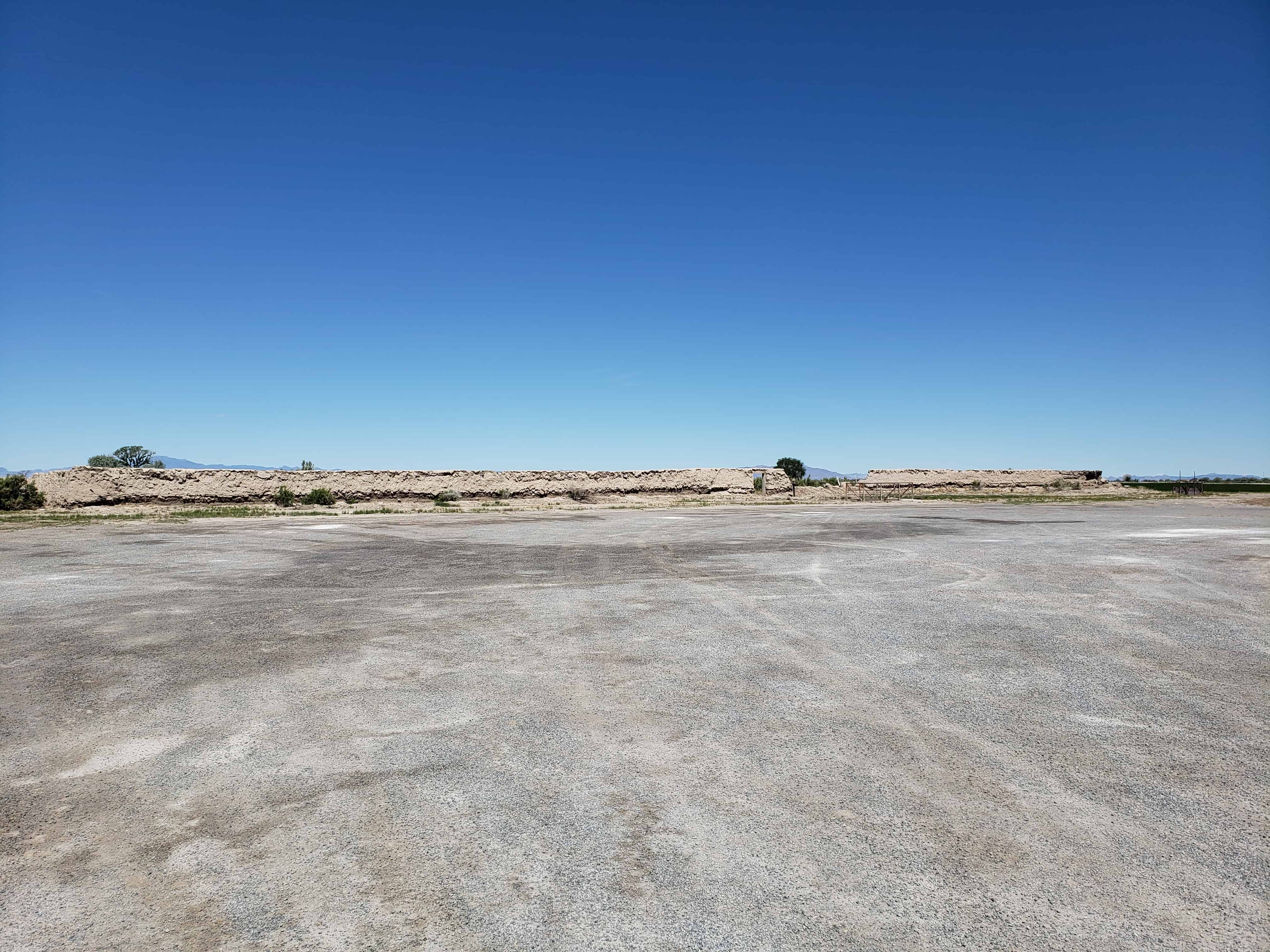
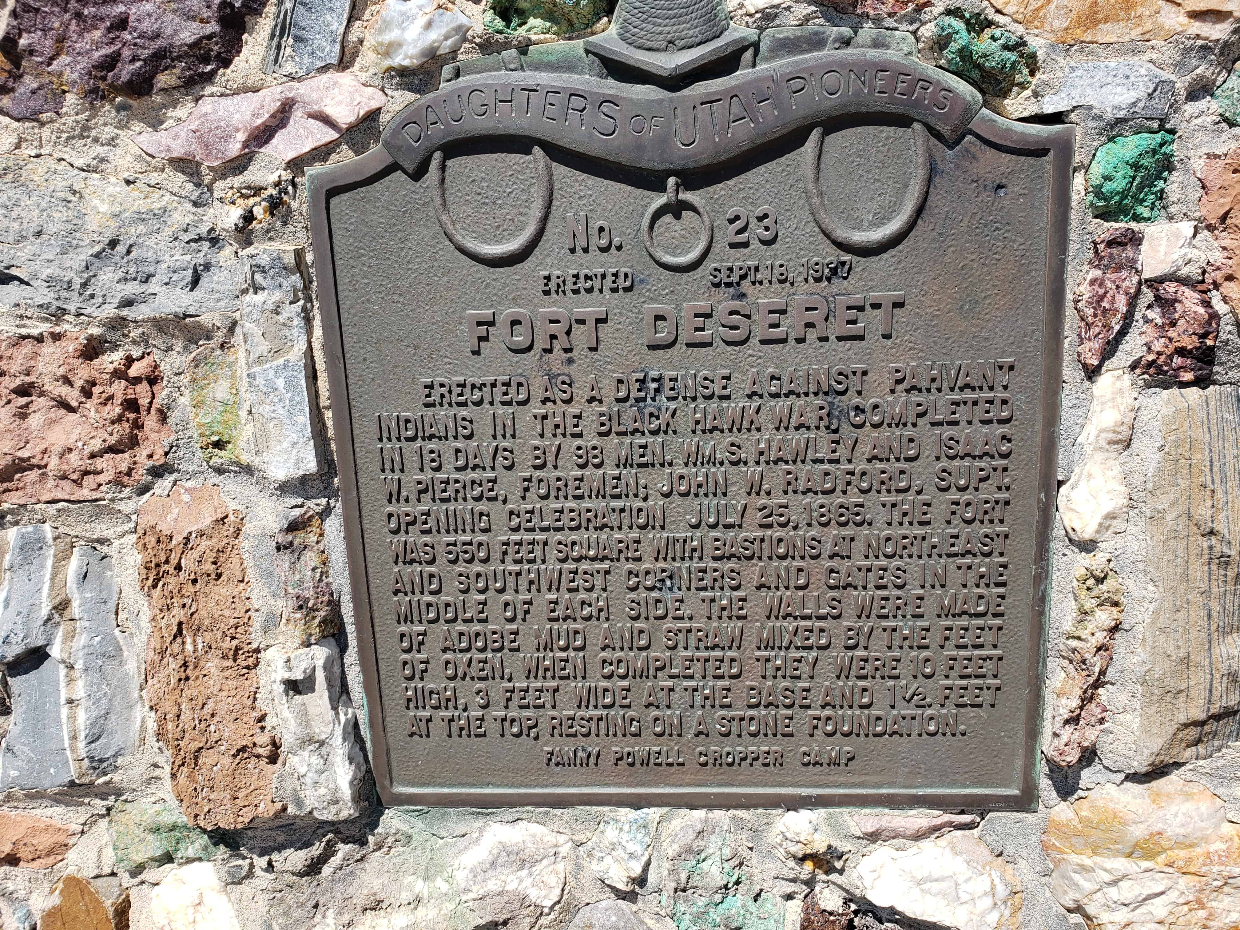
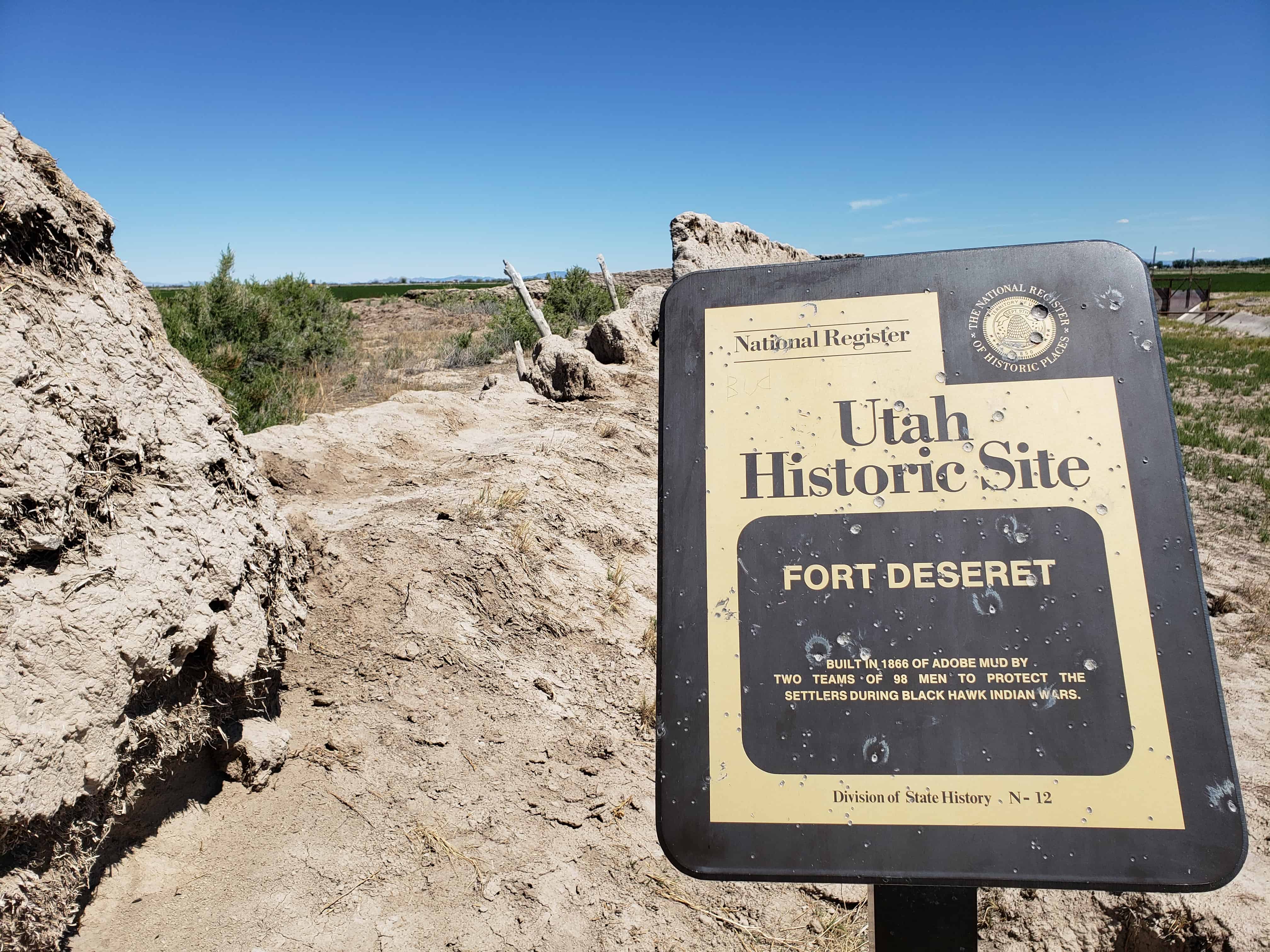
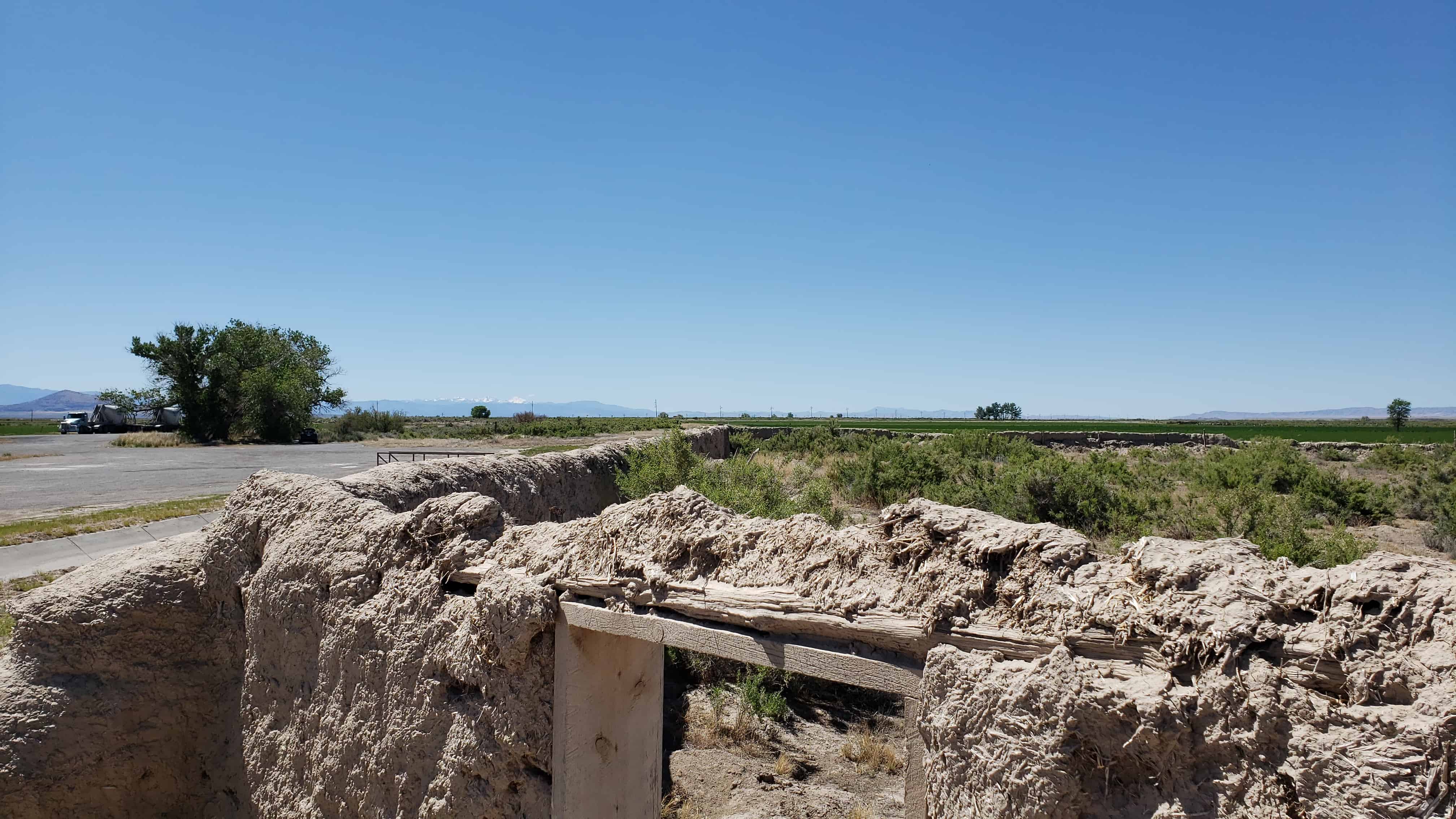
Erected as a defense against Pahvant Indians in the Black Hawk War, completed in 18 days by 98 men. Wm. S. Hawley and Isaac W. Pierce, foremen; John W. Radford, Supt. Opening celebration July 25, 1865. The fort was 550 feet square, bastions at Northeast and Southwest corners and gates in the middle of each wall. Made of adobe mud and straw mixed by the feet of oxen, when completed were 10 feet high, 3 feet wide at base and 1 1/2 feet at top, resting only on a stone foundation.
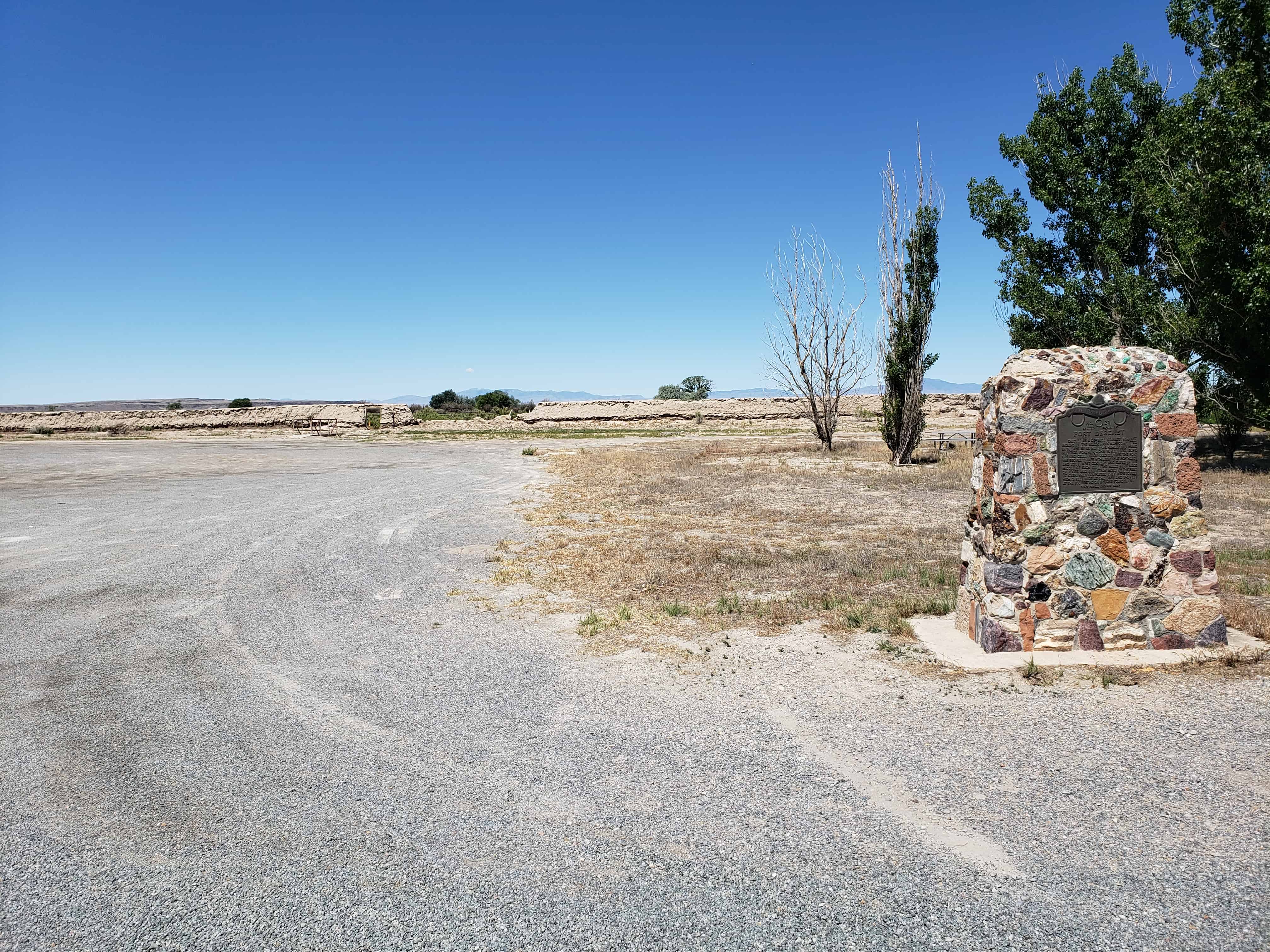
The below text is from the nomination form from when the fort was added to the National Historic Register (#70000624) on October 9, 1970.
The first white settlers reached the lower drainages of the Sevier River, Pahvant Valley, in 1860, and established the community of Deseret, By 1865 they were fairly well established. With the Indian unrest of the Blackhawk war, Brigham Young advised all outlying Mormon settlements to “fort up.” His mandate was reinforced by the early summer visit of Bishop Thomas Callister and Apostle Amasa M. Lyman, Immediately the community set about building a fort, with John W. Radford in charge.
Men with teams were organized to haul lava rock from across the valley to the west and lay the four-foot wide footings. To build the walls themselves, the men divided into two groups, led by William S. Hawley and Isaac W. Pierce, Each team was to build half the wall, with the winning team to be given a party by the losers.
The walls were constructed of adobe mud made by running water into trenches into which dirt and straw were thrown and then mixed by having oxen tromp it. The mud mixture was then stacked up in ten-foot walls three feet wide at the base, tapering to one-and-one-half feet at its top. The center of the walls were high to cause the rain water to drain outward.
The race to construct the fort took the 98 men 18-1/2 days –9- 1/2 days for Pierce’s group and 9 days for Hawley’s; however, as a portion of Hawley’s wall fell, a tie was declared, A big celebration was held July 24, 1866, to commemorate the fort’s completion. It had cost about $3,706 in materials and labor.
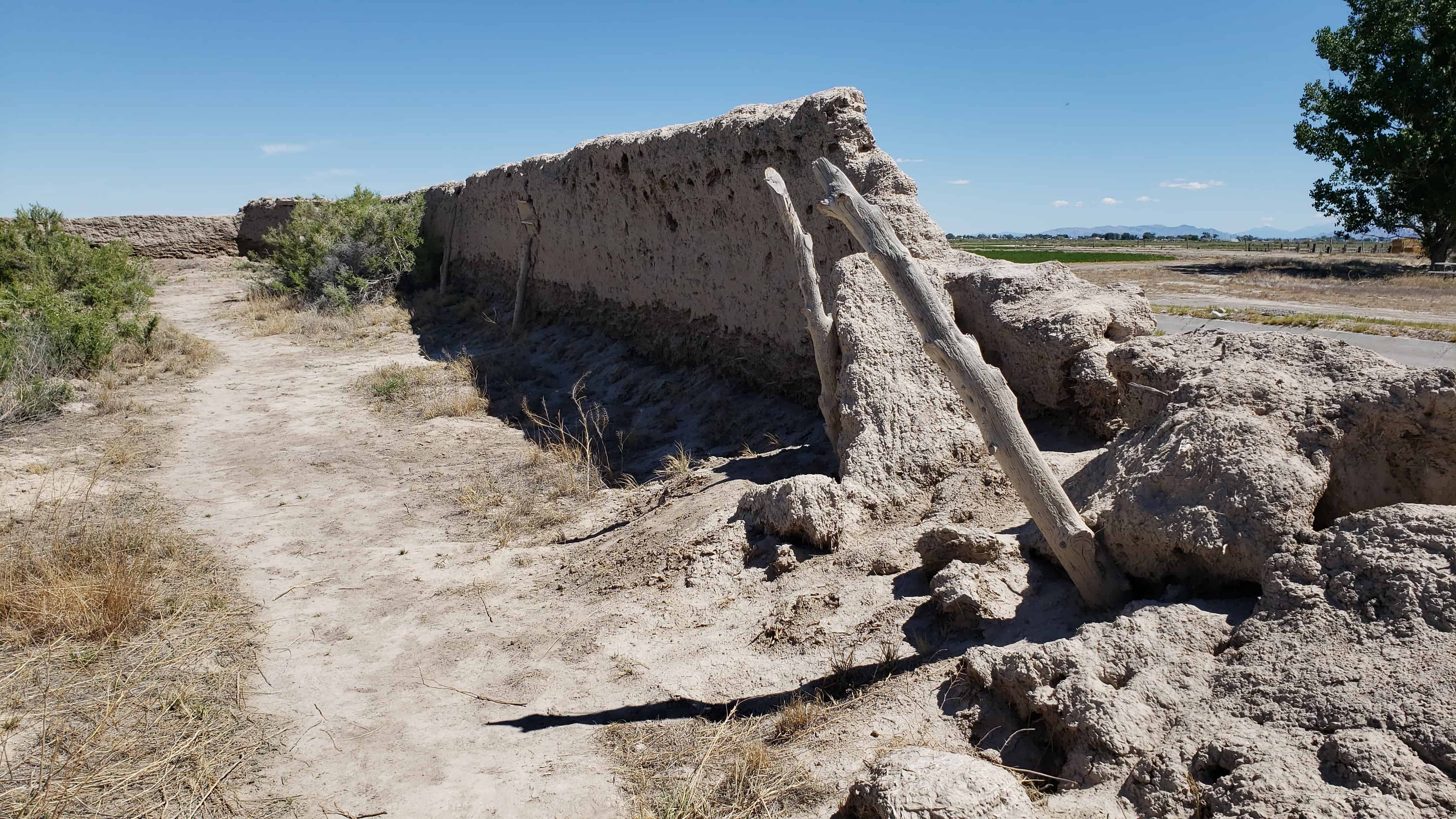
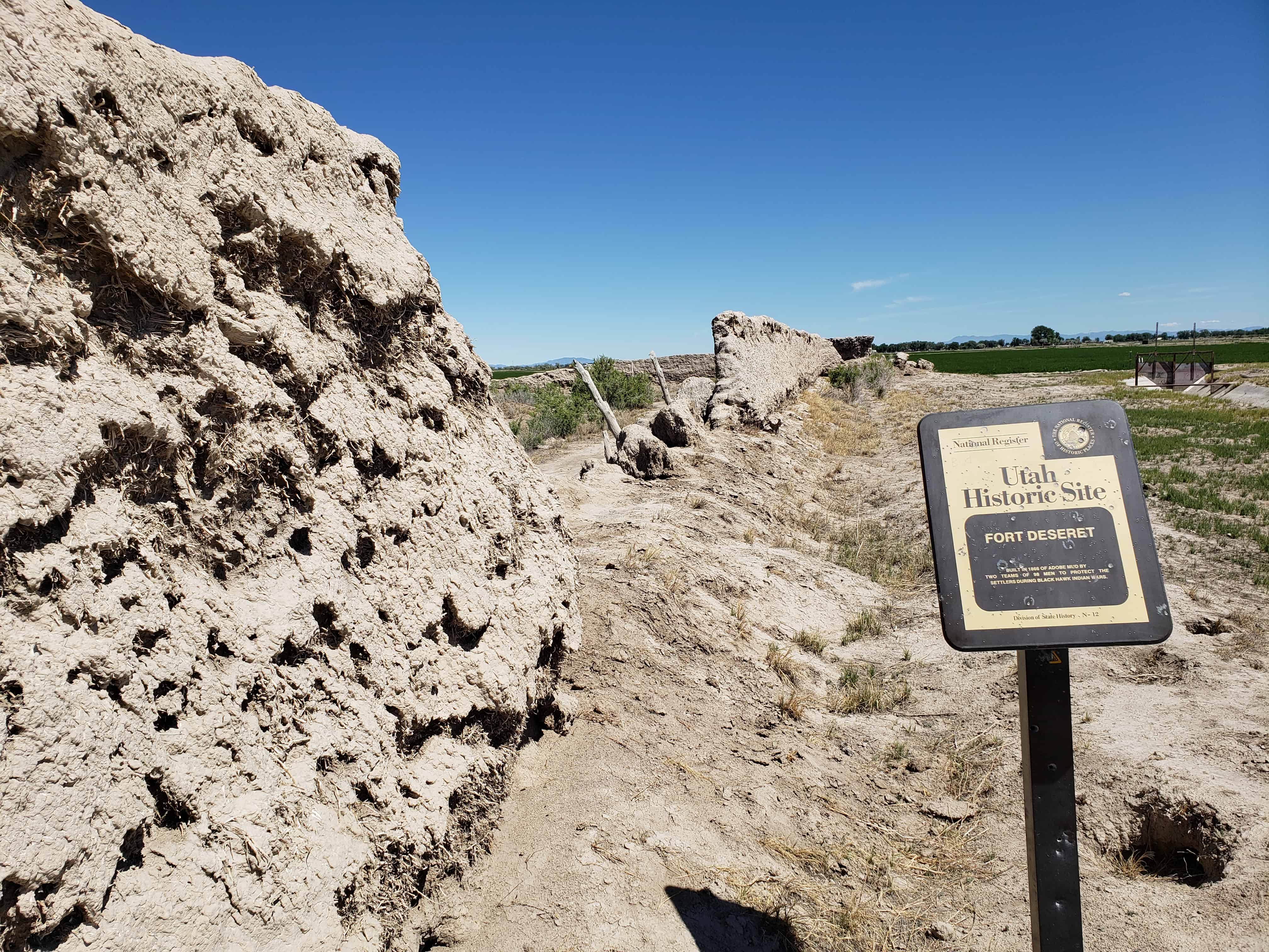
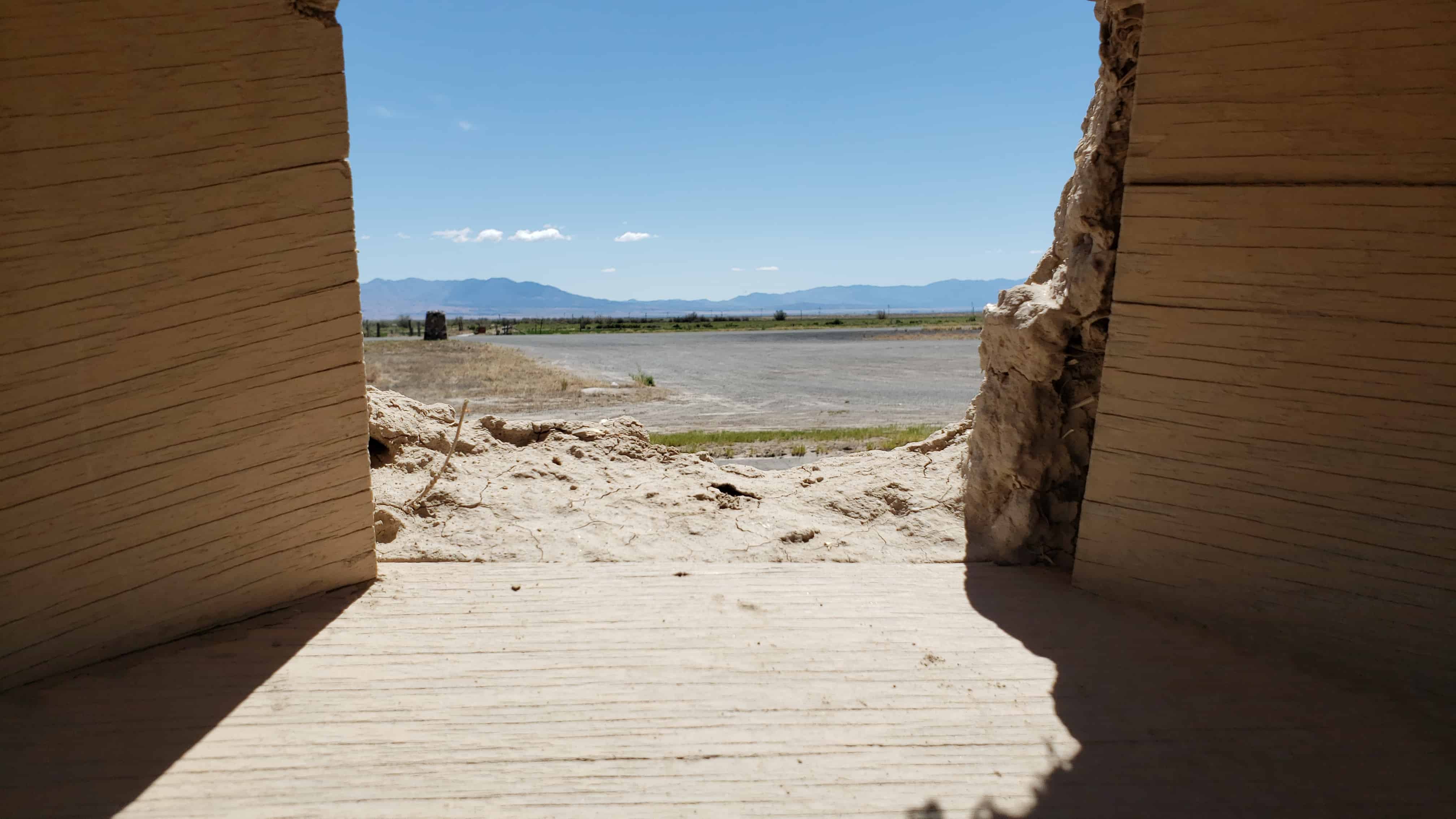
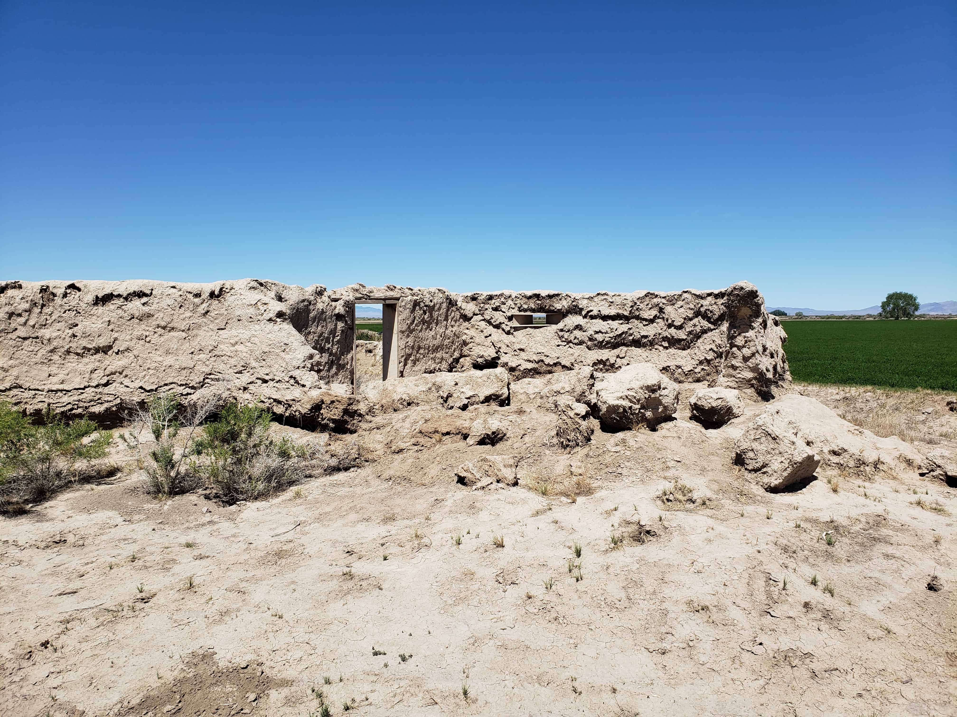
Actually the fort was never used to defend against the Indians, although it did offer security to the small isolated colony during a crucial period of Indian unrest; and cattle from the settlement were frequently corralled in the fort to avoid their being stolen by the Indians. In fact in later years the Indians themselves often used the abandoned fort. The community of Deseret was abandoned in 1868 because of water difficulties and was not reoccupied until 1874. The old mud fort remained a landmark but has slowly eroded during its more than one-hundred-year existence. Today less than half its walls remain standing.
Not only does Fort Deseret remain as a landmark in Mormon pioneering history, but it is the only remaining example of an “adobe mud” fort in Utah. Further, it was built entirely as a community project of materials at hand, thus typifying the cooperative nature of Mormon settlement. Its preservation needs are acute.
Description:
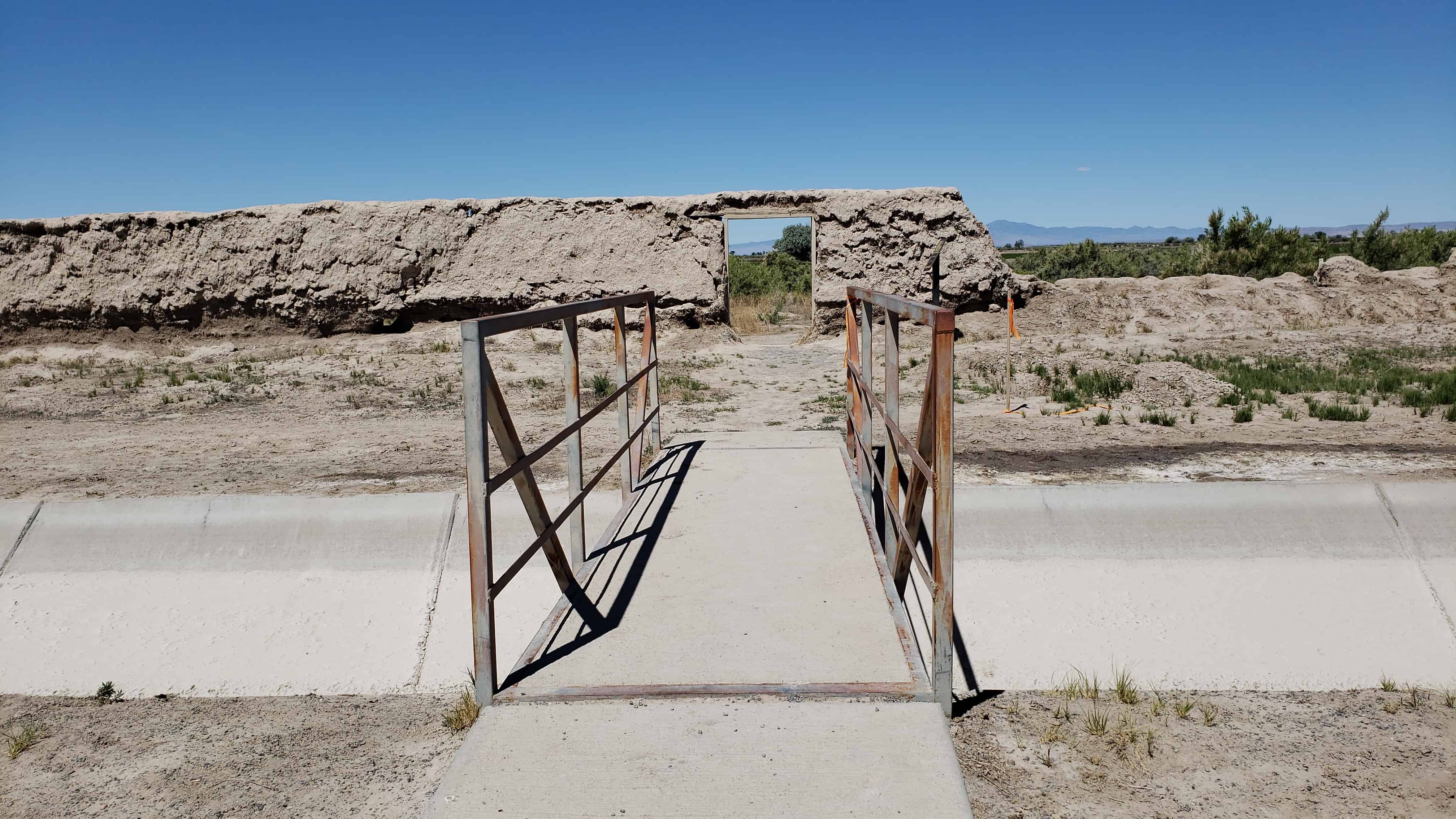
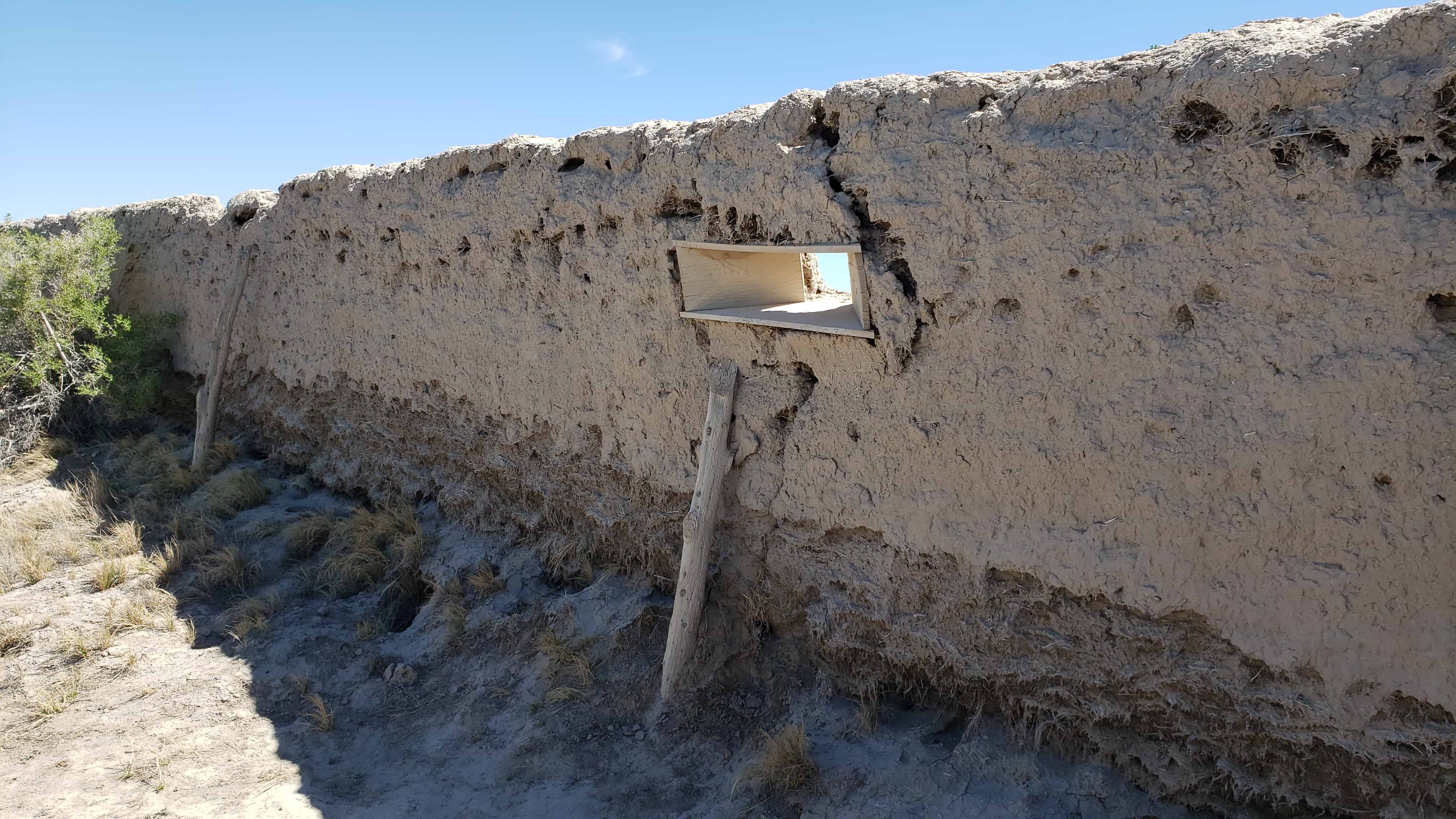
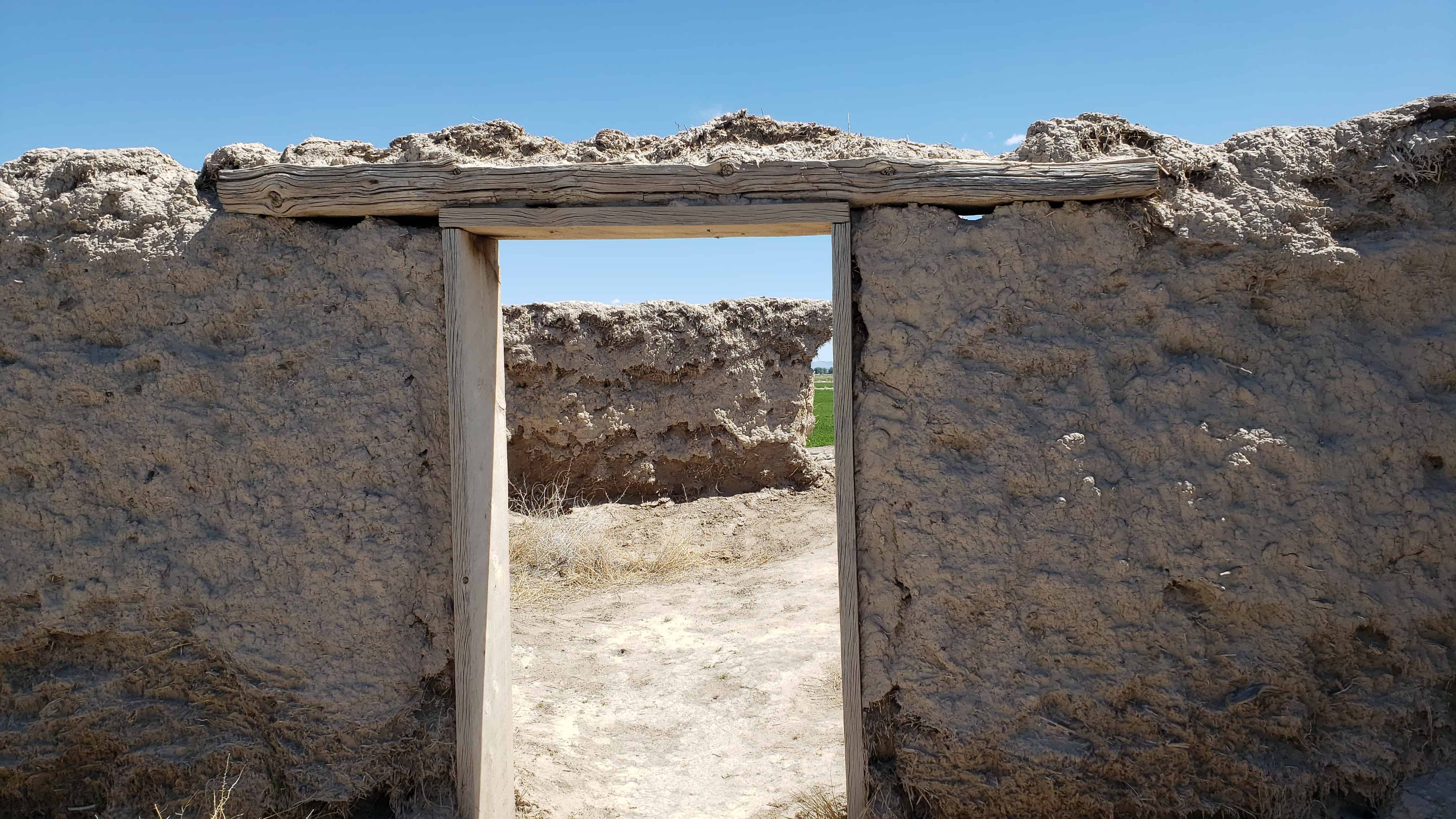
Fort Deseret was laid out in a square 550* x_55.p l . The foundations for the walls were made with 3-foot wide lava rock footings. Adobe mud for the walls was made by turning water into a big trench, then adding clay and straw which was mixed by foot of both humans and oxen. The mud was stacked on the footings to form walls 10′ high, 3′ wide at the base, and 1-1/2′ wide at the top. The center of the wall was the highest, to allow drainage outward.
Taller bastions were constructed in the northeast and southwest corners extending beyond the walls. Rough hewn lumber was used to make the portals through which guns could be fired with a minimum of exposure to the defenders. Three portals were placed in each bastion, several on each side. The main gates were in the north and south walls, with small gates in the east and west walls.
Rain and wind erosion has reduced the walls severely. Only portions remain, mainly on the east wall, the bastions and corners. One can see in the fallen portions of the wall the kind of adobe construction a layer of mud, a layer of straw. The remaining walls are from 6 to 7 feet high and badly eroded.
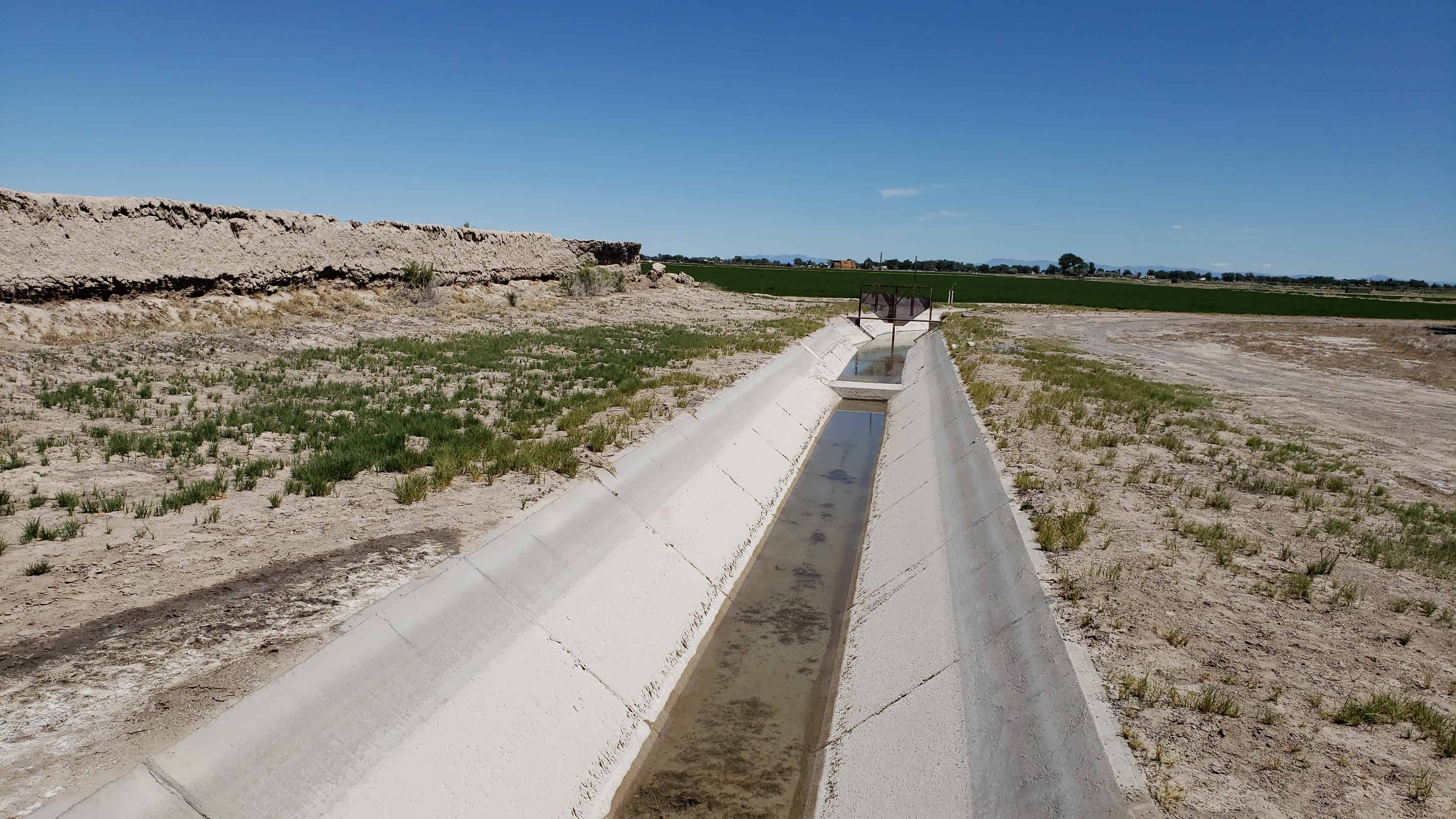
Greasewood and other brush have grown up around the walls. A ditch runs near the north wall and a large lateral in front of the east wall.
The site is near the old Sevier River channel, long since changed by man’s needs. Now owned by Utah State Parks and Recreation, both its preservation and development are being planned.
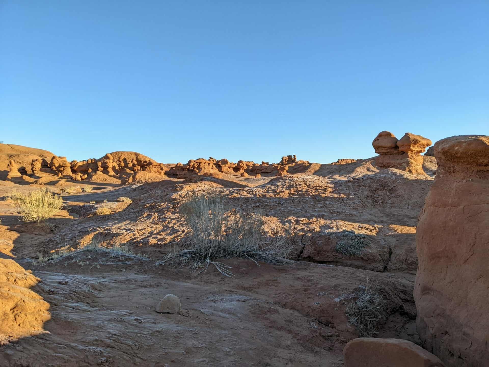
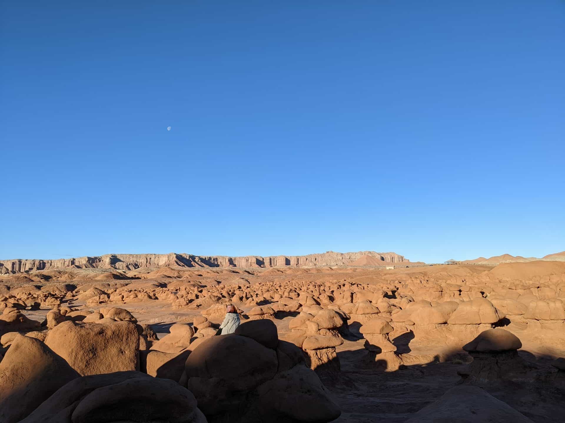
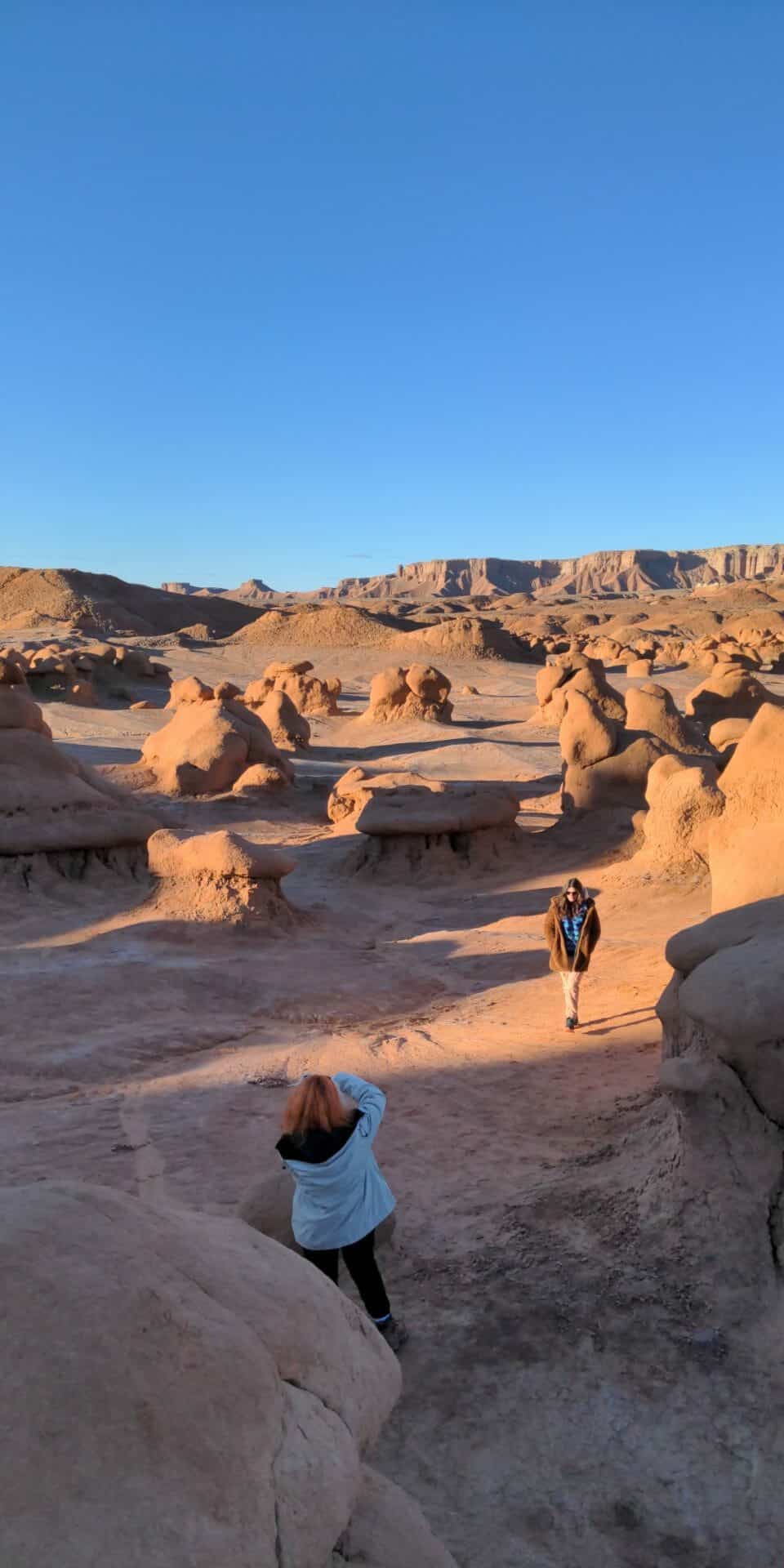
Cowboys searching for cattle first discovered secluded Goblin Valley. Then in the late 1920s, Arthur Chaffin, owner/operator of the Hite Ferry, and two companions were searching for an alternative route between Green River and Caineville. They came to a vantage point about a mile west of Goblin Valley and were awed by what they saw, five buttes and a valley of strange-shaped rock formations surrounded by a wall of eroded cliffs.
In 1949, Chaffin returned to the area he called Mushroom Valley. He spent several days exploring the mysterious valley and photographing its scores of intricately eroded creatures. The area was acquired by the state of Utah and in 1964 was officially designated a state park.
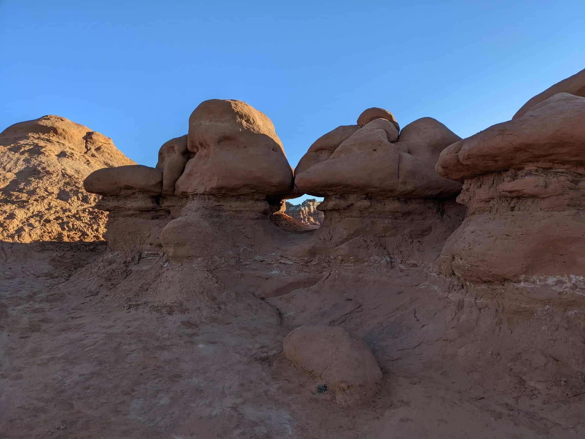
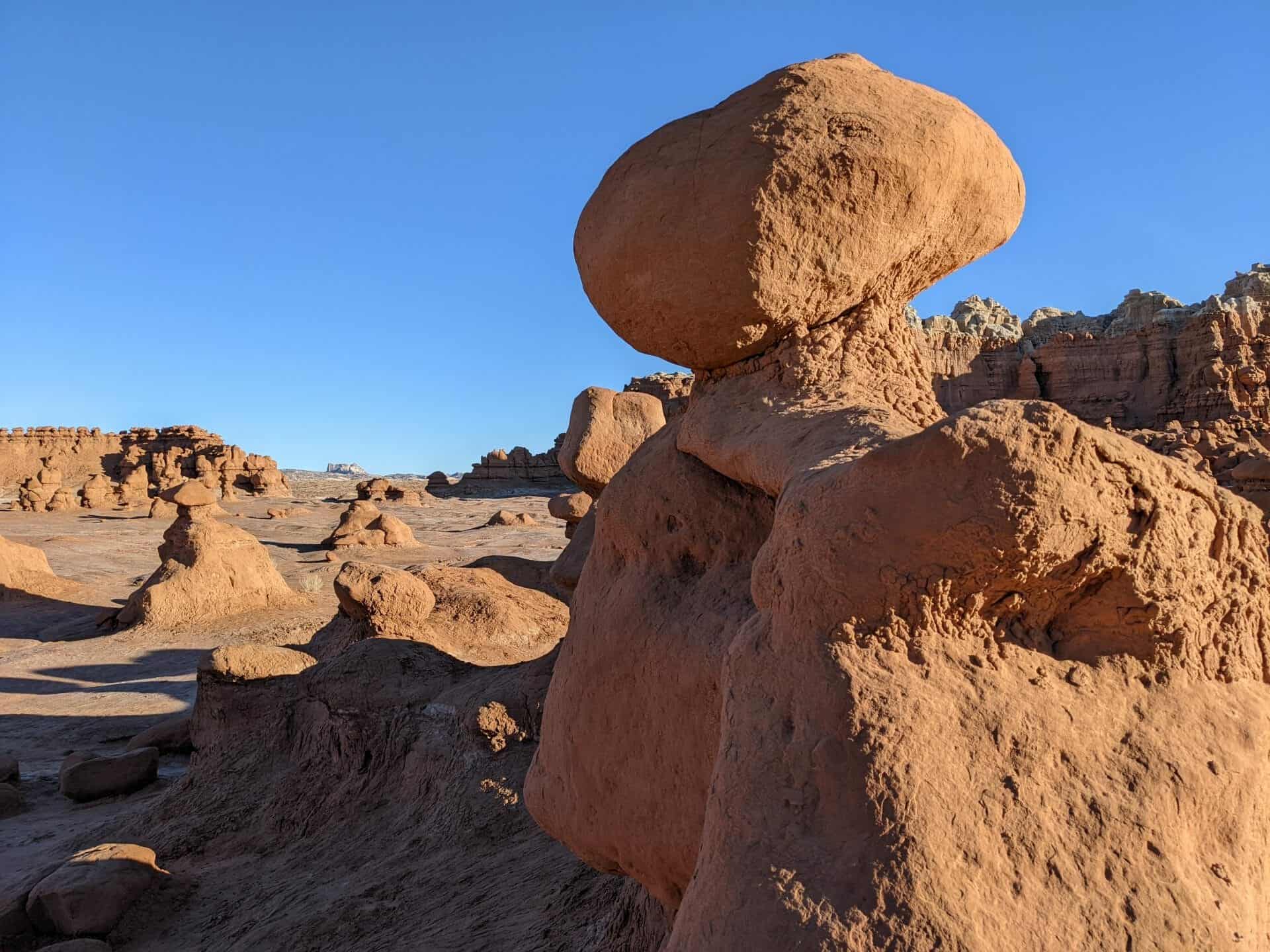
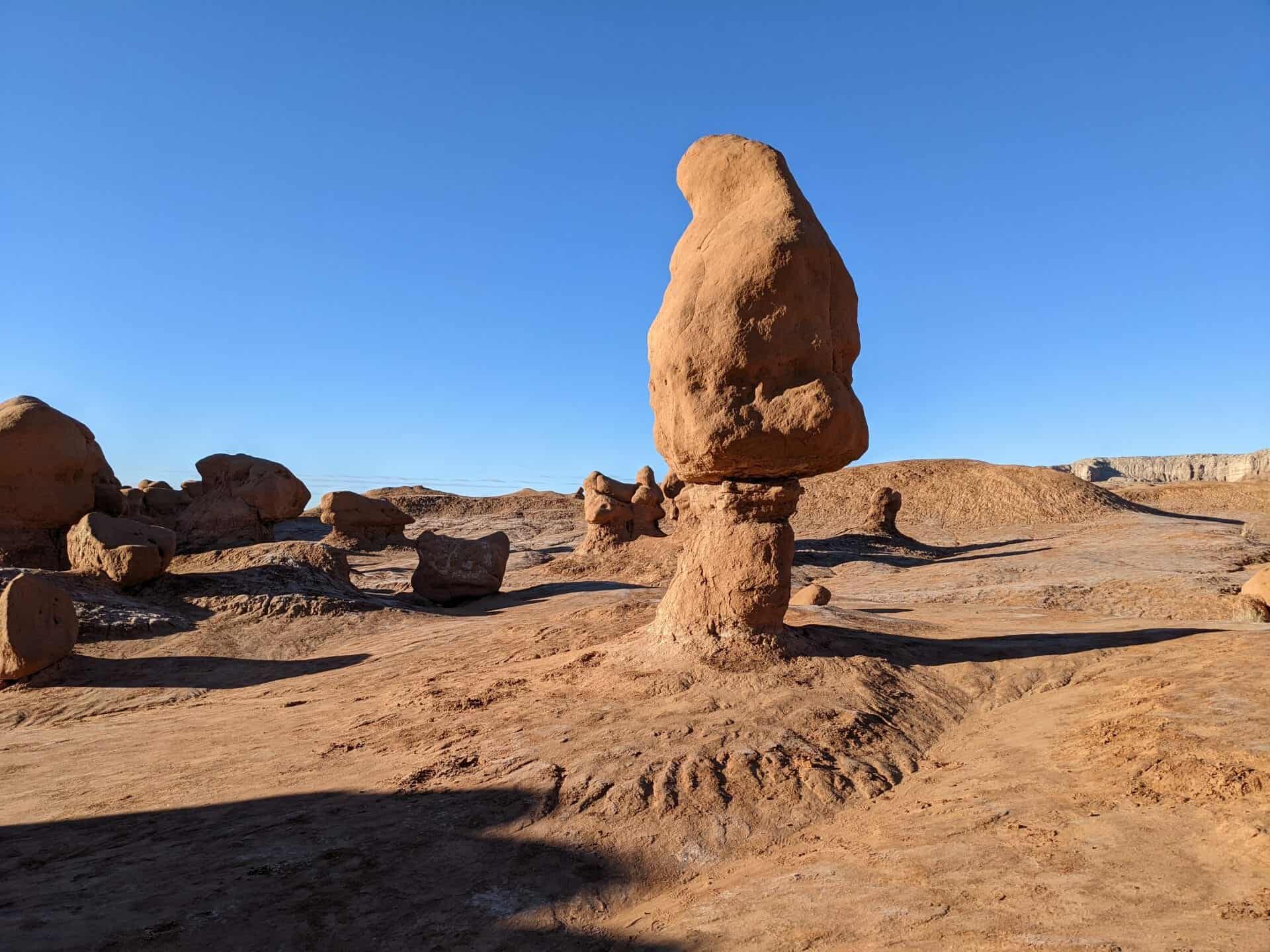
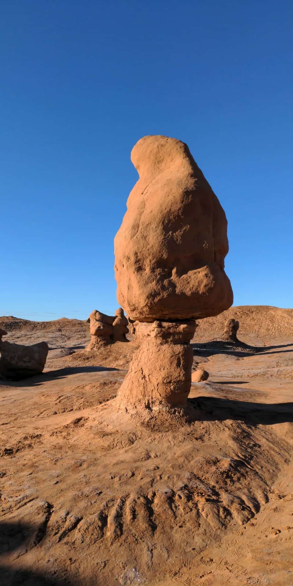
Goblin Valley State Park is a showcase of geologic history. Exposed cliffs reveal parallel layers of rock bared by erosion. Because of the uneven hardness of sandstone, some patches resist erosion much better than others. The softer material is removed by wind and water, leaving thousands of unique, geologic goblins. Water erosion and the smoothing action of windblown dust work together to shape the goblins.
Bedrock is exposed because of the thin soil and lack of vegetation. When rain does fall, there are few plant roots and little soil to capture and hold the water, which quickly disappears, in muddy streams without penetrating the bedrock.