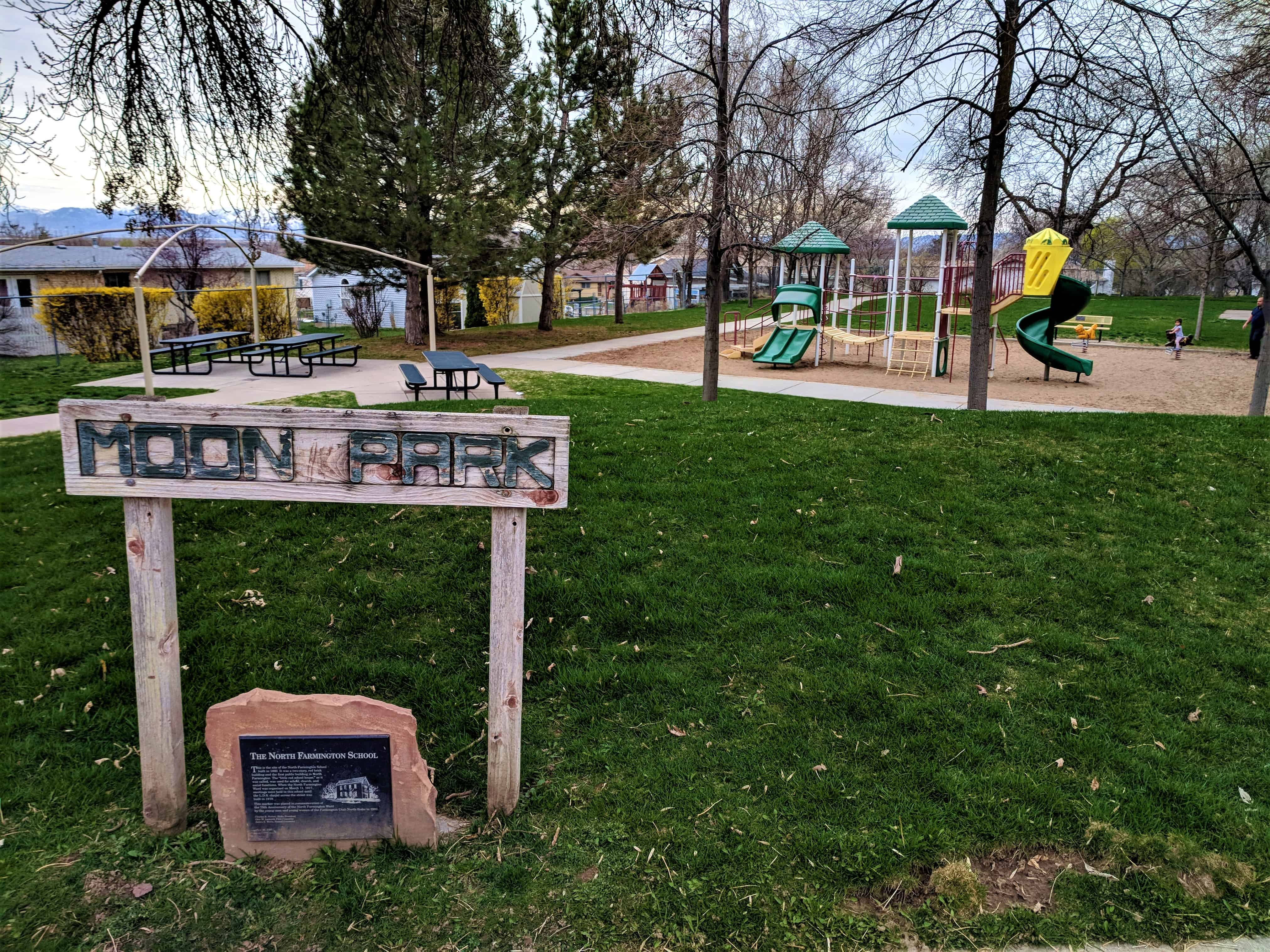
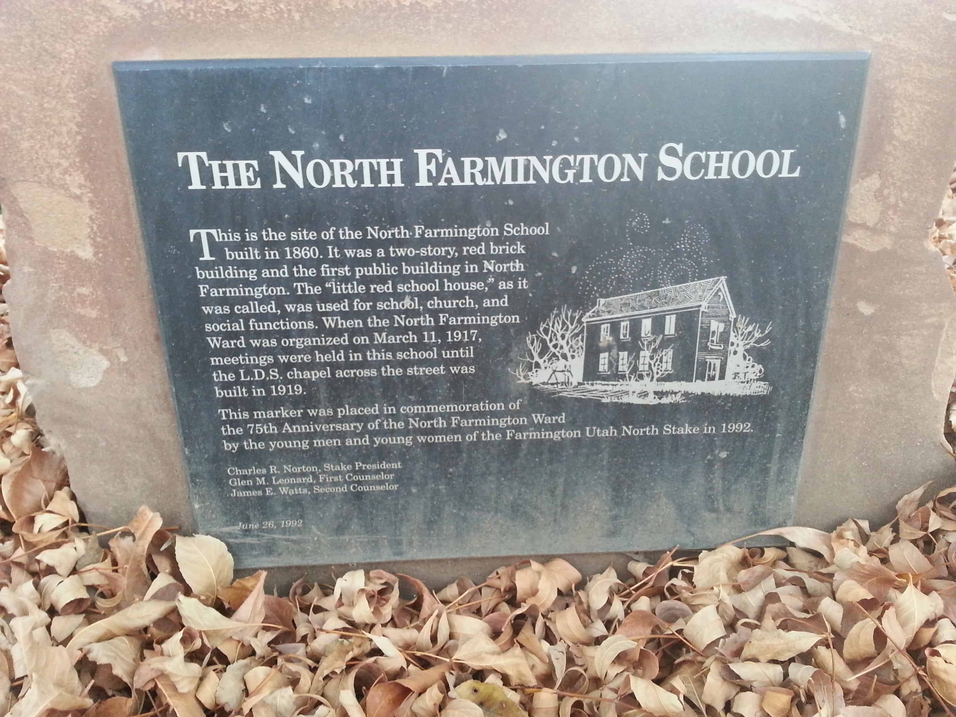
This is the site of the North Farmington School built in 1860. Ut was a two-story, red brick building and the first public building in North Farmington. The “little res school house,” as it was called, was used for school, church, and social functions. When the North Farmington Ward was organized on March 11, 1917, meetings were held in this school until the L.D.S. chapel across the street was built in 1919.
This marker was placed in commemoration of the 75th anniversary of the North Farmington Ward by the young men and young women of the Farmington Utah North Stake in 1992.
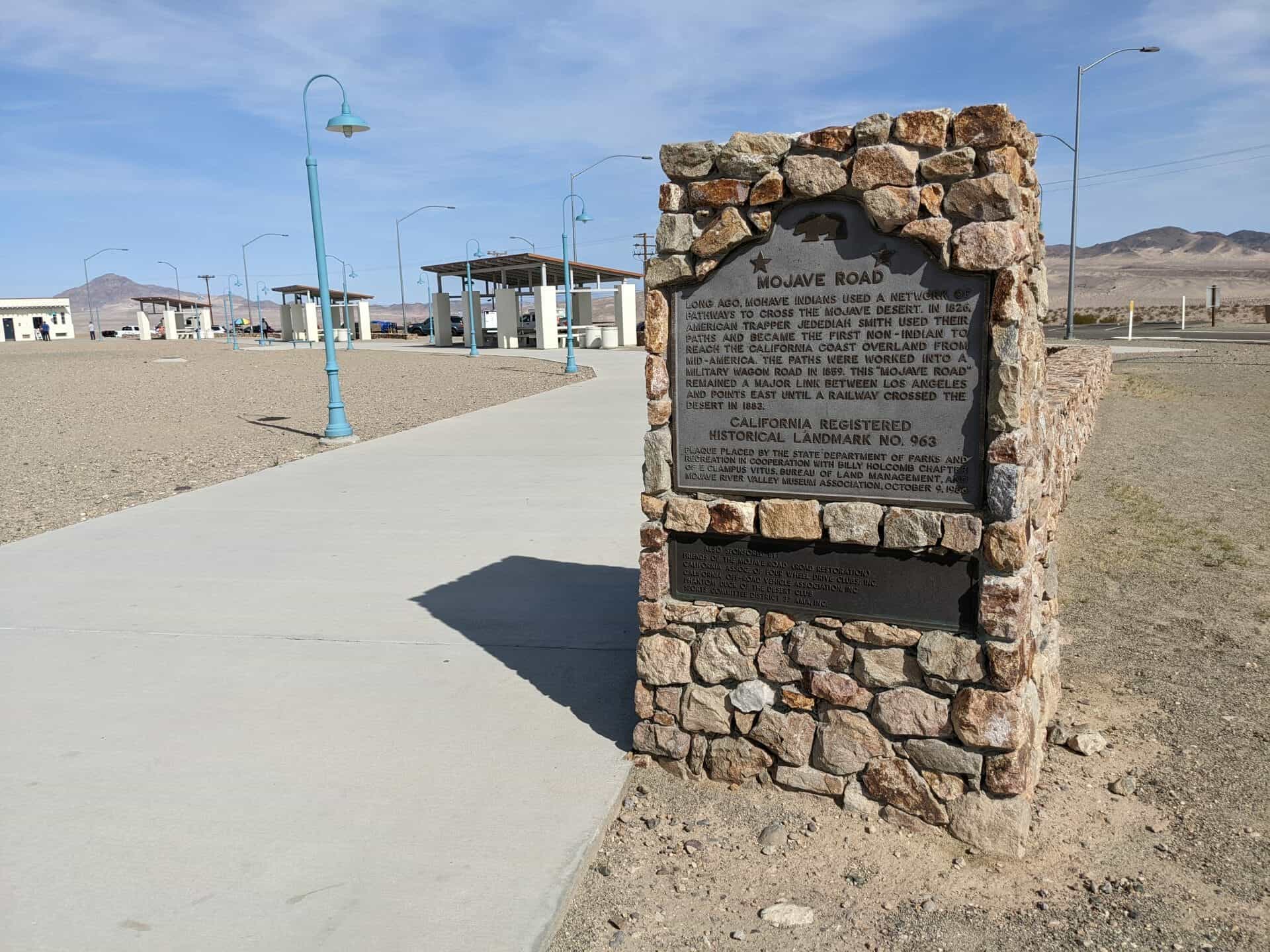
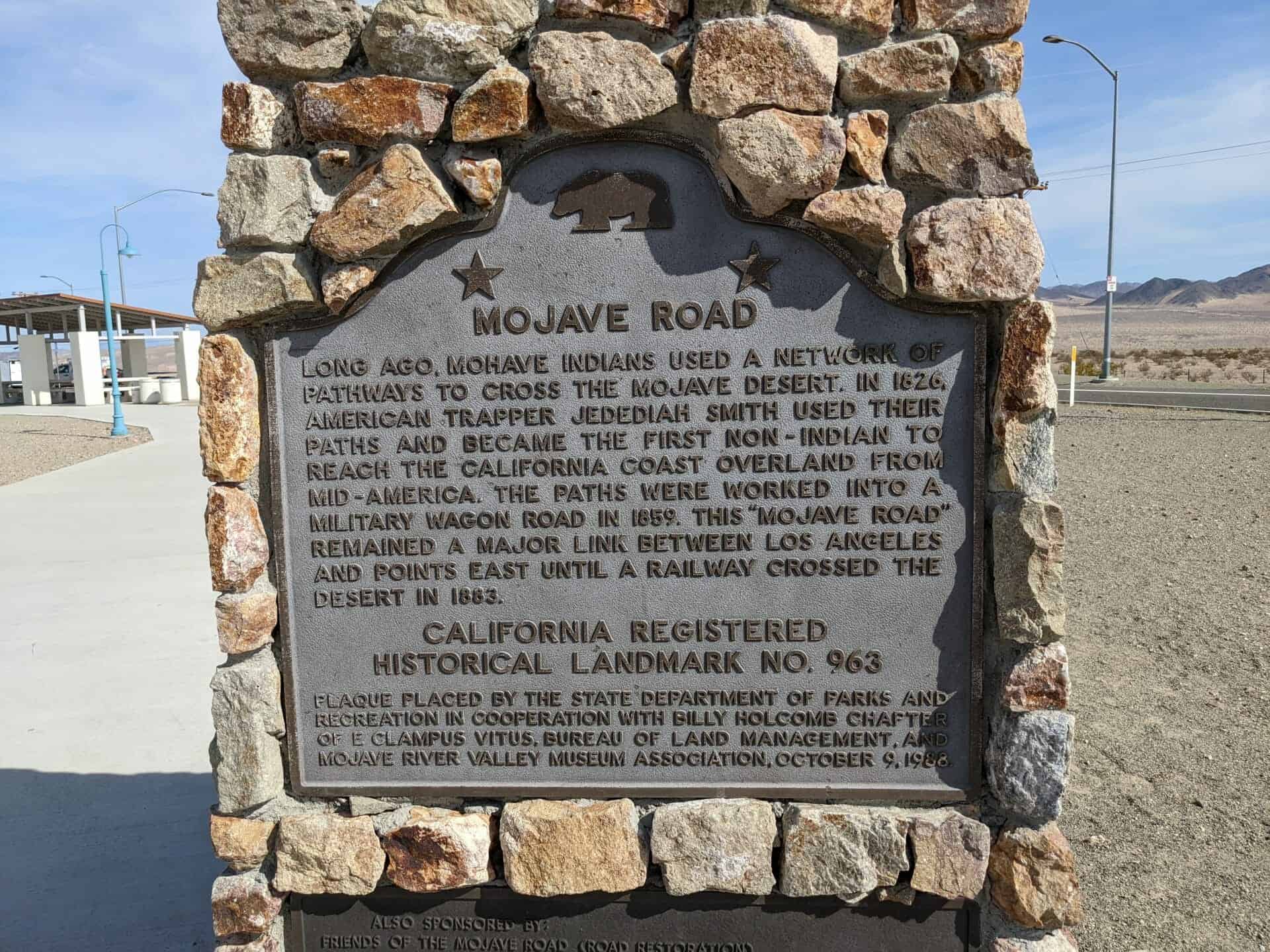
Long ago Mohave Indians used a network of Pathways to cross the Mojave Desert. In 1826 American trapper Jedediah Smith used their Paths and became the first non-Indian to Reach the California coast overland from Mid-America. The paths were worked into a Military wagon road in 1859. This Mojave road remained a major link between Los Angeles And points east until a railroad crossed the Desert in 1883.
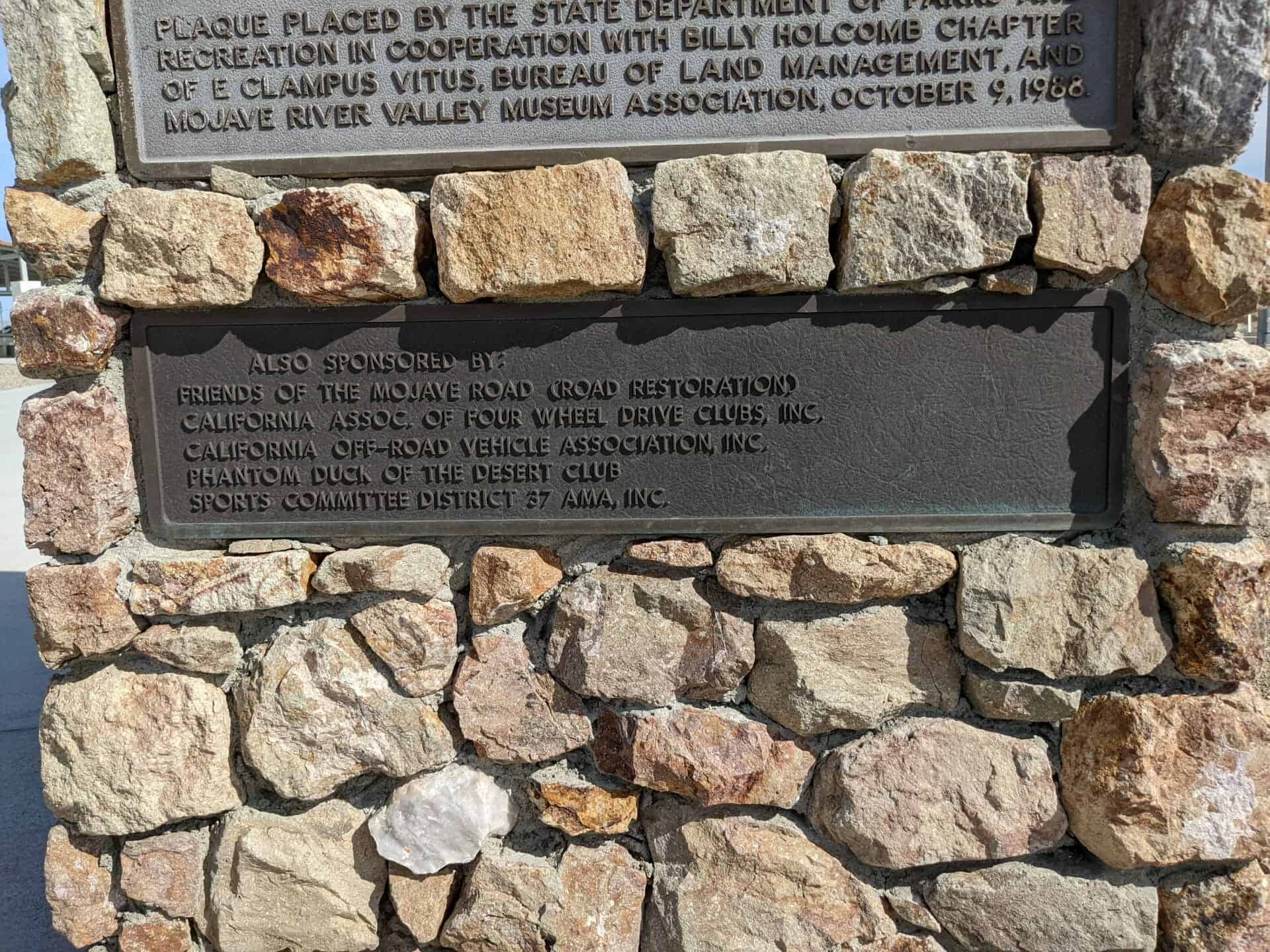
Plaque placed by the state department of parks And recreation in cooperation with Billy Holcomb chapter of E Clampus Vitus, bureau of land management and Mojave River Valley Museum Association Oct. 9, 1988.
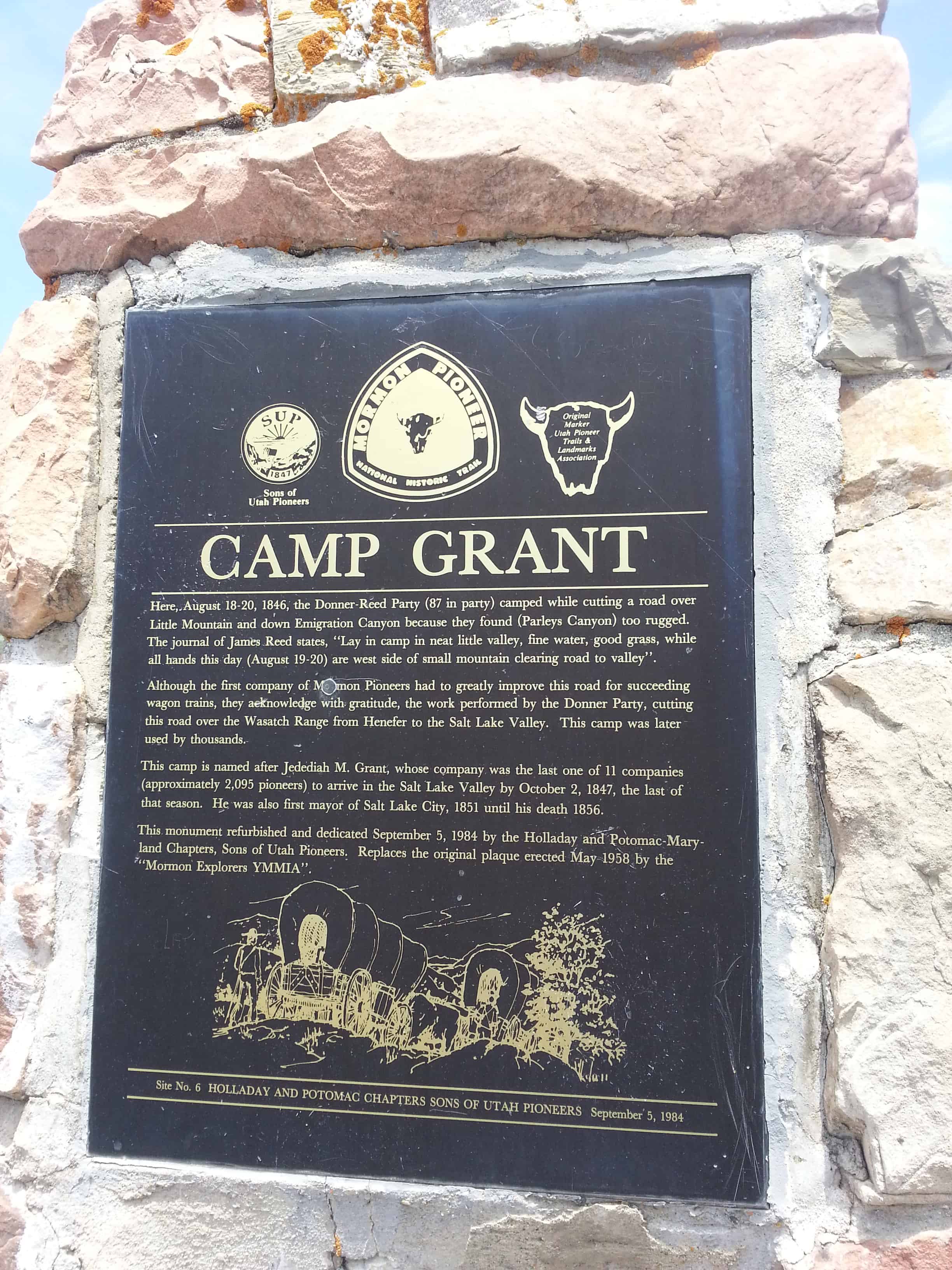
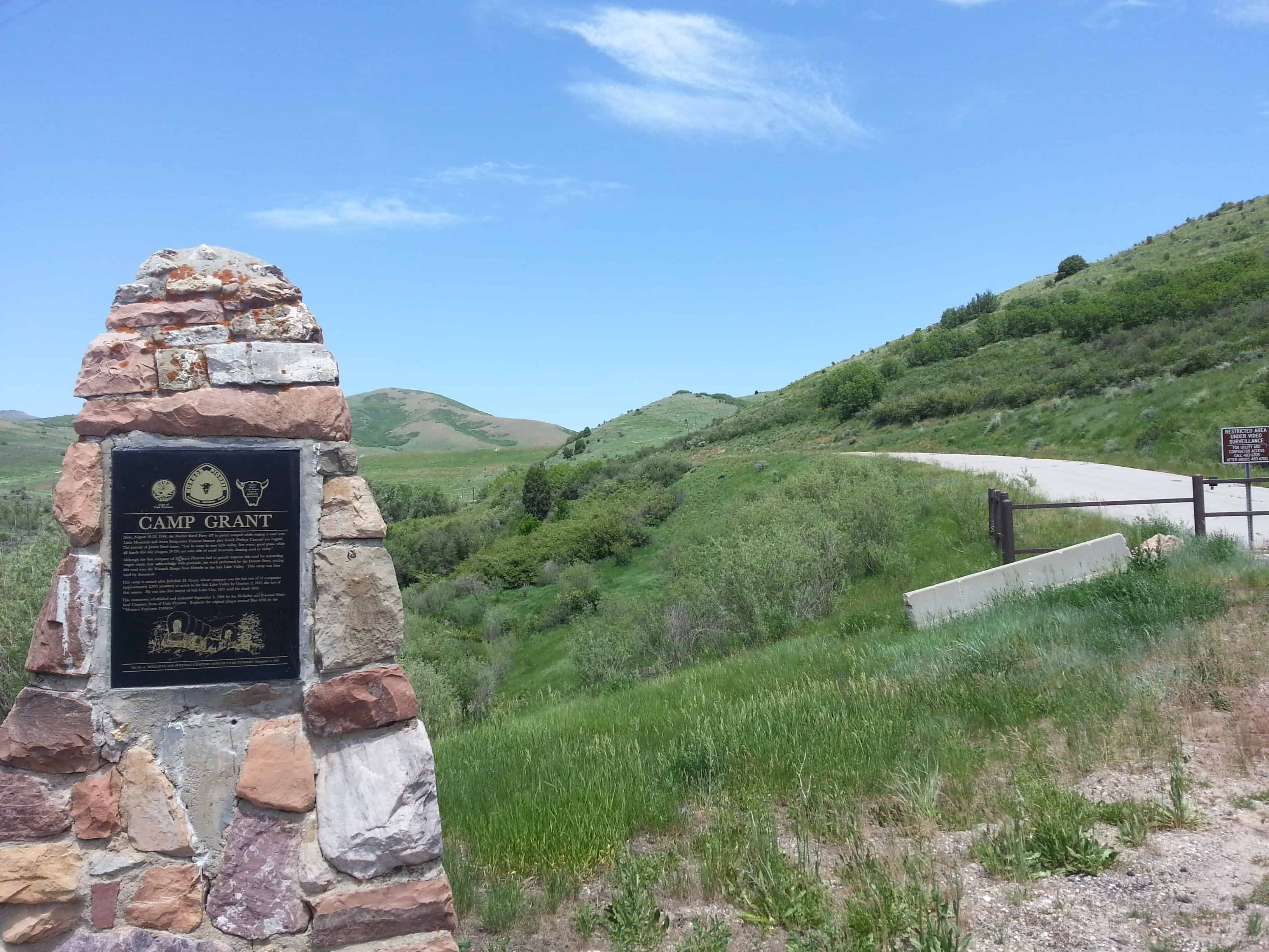
Here, August 18-20, 1846, the Donner-Reed Party (87 in party) camped while cutting a road over Little Mountain and down Emigration Canyon because they found (Parleys Canyon) too rugged. The journal of James Reed states, “Lay in camp in neat little valley, fine water, good grass, while all hands this day (August 19-20) are west side of small mountain clearing road to valley.” Although the first company of Mormon Pioneers had to greatly improve the road for succeeding wagon trains, they acknowledged with gratitude the work performed by the Donner Party, cutting this road over the Wasatch range from Henefer to the Salt Lake Valley. This camp was later used by thousands. This camp is named after Jedediah M. Grant, whose company was the last one of 11 companies (approximately 2,095 pioneers) to arrive in the Salt Lake valley by October 2, 1847, the last of the season. He was also the first mayor of Salt Lake City, 1851 until his death 1856.
This monument refurbished and dedicated September 5, 1984 by the Holladay and Potomac-Maryland Chapters, Sons of Utah Pioneers. Replaces the original plaque erected May 1958 by the “Mormon” Explorers Y M M I A.”
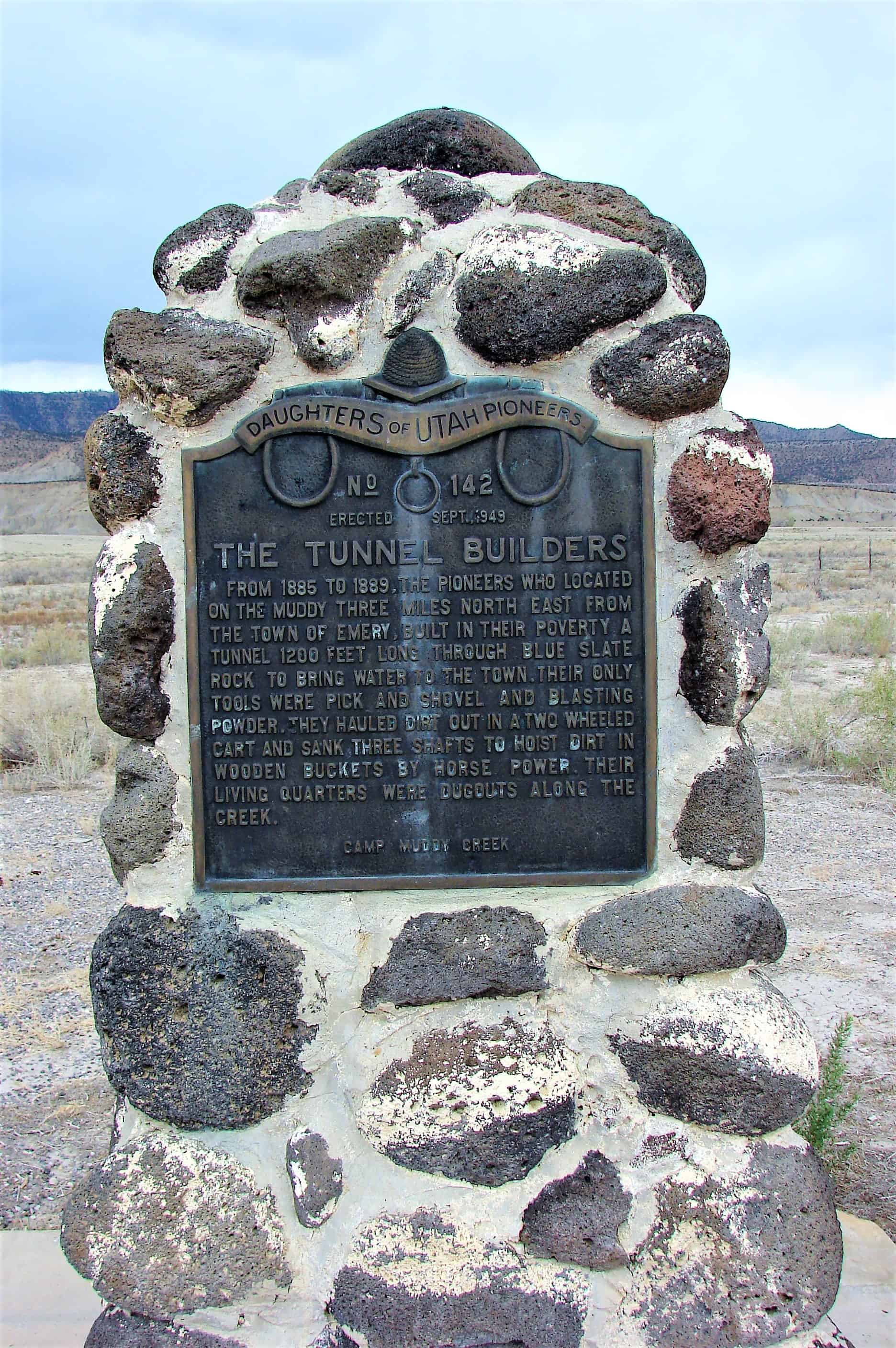
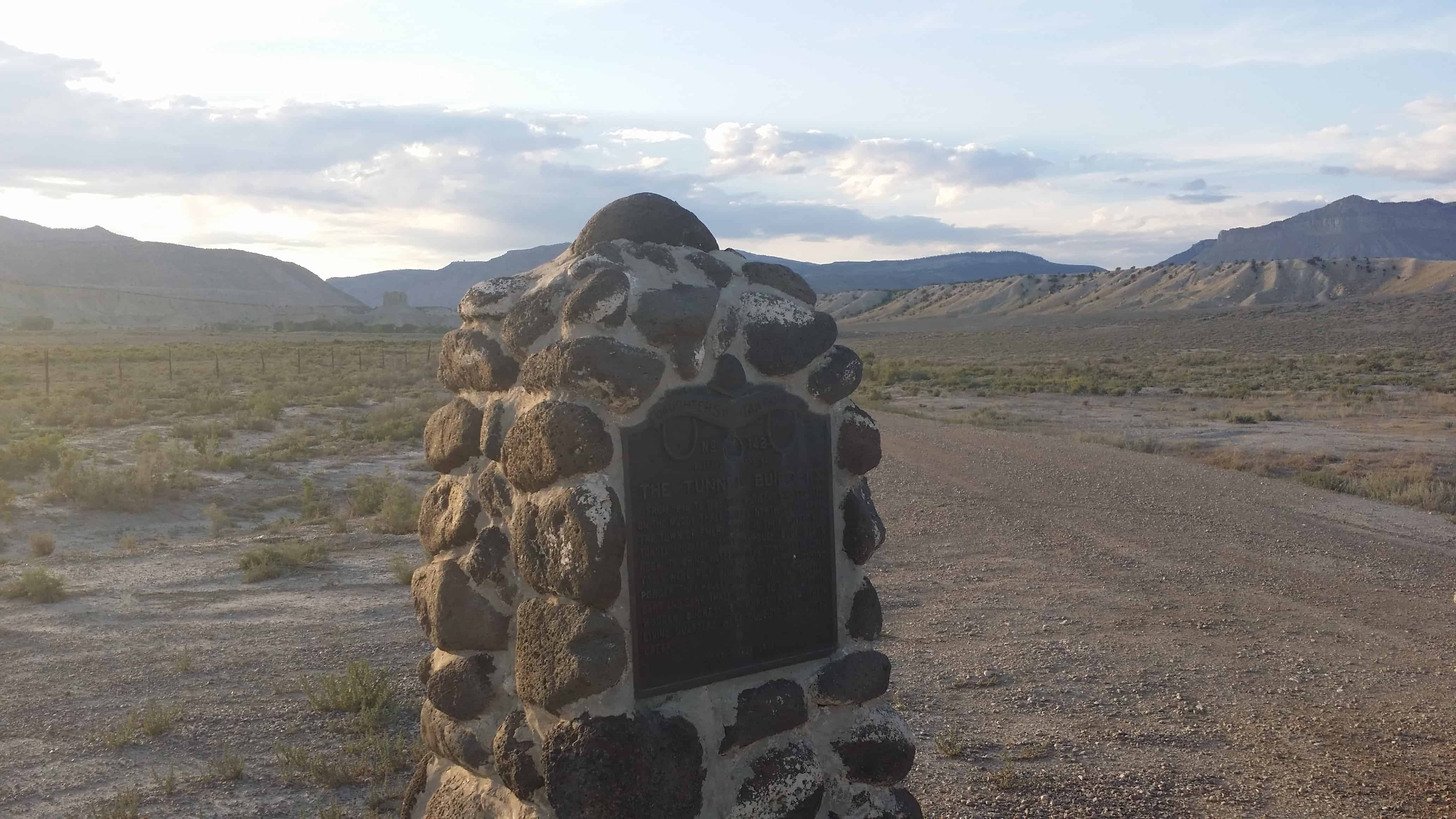
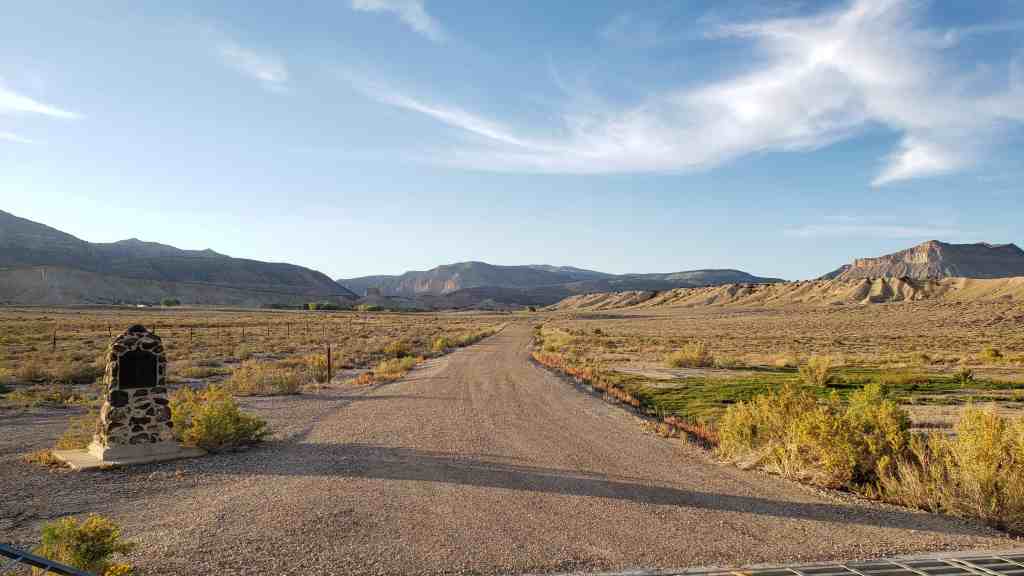
From 1885 to 1889, the pioneers who located on the Muddy three miles N.E. from the town of Emery built in their poverty, a tunnel 1200 feet long through blue slate rock to bring water to the town. Their only tools were pick and shovel and blasting powder. They hauled dirt out in a two wheeled cart and sank three shafts to hoist dirt in wooden buckets by horse power. Their living quarters were dugouts along the creek.
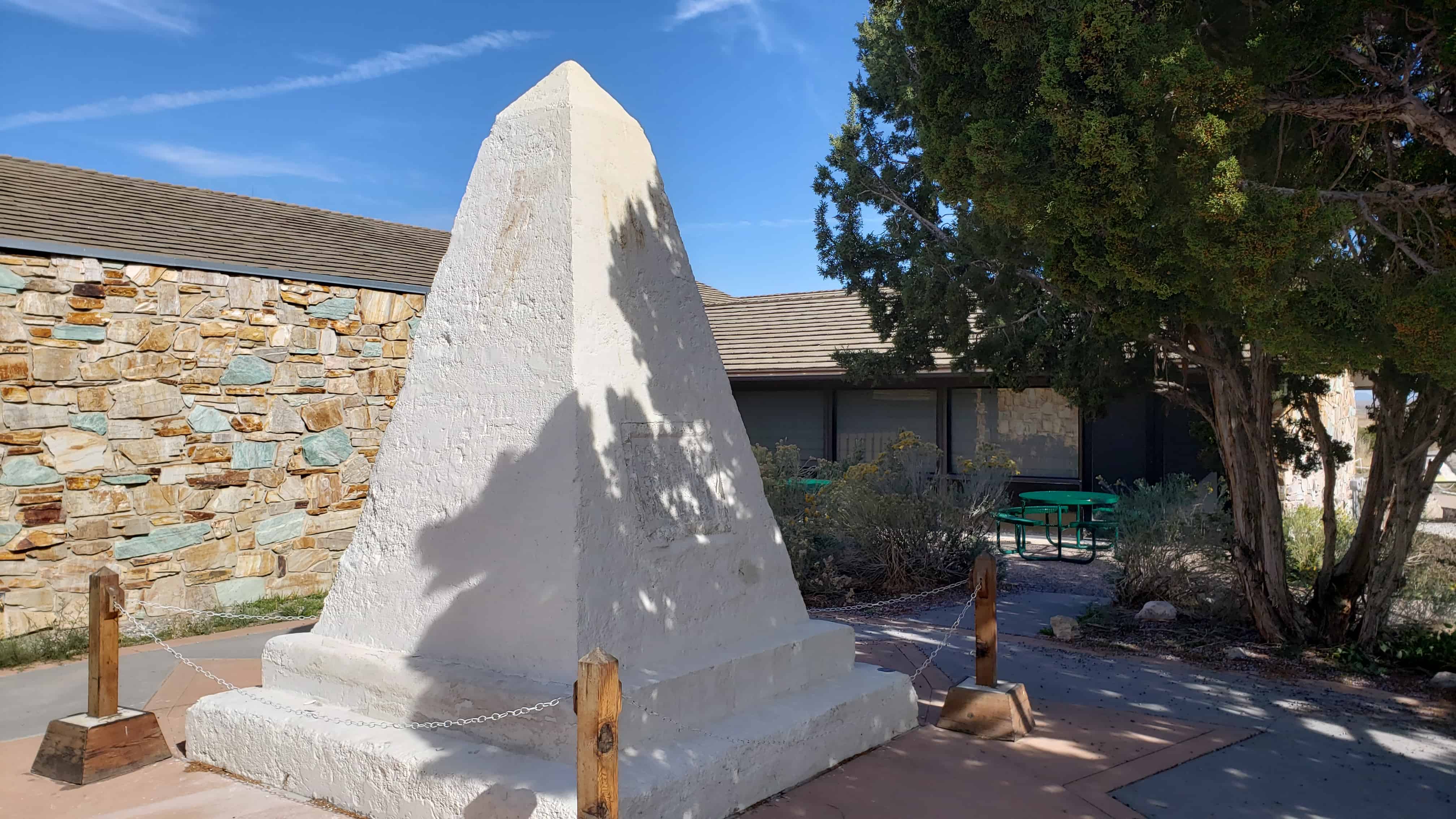
“The last rail is laid. The spike is driven. The Pacific Railroad is completed.” Here at Promontory, Utah at 12:47 p.m. on May 10, 1869 the driving of a golden spike completed the first transcontinental railroad climax of a dramatic railroad-building race between the Union Pacific building from the east and the Central Pacific building from the west. This event symbolized attainment of a long sought goal – a direct transportation route to the Pacific Ocean and the China trade and it achieved the great political objective of binding together by iron bonds the extremities of continental United States. A rail link from ocean to ocean.”
In 1954, the National Park Service assumed ownership of the aging monument, which had been damaged by years of weathering and vandalism. The interior had also been severely damaged by ground water that had wicked up into the monument through its buried base. Early restoration attempts unintentionally contributed to the damage by using materials that did now allow for evaporation of water trapped inside the monument. Based on state of the art technology, the National Park Service began a new repair process in 2001.
Removing the concrete monument from the ground to prevent further moisture absorption and allowing it to dry.
Transferring the monument to its present location.
Replacing old stucco, paint, and patches with a new breathable masonry coating.
Protecting the monument through regularly scheduled maintenance.
Significance of the Monument
In 1916, the Southern Pacific Railroad (formerly the Central Pacific Railroad) placed the monument near the site where the nation’s first transcontinental railroad was completed. For decades, it stood there, a lonely reminder of the driving of the last spike on May 10, 1869 at Promontory Summit, Utah Territory. Today, the handsomely restored monument remains an icon of westward expansion, the settlement of northern Utah and commemorates an historic event that transformed America.
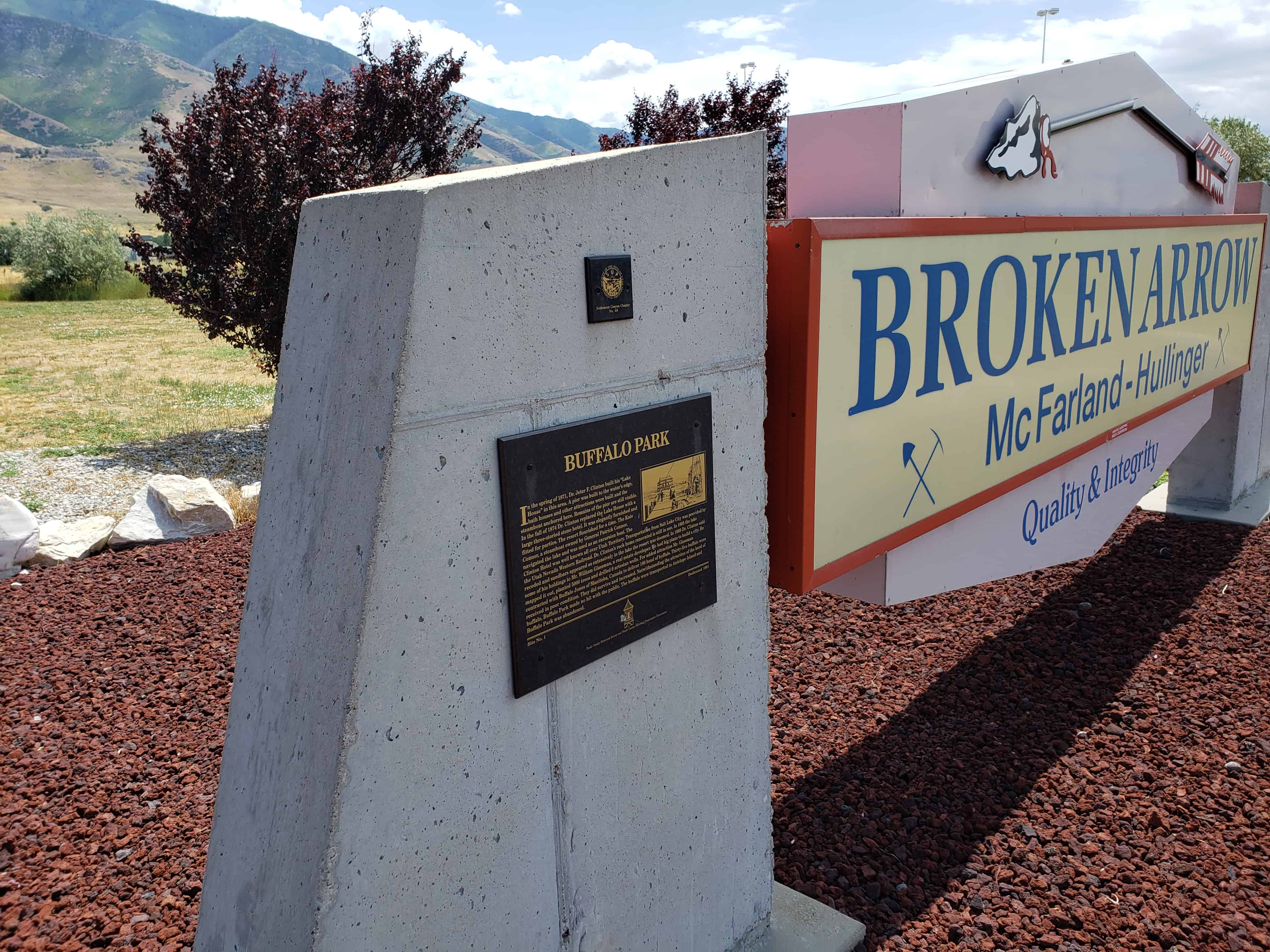
In the Spring of 1871 Dr. Jeter F. Clinton built his “Lake House” in this area. A pier was built to the water’s edge, bath houses and other attractions were built and the steamboat anchored here. Remains of the pier are still visible.
In the fall of 1874 Dr. Clinton replaced the Lake House with a large three-storied stone hotel. It was elegantly furnished and fitted for parties. The resort flourished for a time. The Kate Connor, a steamboat owned by General Patrick Connor, navigated the lake and was used as an excursion boat.
The Clinton Hotel was well known all over Utah Territory. Transportation from Salt Lake City was provided by the Utah Nevada Western Railroad. Dr. Clinton’s rock home renovated is still in use. In 1885 the lake receded and sandbars appeared so extensively in the lake the resort was doomed. In 1889 Dr. Clinton sold some of his holdings to Mr. William Glassman, a real estate developer. He had big plans to build a city. He mapped it out, planted 5,000 trees and drilled 6 artesian wells.
For added attraction Mr. Glassman contracted with Buffalo Jones of Manitoba, Canada to deliver 100 head of buffalo. Thirty-five buffalo were received in poor condition. They did survive and increase. Notwithstanding the attraction of the herd of buffalo, Buffalo Park made no hit with the public, the buffalo were transported to Antelope Island and Buffalo Park was abandoned.
There is a historic marker not far from here that was placed on a boulder taken from the Old Buffalo Ranch.
See other historic markers in the series on this page for SUP Markers.
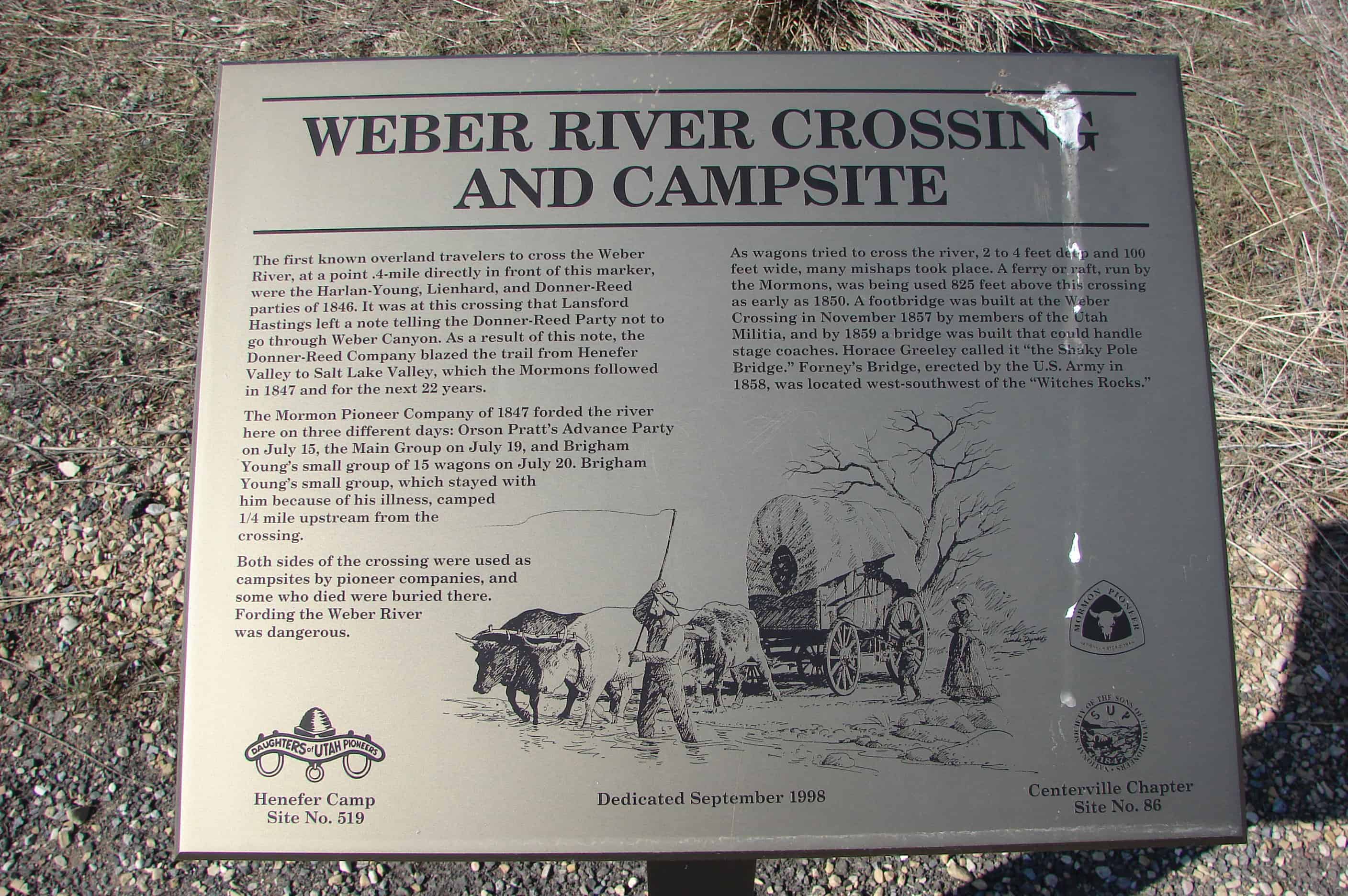
The first known overland travelers to cross the Weber River, at a point .4-mile directly in front of this marker, were the Harlan-Young, Lienhard, and Donner-Reed parties of 1846. It was at this crossing that Lansford Hastings left a note telling the Donner-Reed Party not to go through Weber Canyon. As a result of this note, the Donner-Reed Company blazed the trail from Henefer Valley to Salt Lake Valley, which the Mormons followed in 1847 and for the next 22 years.
The Mormon Pioneer Company of 1847 forded the river here on three different days: Orson Pratt’s Advance Party on July 15, the Main Group on July 19, and Brigham Young’s small group of 15 wagons on July 20. Brigham Young’s small group, which stayed with him because of his illness, camped ¼ mile upstream from the crossing.
Both sides of the crossing were used as campsites by pioneer companies, and some who died were buried there. Fording the Weber River was dangerous.
As wagons tried to cross the river, 2 to 4 feet deep and 100 feet wide, many mishaps took place. A ferry or raft, run by the Mormons, was being used 825 feet above this crossing as early as 1850. A footbridge was built at the Weber Crossing in November 1857 by members of the Utah Militia, and by 1859 a bridge was built that could handle stage coaches. Horace Greeley called it “the Shaky Pole Bridge.” Forney’s Bridge, erected by the U.S. Army in 1858, was located west-southwest of the “Witches Rocks.”
This is DUP Marker #519 and SUP Marker #86, it is located in Henefer, Utah on old Highway 30 (GPS Coordinates are N 41.01232 W 111.48172 )
President Brigham Young, in 1876, gave the Relief Society sisters an assignment to store wheat for a time of need. This historic, oolite limestone building was constructed as a granary in response to this concept. Pioneer women and children followed the threshers to glean wheat leavings. They sold handmade items and Sunday eggs – eggs laid on Sunday – to purchase wheat to fill the bins. Wheat was given to the bishop for the needy, and grain was given to farmers for seed with a repayment of five bushels for each four bushels given.
Relief Society Wheat and flour were contributed to San Francisco after the earthquake in 1906 and to China during the famine in 1907.
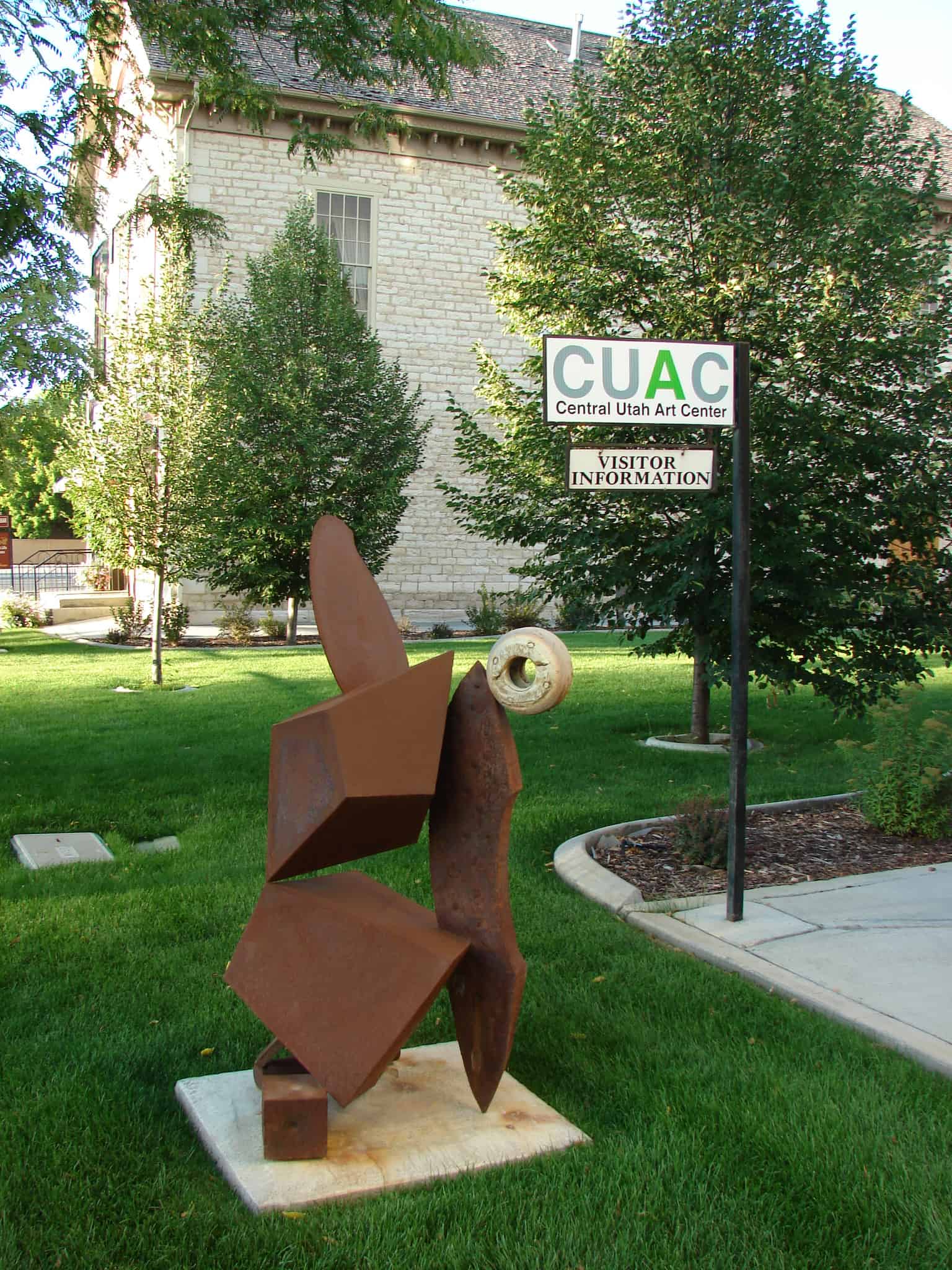
In 1915, the granary was converted to a flour mill that functioned for forty years. In 1969, the granary and adjoining cooperative store were threatened with demolition but were preserved through valiant community efforts. The granary interior was completely reconstructed into The Central Utah Art Center in 1990.
The Mingo Smelter was the largest single producer in Utah of metals such as gold, silver, and lead. When it began in 1873, it was known as the Mountain Chief Smelter and was renamed the Mingo smelter in 1876 when it was expanded. By 1881 it produced 19,000,000 pounds of unrefined metal which was shipped to Pennsylvania. The rich ores came from Little Cottonwood Canyon, Bingham Canyon and Lark and provided work for 500 to 1,200 men. Power for the smelter was provided by water traveling through a network of canals to Allsop’s Pond on the south side of Locust Street. From there, it was channeled through wooden pipes to Mingo. In 1877 the plant consisted of Blake crusher, one pair of Cornish rolls, two reverberatory furnaces for ore, matte, and flue dust, three blast furnaces, two boilers, three blowers, and one 35 horsepower horizontal engine. The iron flux came from the Tintic District, the limestone was bought in Salt Lake City, and the fuel used was coke.
Using all four of its furnaces, the Mingo Smelter could produce enough metal to fill sixteen railroad cars each week. It was destroyed by fire in 1887 and was rebuilt in 1888. The Mingo closed in April 1901 when the ores were depleted. This was one of the most successful of the old smelters that operated in Utah.
The above text is from the monument erected in 1993, located at 50 East 9000 South in Sandy, Utah
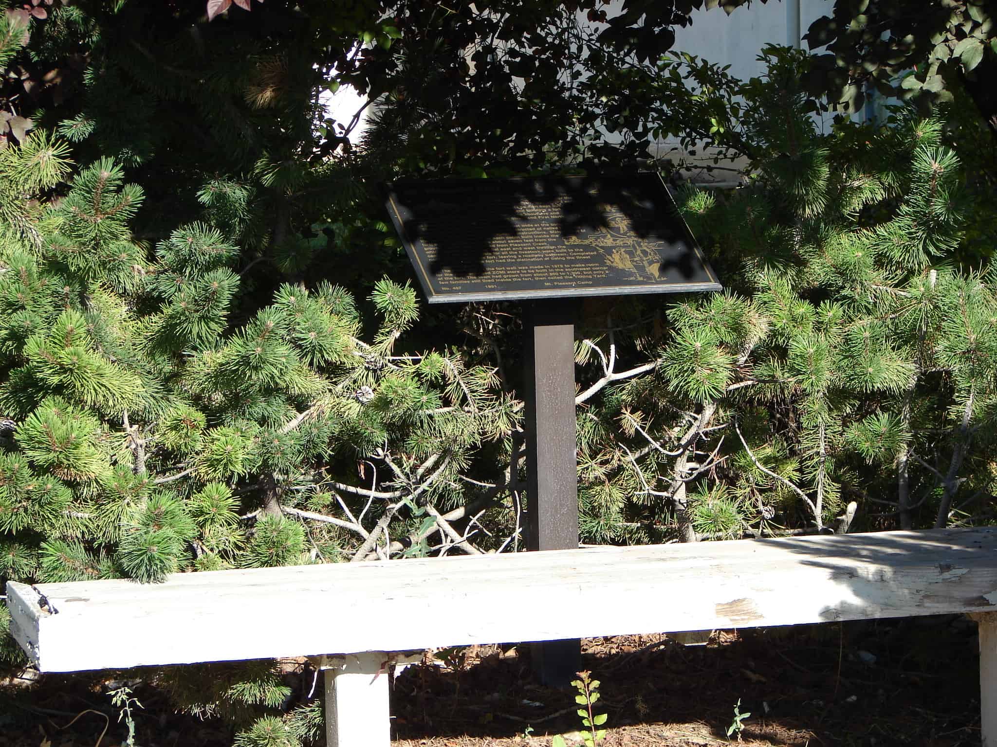
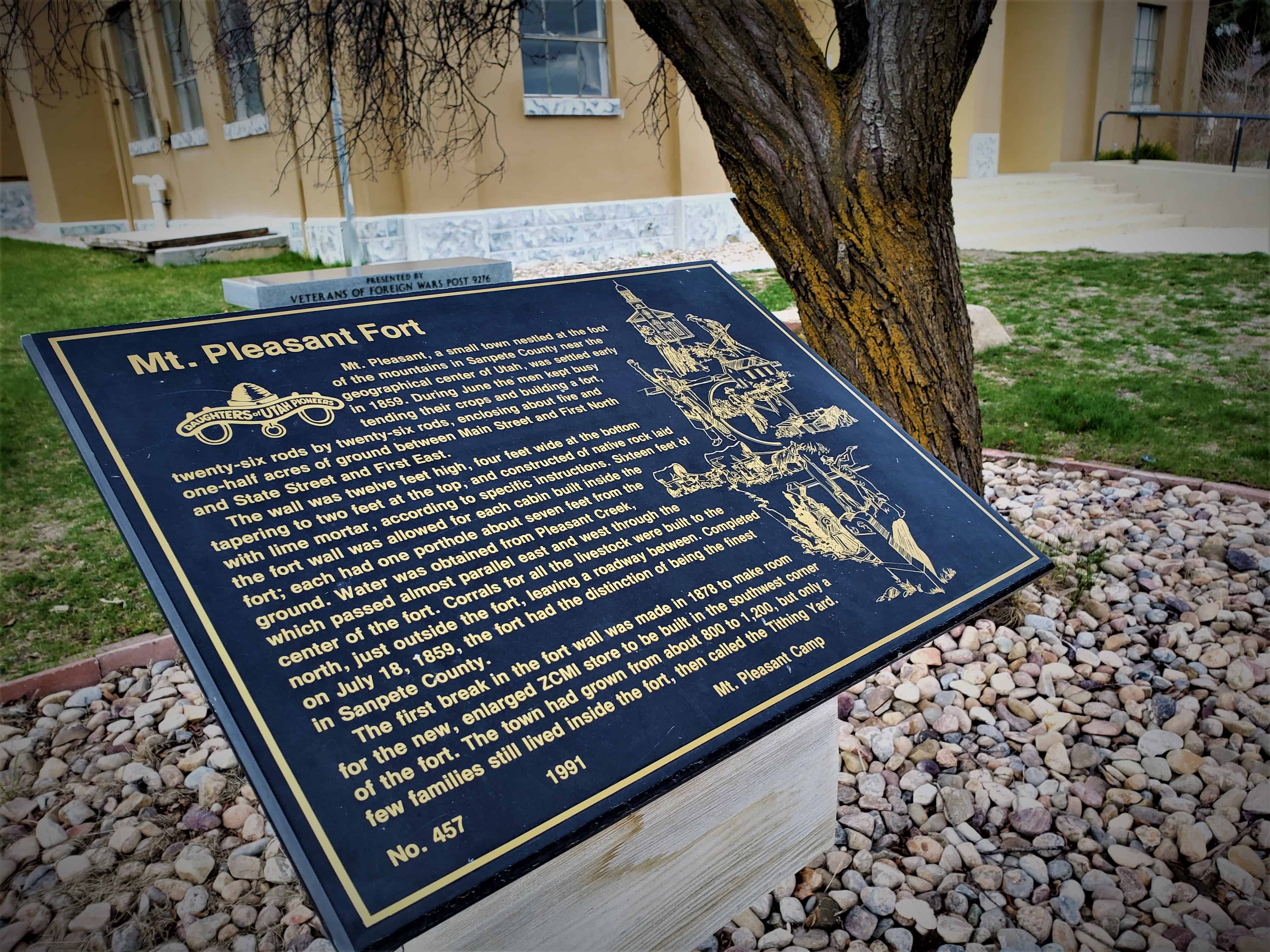
Mt. Pleasant, a small town nestled at the foot of the mountains in Sanpete County near the geographical center of Utah, was settled early in 1859. During June the men kept busy tending their crops and building a fort, twenty-six rods by twenty-six rods, enclosing about five and one-half acres of grounds between Main Street and First North and State Street and First East.
The wall was twelve feet high, four feet wide at the bottom tapering to two feet at the top, and constructed of native rock laid with lime mortar, according to specific instructions. Sixteen feet of the fort wall was allowed for each cabin built inside the fort; each had one porthole about seven feet from the ground. Water was obtained from Pleasant Creek, which passed almost parallel east and west through the center of the fort. Corrals for all the live-stock were built to the north, just outside the fort, leaving a roadway between. Completed on July 18, 1859, the fort had the distinction of being the finest in Sanpete County.
The first break in the fort wall was made in 1878 to make room for the new, enlarged ZCMI store to be built in the southwest corner of the fort. The town had grown from about 800 to 1,200, but only a few families still lived inside the fort, then called the Tithing Yard.