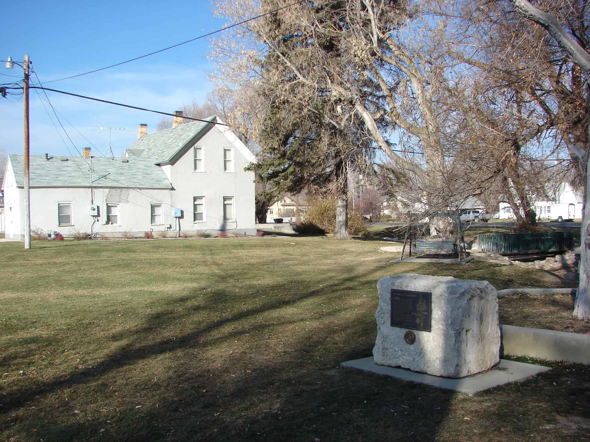
Curlew Valley, named after the curlew snipe that nests here, extends from Snowville, Utah, to the Idaho towns of Stone and Holbrook. The first recorded white men were Peter Skene Ogden‘s large party of trappers, who camped on Deep Creek December 27, 1828.
Some of the discharged members of the Mormon Battalion, on their way from California to Salt Lake City on September 18, 1848, camped on Deep Creek and also in a cave one mile east called Hollow Rock.
The beginning of Deep Creek is a large spring at Holbrook which runs through the center of the valley and has never varied even in dry years. About one mile southwest is Rocky Ford, where the pioneers were able to cross on solid rock. In 1869 William Robbins, Thomas Showell, and William M. Harris settled at the Curlew Sinks, ten miles west of here, where Deep Creek sinks into the ground. The old pioneer trail and the stage line went through their ranch.
The first townsite in Curlew Valley was Snowville, named in honor of President Lorenzo Snow, and laid out August 14, 1876.
The Indian War years of 1865-72 brought bitter hardships to Sanpete and other central Utah areas. Different bands of Indians stealthily attacked settlers from their mountain hideouts, then fled to safety. Twenty-seven settlements were evacuated; two entire counties and portions of seven others were temporarily abandoned; seventy pioneers were slain and many wounded; hundreds of cattle and horses stolen. On Aug. 1, 1866, U.S. Indian Supt., Col. H.F. Head and Stake Pres. Orson Hyde obtained promise of peace from Chief Black Hawk. By Aug. 18, 1868, they had accomplished the hazardous feat of assembling a peace parley in Fort Ephraim on Hans Hansen’s lawn by a red cedar tree. Black Hawk calmed the defiant braves, a pipe of peace was passed, the treaty was signed and later ratified by U.S. Pres. Andrew Johnson. Black Hawk continued to help arrange peace parleys until other hostile chiefs had signed.
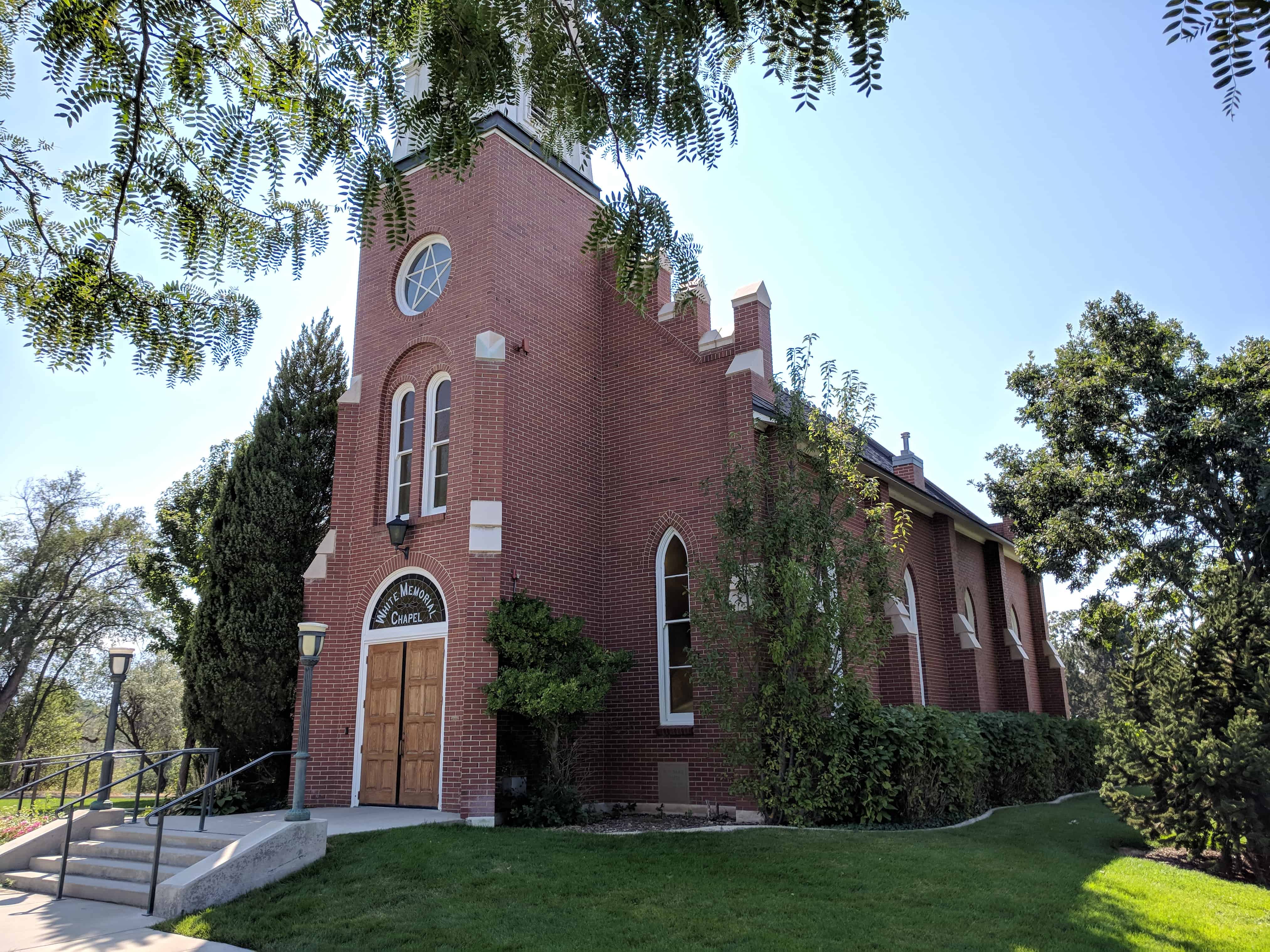
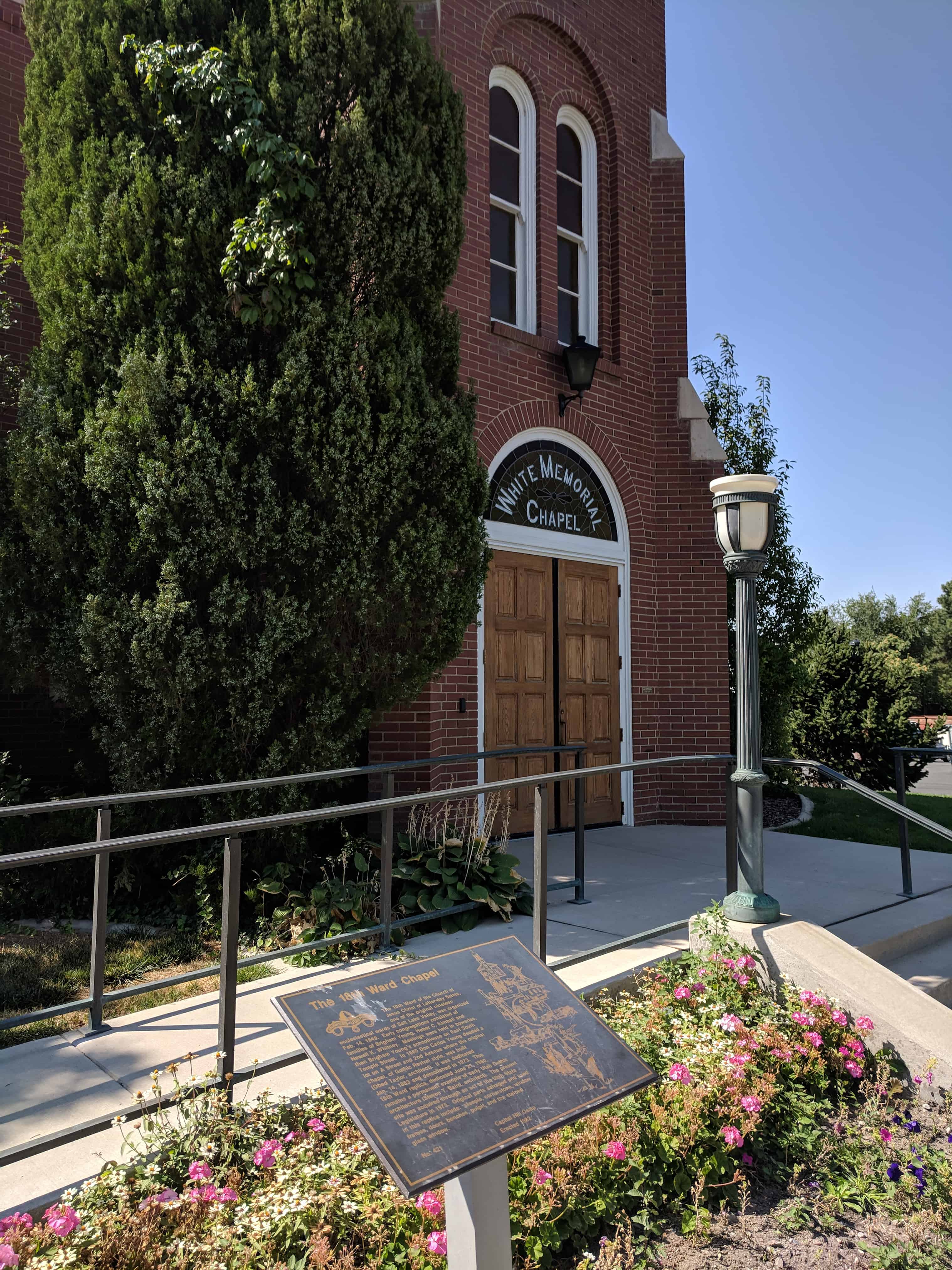
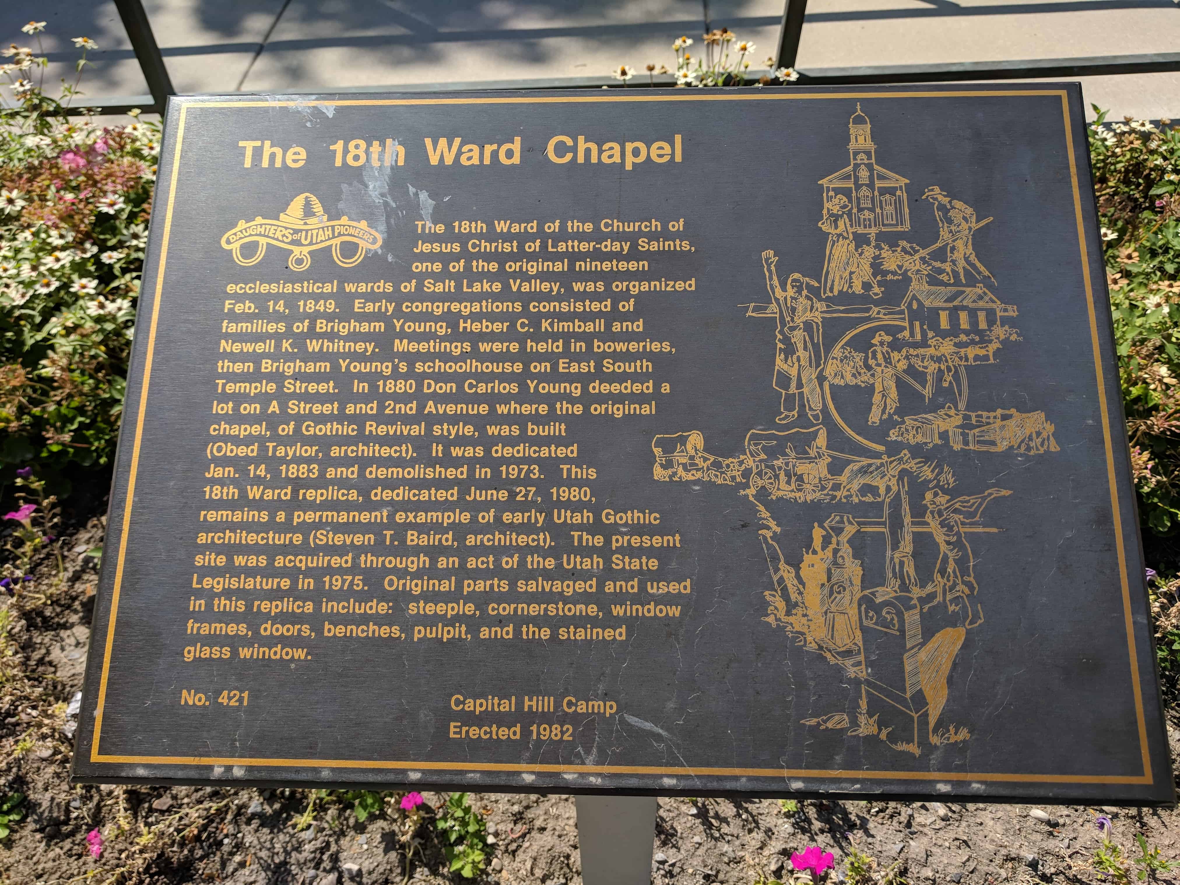
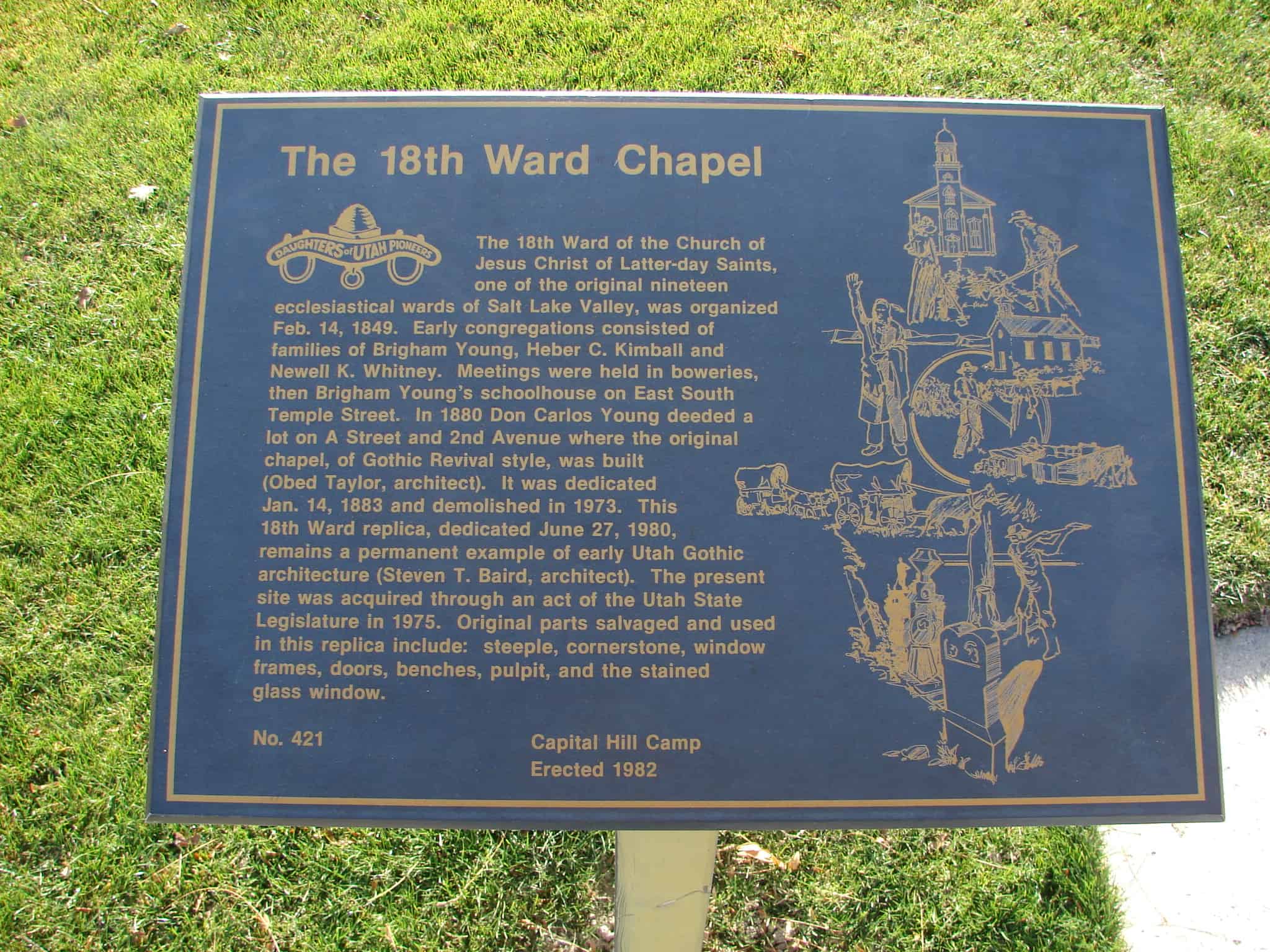
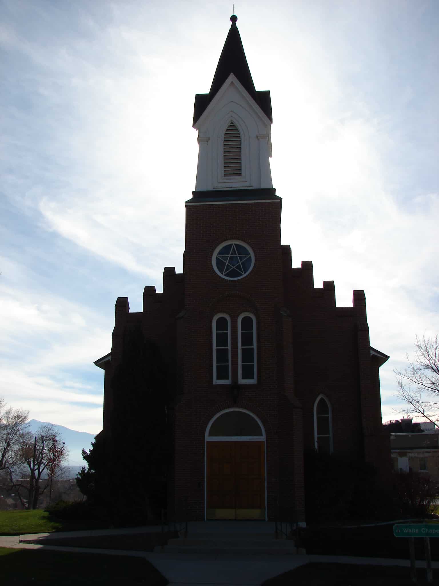
The 18th Ward of the Church of Jesus Christ of Latter-day Saints, one of the original 19 ecclesiastical wards of Salt Lake Valley, was organized Feb. 14, 1849. Early congregations consisted of families of Brigham Young, Heber C. Kimball and Newell K. Whitney. Meetings were held in boweries, then Brigham Young’s schoolhouse on East South Temple Street. In 1880 Don Carlos Young deeded a lot on A Street and 2nd Avenue where the original chapel, of Gothic Revival style, was built (Obed Taylor, architect) dedicated Jan. 14, 1883 demolished in 1973. This 18th Ward replica, dedicated June 27, 1980, remains a permanent example of early Utah Gothic architecture (Steven T. Baird, architect). The present site was acquired through an act of the Utah State Legislature in 1975. Original parts salvaged and used in the replica: steeple, cornerstone, window frames, doors, benches, pulpit, and the stained glass window.
On the north by 7th Ave. (or Ensign Ward), east by C St. (or the 20th Ward), south by South Temple St. (or the 12th-13th Ward), and west by Main St. (or the 17th Ward).
History timeline:
1849 – one of the original nineteen wards into which Salt Lake City was divided in February, 1849. At the time of its organization the ward extended northward and eastward to the mountains The first permanent settlers in the 18th Ward were Pres. Brigham Young and Elders Heber C. Kimball and Newel K. Whitney who, with their families, were the only residents of the ward for several years. 1856 – all that part of the 18th Ward lying east of Walnut St. (later A St.) was organized as the 20th Ward 1877 – boundary line was changed to Pine St. (C St.), its present boundary. 1904 – 18th Ward belonged to Salt Lake Stake, but when Salt Lake City was divided into four stakes in 1904, the ward became a part of Ensign Stake 1913 – The organization of Ensign Ward in 1913 diminished its northern boundary to 7th Ave.
The 18th ward is one of the original 19 wards in Salt Lake City in 1849, you can see the others on this page.
This is a gable roofed, gable facade chapel. The entrance pavilion has a frame cupola. There are buttresses between pointed arched windows. The building is symmetrically arranged with the roof cresting on the main gable. – D. Diana Johnson
The Eighteenth Ward was one of the original ecclesiastical divisions of Salt Lake City, for a few years inhabited only by President Brigham Young and Elders Heber C. Kimball and Newell K. Whitney. “In 1883 a fine brick chapel, erected by the Saints on A Street between 2nd and 3rd Avenues, was dedicated.” This structure was demolished about 1975 and a reconstruction, incorporating elements of the original building, was completed in 1979.
In 1859 James Pace and James Butler built an large adobe home on this site, purchased by Joseph E. Johnson, 1861. He with his brothers Benjamin F. and George W. operated many industries: drug stores, fruit-tree nursery, trunk factory, sorghum mill, cannery, broom factory, wholesale seed house, and printing office where first Utah farm paper, The Farmer’s Oracle, was published. Benjamin F. Johnson, became first Bishop; Samuel Openshaw, Justice of Peace; Don Carlos Babbitt, Constable.
Johnson In memory of those who died 1862 to 1882 Junius Johnson Avoline Butterfield Esther Vilate Babbitt Benjamin Franklin Babbitt Joseph Ezekiel Johnson Frances Rosilla Johnson Thankful Mary Johnson Adelia Jane Johnson Lina Ann LeBaron Hattie May LeBaron Ann Eliza Drollinger Don Carlos Babbitt, Jr. Almon Whiting Babbitt Joseph Almond Openshaw Melita Ann Openshaw William LeBaron Hannah Minnie Johnson Esther Minerva Johnson “Ring” Faithful Dog “Ranger” Faithful Horse
Erected by Spring Lake 2nd Ward Young Women, August 30, 1997
In 1852 Isaac Behunin and family came to Pine Creek. By 1854 seventy-seven families had arrived. Branch L.D.S. Church organized, Rueben W. Allred was presiding elder. Reddick N. Allred captain of militia. Ft. Ephraim incorporated as a city 1868, George Taylor Sr., Mayor. Agnes Armstrong, schoolteacher. Pupils used soft yellow rock for pencils. After Indian raids ended, each man was alloted 20 acres of land outside fort. Home, built near this spot, had the above engraved rock over the door.
On Sept. 7, 1872, the final peace treaty of the Utah Black Hawk Indian War was signed at the home of Bishop Seeley by General Henry A. Morrow, Orson Hyde, Amasa Tucker, Fredrick Olson, Reddick Allred and William S. Seeley. Representing the Indians were sub-chiefs Tabiona, White Hare, Angitzebl and others who served under Chief Black Hawk. The war cost Utah $1,535,000.00, the lives of more than 75 whites and several times that many Indians.
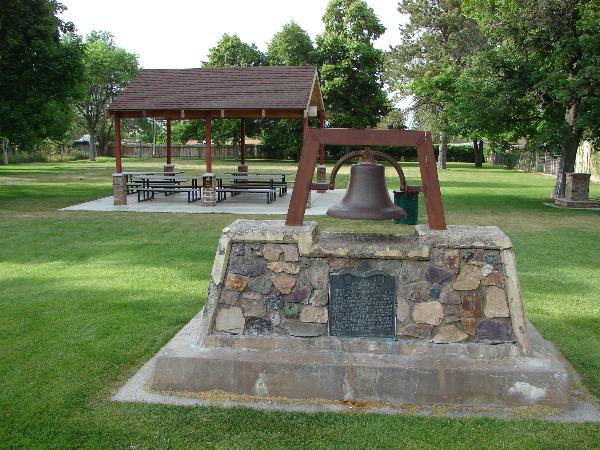
The bell atop the monument is the bell that used to be atop the Hamilton School.
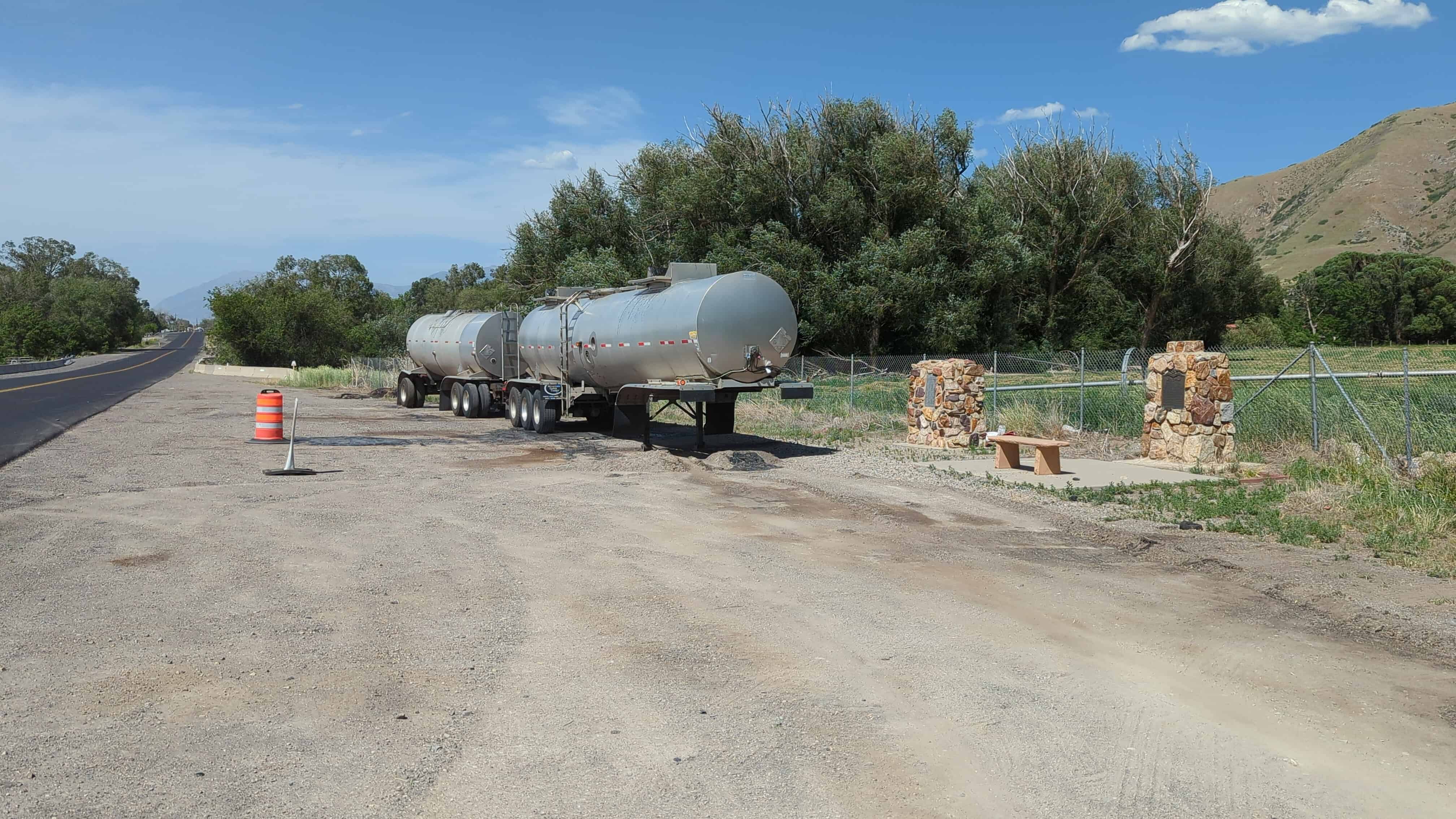
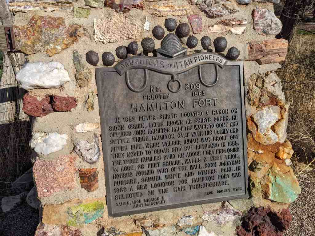
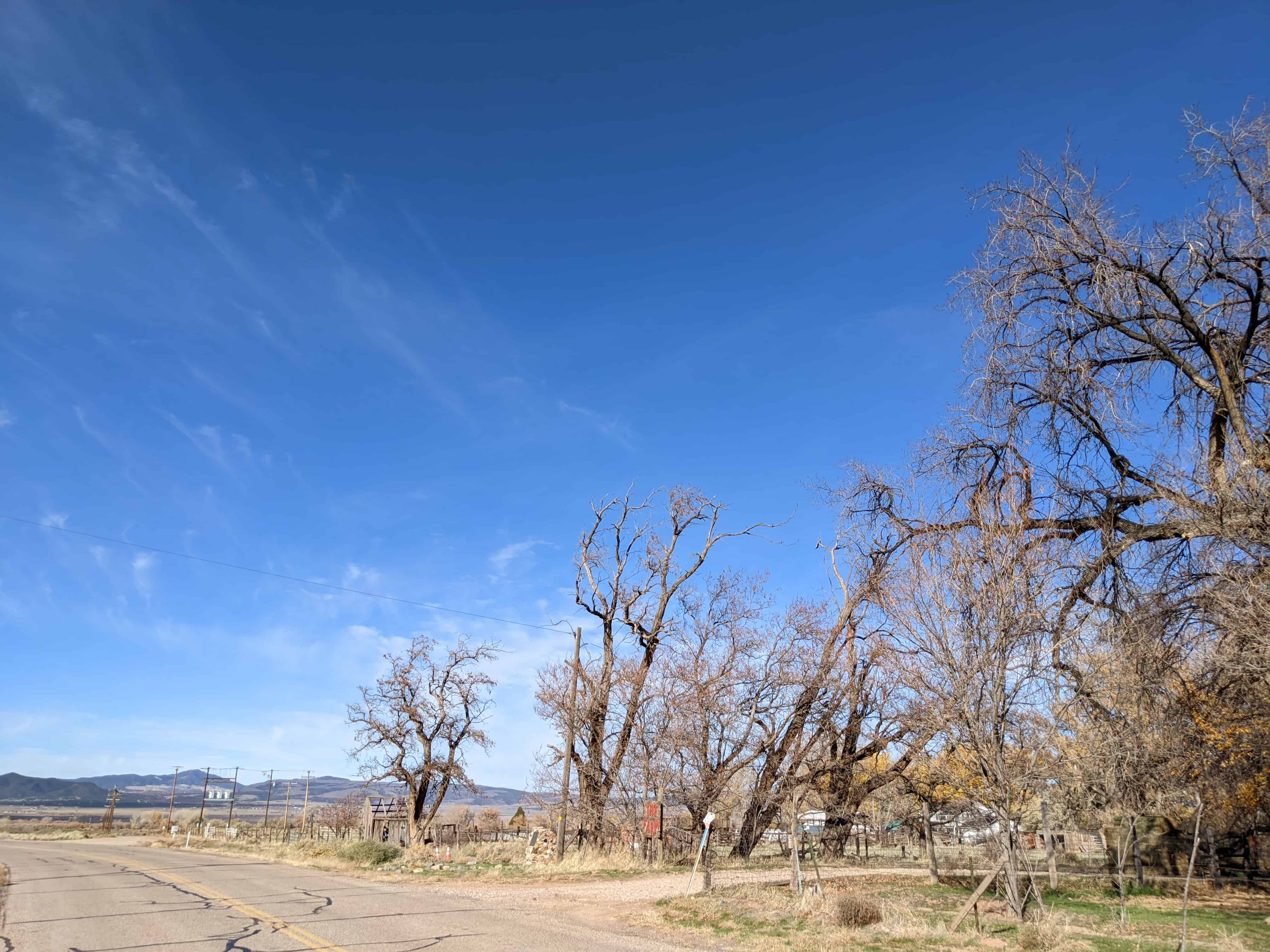
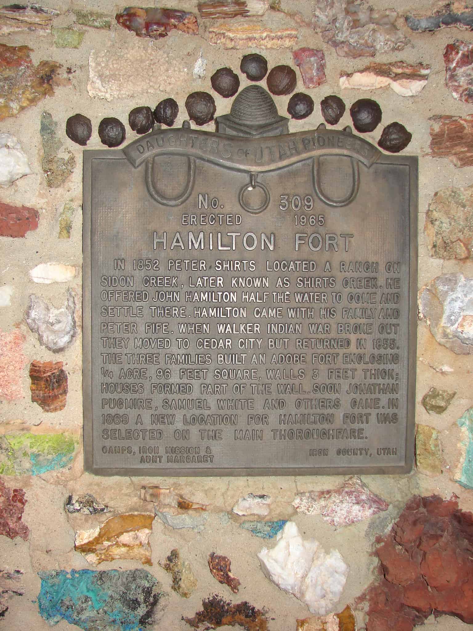
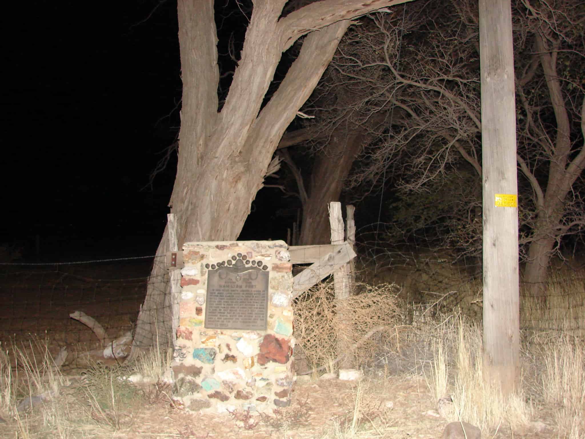
In 1852 Peter Shirts located a ranch on Sidon Creek, later known as Shirts Creek. He offered John Hamilton half the water to come and settle there. Hamilton came with his family and Peter Fife. When Walker Indian War broke out they moved to Cedar City but returned in 1855. The three families built an adobe fort enclosing one-fourth acre, 95 feet square, walls three feet thick; houses formed part of wall. Soon Jonathan Pugmire, Samuel White and others came. In 1869 a new location for Hamilton Fort was selected on the main thoroughfare.
Located on old Highway 91 at approximately 3700 West 2700 South in Cedar City, Utah
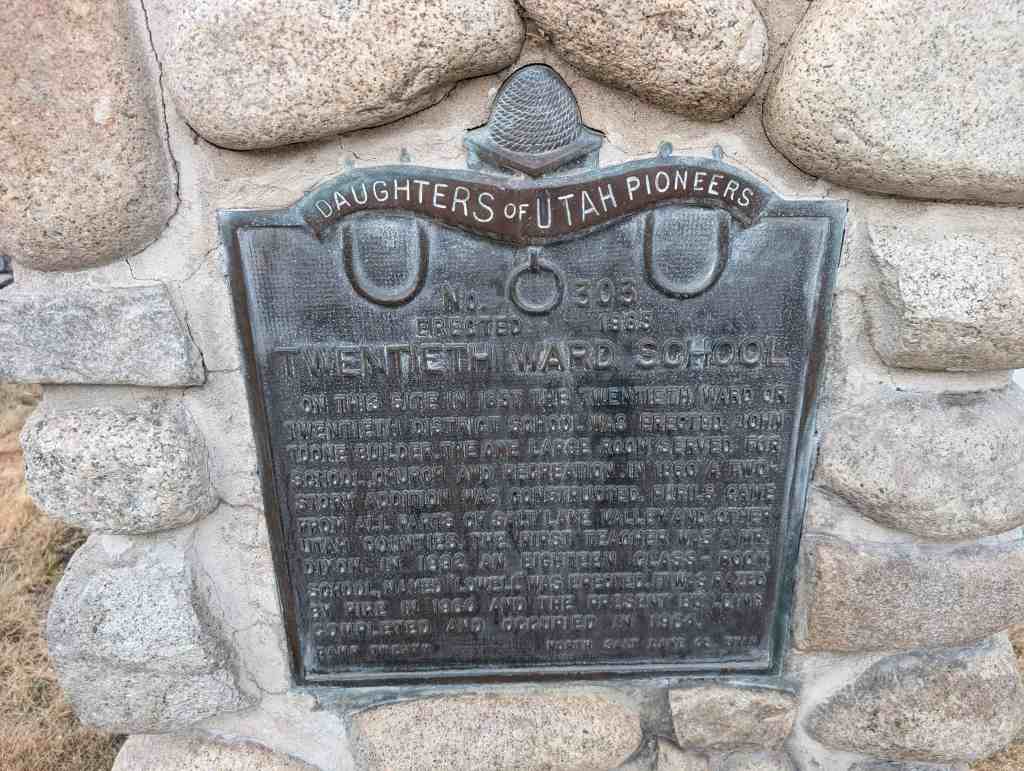
On this site in 1857 the Twentieth Ward or Twentieth District School was erected, John Toone builder. The one large room served for school, church and recreation. In 1860 a two-story addition was constructed. Pupils came from all parts of Salt Lake Valley and other Utah counties. The first teacher was a Mr. Dixon. In 1892 an eighteen class-room school, named “Lowell” was erected. It was razed by fire in 1960 and the present building completed and occupied in 1964.
The text above is from Daughters of Utah Pioneers historic marker #303 which is located at 332 2nd Avenue in The Avenues in Salt Lake City, Utah. (located on the parcel of 134 D Street)
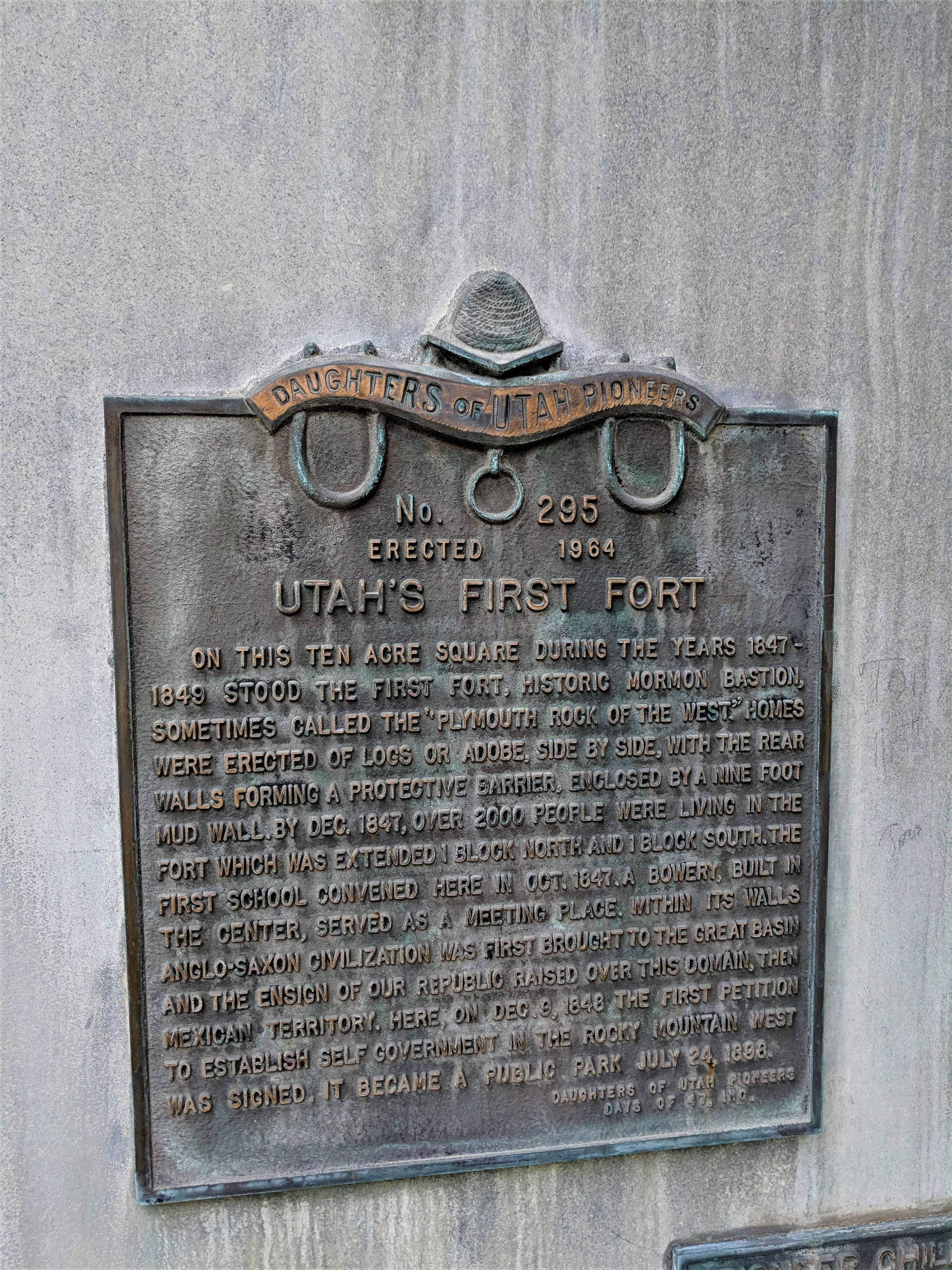
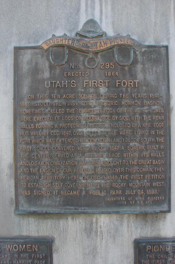
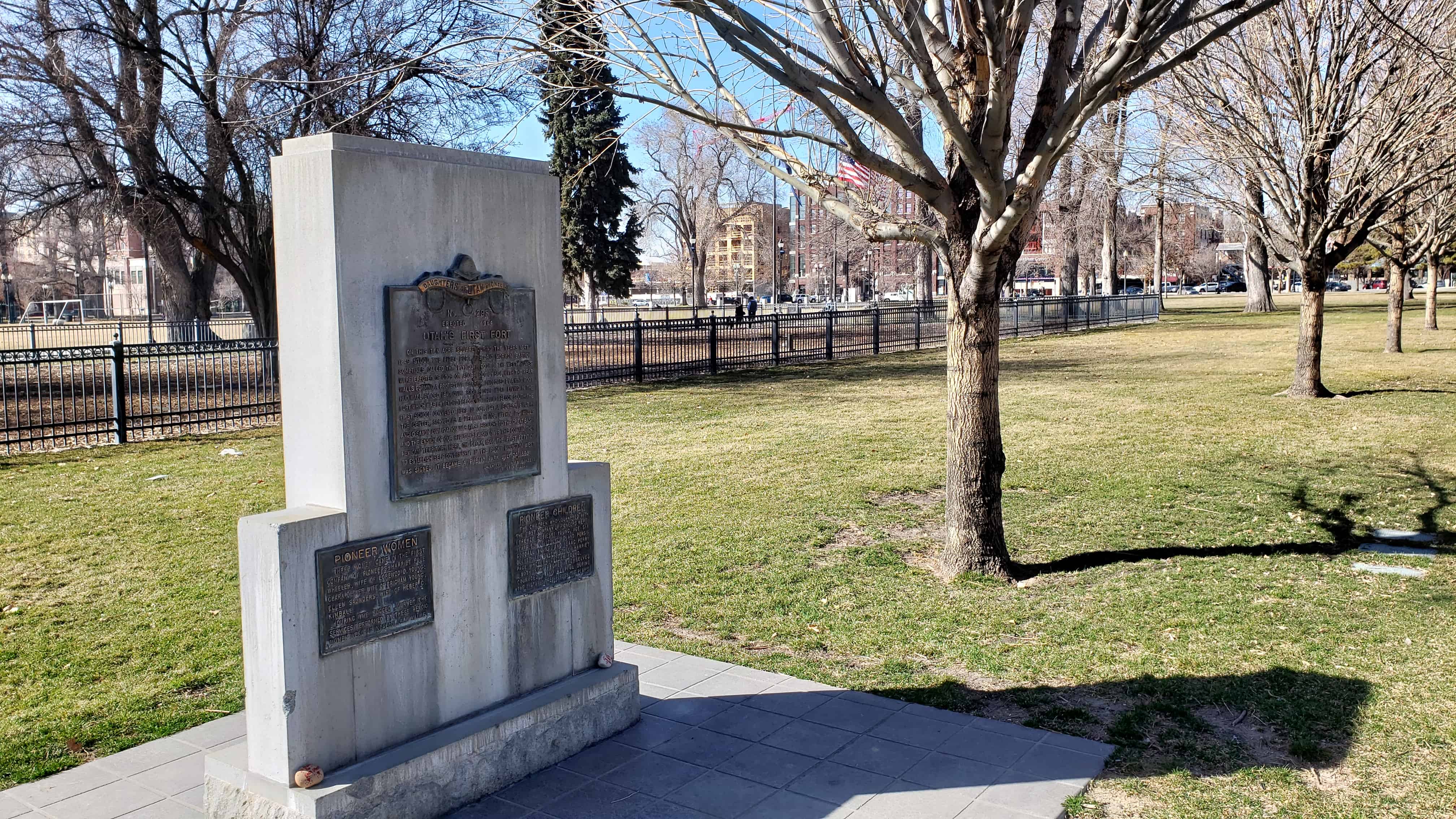
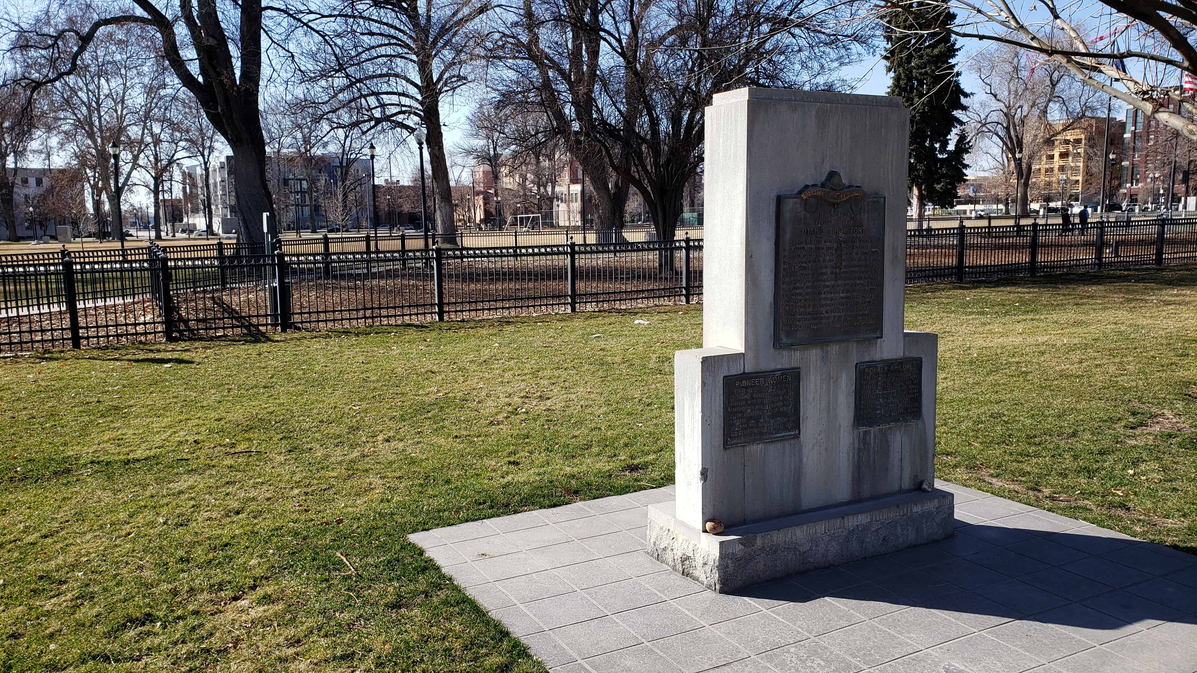
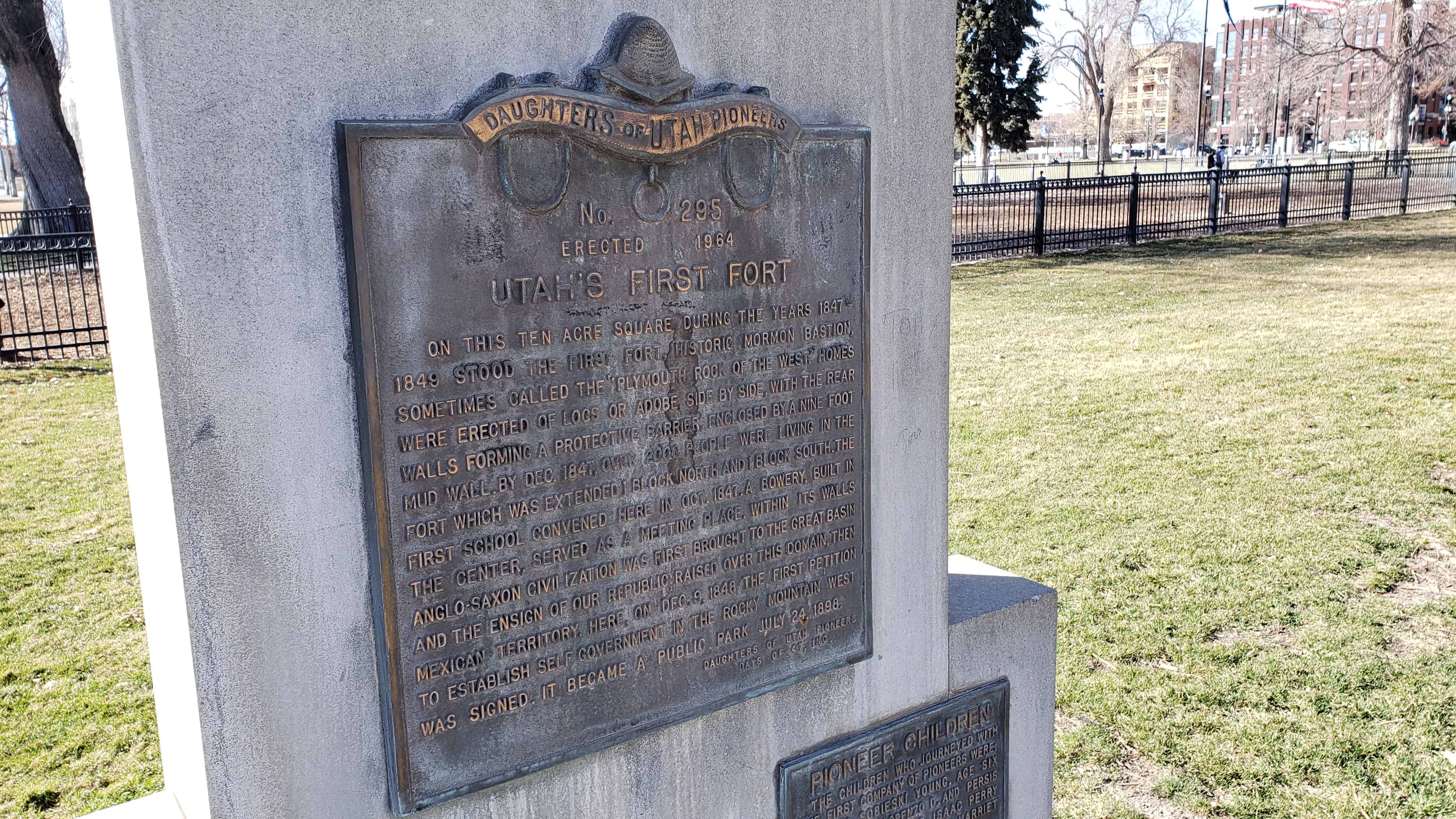
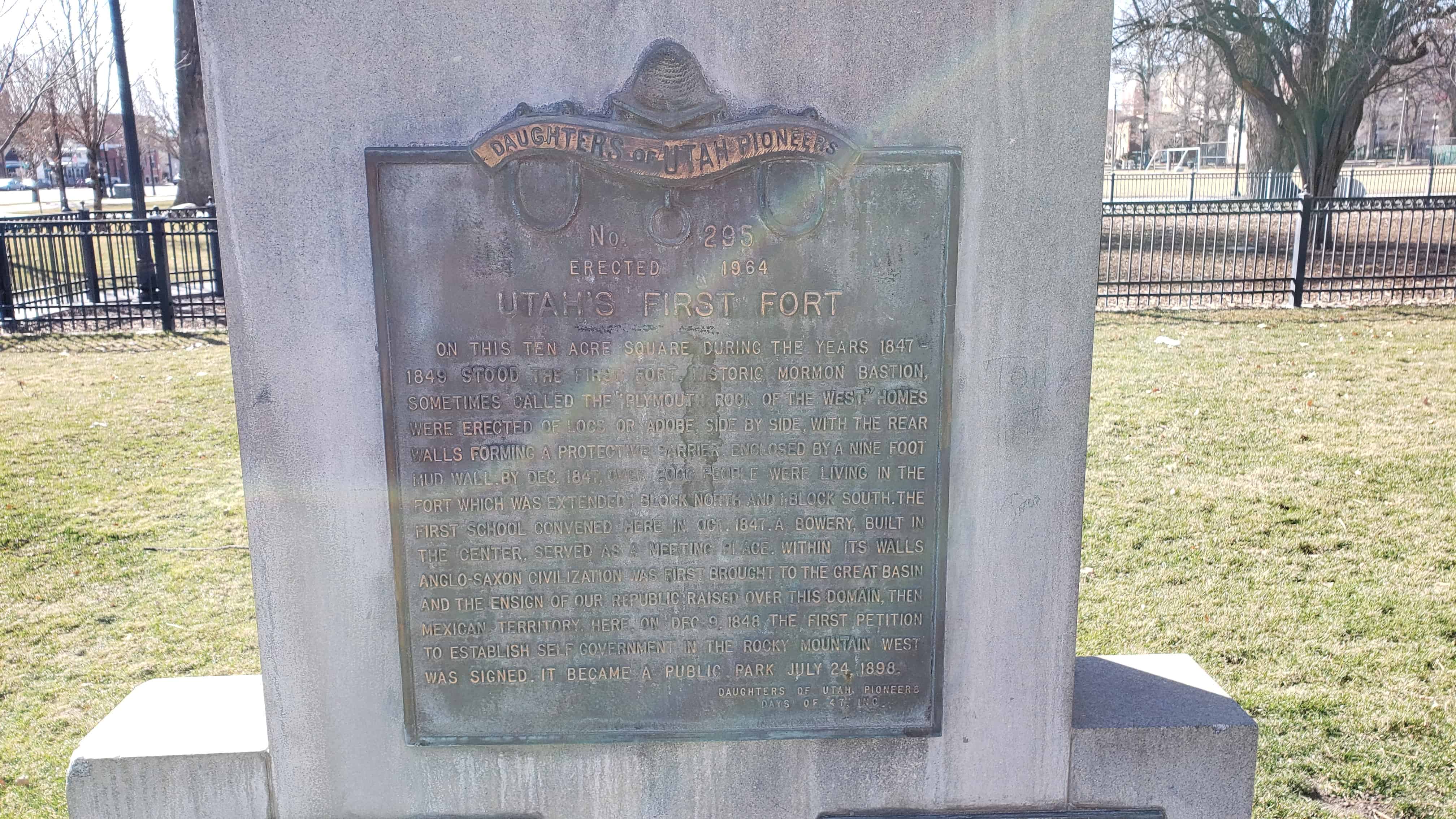
On this ten acre square during the years 1847-1849 stood the first fort, historic Mormon bastion, sometimes called the “Plymouth Rock of the West.” Homes were erected of logs or adobe, side by side, with the rear walls forming a protective barrier; enclosed by a nine foot mud wall. By December 1847, over two thousand people were living in the fort which was extended one block north and one block south. The first school convened here in October 1847. A bowery, built in the center, served as a meeting place. Within its walls Anglo Saxon civilization was first brought to the Great Basin and the ensign of our Republic raised over this domain, then Mexican territory. Here, on December 9, 1848, the first petition to establish self government in the Rocky Mountain West was signed. It became a public park July 24, 1898.
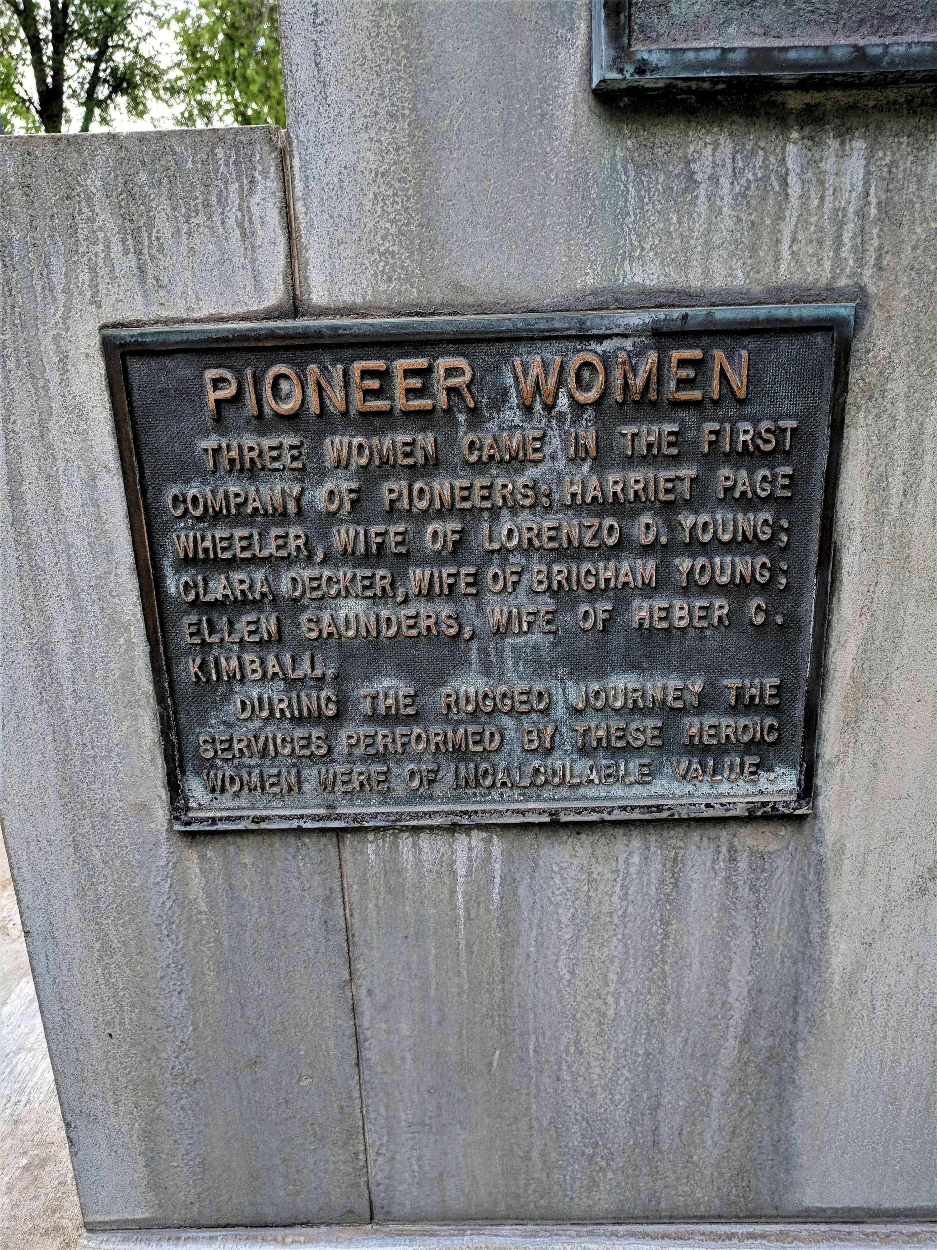
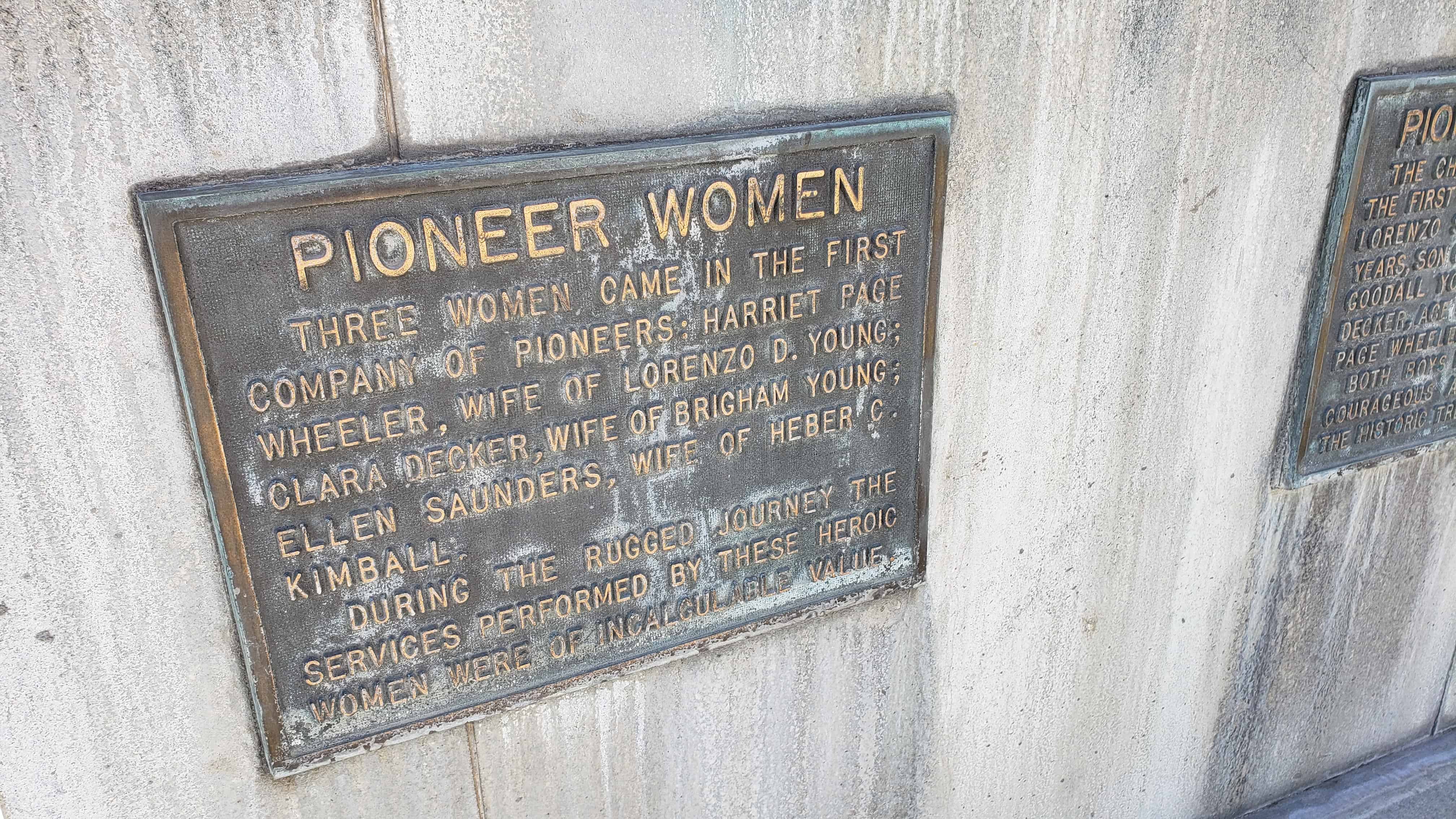
Pioneer Women
Three women came in the first company of pioneers; Harriet Page Wheeler, Wife of Lorenzo D. Young; Clara Decker, Wife of Brigham Young; Ellen Saunders, Wife of Heber C. Kimball. During the rugged journey the services performed by these heroic women were of incalculable value.
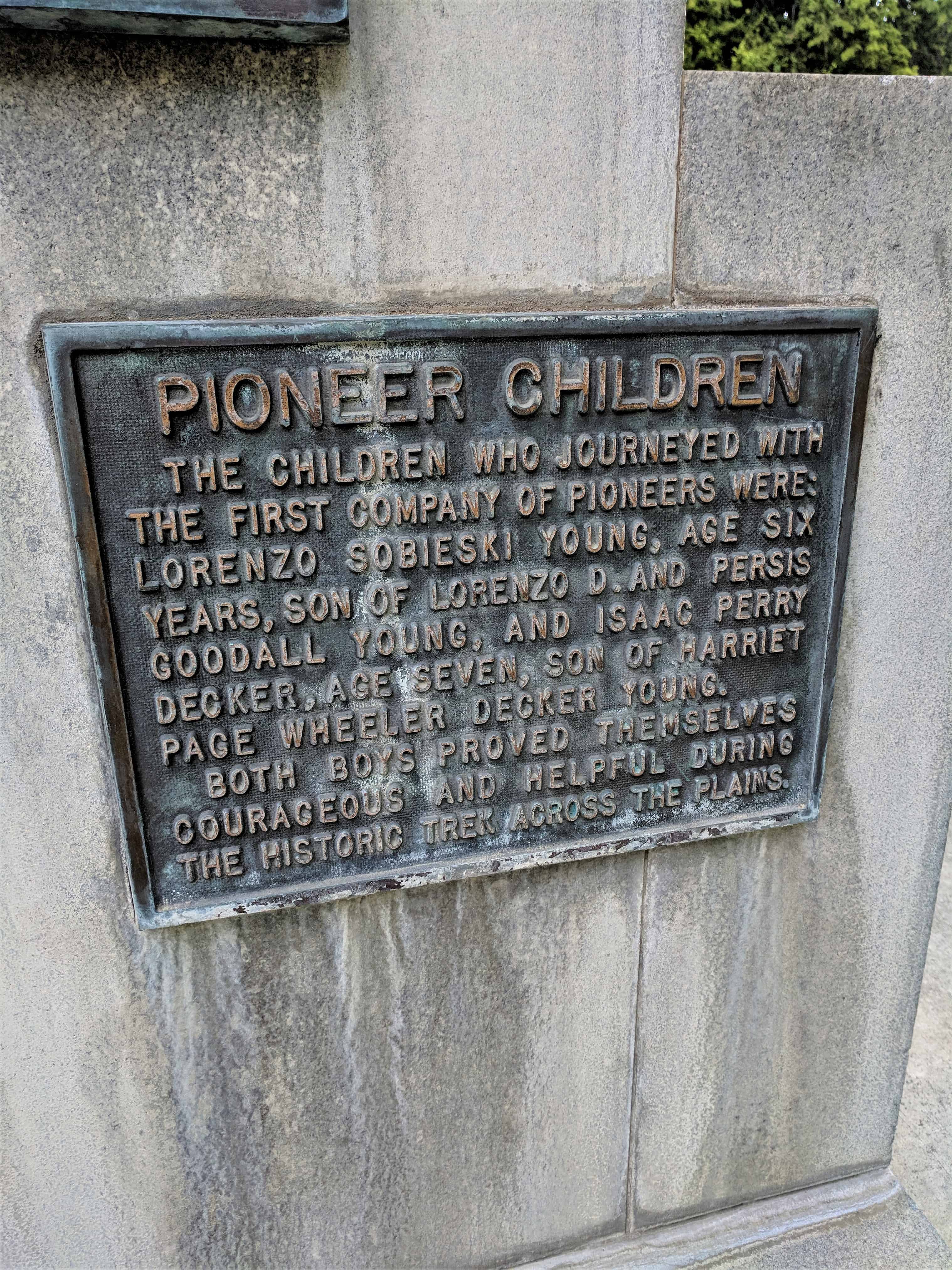
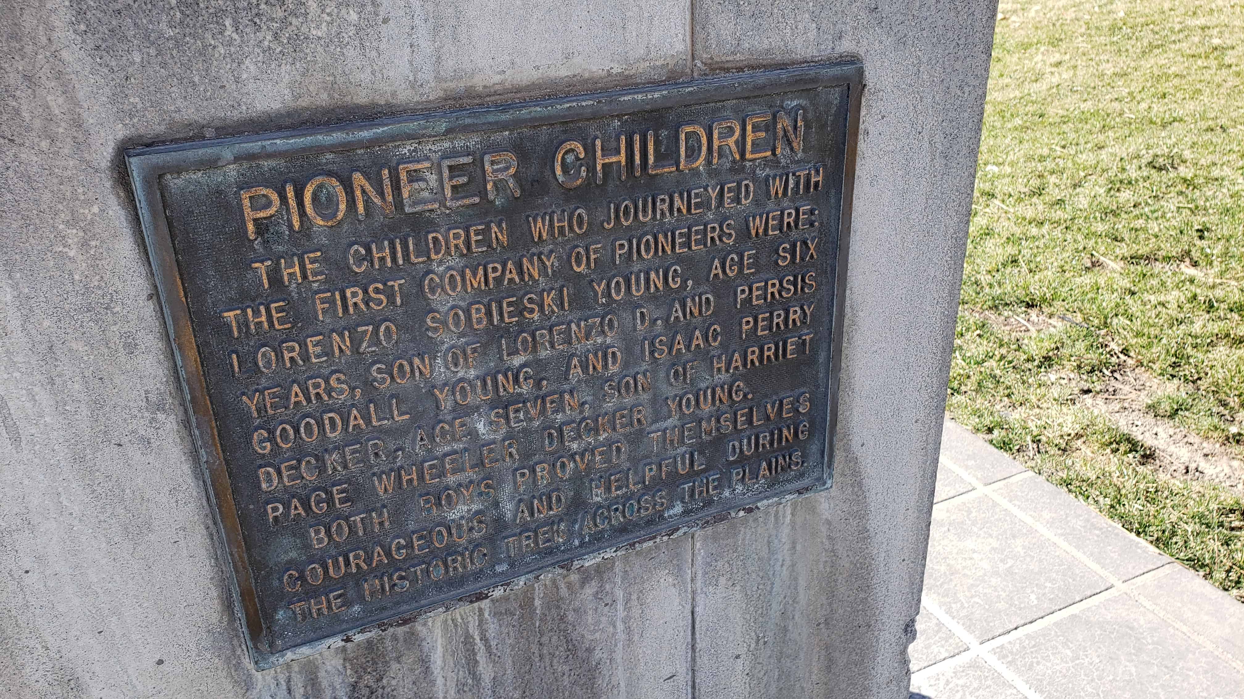
Pioneer Children
The first children who journeyed with the first company of pioneers were: Lorenzo Sobieski Young, age six years, son of Lorenzo D. and Persis Goodall Young, and Isaac Perry Decker, age seven, son of Harriet Page Decker Young. Both boys proved themselves courageous and helpful during the historic trek across the plains.
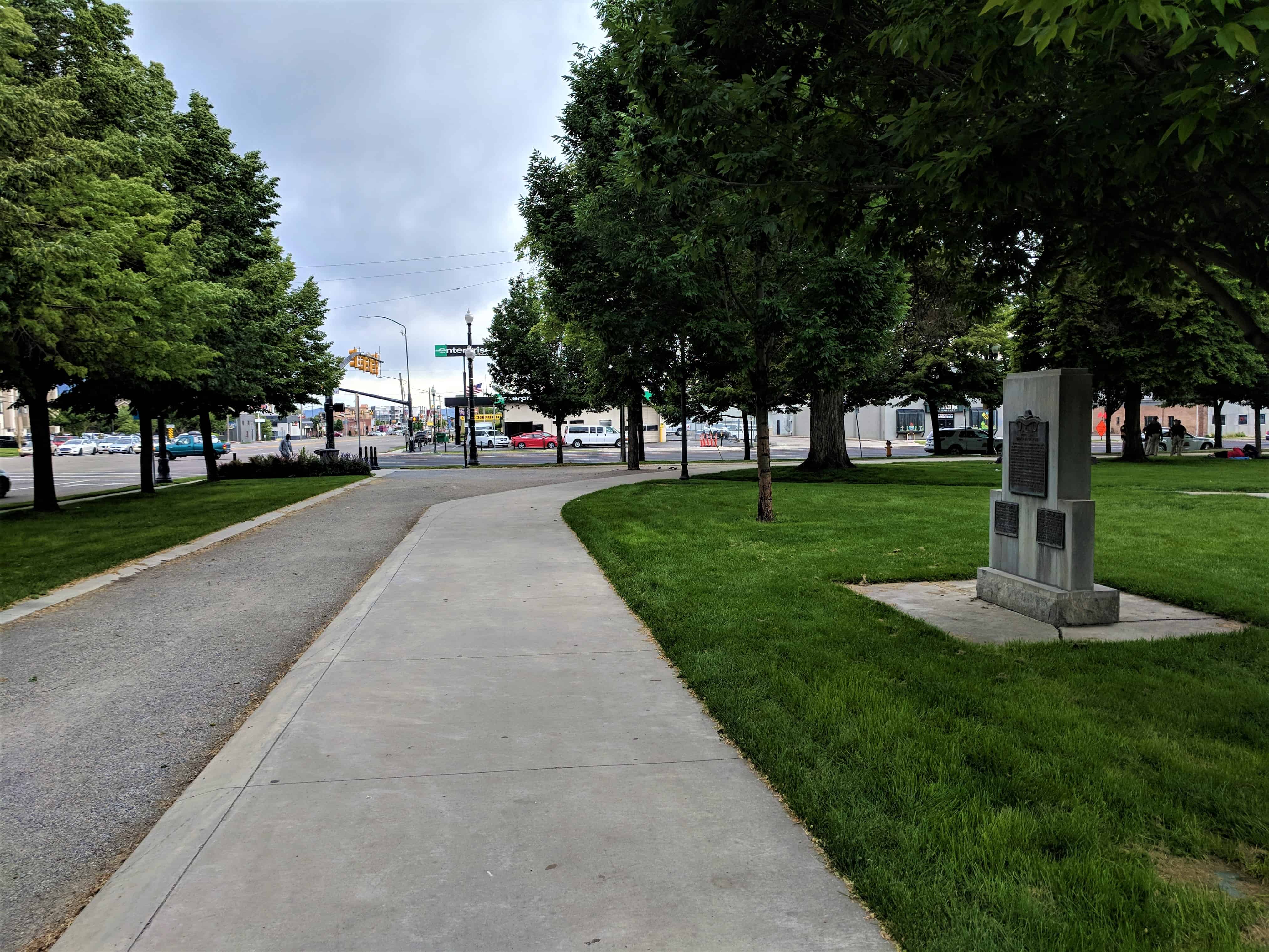
Located in Pioneer Park in Salt Lake City. See other D.U.P. Markers here.
From the National Register of Historic Places Nomination Form: (#74001938 added October 15, 1974.)
The Pioneer Fort site, presently known as Pioneer Park, is located between 3rd South and 4th South and Second West and Third West.
Construction began on the Fort on August 9, 1847 and by the first of September the walls were completed. The walls were seven feet high and three feet thick and built of adobes 18″ long x 6″ wide x 12″ thick.
On August 10, foundations for the first homes were laid. These homes were located along the east side of the fort. They were owned by the church leaders: Brigham Young, Heber C . Kimball, Wilford Woodruff, Willard Richards, George A. Smith, Amasa M. Lyman, Erastus Snow, and Lorenzo Dow Young. There was room for about 160 families in the fort.
The homes inside the fort were constructed of both logs and adobes. The roofs slanted inward and were made rather flat. In August 1847 everything indicated that the Mormons had located in a dry climate. But in the early spring the rains were heavy, resulting in a great inconvenience for the inhabitants. It was often necessary to protect the women with umbrellas while cooking and both women and children while sleeping in bed.
The homes were also plagued by mice. One account says frequently fifty or sixty had to be caught before the family could sleep.
All the doors and windows faced to the inside with a loophole in each room facing the outside. Mrs. Clara Riches Young, wife of Lorenzo D. Young, said that her house had a wooden window “which thro’ the day was taken out for light and nailed in at night.”
Tents and wagon boxes were used for habitation until something more comfortable could be provided.
A week after the arrival of the first Mormon emigrant group to the Salt Lake Valley, a general assembly was called in which it was voted to unite the various camps into one location and construct a corral, houses, and a fort for protection against the Indians . On August 9 , 1847 seventy-six volunteers commenced work by gathering logs and making adobes for the walls.
The fort was an important part of early Mormon activity in the Great Basin. It was the home of the Mormon pioneers until they began to move to their town lots in 1848 and 1849.
It was in this fort that a meeting was held December 9, 1848 in the home of Heber C. Kimball, to organize the provincial State of Deseret. The first elections were held in an adobe school constructed inside the fort.
With the arrival of the larger emigrant groups of 1847, it was necessary to build another fort on two blocks south of the first fort. This second fort became known as the South Fort. On the block north of the original fort some houses were constructed and this became known as the North Fort.
Following its initial use, the Pioneer Fort site was utilized as one of the camping sites for newly arrived emigrants to Utah. After 1890 it was used as a playground and on July 24, 1898 the location was officially dedicated as Pioneer Park.
Although there is nothing left of the fort, the site remains as an important landmark in..the-colonization of the Great Basin.
In 1882, on this site, a Relief Society building was erected under the leadership of Elizabeth J. Stickney, President. It was a one room structure, 20 x 30 feet in size, built of red clay brick made by Joseph Chatwin. The interior was furnished with homemade carpet, a pot belly stove, chairs and benches made of native lumber, an organ and a small table. At one end was a stage with curtains. July 10, 1942, the building was sold to the city for a public library and was later known as the civic center. It toppled to the ground in May, 1963. This old fort and school bell served the community until 1917. It rang for school, alarms, and special events.