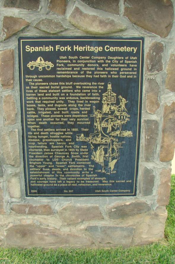
Utah South Company Daughters of Utah Pioneers, in conjunction with the City of Spanish Fork, community donors, and volunteers have reclaimed and restored this hallowed ground in remembrance of the pioneers who persevered through uncommon hardships because they had faith in their God and in their cause.
The pioneers chose this bluff overlooking the river as their sacred burial ground. We reverence the lives of these stalwart settlers who came into a barren land and built on a foundation of faith. Settling a community was arduous, backbreaking work that required unity. They lived in wagon boxes, tents, and dugouts along the river bank. They plowed, sowed crops, herded cattle, irrigated, and built roads and bridges. These pioneers were dependent upon one another for their very survival. When death occurred, they mourned together.
The first settlers arrived in 1850. Their life and death struggles while facing hunger, hostile natives, disease, grasshoppers, and crop failure are heroic and heartrending. Spanish Fork City was chartered, then surveyed in 1855 by Stake President James Chauncey Snow under the direction of George A. Smith, first counselor to LDS Church President Brigham Young. Spanish Fork combined the “upper” and “lower” settlements. The settlers’ lives, deeds, and devotion to the establishment of this community write a powerful chapter in the chronicles of Spanish Fork’s early history. Their valiant examples of strength and courage have left a legacy to be treasured. May this sacred and hallowed ground be a place of rest, reflection, and reverence.
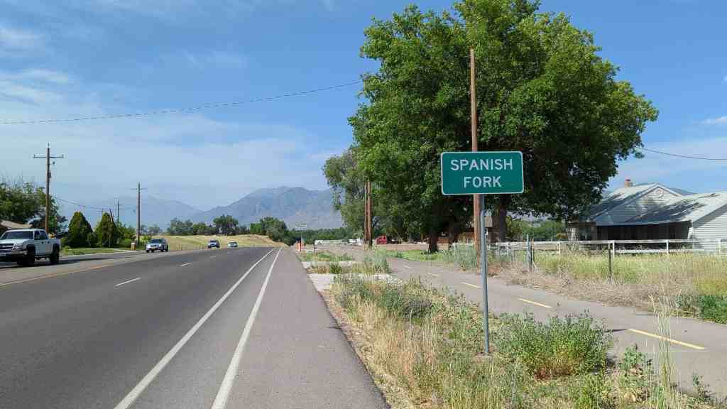
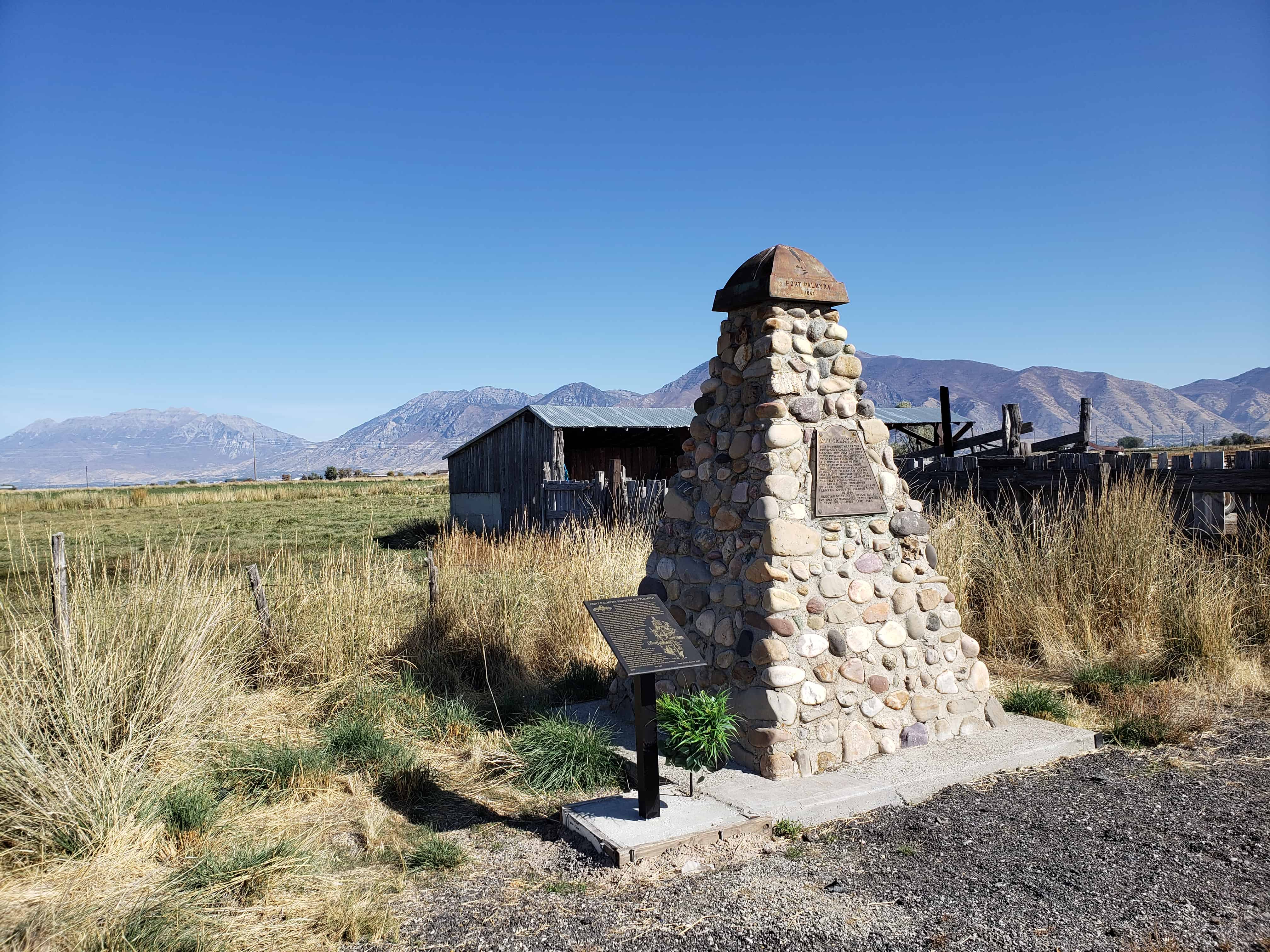
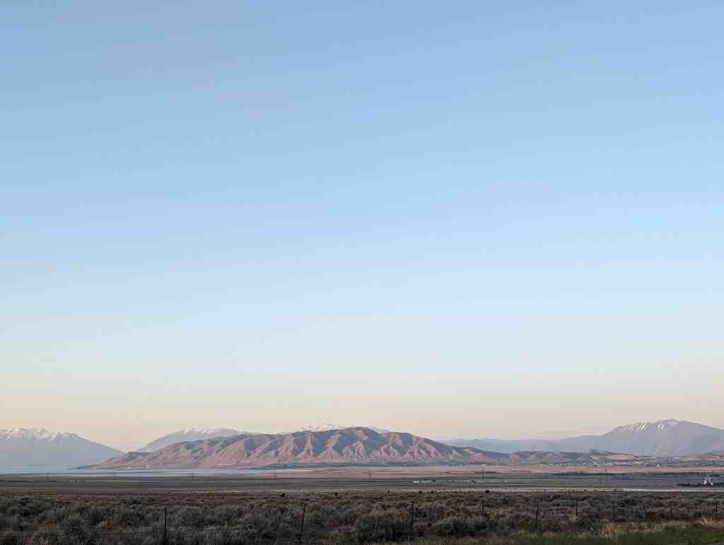
Spanish Fork is eight miles south of Provo on I-15 and the Spanish Fork River. Spanish Fork was an out-growth of Palmyra, Located to the northwest. As the community developed, Palmyra diminished and eventually became a suburb of Spanish Fork. In the early days, both settlements existed with one fort, Fort St. Luke. Spanish Fork received its name from the adjacent river, which was named by the 1776 Dominguez-Escalante expeditions.
Palmyra was founded in 1852 on the banks of the Spanish Fork River. The town soon became absorbed into the city of Spanish Fork. Present-day Palmyra is a later out-growth of Spanish Fork. Both Palmyra’s were named for Palmyra, New York, a town prominent in early Mormon history.
Check out the old historic marker at the site of the old fort here.
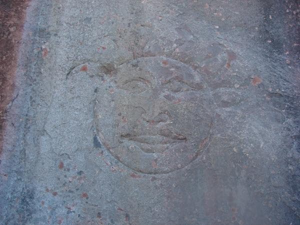
Up Diamond Fork Canyon there is a place to stop called Red Ledges, there are picnic tables, a restroom, an arch, a cool sun and moon carving in the cliff and a lot of fun hiking on red rock.
It’s fun to have a red rock playground like St George or Moab but so close to Utah Valley, we take the kids there and play.
There are often people rappelling down the cliffs too.
Up Diamond Fork Canyon (Off of Spanish Fork Canyon) you can go to Red Ledges and hike up into the red rock and see a sun and moon carved in the cliff. I’ve read books that claim the sun carving is a clue from the Spaniards to their old gold mines, I have heard that the moon appears to be more recent and not authentic.
My friend Russ Eager told me that he’s seen a sun carving across the canyon from this one, I’d love to go see it.
Either way it’s a pretty cool thing to see and red ledges is a fun place to play.
Spanish Fork was settled in 1857. The first flour mill was built by Archibald Gardner in 1858-59. The water for the mill came from the Spanish Fork River. The stream was enlarged to give sufficient power to run the mill. This mill was constructed of rough lumber.
The grinding was accomplished by large round granite stone burrs about four feet in diameter and two feet thick. These stones had grooves running across them; the lower stones remained stationary while the upper one rotated. The wheat came to the center of the burrs through a wooden chute. The husks of the kernels of wheat, when separated, were called bran; the next finer are the shorts; and the finest made of flour. The burrs frequently had to be dressed to keep them in good operating condition. Gardner sold the mill to the Spanish Fork Co-op in 1874. Shortly after it was torn down, it was replaced by a larger, two-story building with more advanced equipment.
This mill was built of shiplap lumber with gables facing north and south. The flumes carried water to the mill wheel, with a fall of twenty feet. Flour was made in the mill for fourteen years until April 15, 1888, when it burned to the ground, probably from spontaneous combustion. Within a short time, a four-story brick building was started at a cost of $40,000. New machinery was installed, and large steel rollers replaced stone burrs. The new mill burned in December 1927. It was never rebuilt. Today nothing remains of the once busy whirring mill.
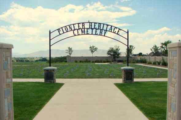
This is Daughters of Utah Pioneers historic marker #526, located at 200 East River Bottom Road in Spanish Fork, Utah.
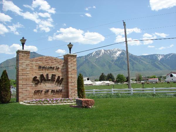
Salem, Utah is in Utah County between Payson and Spanish Fork, also near Elk Ridge and Woodland Hills.
The following is from pondtown.org:
Known as “Summer Spring” by the Indians, and “Pond Town” by early settlers, Salem, in Utah County, was finally named after the birthplace of Lyman Curtis to honor his contributions to the community.
The Indians appreciated the fact that the local springs bubbled up through sandy soil in a tree-shaded hollow, even in summer. In the spring of 1851 David Fairbanks and David Crockett discovered this same precious asset. Fairbanks had been assigned to Peteetneet Creek (Payson), where he was to become LDS bishop of the town. The two men continued to explore the area and found a large, clear stream flowing through a hollow. They realized that by damning the stream they could conserve the water that flowed out into swamplands. They soon moved their families and built the first dam, assisted by others from Payson who needed additional farmland. Some crops were harvested that year.
Winter and the threat of hostile Indians caused the families to return to Peteetneet, but “Pond Town” had a beginning with the dammed springs. In 1852 the two founders built a second and more secure dam, but by the next year the families had moved to Peteetneet and the new settlement was abandoned.
Settlers from nearby Palmyra, fighting drought and alkali salts in the soil, decided to start over at the abandoned Pond Town. George Wilson and his brothers purchased the Fairbanks-Crockett interest and they, along with eight other families, moved to the area in 1856. During that same year, Lyman Curtis, one of the original company of pioneers to enter Salt Lake Valley, joined in the new development with four of his sons.
In the next few years two more dams and an irrigation system were developed. Homes were built adjoining one another for protection against Indian attacks. The homes were constructed of adobe brick and lumber from nearby canyons. The fort homes were used until 1870 when the Indian danger had been reduced. Settlers began moving into the town, which was laid out in five-acre blocks. As was common throughout Utah, homes and barns were built inside the town, with fields and grazing area outside. Boys herded cattle on “common grounds.”
The completion of the Salem Canal in 1869 brought irrigation water from the Spanish Fork River to Salem. Lyman Curtis, who had experience with irrigation in Santa Clara, directed the project to completion. The canal was eight miles long and took two and one-half years to build. Additional water was brought to the area by the Strawberry Valley Irrigation Project, completed in 1916.
Popular crops were wheat and other grains, as well as tomatoes and peas for the Del Monte food-processing plant, located between Salem and Spanish Fork. Beginning in 1891, sugar beets were grown extensively for the factories throughout Utah Valley. A “beet vacation” allowed boys out of school to assist in harvesting. Many farmers specialized in growing garden produce or in raising poultry. Local ranchers had grazing rights and permits in the nearby national forests, in Strawberry Valley, and in privately owned property in Loafer Canyon.
In the nineteenth century blacksmithing was a much needed service, and there also were immigrants skilled in masonry, milling, and cobblery. Sawmills and shingle mills, molasses producing factories, creameries, and confectioneries have supported families and provided for community needs.
The LDS Church started a co-op in Salem in the late 1860s; it operated largely on the barter system until it was discontinued in 1897. Several small stores were operated for short periods of time. In 1908 the Salem Mercantile Company was started by the James Peter Christensen family, which operated it until 1969. For many years the “Merc” used the barter system and issued scrip. In 1946 Melvin R. Hanks started another grocery business on Main Street. Later continued by two sons, this family business also thrived. There were a number of service stations along U.S. Highway 91, and a motel. Through the years the town also had a drugstore, barber shop, and a saloon. A few businesses are still clustered along the highway.
The LDS Provo Stake served Pond Town’s religious needs until Salem Ward was created in 1877. A red brick church was completed in 1898, remodeled in 1938, and replaced in 1972. The one ward was divided in 1956, and currently there are two local LDS stakes.
Education was always important to the settlers, and parents made arrangements for their children to be taught, first in homes and then in a log schoolroom. Several small buildings were used for school, church, and public meetings until the church meetinghouse was built in 1898; it was followed by a new brick school built in 1907.
The “Dream Mine” of John Hyrum Koyle, as well as the pond, became synonymous with Salem. Koyle dreamed of a rich ore mine on the hillside and set out to bring his dream to fruition. Selling shares in the venture, Koyle was able to have a deep shaft dug, but ore was never found.
Salem was incorporated as a town in 1886, and fourteen presidents and boards of trustees served until 1920, at which time the first mayor began his term in office.
Throughout its history, the citizens of Salem have been hardworking, neighborly, and flexible, adapting to the changes time has required of them.
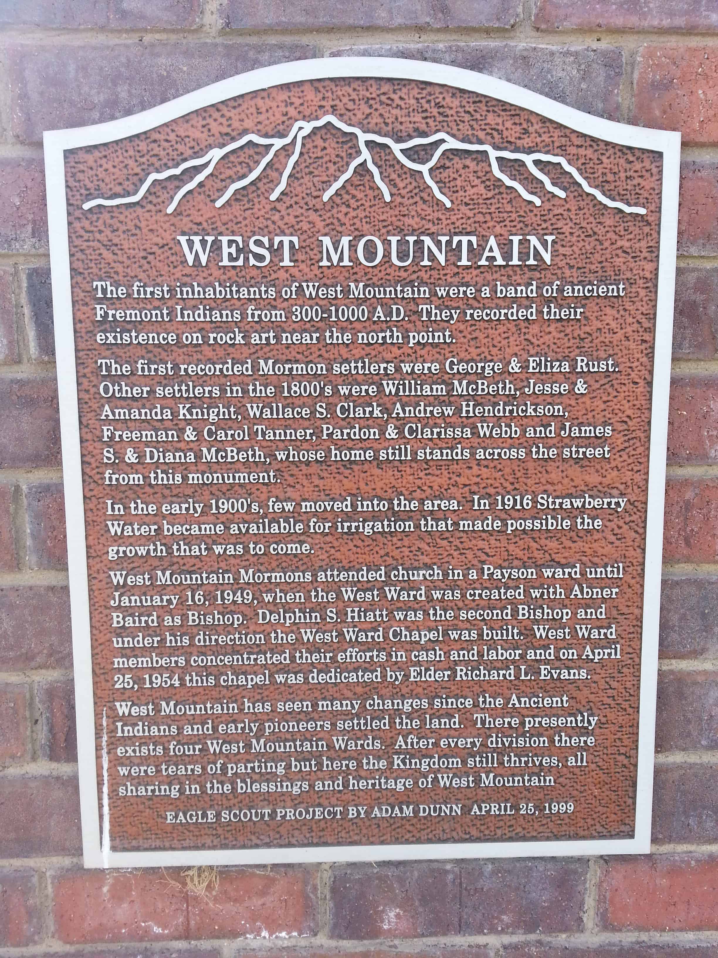
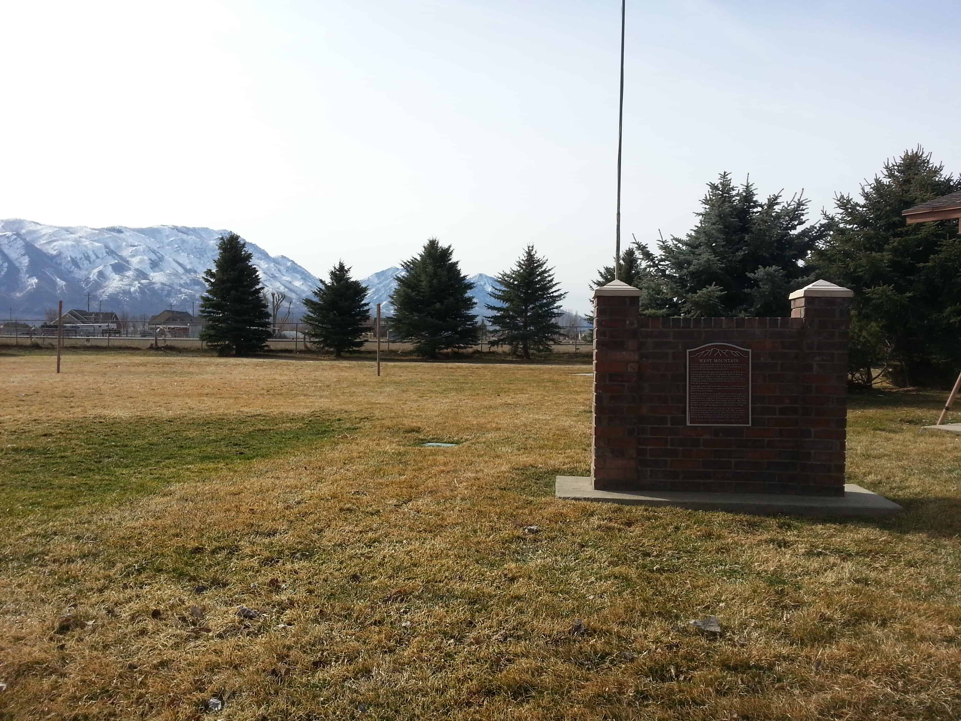
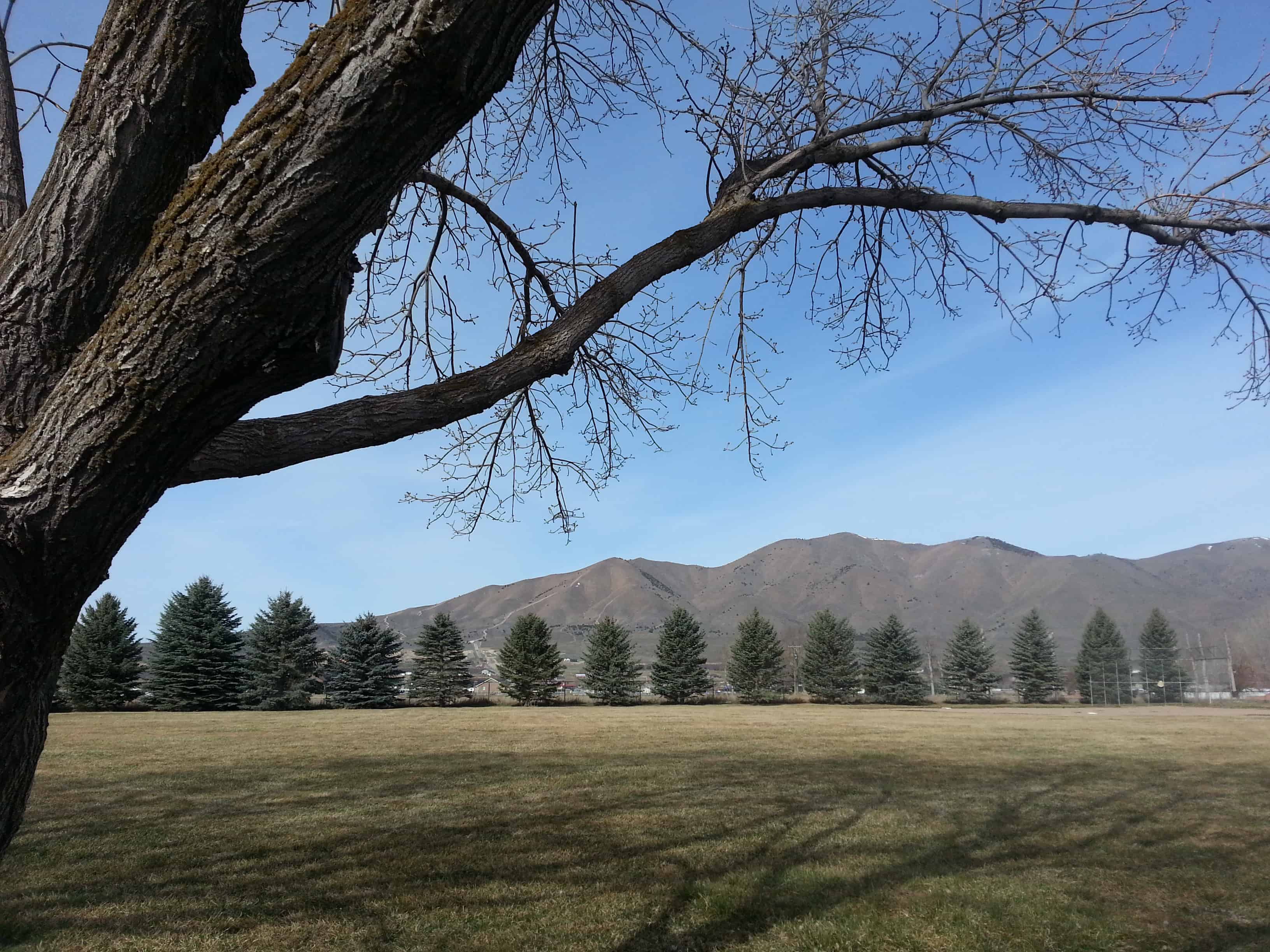
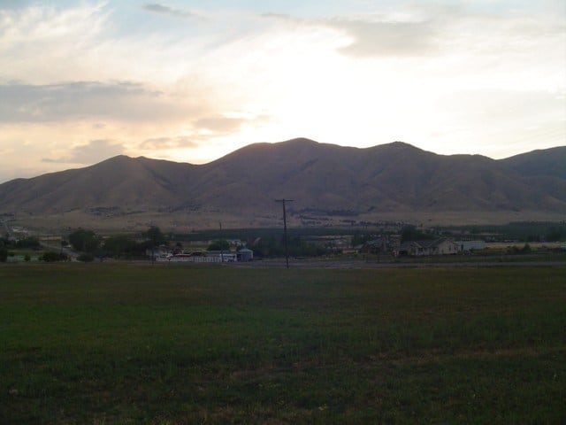
A small town at the base of West Mountain and named for it, West Mountain, Utah is just west of Payson and Benjamin.
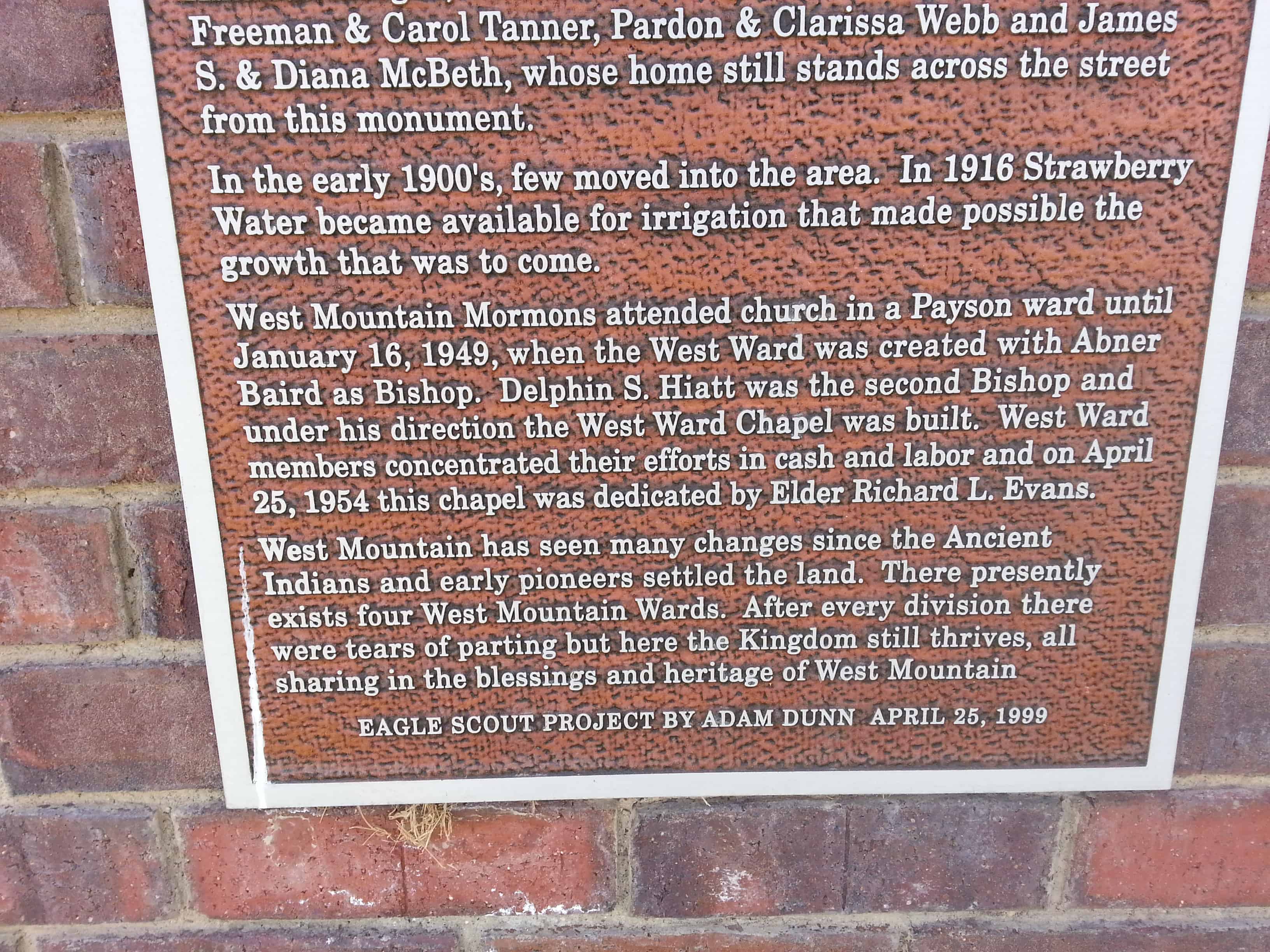
A monument at the chapel in West Mountain reads: The first inhabitants of West Mountain were a band of ancient Fremont Indians from 300-1000 A.D. They recorded their existence on rock art near the north point.
The first recorded Mormon settlers were George and Eliza Rust. Other settlers in the 1800′s were William McBeth, Jesse and Amanda Knight, Wallace S. Clark, Andrew Hendrickson, Freeman and Carol Tanner, Pardon and Clarissa Webb and James S. and Diana McBeth, whose home still stands across the street from this monument.
In the early 1900′s, few moved into the area. In 1916 Strawberry Water became available for irrigation that made possible the growth that was to come.
West Mountain Mormons attended church in a Payson ward until January 16, 1949, when the West Ward was created with Abner Baird as Bishop. Dephin S. Hiatt was the second Bishop and under his direction the West Ward Chapel was built. West Ward members concentrated their efforts in cash and labor and on April 25, 1954 this chapel was dedicated by Elder Richard L. Evans.
West Mountain has seen many changes since the Ancient Indians and early pioneers settled the land. There presently exists four West Mountain Wards. After every division there were tears of parting but here the Kingdom still thrives, all sharing in the blessings and heritage of West Mountain.
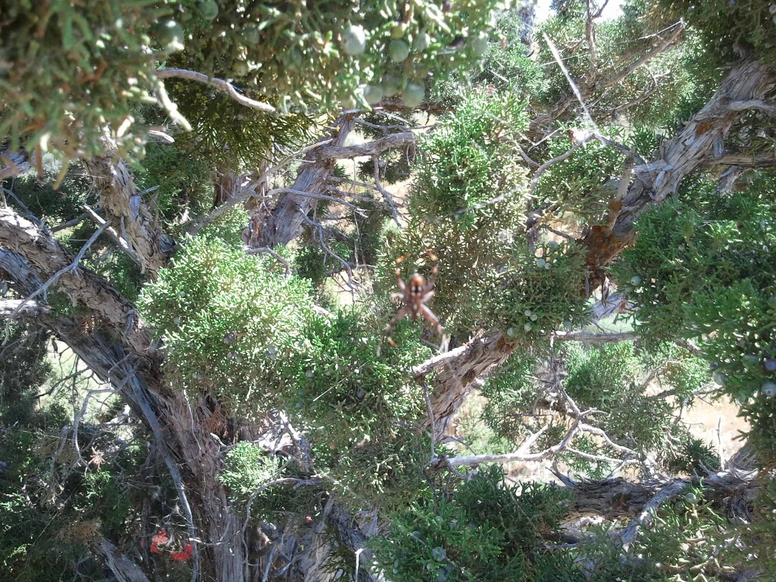
There are plenty of geocaches up there to keep you entertained, but be careful what time of year you go if you’re going to hike around at all because we call it spider mountain for a good reason, every bush, tree or rock has a spider on it, some bushes have hundreds. That was in July.
There’s a fun road that takes you up to the top, it’s a dirt road but it’s graded and you can take pretty much anything up there.