James W. & Estella Walker Gillman House (297 West 1600 North)
James W. & Estella Walker Gillman House
The James W. and Estella Walker Gillman house, built ca. 1909, is a single-story, brick central-block-with-projecting-bay house located on the south side of 1600 North in Orem. The central section has a pyramidal roof with a gabled projecting bay to the north. Victorian Eclectic styling elements can be seen in the segmental arch window heads composed of two rows of header bricks over all of the windows. James W. Gillman built the house in 1909, following his marriage the previous year to Estella Walker in Salt Lake City. James W. was a leader in civic affairs as well as of his church. He served as mayor of Orem for nineteen years and also as County Commissioner. During his years as mayor street signs and lights were installed along State Street, and sources of culinary water were established for the city. He was also president for many years of the Provo Reservoir Company.
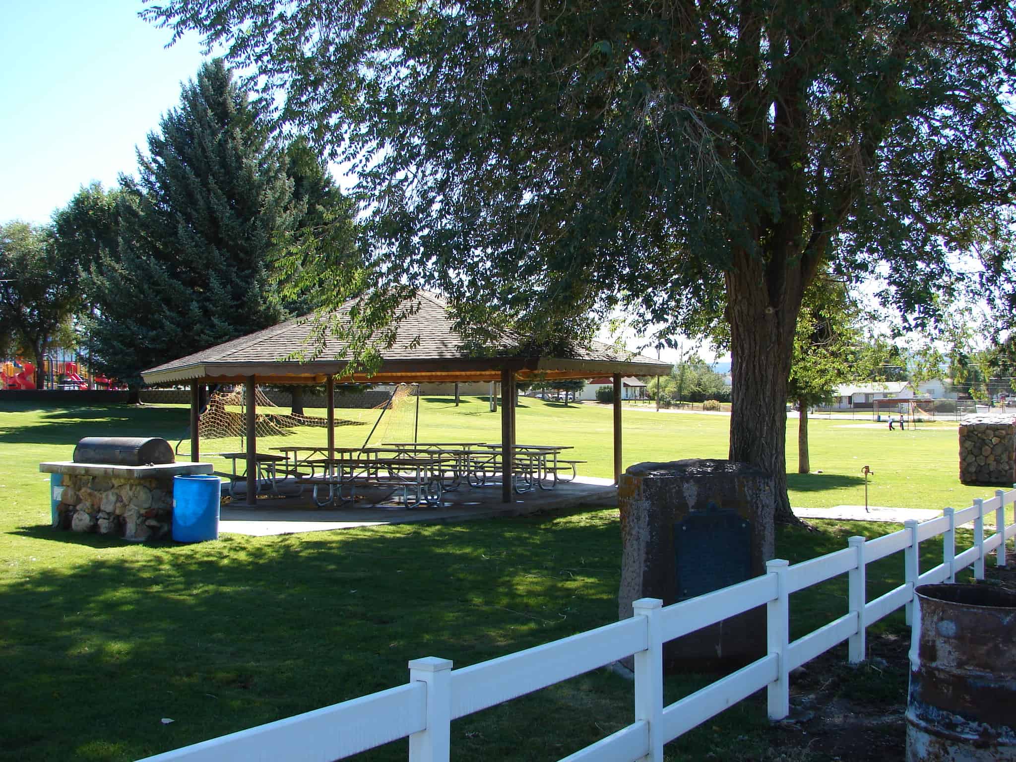
In July 1859 under the leadership of John Bair (Interpreter and Guide), sixteen families settled here. They built log cabins and dugouts between City Creek and Brower Springs. The following spring, other families arrived and a permanent fort was built for protection against Indians. The Fort consisted of two rows of houses running east and west, facing each other, with corrals and sheds for livestock back of the homes. This monument, built in honor of the Pioneers of 1859 and 1860, marks the southwest corner of the fort which ran 3000 feet east by 465 feet north.
John Y. & Chastina H. Walker House (1938 North 400 West)
John Y. & Chastina H. Walker House
The John Y. and Chastina H. Walker house is a small rectangular, one-story brick Victorian Eclectic house with a gabled roof running east/west. Its original red brick walls are covered in stucco. In 1893, John Y. Walker bought 20 acres of land and built the house around 1900. John was appointed to fill his bother’s unexpired term as county commissioner. He served as county commissioner and was a prominent local citizen. This property remained in the Walker family until it was sold in 1940. Additions were made to the house in the early 1940s and the 1950s.
This sign, located in Payson says: “You are a fool for fighting your best friends, for we are the best and the only friends that you have in the world” wrote Brigham Young to the Ute Indian Chief Walkara in 1853, after the latter had engaged the settlers of Utah in their first major Indian war. Angered because the whites had put an end to the Indian slave trade in the territory and had encroached upon their lands, the redmen found a pretext for beginning hostilities at Springville, July 17, 1853, when an Indian, while beating his squaw, was killed by a white man. The following day Alexander Keele, a guard at Payson, was shot by Indians and the war was on. The policy of the white defenders was one of vigilant watch and limited offensive warfare. However, before Governor Brigham Young led a peace mission into Walkara’s camp in May 1854 that ended the conflict, 20 whites had been killed including the U.S. Government surveyor Captain John W. Gunnison, who was massacred with 7 of his men near the present site of Hinckley, Utah.
Marlin H. & Brenda J. Siebach House (987 West 1600 North)
Marlin H. & Brenda J. Siebach House
The Marlin H. and Brenda J. Siebach house (not the original owners), built in ca. 1917, is a Vernacular Arts and Crafts brick front-gabled single story bungalow located on the south side of 1600 North. The bungalow was the most popular house type in Utah in the first quarter of the twentieth century. The Vernacular Arts and Crafts style elements can be seen in the exposed framing members as well as the color and texture of the cladding. In 1979, the Siebachs bought the house and moved it to this site from its previous location. The house was originally located at 1600 North and State Street in Orem.
On this site in 1865-66 a tabernacle was erected by the Pioneers. Built of local brick, lumber and stone. It was of pioneer architecture with a large assembly hall, gallery, full basement, a tower and large bell. This building was used for church and public gatherings. Later a church school was conducted in the basement. After 76 years of service it was torn down and on this historic spot now stands the home of Daughters of Utah Pioneers.
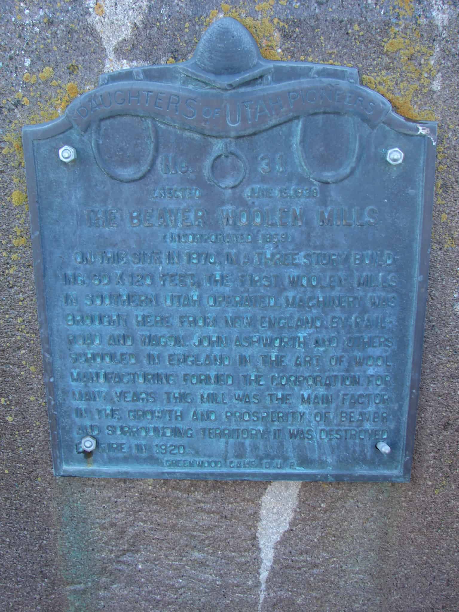
(Incorporated 1869) On this site in 1870, in a three story building, 60 x 120 feet, the first Woolen Mills in Southern Utah operated. Machinery was brought here from New England by railroad and wagon. John Ashworth and others schooled in England in the art of wool manufacturing formed the corporation. For many years this mill was the main factor in the growth and prosperity of Beaver and surrounding territory. It was destroyed by fire in 1920.
Miles Goodyear, the first European-American settler to the Ogden area, built Fort Buenaventura as a fur trading post in 1845. The Mormons arrived in Utah in 1847 and immediately began establishing settlements in promising locations, including Ogden. The general conference of the Church of Jesus Christ of Latter-day Saints (Mormon or LDS church) voted in 1850 to create a permanent city on the site, naming it Ogden after Peter Skene Ogden, a fur trapper who had been in the Ogden Valley in 1825.
The city was laid out in a formal grid pattern typical of Mormon communities in Utah. Although Ogden was to remain a predominantly agricultural community, settlers were encouraged to build houses on the city lots along with permanent public buildings. Lorin Farr was Ogden’s ecclesiastical leader and first mayor. The population in Ogden grew slowly from about 1,100 in 1850 to about 1,500 in 1860.
The Union Pacific Railroad Company built a railroad through Ogden in 1869 as part of the first transcontinental railroad, which was completed in 1869 at Promontory, approximately 30 miles west of Ogden. Once the Union Pacific and Central Pacific railroads joined, Ogden was chosen as the ideal intersection for east-west railroads. Although Corrine, north of Ogden, was a better site geographically for the junction of the north-south lines, Ogden was chosen due to political and financial maneuvering by the LDS church. By 1878, Ogden was recognized as the “Junction City” of the intermountain west, with most passengers and freight traveling through the area stopping there.
Despite common belief, the railroad did not immediately change Ogden’s landscape and population. Even by 1876, seven years after the coming of the railroad, Ogden was still a small-scale town of primarily frame buildings. Ogden began to expand rapidly in the late 1880s and early 1890s; most of this expansion was due to the railroads which had both freight and passenger lines. The population grew from about 3,127 in 1870 to 6,069 in 1880, and soared to 12,889 by 1890.
With the increased railroad activity, due to Ogden’s status as a regional transportation hub, came non Mormons (“gentiles” as they were called). This influx changed Ogden forever by bringing a diversity of religious and political beliefs. Ogden was fought over politically by Mormon and gentile groups such as the People’s party and the Liberal party. By 1889, as a result of a growing non-Mormon population and political disenfranchisement of polygamous Mormons , the anti-Mormon Liberal party took control of Ogden’s municipal government by winning every city office. One visible change made by this new government was the renaming of the north-south street for U.S. presidents, Jefferson Avenue among them. Many members of the controlling body that made up Ogden’s local government over the years lived in the Jefferson Avenue District.
In addition to all of the political changes occurring during this time period, Ogden’s means of financial growth was changing. Due to the railroad, Ogden was no longer a small agricultural community, “inland town,” but a major city of commerce and trade to outside areas.5 By 1889 there were such industries as woolen mills, a broom factory, a vinegar works, an iron works, and three breweries. Many of these businesses, such as flour milling began as pioneer industries. By 1900, many local flour mills were consolidated with David Eccles’ Ogden Milling Company which used wheat that came from local farmers. Lumberyards and sawmills also added to Ogden’s growth. Again, David Eccles was involved, with his Eccles Lumber Company doing $100,000 in business annually by 1888. Ogden’s canning and sugar industries also began during this period, and of course, with all of the railroad traffic, there was a need for hotels of which Ogden provided many.
As businesses expanded, so did the rest of the city’s functions and services. Telephones were added, the telegraph system was expanded, a hospital was established, roads were paved, sidewalks installed, and electricity provided. Permanent schools and churches were also built.
Ogden’s total population in 1910 was 25,580. Approximately 3,900 people worked for the railroads in 1915. By participating in railroad related industries, many of Ogden’ s leading entrepreneurs became wealthy. Many average workers also earned their living working in the same businesses. For example, sugar companies employed about 1,500 people, and mercantile houses employed about 1,100 workers. Much of Ogden’s wealth also resulted from the livestock industry. Ogden’s railroad business surged during World War I and continued its prosperity and growth in the 1920s. The agriculture industry, however, did not fare so well. Like the rest of the country, Ogden was hit hard by the Great Depression of the 1930s. During this time, passenger and freighting business declined and many of Ogden’s major industries suffered or went out of business completely. In general, railroad workers with seniority continued working during the Depression, but part-time workers often lost their jobs.
Today, Ogden remains a relatively healthy and prosperous city, but its condition has little to do with the railroad. Many of the old railroad tracks and structures such as roundhouses, have been destroyed.
(Information from Wikipedia) Brigham City is a city in Box Elder County, Utah. The population was 17,899 at the 2010 census. It is the county seat of Box Elder County. It lies on the western slope of the Wellsville Mountains, a branch of the Wasatch Range at the western terminus of Box Elder Canyon. Brigham City saw most of its growth during the 1950s and 1960s, but has seen a struggling economy and stagnating growth since then. It is near the headquarters of ATK Thiokol, the company that created the solid rocket boosters for the Space Shuttle.
Brigham City is known for its peaches and holds an annual celebration called Peach Days on the weekend after Labor Day. Much of Main Street is closed off to cars and the festival is celebrated by a parade, a car show, a carnival, and other activities. The The Church of Jesus Christ of Latter-day Saints (LDS Church) recently completed building a temple in downtown, which is the 14th in Utah.
Mormon pioneer William Davis first explored the Brigham City area in 1850. He returned with his family and others a year later to create permanent homes. Brigham Young directed Lorenzo Snow to create a self-sufficient city at the site in 1853. Snow directed both religious and political affairs in the settlement, eventually naming it Box Elder in 1855. Brigham Young gave his last public sermon there in 1877 shortly before his death and the name of the town was changed to Brigham City after the church president. In 1864, the cooperative movement began in earnest with the creation of a mercantile co-op store and was an important element of the United Order of Enoch. Other industries were added, and the Brigham City Co-op is widely recognized as the most successful of the Mormon Co-op ventures. Economic hardships brought an end to the Co-op in 1895, though the Co-op had first started selling businesses off in 1876.
World War II brought a major economic boost to the city. The federal government created Bushnell General Hospital on Brigham City’s south side to treat soldiers wounded in the war. Locals sold supplies and food to the hospital while hospital staff patronized local businesses. After the war, the hospital’s buildings were used as Intermountain Indian School. Many young Native Americans attended the boarding school until it closed in 1984, although the Intermountain “I” on the mountain is still visible in tandem with Box Elder High School’s “B”. The facility has left its mark in a number of other ways, with most of the buildings still standing. Some have been converted into businesses and condos, while others remain empty.