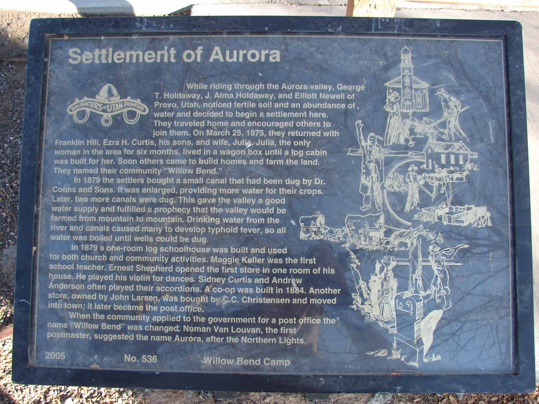
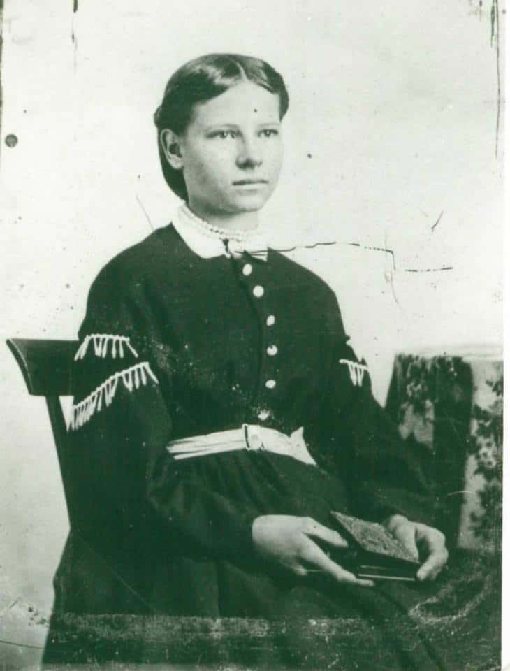
While riding through the Aurora valley, George T. Holdaway, J. Alma Holdaway and Elliott Newell of Provo, Utah, noticed fertile soil and an abundance of water and decided to begin a settlement here. They traveled home and encouraged others to join them. On March 25, 1875, they returned with Franklin Hill, Ezra H. Curtis, his sons, and wife, Julia. Julia, the only woman in the area for six months, lived in a wagon box until a log cabin was built for her. Soon others came to build homes and farm the land. They named their community “Willow Bend.”
In 1879 the settlers bought a small canal that had been dug by Dr. Coons and Sons. It was enlarged, providing more water for their crops. Later, two more canals were dug. The gave the valley a good water supply and fulfilled a prophecy that the valley would be farmed from mountain to mountain. Drinking water from the river and canals caused many to develop typhoid fever, so all water was boiled until wells could be dug.
In 1879 a one-room log schoolhouse was built and used for both church and community activities. Maggie Keller was the first school teacher. Ernest Shepherd opened the first store in one room of his house. He played his violin for dances. Sidney Curtis and Andrew Anderson often played their accordions. A co-op was built in 1884. Another store, owned by John Larsen, was bought by C.C. Christensen and moved into town; it later became the post office.
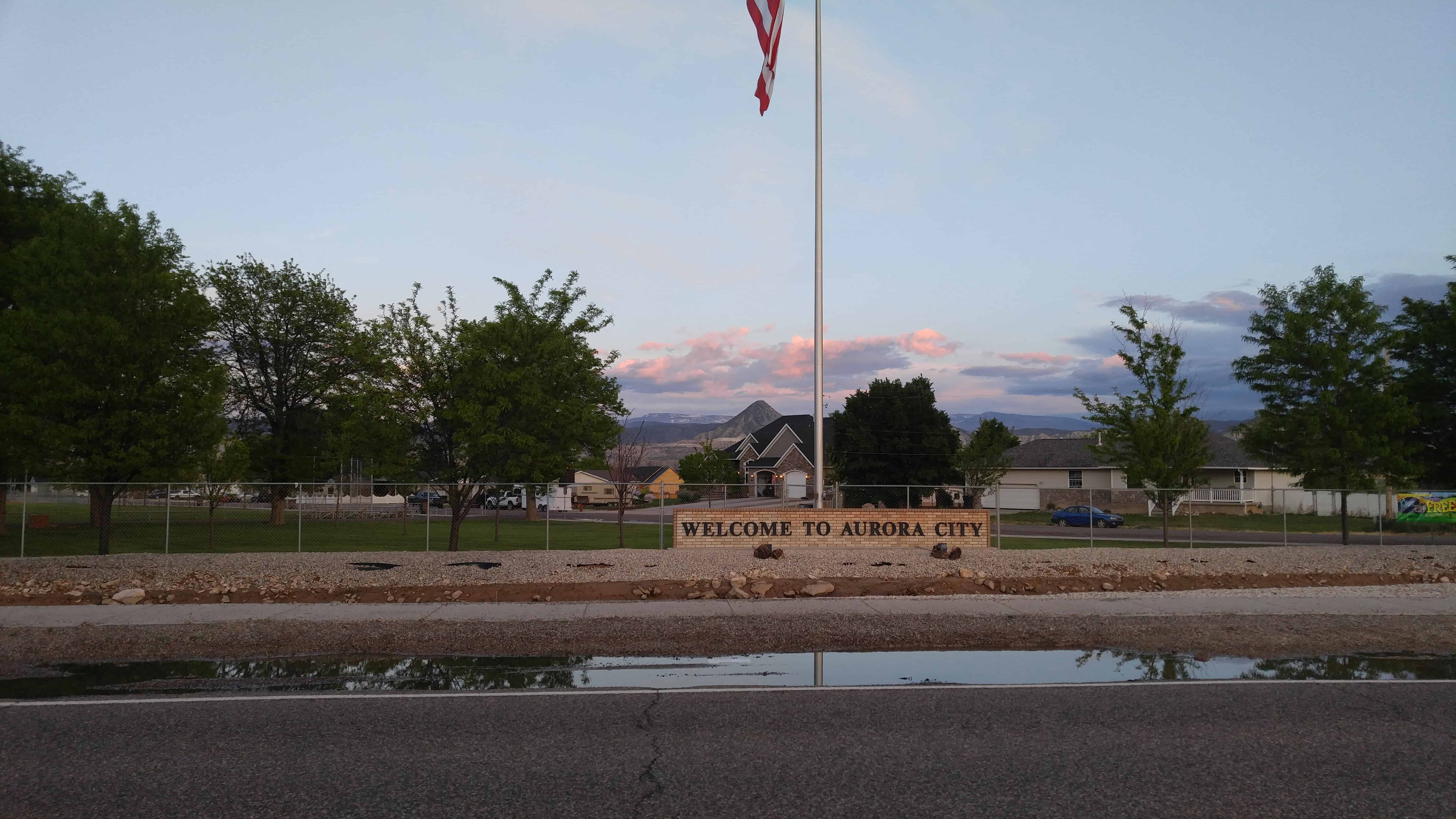
When the community applied to the government for a post office the name “Willow Bend” was changed, Numan Van Louvan, the first postmaster, suggested the name Aurora, after the Northern Lights.
Other markers placed by the Daughters of Utah Pioneers are found here: (Visit Link)
While riding through the Aurora valley, George T. Holdaway, J. Alma Holdaway and Elliott Newell of Provo, Utah, noticed fertile soil and an abundance of water and decided to begin a settlement here. They traveled home and encouraged others to join them. On March 25, 1875, they returned with Franklin Hill, Ezra H. Curtis, his sons, and wife, Julia. Julia, the only woman in the area for six months, lived in a wagon box until a log cabin was built for her. Soon others came to build homes and farm the land. They named their community “Willow Bend.”
In 1879 the settlers bought a small canal that had been dug by Dr. Coons and Sons. It was enlarged, providing more water for their crops. Later, two more canals were dug. The gave the valley a good water supply and fulfilled a prophecy that the valley would be farmed from mountain to mountain. Drinking water from the river and canals caused many to develop typhoid fever, so all water was boiled until wells could be dug.
In 1879 a one-room log schoolhouse was built and used for both church and community activities. Maggie Keller was the first school teacher. Ernest Shepherd opened the first store in one room of his house. He played his violin for dances. Sidney Curtis and Andrew Anderson often played their accordions. A co-op was built in 1884. Another store, owned by John Larsen, was bought by C.C. Christensen and moved into town; it later became the post office.
When the community applied to the government for a post office the name “Willow Bend” was changed, Numan Van Louvan, the first postmaster, suggested the name Aurora, after the Northern Lights.*
Samuel Nephi & Sarah Sixsmith Skinner House (106 West 1200 South)
The Samuel Nephi & Sarah Sixsmith Skinner house consists of the Vernacular Classical style brick hall parlor house and a series of additions to the north and west. Samuel N. Skinner patented the one hundred sixty acre quarter section of land in 1882 from the U.S. Government presumably containing the house that he built earlier. Samuel and Sarah were among the early settlers in Orem, moving to the Provo Bench in 1877-8 when this house was built. Classical styling is found in Utah houses from early pioneer times to 1890.
* As of May 2013, this is just an empty field, I’m unsure when it was demolished.
Carterville is an area of Orem, Utah. Carterville road is partly still in use and partly a walking trail now.
The area is named for the Carter family, a good friend of mine (Stacey Ailshie) is part of the carter family.
Sara Jane Clark Carter 1853-1936
Front: Amanda Williams Clark & Sara Jane Clark Carter Back: Amanda Carter Richins on the left and her daughter on the right: Hilda Richins later married William Aston.
Elizabeth Runnels Sweat Carter 1818-1881 first wife of John Harrison Carter
Erma Carter Pyne.
John Harrison Carter 1816-1896 born in Newry, Oxford, Maine. A blacksmith in Nauvoo
John Hirum Carter Obituary appeared on the front page of The Provo Post on April 6, 1917
John Hirum Carter 1847-1917
Sara Jane Clark Carter and John Hirum Carter
I heard that the area was once called Pleasant View before it was zoned into being part of Orem.
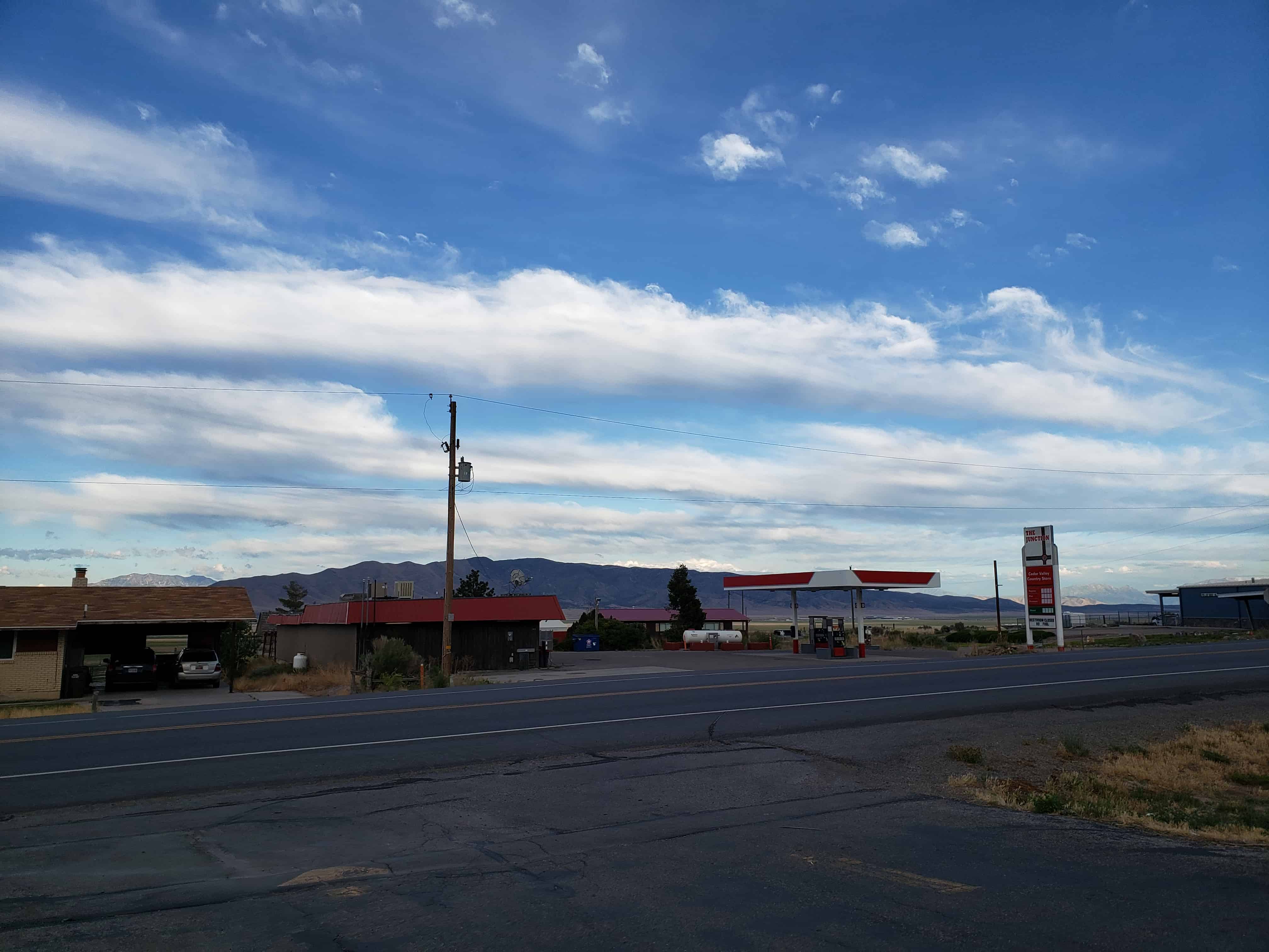
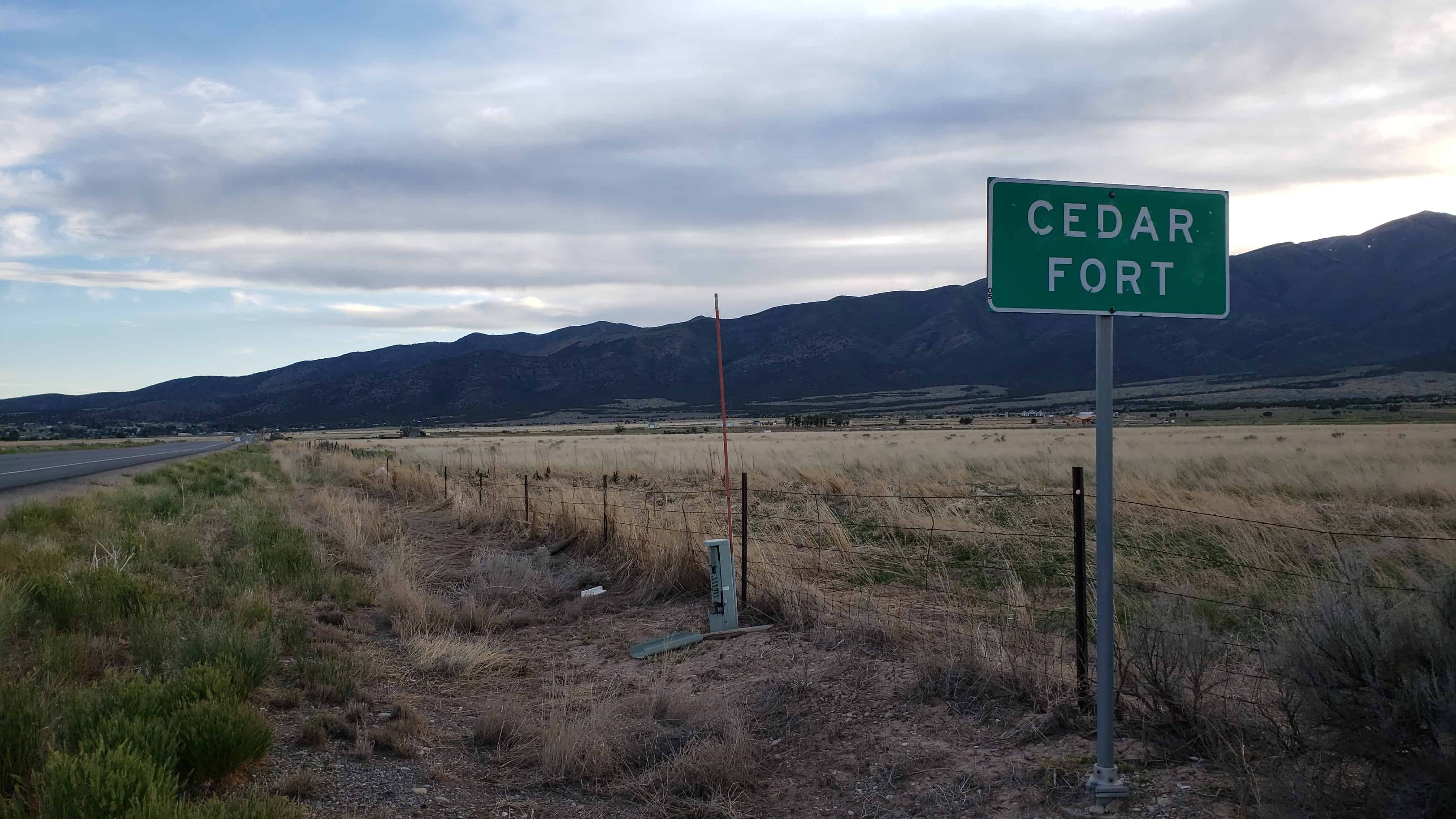
Cedar Fort, while home to only 392 people is the fourth largest city or town in Utah County as far as land size. It was incorporated in May 1965 and was previously the county seat of a Cedar Valley County.
Annie Wilcox and Bishop Allen Weeks were the first settlers of Cedar Fort.
Wilcox, who died as an infant as her parents made the difficult journey to Salt Lake Valley, was buried under a bush. Later that night, unable to sleep, her mother returned to the grave site to find Annie alive. Annie continued on to Utah with her family, who helped settle Cedar Fort. She grew up to become a midwife.
Bishop Allen Weeks’s children were killed by American Indians in the hills around Cedar Fort, yet when those same Indians came to his home wearing his children’s clothing and asking for food, he opened his door and welcomed them in.
This determination, drive and open-door generosity still flows through the veins in this little town where fewer than 400 residents live today, many of them being third, fourth and fifth generation to the original pioneers.(*)
Onlineutah states that “On January 5, 1856, by legislative act, the settlements of Cedar Valley were organized into a county with Cedar Fort as the county seat. The entire area was later absorbed into Utah County.”
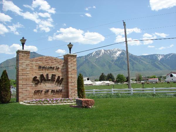
Salem, Utah is in Utah County between Payson and Spanish Fork, also near Elk Ridge and Woodland Hills.
The following is from pondtown.org:
Known as “Summer Spring” by the Indians, and “Pond Town” by early settlers, Salem, in Utah County, was finally named after the birthplace of Lyman Curtis to honor his contributions to the community.
The Indians appreciated the fact that the local springs bubbled up through sandy soil in a tree-shaded hollow, even in summer. In the spring of 1851 David Fairbanks and David Crockett discovered this same precious asset. Fairbanks had been assigned to Peteetneet Creek (Payson), where he was to become LDS bishop of the town. The two men continued to explore the area and found a large, clear stream flowing through a hollow. They realized that by damning the stream they could conserve the water that flowed out into swamplands. They soon moved their families and built the first dam, assisted by others from Payson who needed additional farmland. Some crops were harvested that year.
Winter and the threat of hostile Indians caused the families to return to Peteetneet, but “Pond Town” had a beginning with the dammed springs. In 1852 the two founders built a second and more secure dam, but by the next year the families had moved to Peteetneet and the new settlement was abandoned.
Settlers from nearby Palmyra, fighting drought and alkali salts in the soil, decided to start over at the abandoned Pond Town. George Wilson and his brothers purchased the Fairbanks-Crockett interest and they, along with eight other families, moved to the area in 1856. During that same year, Lyman Curtis, one of the original company of pioneers to enter Salt Lake Valley, joined in the new development with four of his sons.
In the next few years two more dams and an irrigation system were developed. Homes were built adjoining one another for protection against Indian attacks. The homes were constructed of adobe brick and lumber from nearby canyons. The fort homes were used until 1870 when the Indian danger had been reduced. Settlers began moving into the town, which was laid out in five-acre blocks. As was common throughout Utah, homes and barns were built inside the town, with fields and grazing area outside. Boys herded cattle on “common grounds.”
The completion of the Salem Canal in 1869 brought irrigation water from the Spanish Fork River to Salem. Lyman Curtis, who had experience with irrigation in Santa Clara, directed the project to completion. The canal was eight miles long and took two and one-half years to build. Additional water was brought to the area by the Strawberry Valley Irrigation Project, completed in 1916.
Popular crops were wheat and other grains, as well as tomatoes and peas for the Del Monte food-processing plant, located between Salem and Spanish Fork. Beginning in 1891, sugar beets were grown extensively for the factories throughout Utah Valley. A “beet vacation” allowed boys out of school to assist in harvesting. Many farmers specialized in growing garden produce or in raising poultry. Local ranchers had grazing rights and permits in the nearby national forests, in Strawberry Valley, and in privately owned property in Loafer Canyon.
In the nineteenth century blacksmithing was a much needed service, and there also were immigrants skilled in masonry, milling, and cobblery. Sawmills and shingle mills, molasses producing factories, creameries, and confectioneries have supported families and provided for community needs.
The LDS Church started a co-op in Salem in the late 1860s; it operated largely on the barter system until it was discontinued in 1897. Several small stores were operated for short periods of time. In 1908 the Salem Mercantile Company was started by the James Peter Christensen family, which operated it until 1969. For many years the “Merc” used the barter system and issued scrip. In 1946 Melvin R. Hanks started another grocery business on Main Street. Later continued by two sons, this family business also thrived. There were a number of service stations along U.S. Highway 91, and a motel. Through the years the town also had a drugstore, barber shop, and a saloon. A few businesses are still clustered along the highway.
The LDS Provo Stake served Pond Town’s religious needs until Salem Ward was created in 1877. A red brick church was completed in 1898, remodeled in 1938, and replaced in 1972. The one ward was divided in 1956, and currently there are two local LDS stakes.
Education was always important to the settlers, and parents made arrangements for their children to be taught, first in homes and then in a log schoolroom. Several small buildings were used for school, church, and public meetings until the church meetinghouse was built in 1898; it was followed by a new brick school built in 1907.
The “Dream Mine” of John Hyrum Koyle, as well as the pond, became synonymous with Salem. Koyle dreamed of a rich ore mine on the hillside and set out to bring his dream to fruition. Selling shares in the venture, Koyle was able to have a deep shaft dug, but ore was never found.
Salem was incorporated as a town in 1886, and fourteen presidents and boards of trustees served until 1920, at which time the first mayor began his term in office.
Throughout its history, the citizens of Salem have been hardworking, neighborly, and flexible, adapting to the changes time has required of them.
I saw this posted on facebook and thought I’d share it here, the Mendenhall Bank was on the NE corner of 200 South Main Street in Springville, Utah. It was robbed in 1919.
Another post contained the following image of an article detailing the story.
One day in October 1919 four men and a dog entered the Mendenhall Bank stating their dog was sick and asking to be directed to a dog veterinary. The next morning three of the men came in. They commanded the cashier, Guy Mendenhall, who was alone for the moment, to throw up his hands and keep still. Two of them covered him with their guns. The third man went around behind him and commanded him to lie down on the floor. The two men then took the bonds and money out of the safe and locked the cashier in the vault. Taking the plunder with them they ran out and leaped in the car where the fourth man was seated with the motor running. With all possible haste they sped east, then south, then retraced their way north and made their escape. They camped at the lake shore near Provo where two women and the dog were waiting for them. In the meantime a customer entered the bank, found it alone, and a pounding noise inside the locked vault. The cashier was soon liberated, but the bandits were gone. They had car trouble at Strevell, Idaho and while having their car repaired, the party had a quarrel over the booty, and one man and women went to Brigham City. The other woman and three men purchased tickets for Huntington, Oregon, where they were apprehended and placed in jail where they hid the money and bonds under the floor. The woman at Brigham City had several hundred dollars hidden in her hair which was twisted on top of her head. One of the men confessed to the warden, George Stores, where he could find the money in the Oregon jail. The booty was practically all recovered. The bandits are serving a life term in the state penitentiary.
I don’t have any info on Dog Valley, I got off the freeway to explore a little and there’s a sign informing people of the valley’s name. There are also signs warning of flash floods.
Check back on this site or on my youtube channel for other Utah locations and histories.
Draper is in the south-east corner of Salt Lake Valley, near Bluffdale, Sandy, South Jordan and others. Draper is located just north of “Point of the Mountain,” officially “Traverse Mountain,” a popular hang-gliding spot.
Draper was originally called Sivogah, meaning Willows. The town was then known as Willow Creek for the creek the settlers used. They also used the region as a grazing area for their cattle. The town name was then changed to Brownsville for Ebenezer Brown and family who arrived in 1849. Later, the name was again changed to honor William Draper, the town’s first Mormon bishop. The Draper family settled in the area in 1850.