In 1879 the L.D.S. Church sent missionary families to San Juan Country to make settlement and better relations with the Indians. These pioneers led by Silas S. Smith and Platte D. Lyman came through the Hole-in-the-Rock. The company consisted of 83 wagons, men, women and children. Passage was often cut through solid rock or sandstone. On March 5, 1880 they reached the top of this hill, camped, and worked eight days building a road three miles long to bring the wagons safely to the bottom, a drop of 1,000 feet.
Bicentennial Park in Sandy is one of the City’s full service parks, it contain 3 tennis courts, 2 softball fields, a playground, 11 picnic tables and a lighted indoor/outdoor pavilion. The park covers over 6.5 acres and is adjacent to the City’s Parks & Recreation headquarters at (440 East 8680 South).
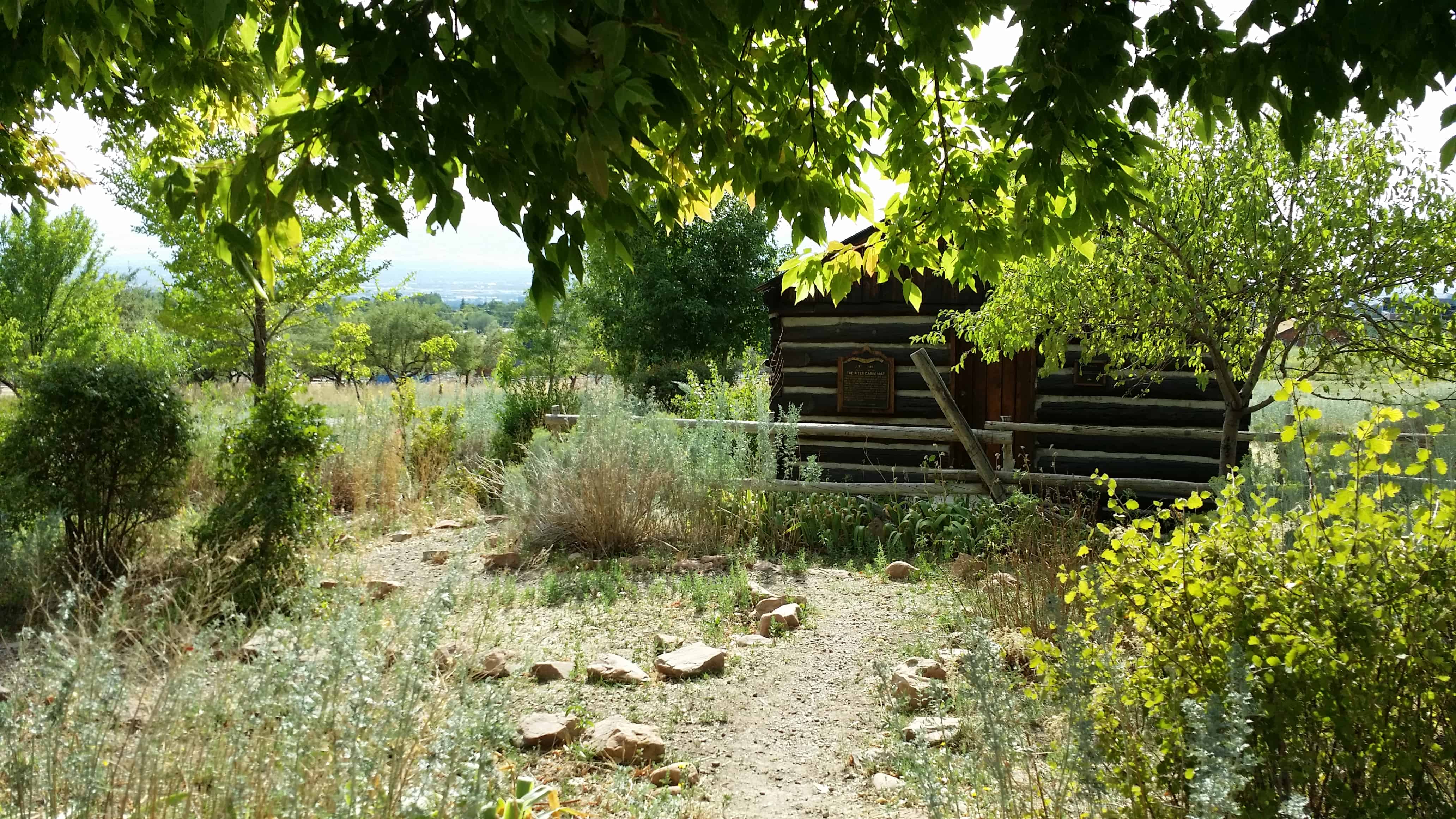
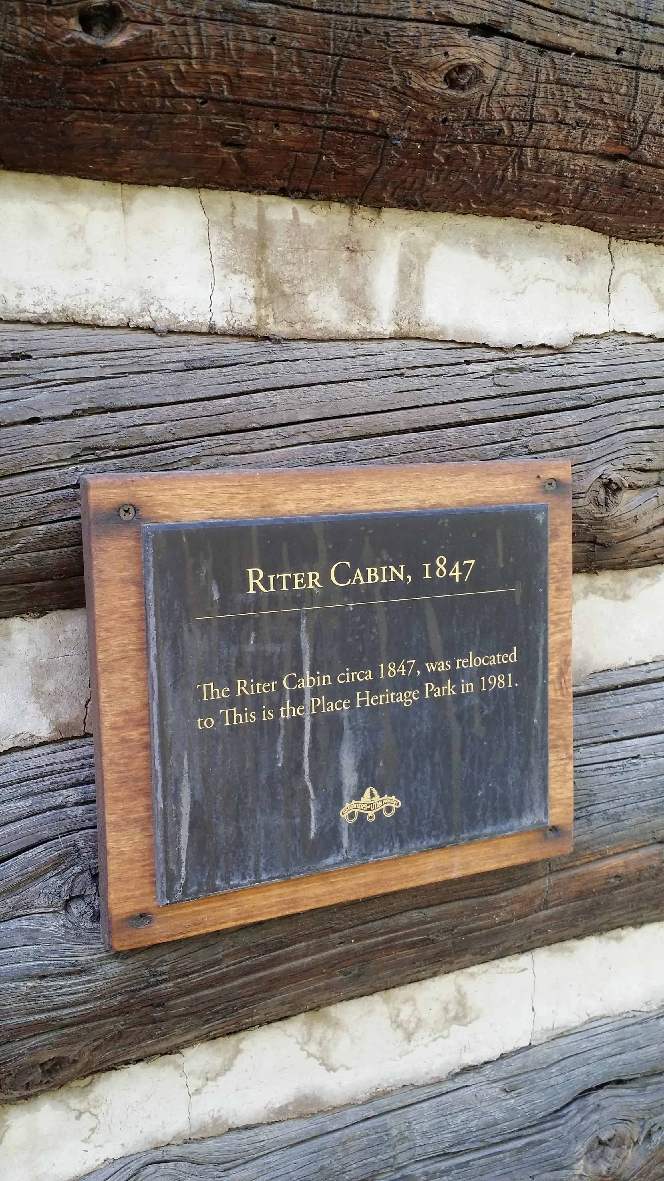
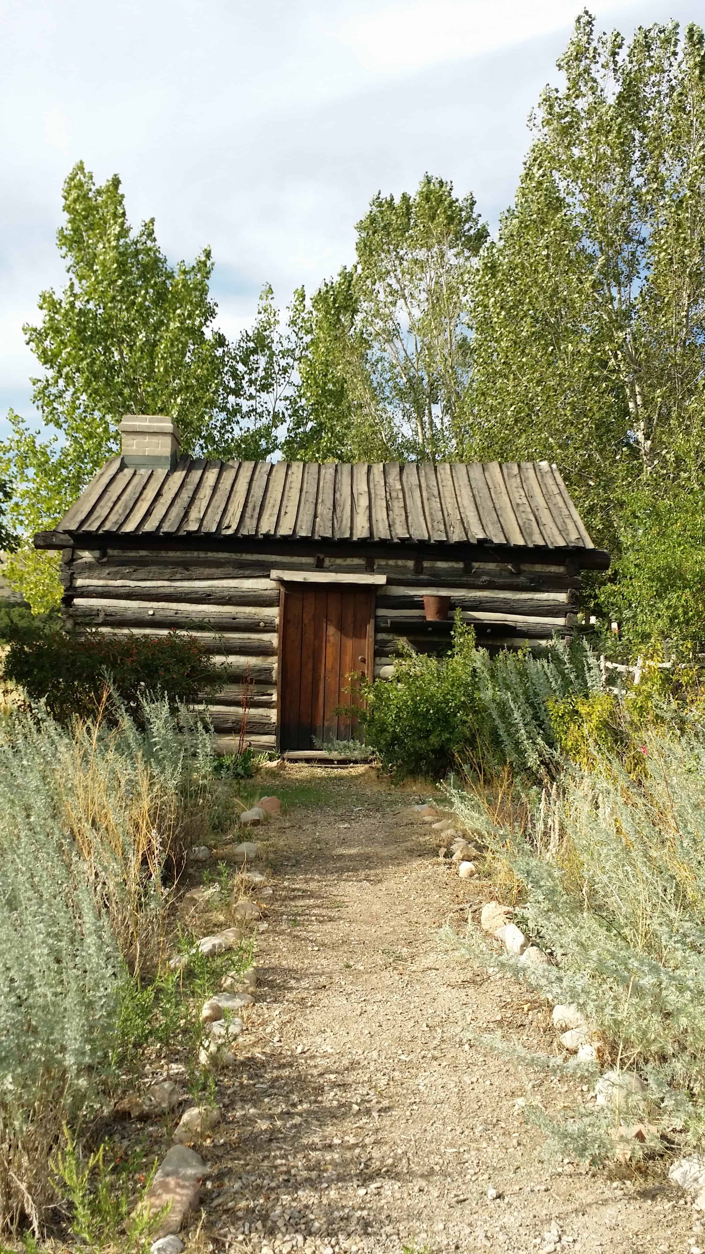
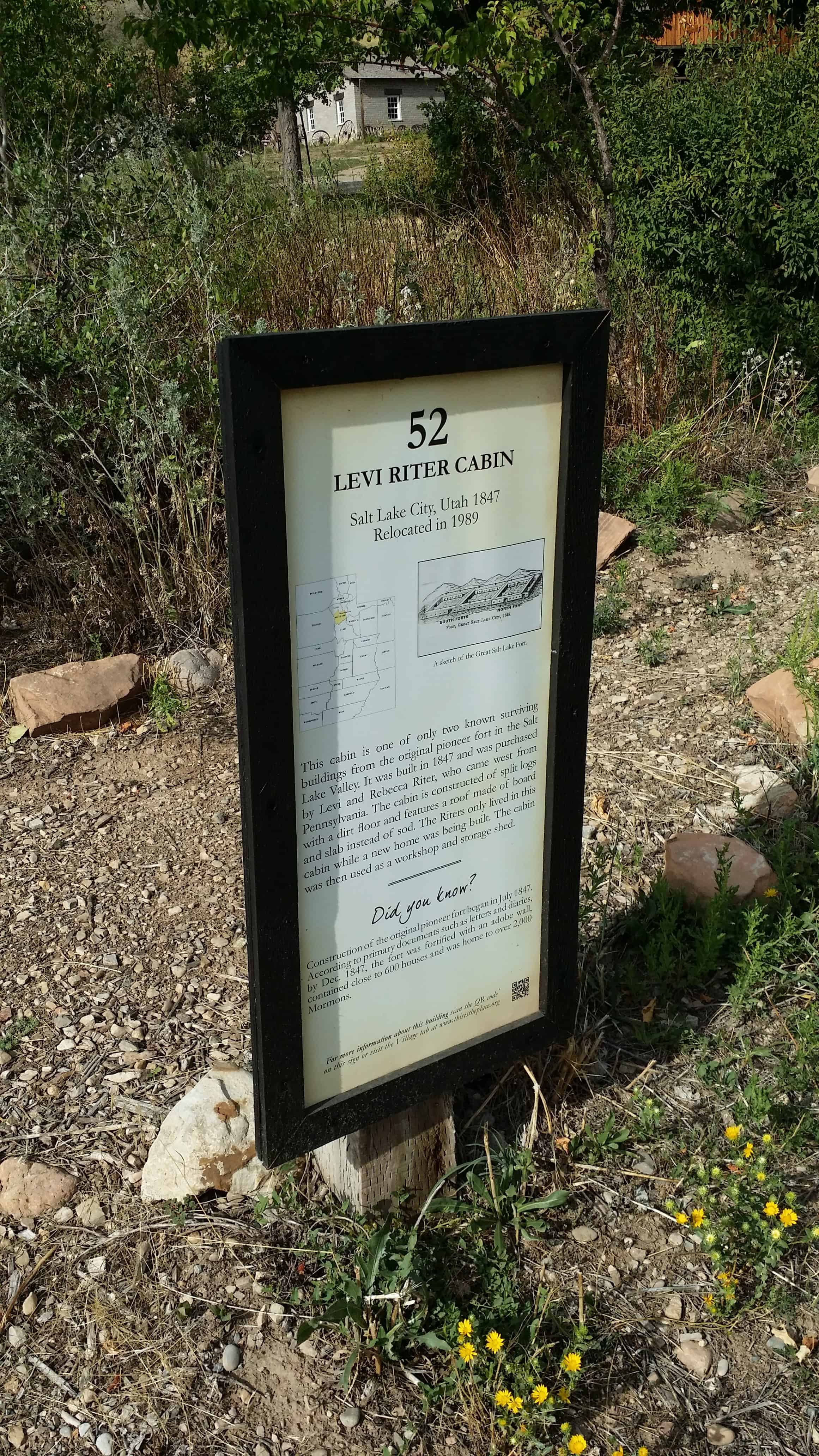
Daughters of Utah Pioneers No. 149 Erected Dec. 1949 The Riter Cabin 1847
This log cabin home, built in the Old Fort (now Pioneer Park in 1847 for Levi E. Riter and his wife Rebecca, at a cost of $50, is typical of the dwellings erected by the pioneers during their first year in Salt Lake Valley. The cabin was presented to the Daughters of Utah Pioneers by W.W. Riter, who lived in it as a boy. It was moved to this site and dedicated July 24, 1924. In October 1949, custody of it was given by Central Company to Salt Lake County.
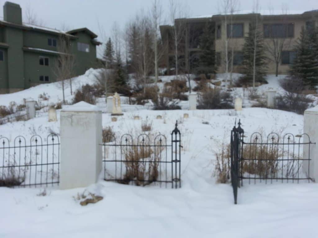
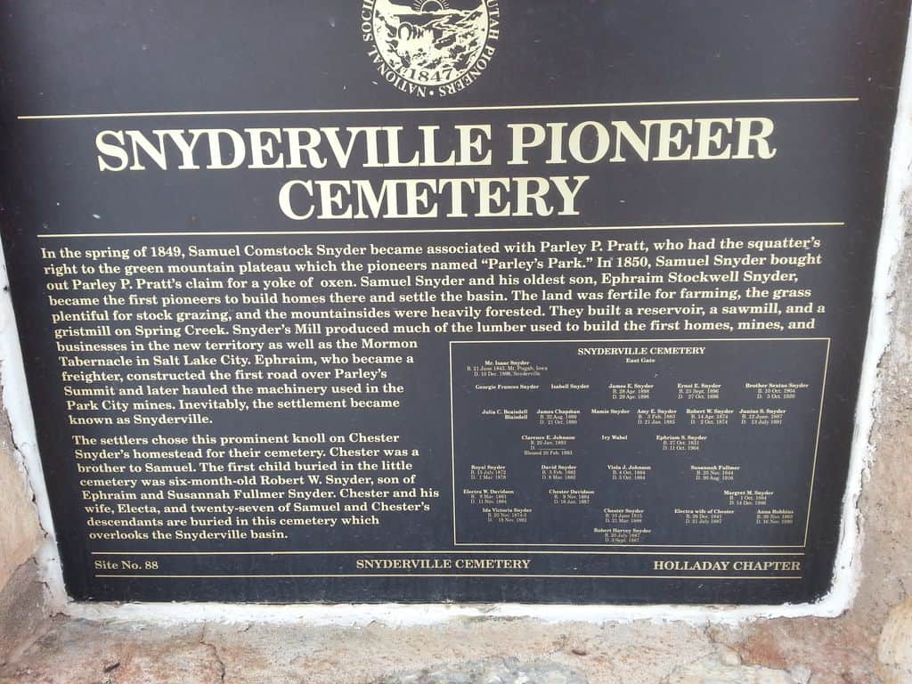
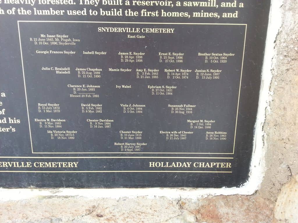
In the spring of 1849, Samuel Snyder became associated with Parley P. Pratt, who had the squatter’s right to the green mountain plateau which the pioneers named “Parley’s Park.” In 1850, Samuel Snyder bought out Parley P. Pratt’s claim for a yoke of oxen. Samuel Snyder and his oldest son, Ephraim Stockwell Snyder, became the first pioneers to build homes there and settle the basin. The land was fertile for farming, the grass plentiful for stock grazing, and the mountainsides were heavily forested. They built a reservoir, a sawmill, and a gristmill on Spring Creek. Snyder’s Mill produced much of the lumber used to build the first homes, mines, and businesses in the new territory as well as the Mormon Tabernacle in Salt Lake City. Ephraim, who became a freighter, constructed the first road over Parley’s Summit and later hauled the machinery used in the Park City mines. Inevitably, the settlement became known as Snyderville.
The settlers chose this prominent knoll on Chester Snyder’s homestead for their cemetery. Chester was a brother to Samuel. The first child buried in the little cemetery was six-month-old Robert W. Snyder, son of Ephraim and Susannah Fullmer Snyder. Chester and his wife Electa, and twenty-seven of Samuel and Chester’s descendants are buried in this cemetery which overlooks the Snyderville basin.
This is the page for the Sons of Utah Pioneers marker in the Snyderville Pioneer Cemetery, click here for the Daughters of Utah Pioneers marker at the same cemetery, or here for Snyderville in general.
See other historic markers in the series on this page for SUP Markers.
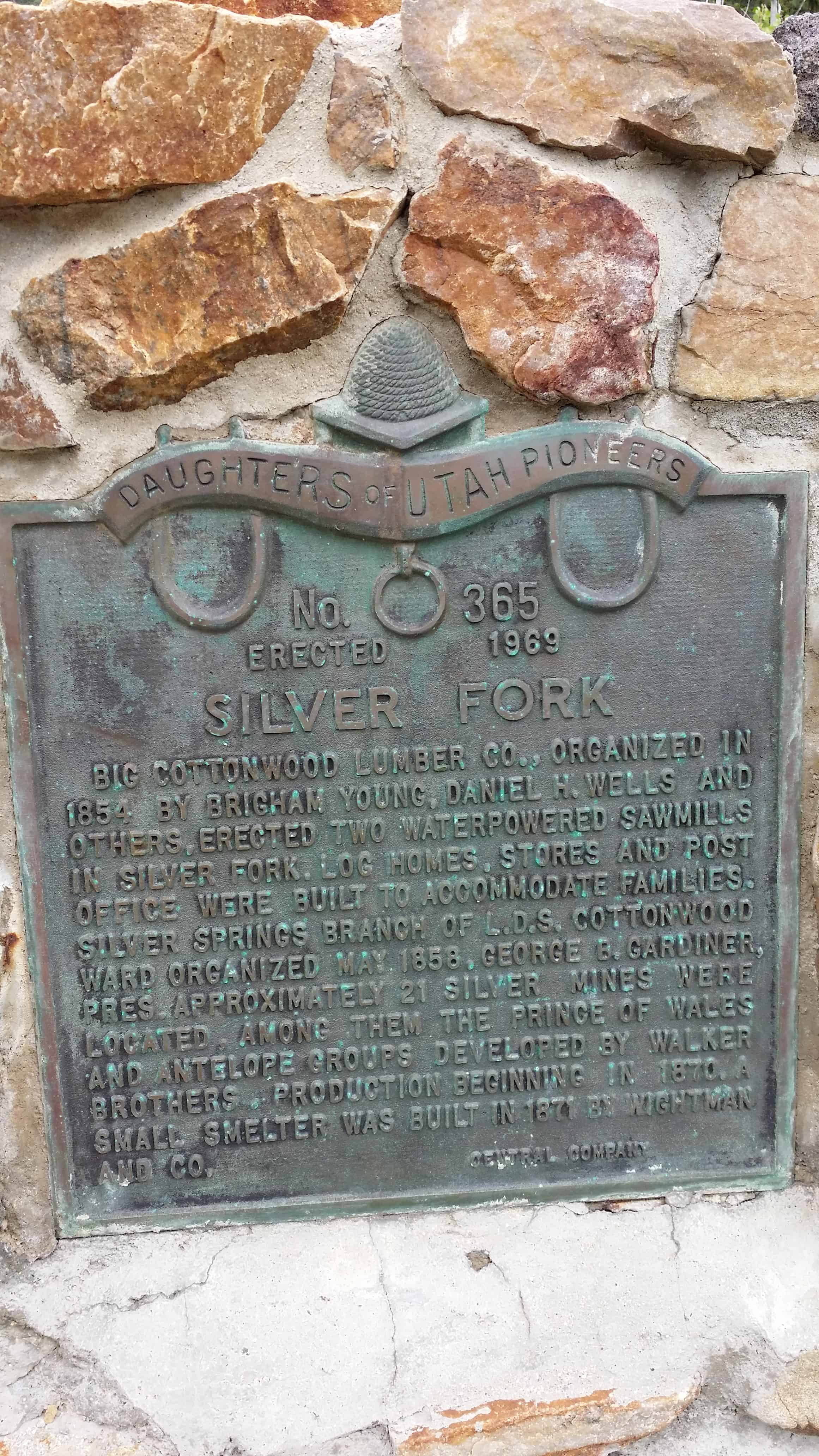
Big Cottonwood Lumber Co., organized in 1854 by Brigham Young, Daniel H. Wells and Others, erected two waterpowered sawmills In Silver Fork. Log homes, stores and post Office were built to accommodate families. Silver springs branch of the L.D.S. Cottonwood Ward organized may 1858, George b. Gardiner, Pres. Approximately 21 silver mines were Located. Among them, the prince of wales and antelope groups developed by Walker Brothers. Production beginning in 1870. A small smelter was built in 1871 by Wightman And Co.
Silver Fork is one of the last forks branching to the south in Big Cottonwood Canyon before reaching Brighton and Silver Lake. Silver Fork, the canyon, is today best known for the large concentration of summer homes and family cabins at its mouth that is Silver Fork, the town.
From the present day tree covered appearance you would hardly guess that this area began as a base for early logging operations. It would be more than 20 years before mining would play a part in the area’s history.
Logging began shortly after the arrival of the pioneers in 1847, by 1854 the Big Cottonwood Lumber Company was in operation with two saw mills and a shingle mill. The mills were located on the flats at the mouth of Silver Fork. A small community of log buildings quickly sprang up around the operation, all there to support the mills and lumbermen who worked them. In time the sawmills relocated and the town was partially abandoned.
By 1870, the one time logging camp became a mining camp. It didn’t take long for the flurry of activity in Little Cottonwood Canyon at Alta to spill over the ridge and into the tops of Silver and Honeycomb Forks. With that activity, and the rush that accompanied it, the town came to life, supporting the mines just as it had the loggers previously. A small smelter was constructed, another hotel, commercial buildings, and the once abandoned cabins, became homes again.
This second life of the town would be short lived, as the mining boom ended by the mid 1880’s. Some mining did take place after this time, but larger mills and smelters in the valley and improved transportation methods combined to set Silver Fork up for its second abandonment.
In 1893, the area was homesteaded by Joy Dunyon who ran sheep in the fork for many years. Around 1925, the Dunyon family who still owned the property, subdivided the land, and the present community of Silver Fork with its many summer homes and mountain cabins came to be.(1) The third life of the town has never ended, and the fork has been a hiking destination in the summer, and a back country skiing area in the winter. It is the skiing that may most directly affect the town and the futuer of Silver Fork.
A fourth life to the area may be in the works. Just this year (2010) Solitude Ski Resort made application to expand their ski resort operations into Silver Fork. At least a part of it. The original application that would have opened the entire fork, some 463 acres, was withdrawn or denied, depending on who you talk to. A second, smaller impact application was then submitted. This application would open 182 acres, pretty much the entire east face of the fork from the ridge with Honeycomb Fork down the slope to within 100 feet of SIlver Creek along its entire length.
If this access were granted, it would encompass almost all of the historic mining sites in Silver Fork, including the Prince of Wales, Wellington, and others. What remains may have to be “reclaimed” to make it safe for the rest of us. If the state does this work, it usually means destroying it. I hope that preservation would be mandated as a part of any permit, but that is a battle yet to be fought.
While that third life goes on, the fourth life being argued, the second life is the focus of this work; the mining boom. One of the earliest mines in the entire territory to have a steam compressor, the Wellington, is found in Silver Fork as well as the Prince of Wales, Antelope, Highland Chief, Boston Tunnel, Alta Tunnel, Star Tunnel, Warrior, Lucky Dutchman and more.
Silver Fork is also the access-way for a large branch fork to the east and south, Honeycomb Fork.
Silver Fork has no structures that remain standing from those early days, but there is hardware, some of it partially buried, but visible nonetheless. That which can be seen, shows the beauty and craftsmanship of those metal workers who designed and built the machinery of mining.(*)
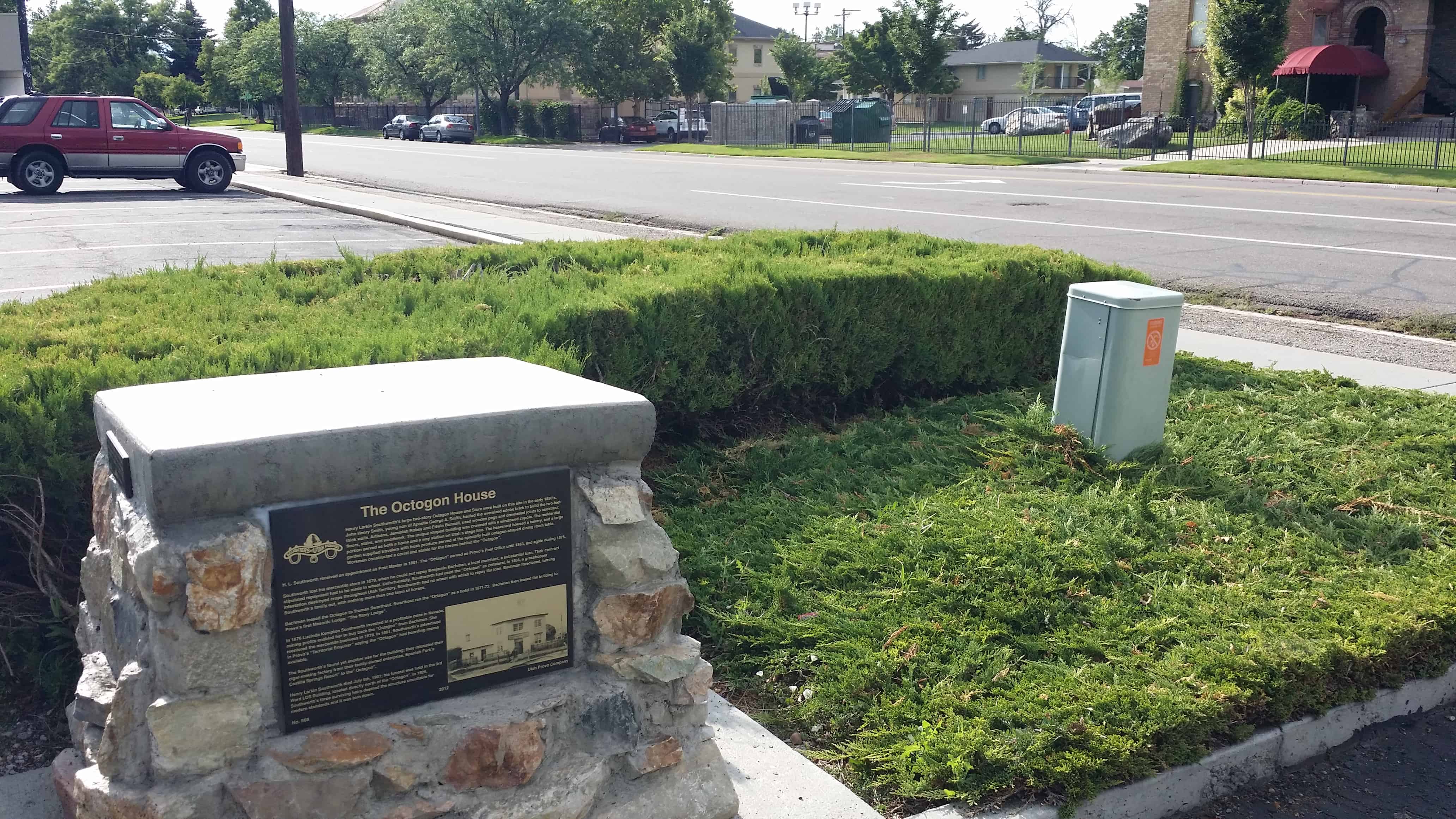
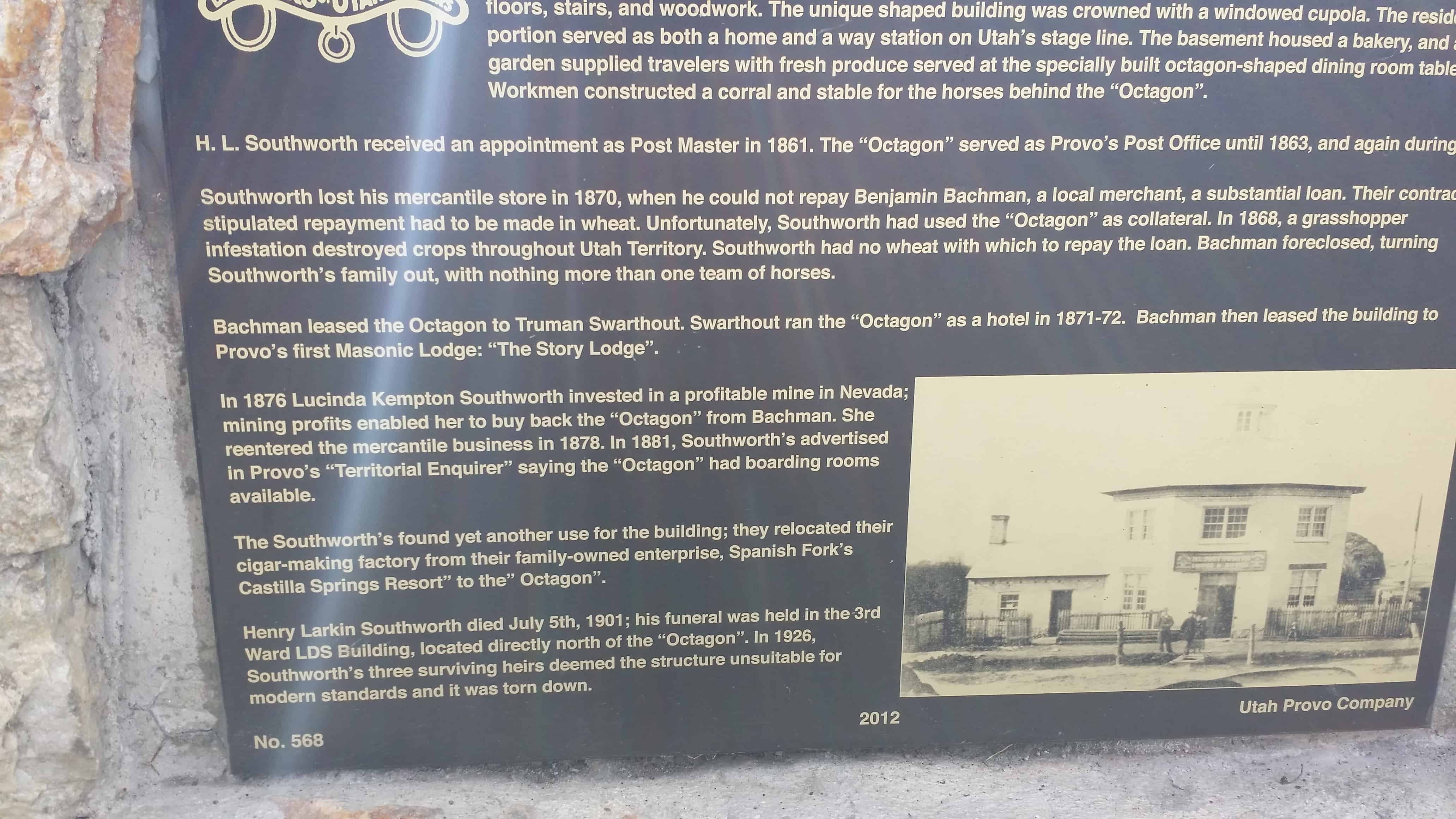
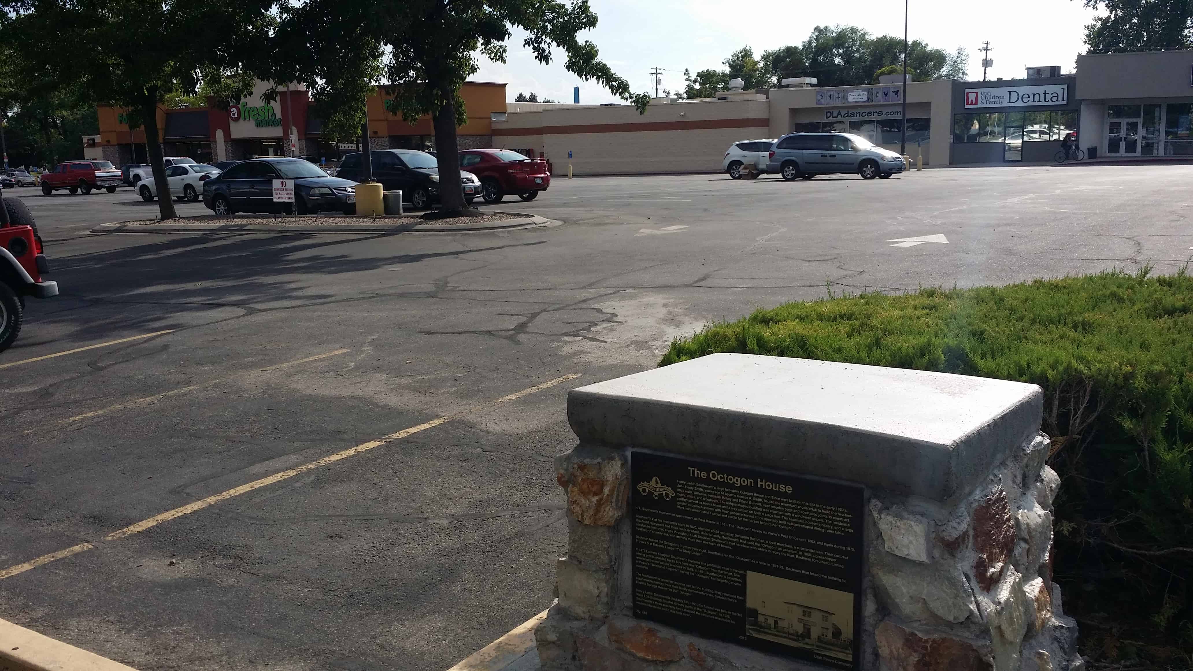
Henry Larkin Southworth’s large two-story Octagon House and Store were built on this site in the early 1850’s. John Henry Smith, young son of Apostle George A. Smith, hauled the oversized adobe brick to build the two-feet-thick walls. Artisans, Jeremiah Robey and Edwin Bunnell, used wooden pegs and dovetailed joined to construct floors, stairs, and woodwork. The unique shaped building was crowned with a windowed cupola. The residential portion served as both a home and a way station on Utah’s stage line. The basement housed a bakery, and a large garden supplied travelers with fresh produce served at the specially built octagon-shaped dining room table. Workmen constructed a corral and stable for the horses behind the “Octagon”.
H.L. Southworth received an appointment as Post Master in 1861. The “Octagon” served as Provo’s Post Office until 1863 and again during 1875.
Bachman leased the Octagon to Truman Swarthout. Swarthout ran the “Octagon” as a hotel in 1871-72. Bachman then leased the building to Provo’s first Masonic Lodge: “The Story Lodge”.
In 1876 Lucinda Kempton Southworth invested in a profitable mine in Nevada; mining profits enabled her to buy back the “Octagon” from Bachman. She reentered the mercantile business in 1878. In 1881, Southworth’s advertised in Provo‘s “Territorial Enquirer” saying the “Octagon” had boarding rooms available.
The Southworth’s found yet another use for the building; they relocated their cigar-making factory from their family-owned enterprise, Spanish Fork’s “Castilla Springs Resort” to the “Octagon”.
Henry Larkin Southworth died July 5th, 1901; his funeral was help in the 3rd Ward LDS Building, located directly north of the “Octagon”. In 1926, Southworth’s three surviving heirs deemed the structure unsuitable for modern standards and it was torn down.
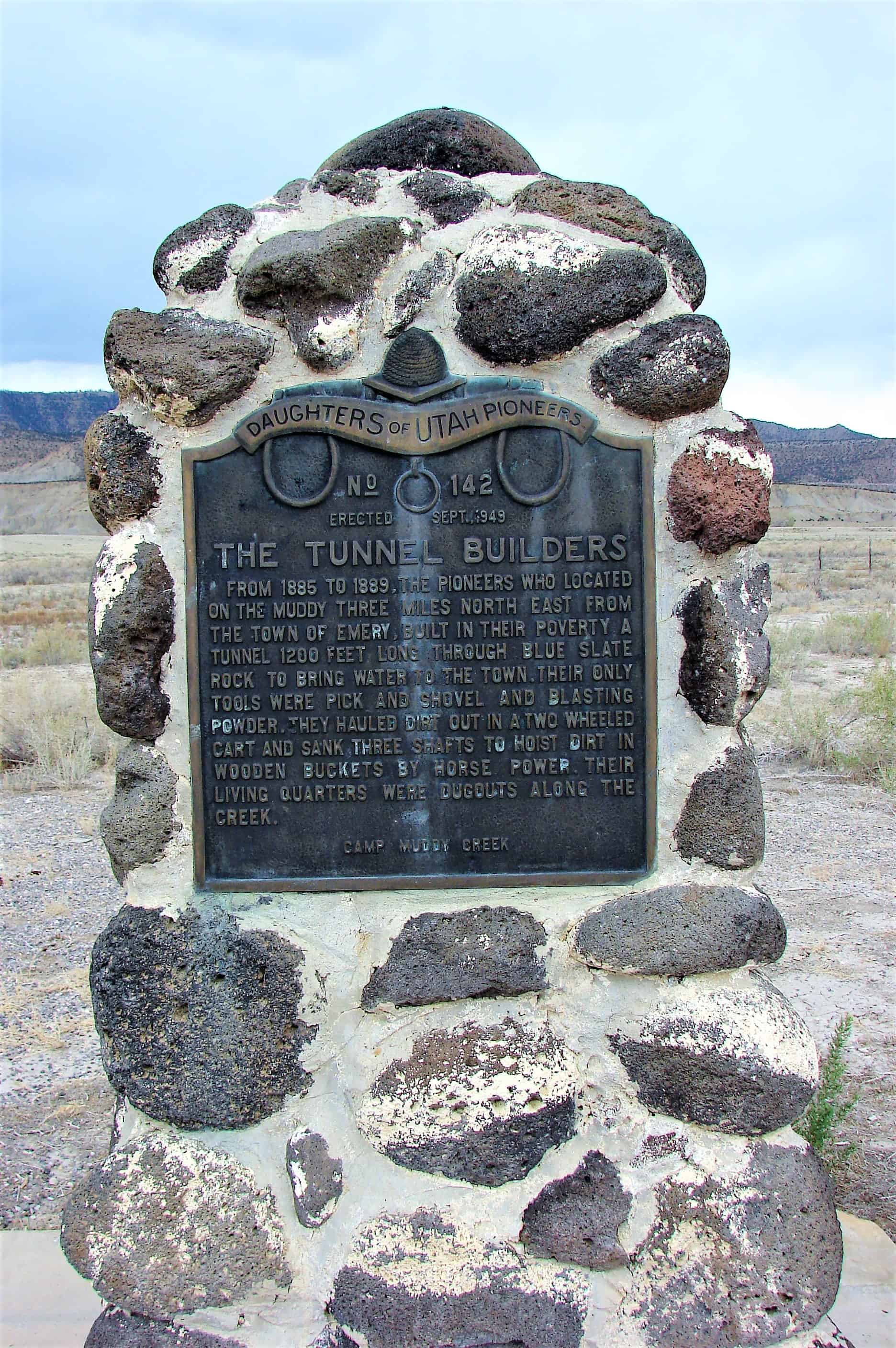
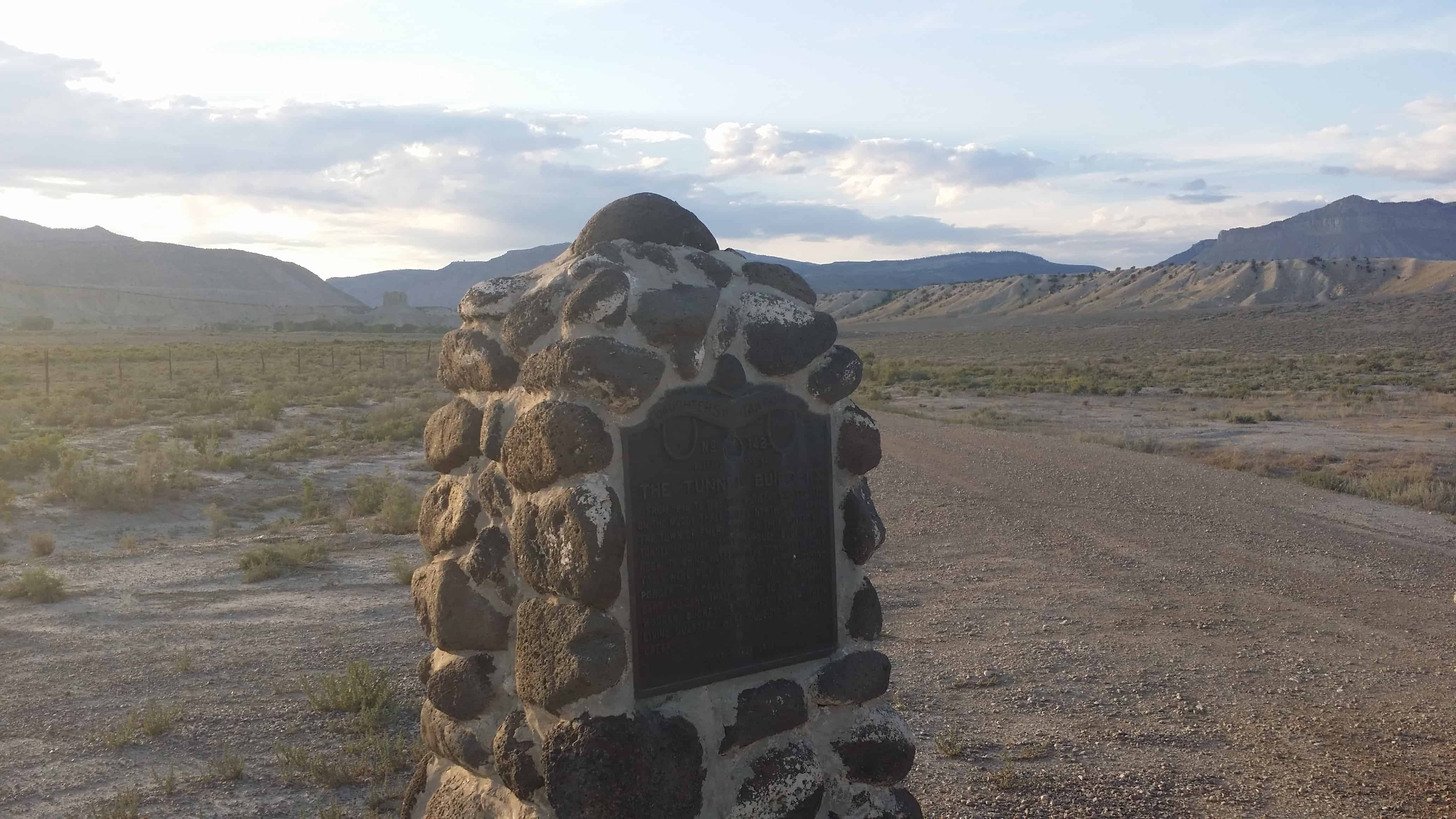
From 1885 to 1889, the pioneers who located on the Muddy three miles N.E. from the town of Emery built in their poverty, a tunnel 1200 feet long through blue slate rock to bring water to the town. Their only tools were pick and shovel and blasting powder. They hauled dirt out in a two wheeled cart and sank three shafts to hoist dirt in wooden buckets by horse power. Their living quarters were dugouts along the creek.