Garfield Beach railroad junction was built in 1905. In 1908, its post office was named Welby in honor of Rio Grande Railroad superintendent. The R.G.R.R. company drilled water wells, built soft water treatment plant, a round house, dance hall, pool hall, hotel, grocery and mercantile store, over 200 homes, and a three room schoolhouse. The first teachers were Ann Phoenix, Bernice Nelson, and Miss Johnson. Harold Nielson was doctor. The railroad company lost its contract and Welby began to fade. The store and school were razed in 1948.
The old railroad roundhouse, at least the foundation for it is still visible just north of here at N 40.59291 W 111.99436.
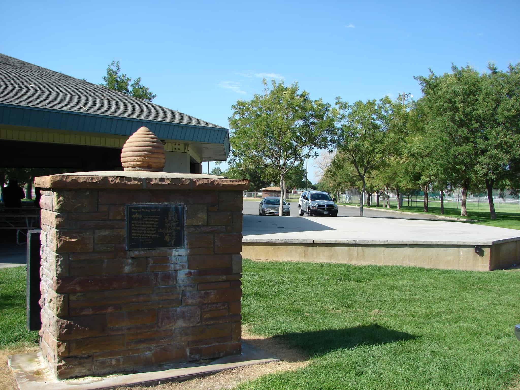
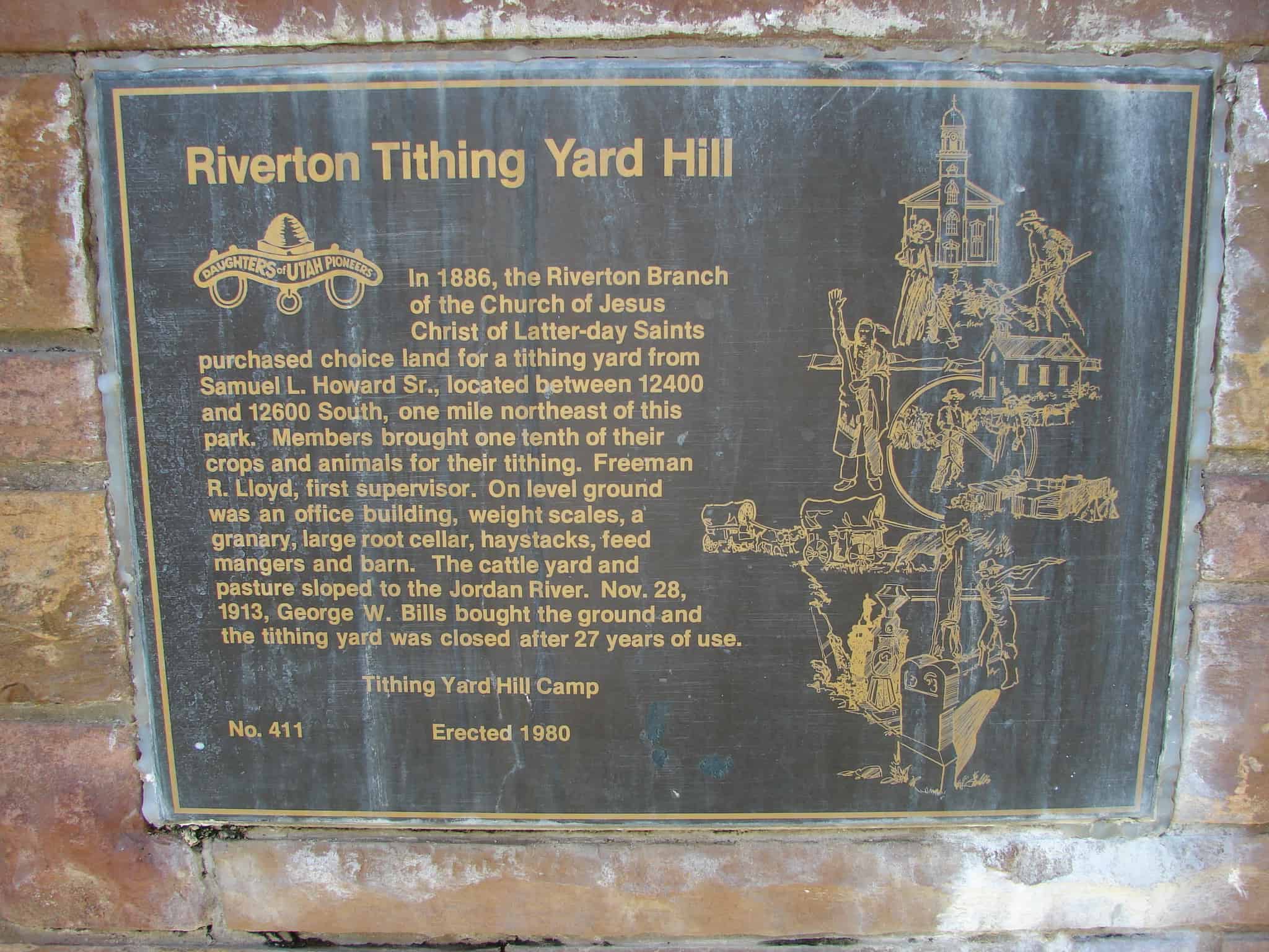
In 1886, the Riverton branch of the Church of Jesus Christ of Latter-day Saints purchased choice land for a tithing yard from Samuel L. Howard, Sr., located between 12400 and 12600 South, one mile northeast of this park. Members brought one tenth of their crops and animals for their tithing. Freeman R. Lloyd first supervisor. On level ground was an office building, weight scales, a granary, large root cellar, haystacks, feed mangers and barn. The cattle yard and pasture sloped to the Jordan River. Nov. 28, 1913, George W. Bills bought the ground and the tithing yard was closed after 27 years of use.
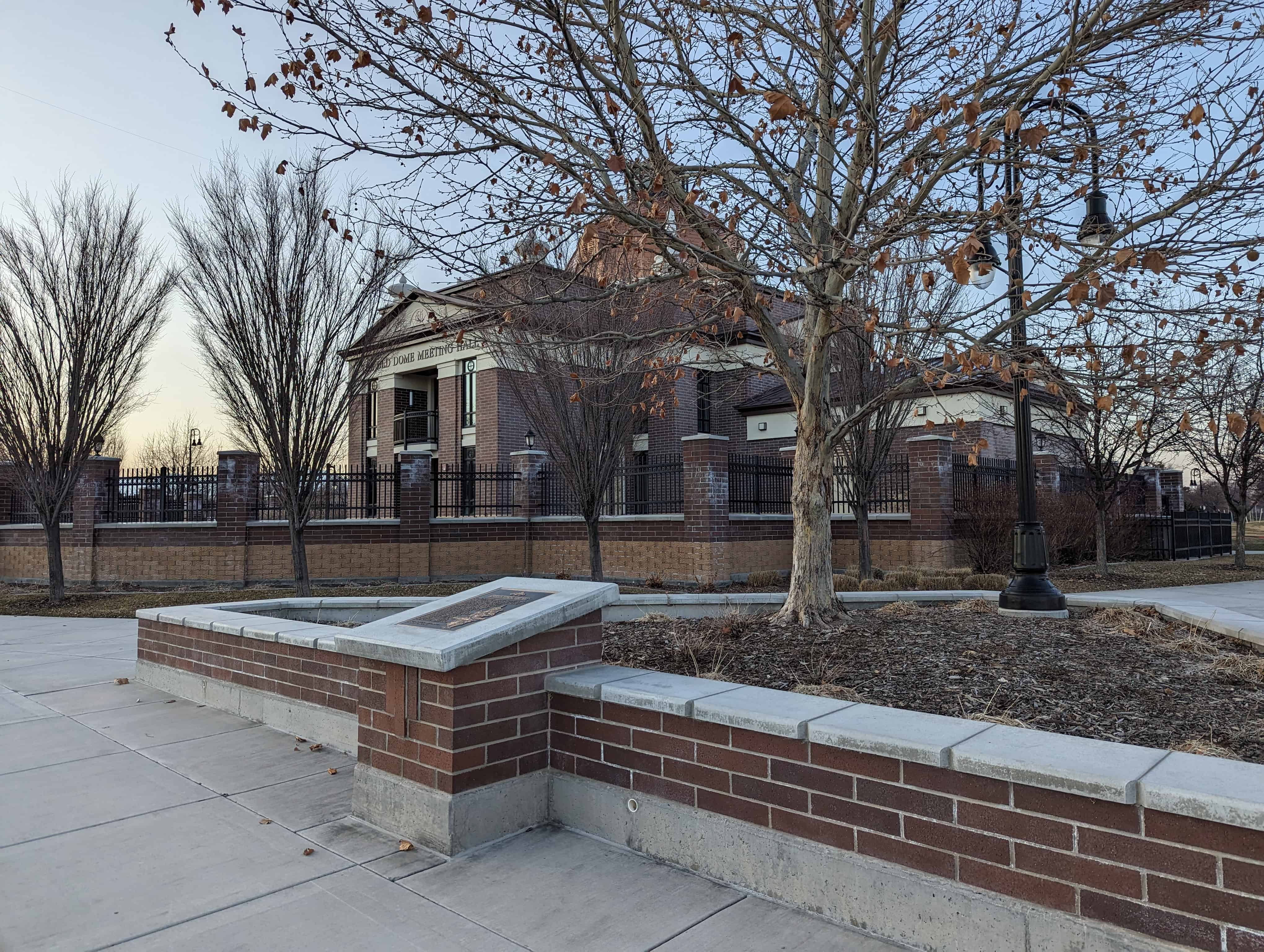
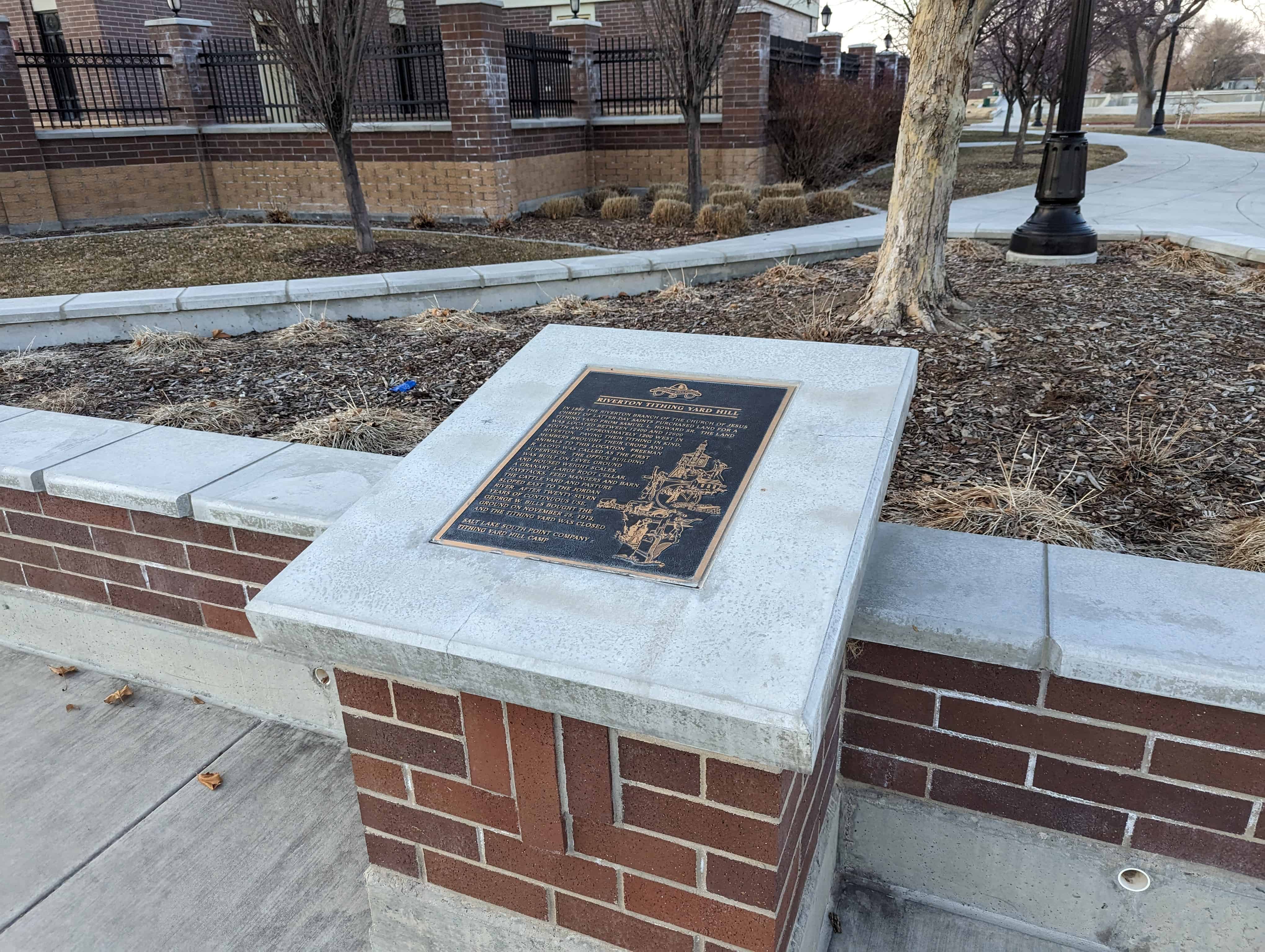
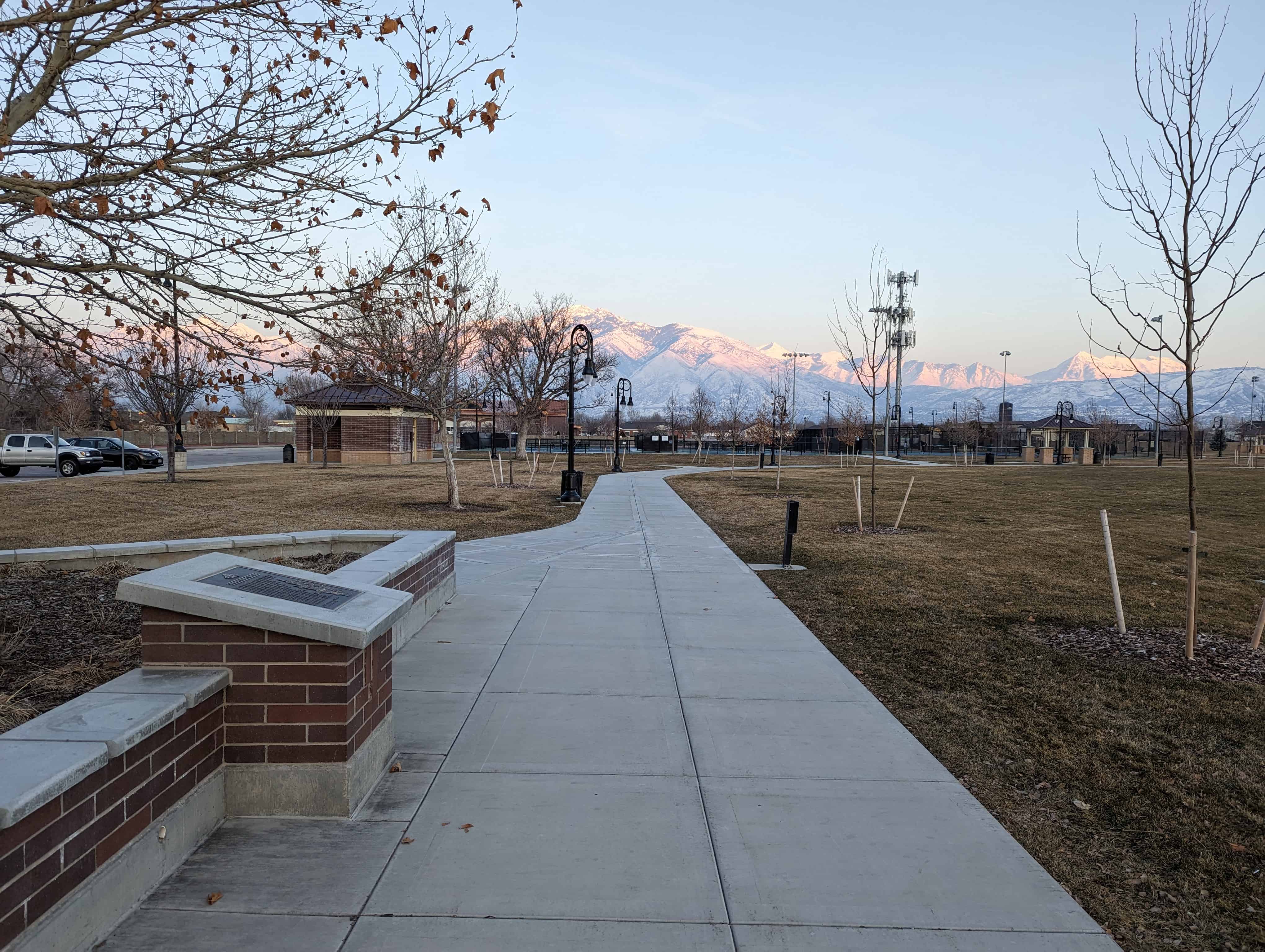
This is Daughters of Utah Pioneers historic marker #411 located at Riverton City Park (1452 W 12600 S in Riverton) – I took the above photos in 2007, the photos below are of the new monument (I took the photos in 2023 but I think the monument was re-done around 2015). The wording is very similar on the new plaque.
–
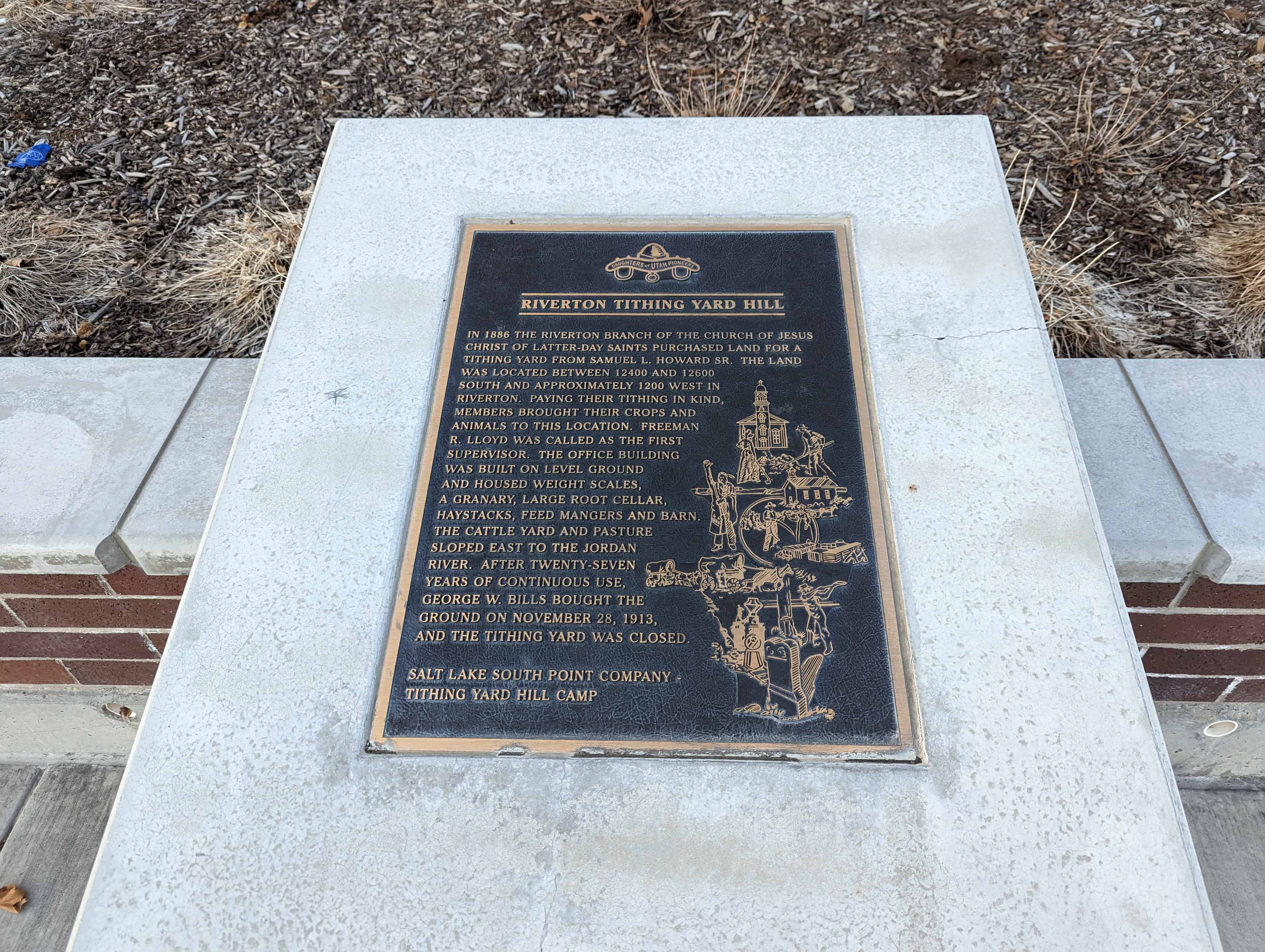
In 1886, the Riverton branch of the Church of Jesus Christ of Latter-day Saints purchased land for a tithing yard from Samuel L. Howard Sr. The land was located between 12400 and 12600 South and approximately 1200 West in Riverton. Paying their tithing in kind, members brought their crops and animals to this location. Freeman R. Lloyd was called as the first supervisor. The office building was built on level ground and housed weight scales, a granary, large root cellar, haystacks, feed mangers and barn. The cattle yard and pasture sloped East to the Jordan River. After twenty-seven years of continuous use, George W. Bills bought the ground on Nov. 28, 1913, and the tithing yard was closed.
These stones, quarried in Chalk Creek and hauled by oxen in 1854, were used in the foundation of the two-storied 30 x 40 adobe church building located in the Pioneer Fort one half block east of Main Street. Remodeled into one 30 x 60 hall with oval ceiling, it was used for church and school until 1900, when it became the Relief Society home for nine years. It then served many different purposes. Sold to Roy and Mary A. Dame in 1915, whose family financed this monument and steps.
Church leader Erastus Snow helped select a new site for Chicken Creek Settlement, relocated due to unfavorable living conditions. Brigham Young named it Levan. Snow appointed W. Morgan and James Wilson as supervisors. Early in 1868, Wm. Dye built a dugout home. Other first families to move were Jabes Broadhead and Jacob Hofheins. James Wilson, first schoolteacher, taught in one room of the Seth Ollorton home. Wm. Tunbridge, town physician.
In 1859, this area was resettled permanently by families of James Allred, Wm. Black, James Ellis, a large Danish colony of gifted craftsmen and stonemasons, and others. They surveyed the land, raised abundant crops, and became known as the breadbasket of Utah; built substantial homes and chapel of oolite stone, quarried south of town. The fort built west of the chapel in 1853 was burned by Indians, 1854. Town was incorporated, named Spring City 1870, John R. Baxter, Mayor.
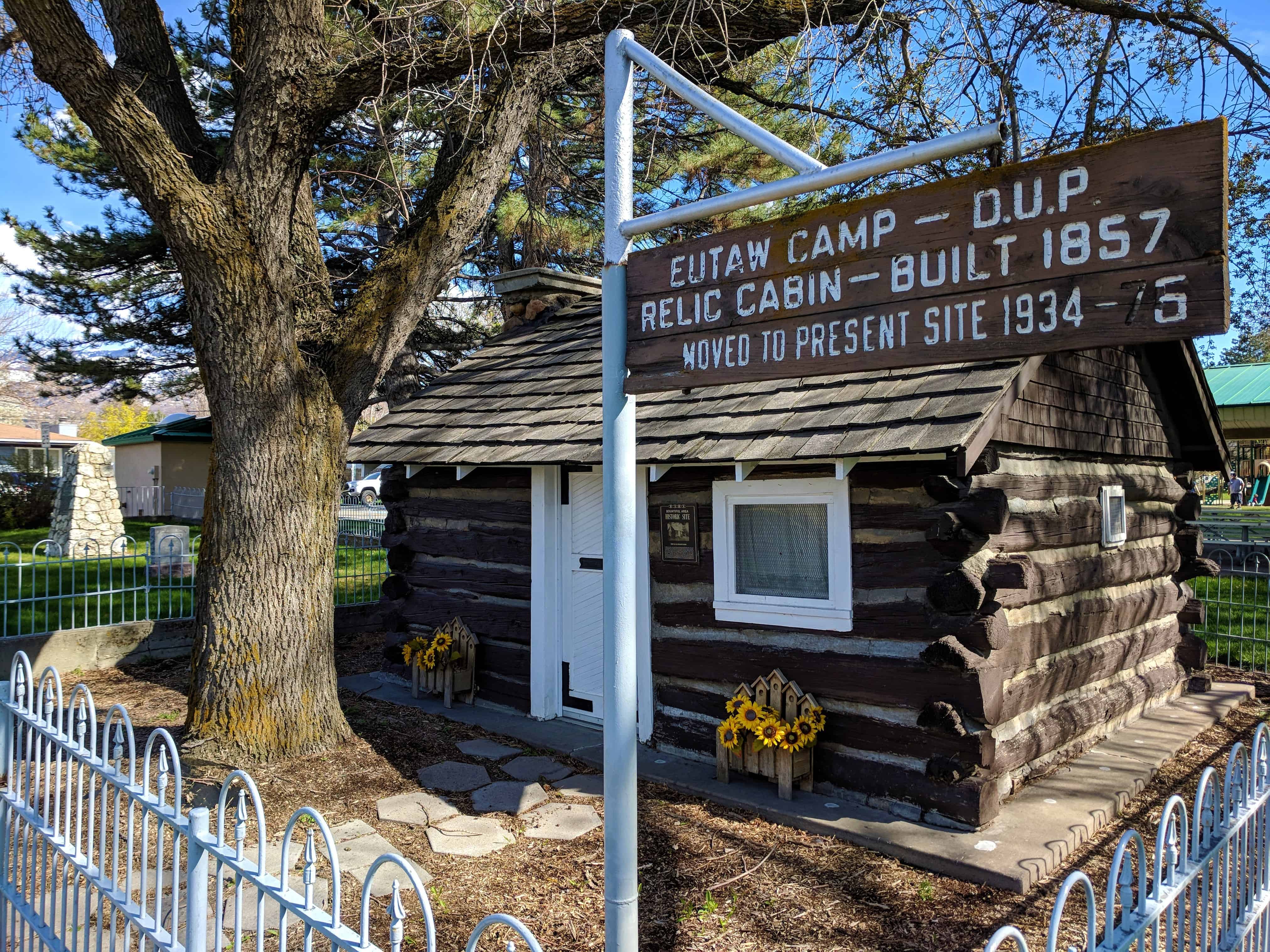
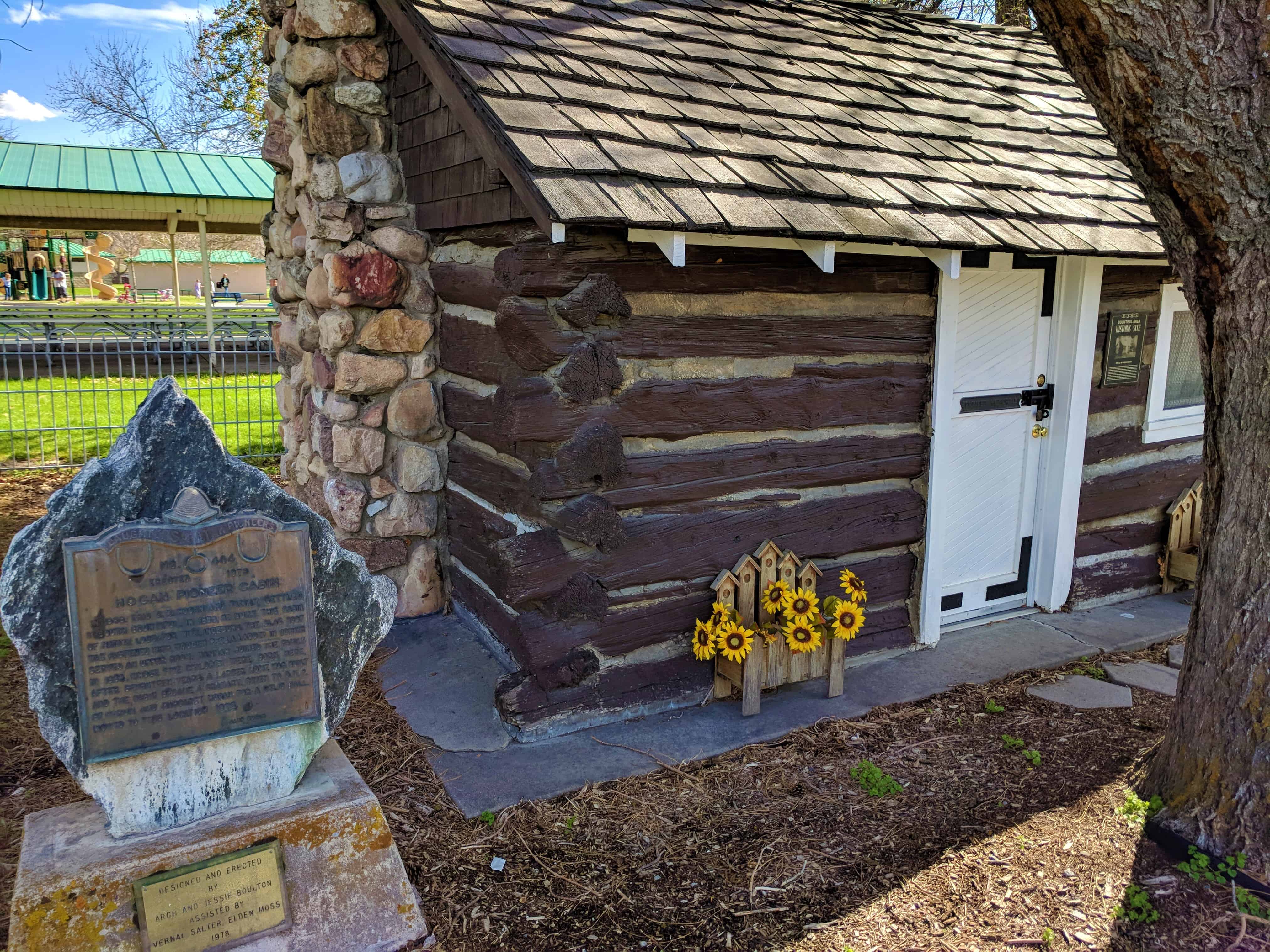
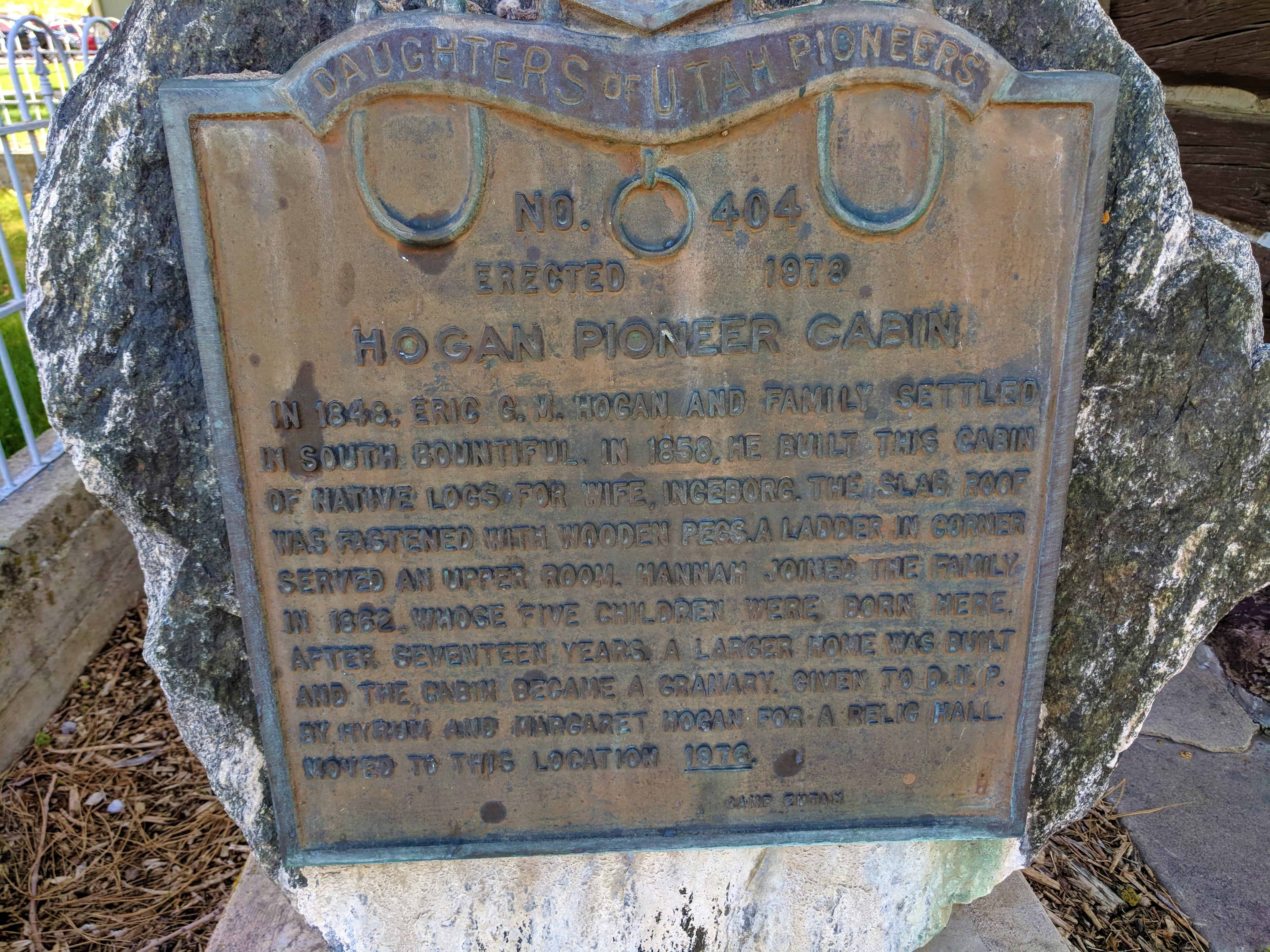
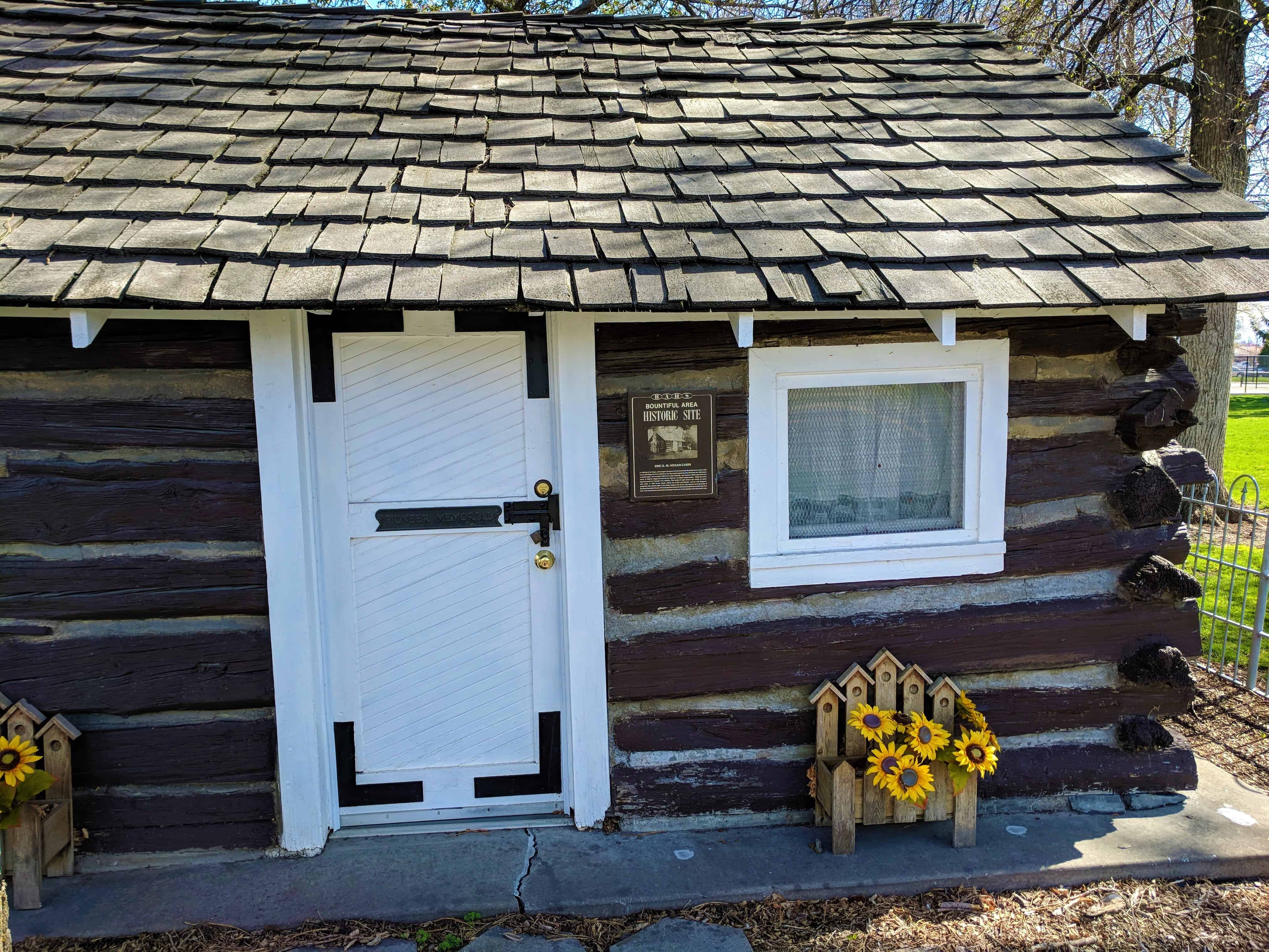
In 1848, Eric C.M. Hogan and Family settled in South Bountiful. In 1858, he built this cabin of native logs for wife, Ingeborg. The slab roof was fastened with wooden pegs. A ladder in corner served an upper room. Hannah joined the family in 1862, whose five children were born here. After seventeen years, a larger home was built and the cabin became a granary. Given to D.U.P. by Hyrum and Margaret Hogan for a Relic Hall. Moved to this location 1976. Plaque B: Designed and erected by Arch and Jessie Boulton assisted by Vernal Salter, Elden Moss, 1978.
First Walker War Casualty, Peter Ludvigson, was killed by the Indians in 1865 three miles south of Sterling. WM. D. and Daniel B. Funk located on Six-Mile Creek in 1872 dug irrigation ditches for farming. Families came later. A Manti branch of Church of Jesus Christ of Latter-Day Saints was organized in 1874. WN. B. Petty, President Dixon & Bunts operated first store. Samuel Trenner M. D. was first school teacher. Jane Snow, Catherine Edwards, Fanny Kenner were midwives.
In 1866 Louis R. Chaffin, at the request of Apostle Erastus Snow, placed a gristmill in Cedar City. His son, Henry, ran it until 1868 when Louis returned from “The Muddy.” Adjoining land was purchased in 1875. Excavation by Alva Matheson proved the dirt floor basement to be 20 x 24 feet. Lava rock walls had an opening in east end. Upper walls were adobe with wood roof. Joseph Walker’s history states he was working in mill in 1881. Later it was destroyed by fire.
Check out all of the historic markers placed by the Daughters of Utah Pioneers at JacobBarlow.com/dup
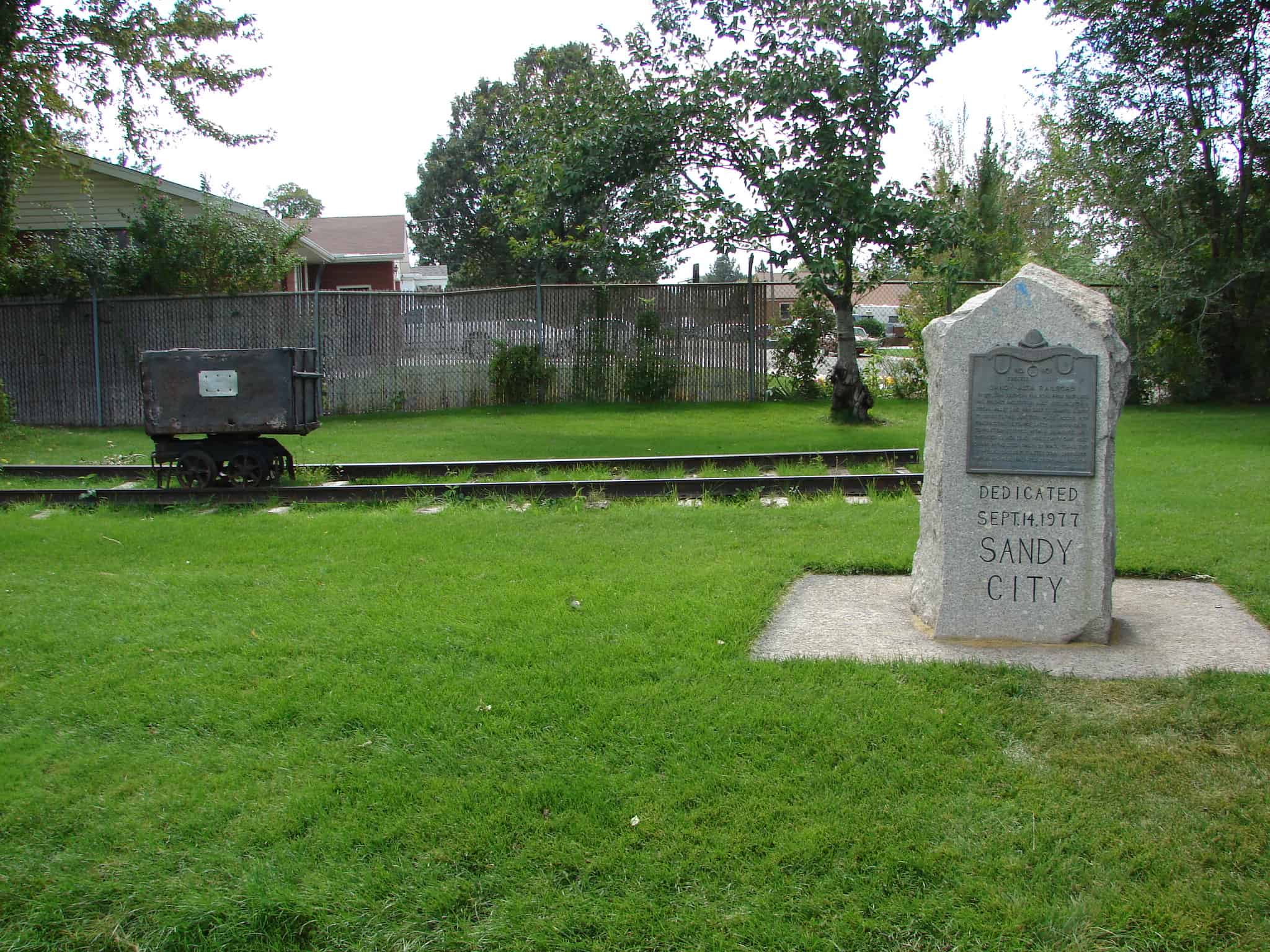
In 1871, Utah Southern Railroad from Salt Lake was finished and station built here. Wasatch and Jordan Valley Line ran east to granite quarry to bring to this junction huge rocks for constructing S. L. Temple. Later, a narrow-gauge, completely covered with a snowshed, was extended to Alta silver mines. Empty cars were drawn up the steep grade by horse team. Two ore-filled cars were coasted down backwards. The brakes were operated by one man from the rear car. Between Wasatch and Alta the grade was too steep for even the most powerful locomotives, being at one place nearly six hundred feet to the mile; consequently, the empty cars had to be drawn up by horses. The traffic consisted almost entirely of ores from the Alta mines bound for sampling works at Sandy.
The above text is from the monument erected in 1977, located in Bicentennial Park at 530 East 8680 South in Sandy, Utah.
A natural ford on Bear River, first used by Indians, trappers and explorers, was selected by John Hailey in 1863, as the crossing point for his new stagecoach road from Salt Lake City, Utah to Boise, Idaho. Unknown hands carved “Boise Ford, 1853” on a large stone on each bank of the river. Located approximately three quarters of a mile south and two miles east of this marker, the ford was used until bridges were built.