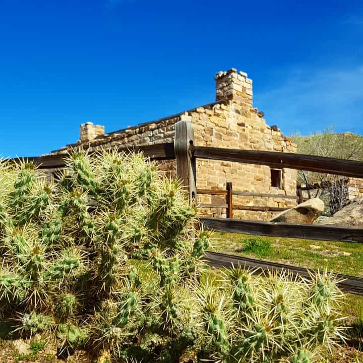
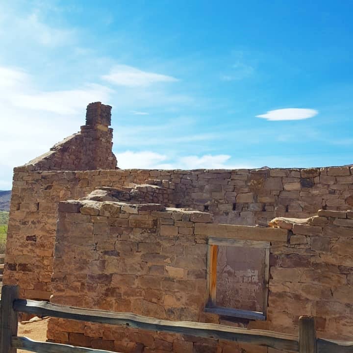
The above photo is the store where Jack Dempsey trained to be a professional boxer, the ruins are still there.
In 1885 Alfred Grames took up residence at Oak Springs Bench at the head of Gordon Creek. Which was later to become Coal City.
In August of 1921 George Storres file a petition to establish a townsite and to develop coal properties. The town was named Great Western.
During 1922, Eugene Andreini built a stone building to serve as the office for Great Western mining. In 1925 it became the general store.
Jack Dempsey took up residence in 1923 and used the town for training. In his honor the town was renamed Dempsey City. In February of 1924 Dempsey decided not to invest in the coal industry. The citizens, upset by his decision, renamed the town Coal City.
The town began to decline during the depression, and by 1940 was just another ghost town.*
A ghost town very near the ghost towns of National and Consumers in Carbon County, the three shared a post office and school.
In 1928 Will Sweet discovered coal in a small canyon northeast of National. Sweets was the smallest of the mines in the Gordan Creek area. It was a tent city for almost 10 years with a population of close to 200 people. They had a post office from January 26, 1927 to September 25, 1941 when it closed.
The Sweets Mine closed temporarily in 1937, but reopened during World War II. In the early 1940’s, there were approximately 20 small three room houses built on the main street of Sweets. They all had red tile roofs.
In 1998 Horizon Mine reclaimed the town of Sweets.
Sweets Mine had the highest death rate of the three towns. They had 17 miners killed, mostly by roof falls. By the early 1950’s Sweets, like Consumers and National were ghost towns.
(From Box Elder County) Among the first settlers to this little valley was Kumen Tarbet. It is said that as he broke the ground from the sagebrush that he used oxen to pull the equipment. Oxen were eventually replaced with mules, and later came horses. Other early settlers were George Henrie, Fred Manning, Tony Nelson, John Adams, P.N. Pierce and John W. Deakin. It wasn’t an easy job clearing the ground of sagebrush and bunch grass. The process of railing, stacking, burning and then plowing with a team of mules or horses was accomplished by long hours and hard work.
Water was a premium. If you drilled a well and were blessed with good water, it was a great advantage. Some wells only produced warm air while others had warm, nasty water. One well, hand dug by the Peter Jensens, was over 400 feet deep and “Cemented up” from the bottom with pipes placed across at intervals as a ladder descended for repairs and maintenance. It is said that Mrs. George Shuman would stand above, holding a mirror so the suns rays could reflect light into the well enabling the workers to see. There was a community well located on the section lines, east of what is called the “Big Field”. Many families would haul water from there for themselves and livestock.
There were two blacksmiths in the valley: Fred Doutre, who also was a craftsman with leather, and Roy Southwell who served as a janitor for the school. Several of the teachers boarded in his home. The fist school was held in an old house in 1914, and in 1915 a new one-room school was built for eight grades and one teacher. The school burned the same night as Mr. Richard Ilger, the storekeeper, was murdered at the Blue Creek Store, and school for the rest of the year was discontinued. The next year a new two-room schoolhouse was built to accommodate two teachers. In 1934 there were four 9th graders and three 5th graders. This was the school’s final year.
A Blue Creek Store was located on the section line north of the Blue Creek Springs. It also housed a post office and was the family home. A third store was located about two miles north by the main road to Snowville. It contained the post office, the family home, and the gas station, and it was the school bus stop for the Snowville bus going to Bear River High School.
In March of 1900, just North of the Blue Creek Springs, Mr. Lewis Grant purchased 160 acres of ground. He built a large two story building which served as their home, a boarding house, and a dance hall. Some of their tenants were school teachers and weary travelers. Just north of their home Mr. Grant opened a store in 1910, selling much needed supplies to the area families and others in need as they were traveling.
Centerdale was an L.D.S. Branch of the Howell Ward. It was organized in 1914, with Peter Jensen as Presiding Elder. Other Presiding Elders were John Adams in 1917, Albert W. Bishop in 1918, John W. Smith in 1923. The total population of Centerdale Precinct was 131. Many baptisms for this area were performed in the large water trough at the Art Nelson Place. Many dances were held at this church building, and there was always a large crowd attending from several communities in the area. Mr. John Glenn played his accordion, and Arba Glenn was his accompanist. Civic functions and other forms of gatherings were held here. One event took place in 1940 when W.W. Whitney was the “Wheat King”. Harvesting 40 bushels per acre, he held a dance and watermelon bust. This was one of the many harvest dances held there.
With the coming of gas powered vehicles, better roads made traveling easier and faster. The families “staying on the farm” soon became part of the past. Electricity came to this valley in 1947, bringing more changes to the way of life. Ice no longer had to be cut during the winter from the reservoir and stored in sawdust or straw for the summer to keep food and drinks cold. As the many years have come and gone, so have many families, and experiences, memories of good times, names and faces fade.
I am asked often about ghost town suggestions, which are the best, coolest, most interesting, closest to a certain city, etc.
I decided to put together a list so people can browse through it and get ideas on what they’d like to go experience. Questions and comments are welcome, hopefully this is valuable to some.
They range from the more popular type, almost like a western movie set like Grafton to places with almost nothing there anymore like Kelton and everything in between. I have split them up by County to make it a little easier to find one in the part of the state you’ll be exploring or you can look at this map:
While some are listed below, you could also click here to see all the posts that have the ghost towns tag.
In 1911, after the depletion of ore at Dragon, Utah, the Uintah Railway extended its line northwest along Evacuation Creek to the terminus of Watson. From this railhead a toll road ran north to points in the Uinta Basin. The rail extended southwest to the mining camp of Rainbow. Watson became the center of Gilsonite and ranching activity with hotels and stores. Thousands of sheep were sheared and wool shipped from here.
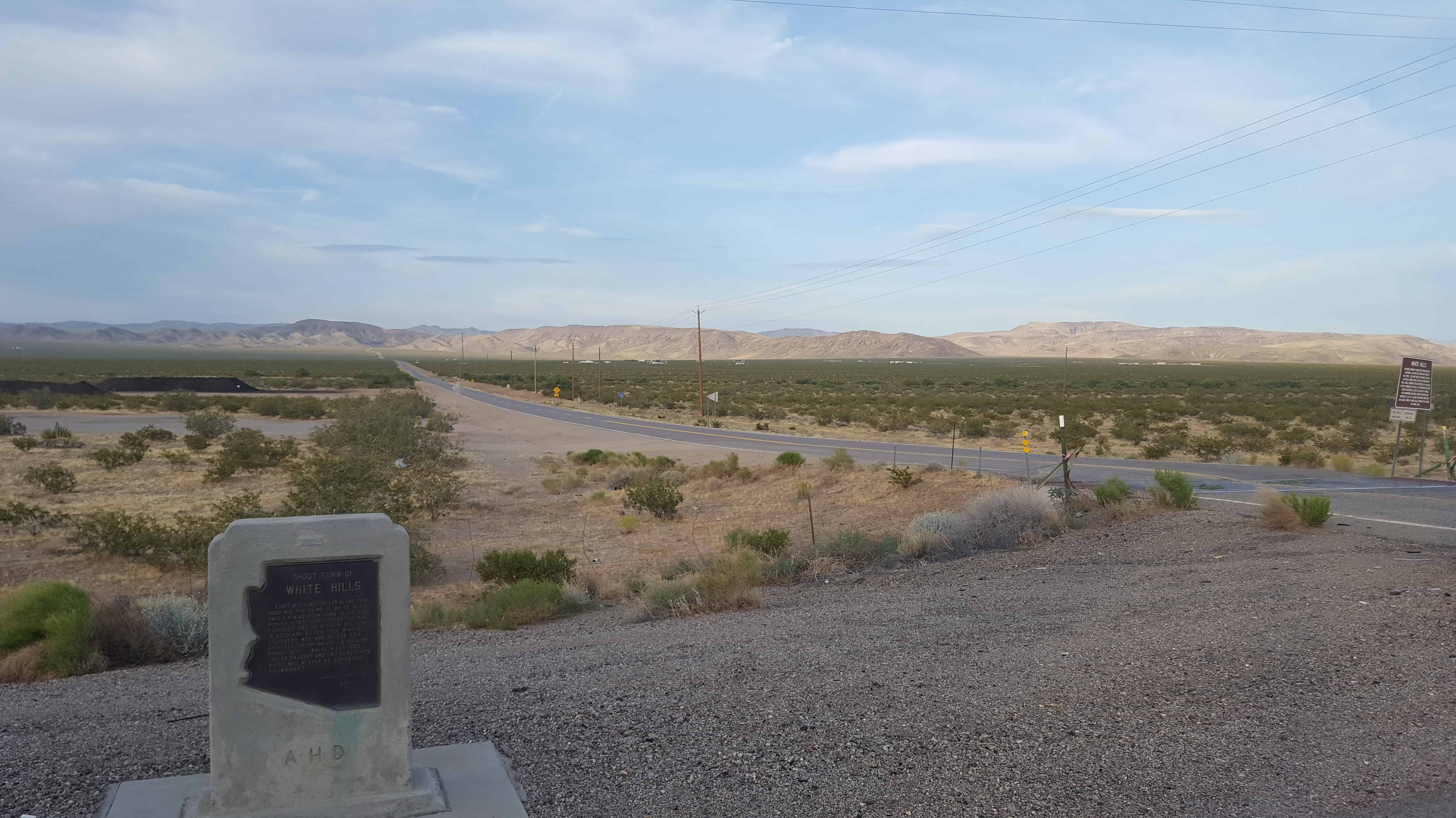
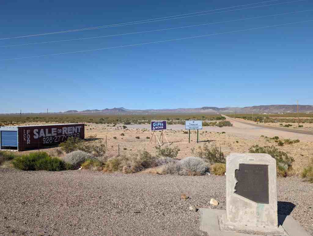
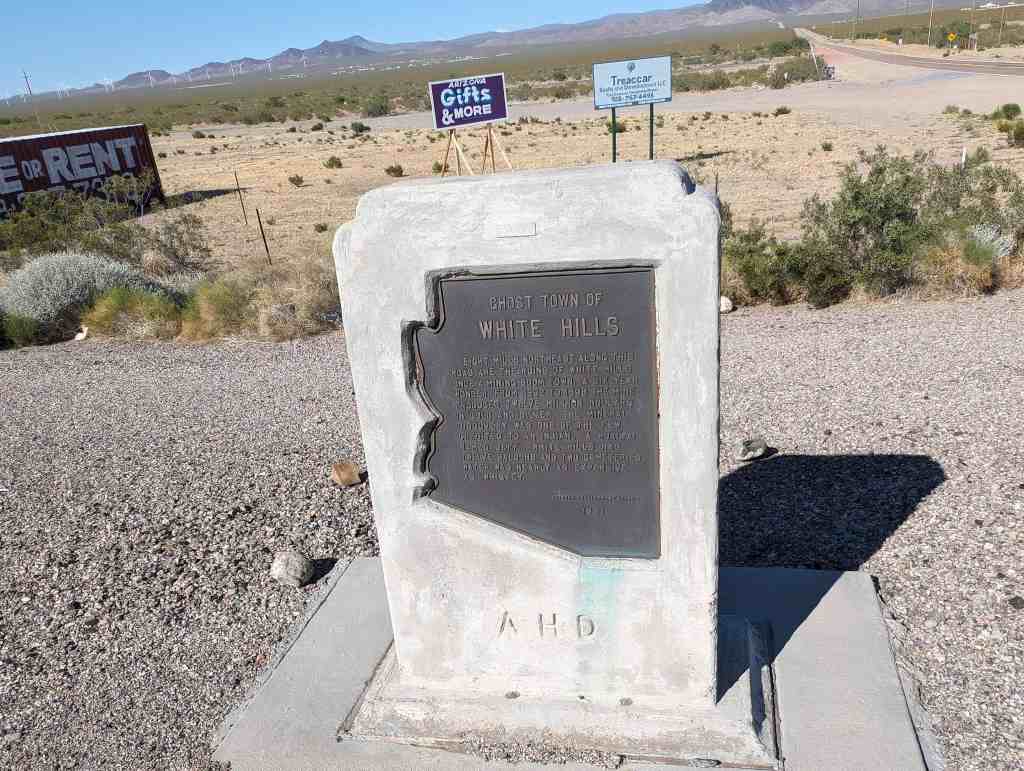
Eight miles northeast along this road are the ruins of White Hills, once a mining boom town. A six-year wonder, from 1892 to 1898 the mine produced twelve million dollars in gold and silver. The mineral discovery was one of the few credited to an indian… a hualpai named Jeff. White Hills had twelve saloons and two cemeteries. Water was nearly as expensive as whiskey.
Formerly known as Indian Secret Mining District or Silverado, the White Hills mining camp started in the 1890’s. The mines were rich producers of silver, especially horn silver, also called chloride silver. This large community was devastated by a flash flood on the morning of August 5, 1899 from which the town never recovered. After the closure of the mines, the remaining buildings slowly disappeared. Now nothing is left of the once prosperous mining camp. The ghost town of White Hills continues to be marked on travel maps.
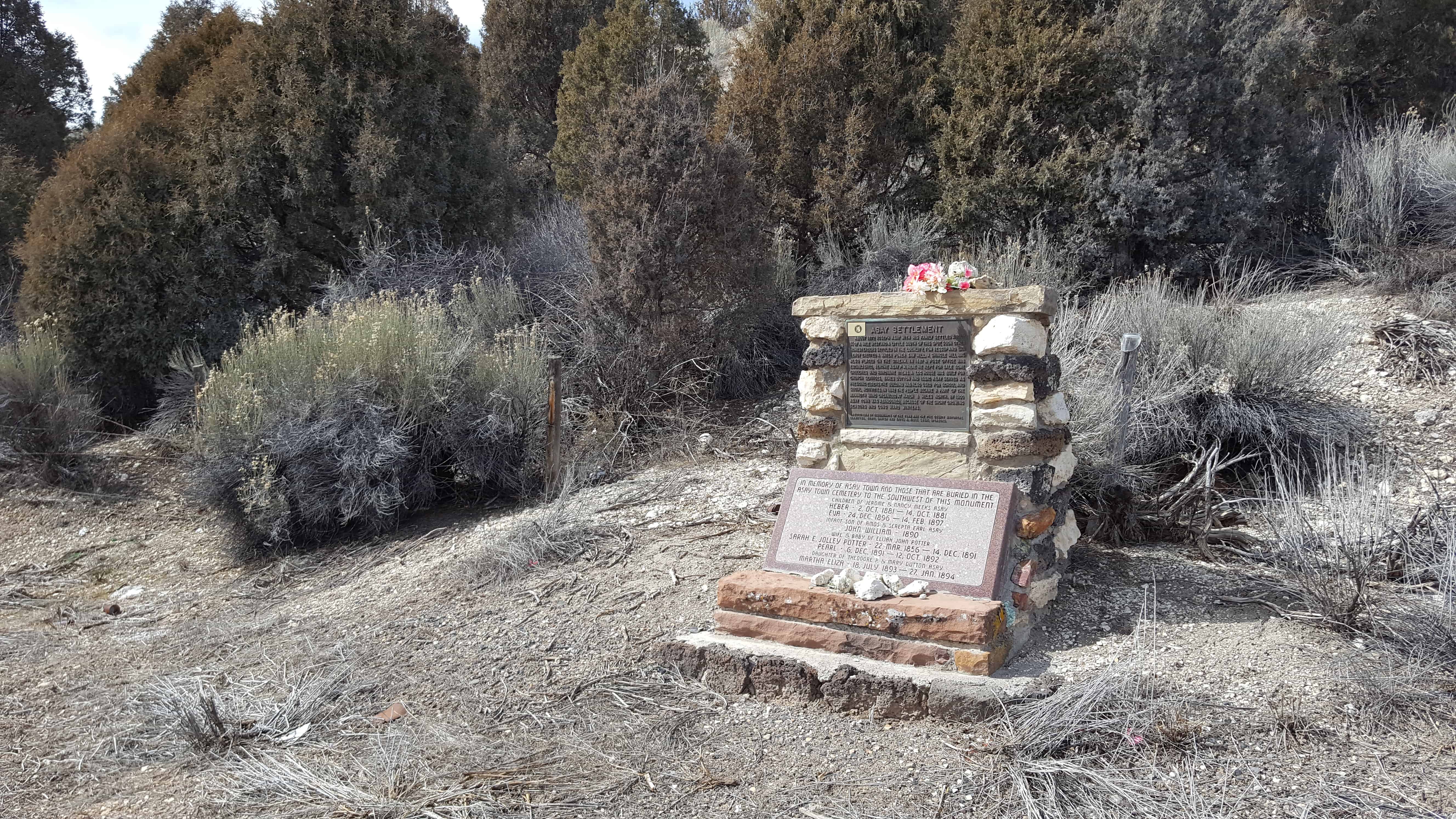
About 1872 Joseph Asay with his family settled about 3/4 of a mile west and a little south of this spot. Soon other homesteaders settled in the locality. Tom Jessup and Dan LeRoy erected a water power saw mill. A shingle mill was established, Jerome Asay P.M. Here he kept for sale some groceries and hardware items. A log house was built for church services, James Dutton and Issac Asay served as presiding elders. The building was also used for school and social activities. In 1892 the people became a part of the Mammoth Ward organized at Hatch 8 miles north. By 1900 Asay Town was abandoned, because of the short growing seasons and long hard winters.
Asay was also known as Aaron for time, named for Aaron Asay.
Chapman Duncan, Alma Minnerly, and a few others settled this area in 1861. But a flood in January of 1862 washed away much of the good farmland. Most of the first settlers moved away and sold their claims to William Theobald, Joseph Wright, William Wright, Clayborne Elder, Jonathan B. Pratt, Robert W. Reeve, and Thomas Burgess. Other settlers moved into the area and formed the village of Duncan’s Retreat.
There are several theories about the origin of the name, Duncan’s Retreat. One of them is that the name came the idea that Chapman Duncan had retreated from this area. Another is that Duncan retreated to this area after botching a canal surveying job in Virgin.
Farming produced good crops of cotton, corn, wheat, and sorghum.
A post office was built in 1863 and a schoolhouse in 1864. They also built an L.D.S. meetinghouse.
In 1866, when the Black Hawk War caused widespread fear of Indian attacks, the town was evacuated to Virgin, although farmers returned to Duncan’s Retreat each day to work their fields. Residents moved back permanently in 1868.
The Duncan’s Retreat settlement was all but abandoned in 1891. By 1930, hardly a trace remained – only a few foundations and trees.
Population
About 70 at the end of 1862
50 in 1864
There were 11 families and 79 people in 1880
There were 9 families in 1890
The village was all but abandoned in 1891
L.D.S. Church History
William Theobald was Presiding Elder between 1864 and 1866.
William Martindale was Presiding Elder starting in 1868.
Joseph Wright was Presiding Elder and/or Branch President until he died in 1873.
The Duncan Branch of the Virgin Ward was formed in 18?? and continued until about 1891.
Samuel Stansworth was Branch President starting in 1873.