• About JacobBarlow.com
  • Cemeteries in Utah
  • D.U.P. Markers
  • Doors
  • Exploring Utah Email List
  • Geocaching
  • Historic Marker Map
  • Links
  • Movie/TV Show Filming Locations
  • Oldest in Utah
  • Other Travels
  • Photos Then and Now
  • S.U.P. Markers
  • U.P.T.L.A. Markers
  • Utah Cities and Places.
  • Utah Homes for Sale
  • Utah Treasure Hunt

JacobBarlow.com

~ Exploring with Jacob Barlow

JacobBarlow.com

Tag Archives: Historic Markers

Circleville

07 Friday Apr 2017

Posted by Jacob Barlow in Uncategorized

≈ 2 Comments

Tags

Circleville, DUP, historic, Historic Markers, Piute County, utah
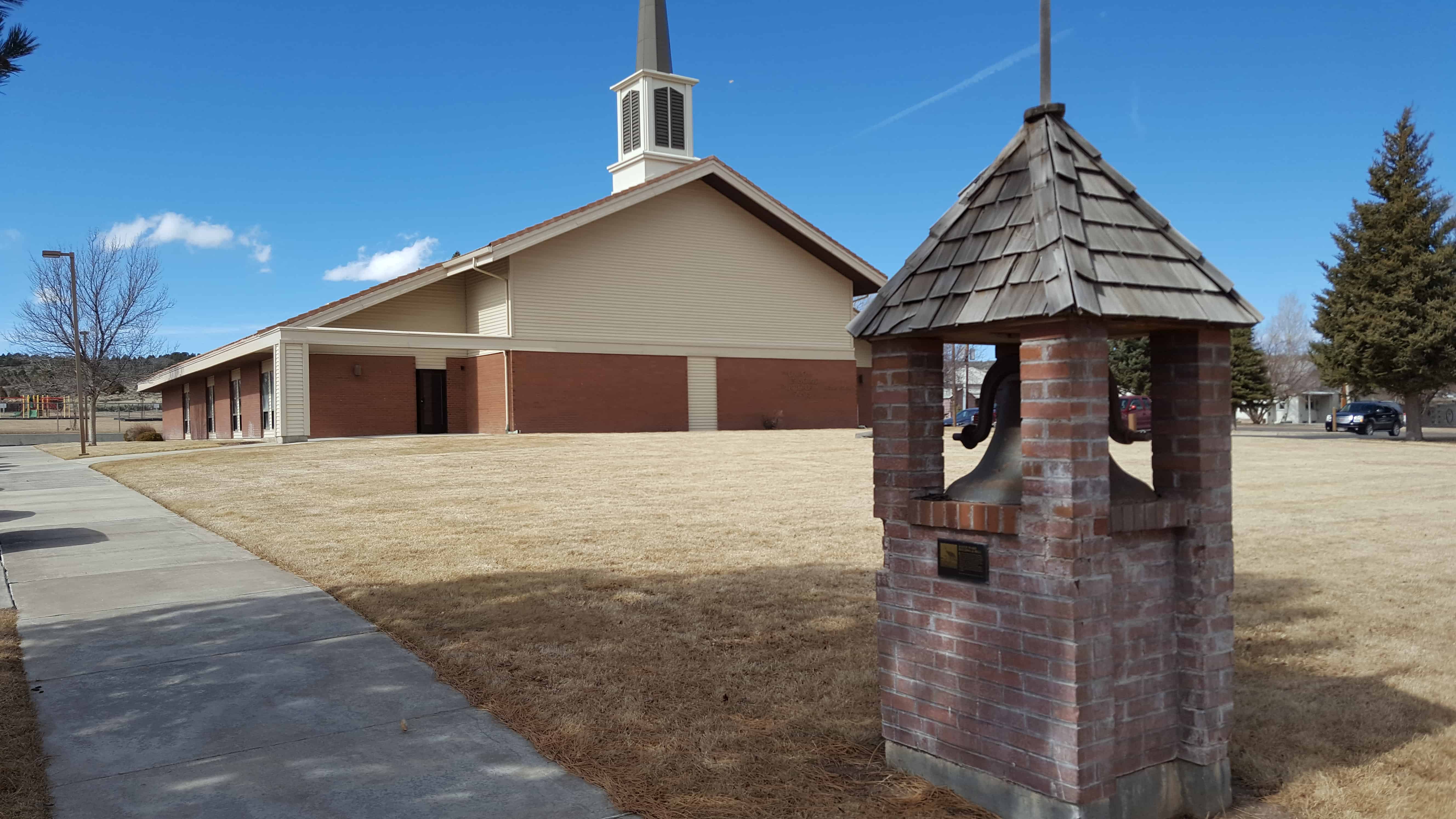
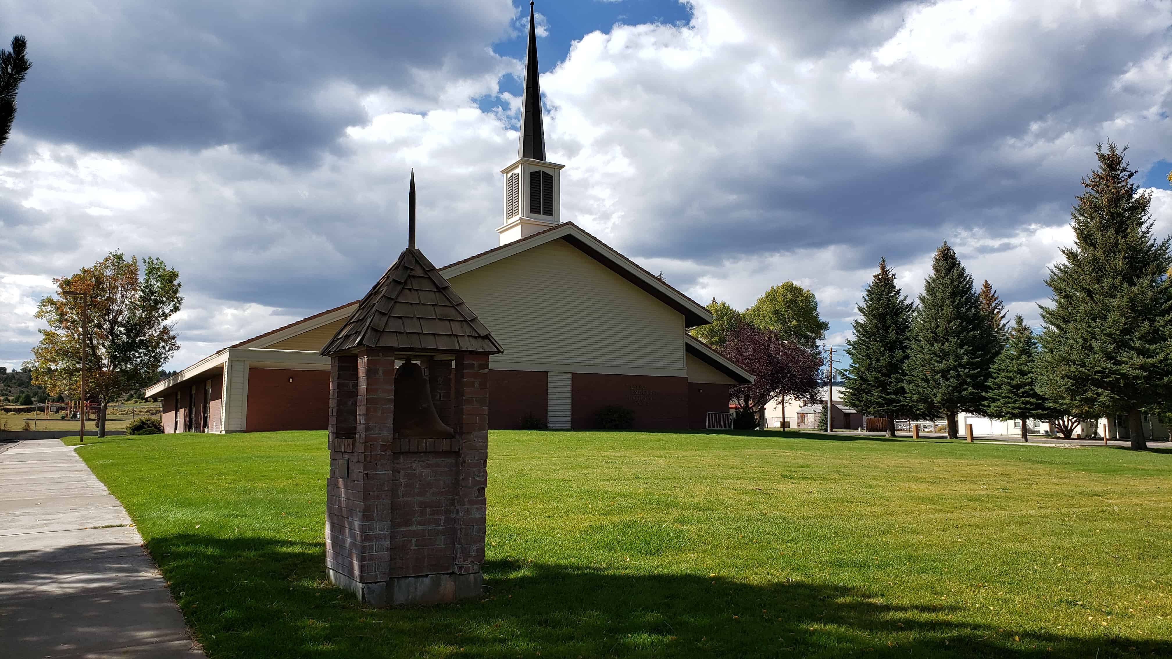
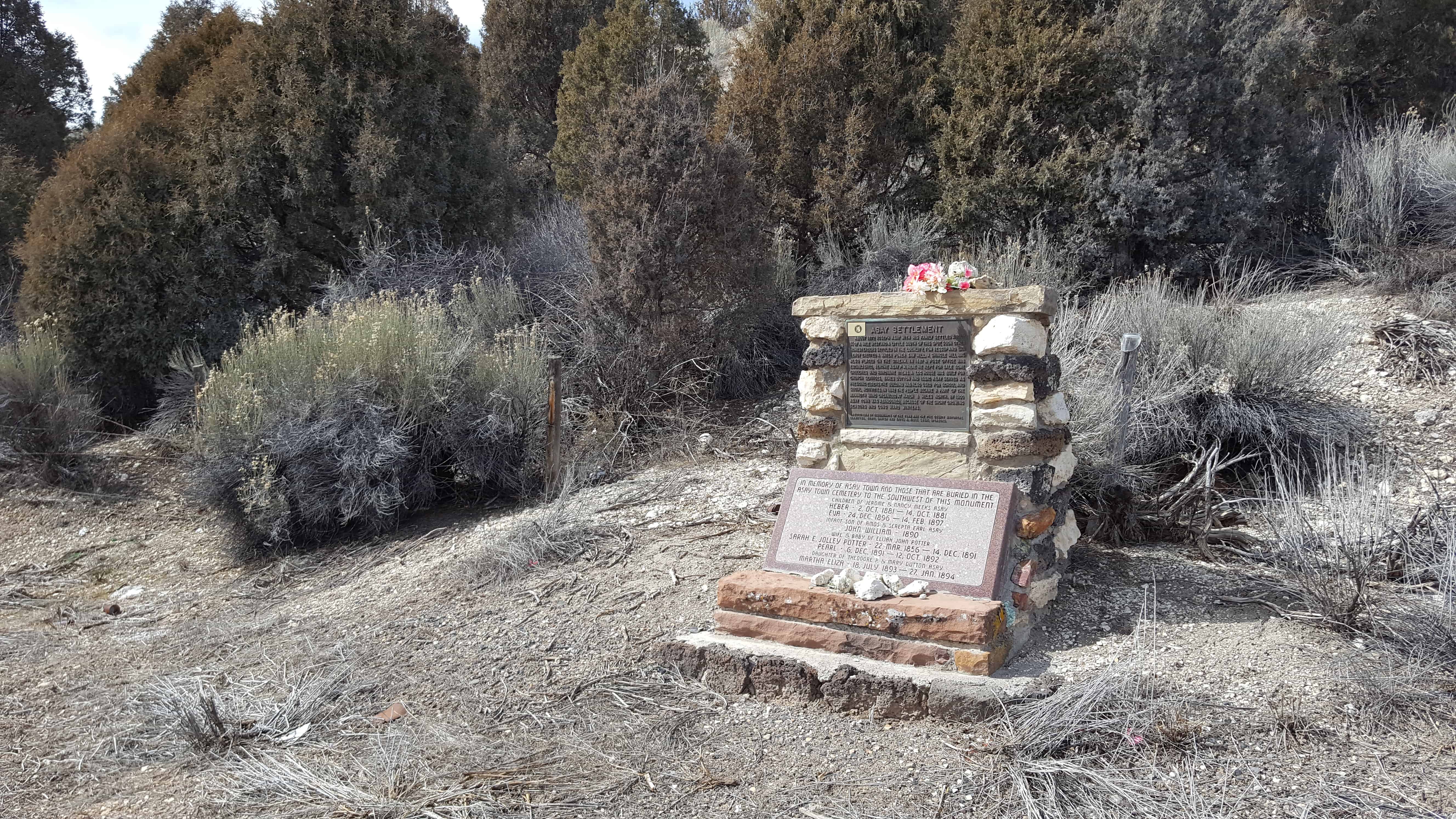
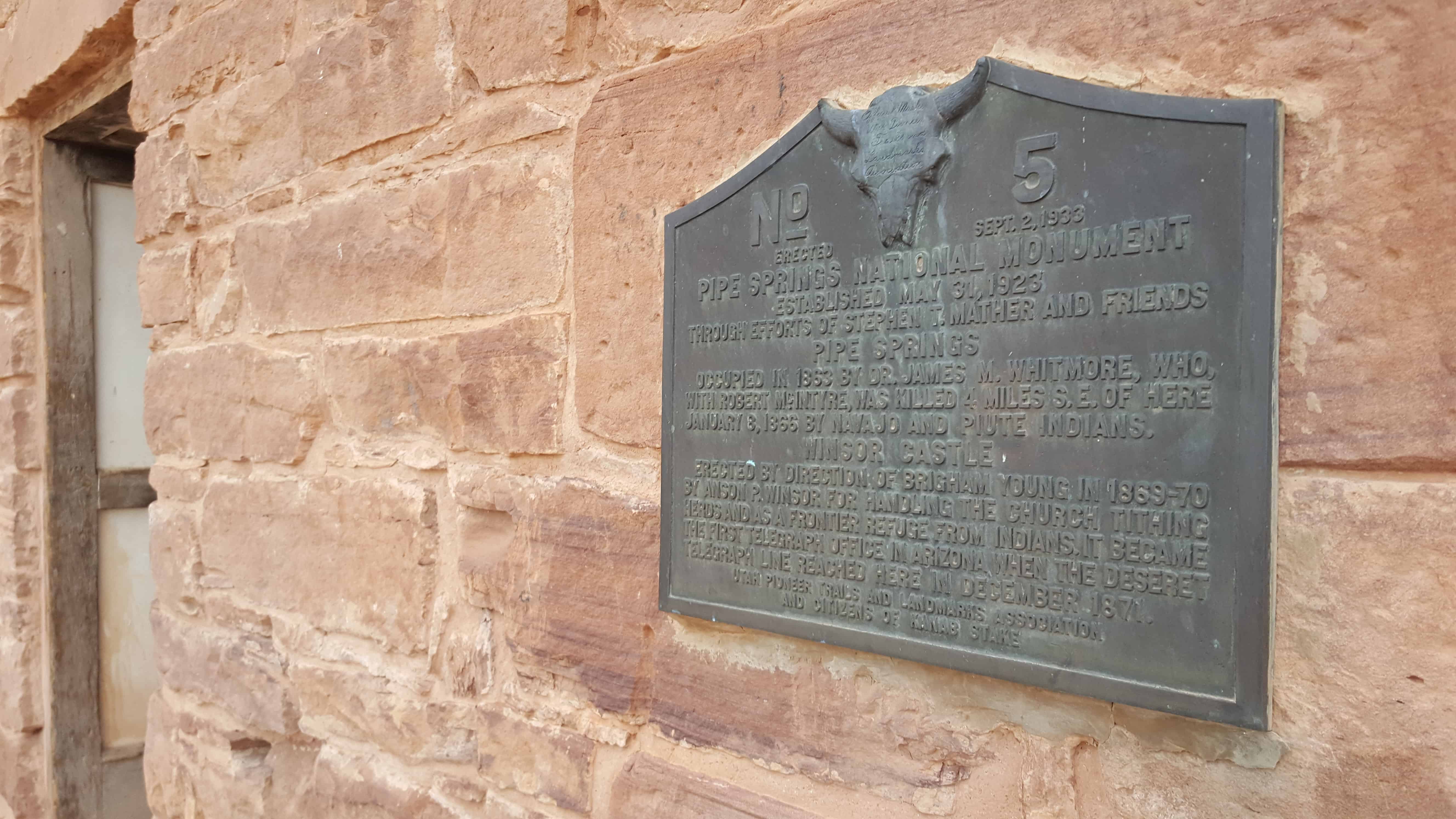
2017-03-05 13.44.01

DUP Marker # 366

Circleville was settled in 1864 by a group of pioneers from Sanpete County, the Church of Jesus Christ of Latter-day Saints organized a branch, William J. Allred, Presiding Elder. Land was cultivated and homes erected. In 1865 the Black Hawk War forced evacuation. Non-Mormons began homesteading the valley in 1873 and Mormons from the Beaver area arrived a year later, Thomas Day, Presiding Elder. In 1876 Thomas King and sons established a United Order 2 miles east of the original settlement.

2017-03-05 13.44.12
2017-03-05 13.44.25
2017-03-05 13.42.14

Hatch Ward Building & Bell

06 Thursday Apr 2017

Posted by Jacob Barlow in Uncategorized

≈ 2 Comments

Tags

Bells, DUP, Garfield County, Hatch, historic, Historic Markers, utah

  • 2017-03-05 12.41.49

Hatch Ward Building & Bell

In 1904 the Hatch LDS Ward building was erected on this lot. A vestibule was added in  1901, and the bell was purchased with donations from ward members. For many years it hung in the tower and rang out for all civic, social and church activities. School was held in the building until 1913. The building was razed March 3, 1983, when the new ward meetinghouse was built.

Hatch Camp/Daughters of Utah Pioneers/1988

Asay Settlement

05 Wednesday Apr 2017

Posted by Jacob Barlow in Uncategorized

≈ Leave a comment

Tags

Asay, Garfield County, Ghost Towns, Hatch, Highway 89, historic, Historic Markers, utah

  • 2017-03-05 12.33.01

About 1872 Joseph Asay with his family settled about 3/4 of a mile west and a little south of this spot.  Soon other homesteaders settled in the locality.  Tom Jessup and Dan LeRoy erected a water power saw mill.  A shingle mill was established, Jerome Asay P.M.  Here he kept for sale some groceries and hardware items.  A log house was built for church services, James Dutton and Issac Asay served as presiding elders.  The building was also used for school and social activities.  In 1892 the people became a part of the Mammoth Ward organized at Hatch 8 miles north.  By 1900 Asay Town was abandoned, because of the short growing seasons and long hard winters.

Asay was also known as Aaron for time, named for Aaron Asay.

  • 2017-03-05 12.36.00

Isaac Behunin Monument

02 Sunday Apr 2017

Posted by Jacob Barlow in Uncategorized

≈ 7 Comments

Tags

historic, Historic Markers, Kane County, Mt. Carmel, utah

2017-03-05 11.37.17

Isaac Behunin
_______________

Early Mormon Pioneer
_______________
In memory of Isaac Behunin,
Mormon Pioneer, Early Utah Settler and
Credited with the naming of Zion Canyon.
Isaac Behunin was born October 20, 1803 in Richland, New York to Albert and Nancy Lord Bohanan (Bohannon). He was involved in the thrust westward, frontierism and the religious revival of early America. In addition to being a farmer, he helped build the Erie Canal as well as other canals during the “Canal Craze” of the 1800s. He married Meribah Morton in 1823 and joined the Mormon Church in 1833. Shortly thereafter, he moved to Kirtland, Ohio to join the main body of the church. Meribah died in Kirtland, leaving Isaac three small boys to raise; Philo, Isaac M. and William. He married Elmina Tyler in 1834, and over the following 19 years they had nine more children. He knew the Prophet Joseph Smith and at times served as one of his body guards. He helped build the Kirtland and Nauvoo Temples. In 1840 he was ordained an Elder and later a Seventy and High Priest. He served a short mission to Iowa. He and his family suffered the losses, hardships and persecutions of the “driving of the saints” through Ohio, Missouri, Illinois and Iowa from 1833 until 1850 when he migrated to Utah.

This monument is located in Mount Carmel and the Mt. Carmel School and Church.

Related posts:

  • Behunin-Beck House
  • Ephraim Settlement
  • Isaac Behunin Dugout Site
  • Northrop

Fort Kanab

29 Wednesday Mar 2017

Posted by Jacob Barlow in Uncategorized

≈ 1 Comment

Tags

historic, Historic Markers, Kanab, Kane County, SUP, utah

2017-03-05 11.03.52

On June14, 1870, Levi Stewart, who had been called from Salt Lake County by President Brigham Young to head a group of pioneers in settling this area, brought a party with seven wagons from Pipe Spring, where they had camped temporarily, to Fort Kanab which had been built a year before by Jacob Hamblin and Indian missionaries.

Kanab Ward was organized September 11, 1878, with Elder Stewart as Bishop. Other settlers arrived, homes were built and plans made for a permanent community. A fire in the Fort on December 14, took the lives of Mrs. Margery Wilkerson Stewart and five sons.

SUP/UPTLA Marker # 115 Located in Levi Stewart Memorial Park in Kanab.

2017-03-05 11.03.46

Jacob Hamblin

29 Wednesday Mar 2017

Posted by Jacob Barlow in Uncategorized

≈ 2 Comments

Tags

historic, Historic Markers, Kanab, Kane County, SUP, utah

Born April 2, 1819 – Died august 21, 1886. The great Mormon Frontiersman and Indian missionary settled in Tooele Valley, Utah in 1850 and began peaceful negotiations with the red men. He was so successful that the officials of the Church of Jesus Christ of Latter-day Saints sent him to establish residence among the Indians at Santa Clara, Utah in 1854.

A fort was erected on this site in 1865 into which he moved in 1869. He assisted Maj. J. W. Powell and party 1869-72. He was transferred in 1878 to Arizona, and later to New Mexico. He is buried at Alpine, Arizona. His friendship with the Indians saved many lives.

This is historic marker #21 in this series by the U.P.T.L.A. (which was later adopted into this series by the S.U.P.) Located in Levi Stewart Memorial Park at 89 North 300 West (Highway 89) in Kanab, Utah.

2017-03-05 11.03.35

Levi Stewart Memorial Park

29 Wednesday Mar 2017

Posted by Jacob Barlow in Uncategorized

≈ Leave a comment

Tags

historic, Historic Markers, Kanab, Kane County, Memorials, Parks, utah

2017-03-05 11.02.45

Levi Stewart Memorial Park has SUP/UPTLA Markers #21 and #115 along with many other historic plaques.

In the winter of 1869, he accompanied Brigham Young to southern Utah to seek out locations for new Mormon settlement. In 1870, Young directed him to form a settlement at the abandoned outpost of Kanab. Stewart arrived in June. He led a number of families to the area. Levi Stewart became the first Mormon Bishop of Kanab, Utah in September 1870. Over the next several years he directed the construction of dams and roads in the area, and he helped build a good relationship with the local Indians.

2017-03-05 11.02.53
2017-03-05 11.02.56

2017-03-05 11.03.11
2017-03-05 11.03.18

2017-03-05 11.03.58
2017-03-05 11.04.03
2017-03-05 11.04.12
2017-03-05 11.04.24
2017-03-05 11.04.44
2017-03-05 11.04.56

Kanab Library

27 Monday Mar 2017

Posted by Jacob Barlow in Uncategorized

≈ 3 Comments

Tags

Historic Buildings, Historic Markers, Kanab, Kane County, Libraries, NRHP, utah

2017-03-05 10.48.58

Kanab Library

The Kanab Library was built between 1939 and 1940 as a Works Progress Administration (WPA) project. The library is one of 226 buildings constructed in Utah under the WPA and is important in documenting the impact of New Deal programs in the state. Utah was one of the most severely affected states during the Depression, having a 25 percent average unemployment rate during the era. For this reason, the state was ninth among the 48 states for per-capita federal spending.

Although the Kanab Library was founded in 1915, it was not at first housed in a permanent structure but was rather moved around to various temporary accommodations. In 1938, an $8,000 bond election was approved to build a permanent library, and plans drawn by the architect Carson F. Wells were acquired from the city of Salina, which had just constructed a library, The Kanab Library is basically identical to the Salina building and combines features of both the Prairie School and Art Deco styles. Wells’s design combines a symettrical facade with abstract geometrical embellishments which tones down the rigidly formal appearance of the building.

2017-03-05 10.49.27

2017-03-05 10.48.58
2017-03-05 10.49.22
2017-03-05 10.49.37
2017-03-05 10.49.42
2017-03-05 10.49.46
2017-03-05 10.49.50

Pipe Spring National Monument

22 Wednesday Mar 2017

Posted by Jacob Barlow in Uncategorized

≈ 1 Comment

Tags

Arizona, Forts, historic, Historic Markers, LDS, Mohave County, National Monuments, Pipe Spring, Springs

2017-03-05 09.36.00

UPTLA (SUP) Marker #5 at Pipe Spring National Monument.

PIPE SPRINGS NATIONAL MONUMENT, Established May 31, 1923, through efforts of Stephen T. Mather and friends. PIPE SPRINGS, occupied in 1863, by Dr. James M Whitmore, who, with Robert McIntire was killed 4 miles S.E. of Pipe Springs January 8, 1866, by Navajo and Piute Indians.
WINDSOR CASTLE Erected by direction of Brigham Young in 1869 – 70 by Anson Windsor for handling the Church tithing herds and as a frontier refuge from Indians. It became the first telegraph office in Arizona when the Deseret Telegraph Line reached here in December 1871.

See other historic markers in the series on this page for UPTLA/SUP Markers.

2017-03-05 09.35.04

2017-03-05 09.35.23

The Historic Dixie-Long Valley, Utah Pioneer Trail

18 Saturday Mar 2017

Posted by Jacob Barlow in Uncategorized

≈ 1 Comment

Tags

historic, Historic Markers, Hurricane, SUP, utah, Washington County

2017-03-05 08.35.00

SUP Marker #118 in Hurricane.  (Also located here is #101B)

Segments of the old Indian trails between St. George and Long Valley were used by Mormon pioneers to settle Long Valley in 1864 and for its resettlement in 1871 following Indian conflicts. This trail scaled the Hurricane Fault on the Johnson Twist. One segment went south from Virgin City and then east and the other went east to Rockville-Crafton and then south to Big Plains where they merged. The desert trail, about 85 miles long, traversed deep sand, sandstone ledges and lava faults and was the primary transportation route, including mail and heavy freight, for half a century. It took four days for loaded wagons drawn by horse or ox teams to travel the distance.

See other historic markers in the series on this page for SUP Markers.

2017-03-05 08.35.06

2017-03-05 08.35.48
2017-03-05 08.35.39
2017-03-05 08.35.26
2017-03-05 08.35.13

← Older posts
Newer posts →

Follow Jacob

Follow Jacob

Come wander with me on Youtube.

Blog Stats

  • 2,092,718 hits

Social and Other Links

BarlowLinks.com

Recent Posts

  • Provo High School Seminary Building
  • 821 E 100 S
  • 820 E 100 S
  • 817-819 E 100 S
  • 814 E 100 S

Archives

Loading Comments...