
He traveled through Nevada in 1775-‘6
Erected 1953-1954 by Francisco Garcés Chapter
Daughters of the American Revolution
In memory of Padre Francisco Garcés
First recorded white man to enter Nevada
The small rocks are from the 48 states.

03 Saturday Dec 2016
Posted in Uncategorized
He traveled through Nevada in 1775-‘6
Erected 1953-1954 by Francisco Garcés Chapter
Daughters of the American Revolution
In memory of Padre Francisco Garcés
First recorded white man to enter Nevada
The small rocks are from the 48 states.
03 Saturday Dec 2016
Posted in Uncategorized
Tags
UPTLA #119
Captain Jefferson Hunt, Soldier, Pioneer, Churchman,
Born January 20, 1804 in Kentucky – Died May 11 1879 in Idaho
Charles Jefferson Hunt served in the Mormon Battalion as Captain of Company “A” and as assistant executive officer, in its historic march from Council Bluffs, Iowa to San Diego, California, 1846-47. His service won the commendation of all who served with him.
Under appointment by President Brigham Young in 1851, Captain Hunt was guide for the pioneers to San Bernardino, California.. His pioneer service included also Provo, Parowan and Huntsville, (which bears his name) in Utah, and Oxford, Idaho.
A convert to the Church of Jesus Christ of Latter-day Saints, he was loyal, obedient and faithful to the end.
See other historic markers in the series on this page for UPTLA/SUP Markers.

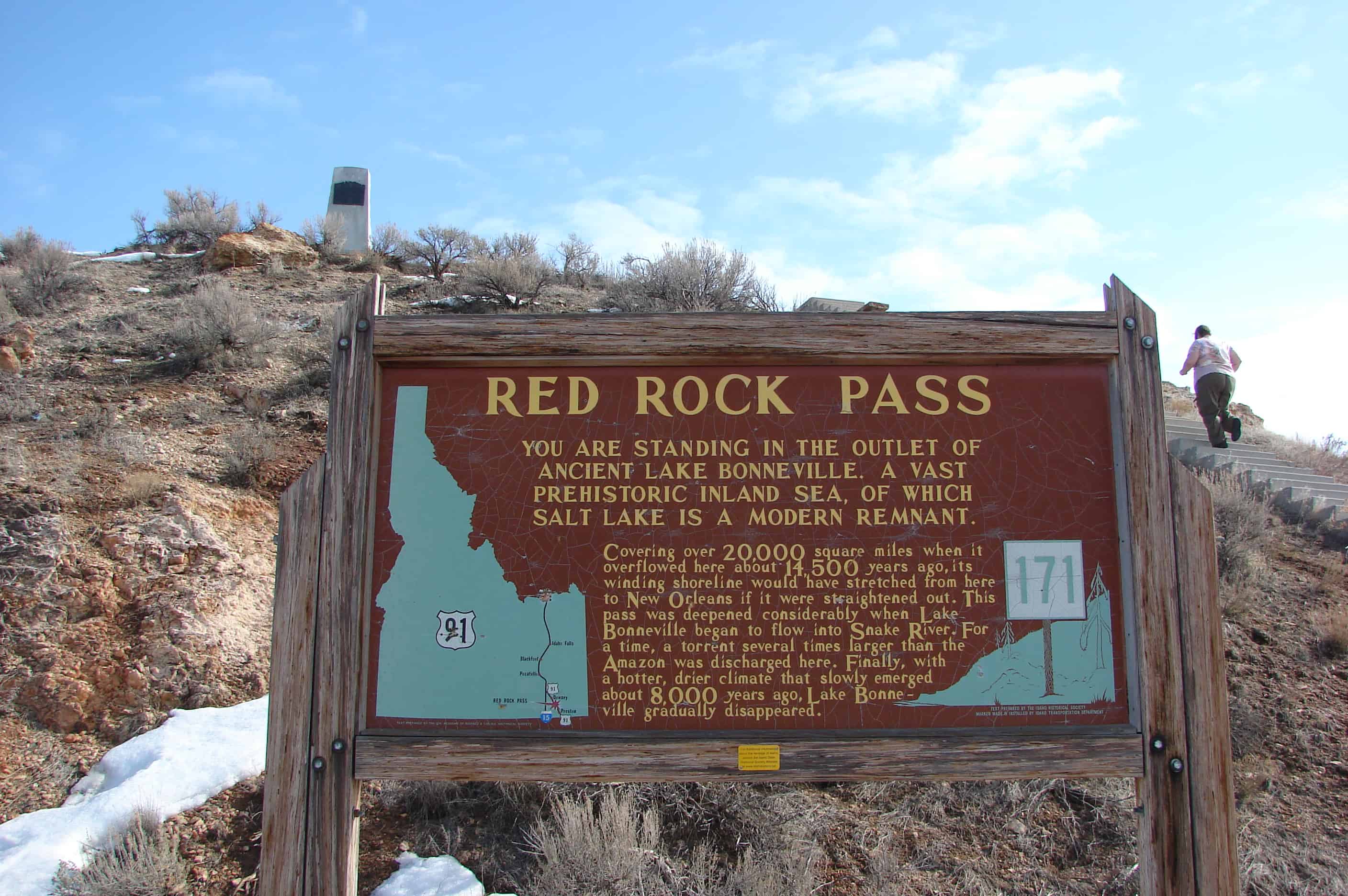
Red Rock Pass
You are standing in the outlet of ancient Lake Bonneville, a vast prehistoric inland sea, of which Salt Lake is modern remnant.
Covering over 20,000 square miles when it overflowed here about 14,500 years ago, its winding shoreline would have stretched from here to New Orleans if it were straightened out. This pass was deepened considerably when Lake Bonneville began to flow into Snake River. For a time, a torrent several times larger than the Amazon was discharged here. Finally, with a hotter drier climate that slowly emerged about 8,000 years ago, Lake Bonneville gradually disappeared.
29 Tuesday Nov 2016
Posted in Uncategorized
Tags
DUP, historic, Historic Buildings, Historic Homes, Historic Markers, LDS, LDS Church, Monuments, Salt Lake City, Salt Lake County, SUP, This Is The Place Heritage Park, utah
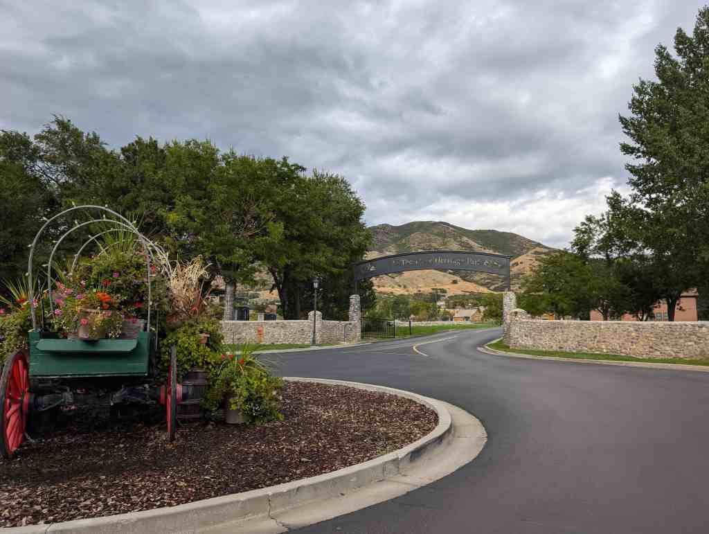
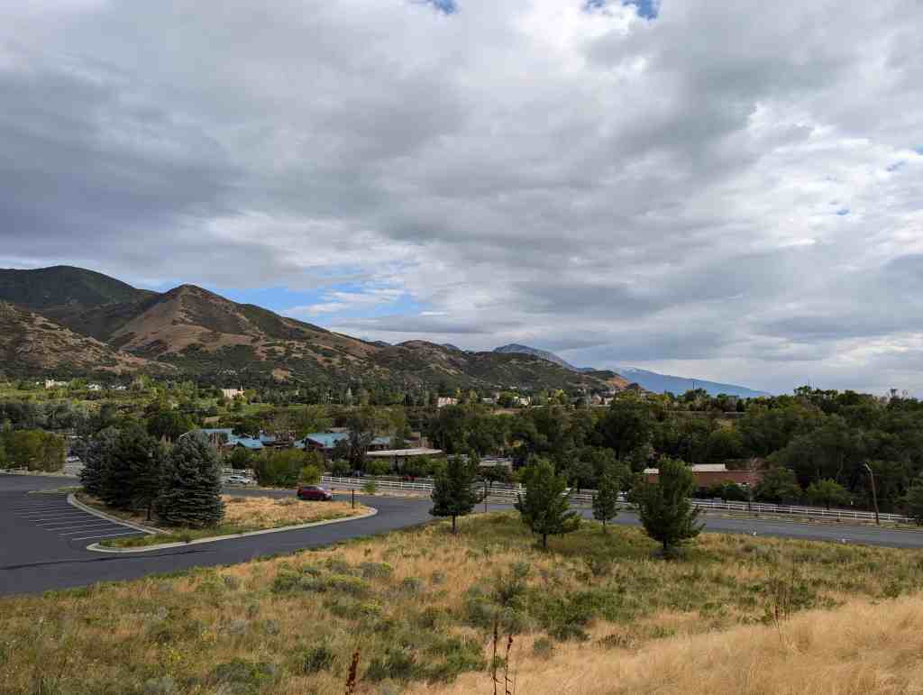
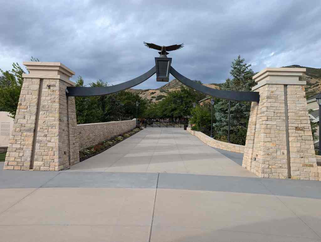
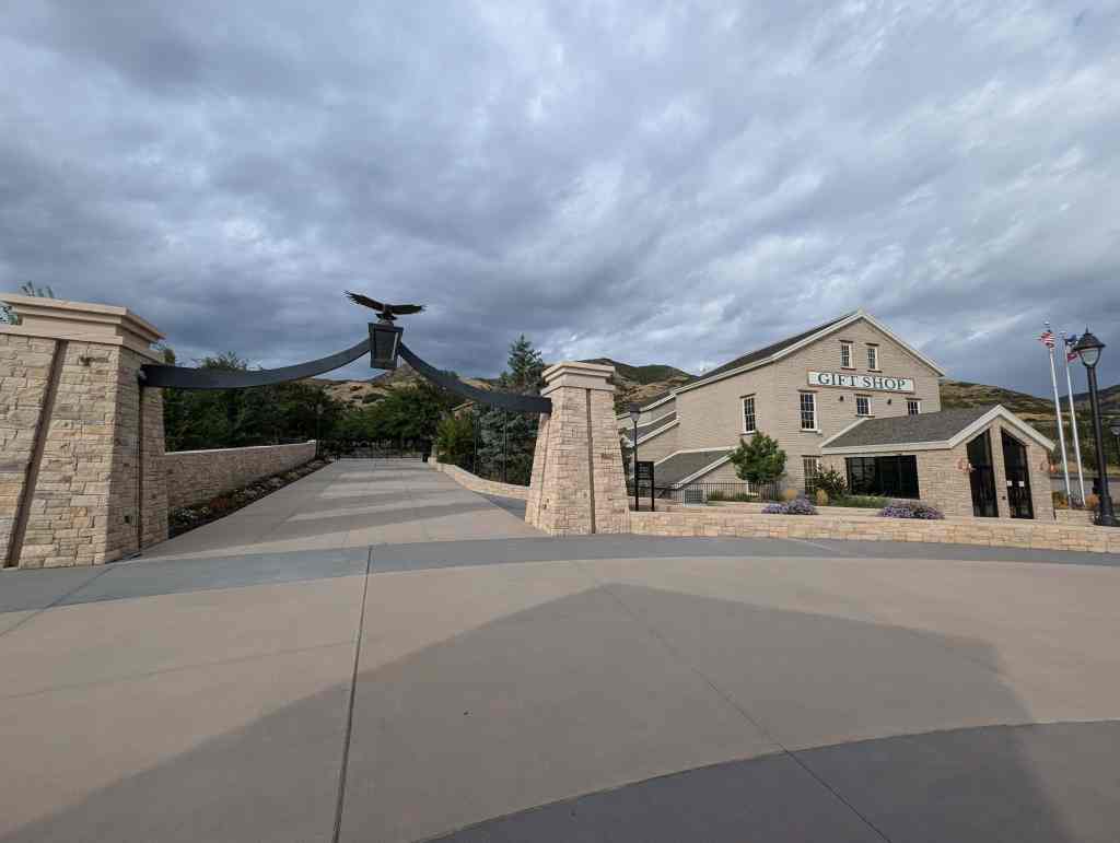
The location of the park is where, on July 24, 1847, Brigham Young first saw the Salt Lake Valley that would soon become the Mormon pioneers’ new home. Members of The Church of Jesus Christ of Latter-day Saints believe that Young had a vision shortly after they were exiled from Nauvoo, Illinois. In the vision, he saw the place where the Latter-day Saints would settle and “make the desert blossom like a rose” and where they would build their State of Deseret. As the account goes, Brigham Young was very sick with Rocky Mountain Spotted Fever and was riding in the back of a wagon. After exiting Emigration Canyon and cresting a small hill, he asked to look out of the wagon. Those with him opened the canvas cover and propped him up so he could see the empty desert valley below. He then proclaimed, “It is enough. This is the right place. Drive on.” The words, “this is the place,” were soon heard throughout the wagon train as the Mormon pioneers descended into the valley, their long journey having come to an end. The statement was first attributed to Young by Wilford Woodruff more than thirty years after the pioneer advent.
Over the next several years, tens of thousands of Mormon pioneers emerged from Emigration Canyon and first saw their new home from this same location. A Utah state holiday, Pioneer Day, occurs each year on July 24 to commemorate the Mormon pioneers’ entry into the valley.

See also:
Located at 2601 Sunnyside Avenue in Salt Lake City, Utah


For other State Parks in Utah visit this page. and for other parks in Salt Lake this page.
27 Sunday Nov 2016
Posted in Uncategorized
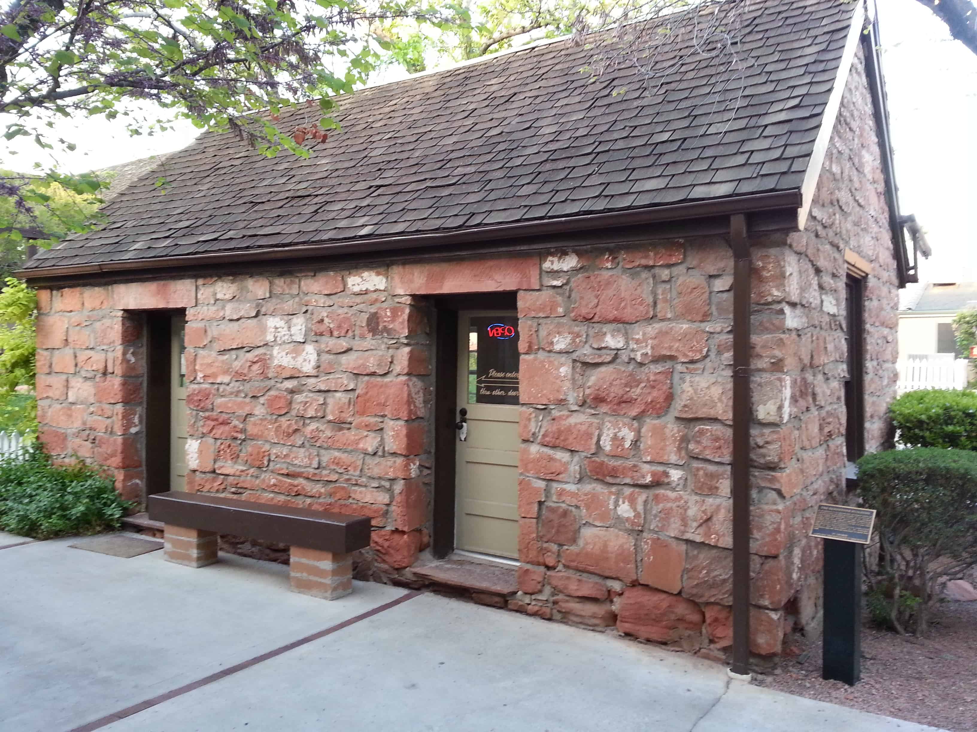
The Sandstone Building
It is difficult to establish an exact date of construction of this building. It is one of a half-dozen structures build in St. George from leftover rock from the Tabernacle during the 1860’s/ George Brooks is thought to have built the building, as he did his own similar home up Main Street.
The building was scheduled for demolition when it was discovered to be historic. Ancestor Square was redesigned to save this gem.

27 Sunday Nov 2016
Posted in Uncategorized

Erastus Fairbanks Snow
Missionary, Founder of St. George,
President of the Cotton Mission
Erastus Snow was born in St. Johnsbury, Vermont in 1818. He entered the Salt Lake Valley on July 21, 1847, in advance of the first company of Mormon Pioneers. He was ordained an Apostle at the age of thirty. As a missionary for The Church of Jesus Christ of Latter-Day Saints, he crossed the Great Plains seven times and published the first foreign translation of the Book of Mormon in Denmark in 1850. Elder Snow presided over the Cotton Mission from 1861 to 1888 and supervised the construction of the St. George Temple and Tabernacle.
This monument is dedicated to Elder Snow’s leadership and the great sacrifice of the Cotton Mission Pioneers.
May 24, 1997

27 Sunday Nov 2016
Posted in Uncategorized

First exploration probably by early Spanish explorers, Espejo in 1852 and Farfan in 1589. Explored later by Lt. Amiel W. Whipple in 1854. Important agriculture, mining, milling, and smelting area in our early days. The McCrackin Mine discovered by Jackson McCrackin and H. A. “Chloride Jack” Owen in 1874, lies 18 miles south. The Signal Mine was 12 miles south. Stamp mills were at Greenwood, 8 miles southwest and at Virginia City, 9 miles southwest. Cofer Hot Springs 3 miles east.


27 Sunday Nov 2016
Posted in Uncategorized
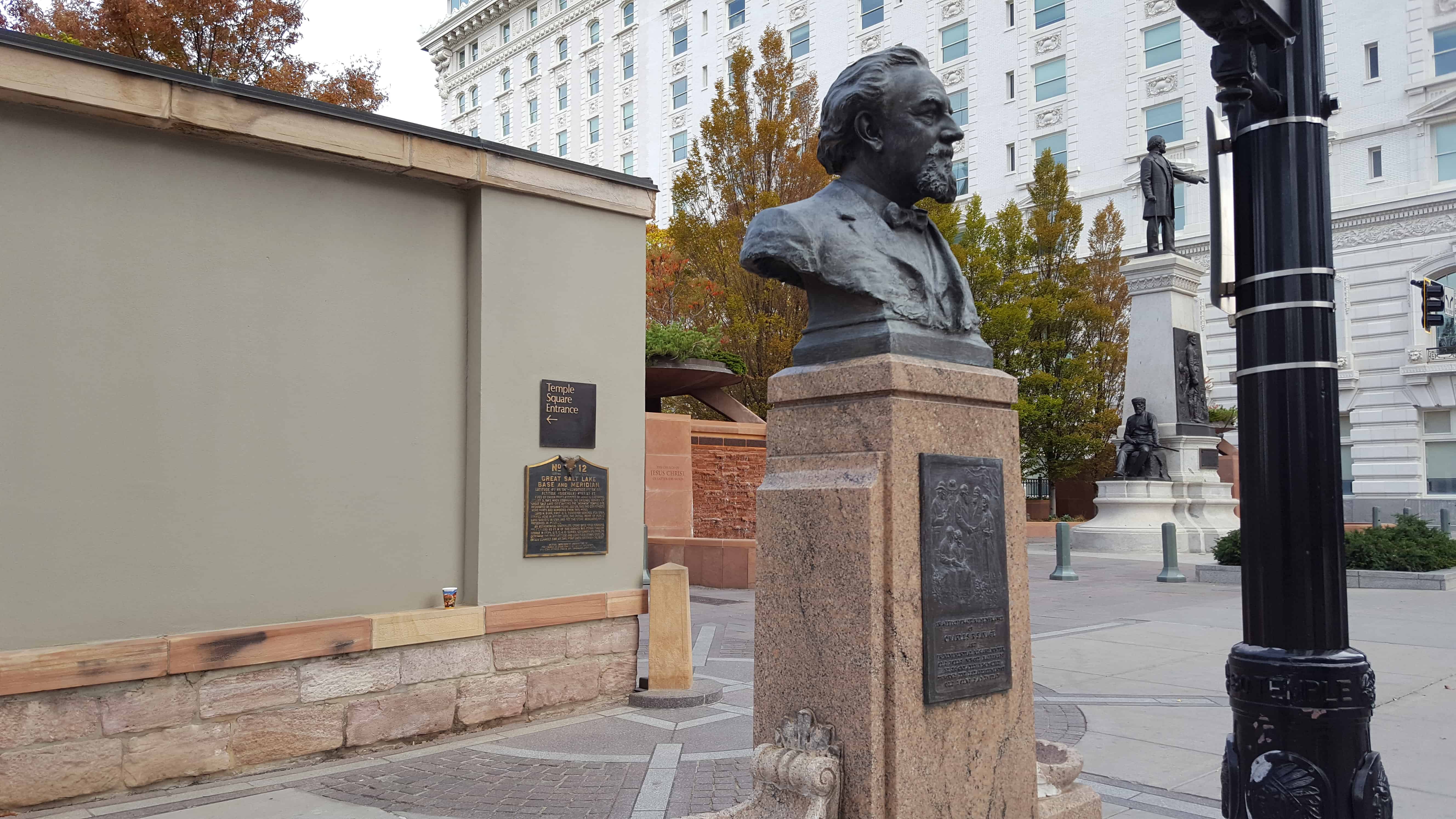
Honor thy Father and Thy Mother
Old Folks Day was inaugurated in Salt Lake City in 1875, by Charles R. Savage, assisted by Edward Hunter, Presiding Bishop of the Church of Jesus Christ of Latter-day Saints, and George Goddard, since which time all persons seventy or more years of age have been honored at an annual celebration in nearly every community in Utah. Travel, refreshment and entertainment are free. (Gilbert Griswold So.)
See other historic markers in the series on this page for UPTLA/SUP Markers.


27 Sunday Nov 2016
Posted in Uncategorized
Tags

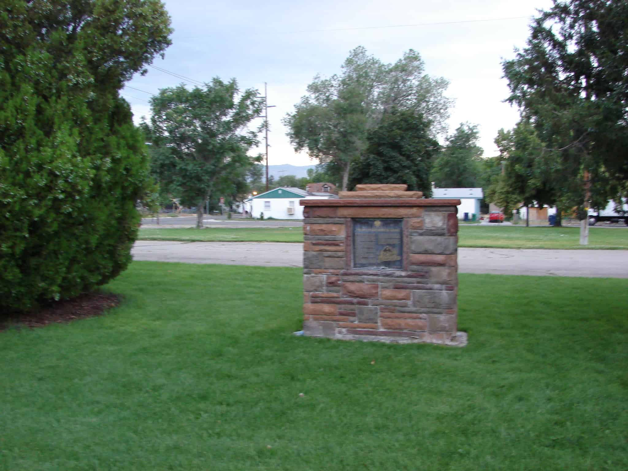
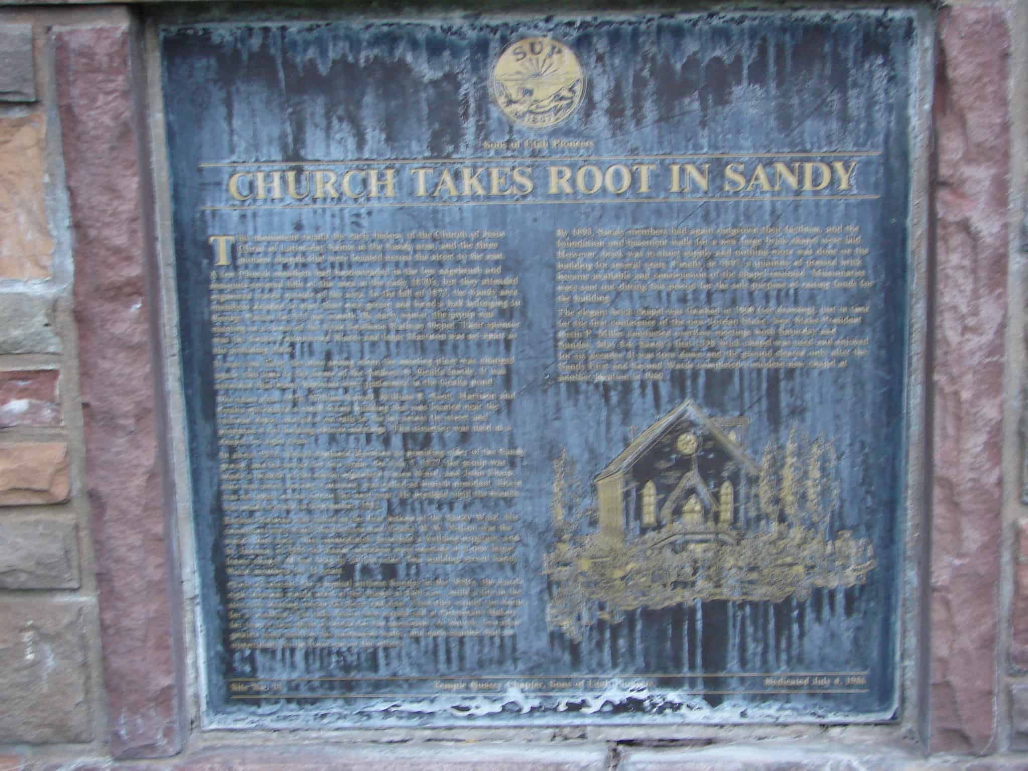
The text below is from Sons of Utah Pioneers historic marker #11, which has two plaques, Church Takes Root in Sandy and Early Sandy Schools. Located at 8780 South 280 East in the historic sandy area of Sandy, Utah
Church Takes Root in Sandy
This monument recalls the early history of the Church of Jesus Christ of Latter-day Saints in the Sandy area, and the three pioneer chapels that were located across the street to the east.
A few Church members had homesteaded in the low sagebrush and mesquite-covered hills of this area in the early 1870’s, but they attended organized wards outside of the area. In the fall of 1873, the Sandy area members decided to start their own group and hired a hall belonging to George Parker for $15 per month. By early winter, the group was meeting in a room of the Utah Southern Railway Depot. Their sponsor was the South Cottonwood Ward, and Isaac Harrison was set apart as the presiding elder.
It was very likely the next spring when the meeting place was changed again, this time to the home of the Andrew O. Gealta family. It was recorded that many baptisms were performed in the Gealta pond.
The same year, 1874, William Newell, William R. Scott, Harrison and Gealta purchased a small frame building that was located near the railroad depot, moved it on rails to the lot across the street and prepared it for holding church meetings. This structure was used as a chapel for eight years.
In about 1875, Newell replaced Harrison as presiding elder of the Sandy group, and he served for two years. On July 7, 1877, the group was made a branch of the newly-organized Union Ward, and John Sharp, who was away serving a mission, was called as branch president. Sharp was set apart on his return the next year. He presided until the branch was made a ward in September, 1882.
Ezekial Holman was called as the birst bishop of the Sandy Ward. His counselors were Emil Hartvicksen and Gealta. W.W. Wilson was the ward’s first clerk. They immediately launched a building program, and by January of 1883 the Sandy members were meeting in a new larger frame chapel, 40 feet long by 26 feet wide. This building served Sandy Ward members for 18 years.
(Note of interest: On a typical autumn Sunday in the 1880’s, the ward’s eight deacons would meet at the chapel at 8:00 a.m., build a fire in the stove for heating, sweep the floor and dust. Then they would run home for a “washup.” On their return they would call at Osterman’s Bakery for two or four slices of bread for the sacrament. At church, two silver goblets were used for the sacrament water, and each member had an opportunity to sip from one or the other.)
By 1893, Sandy members had again outgrown their facilities, and the foundation and basement wall for a new large brick chapel were laid. However, brick was in short supply and nothing more was done on the building for several years. Finally, in 1897, a quantity of pressed brick became available and construction of the chapel resumed. Missionaries were sent out during this period for the sole purpose of raising funds for the building.
The elegant brick chapel was finished in 1900 (see drawing), just in time for the first conference of the new Jordan Stake. New Stake President Orrin P. Miller conducted overflow meetings both Saturday and Sunday, May 5-6. Sandy’s first LDS brick chapel was used and enjoyed for six decades. It was torn down and the ground cleared only after the Sandy First and Second Wards completed a modern new chapel at another location in 1960.


26 Saturday Nov 2016
Posted in Uncategorized
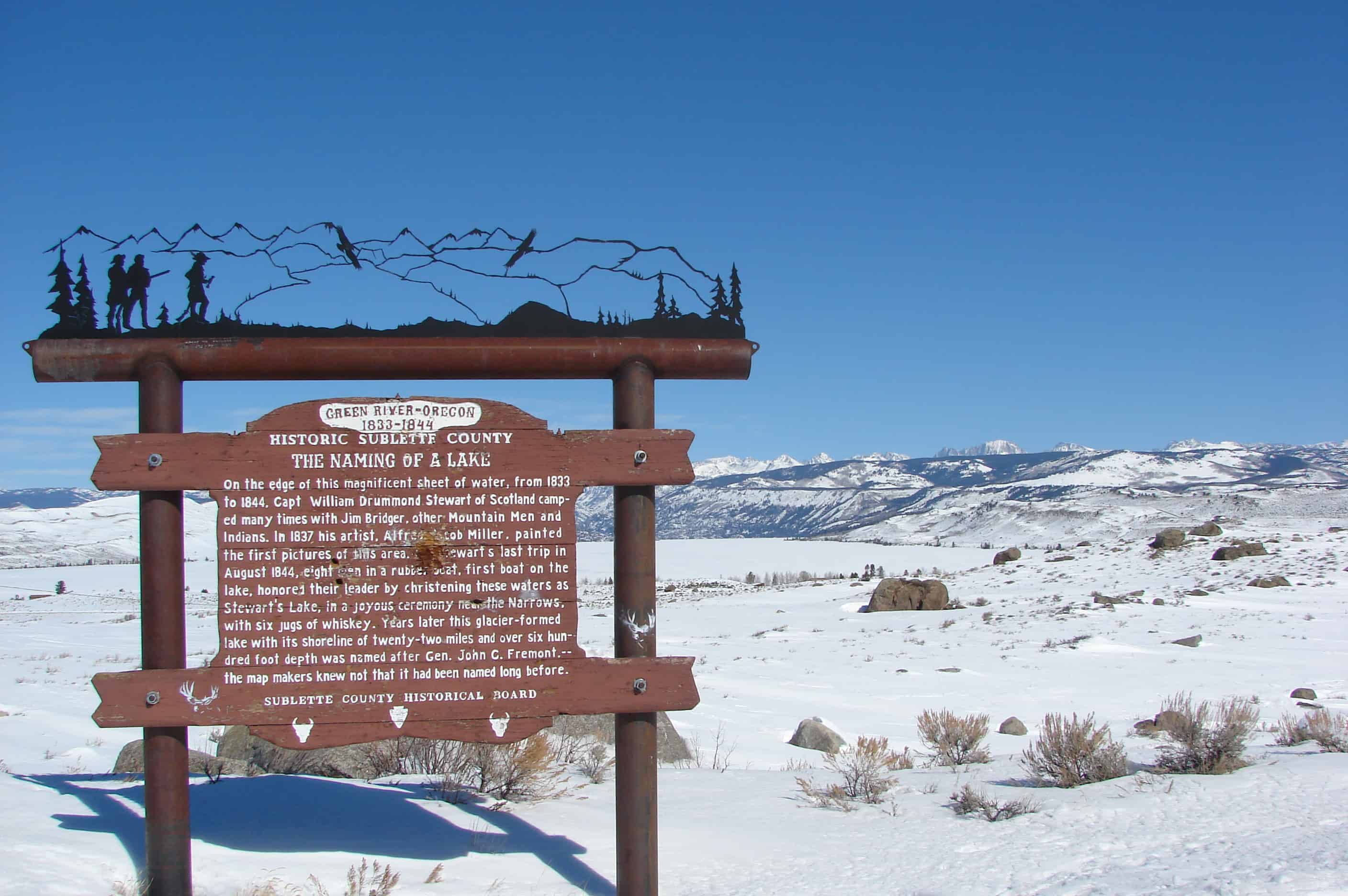
On the edge of this magnificent sheet of water, from 1833 to 1844, Captain William Drummond Stewart of Scotland, camped many times with Jim Bridger and other Mountain Men and the Indians. In 1837 his artist, Alfred Jacob Miller, painted the first pictures of this area. On Stewart’s last trip in 1844, eight men in a rubber boat, first boat on the lake, honored their leader by christening these waters as Stewart’s Lake in a joyous ceremony near the narrows with a jug of whiskey. Years later this glacier-formed lake with its shoreline of twenty-two miles and over six hundred foot depth was named for John C. Fremont, – the map makers knew not it had been named long before.


The marker pictured above has been replaced and the new one says:
Sir William Drummond Stewart of Scotland can be called Wyoming’s first tourist. Stewart attended every summer rendezvous from 1833 to 1838, during the heyday of the mountain man fur trade. Four of those gatherings took place nearby, at the confluence of Horse Creek and the Green River.
This magnificent glacier-carved lake must have been one of Stewart’s favorite spots. Artist Alfred Jacob Miller accompanied Stewart in 1837 and painted the first pictures of the area, including the mountain lakes that inspired both men.
Although the last rendezvous was held in 1840, Stewart and mountain man William Sublette returned one more time in 1843. They camped here for 10 days in August, visited old Shoshone Indian and trapper friends, and raced horses on a flat to the west near the New Fork River. Stewart and a small party floated to the head of the lake in an India-rubber boat brought especially for that purpose. At that time this lake was called both Stewart’s Lake and Loch Drummond.
The year before, in 1842, explorer John C. Fremont had made his first trip west, and guided by Kit Carson, climbed what he thought was the highest summit in the Wind River Mountains. This peak, which towers over the lake, was later named Fremont’s Peak. Long after, not knowing that the lake had already been named in honor of Stewart, Fremont supporters named it Fremont Lake even though John C. Fremont had never actually been there.
At 9 miles long, 1 mile wide and 600 feet deep, Fremont Lake is the second largest natural lake in Wyoming.
20 Sunday Nov 2016
Posted in Uncategorized

The historical marker reads as follows:
MISSION SAN LUÍS REY DE FRANCIA
Founded June 12, 1798 by Father Lasuén, then president of the California missions, and administered by Father Peyrí, Mission San Luís Rey is notable for its impressive architecture-a composite of Spanish, Moorish, and Mexican.
The following text was copied from Wikipedia.
Mission San Luis Rey de Francia was founded on June 13, 1798 in what is now the town of Oceanside, California. In 1816, Mission San Antonio de Pala was established twenty miles inland as its asistencia (“sub-mission”). The local Payomkowishum tribe became known as the Luiseño, after the San Luis mission. An early account of the mission was written by one of its Luiseño neophytes, Pablo Tac.
No services were held at the Mission for 46 years. It was not until 1892 when two Mexican priests were given permission to restore the Mission as a monastery; Father Joseph O’Keefe was assigned as an interpreter for the monks. It was he who began to restore the old Mission in 1895. The cuadrángulo (quadrangle) and church were completed in 1905. Today, Mission San Luis Rey de Francia is a working mission. It is cared for by the people who belong to the parish, and is still being restored. There is a museum and visitors center at the Mission, as well as a small cemetery.


Located at 4050 Mission Ave in Oceanside, California.
Also located here:
Related: