• About JacobBarlow.com
  • Cemeteries in Utah
  • D.U.P. Markers
  • Doors
  • Exploring Utah Email List
  • Geocaching
  • Historic Marker Map
  • Links
  • Movie/TV Show Filming Locations
  • Oldest in Utah
  • Other Travels
  • Photos Then and Now
  • S.U.P. Markers
  • U.P.T.L.A. Markers
  • Utah Cities and Places.
  • Utah Homes for Sale
  • Utah Treasure Hunt

JacobBarlow.com

~ Exploring with Jacob Barlow

JacobBarlow.com

Tag Archives: Historic Markers

United Order Industries

06 Sunday Nov 2016

Posted by Jacob Barlow in Uncategorized

≈ 1 Comment

Tags

DUP, Glendale, historic, Historic Markers, Kane County, Mount Carmel, Mount Carmel Junction, Orderville, United Order, utah

  • 2016-09-06-19-55-45

D.U.P. Marker #290.

Here on March 30, 1874, the Church of Jesus Christ of Latter-day Saints organized a modern Order of Enoch, called the United Order, Israel Hoyt, first president. A community dining hall with bakery was constructed, also a garden house for seeds and tools. They built a carpenter, blacksmith and shoe shop, tannery, gristmill, sawmill, molasses mill, bucket factory, a woolen and cotton factory; engaged in the silk industry, dairying, broom and hat making. The people planted farms, orchards and gardens, raised sheep and cattle. The cooperative ended in 1886.

Located at 20 South Center Street in Orderville, Utah

Related:

  • DUP Markers
  • 2016-09-06-19-55-36

Settlement of Long Valley and Mt. Carmel

06 Sunday Nov 2016

Posted by Jacob Barlow in Uncategorized

≈ 3 Comments

Tags

DUP, historic, Historic Markers, Kane County, Mount Carmel, Mount Carmel Junction, Orderville, utah

2016-09-06-19-37-15

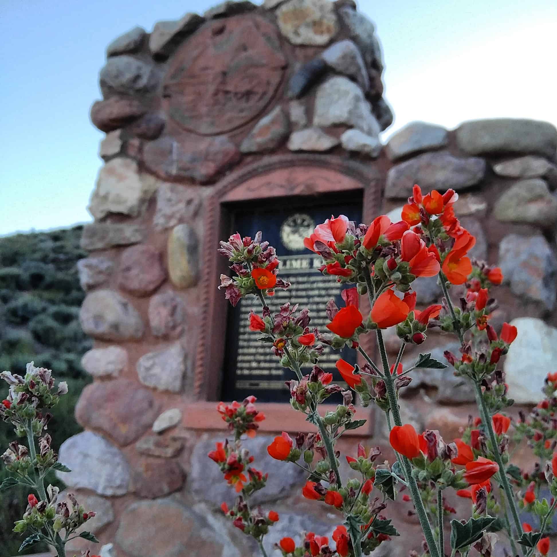
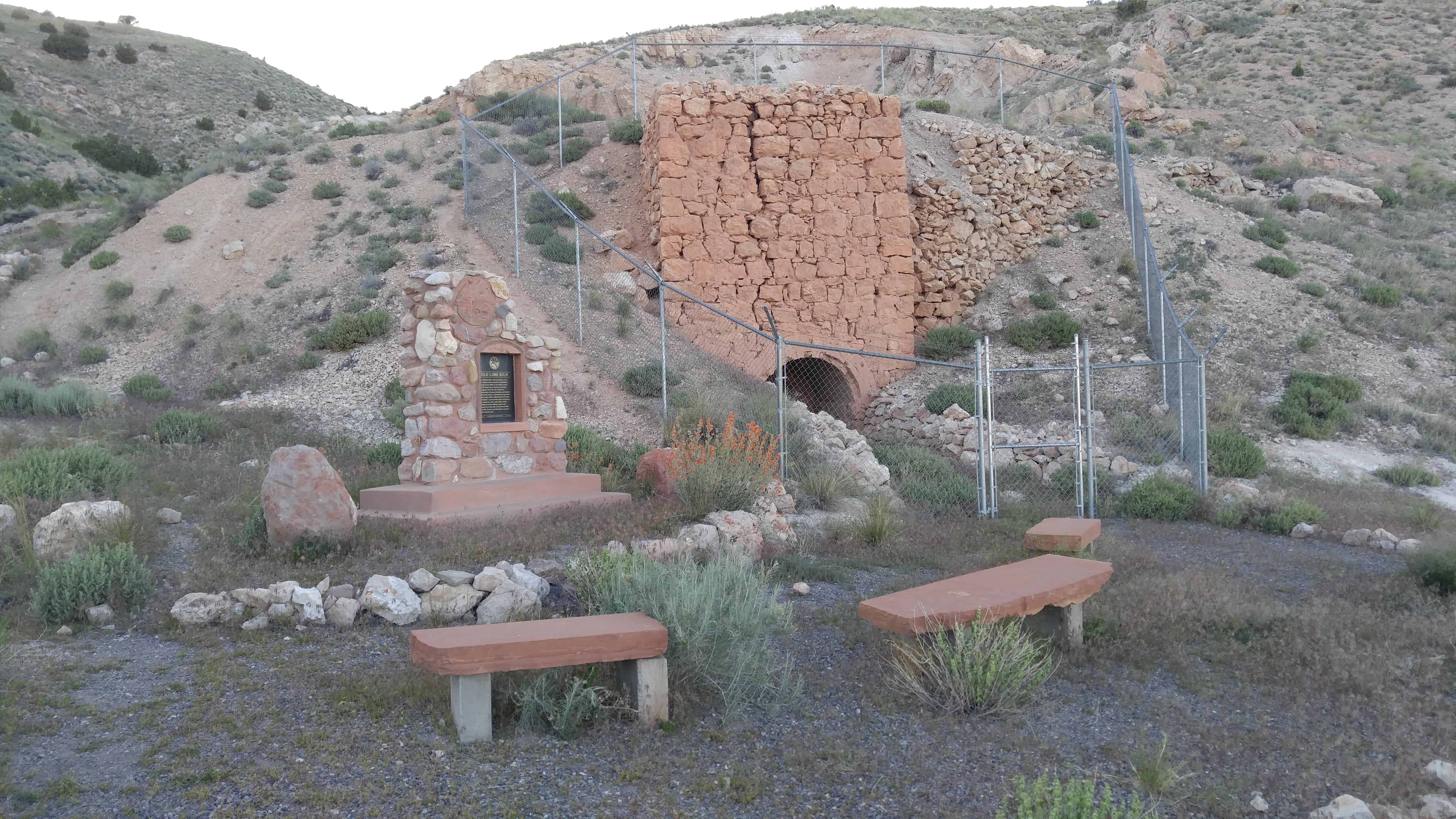
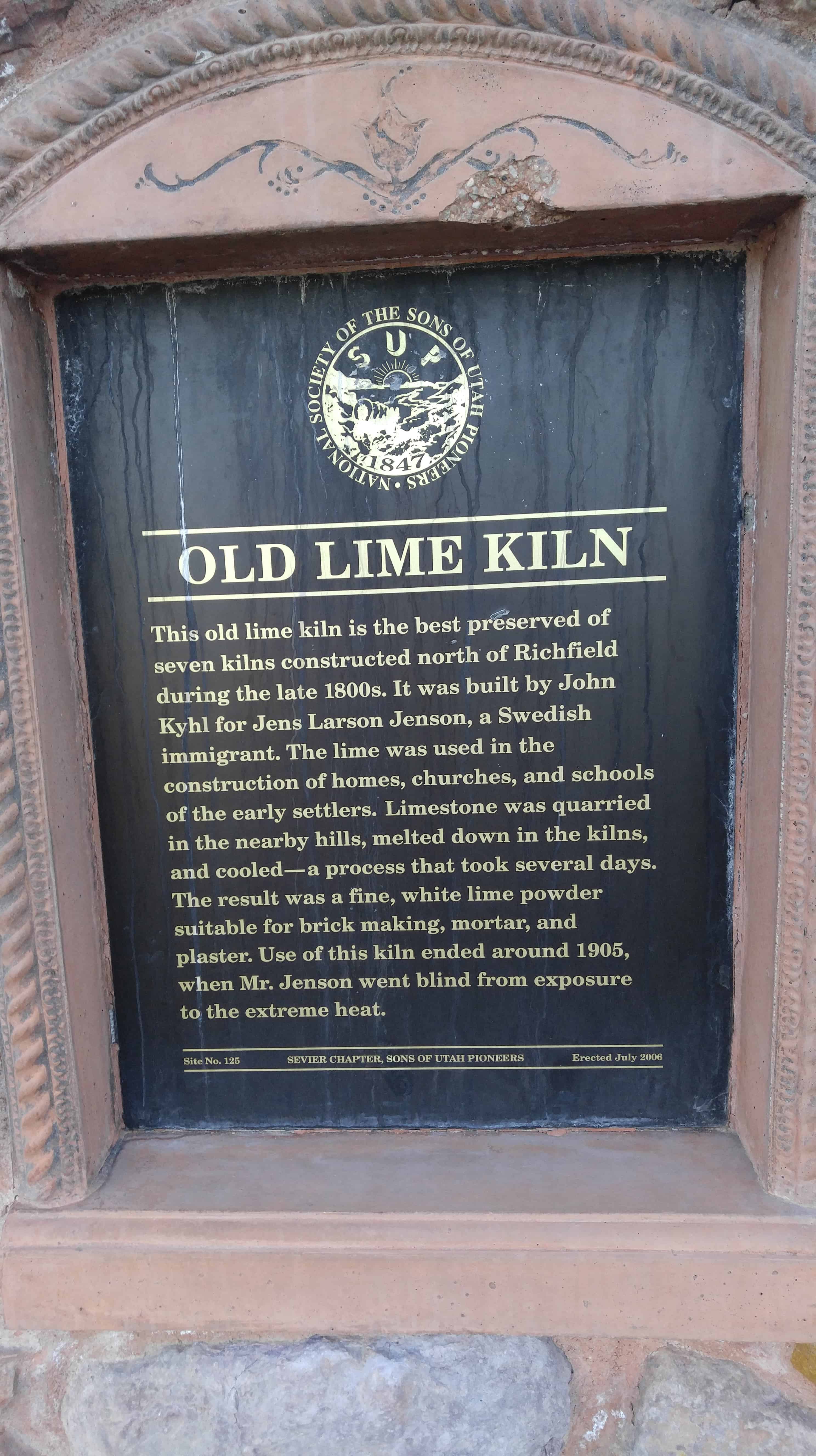
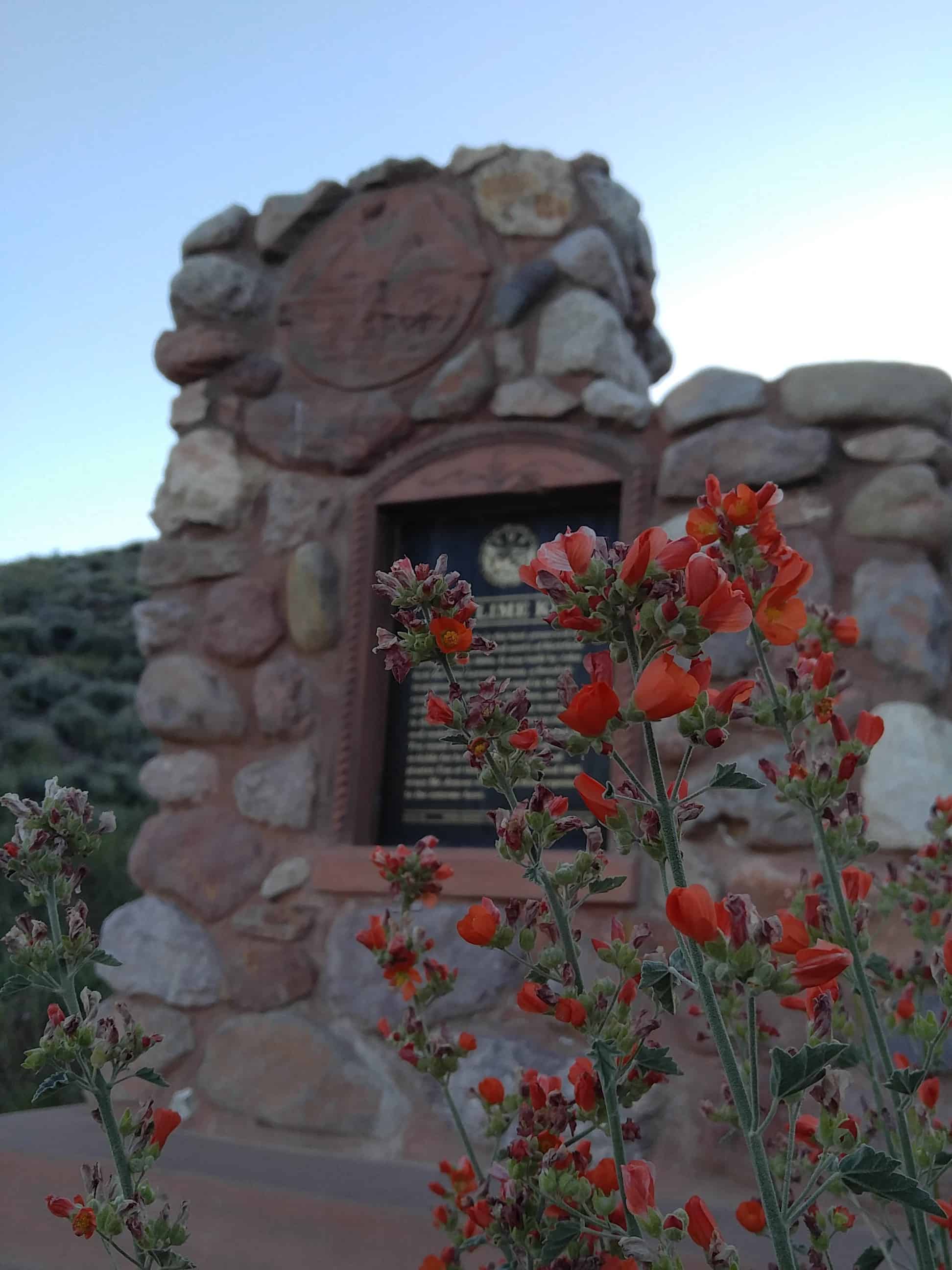
D.U.P. Marker #485 (see the others here.)

The first written account of the exploration of Long Valley was given by John D. Lee in 1852. Coming from Parowan, the explorers were under the direction of Bishop John R. Smith. James Lewis kept the records. The others were John D. Lee, John Steel, John Dart, Solomon Chamberlain, Francis T. Whitney and Dr. Priddy Meeks.

The party entered the Sevier Valley, followed the Sevier River south, over the divide and down the east fork of the Virgin River through Long Valley. Stopped from going further by Zion Canyon on the west they retraced their tracks returning to Parowan.

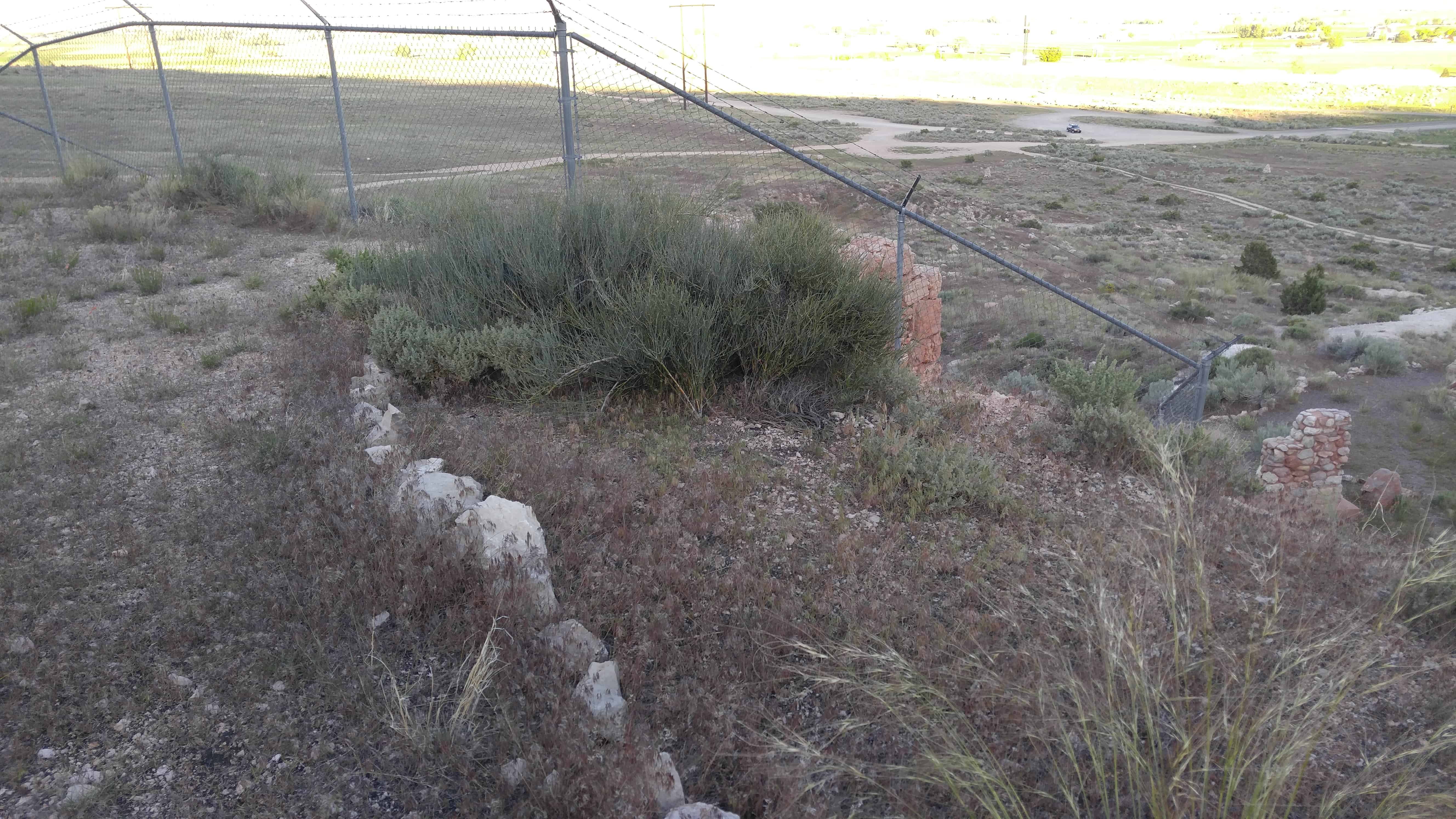
In the summer of 1862, a group guided by Dr. Priddy Meeks, John and William Berry came to Long Valley looking for grazing and farm land. In the spring of 1864, this group with others again returned to the valley. Priddy Meeks became the first white settler in Lower Long Valley when he and his family built a dugout in the hill behind this marker. The town was first called Windsor then changed to Mt. Carmel by Joseph W. Young because the cedar covered hills resembled the country of Mt. Carmel in Palestine.

Sarah Deseret, daughter of Dr. Meeks and Mary Jane, was born in 1864 in Berryville. She was the first child born in Long Valley and present day Kane County. The settlers had to leave Long Valley during Indian difficulties, but returned to stay in March of 1871.

2016-09-06-19-36-37

2016-09-06-19-36-44

DR. PRIDDY MEEKS

Pioneer Doctor, Community Leader

Born: August 29, 1795, South Carolina – Died: October 7, 1886, Orderville, Utah

Converted to the LDS Church in 1840 in Brown County, Illinois where he served as Bishop. Joined the Saints at Nauvoo, Illinois from 1842 to 1847. Blessed by the Prophet Joseph Smith and Hyrum Smith that he would have children and sons to carry on his name. They requested that he name his sons after them. Donated his ox team and wagon to the vanguard Mormon pioneer company. Later outfitted, he arrived in Salt Lake Valley in October 1847. Assisted with settlement of the city. Served as first presidency of “Society of Health” which trained the saints in better medical practice.

The remainder of his life was spent in colonizing Southern Utah. He assisted in the first settlements in Parowan (1850), Leeds – Harrisburg (1862) and Berryville, now Glendale (1846). His family was the first in Mt. Carmel (1864) living in a dugout at this site. They joined the United Order and moved to Orderville in 1879. He was the father of nineteen children including sons named Joseph and Hyrum. Descendants of Dr. Meeks and former patients continue to use many of his herbal remedies.

Mary “Polly” Bartlett Meeks

Born: 1793

Died: January 24, 1824, Spencer, Indiana

Married Priddy Meeks in 1815. He was 20, she age 22. He called her “my beloved Polly”. Together they carved out a farmstead out of Indiana Territory. She died at age 31 having sacrificed all to build a better life for her family on the American Frontier.

Children Lovin, Eliza, Athe, Elizabeth.

Elizabeth married Edward Dalton, Marcy 6, 1848 in Salt Lake City. They moved with Priddy Meeks to Parowan, Utah in 1851, where they helped settle that city.

Sarah Maurin Meeks

Born: December 12, 1801 Grayson County, Kentucky

Died: August 17, 1900, Orderville, Utah

The widow of Anthony Smith. Married Priddy Meeks December 24, 1826. Sarah’s daughter, Susan Smith, joined the Meeks family and later married Orson Adams. Sarah made a splendid step-mother to Priddy’s children.

The Meeks and Adams family were converted to the LDS religion and moved to Nauvoo, Illinois in 1842. They were part of the Mormon pioneer trek to the West, arriving in Salt Lake Valley October 1847.

Priddy said of Sarah, “I must pay a tribute of praise for my ‘better half’. She never left anything unturned that would contribute to our comfort, either in body or mind. She neither murmured or scolded. She bore everything in patience like a Saint of God. She truly proved a helpmeet (sic) to me.”

Children Sarah Jane, Sarah Angeline, Steven Mahuren, Hilda, Margaret Jane.

Margaret Jane married Samuel Hamilton.

Mary Jane McCleve Meeks

Born: August 21, 1840

Died: January 19, 1933, Orderville, Utah

Baptized a member of the LDS Church in the Irish Sea at age of 10. In 1856, her family sailed to America and joined the second Mormon Handcart Company. She painted “9” on their cart as the number trekking in her family. Her father, John McCleve, died two days before they arrived in the Salt Lake Valley. Married to Dr. Priddy Meeks, November 14, 1856, by President Brigham Young.

Priddy wrote of her “Mary Jane was nearly seventeen and I sixty-two. If there was ever a match consummated by the providence of God, this was one; she has borne me ten children and they were well formed and intelligent. If I had picked the territory, I could not have suited myself as well as in Mary Jane.”

She learned the art of healing from Priddy and delivered over 700 babies without loss of life. Mary Jane was widowed at age 46. She did not remarry.

Children Joseph, Nancy Jane, Hyrum Smith, John Priddy, Sara Deseret, Mary Ellen, Heber Jesse, Charles Mason, Elizabeth Dalton, Alfred Randall.

2016-09-06-19-36-55
2016-09-06-19-37-05

Pahreah

06 Sunday Nov 2016

Posted by Jacob Barlow in Uncategorized

≈ Leave a comment

Tags

Big Water, DUP, historic, Historic Markers, Kanab, Kane County, Pahreah, Paria, utah

2016-09-06-18-26-23

This Historical Marker is located on the north side of US Highway 89 about 33 miles east of Kanab or 23 miles west of Big Water.

In 1865 Peter Shirts made the first settlement in this area. Other pioneers followed but were forced to vacate because of Indian raids. The town was resettled upstream in 1870; church and school buildings were erected under the direction of William Meeks, presiding elder of The Church of Jesus Christ of Latter-day Saints. The post office was established prior to 1893. Considerable progress was made in farming and stock raising until repeated floods destroyed property, forcing the inhabitants to leave.

2016-09-06-18-26-15

2016-09-06-18-26-35
2016-09-06-18-26-43
2016-09-06-18-26-59
2016-09-06-18-27-21

Memories at Mountain Dell

01 Tuesday Nov 2016

Posted by Jacob Barlow in Uncategorized

≈ 2 Comments

Tags

historic, Historic Markers, Pioneers, Salt Lake County, SUP, utah

c02146f6-479e-4118-b265-90b84f02f1cd_l

Memories at Mountain Dell


From the summit of Big Mountain, the pioneers had their first glimpse of the Salt Lake Valley. The natural gorge, which rests south of Big Mountain and the northwest slopes of Little Mountain was known as Hanks or Big Canyon Creek and named by Ephraim Hanks as Mountain Dell.

As one of the handcart companies approached the bottom of Big Mountain, food and supplies were low. As they approached the Pony Express Station, Isabelle Siddoway, an eleven-year-old girl in the company, asked the station keeper if she could have a potato growing in the ground. Isabelle said it was the most delicious thing she had ever eaten.

Francis Armstrong purchased the property at Mountain Dell in 1870 and gave it to his wife, Isabelle Siddoway Armstrong. Mountain Dell was use as a summer farm by the Armstrong family. In 1882 Francis built a stone farmhouse; the farmhouse stood until July 1999 when it was torn down.
Francis kept two racehorses, Chief and Scout. He also raised peacocks at the farm. Francis loved to race the train down Parley’s Canyon on one of his horses. He would jump the track just in front of the train. As the train went by, the conductor would shake his fist at Francis.

One day the conductor appeared at a meeting in the Mayor’s Office, complaining of some fool who was always trying to race the train down Parley’s Canyon. After listening to the man’s complaint, Mayor Armstrong spoke up and said, “Well, sir, I am that fool. I have enough confidence in myself and my horse to know that I am in no danger.”

Related:

  • Little Dell Station

See other historic markers in the series on this page for SUP Markers.

  • 5edbfa00-f0fd-4d74-9bf5-3655ed55af65_l

Golden Pass Road

19 Wednesday Oct 2016

Posted by Jacob Barlow in Uncategorized

≈ 1 Comment

Tags

historic, Historic Markers, History, Salt Lake, Salt Lake City, Salt Lake County, utah

2013-04-10-12-34-57

Golden Pass Road

Photograph: “Portion of road up Parley’s Canyon, showing how unfinished it was, but adequate to get wagons and horses over.” Photograph: “Early form of transportation up Parley’s Canyon. Notice narrow path behind wagon.” Parley P. Pratt’s toll road. The “Deseret News” dated June 29, 1850, described Parley Pratt’s new route through Parley’s Canyon as the Golden Pass, the new route through the mountains. This alternate valley entrance was explored and built by Parly P. Pratt and was used as a means of securing fuel and timber for himself and other emigrants. To defray his expenses for the road building, he initiated a toll for others to use his road in 1848. His established rates were as follows: 75c for a two-horse outfit, 10c for each additional pack or saddle animal, and 1c per head for sheep and loose stock. His toll house was located near the creek and approximately 1/2 mile west of Suicide Rock. Initially the Golden Pass Road was passible for horse and wagon, and between 1850-1869 thousands of Mormon pioneer emigrants, California-bound gold seeks, Pony Express riders, overland stage coaches, plus thousands of soldiers traveled over this dirt road.

The marker for Brigham Young Industrial Center is at the same location.

See other historic markers in the series on this page for SUP Markers.


2013-04-10-12-34-53
2013-04-10-12-42-28
2013-04-10-12-35-05


picture24nov07-135
picture24nov07-136
picture24nov07-137

Brigham Young Industrial Center

19 Wednesday Oct 2016

Posted by Jacob Barlow in Uncategorized

≈ 1 Comment

Tags

historic, Historic Markers, Salt Lake, Salt Lake City, Salt Lake County, SUP, utah

2013-04-10-12-34-48

Brigham Young Industrial Center

Built on a 200 acre farmland north of Parley’s Creek and east of 20th East between the years of 1849-1852, it was the largest grist mill in the Utah Territory. It operated between 1852-1857 and was shut down in 1857 due to the entrance of Johnson’s U.S. Army. The mill was operated by means of a large water wheel located on the northeast corner of the mill. Water in turn was conveyed by a mill race from Parley’s Creek (just east of Suicide Rock) approximately one mile to the spillway and onto a twelve foot diameter water wheel. The shaft of this waterwheel conveyed take-off power for belt drive to the Industrial Center’s machinery. Following in 1857 start-up, the milling equipment was removed in 1863 and the plant was changed over to a cotton mill and then a woolen mill until its demise by fire.

The marker for Golden Pass Road is at this same location.

See other historic markers in the series on this page for SUP Markers.


2013-04-10-12-34-40
2013-04-10-12-35-05
2013-04-10-12-42-28


picture24nov07-135
picture24nov07-136
picture24nov07-137


The Old Brinton Ward

08 Saturday Oct 2016

Posted by Jacob Barlow in Uncategorized

≈ Leave a comment

Tags

historic, Historic Markers, Holladay, LDS Church, Salt Lake City, Salt Lake County, utah

picture13feb08-024

The Old Brinton Ward

The original portion of the ward house at this location was completed in 1914, for the members of the newly-formed Brinton Ward. The land was donated by Ensign Woodruff, son of the fourth president of the Church, Wilford Woodruff. Prior to meeting here, members of the first ward, formed in 1911, met in the original Oakwood School building, immediately north on Highland Drive. A peach orchard, intended for the church Welfare System, and a granary, for the use of the neighbors and ward members, once occupied this site adnacent to the chapel.

In the summer of 1997, the Cottonwood First and Fifth Wards, then occupying these premises, built this recreation center to commemorate the celebration of the sesquicentennial year of the Mormon Pioneers’ entrance into the Salt Lake Valley. A millstone was chosen as the centerpiece of this monument, a fitting symbol of pioneer self-reliance and industry to honor the memory and heritage of the Brinton Ward.

picture13feb08-022

Pony Express Station – Big Sandy

15 Thursday Sep 2016

Posted by Jacob Barlow in Uncategorized

≈ 2 Comments

Tags

Farson, historic, Historic Markers, Pony Express, Sweetwater County, Wyoming, Wyoming Historic Markers

180cd54a-c46a-4f4d-a5ca-267bfeed4866

See also, Pony Express Stations.

Located 13 miles from Little Sandy Station and 15 miles from Big Timber Station at west edge of the town of Farson and east of Big Sandy Creek. (Henderson) Burned by Indians in 1862. The Sandy and Little Sandy flow past on the west and south. (Wyoming Guide) The Big Sandy was a stage station on the Overland route which was destroyed by the Indians when they set fire to several stage stations and farm houses in 1864. On the eastern division of the stage line, between Big Sandy and Thirty Two Mile Creek, every station but one was burnt by the Indians. Nearly every ranchman’s house between old Julesburg and Big Sandy was deserted. Big Sandy, Little Sandy and Old Dry Sandy were stage stations which were named from the creeks in that region. (WPA)

Cross Miry Creek. Road down Pacific Creek; water scarce for 20 miles. After 11 miles, “Dry Sandy Creek ;” water scarce and too brackish to drink ; grass little; sage and greasewood plentiful. After 16 miles, “Sublette’s Cut-off,” or the “Dry Drive,” turns N.W. to Soda Springs and Fort Hall: the left fork leads to Fort Bridger and Great Salt Lake City. Four miles beyond the junction is “Little Sandy Creek,” 20-25×2; grass, timber, and good camping-ground. Eight miles beyond is “Big Sandy Creek,” clear, swift, and with good crossing, 110×2. The southern route is the best; along the old road, no water for 49 miles. Big Sandy Creek Station.(*)

9f43766d-c2c8-4050-b756-bf882b5d479d

b400cbf4-7133-4543-878b-efc0ceb216c1

f75fa329-a959-42d8-8641-72a609902aad

More photos from another time stopping by, in January 2018.

2018-01-05 14.49.35

2018-01-05 14.49.56

2018-01-05 14.50.00


2018-01-05 14.50.06.jpg

2018-01-05 14.50.11

2018-01-05 14.51.27

Old Lime Kiln

13 Monday Jun 2016

Posted by Jacob Barlow in Uncategorized

≈ 3 Comments

Tags

historic, Historic Markers, Kilns, NRHP, Richfield, Sevier County, SUP, utah

IMG_20160601_194414

This old lime kiln, now restored, is the best preserved of seven kilns constructed here during the late 1880’s. It was built by John Kyhl for Jens Larsen Jenson, a Swedish immigrant. The vital lime was used in the construction of homes, churches and schools of the early settlers. Limestone was quarried in the nearby hills, malted down in the kilns and cooled – a process that took several days. The result was a fine, white powder suitable for brick-making, mortar and plaster. Use of this kiln ended around 1905 when Mr. Jensen went blind from exposure to the extreme heat.

This is Sons of Utah Pioneers marker #125, located in Richfield, Utah (Just north of 1-15 at Main Street)

The Jens Larson Jenson Lime Kiln was added to the National Historic Register (#78002693) on December 22, 1978.

Related:

  • S.U.P. Historic Markers

The Jens Larson Jenson Lime Kiln represents a remaining structure important in the development of communities in the Sevier Valley. Built by Jens L. Jenson, Richfield’s “well-known” lime burner, the kiln cured lime which was used for mortar utilized in the construction of numerous rock and brick structures, as well as in the production of the whitewash used on structures basic to successful rural life.

Work was eventually ended at the kiln (n.d.) but its presence against the hillside, overlooking the valley it helped to develop, forms a link between past and present. The valley development now poses a potential threat to the structure with proposed housing units, etc., expected to be built near its site. Its preservation is met with particular interest by the Sevier Valley Chapter of the Utah State Historical Society, who harbors plans for its restoration.

Jens Larson “Limeburner” Jenson (sometimes spelled Jensen) was born in Dalby, Scona, Sweden, July 14, 1827. He was baptized into the Church of Jesus Christ of Latter-day Saints in 1855, and arrived in Utah in 1859 as a member of the Rowley Handcart Company. Jenson lived the doctrine of plural marriage, being joined to three women; and later served a sixty-two day sentence for polygamy.

In the late 1880’s Jens L. Larson returned to Richfield to settle, where he fostered his trade as a lime burner. His first kilns were small structures built in a wash near the town. According to a 1903 newspaper article, Jenson was planning to build “a more convenient commodious and rapid working plant,” allowing for the continuous burning of lime.

J. H. Kyhl, a local mason, submitted the plans to Jenson and the kiln was completed in the spring of 1903. As mentioned in the description the kiln measured twenty feet in height and twenty in diameter, with eight foot thick walls to withstand the pressure of limestone.

Workers quarried limestone in the nearby hills north and west of Richfield. The stone was dumped into the top of the kiln. A fire was then built under the grate to burn or “cure” the rocks, and left burning for three to five complete days. A three-day cooling period followed, after which time the lime was hauled in wagons to communities where it sold for a reportedly one dollar per three bushels.

Jens L. Jenson eventually lost his eyesight due to the intense heat in the Limeburning process. He died January 3, 1907, but work was carried on by his sons and family until 1910, when the kiln was sold to Leonard Ogden. Ogden burned lime for many Sevier Valley structures, including the Richfield First Ward Chapel, and the Elsinore Sugar Factory at Austin.

The North Farmington School

07 Saturday Feb 2015

Posted by Jacob Barlow in Uncategorized

≈ 1 Comment

Tags

Davis County, Farmington, historic, Historic Markers, LDS Church, Parks, utah

2018-03-31 17.55.08

This is the site of the North Farmington School built in 1860. Ut was a two-story, red brick building and the first public building in North Farmington. The “little res school house,” as it was called, was used for school, church, and social functions. When the North Farmington Ward was organized on March 11, 1917, meetings were held in this school until the L.D.S. chapel across the street was built in 1919.

This marker was placed in commemoration of the 75th anniversary of the North Farmington Ward by the young men and young women of the Farmington Utah North Stake in 1992.

2018-03-31 17.55.14

2013-11-05 17.16.01

2013-11-05 17.16.07

2013-11-05 17.16.09

2013-11-05 17.16.11

← Older posts
Newer posts →

Follow Jacob

Follow Jacob

Blog Stats

  • 2,062,391 hits

Social and Other Links

BarlowLinks.com

Recent Posts

  • The Old Settler’s “Swallow’s Nest”
  • Arthur Miles Home
  • Navajo Shadehouse Museum
  • Impossible Canyons
  • The Old Hurricane Bell

Archives

Loading Comments...