Tags
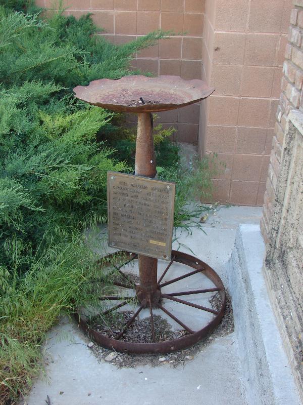
This Historic Bell rang if the Mapleton School from 1907 to 1932.


11 Monday Aug 2014
Posted in Uncategorized
Tags
This Historic Bell rang if the Mapleton School from 1907 to 1932.
11 Monday Aug 2014
Posted in Uncategorized

NATIONAL HISTORIC SITE GOLDEN SPIKE
“The last rail is laid. The spike is driven. The Pacific Railroad is completed.” Here at Promontory, Utah at 12:47 p.m. on May 10, 1869 the driving of a golden spike completed the first transcontinental railroad climax of a dramatic railroad-building race between the Union Pacific building from the east and the Central Pacific building from the west. This event symbolized attainment of a long sought goal – a direct transportation route to the Pacific Ocean and the China trade and it achieved the great political objective of binding together by iron bonds the extremities of continental United States. A rail link from ocean to ocean.”
Located at Golden Spike National Historical Park at Promontory, Utah.


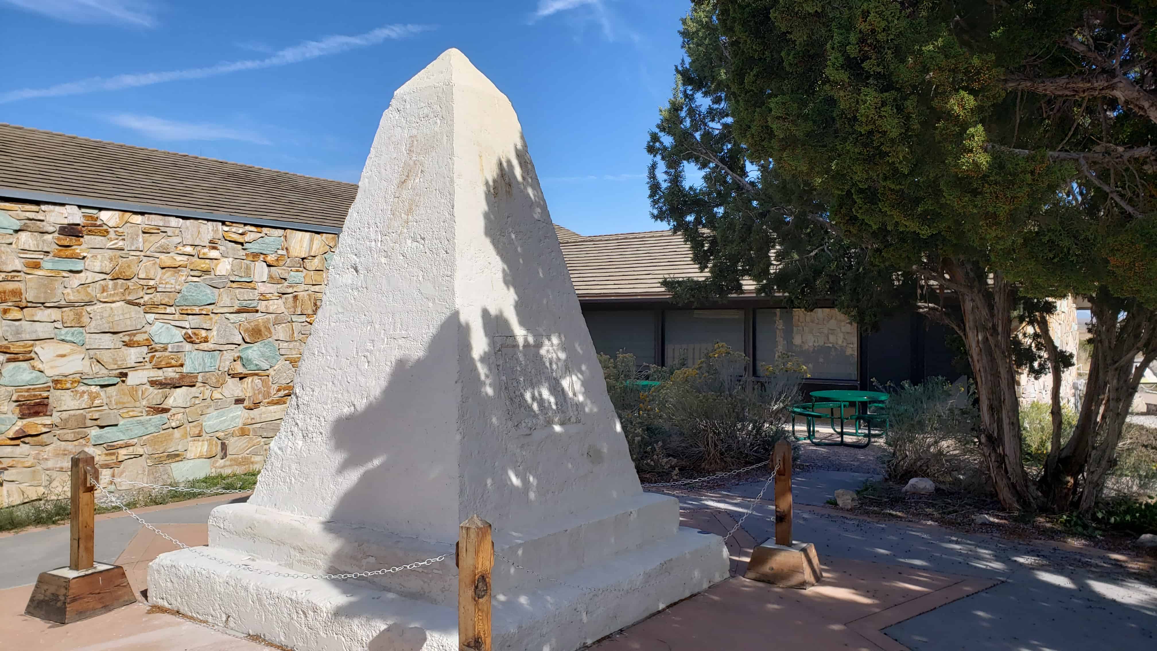
The Southern Pacific Monument
An Icon Restored
In 1954, the National Park Service assumed ownership of the aging monument, which had been damaged by years of weathering and vandalism. The interior had also been severely damaged by ground water that had wicked up into the monument through its buried base. Early restoration attempts unintentionally contributed to the damage by using materials that did now allow for evaporation of water trapped inside the monument. Based on state of the art technology, the National Park Service began a new repair process in 2001.
Significance of the Monument
In 1916, the Southern Pacific Railroad (formerly the Central Pacific Railroad) placed the monument near the site where the nation’s first transcontinental railroad was completed. For decades, it stood there, a lonely reminder of the driving of the last spike on May 10, 1869 at Promontory Summit, Utah Territory. Today, the handsomely restored monument remains an icon of westward expansion, the settlement of northern Utah and commemorates an historic event that transformed America.


11 Monday Aug 2014
Posted in Uncategorized
Tags
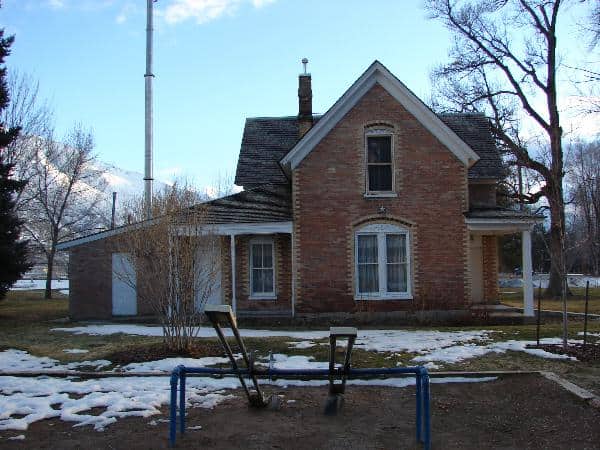
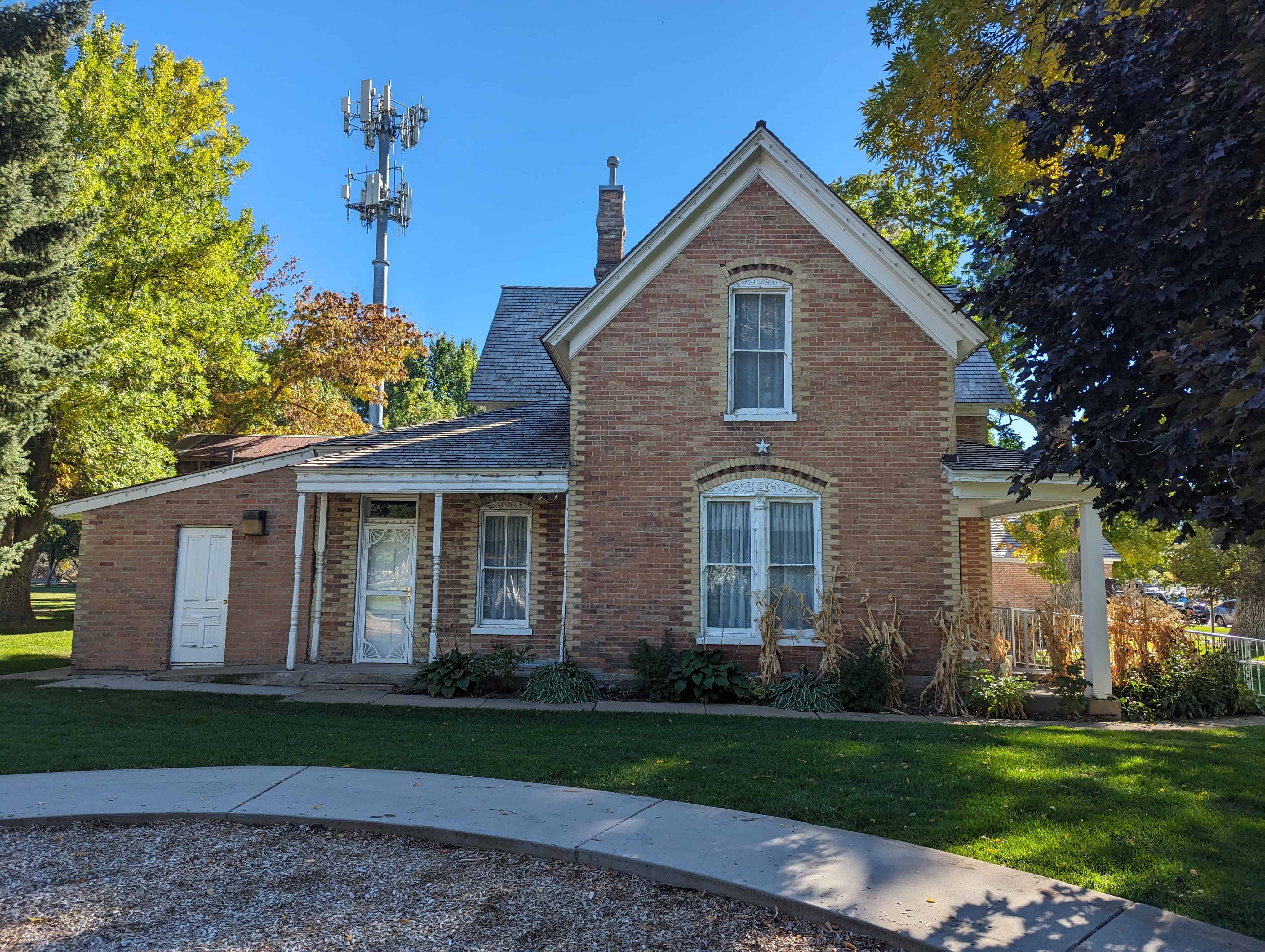
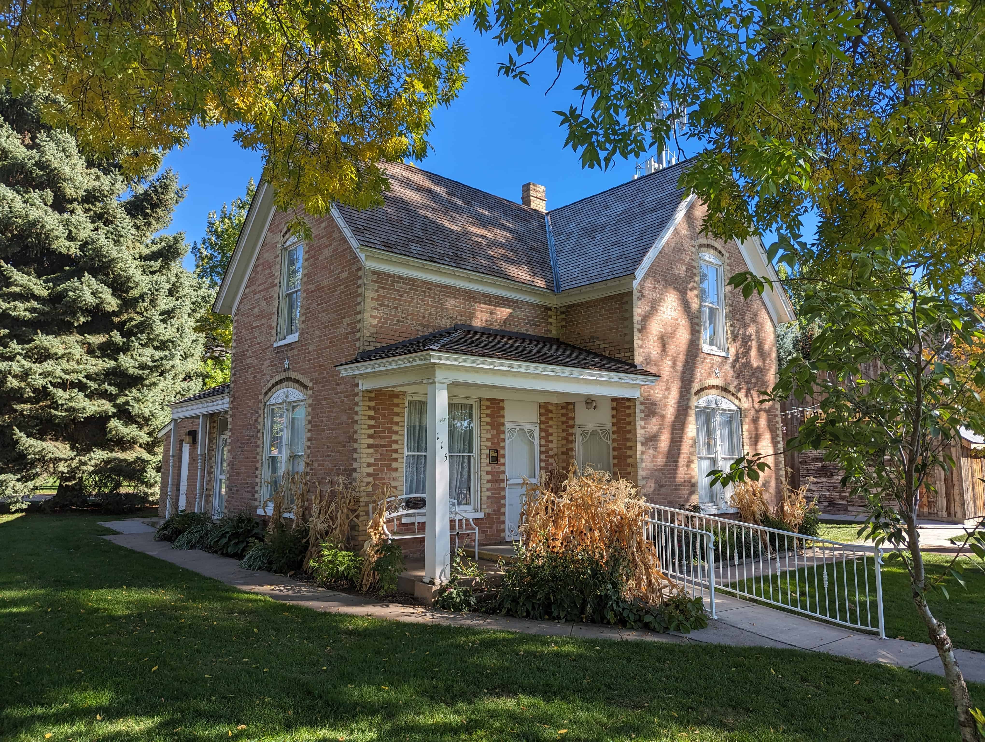
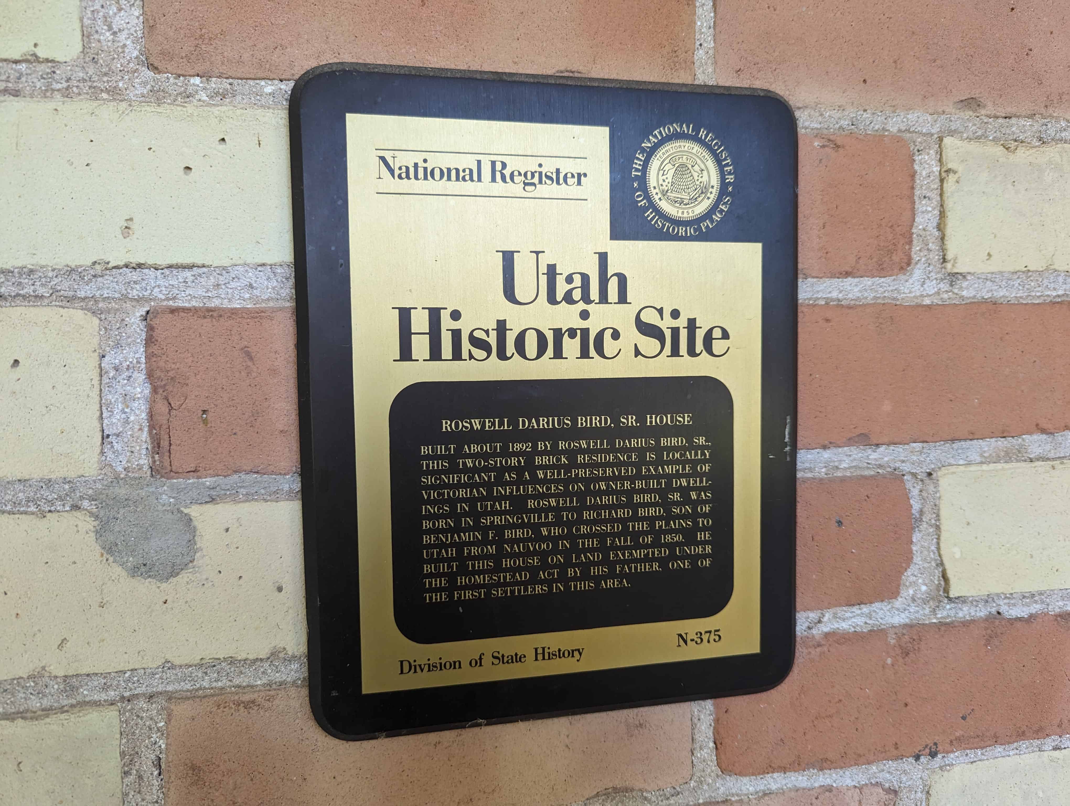
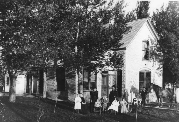
Roswell Darius Bird, Sr. House
Built about 1892 by Roswell Darius Bird, Sr., this two-story brick residence is locally significant as a well-preserved example of Victorian influences on owner-built dwellings in Utah. Roswell Darius Bird, Sr. was born in Springville to Richard Bird, son of Benjamin F. Bird, who crossed the plains to Utah from Nauvoo in the fall of 1850. He built this house on land exempted under the Homestead Act by his father, one of the first settlers in the area.
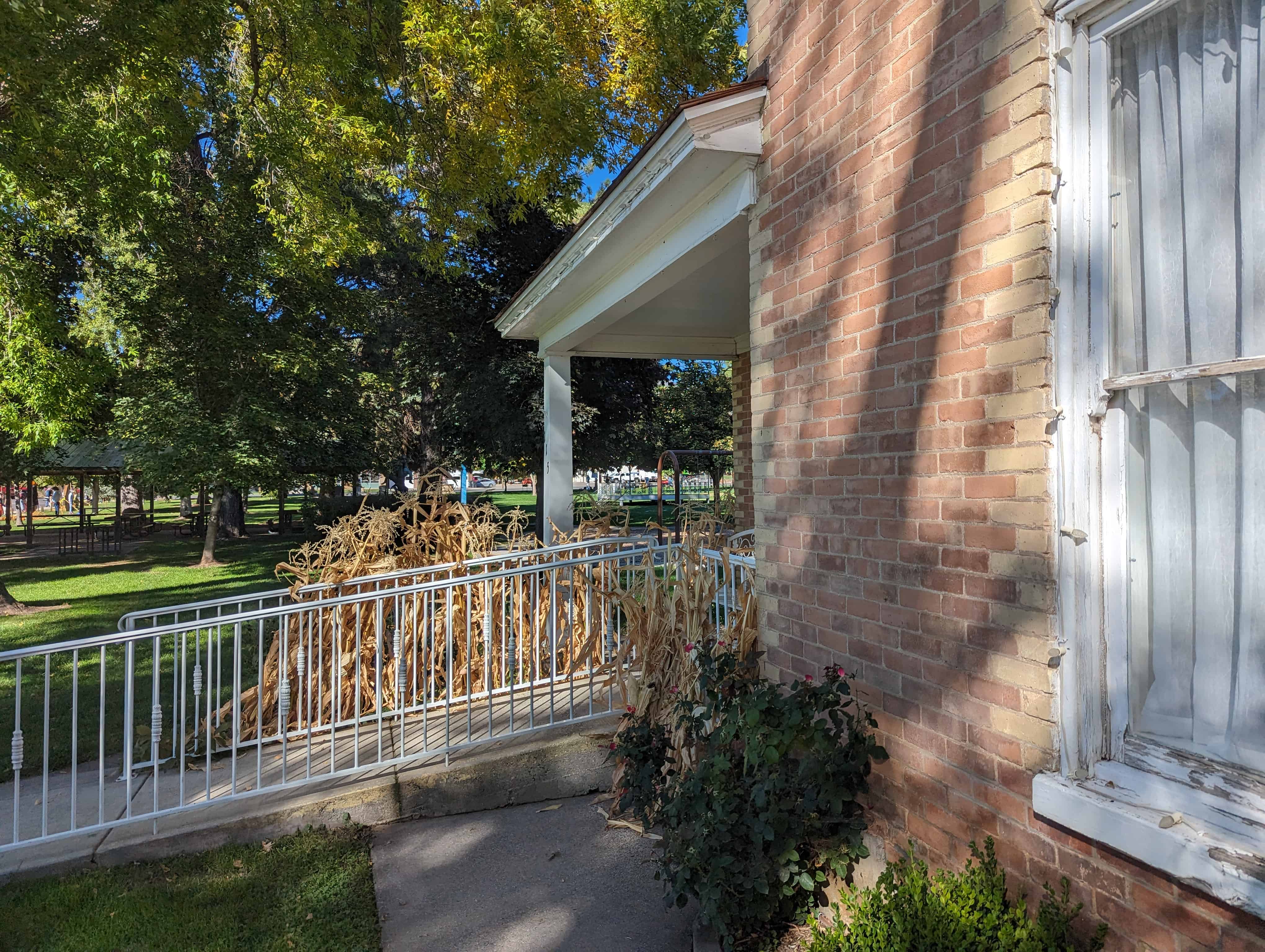
Located in the Mapleton Historic Village at Mapleton City Park at 125 South Main Street in Mapleton, Utah.


Related Posts:
Roswell, on returning to Springville, found his childhood sweetheart, Evaline Steel. They were married on October 6, 1880 in Salt Lake City at the home of Daniel H. Wells. Their first home was in Springville.
Roswell spent most of the next two years away from home working on the railroad. While he was away his father, Richard, went to “Union Bench” and took up land. He gave each of his son’s 10 acres. Roswell got the ground where the Mapleton Park is. They finally owned 100 acres. The ballpark is some of it. He owned 10 acres where the Beck’s home is also.
Roswell sold his home in Springville and came to Mapleton. They were among some of the first settlers in Mapleton. They built a two-room log house, called the “frame home” and later called the “summer kitchen” as they used it to cook in the summer.
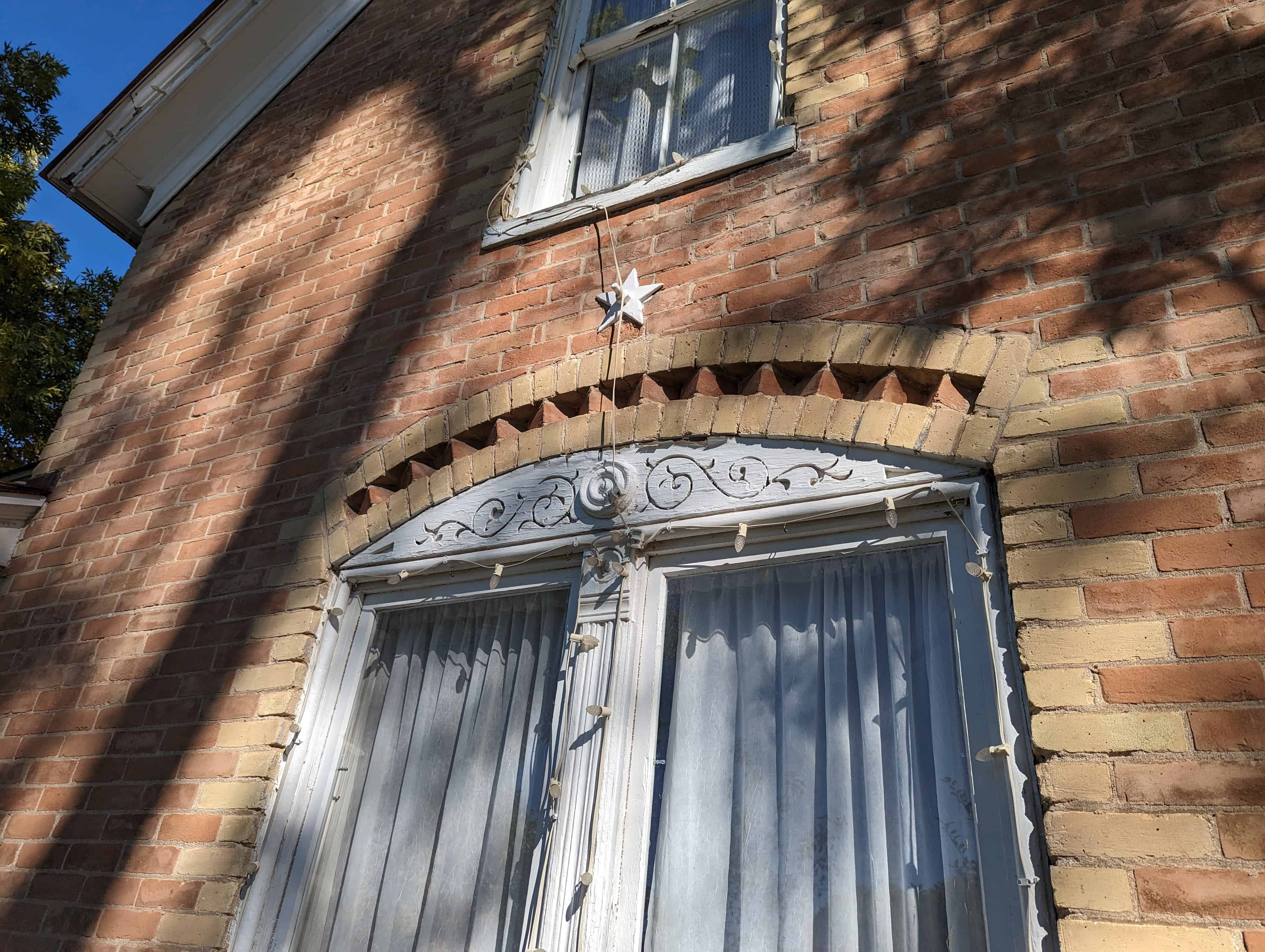
Having been blessed with seven lovely children, the two-room house was replaced with a seven-room brick home at 65 South Center, in 1892. It is now on the Utah Historical Homes Register. It is constructed of red sand brick with white brick trim around the windows, door and at the corners. There are two steel beams that run through to hold it together. The trees surrounding the home are Silver Maple and White Ash. They were planted at the time the house was built. They are now designated as Heritage Trees.
In 1903 Roswell was called on a mission to the Central States. This call was gladly accepted, although it worked quite a hardship on the family. After he was there eleven months, his four-year-old daughter died with scarlet fever. Four other members of his family were seriously ill with the same disease. Roswell returned home with an honorable release. President Smith said his place was at home.
Evaline made all her own carpets, pillows, and feather beds. It was the girls’ task each night after school to sew a ball of carpet rags. By spring they would have enough for one room. One of the rooms still has the same wallpaper from when the house was built.
Duck picking was one of the tasks they did about every six weeks. A tub was placed in the middle of the room. Each one gathered around and picked all the feathers off. If the duck wasn’t held just so it often flapped its wings, sending feathers every which way. Soap was also made at home. It was the only soap they had for clothes, hair, hands and bath.
One of the yearly events that were outstanding was the traveling theater troupe, which for one week put on the latest and most popular plays. These troupes always stayed at the Birds.
A town hall was very badly needed so Roswell gave the ground on the park for a new town hall.
After the death of Roswell, Evaline moved to Provo to be near her three unmarried daughters. They had jobs in Provo. After the girls were married, she moved back to Mapleton. Roswell, Jr. lived in the two north rooms and Evaline had the two south rooms. A bath was added in the middle, which they both used, and the porch on the front was added.
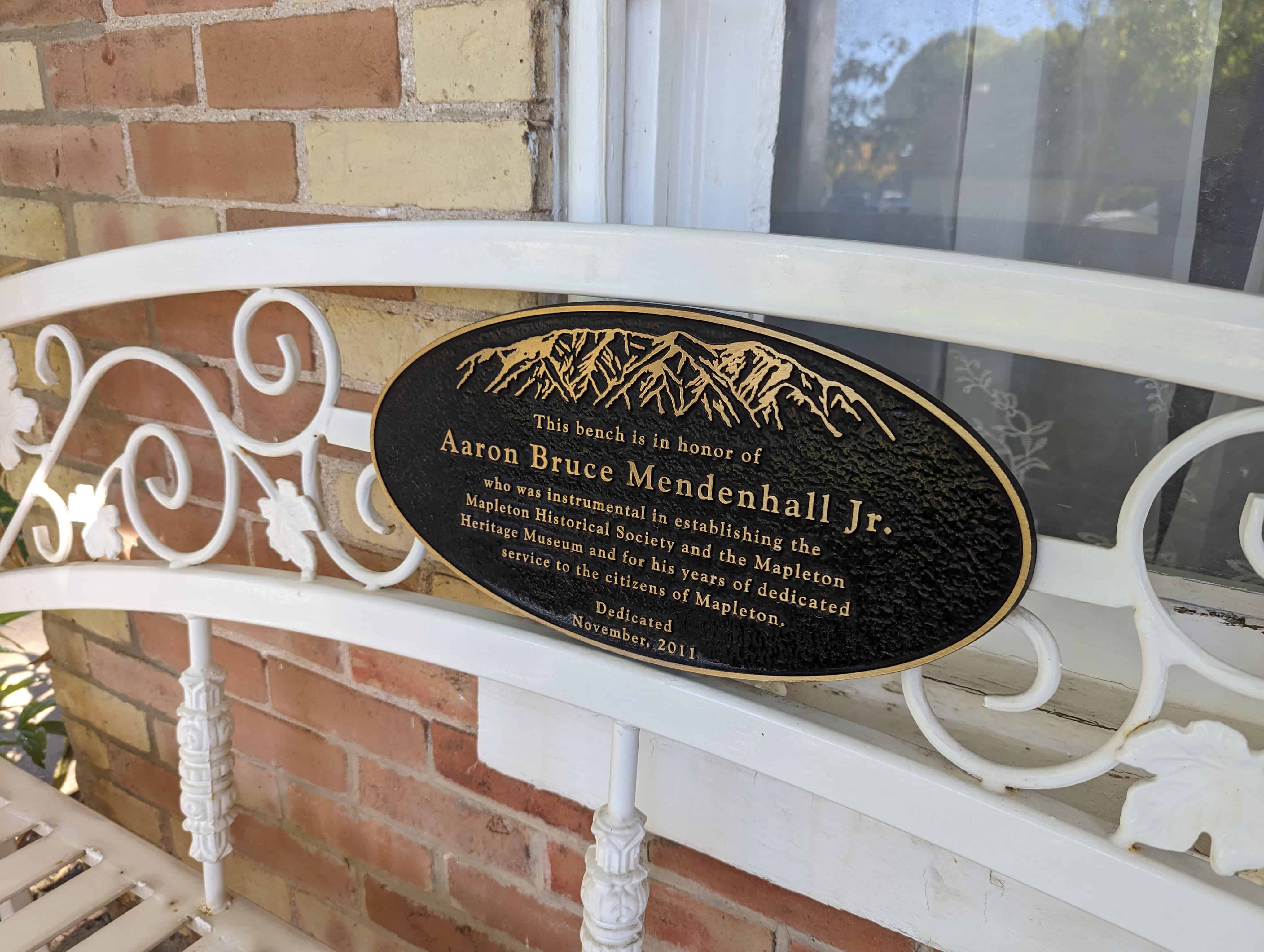
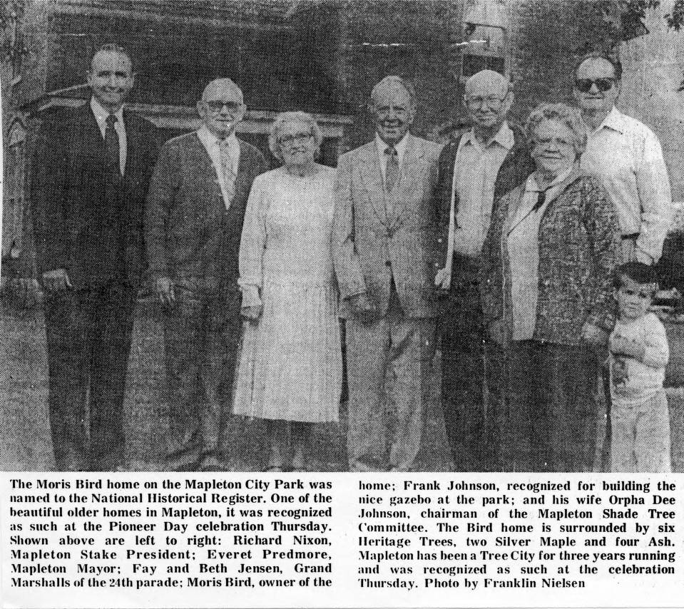
After Evaline died, Floyd, son of Roswell, Jr., lived in the house. When Floyd died, Floyd’s son, Dwayne, lived in it, and then his son, Ronald, lived in it for a while. It is now owned by Morris Bird, a son of Roswell, Fr. Morris has added another bath and a kitchen, and arches between some of the rooms were made. Morris has also fixed a furnace in it. The north side is fixed so a library can be made for the town. This home is currently the Mapleton Historic Museum that under renovation.
These two photos are from UVU’s Mapleton, Utah Historical Photographs:
11 Monday Aug 2014
Posted in Uncategorized
Tags

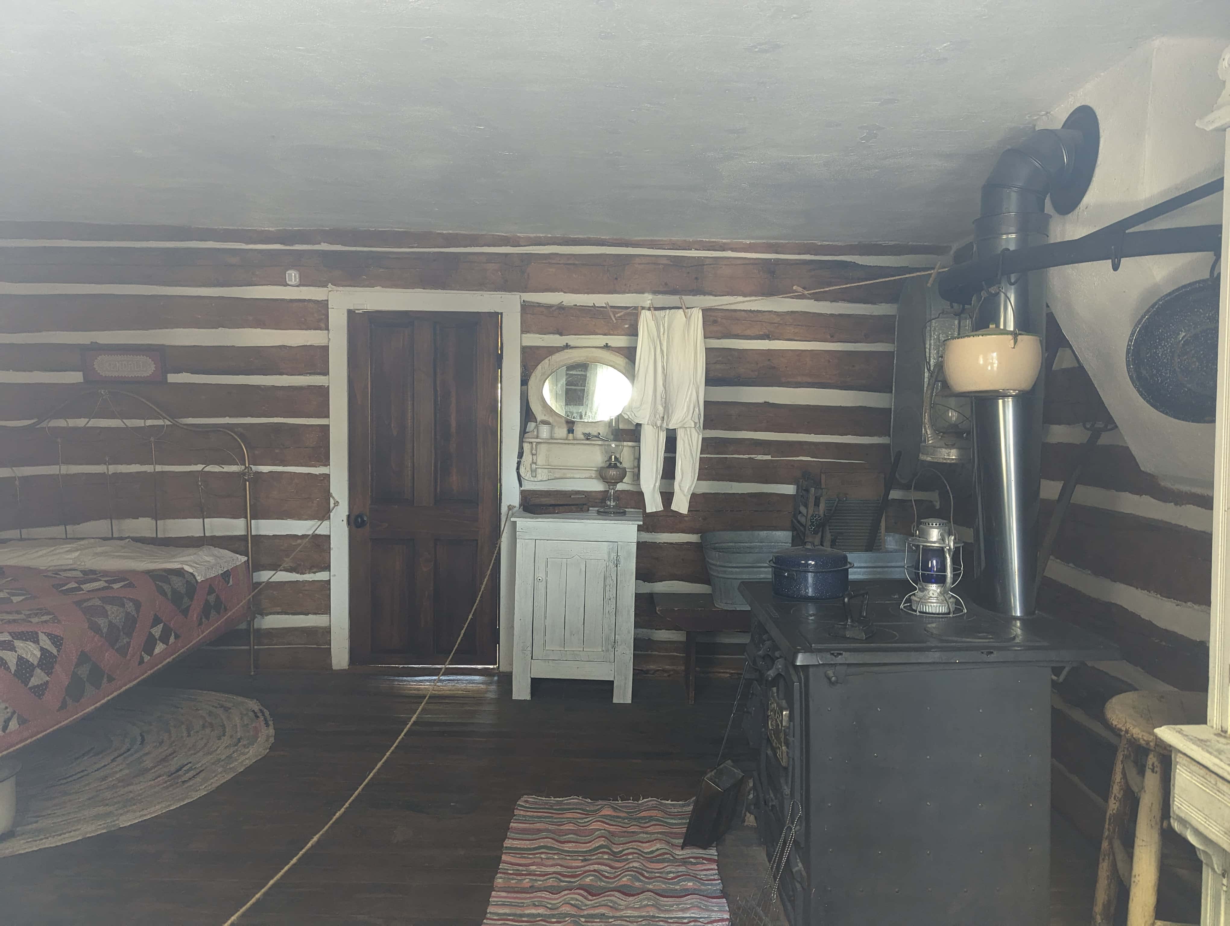
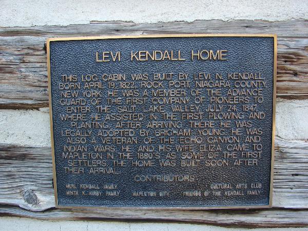
Levi Kendall Home
This log cabin was built by Levi N. Kendall, born April 19, 1822, Rock Port, Niagara County, New York. He was a member of the Advance Guard of the first company of pioneers to enter the Salt Lake Valley, July 24, 1847, where he assisted in the first plowing and planting. After arriving there he was legally adopted by Brigham Young. He was also a veteran of the Echo Canyon and Indian Wars. He and his wife Eliza came to Mapleton in the 1880’s as some of the first settlers. The home was built soon after their arrival.

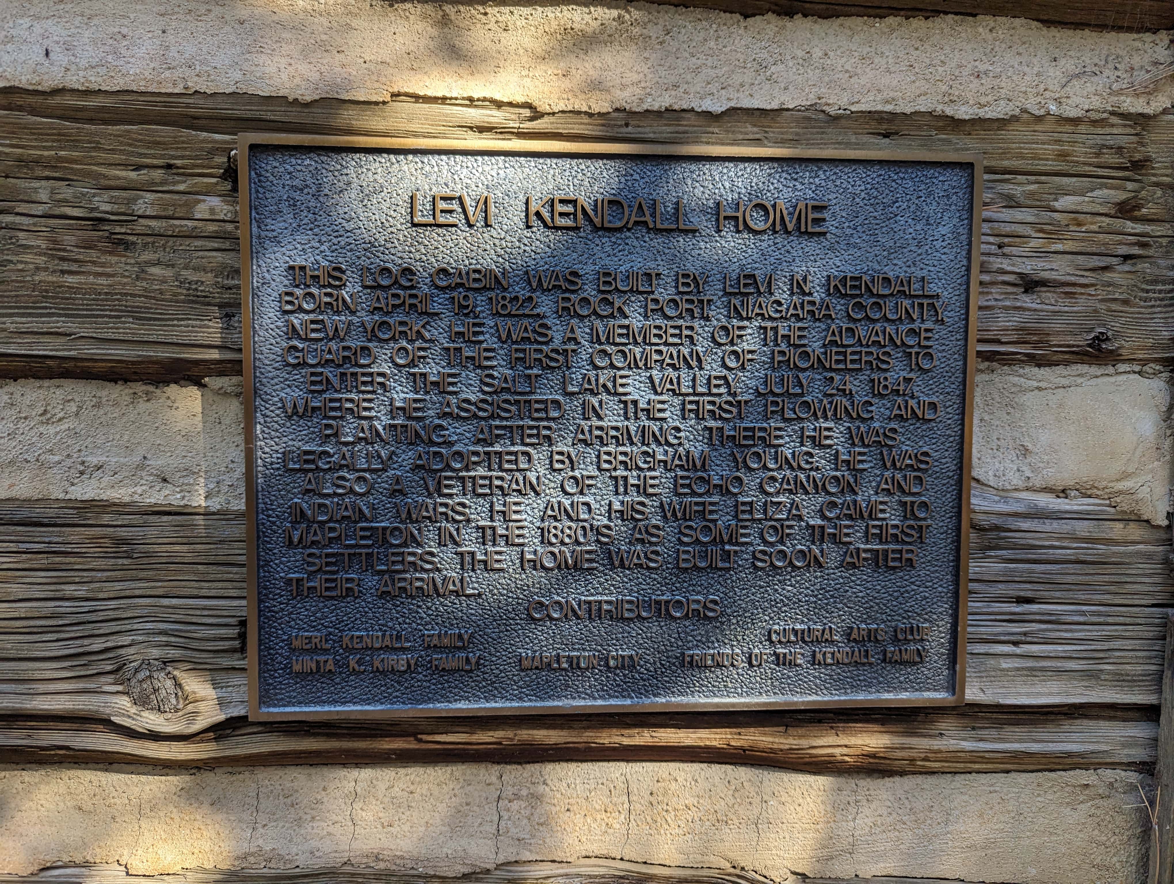
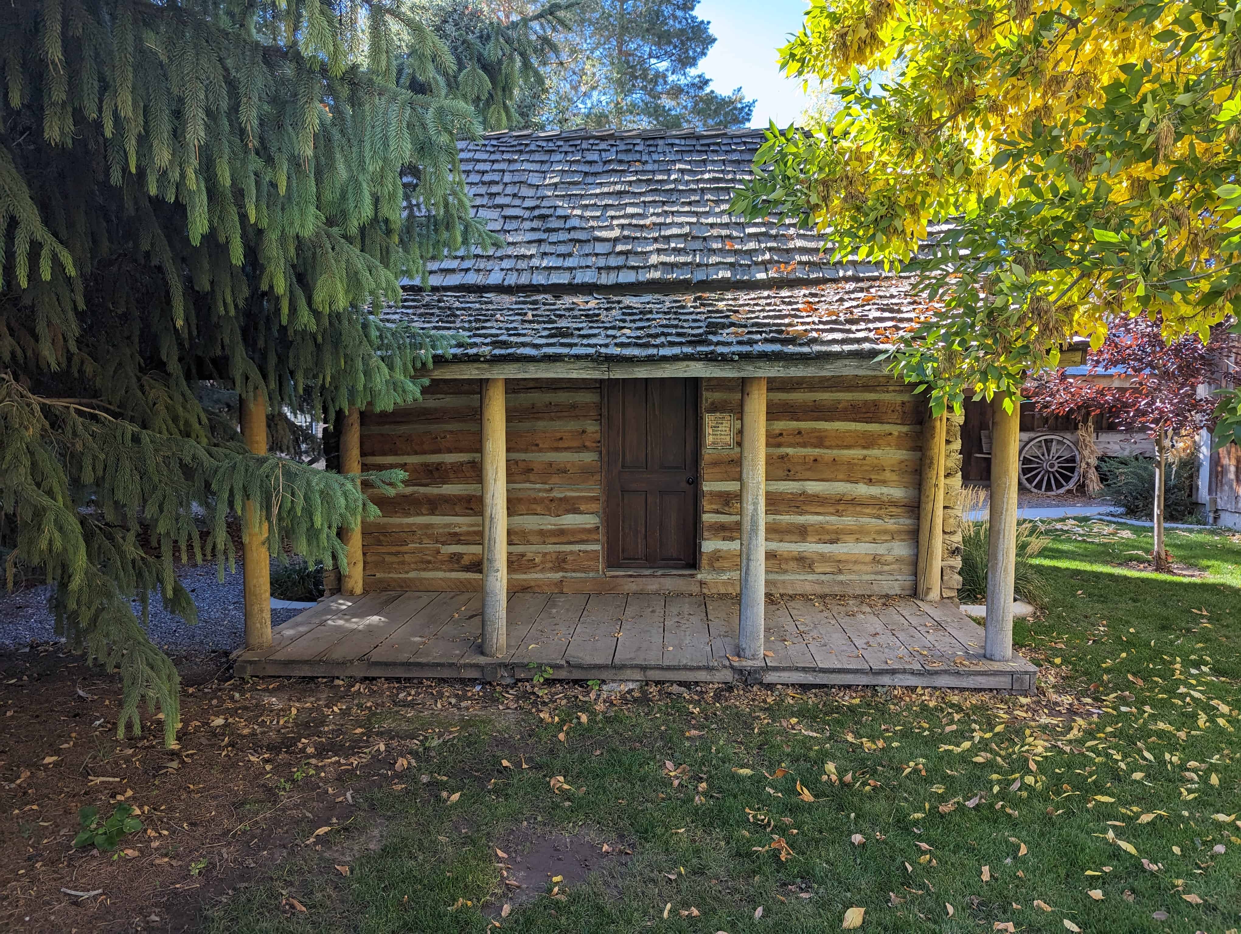
Levi Kendall was a member of the advance guard of the First Company of Pioneers to enter the Salt Lake Valley, July 24, 1847. He assisted in the first plowing and planting after he arrived there. Levi was legally adopted by Brigham Young and was a veteran of the Echo Canyon and Indian Wars.
He and his wife, Eliza, came to Mapleton in the 1880’s, as some of the first settlers. The home was built soon after their arrival to Mapleton, which was then called Union Bench. Morris Bird bought the log house and had it moved over by the Roswell Bird home, as it reminded him of the log cabin that was on the Bird property. He built a cement foundation for it to be put on. This cabin was built originally at 560 West 1600 North in Mapleton. Morris lived in the cabin during the summers.
Related Posts:
This is located in the Mapleton Historic Village at Mapleton City Park at 125 South Main Street in Mapleton, Utah


09 Saturday Aug 2014
Posted in Uncategorized
Tags
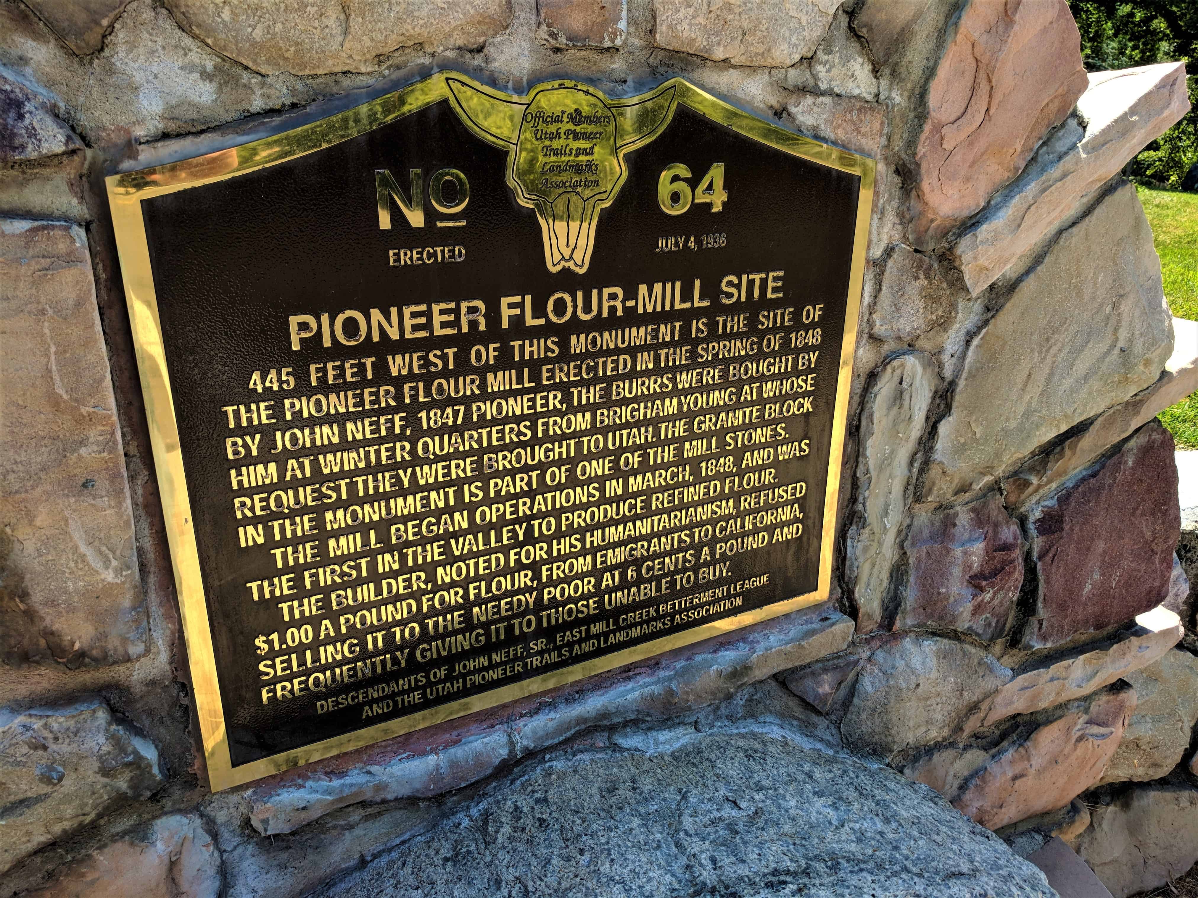
historic, Mills, Salt Lake City, Salt Lake County, SUP, utah

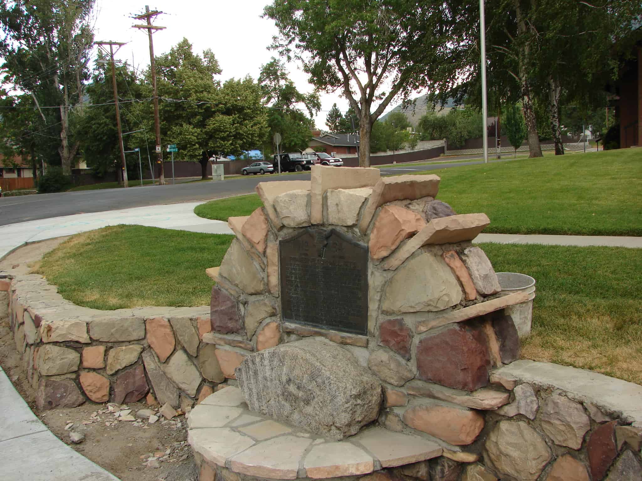
445 feet west of this monument is the site of the pioneer flour mill erected in the spring of 1848 by John Neff, 1847 Pioneer. The burrs were bought by him at Winter Quarters from Brigham Young at whose request they were brought to Utah. The granite block in the monument is part of one of the mill stones. The mill began operations in March, 1848, and was the first in the valley to produce refined flour. The builder, noted for his humanitarianism, refused $1.00 a pound for flour from emigrants to California, selling it to the needy poor at 6 cents a pound and frequently giving it to those unable to buy.
This is historic marker #64 in this series by the U.P.T.L.A. (which was later adopted into this series by the S.U.P.) Located at 2702 East Evergreen Ave in Salt Lake City, Utah.


09 Saturday Aug 2014
Posted in Uncategorized
Returning from California, first explorer to cross the Sierra Nevadas and the Great Basin from West to East.
June 27, 1827 … Coming to a point of the ridge which formed the Eastern boundary of the valley I saw an expanse of water extending far to the North and East. The Salt Lake a joyful sight was spread before us.”
Smith traveled more unknown wilderness than any contemporary of the century.
Another Marker about Jedediah is in downtown Ogden here.


09 Saturday Aug 2014
Posted in Uncategorized
Tags
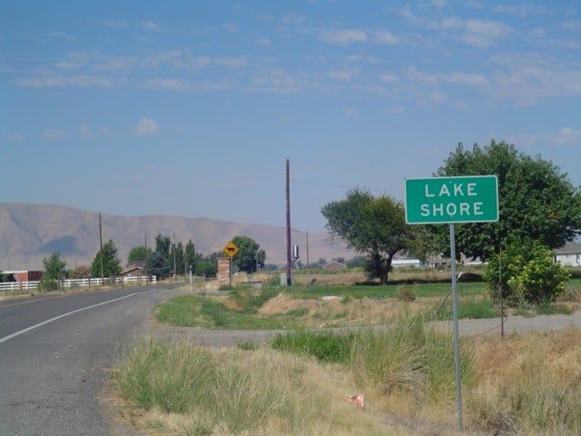
historic, Lake Shore, Palmyra, spanish fork, utah, utah county

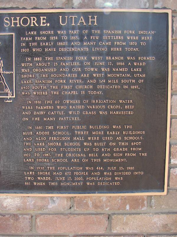
Lake Shore was part of the Spanish Fork Indian Farm from 1854 to 1865. A few settlers were here in the early 1860s and many came from 1870 to 1900 who have descendants living here today.
In 1880 the Spanish Fork West Branch was formed with about 25 families. On June 12, 1886 a ward was organized and our town was named Lake Shore. The boundaries are West Mountain, Utah Lake, Spanish Fork River and 1/4 mile South of 6400 South. The first church dedicated in 1892, was where the chapel is today.
Related:
In 1881 the 60 owners of irrigation water were farmers who raised various crops, beef and dairy cattle. Wild grass was harvested on the many pastures.
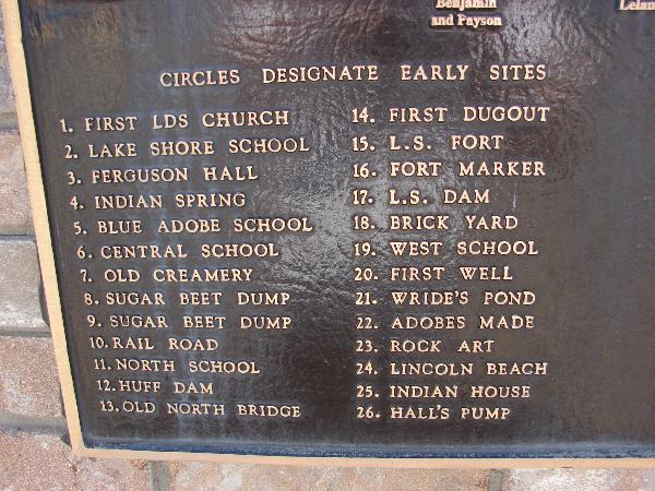
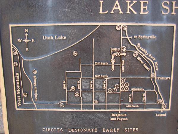
In 1881 the first public building was the Blue Adobe School, three more buildings and also Furguson Hall were used as schools. The Lake Shore School was built on this spot and used for students up to 8th grade from 1922 to 1987. The original bell and sign from the Lake Shore School are on this monument.
In 1930 the population was 464. July 13, 1980 Lake Shore had 670 people and was divided into two wards. June 17, 2000 population was 861 when this monument was dedicated.

Next to the monument with the bell is a commemorative drinking fountain for the first artesian well driven in this part of the Country, the rig was fashioned by Joseph Francis and with the help of his brother, Samuel, the well was driven in 1877 on the Samuel Francis homestead one and three fourths miles west of this spot.


09 Saturday Aug 2014
Posted in Uncategorized
Tags
historic, Ogden, SUP, utah, Weber County

ODGEN CANYON TOLL GATE
805 feet north of this site was located the toll gate, established November 15, 1860, by Lorin Farr and Isaac Goodale, builders of the first road through Ogden Canyon. From 1865 to 1882 it was operated by the Ogden Canyon Road Company, with the original builders and John Taylor as principle stockholders. James Dinsdale was gate keeper for 14 years. It became a public road February 10, 1882.
See other historic markers in the series on this page for UPTLA/SUP Markers.


08 Friday Aug 2014
Posted in Uncategorized
Tags
historic, Rush Valley, Stockton, SUP, Tooele, Tooele County, utah

LOOKOUT POINT
Look north, see trees that mark site of TOD PARK, which was home for civilian employees of Army Depot (1943-1960). Look northwest, see the 10,000 acres of Tooele Army Depot ammunition storage, warehouses, mainenance shops and administration buildings. Look west, see the water mark on South Mountain made by Old Lake Bonneville at the 5200 foot level. Look south, see the geologic wonder of Stockton Bar which was created by wave action of Old Lake Bonneville. Look down west, see the trees that mark the site of the Ghost Town of Bauer (private property), the Honerine Tunnel adit, and the terminix of the old Utah Nevada Western Railroad (1885-1905). Look east in gully, see Soldier Bridge on old road built by Steptoe’s Army in 1854. Look northeast, see bench across Silcox Canyon which was created by an earthquake that happened before the last Ice Age. Glaciers cut through the bench and created a wide flat bottom canyon.
See other historic markers in the series on this page for SUP Markers.


08 Friday Aug 2014
Posted in Uncategorized
Tags
historic, Rush Valley, Stockton, Tooele, Tooele County, utah
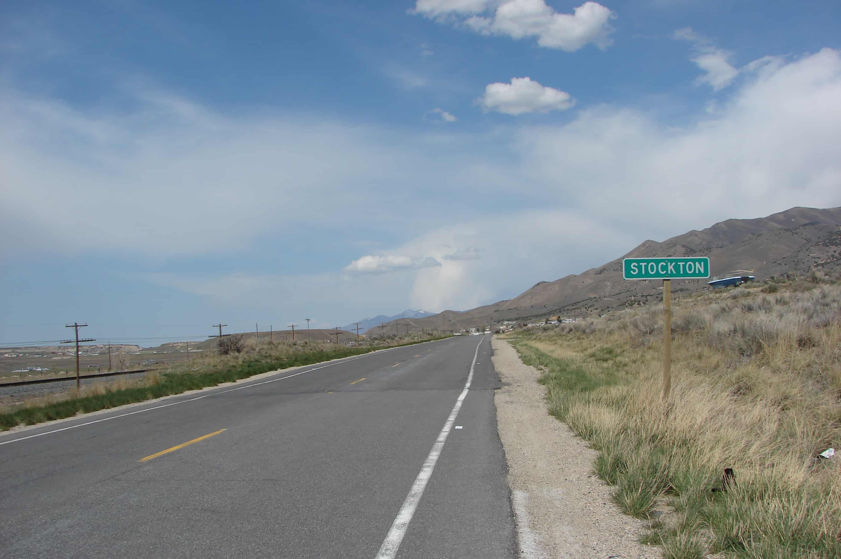
Stockton has a lot of “firsts,” it was the home of the First Electric Light in the State, the First Smelter Center in the West, and the First Mining Camp in the State, first town in the Utah Territories to have its streets surveyed and named and the first town to get a telephone.
Related:


