Historic Homes in Coalville
29 Monday Jan 2018
Posted in Uncategorized

29 Monday Jan 2018
Posted in Uncategorized
29 Monday Jan 2018
Posted in Uncategorized
Historic Buildings in Coalville.
29 Monday Jan 2018
Posted in Uncategorized
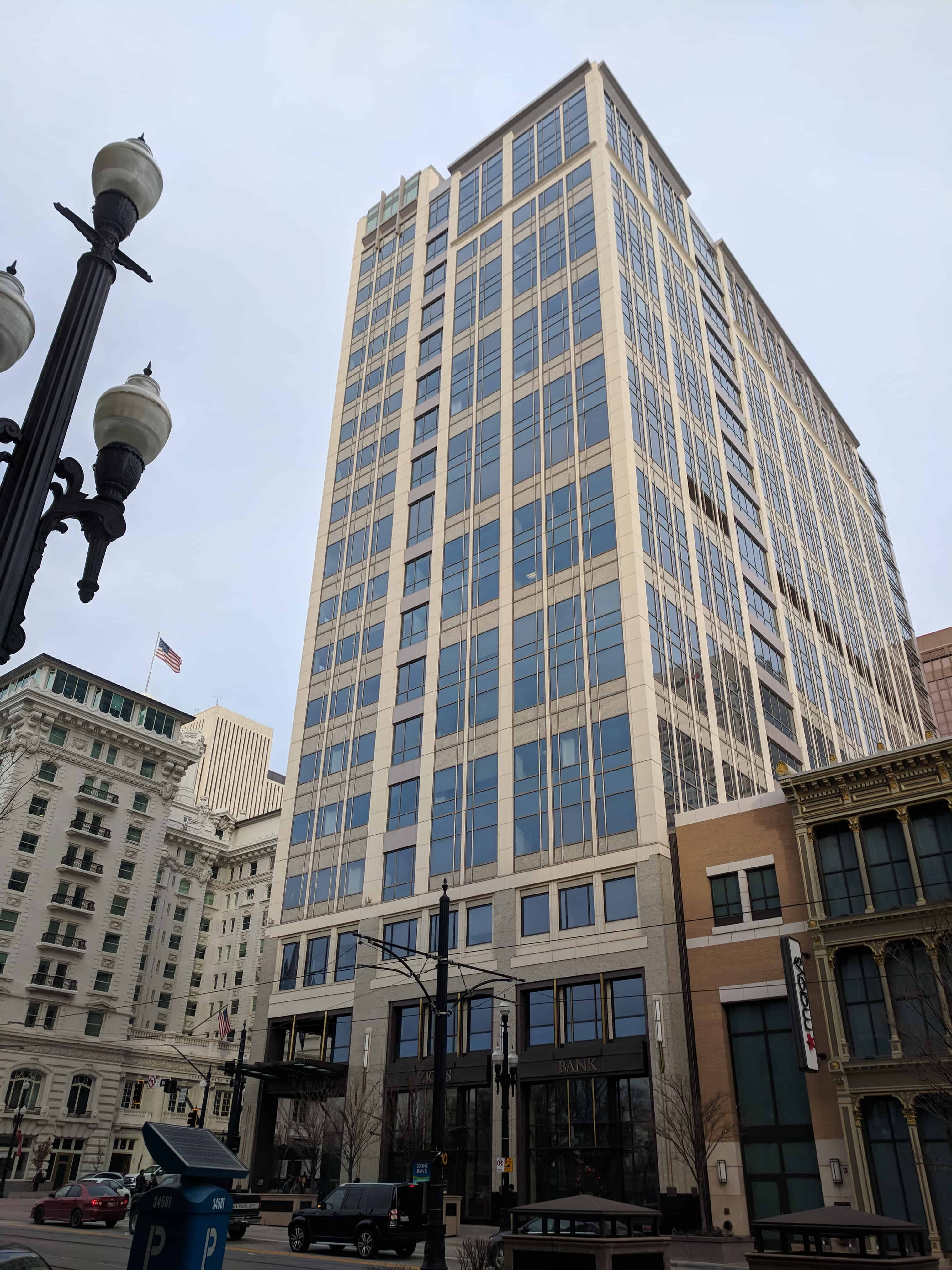
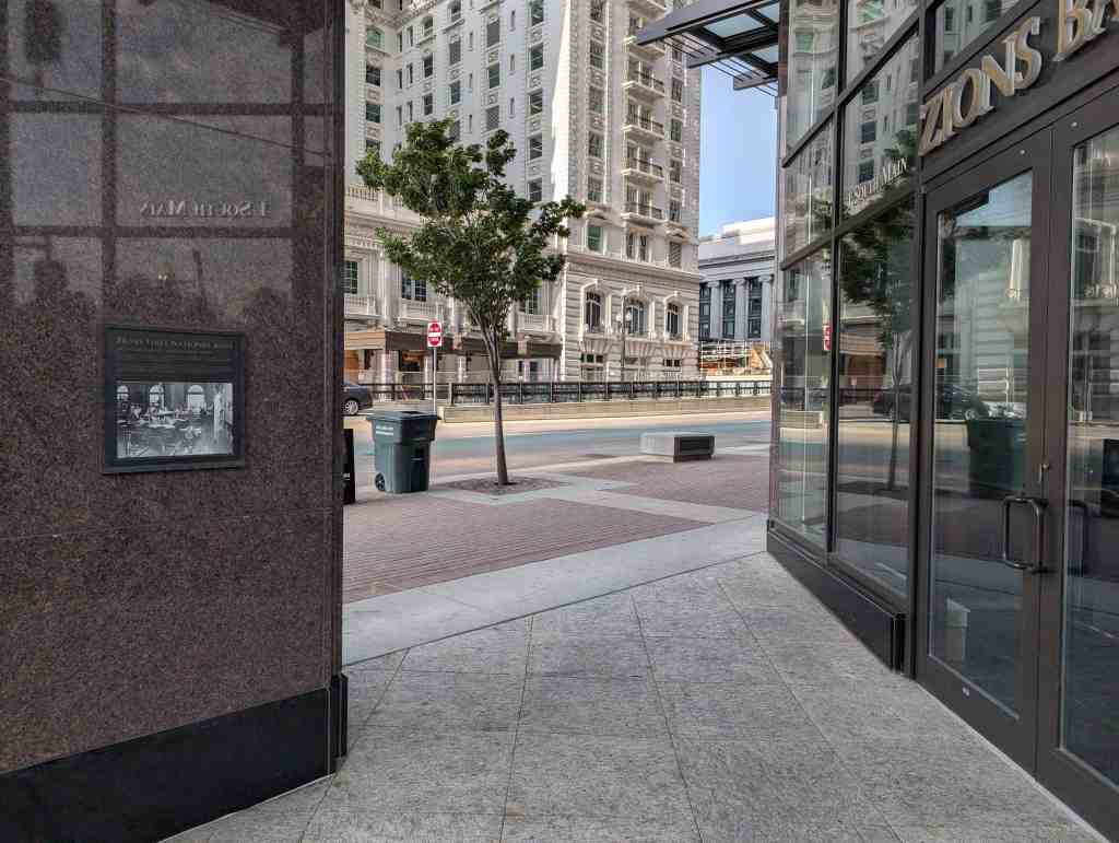
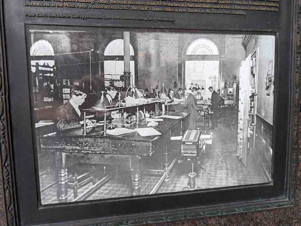
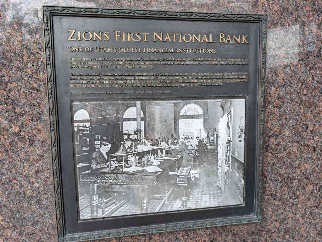
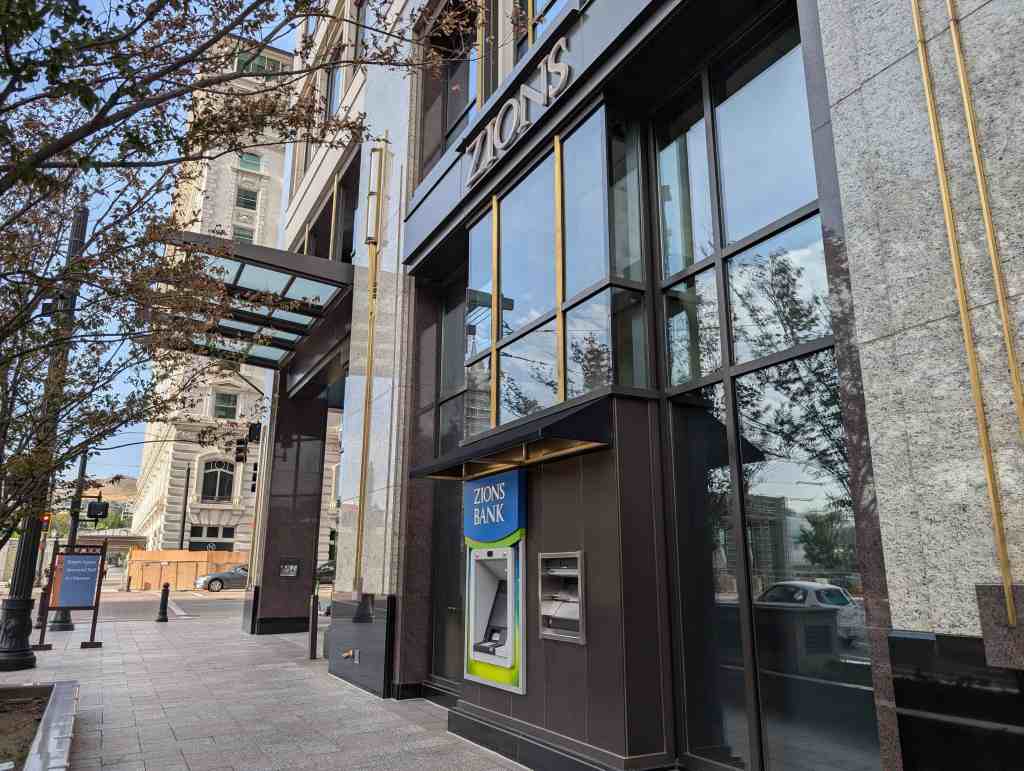
Zions First Nation Bank
One of Utah’s Oldest Financial Institutions
Brigham Young founded Zion’s Savings Bank and Trust Company in 1873 to promote thrift and generate savings for investments in the wake of financial panic. For the first few years the bank operated out of various storefronts on Main Street, but in 1890 it moved to spacious new quarters at this site in the Templeton Building.
The bank successfully weathered the financial difficulties of the Great Depression and in 1957 changed its name to Zions First National Bank when it merged with two other financial institutions. In 1965 the bank moved into its current quarters when the Kennecott Building replaced the Templeton Building. Today, the bank has more than 100 branches in Utah and Idaho and is one of the most influential banking institutions in the West. After a renovation in 2007, the bank’s home office is now known as the Zions Bank Building.
Located at 1 South Main Street in Salt Lake City, Utah at the site of the old Templeton Building.


29 Monday Jan 2018
Posted in Uncategorized

A list of the historic homes in Salt Lake City that I’ve come across.

29 Monday Jan 2018
Posted in Uncategorized
Tags

The Utah War – Diplomacy Prevails
By February 1858, misunderstandings began to clear away. Colonel Thomas L. Kane, a friend of the Mormons, met in Washington with President Buchanan and tried to work out a peaceful settlement. Kane traveled via Panama and California to Salt Lake, where he met with Brigham Young, who agreed to let Governor Cumming enter Salt Lake without the U.S. Army. Colonel Kane then went to Camp Scott with that message. He was not well received by Colonel Johnston, who arrested him as a spy. Nevertheless, Colonel Kane was successful in convincing Colonel Johnston to allow Governor Cumming to travel with him to Salt Lake, without the Army.
Kane and Cumming were escorted through Echo Canyon by members of the Utah Militia. They were taken through at night to impress Cumming with the fortifications. Bonfires were lit along the mountain ledges to illuminate the high, overhanging walls. The scene was made more ominous by the sharply spoken demands, counter-signs, the clanking of arms, and a campfire. After a group of Militia at the first check point had engaged the incoming Governor, they were (unbeknownst to the Governor) directed to hurry down to the next checkpoint. The Governor was again confronted in military fashion by many of the same people. After a third similar confrontation, the group was allowed to move on to Salt Lake, arriving there on April 7, 1858. Later, Cumming was displeased about his having been deceived.
Governor Cumming was accepted by the people as the new governor and reported the true state of affairs to Washington. President Buchanan sent a peace commission of three men to Salt Lake City who arrived on June 7, 1858, with a pardon from President Buchanan. Brigham Young accepted the pardon. On June 26, 1858, 3,000 soldiers of the U.S. Army, commanded by Colonel Johnston, passed peacefully through Salt Lake and established Camp Floyd, 40 miles south of the City. By mid-1861, the soldiers of the U.S. Army had left Utah Territory to participate in the Civil War.
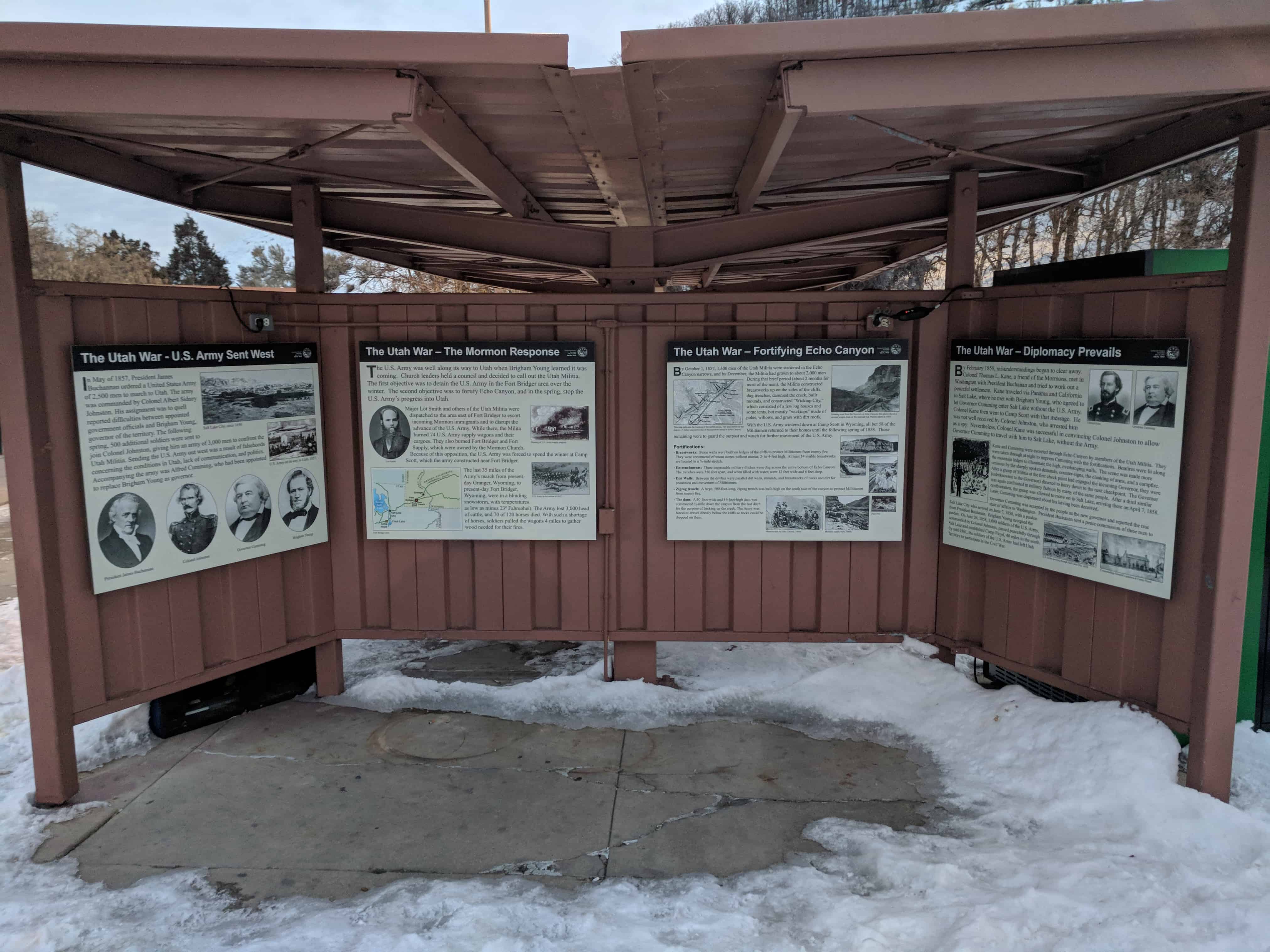
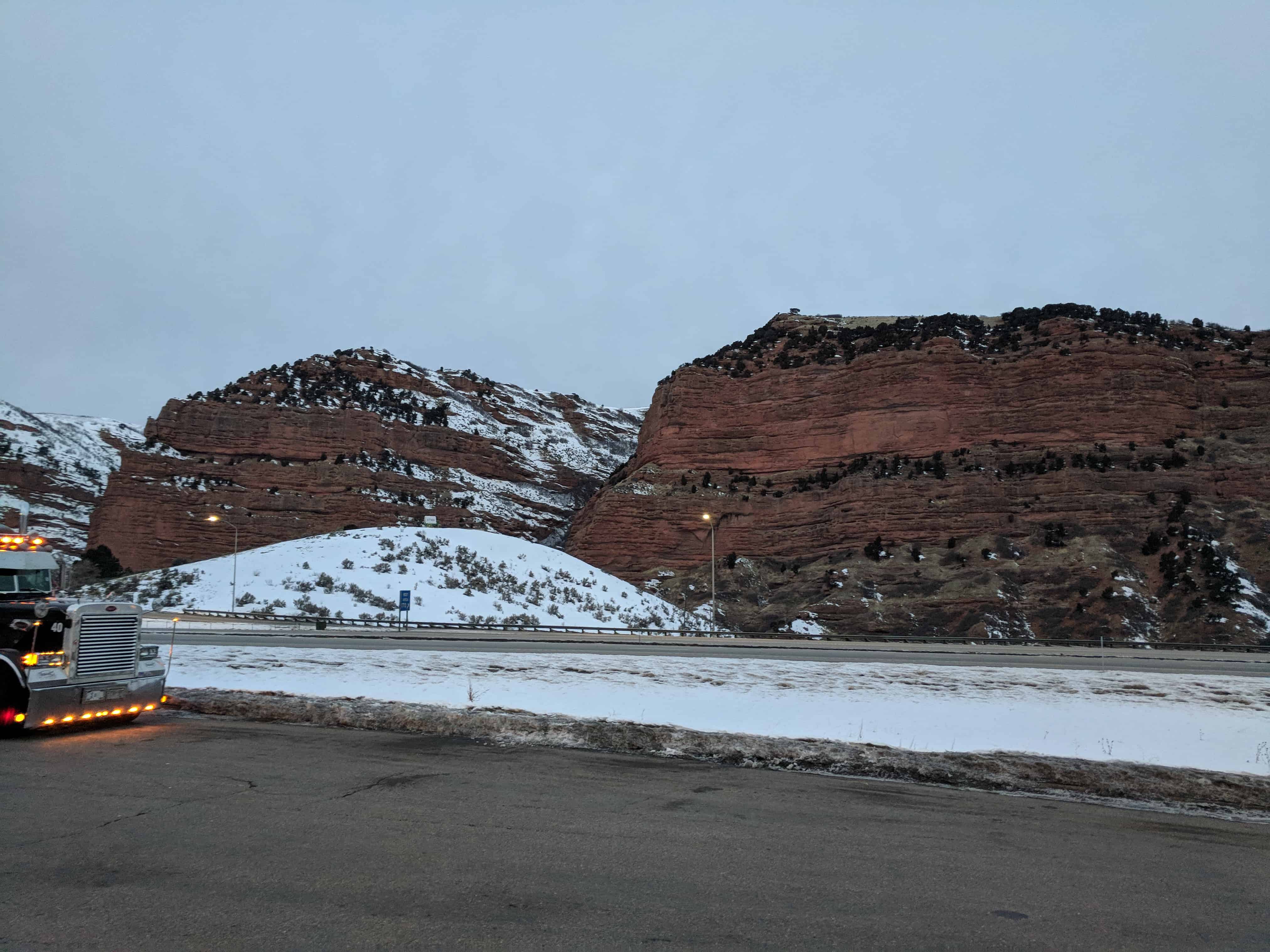
This is part of a cluster of S.U.P. Historic Markers, #185-A, 185-B, 185-C, 185-D located at the eastbound rest stop in I-80 in Echo Canyon. For other S.U.P. Historic Markers see this page.

29 Monday Jan 2018
Posted in Uncategorized
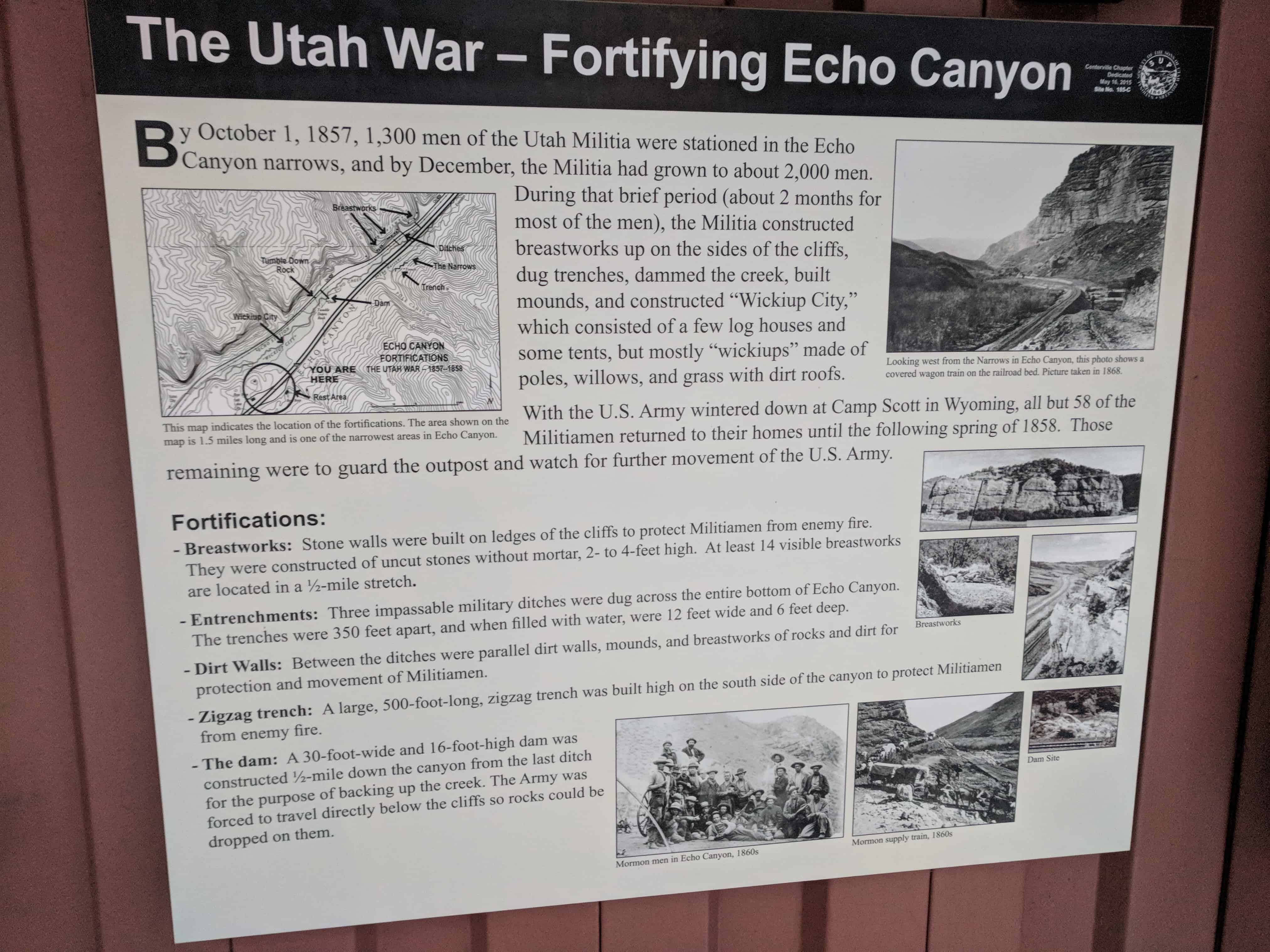
The Utah War – Fortifying Echo Canyon
By October 1, 1857, 1,300 men of the Utah Militia were stationed in the Echo Canyon narrows, and by December, the Militia had grown to about 2,000 men. During that brief period (about 2 months for most of the men), the Militia constructed breastworks up on the sides of the cliffs, dug trenches, dammed the creek, built mounds, and constructed “Wickiup City,” which consisted of a few log houses and some tents, but mostly “wickiups” made of poles, willows, and grass with dirt roofs.
With the U.S. Army wintered down at Camp Scott in Wyoming, all but 58 of the Militiamen returned to their homes until the following spring of 1858. Those remaining were to guard the outpost and watch for further movement of the U.S. Army.
Fortifications:
This is part of a cluster of S.U.P. Historic Markers, #185-A, 185-B, 185-C, 185-D located at the eastbound rest stop in I-80 in Echo Canyon. For other S.U.P. Historic Markers see this page.
29 Monday Jan 2018
Posted in Uncategorized
Tags
Echo Canyon, Fort Bridger, Fort Supply, Forts, Historic Markers, summit county, SUP, The Utah War, utah, Utah Militia, War
The Utah War – The Mormon Response
The U.S. Army was well along its way to Utah when Brigham Young learned it was coming. Church leaders held a council and decided to call out the Utah Militia. The first objective was to detain the U.S. Army in the Fort Bridger area over the winter. The second objective was to fortify Echo Canyon, and in the spring, stop the U.S. Army’s progress into Utah.
Major Lot Smith and others of the Utah Militia were dispatched to the area east of Fort Bridger to escort incoming Mormon immigrants and to disrupt the advance of the U.S. Army. While there, the Militia burned 74 U.S. Army supply wagons and their cargoes. They also burned Fort Bridger and Fort Supply, which were owned by the Mormon Church. Because of this opposition, the U.S. Army was forced to spend the winter at Camp Scott, which the army constructed near Fort Bridger.
The last 35 miles of the Army’s march from present- day Granger, Wyoming, to present-day Fort Bridger, Wyoming, were in a blinding snowstorm, with temperatures as low as minus 23° Fahrenheit. The Army lost 3,000 head of cattle, and 70 of 120 horses died. With such a shortage of horses, soldiers pulled the wagons 4 miles to gather wood needed for their fires.
This is part of a cluster of S.U.P. Historic Markers, #185-A, 185-B, 185-C, 185-D located at the eastbound rest stop in I-80 in Echo Canyon. For other S.U.P. Historic Markers see this page.

29 Monday Jan 2018
Posted in Uncategorized
Tags
Echo Canyon, Historic Markers, summit county, SUP, The Utah War, utah, War
The Utah War – U.S. Army Sent West
In May of 1857, President James Buchannan ordered a United States Army of 2,500 men to march to Utah. The army was commanded by Colonel Albert Sidney Johnston. His assignment was to quell reported difficulties between appointed government officials and Brigham Young, governor of the territory. The following spring, 500 additional soldiers were sent to join Colonel Johnston, giving him an army of 3,000 men to confront the Utah Militia. Sending the U.S. Army out west was a result of falsehoods concerning the conditions in Utah, lack of communication, and politics. Accompanying the army was Alfred Cumming, who had been appointed to replace Brigham Young as governor.
This is part of a cluster of S.U.P. Historic Markers, #185-A, 185-B, 185-C, 185-D located at the eastbound rest stop in I-80 in Echo Canyon. For other S.U.P. Historic Markers see this page.

29 Monday Jan 2018
Posted in Uncategorized
Tags
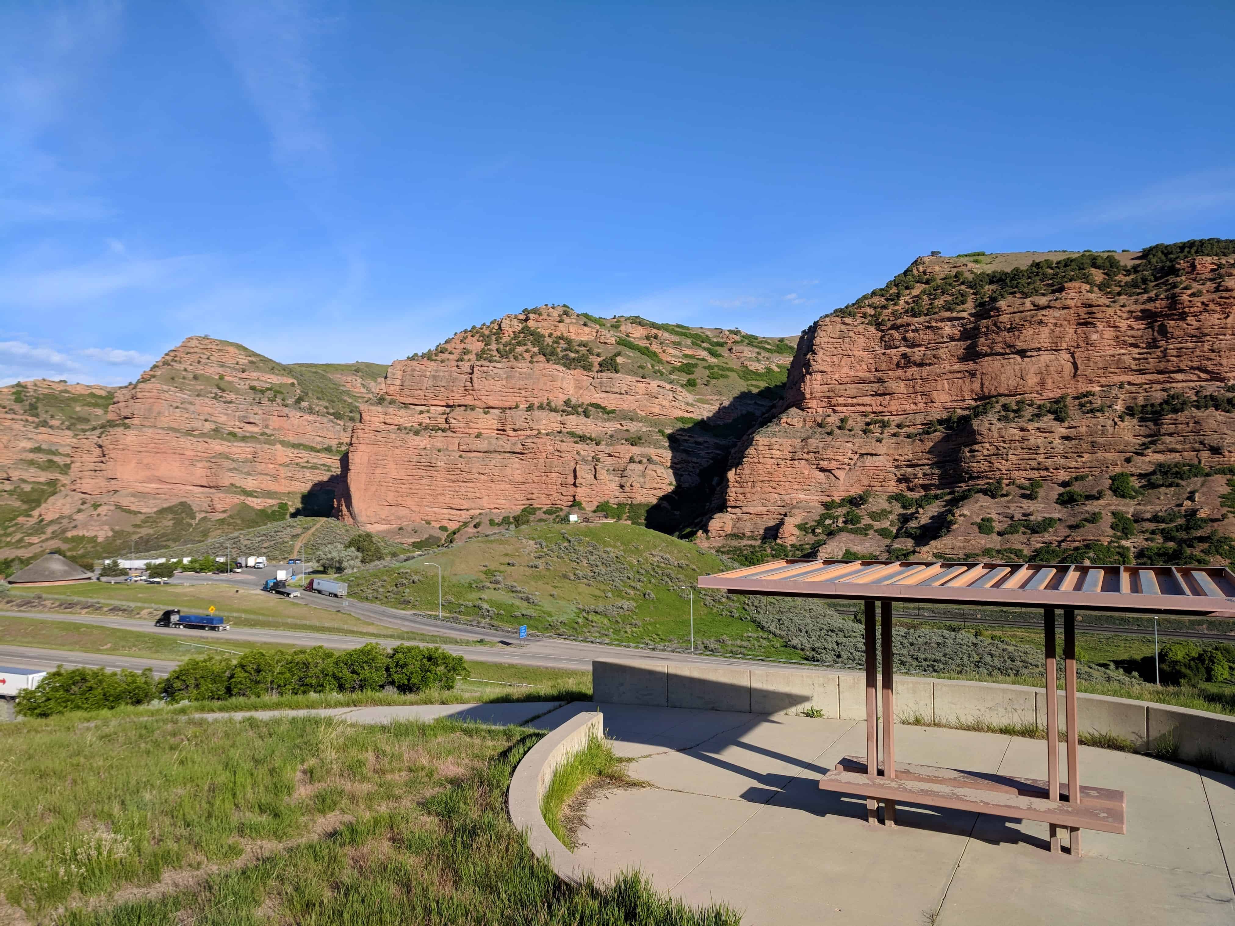
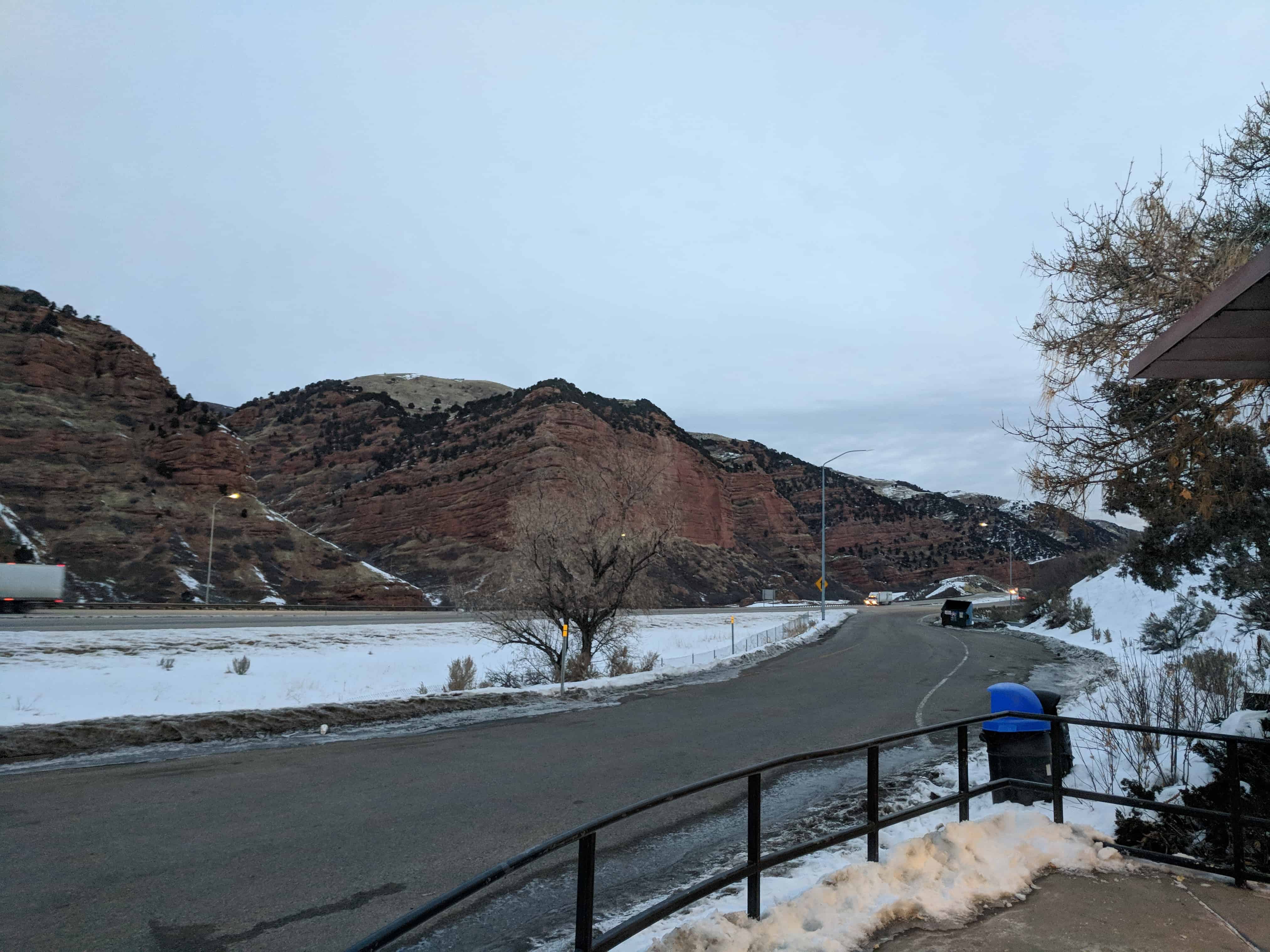
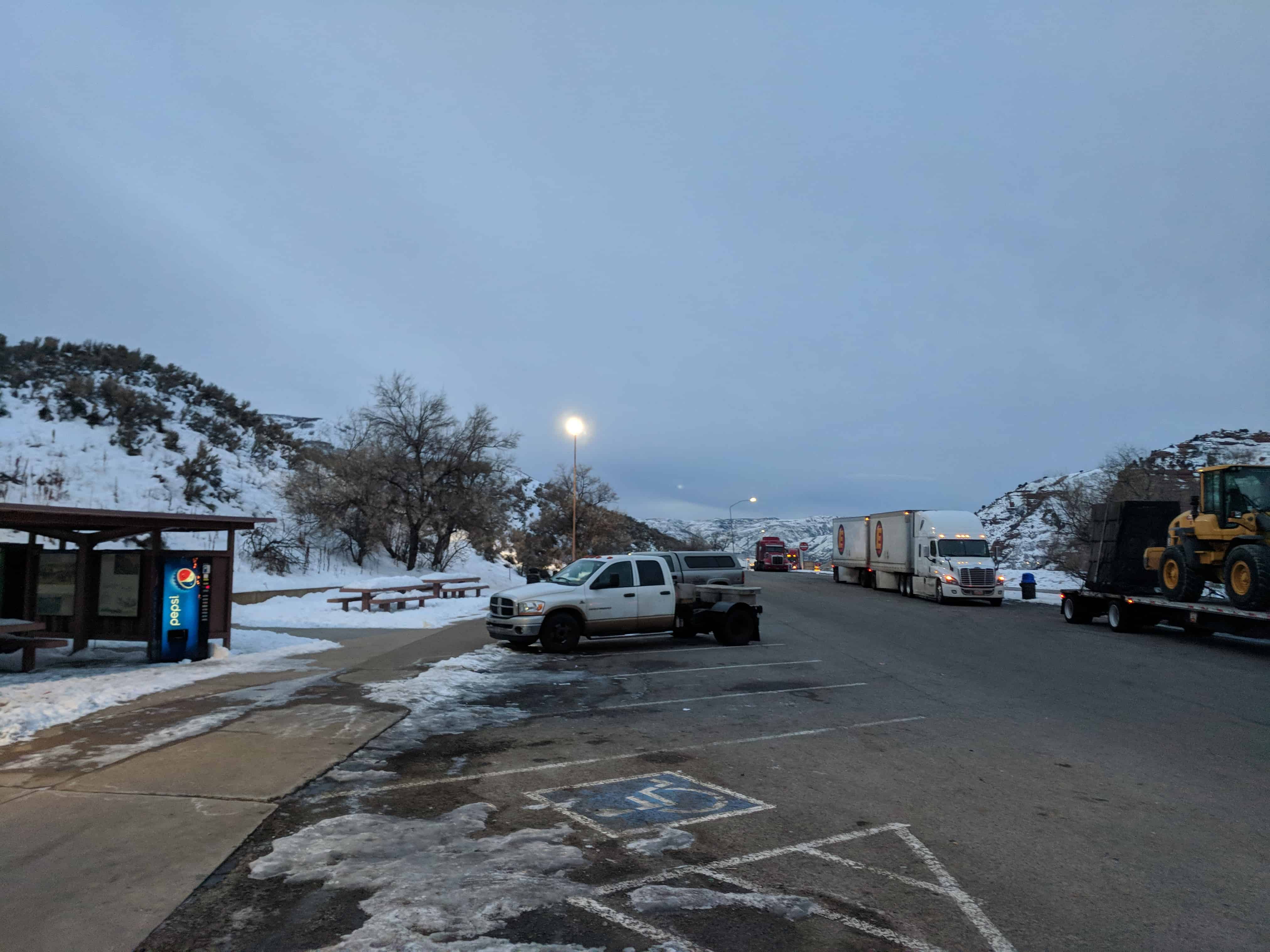
Echo Canyon – Eastbound Rest Area
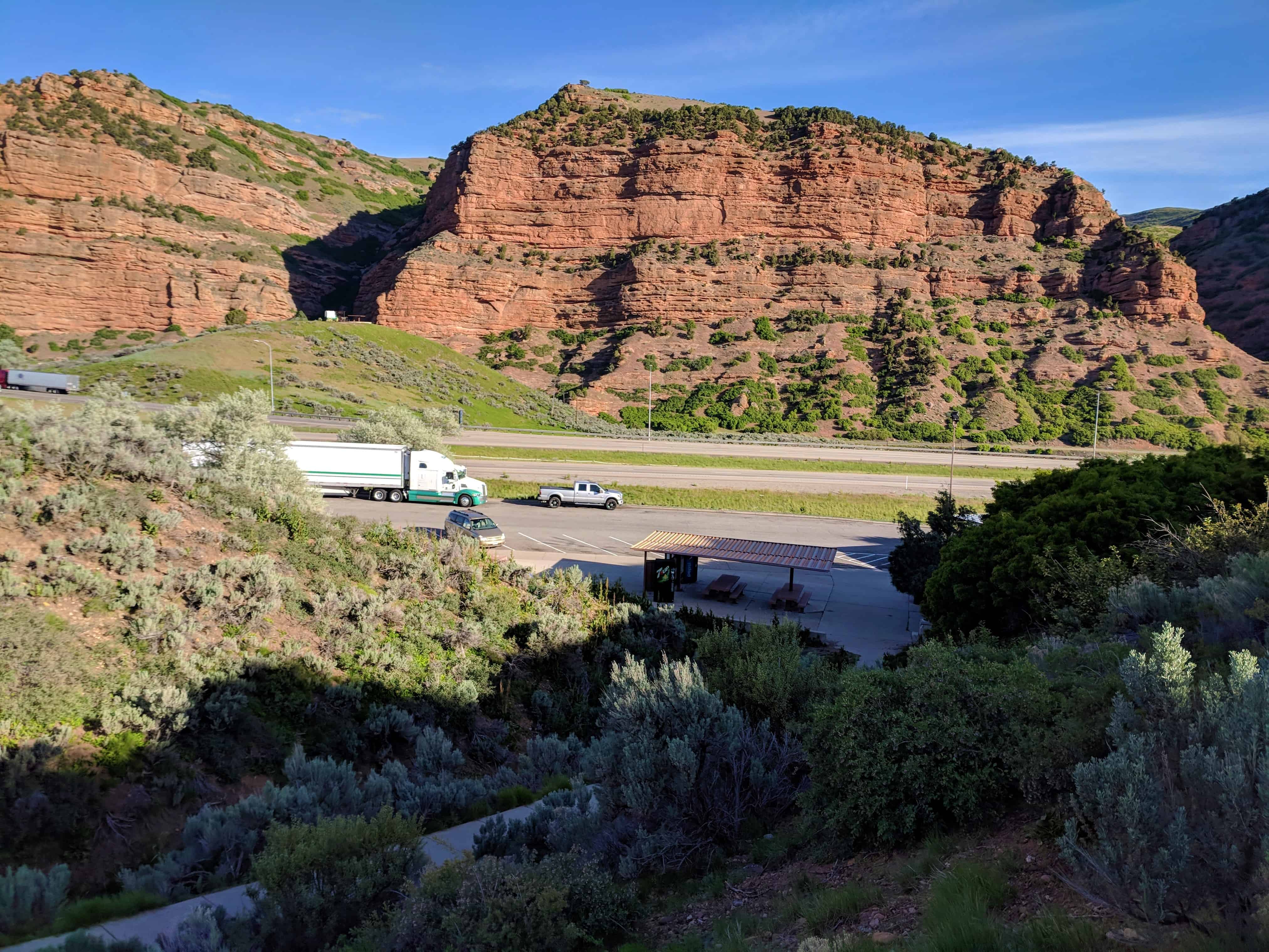
This is the rest stop near the mouth of Echo Canyon for eastbound travel, westbound is on this page.
There is a restroom and a small hiking path, some friendly potguts who like to beg for food and a cluster of historic markers:

29 Monday Jan 2018
Posted in Uncategorized
Tags

Heber and Luna Clark House
This house was built c.1882 for George “Heber” Clark and his wife, Luna. Heber was a partner in Clark Brothers Store. This house remains an excellent example of how houses traditionally intermingled with businesses on Main and Center Streets. Maxine Radmall purchased the house from Clark descendants in 1976, restoring it in 1995.
(text from the plaque on the building)
Located at 67 South Main Street in Pleasant Grove on historic Main Street.


2023: I stopped by and noticed it has been completely demolished, I’m not sure when. Sometime in the past couple of years.


