• About JacobBarlow.com
  • Cemeteries in Utah
  • D.U.P. Markers
  • Doors
  • Exploring Utah Email List
  • Geocaching
  • Historic Marker Map
  • Links
  • Movie/TV Show Filming Locations
  • Oldest in Utah
  • Other Travels
  • Photos Then and Now
  • S.U.P. Markers
  • U.P.T.L.A. Markers
  • Utah Cities and Places.
  • Utah Homes for Sale
  • Utah Treasure Hunt

JacobBarlow.com

~ Exploring with Jacob Barlow

JacobBarlow.com

Tag Archives: Historic Buildings

South Cottonwood Campground

30 Thursday Nov 2017

Posted by Jacob Barlow in Uncategorized

≈ 1 Comment

Tags

DUP, Historic Buildings, Historic Markers, Murray, Salt Lake County, SUP, utah

  • 2017-09-29 15.08.53

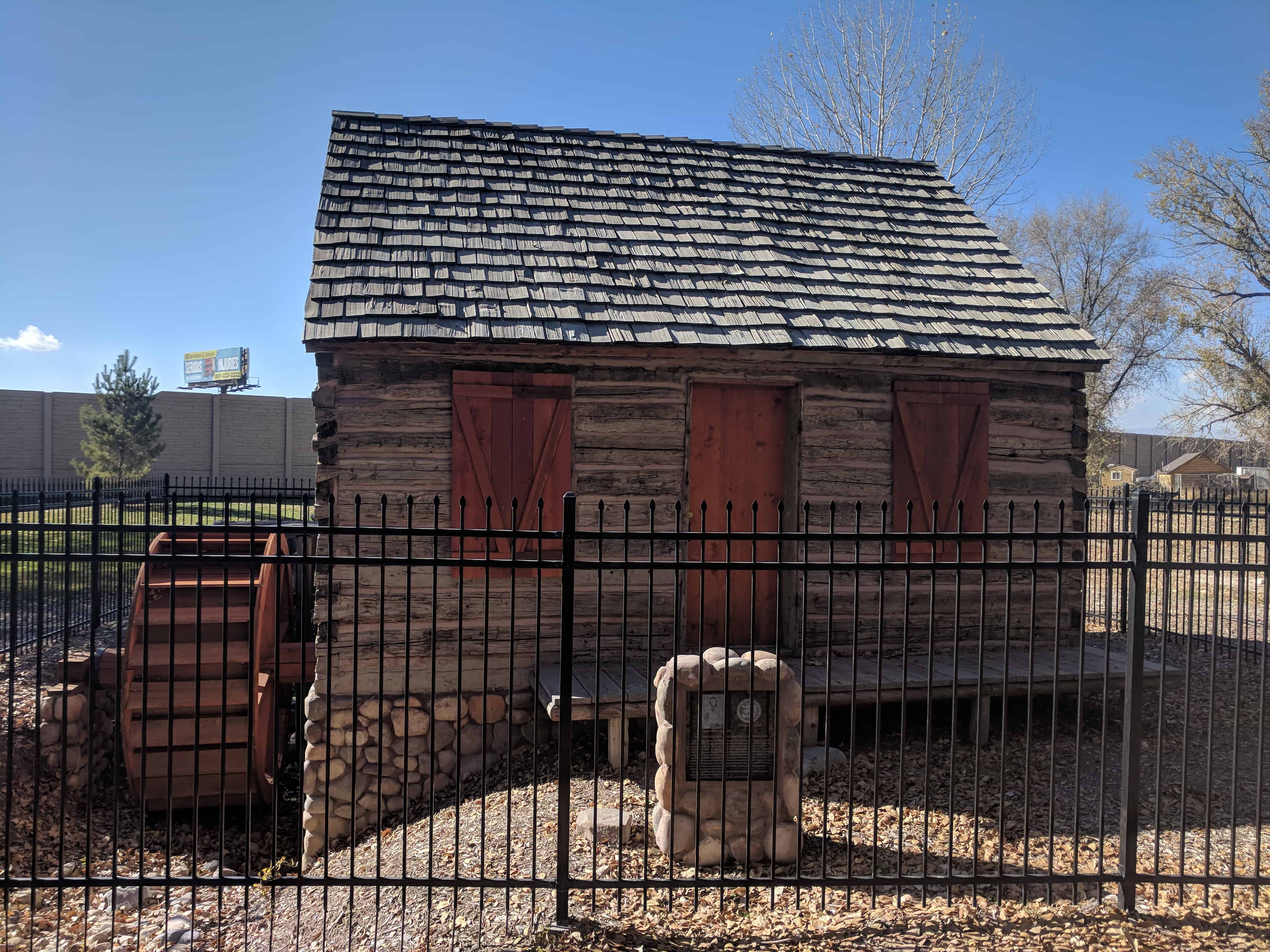
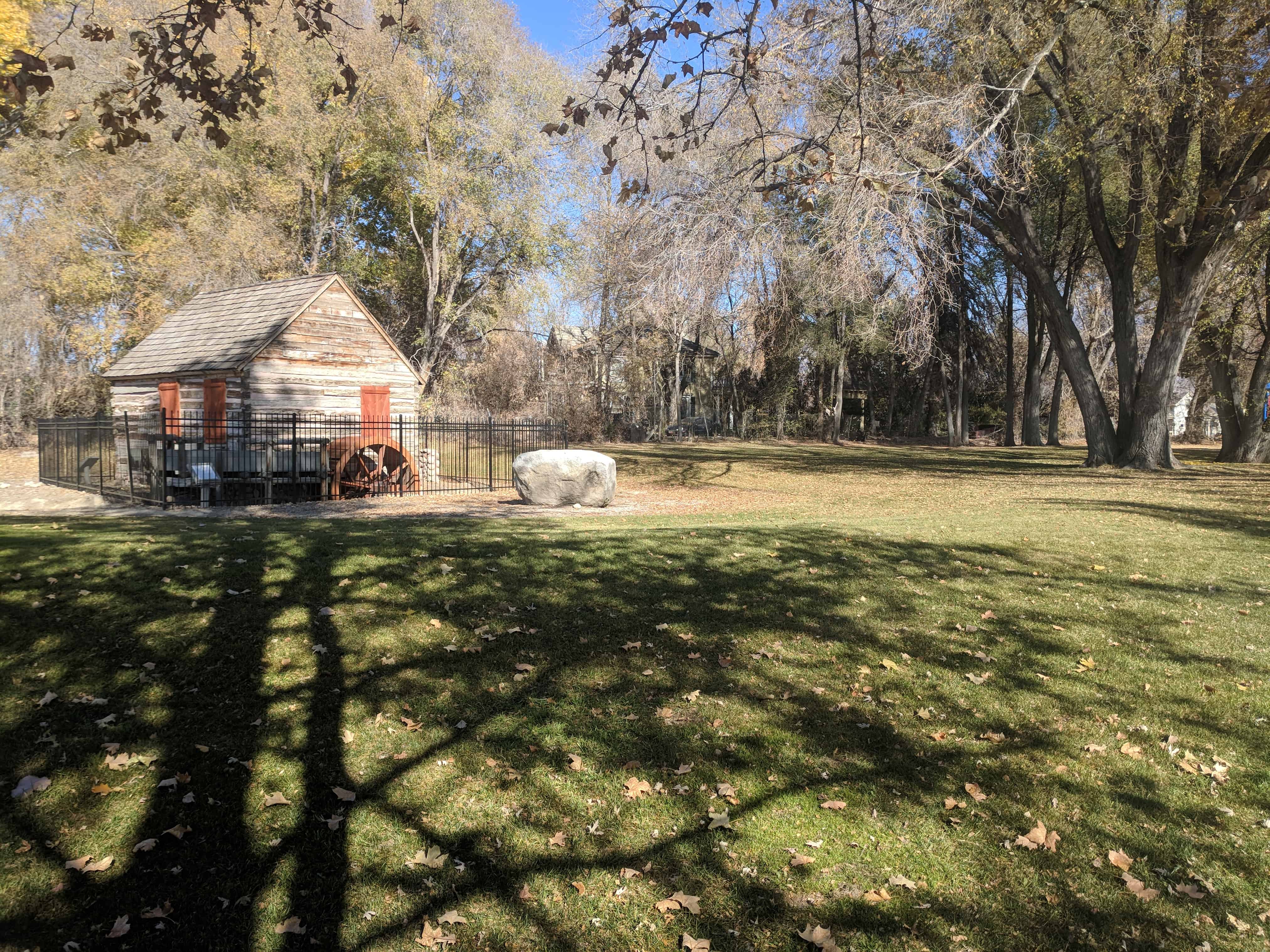
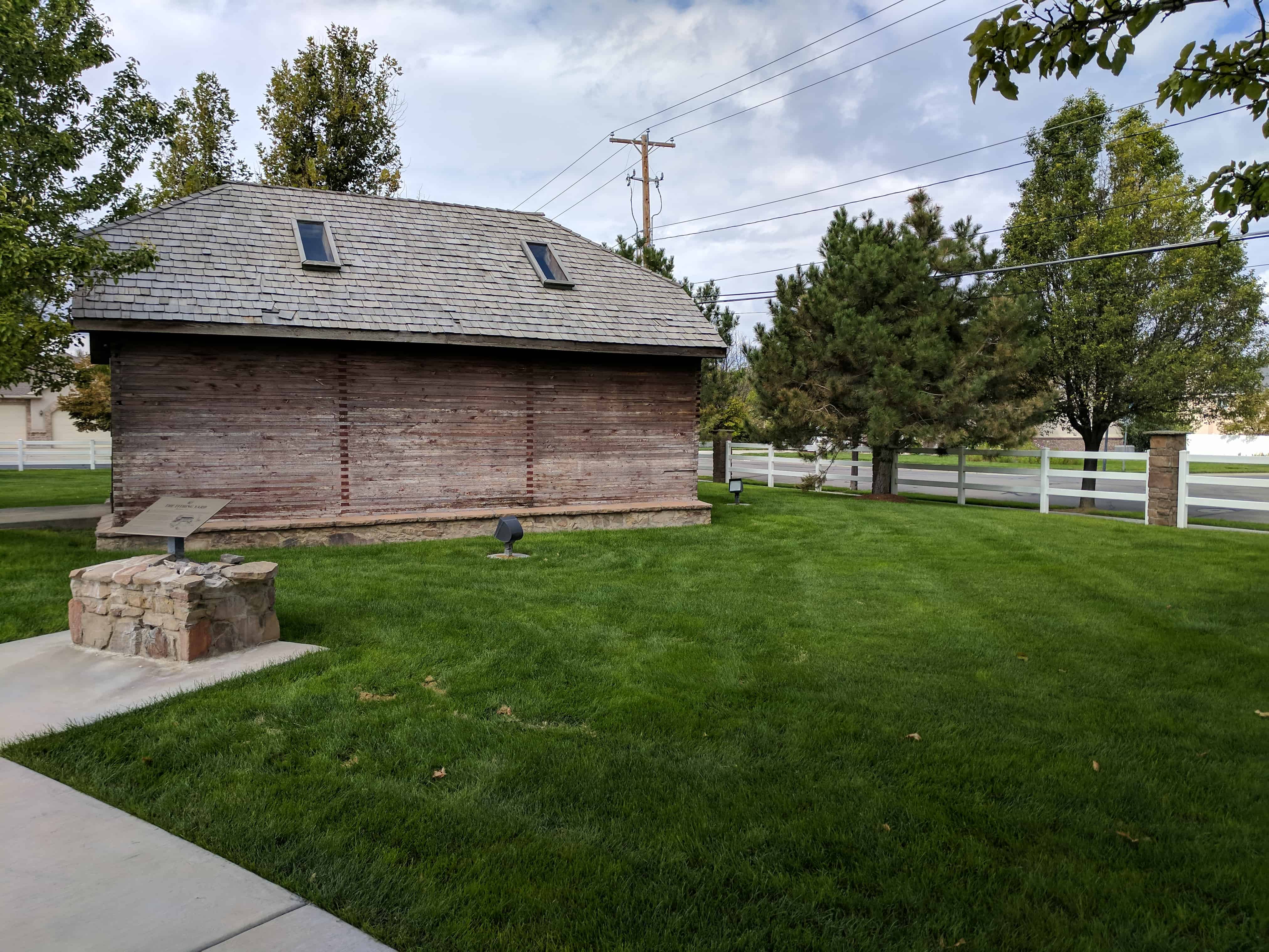
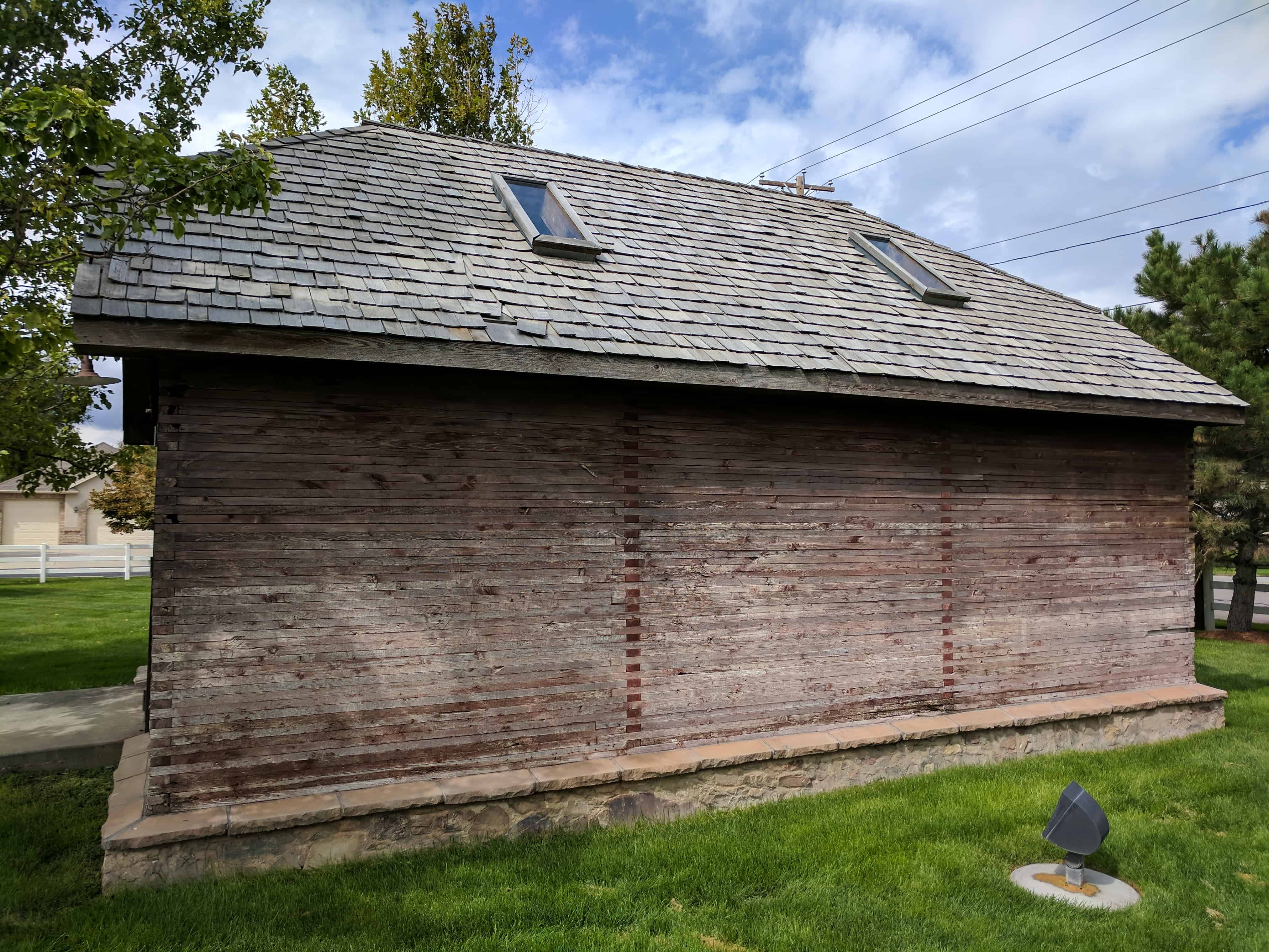
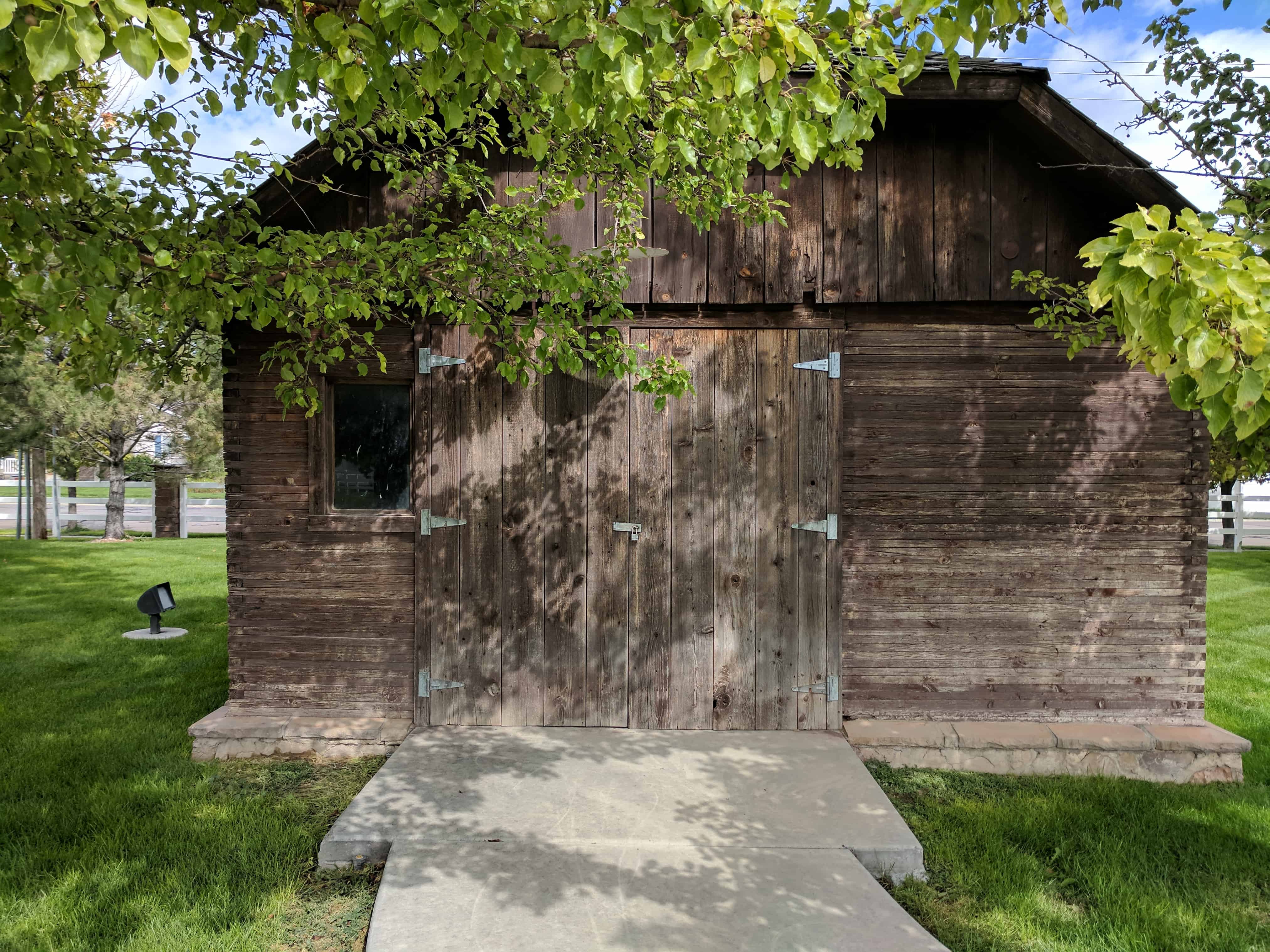
A small cluster of historic markers, a wagon and a cabin are all located here in the back of an LDS Church parking lot.

SUP Historic Marker #33 – South Cottonwood Campground

This area, 56th South and Vine Street, known as South Cottonwood, was one of the early religious and social centers for the Church in the Salt Lake Valley. To the north of here about 600 feet was a campground used by the stone haulers for the Salt Lake Temple, the site being approximately halfway between the quarry and the temple ground.

Also, may it be remembered that for those sturdy men who struggled here; the summer heat, spring and fall mud, and inadequate equipment made the task difficult. But they prevailed.

This is located at the chapel parking lot at 5605 South Vine Street in Murray, Utah. Check out this page for links to other markers also located here.

Related:

  • Other S.U.P. Markers
  • 2017-09-29 15.09.43
  • 2017-09-29 15.09.56

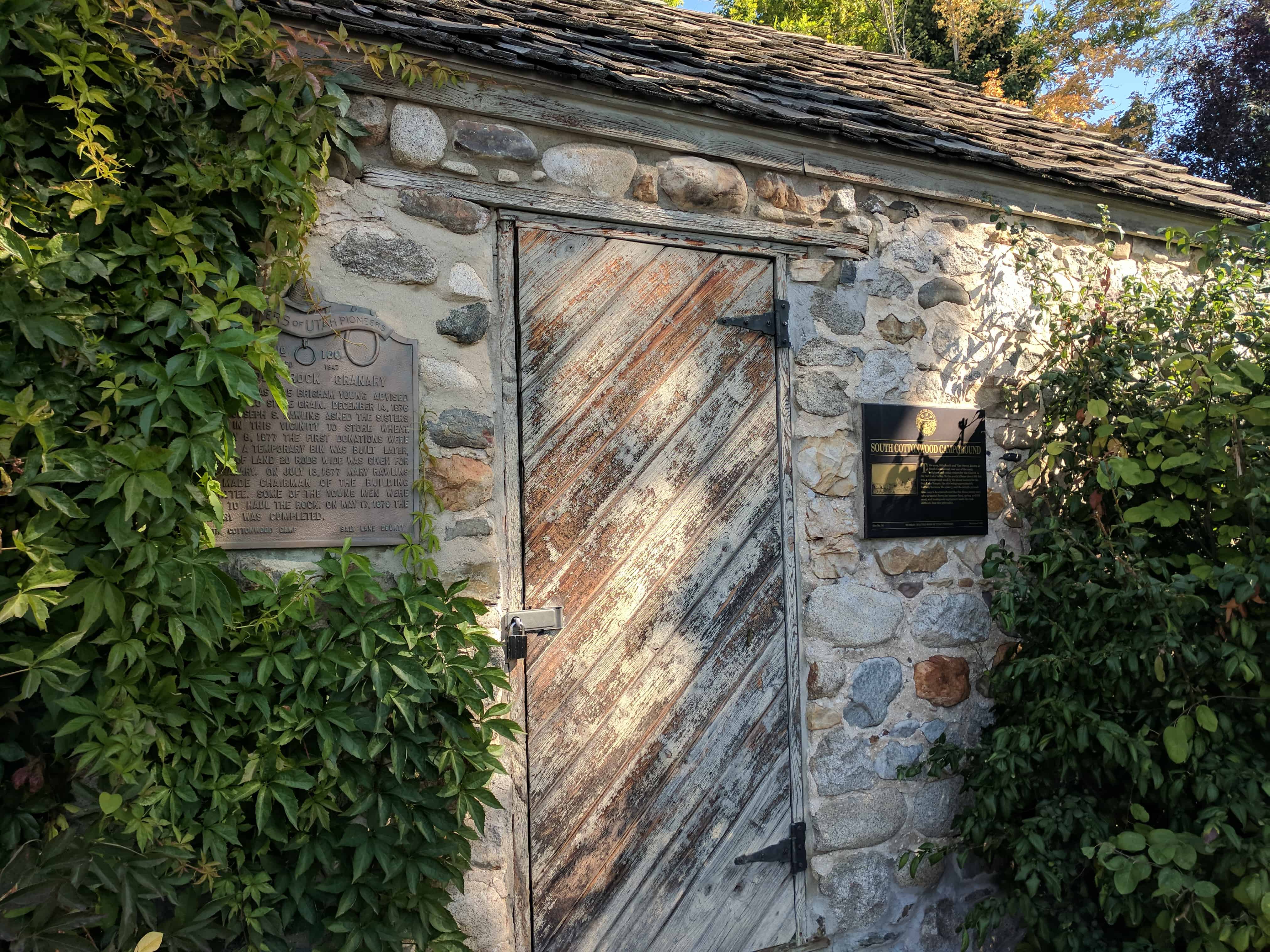
South Cottonwood Temple Granite Rest Camp

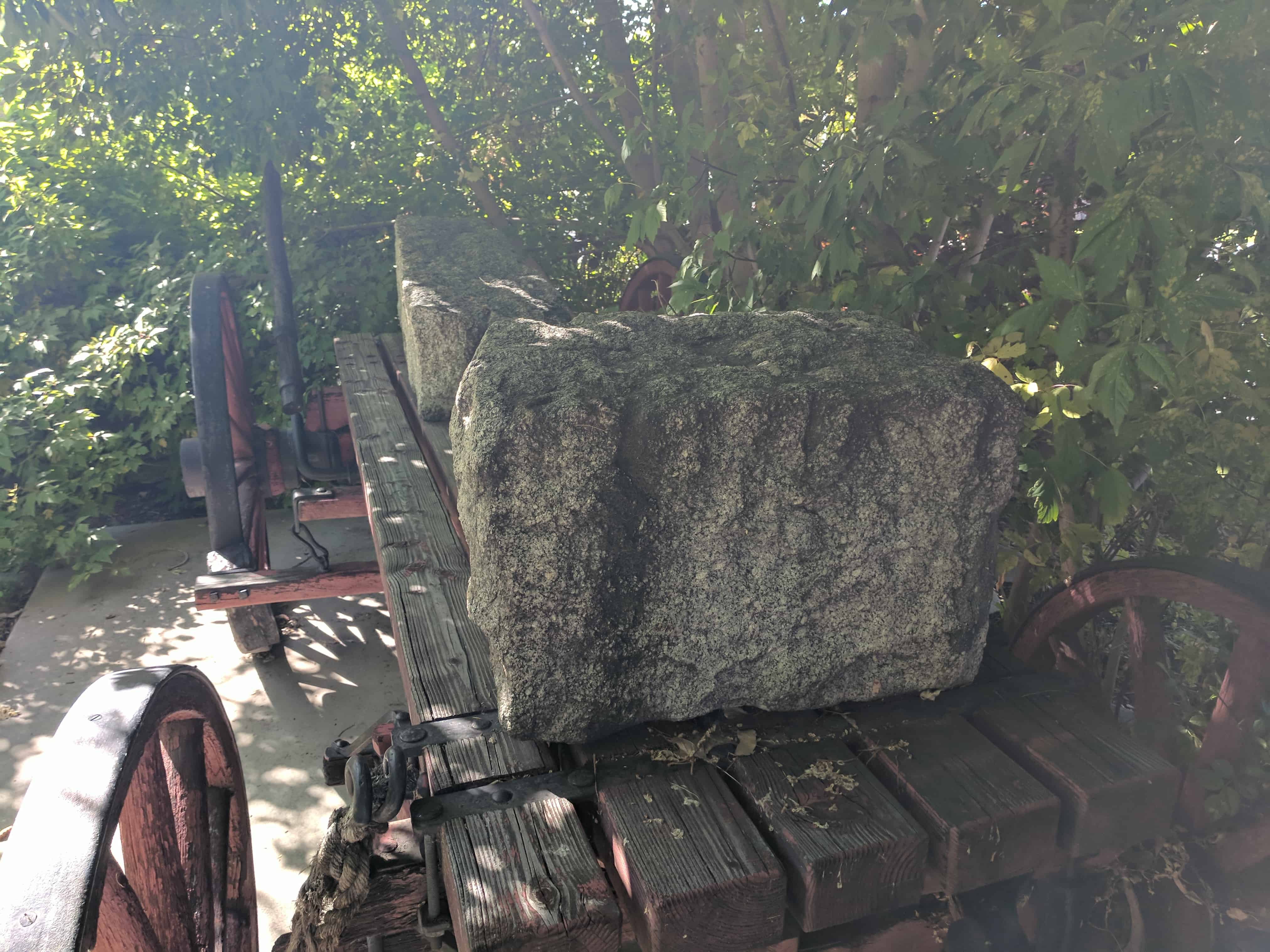
Since 1848 this area has been known as South Cottonwood and was one of the early religious and social centers of the pioneers in the Salt Lake Valley. Approximately 600 feet north of this site, was the campsite used by stone haulers who transported large granite blocks to the Salt Lake Temple. These sturdy men moved many tons of stone with horses and wagons until a narrow gauge railway was constructed for the quarry into Salt Lake City. The wagon displayed here is a replica of similar wagons used then. On it is a stone from the old narrow gauge railway as well as large stones found along the wagon trail, from the Sandy area farm of John Smart. Marks of the rock drill are still plainly visible.

  • 2017-09-29 15.09.06
  • 2017-09-29 15.09.24

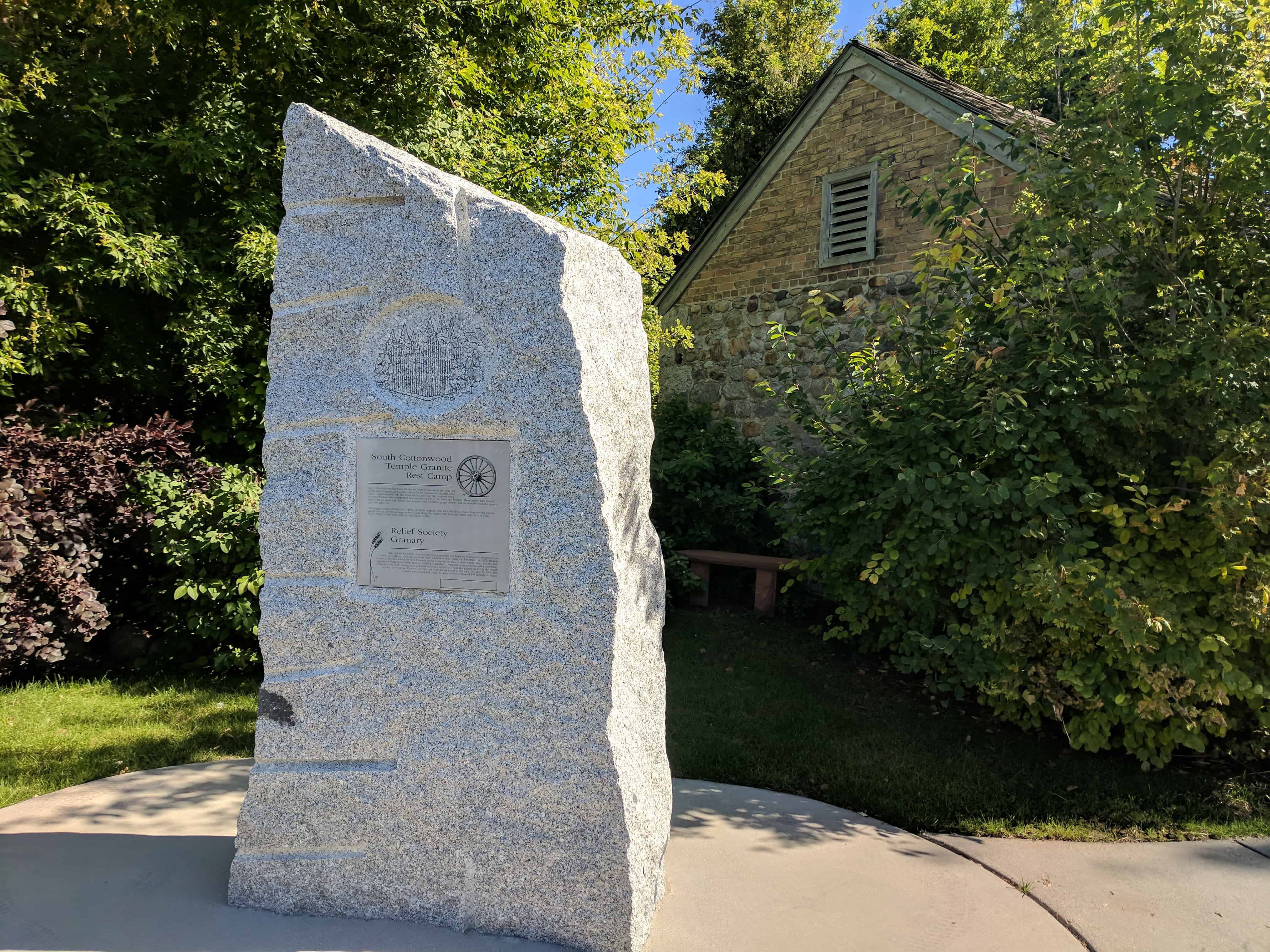
Relief Society Granary

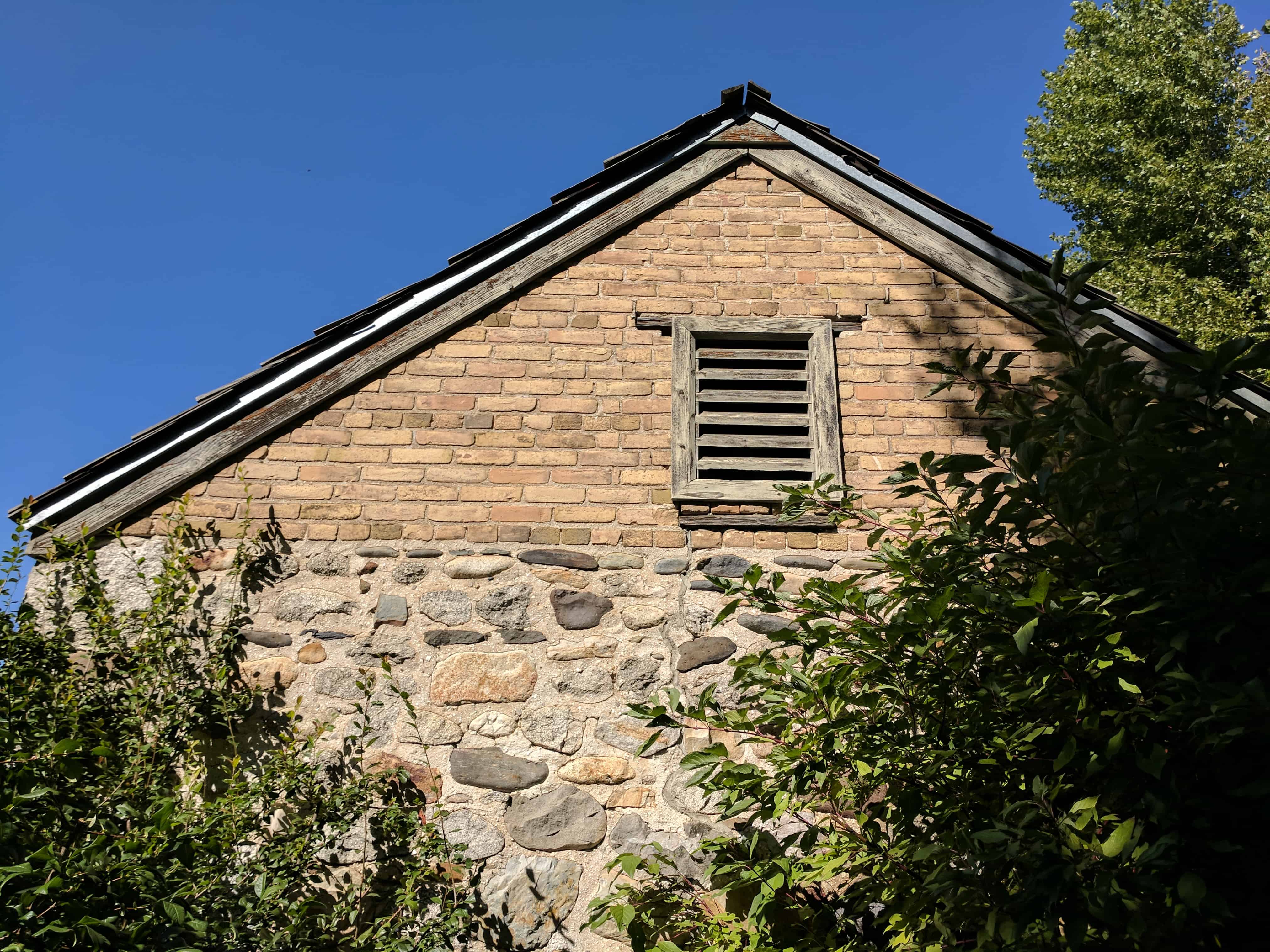
The old Rock Granary exterior has been preserved as closely to its original construction as possible. As early as 1845, the pioneers were advised to store grain. On December 14, 1876, Bishop Joseph S. Rawlins asked the Relief Society Sisters living in this area to store wheat. Mary Rawlins was appointed chairman of the Granary building committee. Donations were received and a temporary wheat bin was built. Young men gathered the rocks, much of it from the granite quarry at the mouth of Little Cottonwood Canyon, and the rest from stones found in this area. On May 17, 1878, this granary was completed, ready to store its first deposit of 195 bushels of wheat.

DUP Marker #100 – The Old Rock Granary

As early as 1845 Brigham Young advised the Saints to store grain. December 14, 1876 Bishop Joseph S. Rawlins asked the sisters living in this vicinity to store wheat. February 8, 1877 the first donations were received. A temporary bin was built. Later, a tract of land 20 rods wide was given for the granary. On July 13, 1877 Mary Rawlins was made chairman of the building committee. Some of the young men were asked to haul the rock. On May 17, 1878 the granary was completed. (see the page for this DUP Marker here)

  • 2017-09-29 15.09.48
  • 2017-09-29 15.11.05
  • 2017-09-29 15.11.13
  • 2017-09-29 15.10.21
  • 2017-09-29 15.10.43
  • 2017-09-29 15.10.51
  • 2017-09-29 15.10.57
  • 2017-09-29 15.11.01
  • 2017-09-29 15.10.11
  • 2017-09-29 15.09.34
  • 2017-09-29 15.08.50

Log Cabin Grist Mill

16 Thursday Nov 2017

Posted by Jacob Barlow in Uncategorized

≈ Leave a comment

Tags

American Fork, Grist Mills, Historic Buildings, Historic Markers, Mills, utah, utah county

2017-11-11 12.24.07

During the winter of 1850-51, Arza and Sabina Adams moved their family of seven children here from Mill Creek, Salt Lake Valley. They built a log cabin across the street east of where you stand. Journals tell that Arza built a Grist Mill near his log cabin. Arza learned how to build and operate flour mills from his father, Capt. Joshua Adams, in Ontario, Canada. The Adams Flour Mill was the first to produce baking flour for American Fork families. In 1853 Arza moved the water wheel, mill stones and other workings 4½ blocks north of here and built a larger mill near the Lake City Fort. During his lifetime, Arza also built and operated a third flour mill one mile north of town.

No photographs exist of the original 1851 mill. The log cabin and water wheel in front of you is a replication of that grist mill. Arza Adams built this log cabin at 234 North 100 East, American Fork in 1880. It became the home of his daughter, Bets Adams Robinson. The cabin was taken down log by log in 2012 and reassembled on this site in 2014. The water wheel is a replica of a wheel built in the mid 1800s. This park property originally belonged to Stephen Chipman who was Arza’s maternal uncle.

This Log Cabin Grist Mill stands as a Historical Monument of American Fork City and a tribute to Arza Adams, pioneer miller and one of the co-founders of this city.

SUP Monument dedicated July 11, 2015 by Daniel K. Adams, Arza’s Great-Grandson.

This is located in Centennial Park in American Fork.
See other historic markers in the series on this page for SUP Markers.

2017-11-11 12.22.58
2017-11-11 12.23.15
2017-11-11 12.23.21
2017-11-11 12.23.31
2017-11-11 12.23.41
2017-11-11 12.23.48
2017-11-11 12.24.22

First Flour Mill

16 Thursday Nov 2017

Posted by Jacob Barlow in Uncategorized

≈ 1 Comment

Tags

American Fork, Flour Mills, Historic Buildings, Historic Markers, Mills, utah, utah county

2017-11-11 12.45.04

First Flour Mill, American Fork

Location: 49 East 200 North, American Fork, UT, on the same block where the second Arza Adams mill was located next to the millstream.

EARLY FLOUR MILLING

Arza Adams (1804-1889), pioneer millwright from Canada, came to Utah Valley with other pioneers to settle this area in 1850, soon after the first pioneers arrived in the Salt Lake Valley in 1847. Arza built a waterpowered “grist” mill on the adjacent creek to turn a pair of mill stones to grind wheat into flour. The mill stone atop this monument was used in Arza’s first mill located at 3rd South Center St. (See Adams history plaque at A.F. Cemetery Pioneer Mon.)

In 1853, Brigham Young directed pioneer settlers to build forts to avoid conflict with Native Americans. Arza relocated his flour mill upstream just north of the Lake City Fort (American Fork), located about 450 feet south of this monument. New machinery and other improvements were added to that flour mill pictured here (photo drawing by Gail Gibson). In the 1880’s Arza built another mill about a mile north of American Fork on this same creek.

The history of grinding seeds with stones is very ancient. The Native Americans here in Utah Valley, known as Timpanogos Utes, used grinding stones like the ones shown below this monument. These stones came from the Doyle Smith farm near Utah Lake. The basin stone is called a metate, and the hand-held stone is called a mano. The Native Americans shared their locally adapted seeds, such as beans, corn, squash, etc., with pioneer settlers. This exchange helped build peaceful relations.

This monument was erected with cobble stones from the mill creek by the Timpanogos Chapter of the Sons of Utah Pioneers. Dedicated July 28, 2012. SUP Mon. No. 171.

See other historic markers in the series on this page for SUP Markers.

2017-11-11 12.45.18

2017-11-11 12.45.12

A Place of Gathering

04 Saturday Nov 2017

Posted by Jacob Barlow in Uncategorized

≈ 5 Comments

Tags

Historic Buildings, LDS Church, Provo, Tabernacles, Temples, utah, utah county

Provo-Baptistry-ca.-1885

(Above:  The Meetinghouse and the Utah Stake Tabernacle as they appeared circa 1885.  The baptistry is located in front of the meetinghouse.)

Members of The Church of Jesus Christ of Latter-day Saints have gathered on this block since the 1850s to worship and make sacred covenants.  The transformation of the Utah Stake Tabernacle into the Provo City Center Temple continues this sacred heritage.

After President Brigham Young selected the site, construction began on a meetinghouse in 1856.  It was designed by Church architect Truman O. Angell, and Church members worshiped in this building until it was razed in 1919.  Members of the Daughters of Utah Pioneers and the Sons of Utah Pioneers preserved the lintel stone (adjacent to this marker from the original meetinghouse.

In the late 1870s, a baptistry was built to the west of the meetinghouse.  Uncovered during an archaeological dig in 2012, the font reveals this site as a place where Latter-day Saints historically made sacred covenants with the Lord.

As the community outgrew the capacity of the meetinghouse, Church leaders commissioned William H. Folsom to design a new, larger structure.  Initiated in 1883, construction of the Utah Stake Tabernacle ended in 1898.  For more than one-hundred years the tabernacle housed worship services, community gatherings, and cultural events.  Early in the morning of December 17, 2010, a fire consumed all but the outer shell of the building.  Ten months later, President Thomas S. Monson announced that the building would be restored and used as a temple.

Today Church members continue to gather to this historic place.  They, like their predecessors, make sacred covenants with God through the ordinances offered in the House of the Lord.

Related posts:

  • A Place of Gathering
  • Choosing the Site of Provo’s First Tabernacle Caused Some Controversy
  • First Tabernacle
  • Old Tabernacle Lintel Stone
  • Provo City Center Temple
  • Provo City Center Temple Square

2017-09-27 17.42.52-1

2017-09-27 17.45.48
2017-09-27 17.46.38
2017-09-27 17.46.52
2017-09-27 17.47.29
2017-09-27 17.47.54

2017-09-27 17.48.00

2017-09-27 17.48.03

2017-09-27 17.51.06

2017-09-27 17.52.17

2017-09-27 17.52.28

2017-09-27 17.52.57

2017-09-27 17.53.32

2017-09-27 17.54.30

2017-09-27 17.55.41

2017-09-27 17.55.45

2017-09-27 17.57.42

2017-09-27 17.58.25

2017-09-27 17.58.32

2017-09-27 17.58.59

2017-09-27 17.59.10

Old Tabernacle Lintel Stone

04 Saturday Nov 2017

Posted by Jacob Barlow in Uncategorized

≈ 5 Comments

Tags

Historic Buildings, Provo, utah, utah county

2017-09-27 17.53.06

This sandstone lintel capped the front entrance of the Old Provo meeting house (Old Tabernacle), once a landmark of the tabernacle block.

The building was dedicated by Apostle John Taylor August 24, 1867 at services conducted by President Brigham Young.

It was dismantled in 1914-19 by George Albert Clark and Sons. The Clark Family donated it to the Sons and Daughters of Utah Pioneers of Provo for preservation.

Note: After the new Tabernacle was built in 1898, this meetinghouse continued to be used until 1918. This stone was then placed in Sowiette Park on July 24, 1954 and subsequently removed to be re-installed later on the temple lot of the new Provo City Temple.

Related posts:

  • A Place of Gathering
  • Choosing the Site of Provo’s First Tabernacle Caused Some Controversy
  • First Tabernacle
  • Old Tabernacle Lintel Stone
  • Provo City Center Temple
  • Provo City Center Temple Square

See other historic markers in the series on this page for SUP Markers.

2017-09-27 17.53.15

2017-09-27 17.52.28

2017-09-27 17.53.09

The Tithing Yard

02 Thursday Nov 2017

Posted by Jacob Barlow in Uncategorized

≈ 4 Comments

Tags

Historic Buildings, Historic Markers, LDS Church, Riverton, Salt Lake County, SUP, utah

2017-09-23 12.04.15

In 1886 a “tithing yard” was established in Riverton on land purchased from Samuel L. Howard. Located on the brow of the bench (1150 West 12400 South) and sloping down the bank towards the river, the site was locally designated “Tithing Yard Hill”. Faithful Mormon Church members brought their tithed increase in produce, livestock, poultry, grains, and other farm products to this collection site.

A locally situated “tithing yard” was a real convenience for the farmers. On the bench ground, there was an office building, weigh scales, a small granary, a large root cellar, haystacks, feed managers, and a barn. Cattle yards and pastures sloped to the river. Freeman R. Lloyd was the first supervisor of the Tithing Yard. Others who operated the “yard” included George W. Bills, George William, and Nevada Butterfield. Thomas B. Lloyd, a son of Freeman, wrote about the operation of the Tithing Yard:

“We fed sheep, hogs, chicken & etc. that was turned in on tithing. When the cattle & sheep & etc. were fat, they were driven to the Church farm at old 13th South & 1st West, Now 27th South. I spent many a day, trailing cattle and sheep to the Church farm. There they were butchered and sold and the money turned over to the general authorities of the Church”

The Tithing Yard discontinued operation in 1913.

See also:

  • Riverton Tithing Yard Hill

This plaque is located in Tithing Hill Park.

See other historic markers in the series on this page for SUP Markers.

2017-09-23 12.04.18

2017-09-23 12.04.48

2017-09-23 12.05.02

2017-09-23 12.05.18

2017-09-23 12.04.58

2017-09-23 12.04.40


Provo’s First Cooperative Opened in 1869

27 Friday Oct 2017

Posted by Jacob Barlow in Uncategorized

≈ 3 Comments

Tags

Co-op, Historic Buildings, Provo, utah, utah county, ZCMI

2017-10-07 11.16.55

Provo Citizens Opened One of Utah’s First Co-operative Retail Stores in 1869

As the transcontinental railroad neared completion late in 1868, leaders of The Church of Jesus Christ of Latter-day Saints worried that it might undermine self-sufficiency in Utah and increase the power of Gentile merchants.  Brigham Young proposed co-operative merchandising as an alternative to “trading with the enemy.”

He initiated the formation of a wholesale house, Zions Co-operative Mercantile Institution, in Salt Lake City.  Young hoped this wholesale outlet would provide inexpensive merchandise to co-operative stores owned by local stockholders in every Utah community.

The people of Provo established one of the first co-operative stores early in 1869.  Kimball & Lawrence, a Mormon firm located in Salt Lake City, had just built a two-story brick building where the Knight Block stands today on the northeast corner of University Avenue and Center Street.

The firm realized that they would lose most of their customers to the co-operative movement, so they sold the building and its stock at cost to the Provo Co-operative Mercantile Institution, called by locals the “East Co-op.”

The Co-op did well and doubled in size in 1880 by building an addition onto the east side of the store.  The firm continued to show a profit until 1887 when earnings began to fall.  By 1895, the co-operative store was bankrupt partly because of extending too much credit.

It successfully reopened two years later, and Jesse Knight bought the property from Z.C.M.I. in 1898.  His interests ran the store until 1900, when Knight closed out the stock, tore down the building, and built the present Knight Block, one of the most beloved buildings in the city.

See also:

  • Old Z.C.M.I Building
  • Provo West Co-op

This plaque is located in Ron Last Park in Provo and is part of this series of plaques.

2017-10-07 11.17.07
2014-03-07 15.48.37

Solari Windmill

18 Wednesday Oct 2017

Posted by Jacob Barlow in Uncategorized

≈ 3 Comments

Tags

California, historic, Historic Buildings, Redwood City, San Mateo County, Windmills

2017-10-02 13.13.42

Located at the Historic Union Cemetery.  The Solari Family Windmill was built in the 1880’s on the Solari farm, located at Whipple Avenue and Old County Road in Redwood City.

It was move in the 1930’s to the new family farm located on Manzanita Street near Middlefield Road and the railroad tracks, two blocks east of its present day location. It was again moved in 1990 as the property had been sold. To save the windmill from being demolished, it was disassembled and reconstructed on the grounds of the Garfield School and later disassembled again and stored at a Redwood City maintenance yard.

In May 2007, through the efforts of the City of Redwood City, Redwood City Parks and Recreation Department, and Redwood Parlor No. 66 Native Sons of the Golden West, the windmill was reassembled and refurbished at its present location in Union Cemetery, Redwood City.

The Solari Family Windmill is the last known functional windmill of its kind on the Peninsula.

George Solari, the last owner of the windmill was born in Redwood City on January 14, 1904 and lived on the family farms his entire life. He was a member of the Native Sons of the Golden West, Redwood Parlor No. 66, being initiated on July 17, 1924. He as an active member for 65 years, serving as Parlor President in 1945. George Solari passed on the Grand Parlor on High on March 29, 1998.

2017-10-02 13.14.04

2017-10-02 13.14.24

This reconstructed windmill was originally built in the 1890’s on the George Solari family farm which was located near Whipple Avenue and Old County Road in Redwood City. When the area was subdivided in the 1930’s, the windmill was moved to the new family farm located near Woodside Road and Middlefield Road.

In 1990, the windmill was relocated to Garfield School as part of a new agricultural program. In order to save the windmill from demolition, Jean Cloud and Jeri Joseph-Hover encouraged the city of Redwood City to relocate the windmill to the city’s maintenance yard in June 2000. In 2006, the Union Cemetery site was approved as the new home of the Solari Windmill. The final phase of reconstruction was started in early 2007. Redwood Parlor #66 of the Native Sons of the Golden West refurbished the water tank house which was moved to the Union Cemetery site on May 18, 2007. This project was completed with the support of a number of local volunteers and community donations.

2017-10-02 13.14.17

2017-10-02 13.14.13

Choosing the Site of Provo’s First Tabernacle Caused Some Controversy

09 Monday Oct 2017

Posted by Jacob Barlow in Uncategorized

≈ 7 Comments

Tags

Historic Buildings, Historic Markers, Parks, Provo, Tabernacles, utah, utah county

2017-09-12 19.25.24

Choosing the Site of Provo’s First Tabernacle Caused Some Controversy.

Provo constructed its first tabernacle on the northeast quarter of the block fronting on Center Street and University Avenue. Selecting its site caused a fair amount of controversy.

When Brigham Young visited Utah Valley for the first time in September, 1849, the settlers lived in Fort Utah located where I-15 crosses the Provo River today. Young explored the vast area easy of the fort and selected a site for the central square and tabernacle.

After the settlers began to leave Fort Utah in 1850, they established Fort Provo, where North Park is located today. In spite of President Young’s wishes they located their townsite five blocks west of the site Young selected. In 1852, George A. Smith selected a site for the first tabernacle on the town square, today’s Pioneer Park. Church leaders dedicated the land and broke the ground for a building designed by LDS Church architect, Truman O. Angel, who had designed the Salt Lake Temple.

Men dig a large hole, hauled in some rock for the basement wall–and then the work ended. During a special conference held in Provo in July, 1855, Brigham Young relocated the site he had selected for the tabernacle in 1849, and Heber C. Kimball ordered the congregation to fill the first hole on the public square and go to work on the new site five blocks to the east. The tabernacle was finally dedicated on August 24, 1867. After a half century of use, it was demolished during the winter of 1918/1919.

Archaeologists excavated the site of the old tabernacle and located it’s rock foundation in 2012 during construction for the Provo City Center Temple.

This marker is located in Rock Canyon Park in Provo, for other markers in this series click here.

Related posts:

  • A Place of Gathering
  • Choosing the Site of Provo’s First Tabernacle Caused Some Controversy
  • First Tabernacle
  • Old Tabernacle Lintel Stone
  • Provo City Center Temple
  • Provo City Center Temple Square

2017-09-12 19.25.29

Provo’s First Tithing Office was South of Provo’s Town Square, Now Pioneer Park.

03 Tuesday Oct 2017

Posted by Jacob Barlow in Uncategorized

≈ 2 Comments

Tags

historic, Historic Buildings, History, Provo, utah, utah county

2017-09-12 18.49.36

Provo’s First Tithing Office was South of Provo’s Town Square, Now Pioneer Park.

Because of the scarcity of money in Utah Territory, Provo’s early settlers paid their tithing in kind, donating ten percent of what they produced to the LDS Church. It became necessary for each community to build a tithing office and yard where a clerk recorded everything people brought in and safely stored a variety of donations that included butter, eggs, livestock, hay, potatoes, brooms and even salted fish in barrels.

The community’s Presiding Bishop supervised the collection and storage of the tithing. He also distributed goods to public workmen and the needy. Freighters transported the surplus tithing to the General Tithing Office in Salt Lake City.

On February 12, 1852, Brigham Young directed Provo’s Presiding Bishop, Elias H. Blackburn, to build a tithing office, corral and other needed storage facilities. Men donating labor tithing soon began construction of Provo’s first tithing yard and office located on the northeast quarter of the block directly south of Pioneer Park, Provo’s first town square.

The adobe, two-story office was built on a good, rock basement level, and measured 36 feet long and 24 feet wide. Workmen finished the sturdy storehouse that fall. In April, 1854, an earthquake visibly rocked the tithing office for two or three seconds but the tremor did not damage the building.

In 1858, after only six years of use, Brigham Young wanted the tithing office and yard moved to another location on the east side of town. The church then rented out the old property. The exact date of the building’s eventual demolition is unknown.

This marker is located in Rock Canyon Park in Provo, for other markers in this series click here.

2017-09-12 18.49.47

← Older posts
Newer posts →

Follow Jacob

Follow Jacob

Come wander with me on Youtube.

Blog Stats

  • 2,095,952 hits

Social and Other Links

BarlowLinks.com

Recent Posts

  • Scout Monument
  • Provo High School Seminary Building
  • 821 E 100 S
  • 820 E 100 S
  • 817-819 E 100 S

Archives

Loading Comments...