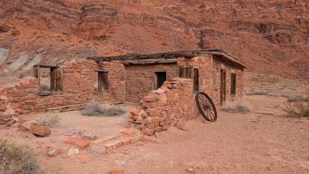
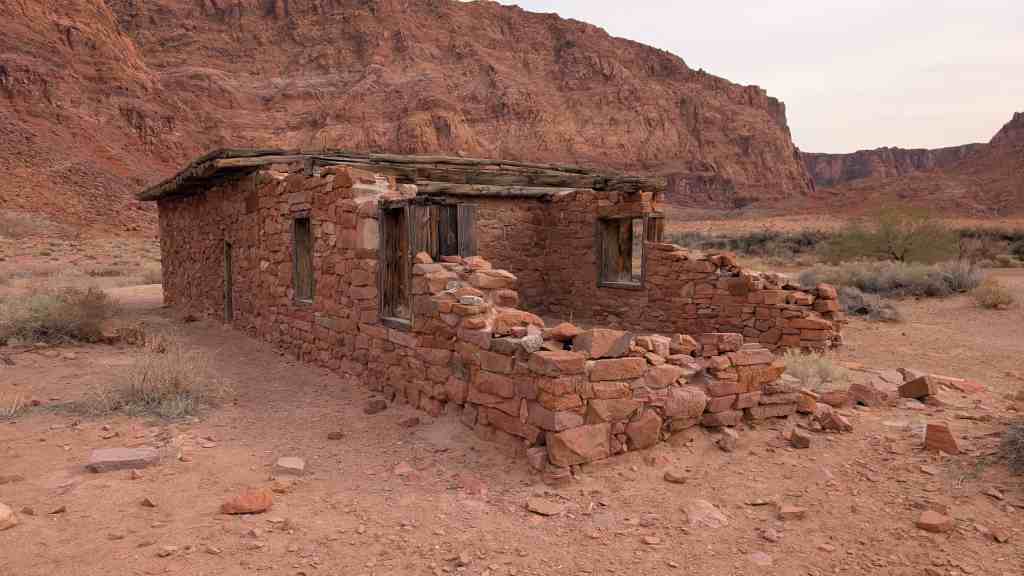
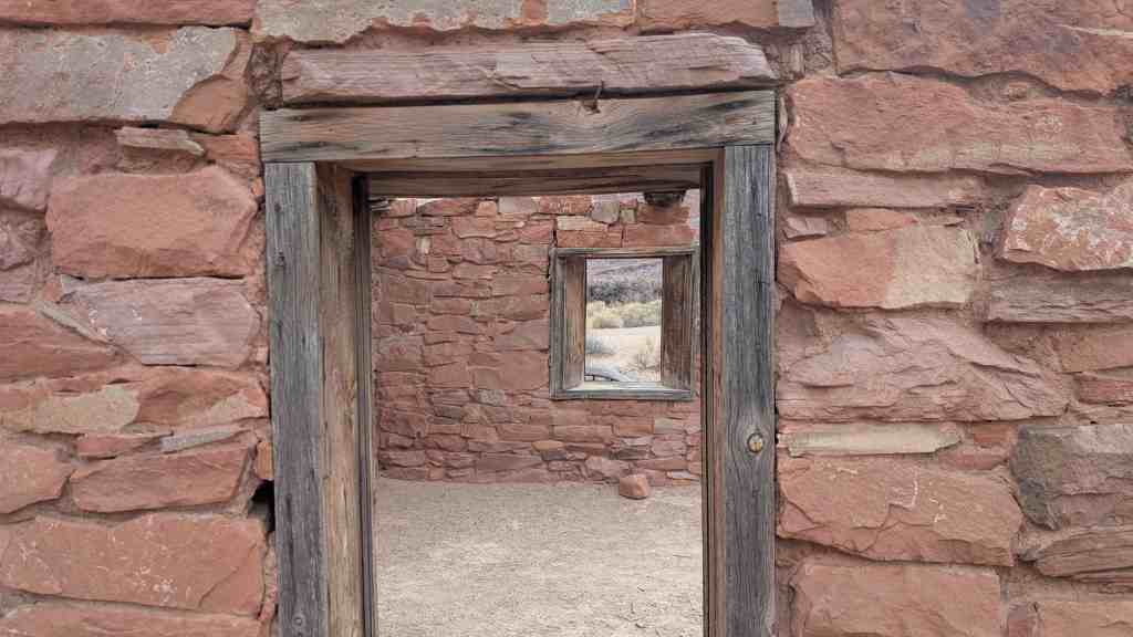
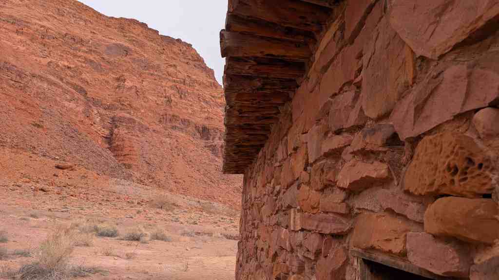
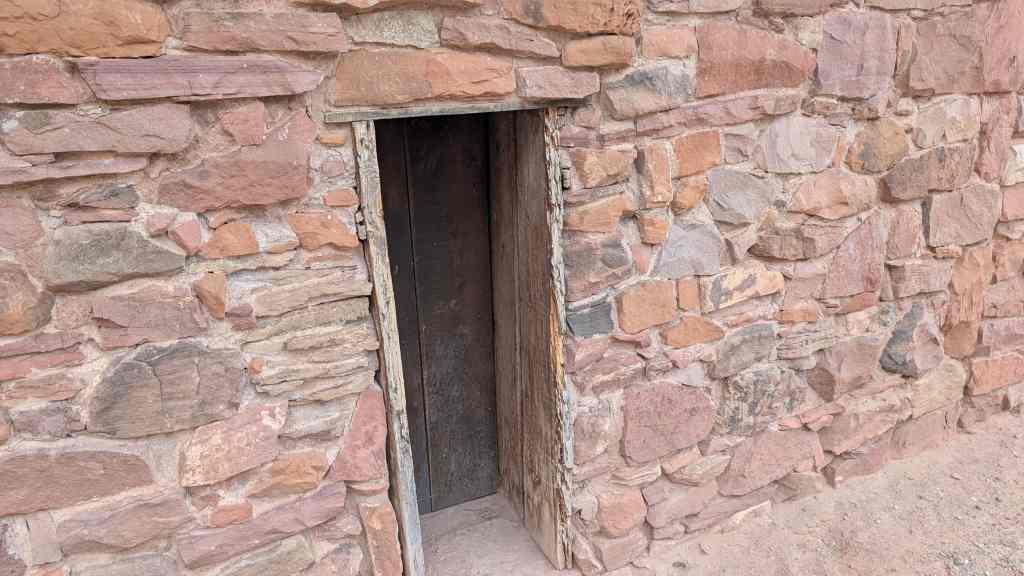
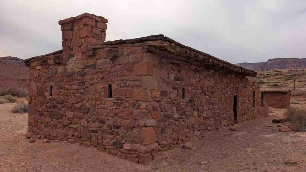
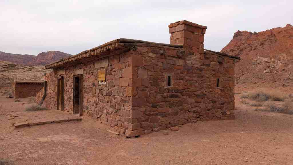
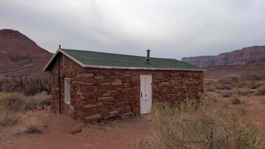
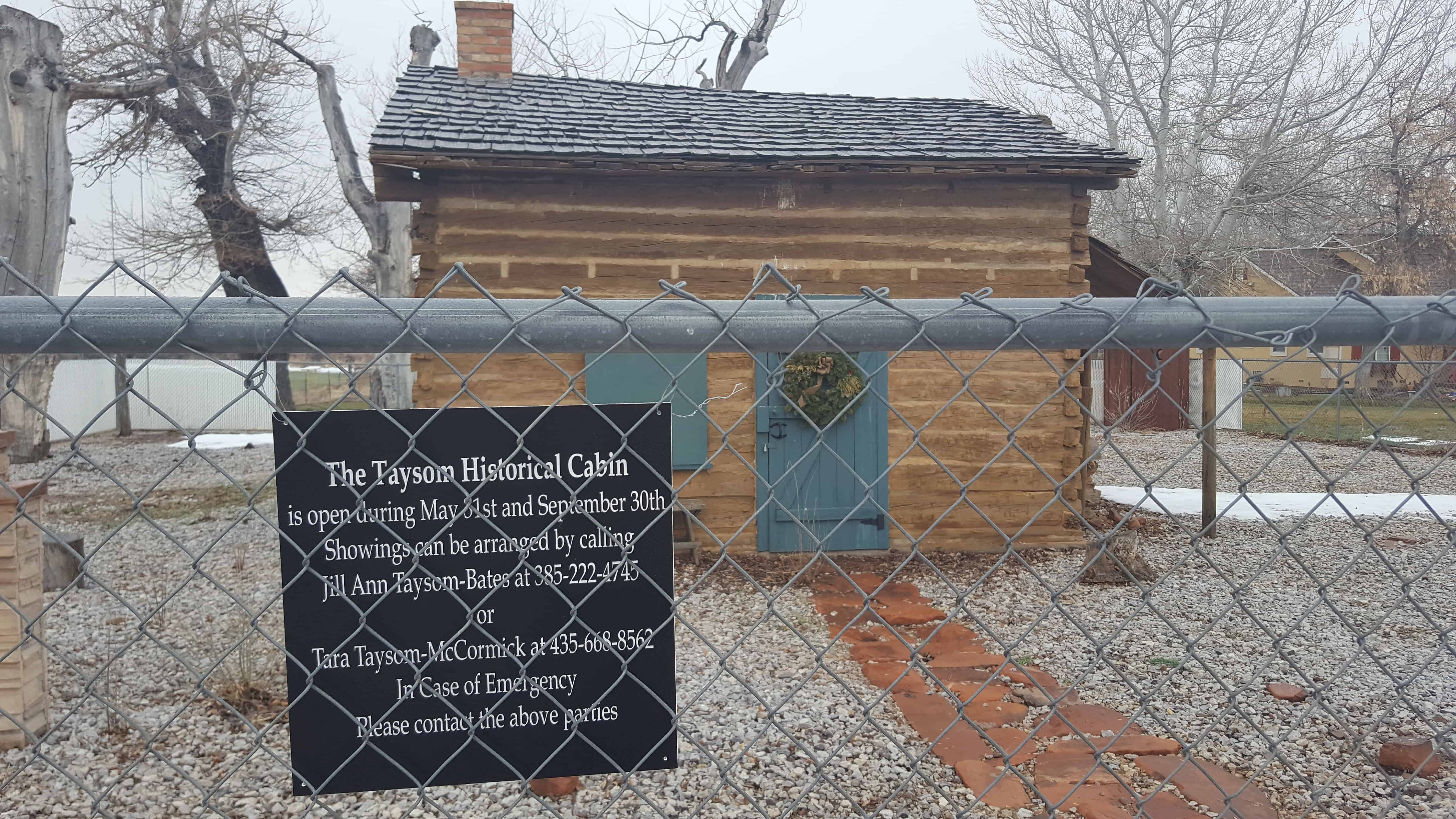
Charles Taysom built this cabin at this location in 1866
Restored by the descendants of Charles & Mariah Taysom
Dedicated in memory of their pioneer sacrifices and endurance 2002


22 Sunday Jan 2017
Posted in Uncategorized
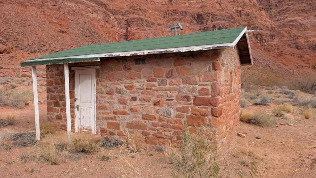
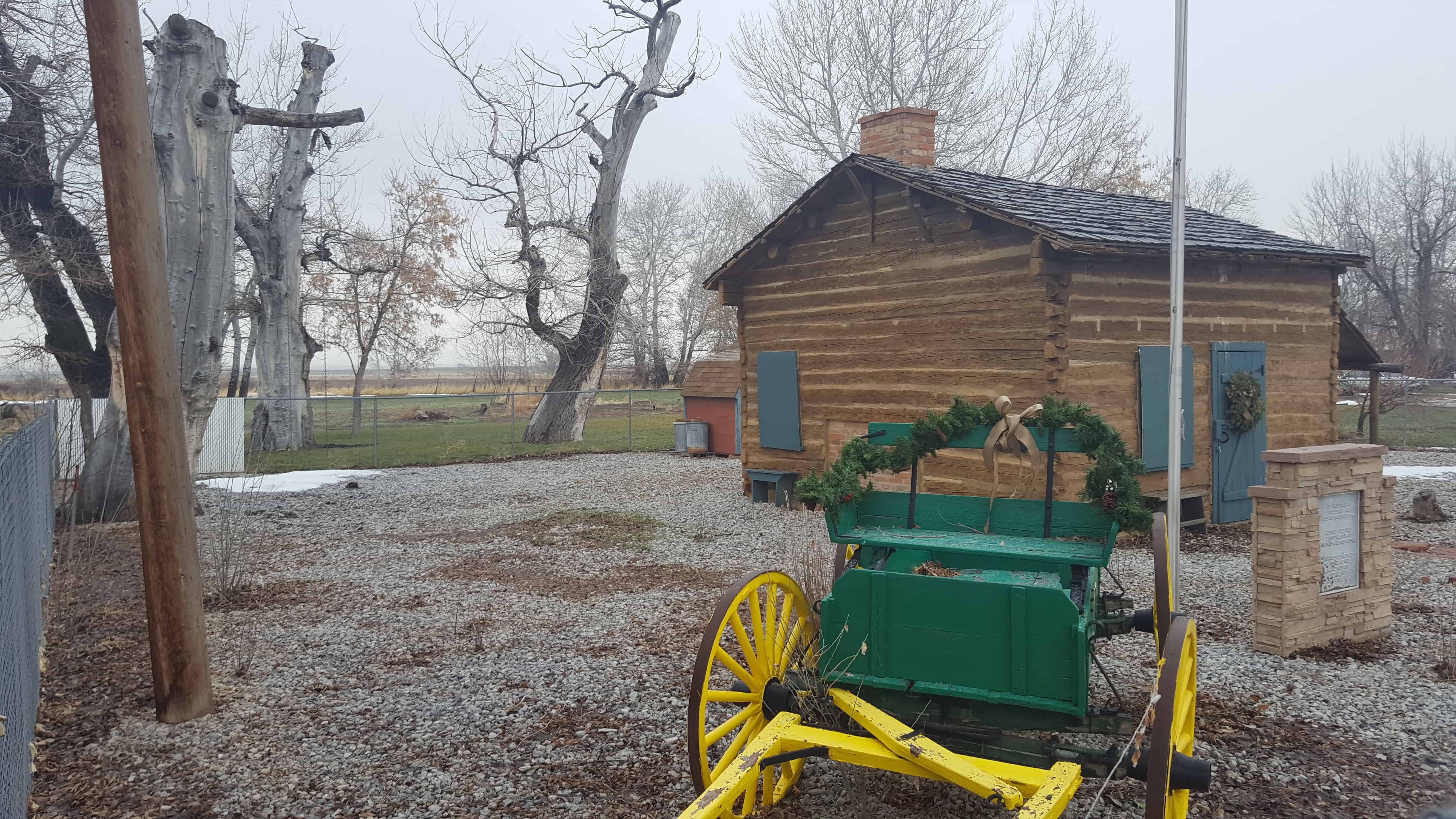
Charles Taysom built this cabin at this location in 1866
Restored by the descendants of Charles & Mariah Taysom
Dedicated in memory of their pioneer sacrifices and endurance 2002
22 Sunday Jan 2017
Posted in Uncategorized

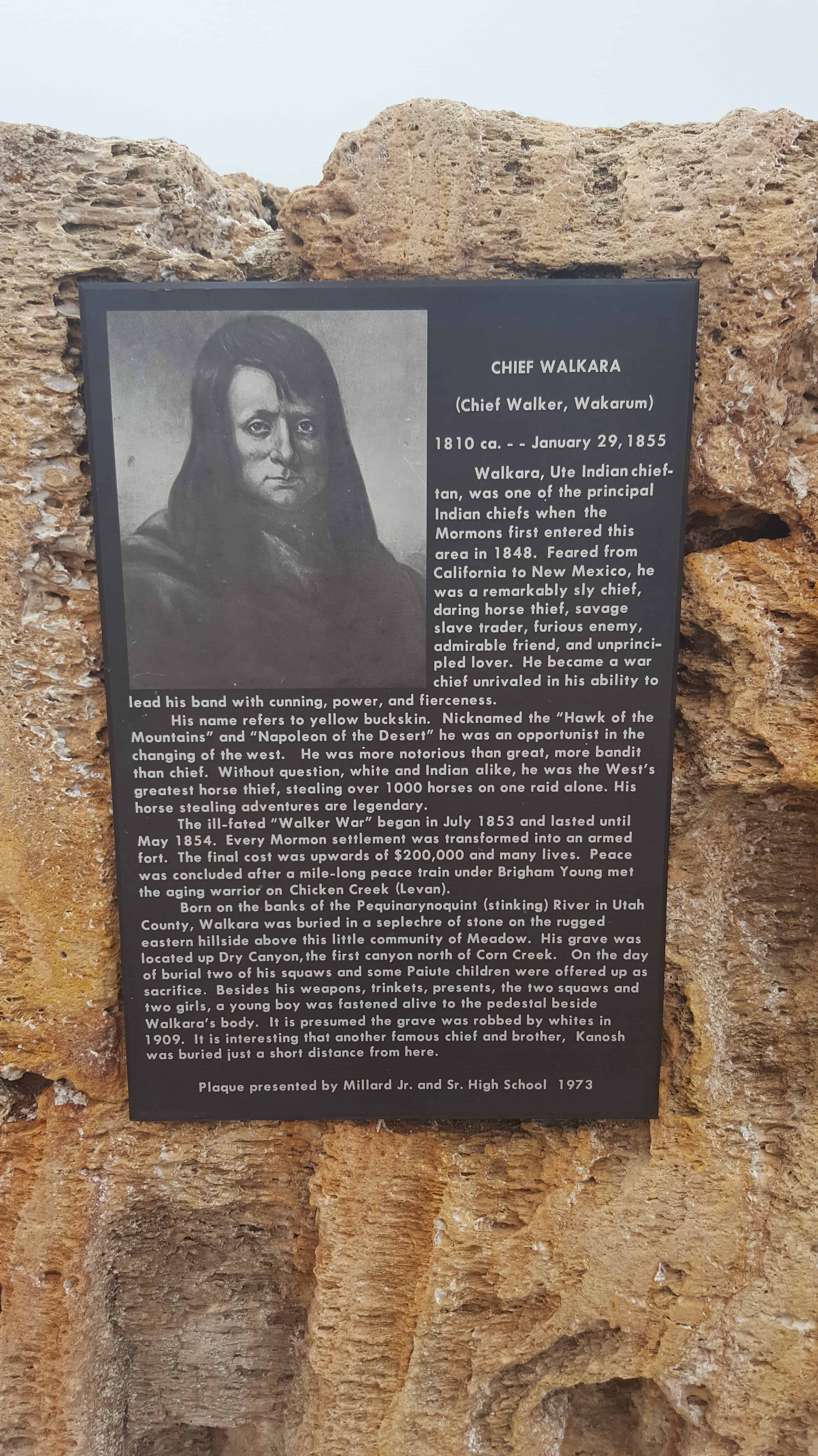
Chief Walkara(Chief Walker, Wakarum) 1810 ca. – – – – January 29, 1855
Walkara, Ute Indian chieftan, was one of the principal Indian chiefs when the Mormons first entered this area in 1848. Feared from California to New Mexico, he was a remarkably sly chief, daring horse thief, savage slave trader, furious enemy, admirable friend, and unprincipaled lover. He became a war chief unrivaled in his ability to lead his band with cunning, power and fierceness.
His name refers to yellow buckskin. Nicknamed the “Hawk of the Mountains” and “Napoleon of the Desert” he was an opportunist in the changing of the west. He was more notorious than great, more bandit than chief. Without question, white and Indian alike, he was the West’s greatest horse thief, stealing over 1000 horses on one raid alone. His horse stealing adventures are legendary.
The ill-fated “Walker War” began in July 1853 and lasted until May 1854. Every Mormon settlement was transformed into an armed fort. The final cost was upward of $200,000 and many lives. Peace was concluded after a mile-long peace train under Brigham Young met the aging warrior on Chicken Creek (Levan).
Born on the banks of the Pequinarynoquint (Stinking) River in Utah County, Walkara was buried in a seplechre of stone on the rugged eastern hillside above this little community of Meadow. His grave was located up Dry Canyon, the first canyon north of Corn Creek. On the day of burial two of his squaws and some Paiute children were offered up as sacrifice. Besides his weapons, trinkets, presents, the two squaws and two girls, a young boy was fastened alive to the pedestal beside Walkara’s body. It is presumed the grave was robbed by whites in 1909. It is interesting that another famous chief and brother, Kanosh was buried just a short distance from here.
Plaque presented by Millard Jr. and Sr. High School 1973


08 Sunday Jan 2017
Posted in Uncategorized
Tags
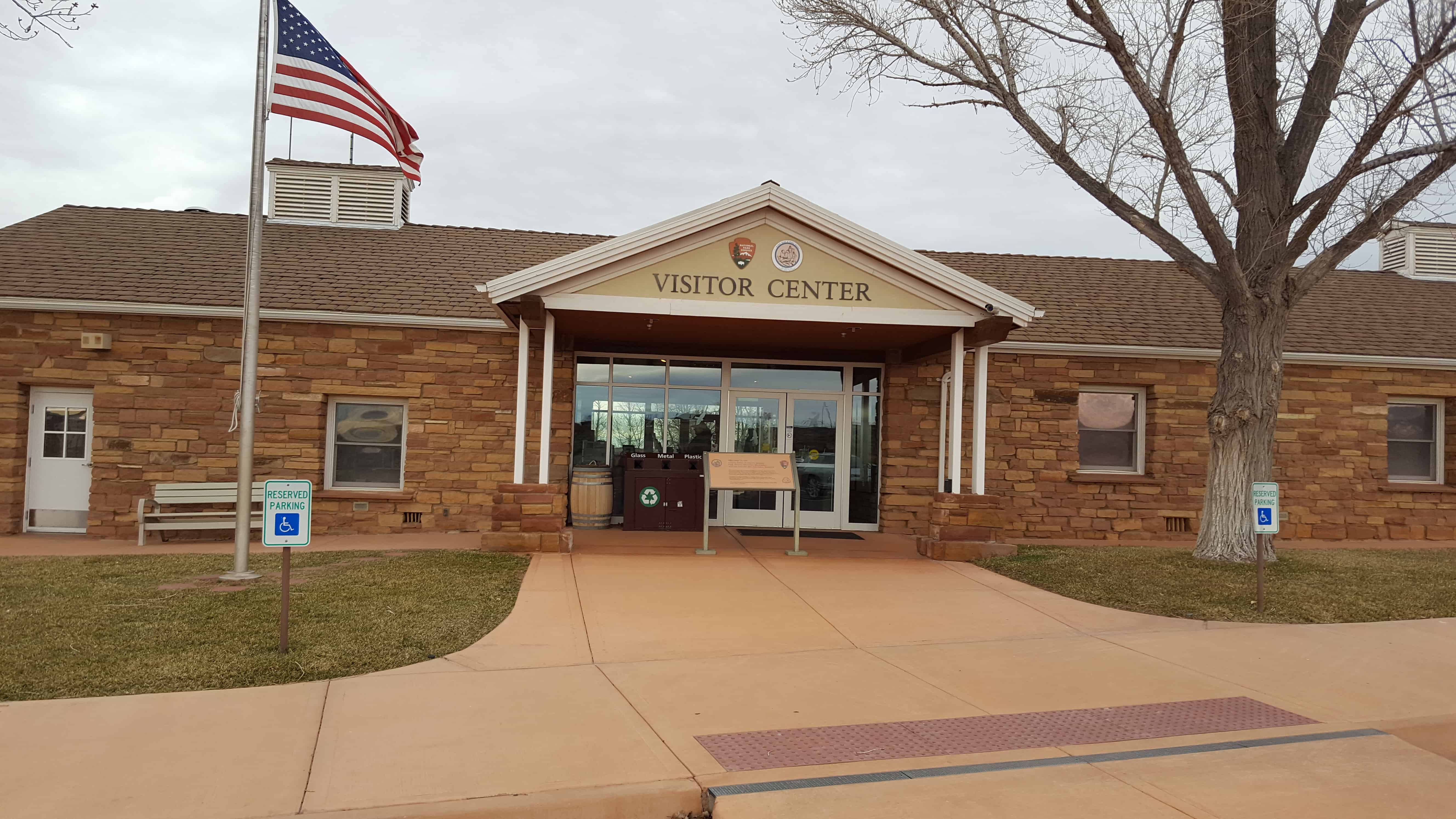
Arizona, Arizona Historic Markers, Forts, historic, Historic Buildings, Historic Markers, Mohave County, National Monuments, National Parks, Pipe Spring National Monument, Springs

Pipe Spring National Monument Posts:
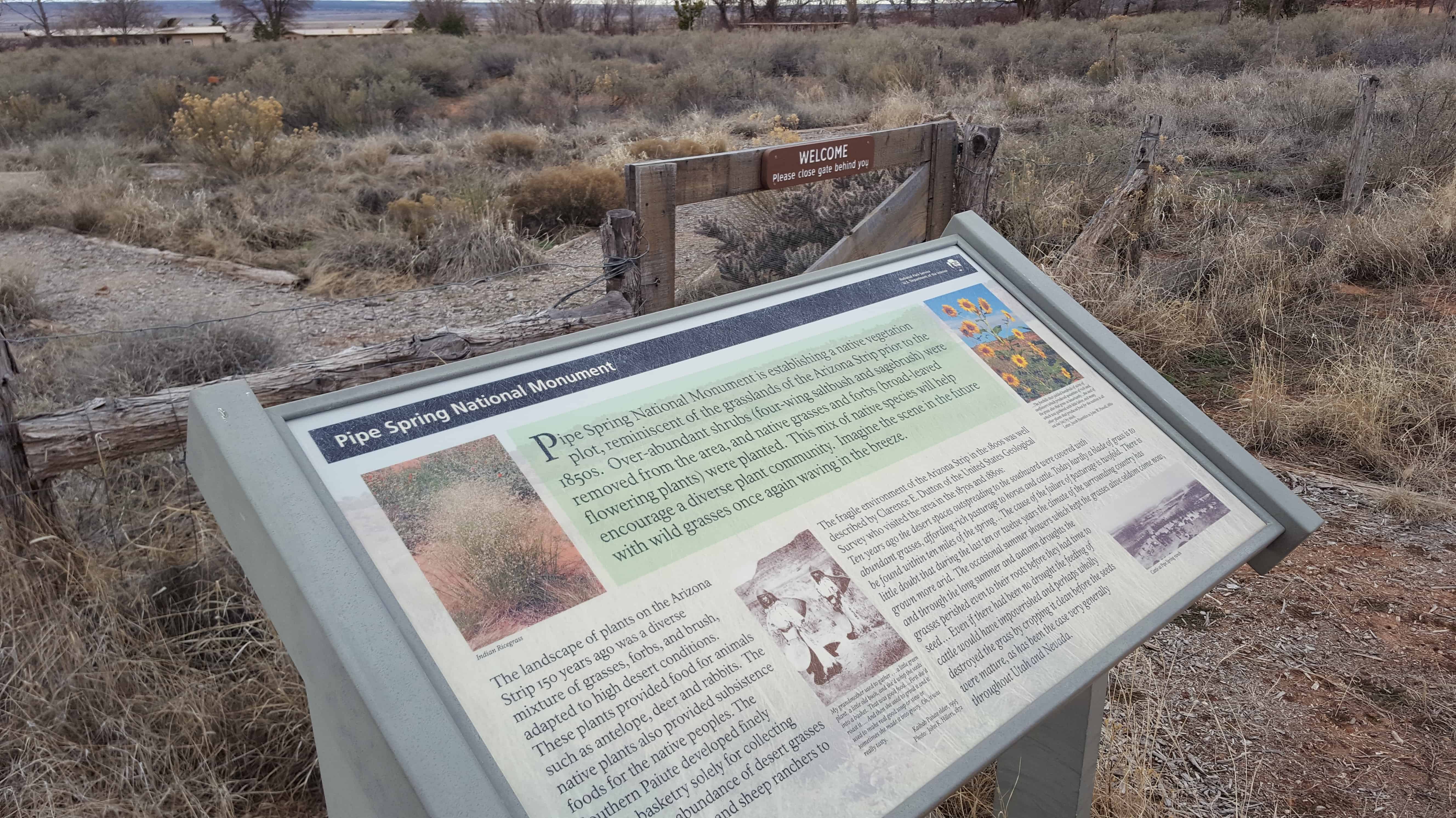
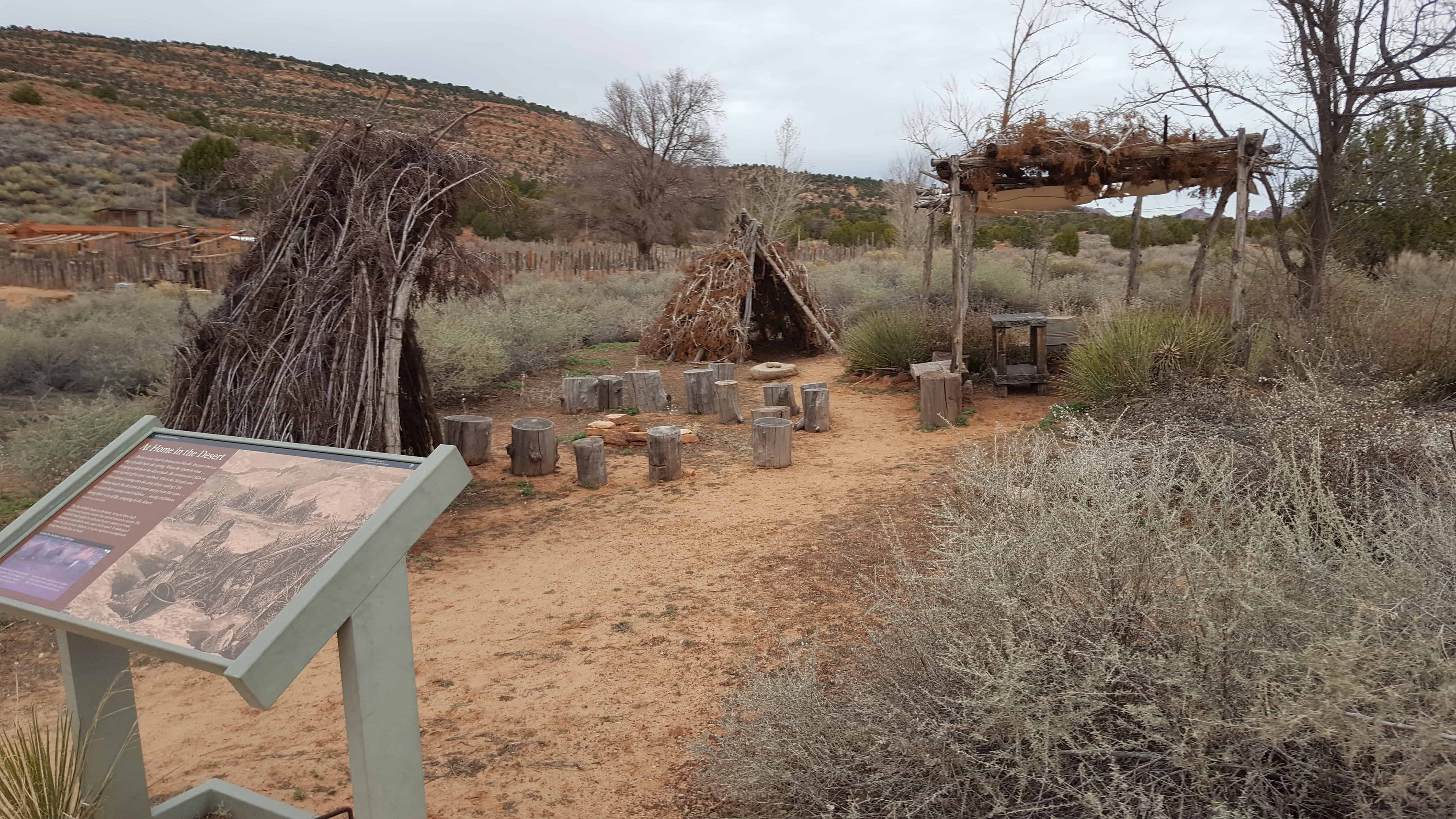
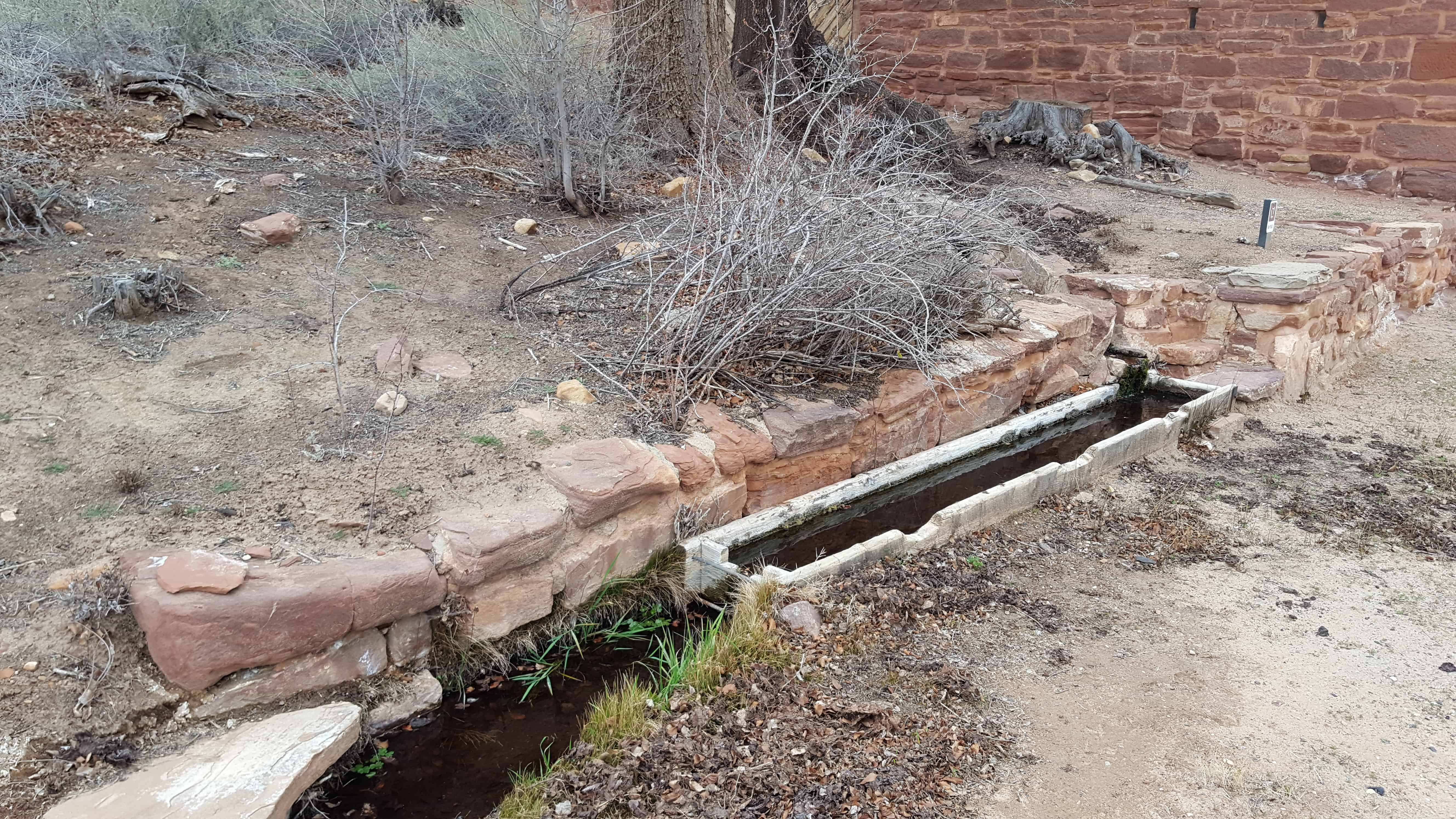
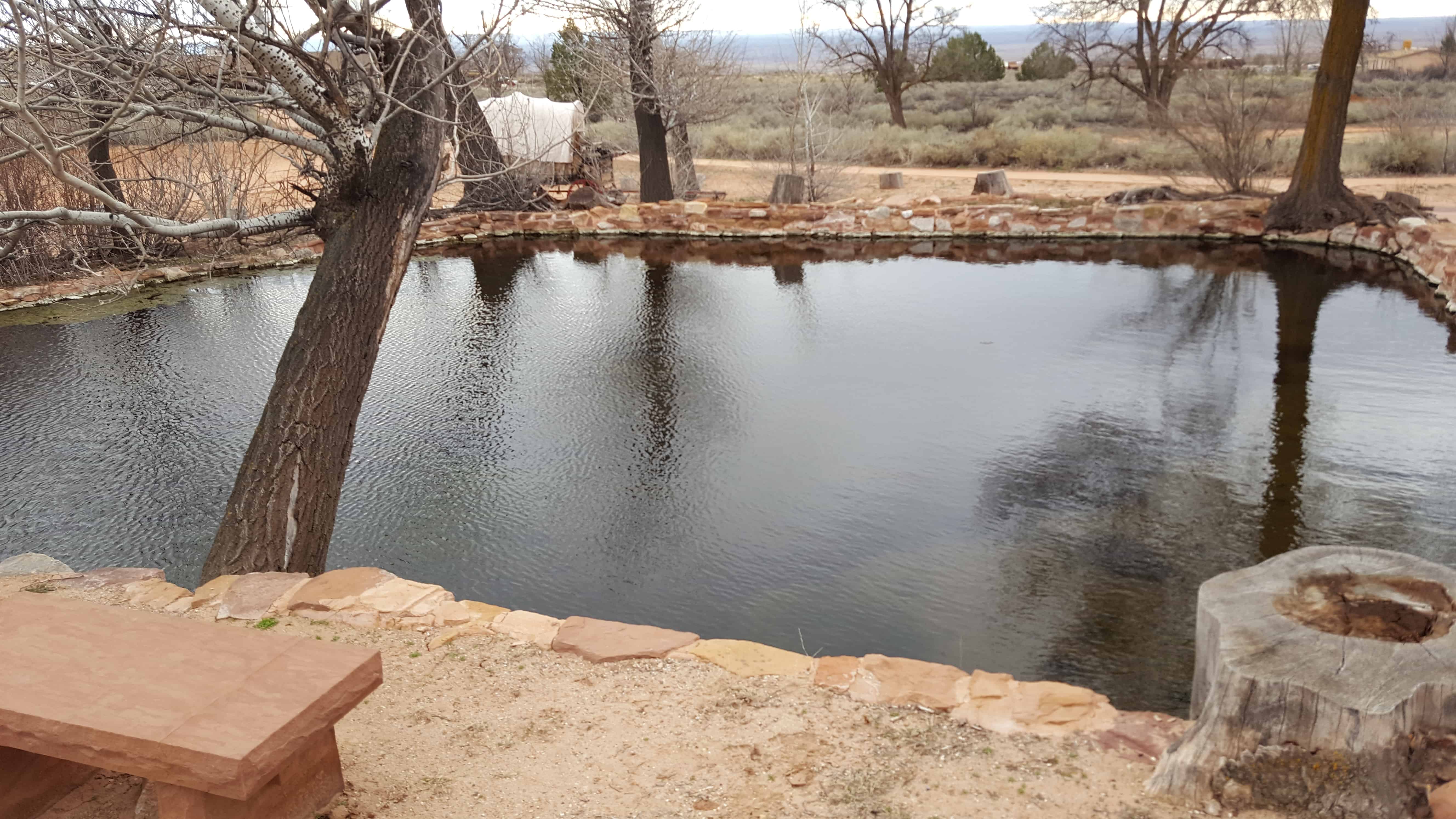
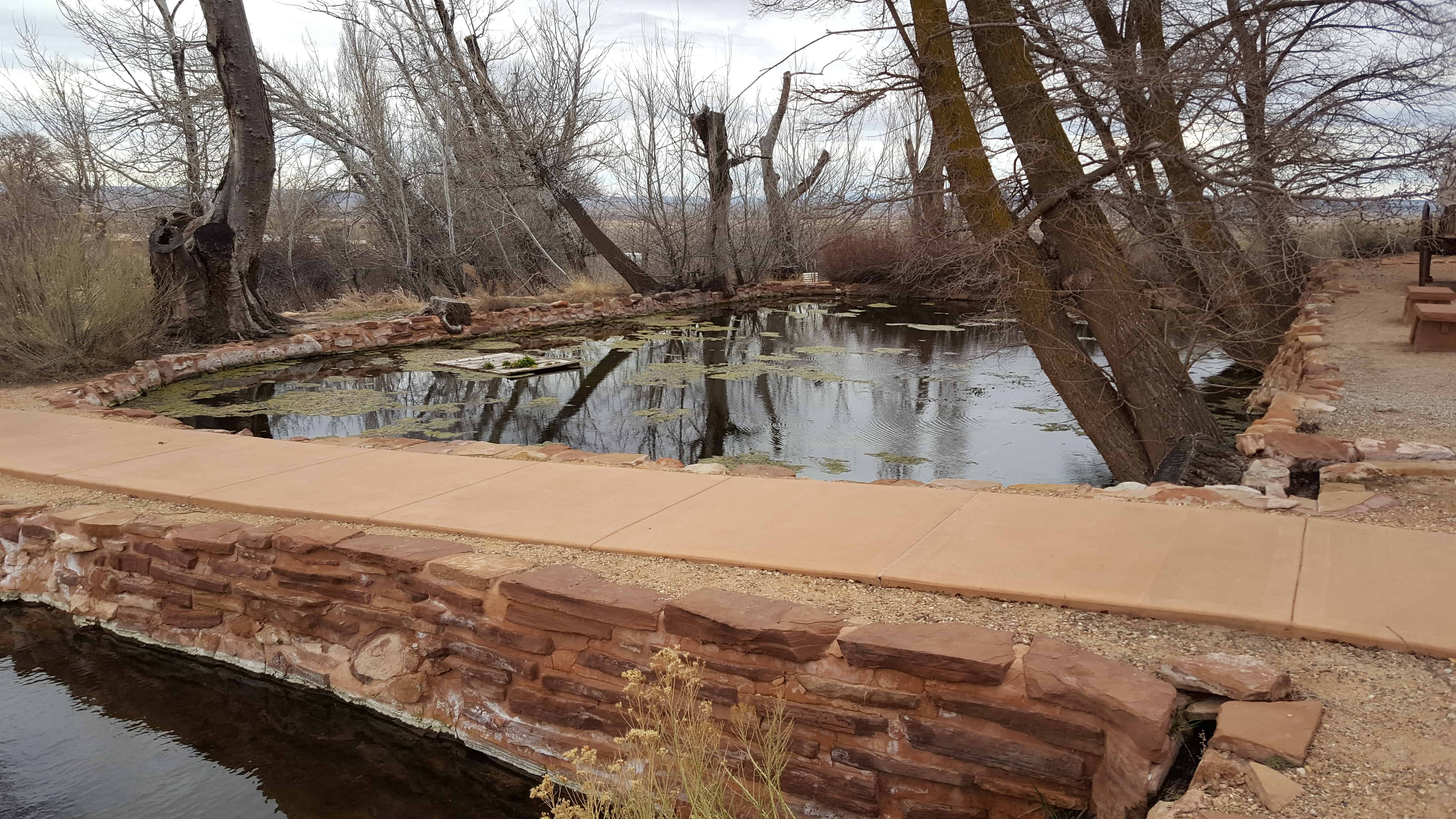
The water of Pipe Spring has made it possible for plants, animals, and people to live in this dry desert region. Ancestral Puebloans and Kaibab Paiute Indians gathered grass seeds, hunted animals, and raised crops near the springs for at least 1,000 years.
Antonio Armijo discovered the springs when he passed through the area in 1829, when he established by the Armijo Route of the Old Spanish Trail.
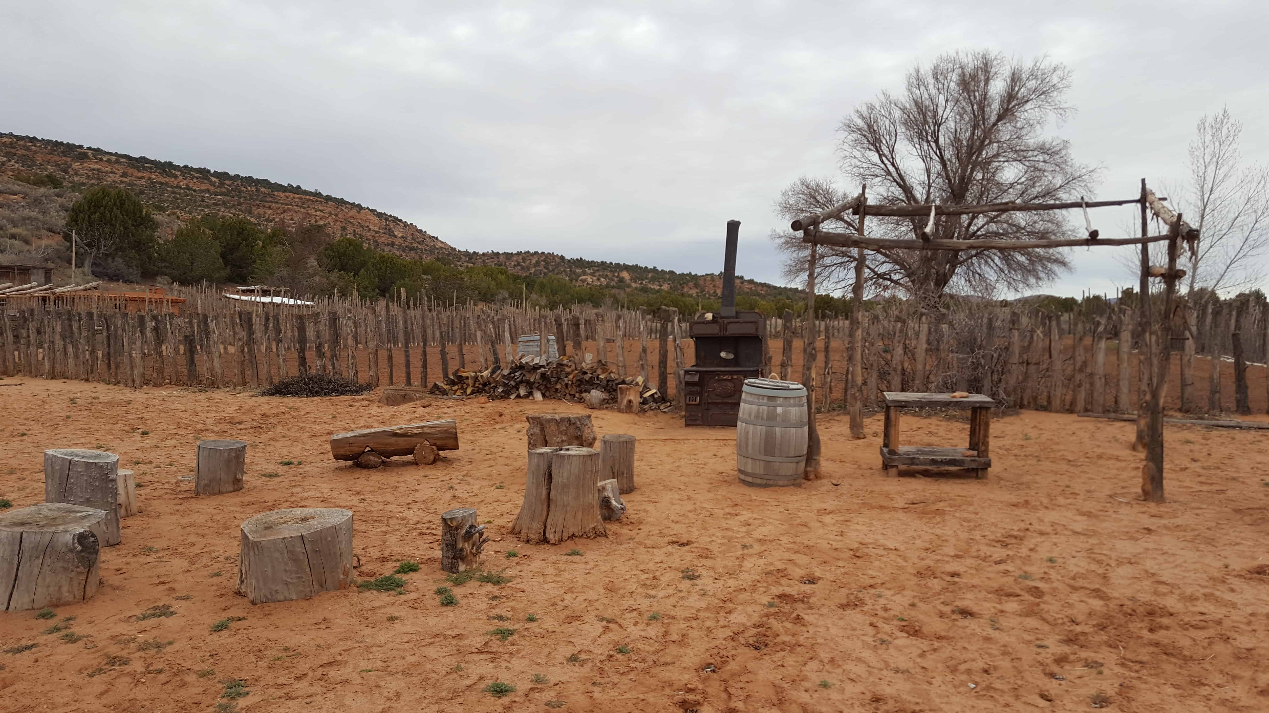
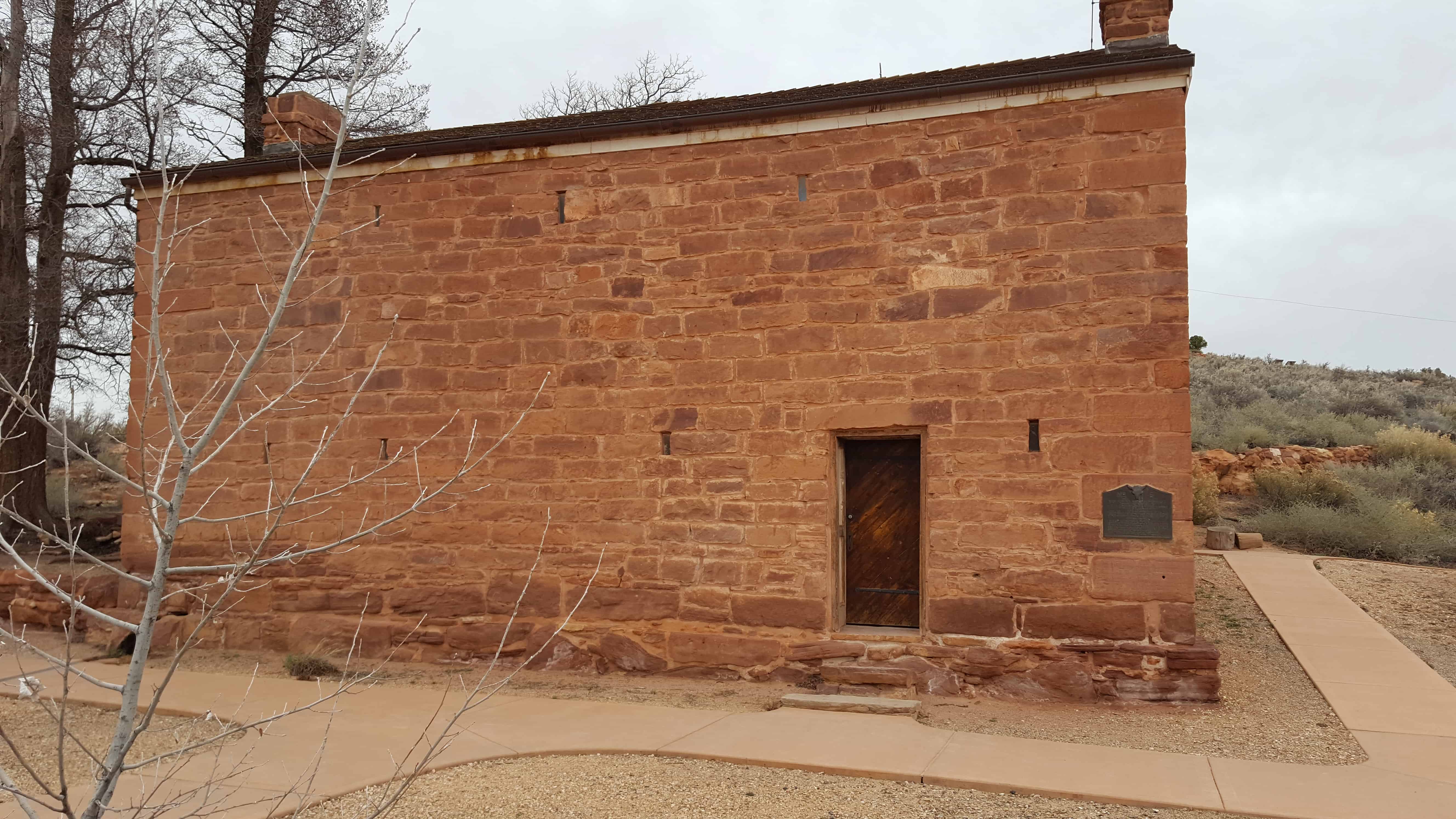
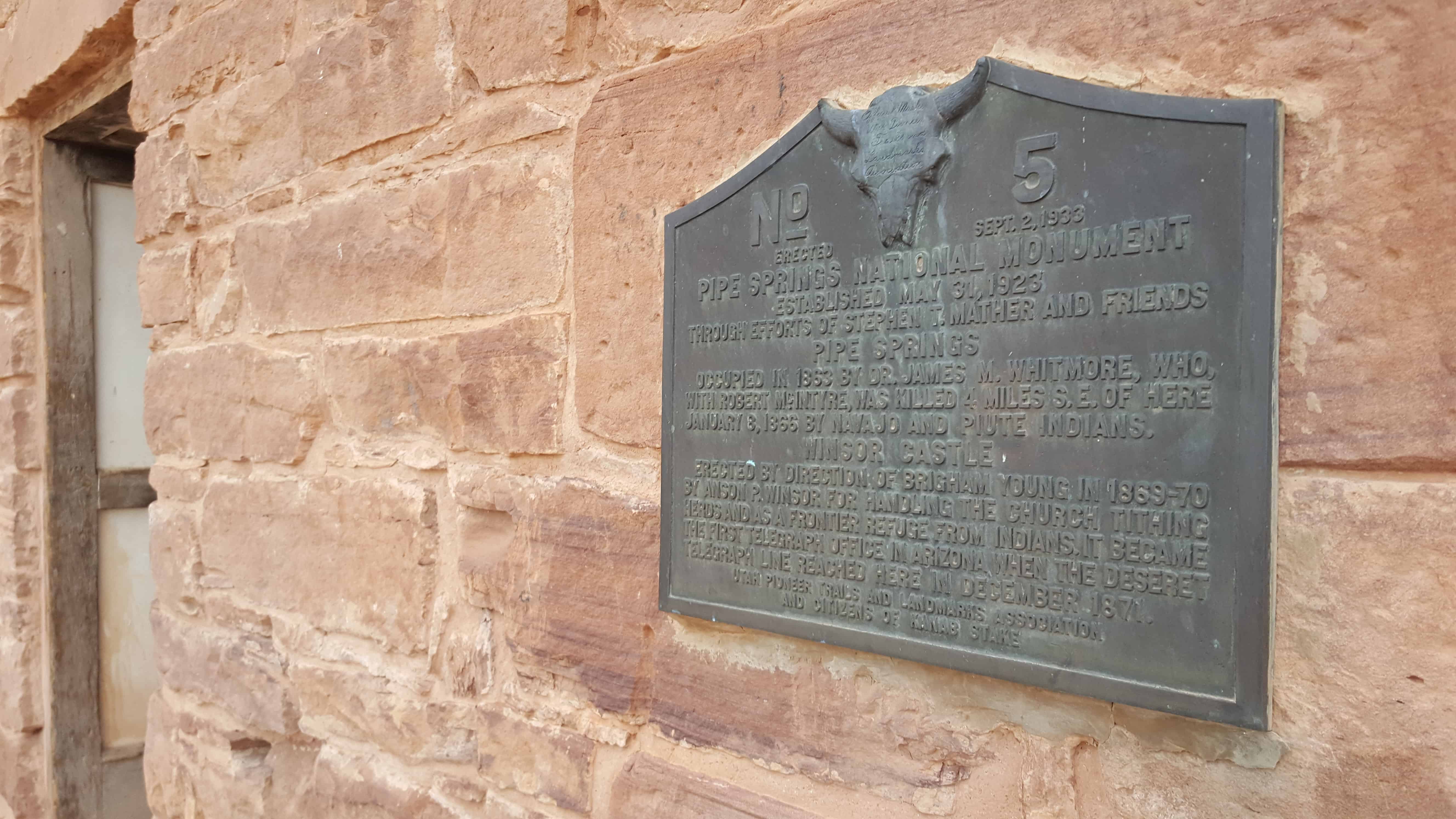
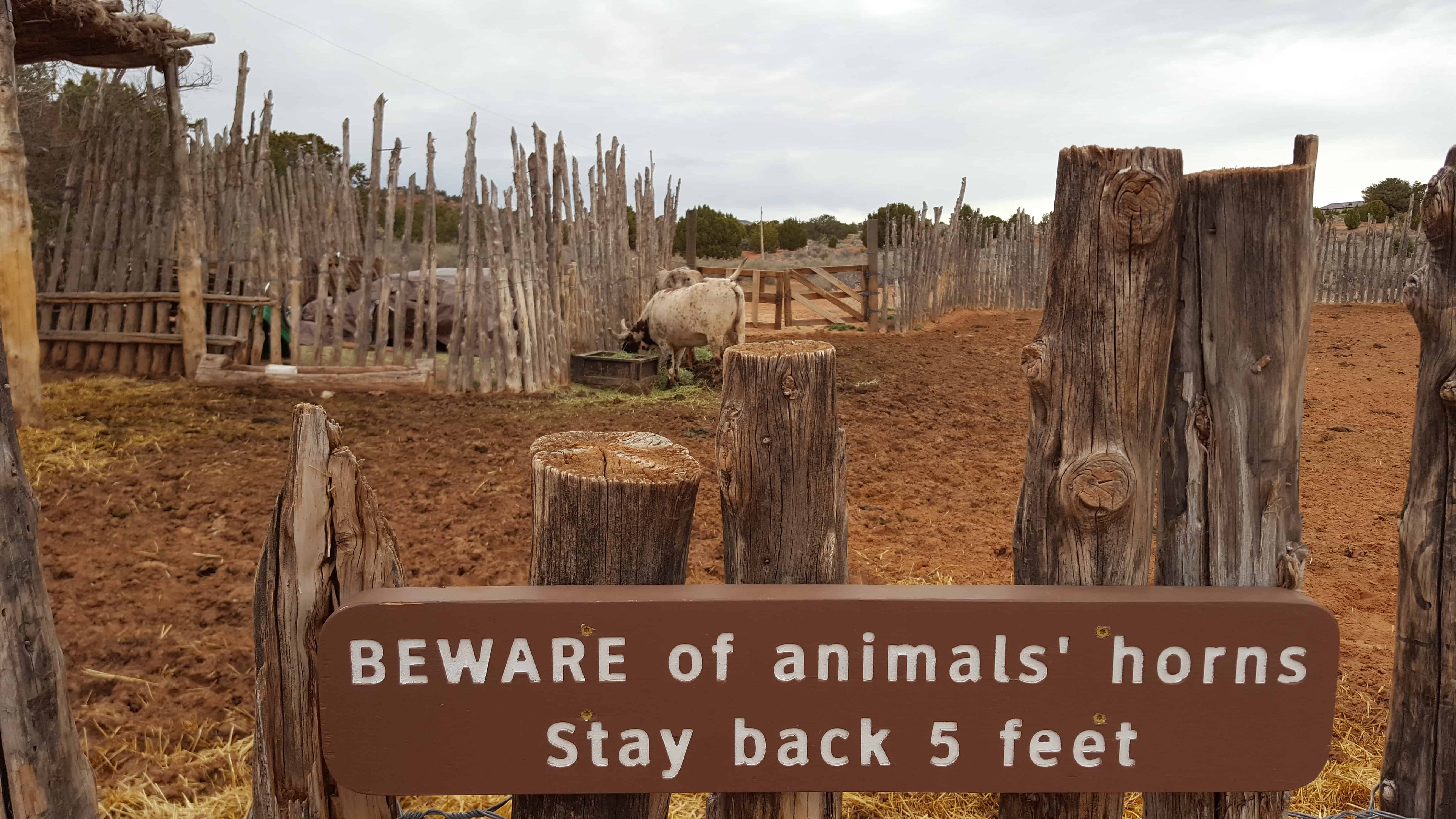
Pipe Spring was named by the 1858 Latter-day Saint missionary expedition to the Hopi mesas led by Jacob Hamblin. In the 1860s Mormon pioneers from St. George, Utah, led by James M. Whitmore brought cattle to the area, and a large cattle ranching operation was established. In 1866 the Apache, Navajo and Paiute tribes of the region joined the Utes for the Black Hawk War, and, after they raided Pipe Spring, a protective fort was constructed by 1872 over the main spring. The following year the fort and ranch was purchased by Brigham Young for The Church of Jesus Christ of Latter-day Saints (LDS Church). The LDS Bishop of nearby Grafton, Utah, Anson Perry Winsor, was hired to operate the ranch and maintain the fort, soon called Winsor Castle. This isolated outpost served as a way station for people traveling across the Arizona Strip, that part of Arizona separated from the rest of the state by the Grand Canyon. It also served as a refuge for polygamist wives during the 1880s and 1890s. The LDS Church lost ownership of the property through penalties involved in the federal Edmunds-Tucker Act of 1887.
Although their way of life was greatly impacted by Mormon settlement, the Paiute Indians continued to live in the area and by 1907 the Kaibab Paiute Indian Reservation was established, surrounding the privately owned Pipe Spring ranch. In 1923, the Pipe Spring ranch was purchased and set aside as a national monument to be a memorial to western pioneer life.


08 Sunday Jan 2017
Posted in Uncategorized
08 Sunday Jan 2017
Posted in Uncategorized


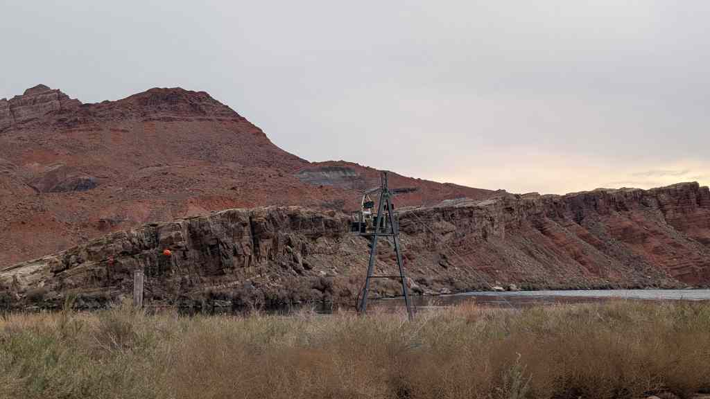
Cameron (Orinally Tanner’s Crossing)
Named for one of Arizona’s first U.S. Senators. A pioneer in development of trails and copper mines in Grand Canyon. Near here was the site of Tanner’s Crossing of the Little Colorado River on The Mormon Trail from Utah via Lee Ferry to settlements in Arizona and Mexico.
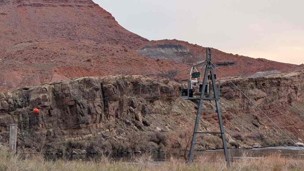
n 1911, a sway-back, one-track suspension bridge was erected over a gorge of the Little Colorado on the edge of Navajo and Hopi country. Hubert and C.D. Richardson built a small trading post there in 1916.
Designer – Midland Steel Co.
Location – Cameron, Arizona, USA
Date – 1911
Building Type – Transportation
Construction System – Concrete, Steel, Aluminum
Architectural Style – Suspension-truss hybrid
Street Address – Carries US 89 over the Little Colorado River
Notes – also known as Cameron Bridge;Little Colorado River Bridge
Related:


07 Saturday Jan 2017
Posted in Uncategorized

Gardner’s Saw Mill was erected by Robert Gardner and his sons Archibald, Robert and William, on warm springs stream, in Salt Lake City, Oct. 1847 where three boards were sawed. The mill was moved to this site in 1848 producing the first commercial lumber in Utah on the first formal grant of water for industrial use. Later, a flour mill was erected a few rods upstream, these plants giving the name, Millcreek, to the stream and canyon. Gardner’s Fort, domicile of the Gardner families, was located a short distance northeast, the Gardners receiving the first permit to leave the pioneer fort.
Related Posts:


07 Saturday Jan 2017
Posted in Uncategorized
Tags

WILLARD CENTRAL SCHOOL BELL
When the Willard Central School was constructed in 1902, a bell tower with a large brass bell was installed on the roof toward the front of the building. The bell was rung 15 minutes before school began and again at noon. Students vied for the privilege of pulling the bell cord. The ring could be heard a mile away warning dawdling students to hurry. Although the bell tower was remodeled in 1911-12, the bell remained in place for 37 years.
In 1939, during a remodeling of the school, the bell was removed from the roof and mounted on a circular rock foundation immediately in front of the school. The bell no longer rang but served as a memorial to bygone days.
The school was demolished in 1956 to make room for a new one. This monument, on the old playground, is constructed of rocks from the Fort Wall which was built between 1852-55 and which surrounded the old town of Willard.
Willow Creek Camp DUP Free-standing engraved granite plaque on post: This marker is also built of native stone as well as rocks from the fort wall. The rail was used in the first transcontinental railroad of 1869. Willow Creek Camp 1989

06 Friday Jan 2017
Posted in Uncategorized

Beginning in 1843, emigrants traveled across the continent along what became known as the Oregon Trail. Increased traffic during the 1850’s resulted in the first government road construction project in the west. The 345 mile Central Division of the Pacific Wagon Road went from South Pass, Wyoming, to City of Rocks, Idaho, a geologic formation, which marked the Division’s western boundary. Superintendent Frederick W. Lander of Salem, Massachussetts, supervised construction for the U. S. Department of the Interior. The 256 mile section of the road leading from South Pass to Fort Hall, Idaho, is known as the Lander Cut-off. The cut-off traversed this Salt River Valley for 21 miles and parallels Highway 89 through this area. The new route afforded water, wood, and forage for emigrants and their stock. Between 1858 and 1912, it provided travelers with a new, shorter route to Oregon and California, saving wagon trains seven days. Lander, with a crew of 15 engineers, surveyed the route in the summer of 1857. The following summer, 115 men, many recruited from Salt Lake City’s Mormon emigrants, constructed the road in less that 90 days at a cost of $67,873. The invention of the automobile led to its abandonment.
Lander Cut-Off of the Oregon Trail. Dedicated to all the pioneers who passed to win and hold the West.


02 Monday Jan 2017
Posted in Uncategorized
Tags

Location: 905 Orchard Drive (corner Orchard Dr. and Mill St.), Bountiful, Utah
Markers at this location:
The Heber C. Kimball Gristmill, the foundation of which can be seen just east of this monument, was in operation from 1852 until 1892, using these burr-type gristmill stones. When the use of roller mills was introduced, mills of this type were no longer used.
The South Davis Chapter, Sons of Utah Pioneers, formerly owned the property this mill was located on. In 1984, it was sold to Davis County, who, in cooperation with Bountiful City, constructed a debris catch basin on the site. During the excavation of the basin site, these two original gristmill stones were uncovered and found to be in remarkably good condition after all these intervening years.
Permission was granted the South Davis Chapter, Sons of Utah Pioneers to construct this monument so as to complement and enhance the Daughters of Utah Pioneers replica of the old mill, and their monument, located just to the right of this monument. Thanks is given to all who had a hand in making this effort a reality and being able to bring back a few memories of our Pioneer Ancestors.
See other historic markers in the series on this page for SUP Markers.


02 Monday Jan 2017
Posted in Uncategorized
Tags

Location: 905 Orchard Drive (corner Orchard Dr. and Mill St.), Bountiful, Utah
Markers at this location:
Daniel Davis was born on December 18, 1808, in Amesbury, Essex County, Massachusetts, the third child of Wells Davis and Mary Kelly Davis. As a young man Davis traveled to Nauvoo, Illinois, where he was converted to the Church of Jesus Christ of Latter-day Saints, and was adopted into the Heber C. Kimball family.
On April 20, 1846, Davis was forced from Nauvoo and joined the Saints’ western migration. During the migration, Heber C. Kimball assigned Davis to assist in building Winter Quarters at Council Bluffs, Iowa. Davis reached the Salt Lake Valley September 24, 1848.
Pursuant to Kimball’s desire to erect a flour gristmill on this site, which was then known as North Mill Cañon, Daniel Davis began to clear this ground on July 18, 1852. On April 20, 1853, the mill’s northeastern cornerstone was laid by Isaac Hunter, the southeastern stone by Daniel Davis. The next day Heber C. Kimball dedicated the site.
Upon the mill’s completion Davis assumed its management, living in an adobe house southwest of this site. The three-story mill was then the largest in Utah Territory. In 1869, the Kimball grist mill was purchased for $8,000 by Bishop John Stoker and others of the Bountiful Cooperative Mercantile from the trustees of the Heber C. Kimball estate. Later, the mill became an entertainment center.
Daniel Davis died at age 84, on February 25, 1892. Now, a century later, we recognize his many contributions to the mill and the community.
See other historic markers in the series on this page for SUP Markers.