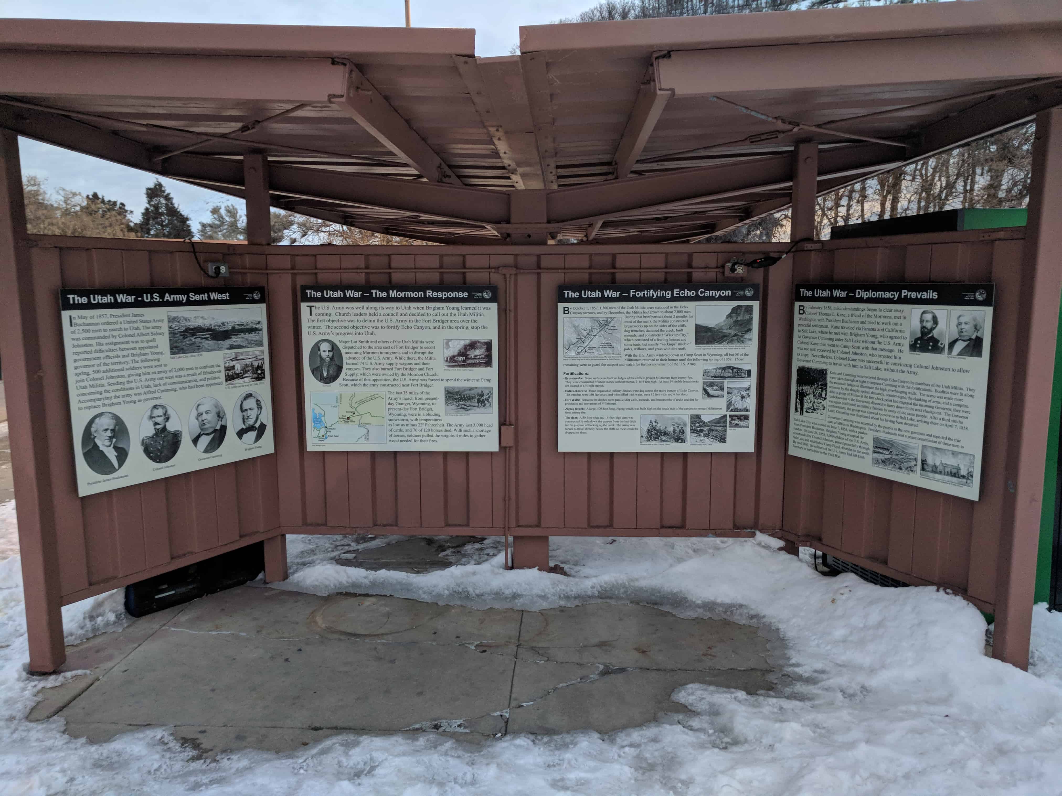
By February 1858, misunderstandings began to clear away. Colonel Thomas L. Kane, a friend of the Mormons, met in Washington with President Buchanan and tried to work out a peaceful settlement. Kane traveled via Panama and California to Salt Lake, where he met with Brigham Young, who agreed to let Governor Cumming enter Salt Lake without the U.S. Army. Colonel Kane then went to Camp Scott with that message. He was not well received by Colonel Johnston, who arrested him as a spy. Nevertheless, Colonel Kane was successful in convincing Colonel Johnston to allow Governor Cumming to travel with him to Salt Lake, without the Army.
Kane and Cumming were escorted through Echo Canyon by members of the Utah Militia. They were taken through at night to impress Cumming with the fortifications. Bonfires were lit along the mountain ledges to illuminate the high, overhanging walls. The scene was made more ominous by the sharply spoken demands, counter-signs, the clanking of arms, and a campfire. After a group of Militia at the first check point had engaged the incoming Governor, they were (unbeknownst to the Governor) directed to hurry down to the next checkpoint. The Governor was again confronted in military fashion by many of the same people. After a third similar confrontation, the group was allowed to move on to Salt Lake, arriving there on April 7, 1858. Later, Cumming was displeased about his having been deceived.
Governor Cumming was accepted by the people as the new governor and reported the true state of affairs to Washington. President Buchanan sent a peace commission of three men to Salt Lake City who arrived on June 7, 1858, with a pardon from President Buchanan. Brigham Young accepted the pardon. On June 26, 1858, 3,000 soldiers of the U.S. Army, commanded by Colonel Johnston, passed peacefully through Salt Lake and established Camp Floyd, 40 miles south of the City. By mid-1861, the soldiers of the U.S. Army had left Utah Territory to participate in the Civil War.
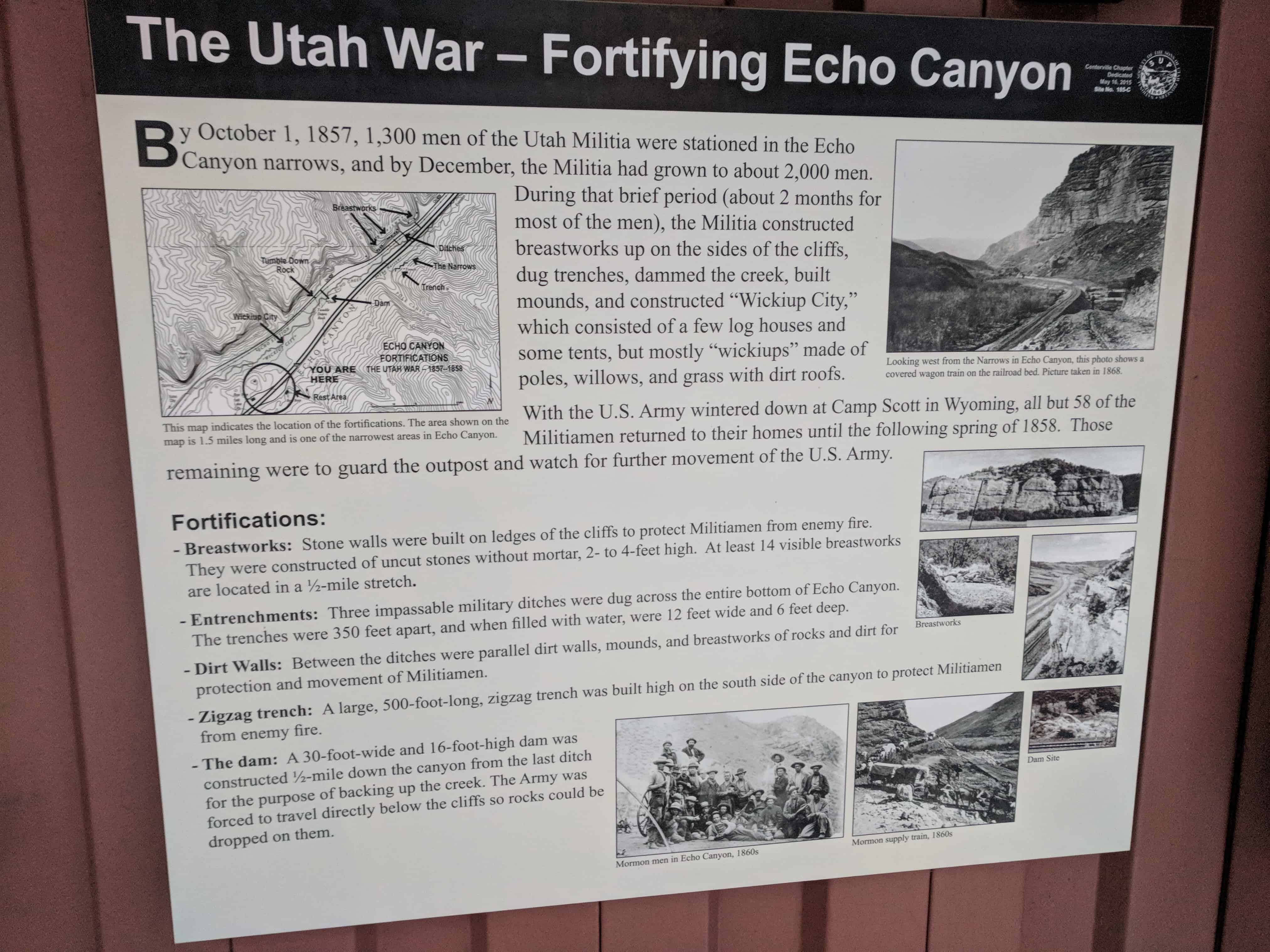
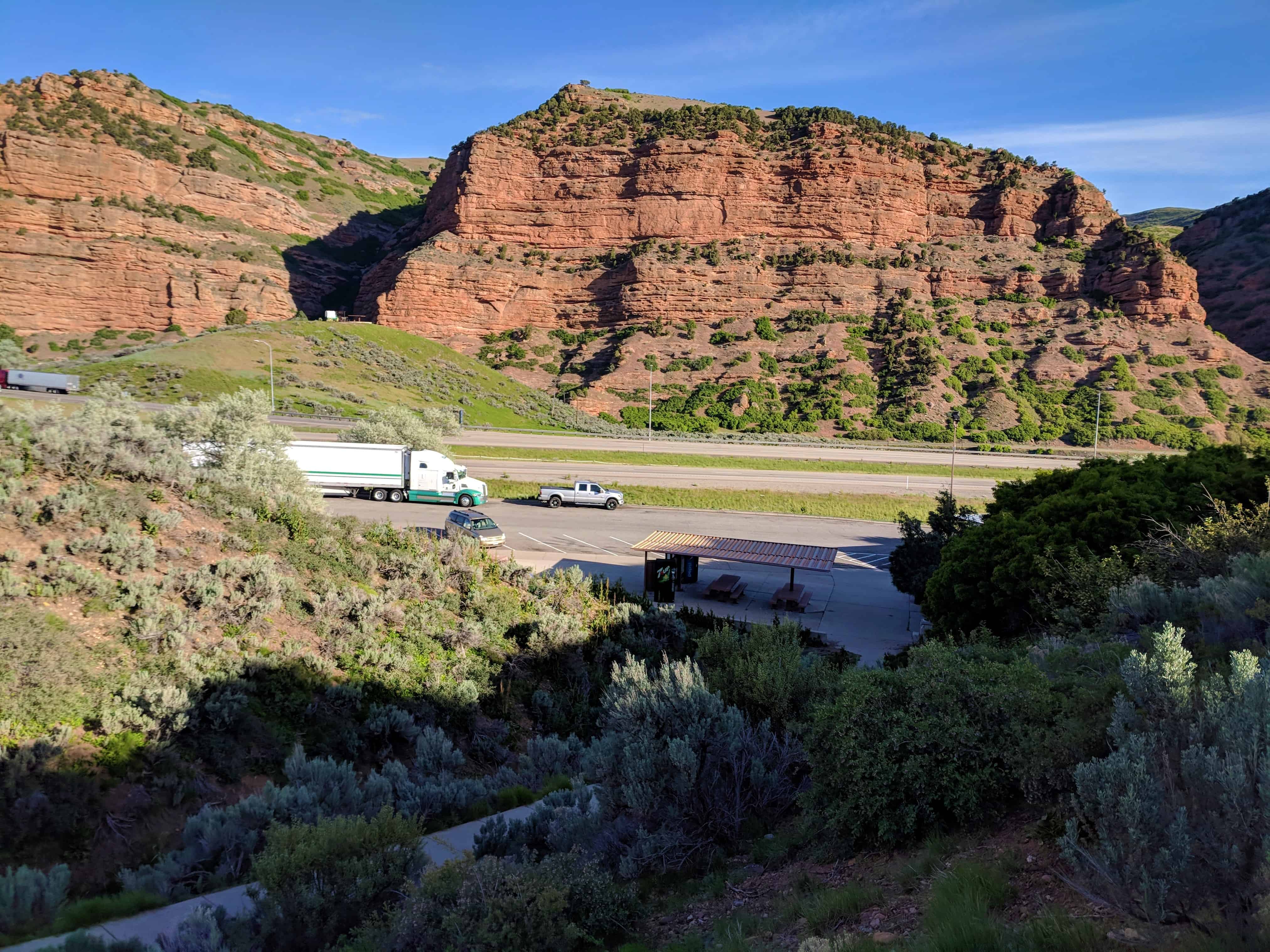
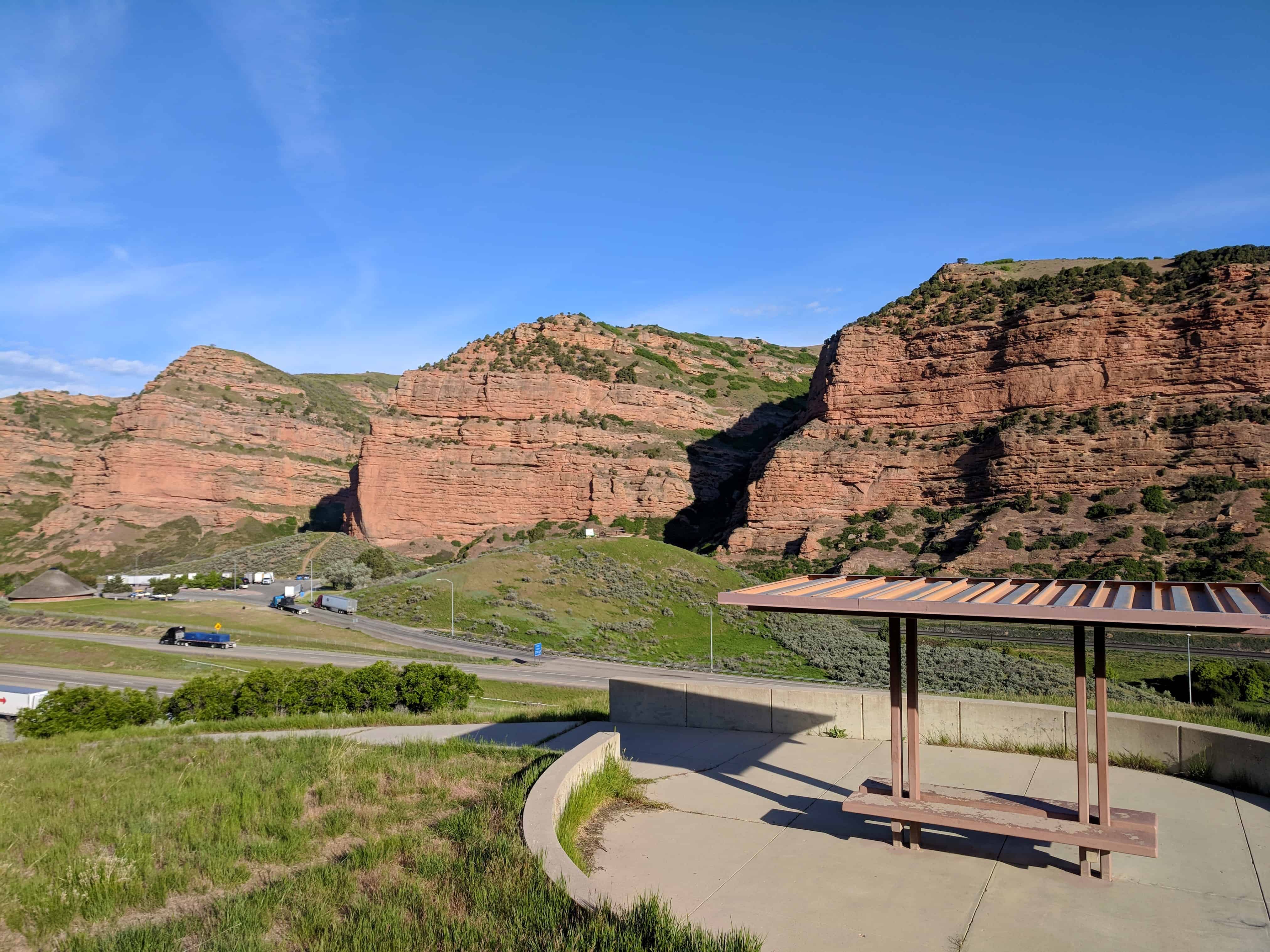
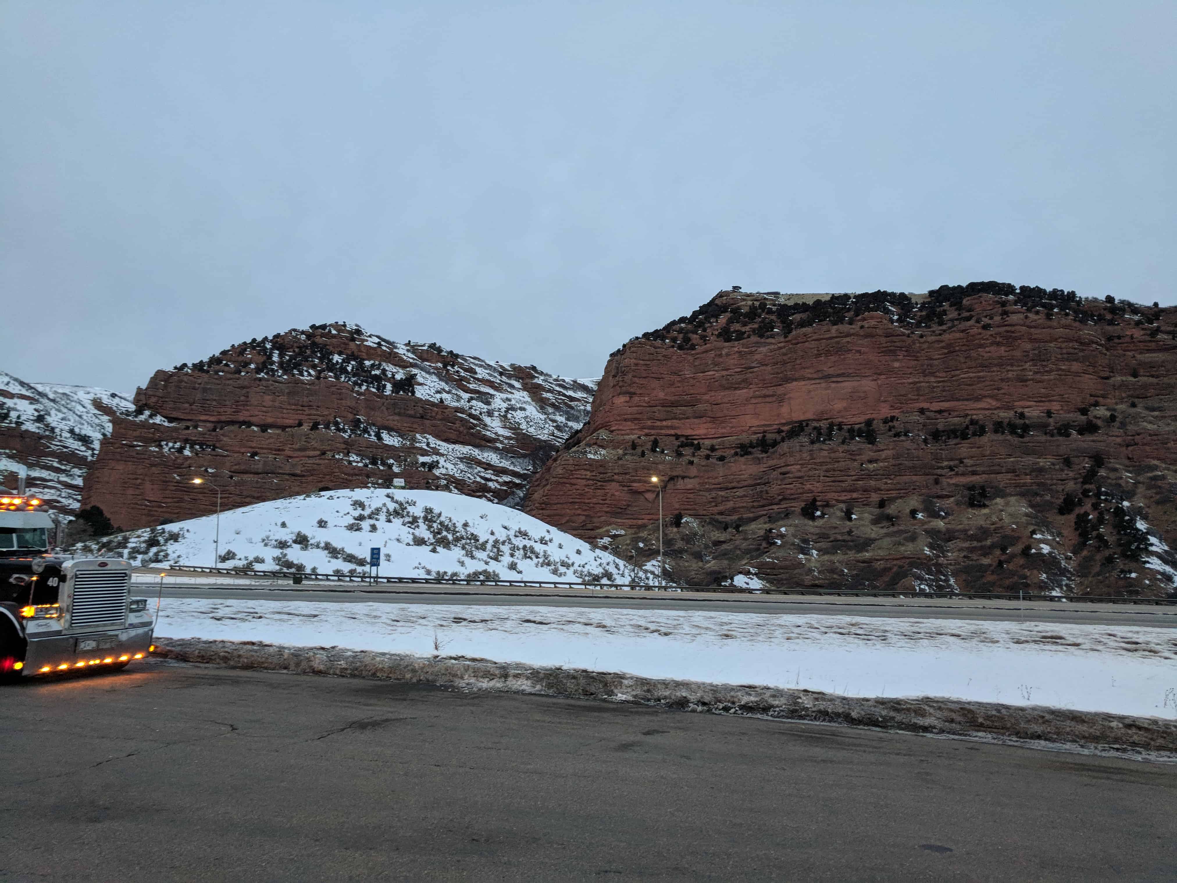
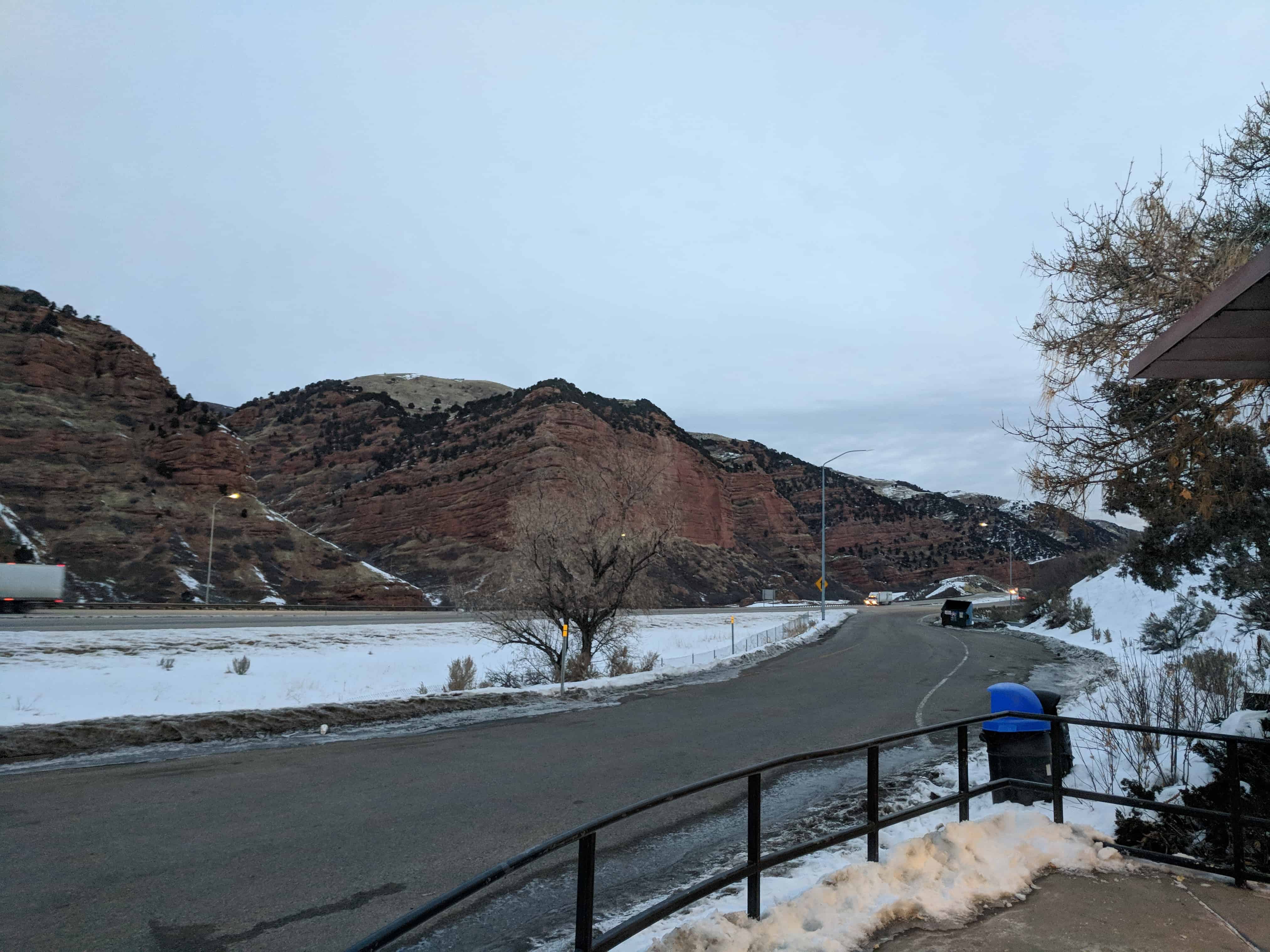
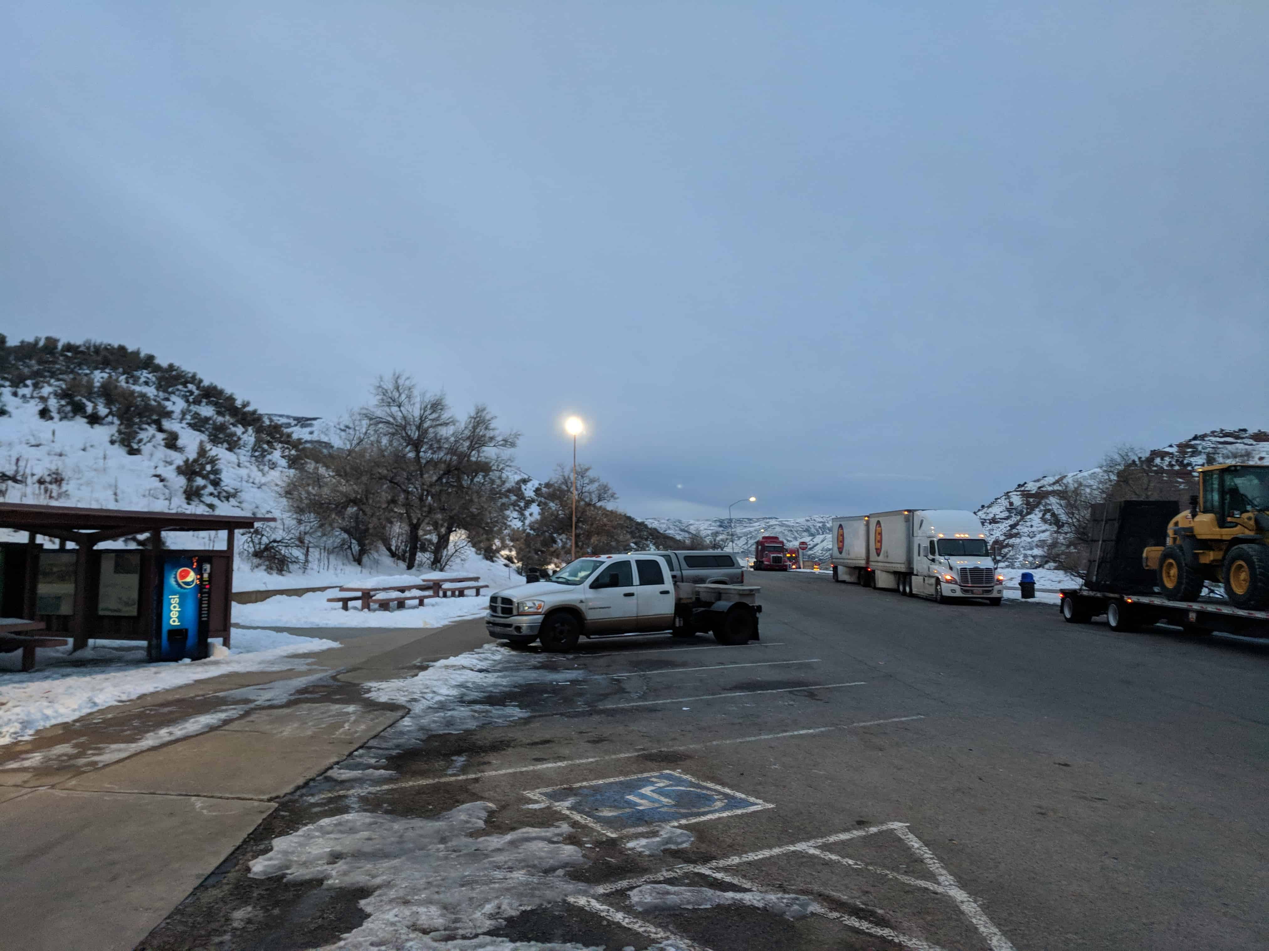
By October 1, 1857, 1,300 men of the Utah Militia were stationed in the Echo Canyon narrows, and by December, the Militia had grown to about 2,000 men. During that brief period (about 2 months for most of the men), the Militia constructed breastworks up on the sides of the cliffs, dug trenches, dammed the creek, built mounds, and constructed “Wickiup City,” which consisted of a few log houses and some tents, but mostly “wickiups” made of poles, willows, and grass with dirt roofs.
With the U.S. Army wintered down at Camp Scott in Wyoming, all but 58 of the Militiamen returned to their homes until the following spring of 1858. Those remaining were to guard the outpost and watch for further movement of the U.S. Army.
Fortifications:
Breastworks: Stone walls were built on ledges of the cliffs to protect Militiamen from enemy fire. They were constructed of uncut stones without mortar, 2- to 4-feet high. At least 14 visible breastworks are located in a 1⁄2-mile stretch.
Entrenchments: Three impassable military ditches were dug across the entire bottom of Echo Canyon. The trenches were 350 feet apart, and when filled with water, were 12 feet wide and 6 feet deep.
Dirt Walls: Between the ditches were parallel dirt walls, mounds, and breastworks of rocks and dirt for protection and movement of Militiamen.
Zigzag trench: A large, 500-foot-long, zigzag trench was built high on the south side of the canyon to protect Militiamen from enemy fire.
The dam: A 30-foot-wide and 16-foot-high dam was constructed 1⁄2-mile down the canyon from the last ditch for the purpose of backing up the creek. The Army was forced to travel directly below the cliffs so rocks could be dropped on them.
The U.S. Army was well along its way to Utah when Brigham Young learned it was coming. Church leaders held a council and decided to call out the Utah Militia. The first objective was to detain the U.S. Army in the Fort Bridger area over the winter. The second objective was to fortify Echo Canyon, and in the spring, stop the U.S. Army’s progress into Utah.
Major Lot Smith and others of the Utah Militia were dispatched to the area east of Fort Bridger to escort incoming Mormon immigrants and to disrupt the advance of the U.S. Army. While there, the Militia burned 74 U.S. Army supply wagons and their cargoes. They also burned Fort Bridger and Fort Supply, which were owned by the Mormon Church. Because of this opposition, the U.S. Army was forced to spend the winter at Camp Scott, which the army constructed near Fort Bridger.
The last 35 miles of the Army’s march from present- day Granger, Wyoming, to present-day Fort Bridger, Wyoming, were in a blinding snowstorm, with temperatures as low as minus 23° Fahrenheit. The Army lost 3,000 head of cattle, and 70 of 120 horses died. With such a shortage of horses, soldiers pulled the wagons 4 miles to gather wood needed for their fires.
In May of 1857, President James Buchannan ordered a United States Army of 2,500 men to march to Utah. The army was commanded by Colonel Albert Sidney Johnston. His assignment was to quell reported difficulties between appointed government officials and Brigham Young, governor of the territory. The following spring, 500 additional soldiers were sent to join Colonel Johnston, giving him an army of 3,000 men to confront the Utah Militia. Sending the U.S. Army out west was a result of falsehoods concerning the conditions in Utah, lack of communication, and politics. Accompanying the army was Alfred Cumming, who had been appointed to replace Brigham Young as governor.
This house was built c.1882 for George “Heber” Clark and his wife, Luna. Heber was a partner in Clark Brothers Store. This house remains an excellent example of how houses traditionally intermingled with businesses on Main and Center Streets. Maxine Radmall purchased the house from Clark descendants in 1976, restoring it in 1995. (text from the plaque on the building)
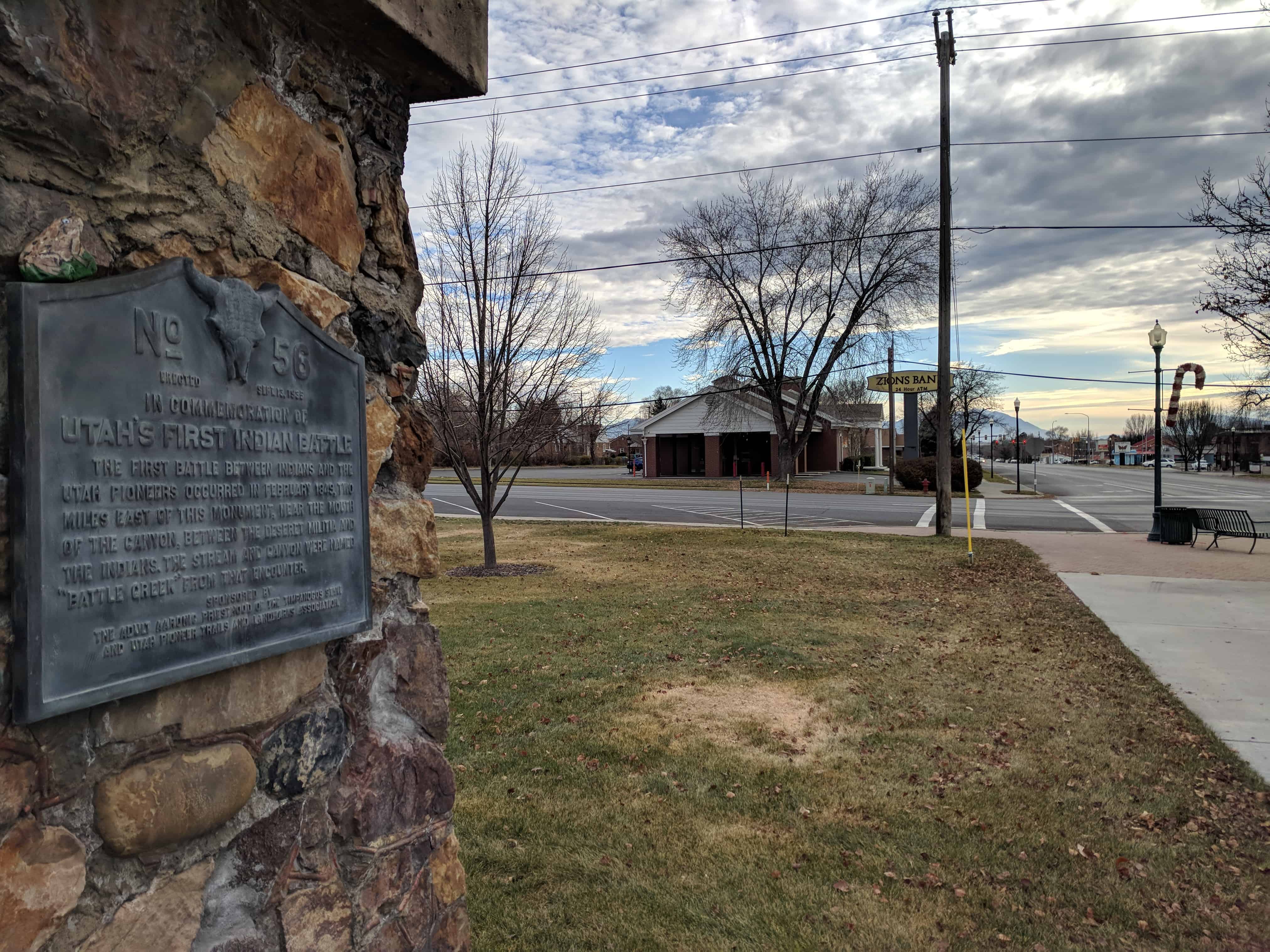
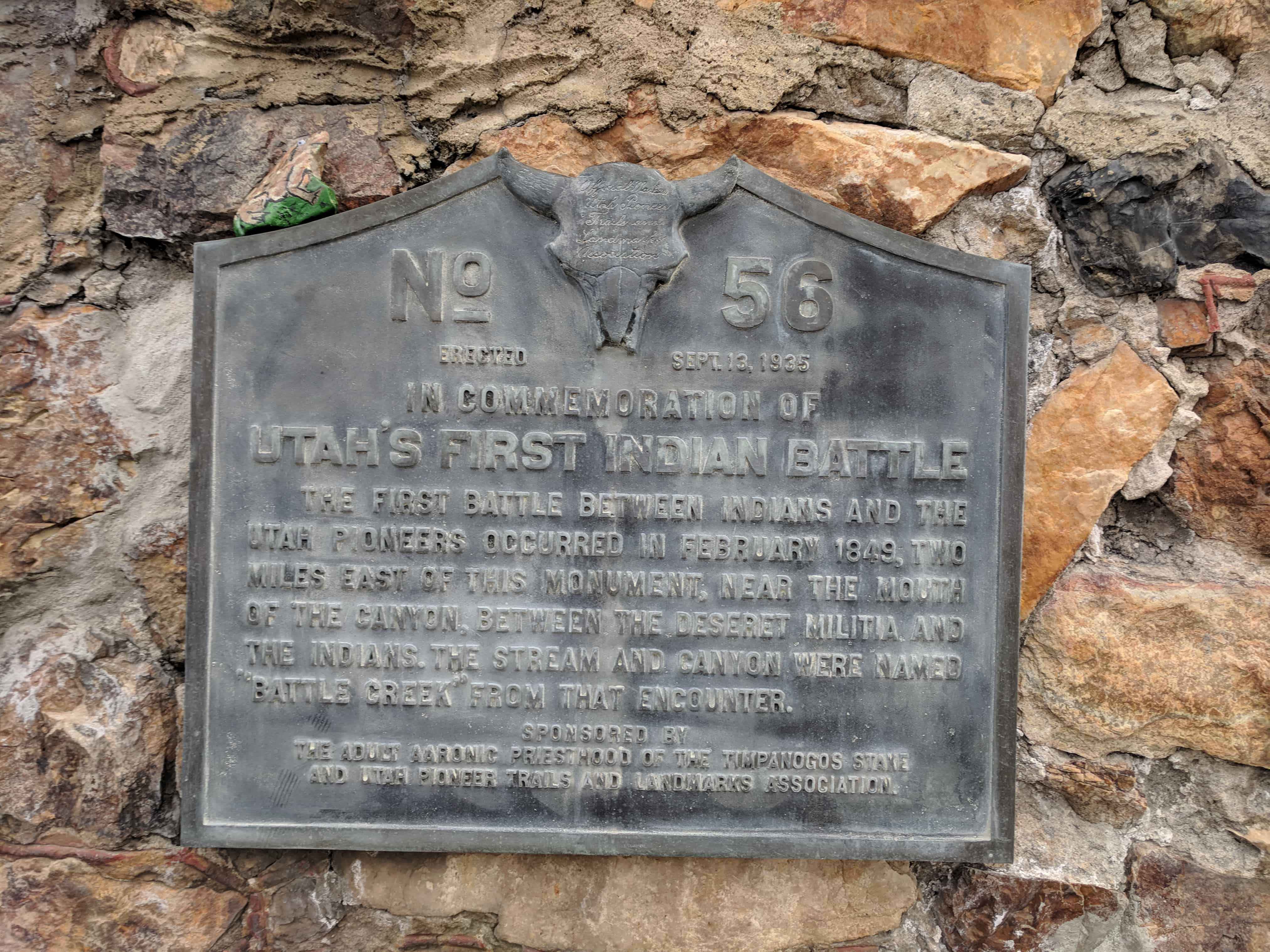
The first battle between Indians and the Utah Pioneers occurred in February 1849, two miles east of this monument, near the mouth of the canyon, between the Deseret Militia and the Indians. The stream and canyon were named “Battle Creek” from that encounter.
This is U.P.T.L.A. Marker # 56, see other SUP/UPTLA Markers on this page. This historic marker is located in Downtown Park in Pleasant Grove, Utah.
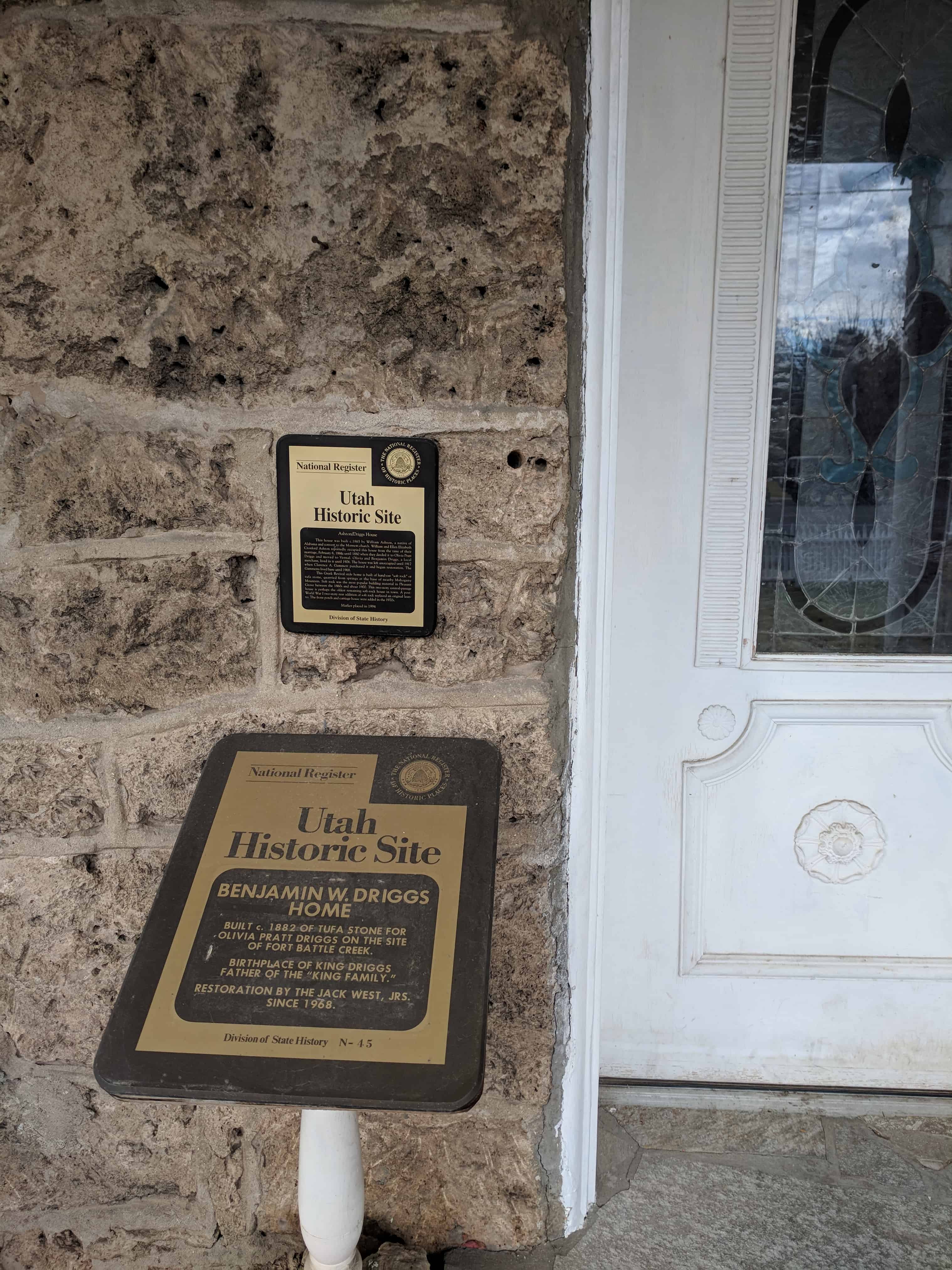
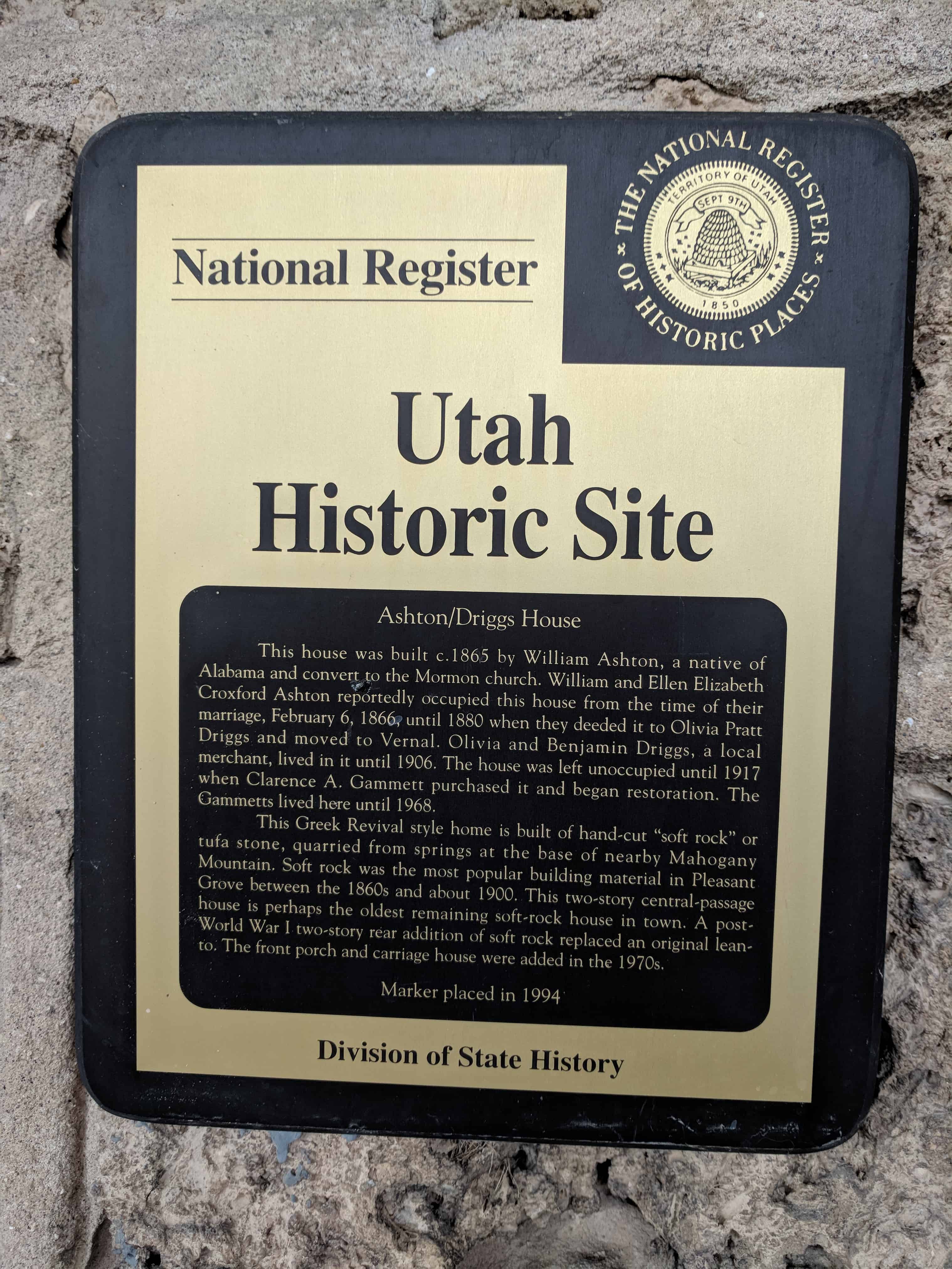
This house was built c.1865 by William Ashton, a native of Alabama and convert to the Mormon church. William and Ellen Elizabeth Croxford Ashton reportedly occupied this house from the time of their marriage, February 6, 1866, until 1880 when they deeded it to Olivia Pratt Driggs and moved to Vernal. Olivia and Benjamin Driggs, a local merchant, loved in it until 1906. The house was left unoccupied until 1917 when Clarence A Gammett purchased it and began restoration. The Gammetts lived here until 1968.
The Greek Revival style home is built of hand-cut “soft rock” or tufa stone, quarried from springs at the base of nearby Mahogany Mountain. Soft rock was the most popular building material in Pleasant Grove between the 1860s and about 1900. This two-story central-passage house is perhaps the oldest remaining soft-rock house in town. A post-World War I two story rear addition of soft rock replaced an original lean-to. The front porch and carriage house were added in the 1970s.
The Ashton-Driggs House is located at 119 East 200 South (Battle Creek Drive) in Pleasant Grove, Utah and was added to the National Historic Register (#72001261) on April 14, 1972.
Benjamin W. Driggs Home Built c.1882 of tufa stone for Olivia Pratt Driggs on the site of Fort Battle Creek. Birthplace of King Driggs, father of the “King Family.” Restoration by the Jack West, Jrs. Since 1968.
The home was built c. 1882 by Benjamin Woodbury Driggs for his first wife Olivia Pratt Driggs. It Is significant because of the people that have lived there, because it is a unique stone home, and because it has been restored with loving care.
The site is within the area of the original stone fort of Battle Creek, The Driggs purchased the property In 1882. Benjamin Driggs was a pioneer, colonizer, railroad builder and owner of the Battle Creek Co-op, a successful general mercantile establishment. Olivia was the eldest daughter of the noted Mormon, Parley P. Pratt. She bore 12 children. William King Driggs, who was the 12th and the only one to be born in the rock house, is the forefather of the television personalities, The King Family.
The home is unique with its 2′ thick walls, built of rich colored and textured “soft rock” or tufa stone, quarried from the lower slopes of Mt. Timpanogas in a quarry just four miles to the north. It is one of the best examples of the stone homes in Utah and certainly one of the most important *n terms of the recent attention and care it has received.
The restoration of the home began in 1917 when Clarence A. Gammett purchased the abandoned home. Then ensued a careful restoration of the home and gardens. After the death of the Gammetts, the home was purchased by lack West, Jr. In 1968. He and his family continued the restoration with quality effort and have carefully gathered furnishings authentic to the original era of the home. The Wests, upon completion of their restoration project, held an open house and gala affair hosting more than 2,500 persons.
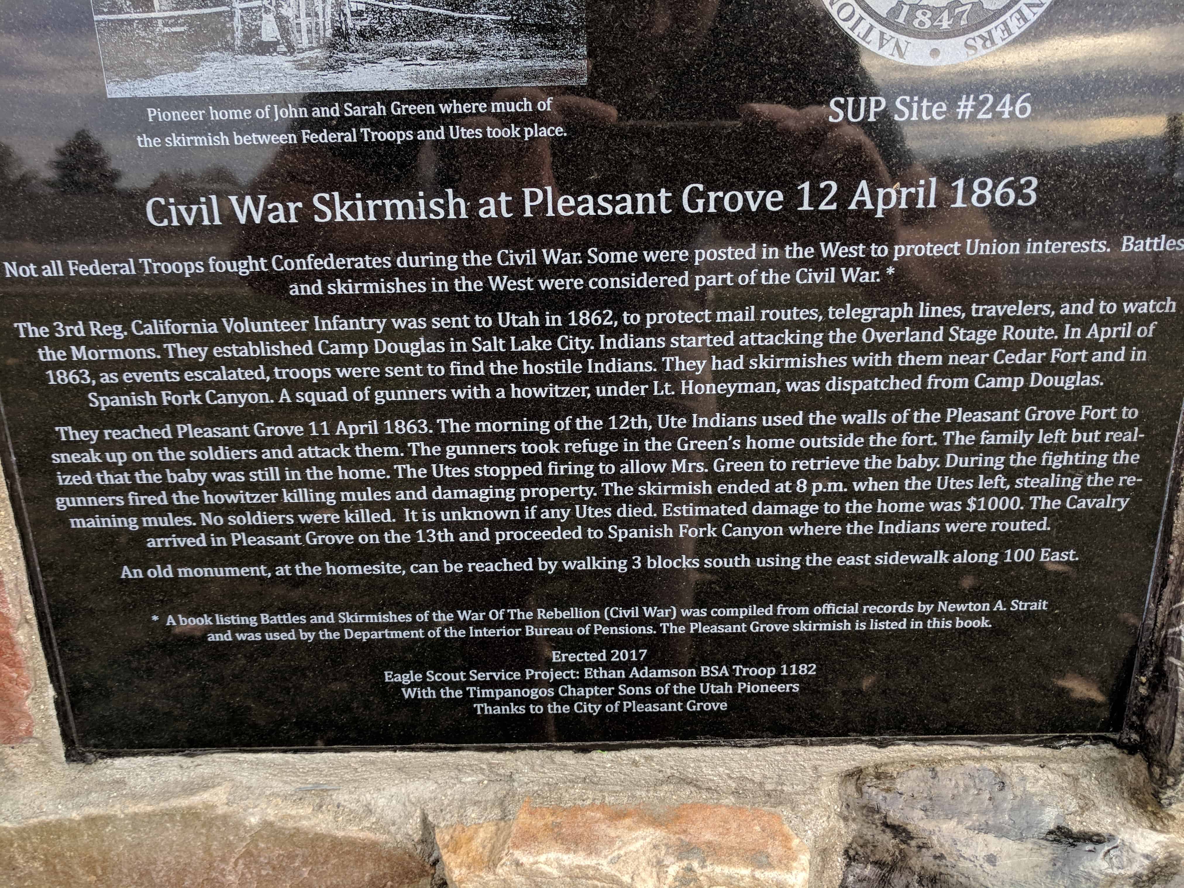
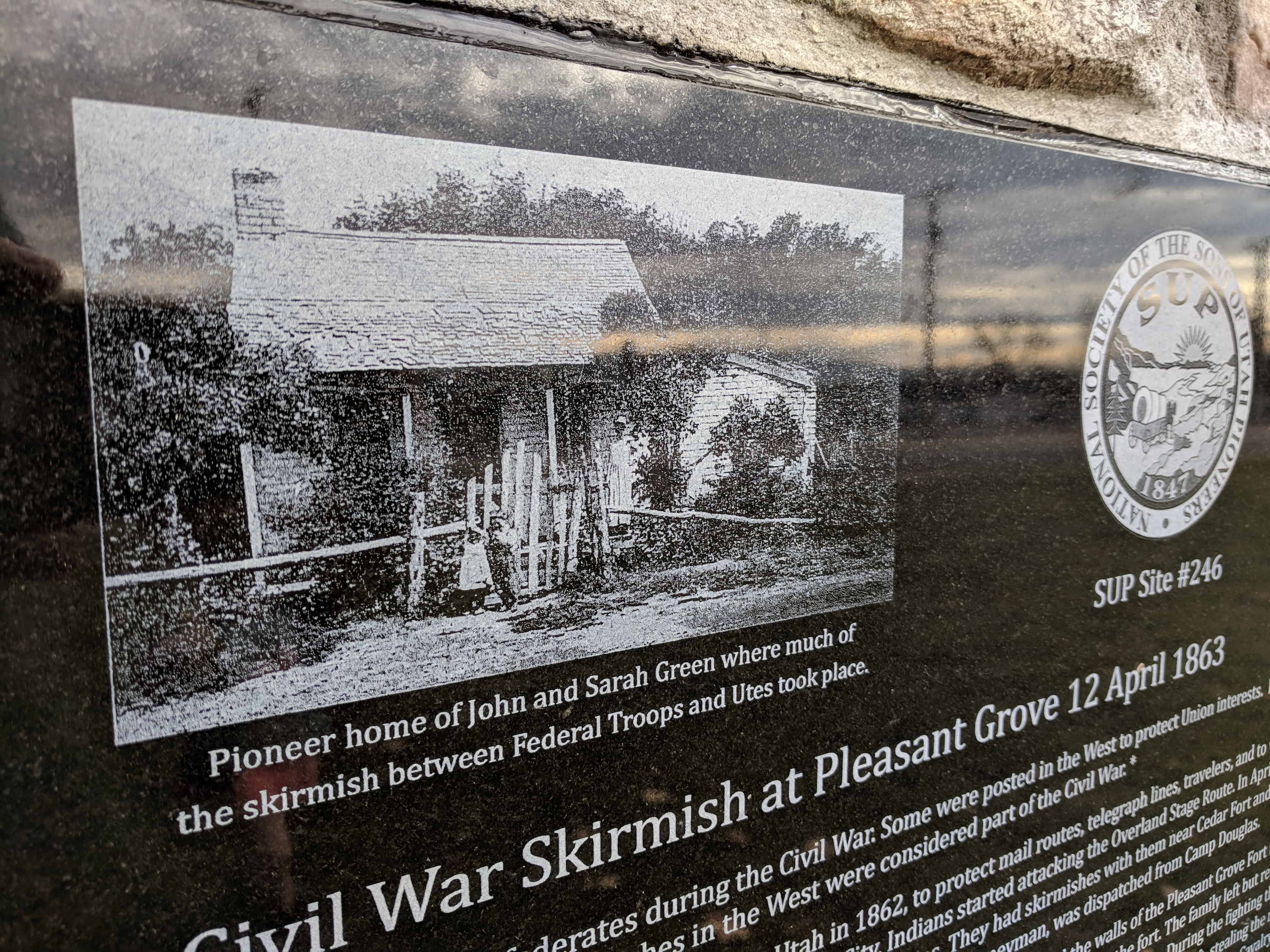
Civil War Skirmish at Pleasant Grove 12 April 1863
Not all Federal Troops fought Confederates during the Civil War. Some were posted in the West to protect Union interests. Battles and skirmishes in the West were considered part of the Civil War. *
Col. Patrick Conner and the 3rd Reg. California Volunteer Infantry were sent to Utah in 1862, to protect mail routes, telegraph lines, travelers and to watch the Mormons. They established Camp Douglas, now Fort Douglas, in Salt Lake City. Indians started attacking the Overland Stage Route. In April of 1863, as events escalated, troops were sent to find the hostile Indians. They had skirmishes with Indians near Cedar Fort and in Spanish Fork Canyon. A squad of gunners with a howitzer, under Lt. Honeyman, was dispatched from Camp Douglas.
They reached Pleasant Grove 11 April 1863. The morning of the 12th, Ute Indians used the walls of the Pleasant Grove Fort to sneak up on the soldiers and attack them. The gunners took refuge in the Green’s home outside the fort. The family was allowed to leave but realized that the baby was still in the home. Because the family had been on good terms with the Utes, they stopped firing to allow Mrs. Green to retrieve the baby. During the fighting the gunners fired the howitzer only to kill mules and damage property. The skirmish ended at 8 p.m. when the Utes left, stealing the remaining mules. No soldiers were killed. It is unknown if any Utes died. Estimated damage to the home was $1000. The Cavalry arrived in Pleasant Grove on the 13th. They followed the Ute trail to Spanish Fork Canyon, and with the soldiers already there routed the combined Indian forces.
An old monument, at what is thought to be the site of the John and Sarah Green home, can be found 3 blocks south of this location. It is best reached by walking along the east sidewalk on 100 East.
Pioneer home of John and Sarah Green where much of the skirmish between Federal Troops and Utes took place.
Erected 2017 Eagle Scout Service Project: Ethan Adamson BSA Troop 1182 With the Timpanogos Chapter Sons of the Utah Pioneers Thanks to the City of Pleasant Grove
* A book listing Battles and Skirmishes of the War Of The Rebellion (Civil War) was compiled from official records by Newton A. Strait and was used by the Department of the Interior Bureau of Pensions. The Pleasant Grove skirmish is listed in this book.