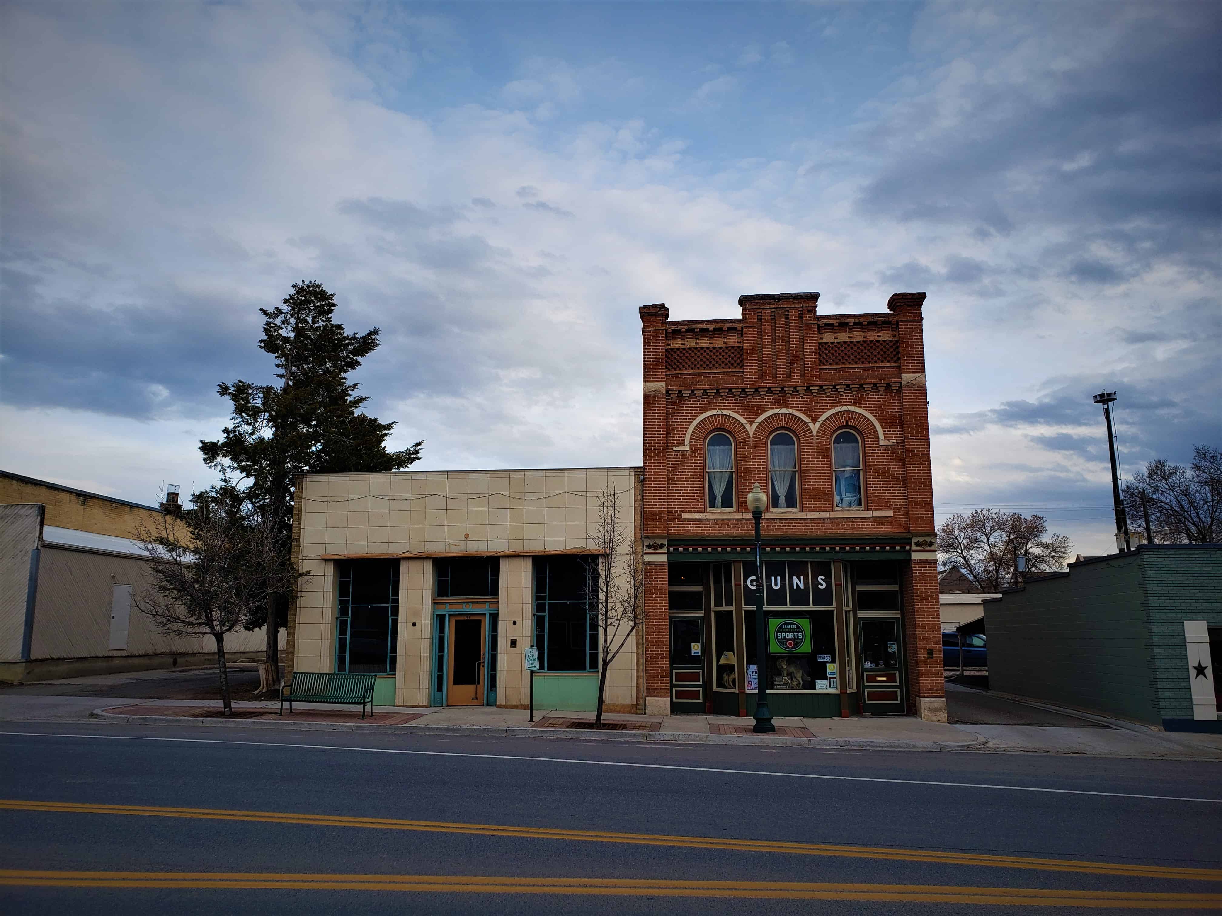
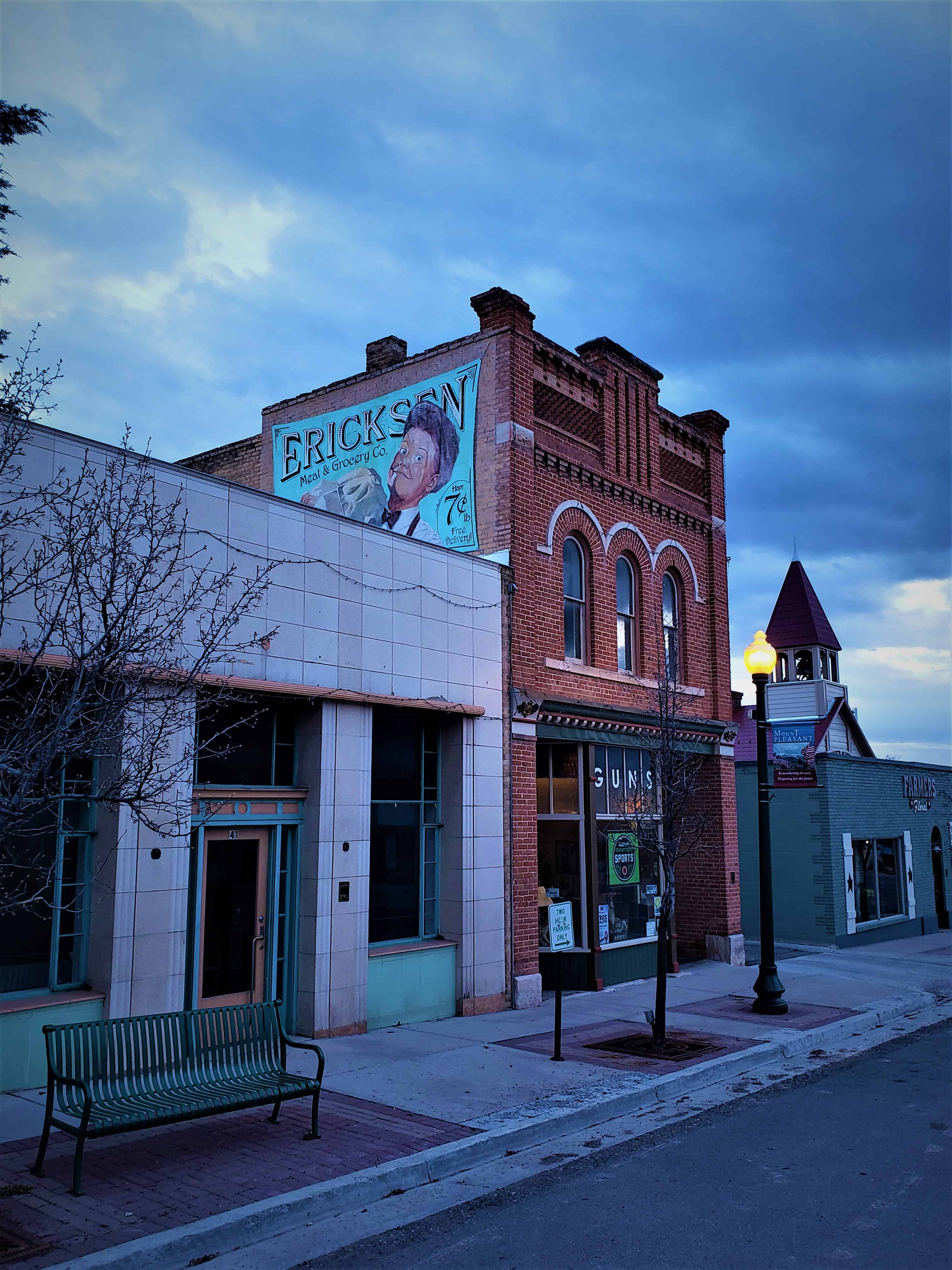
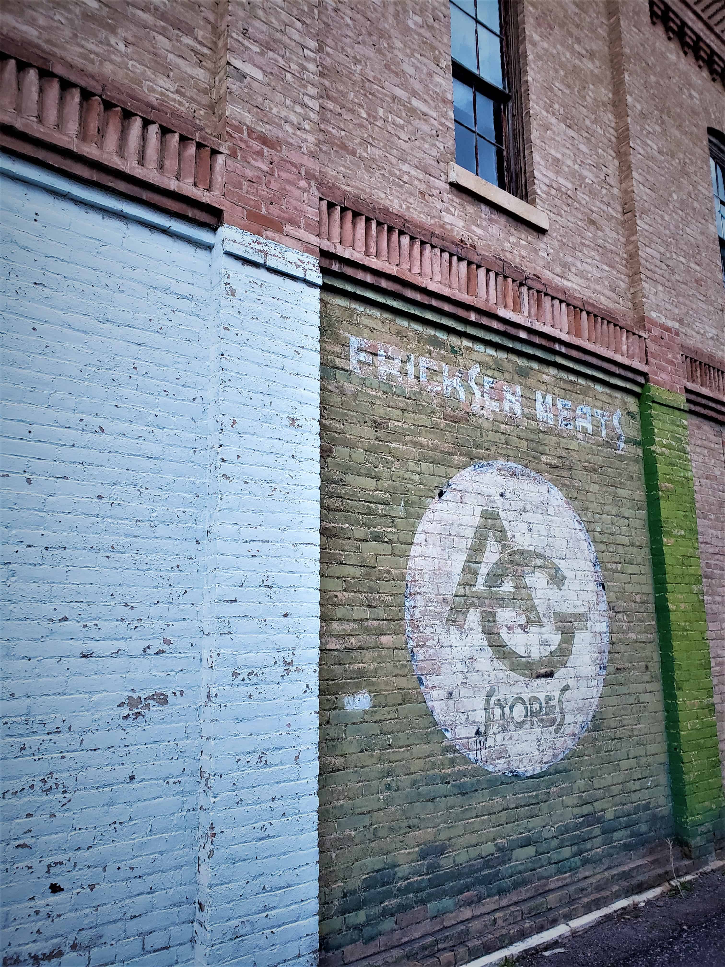
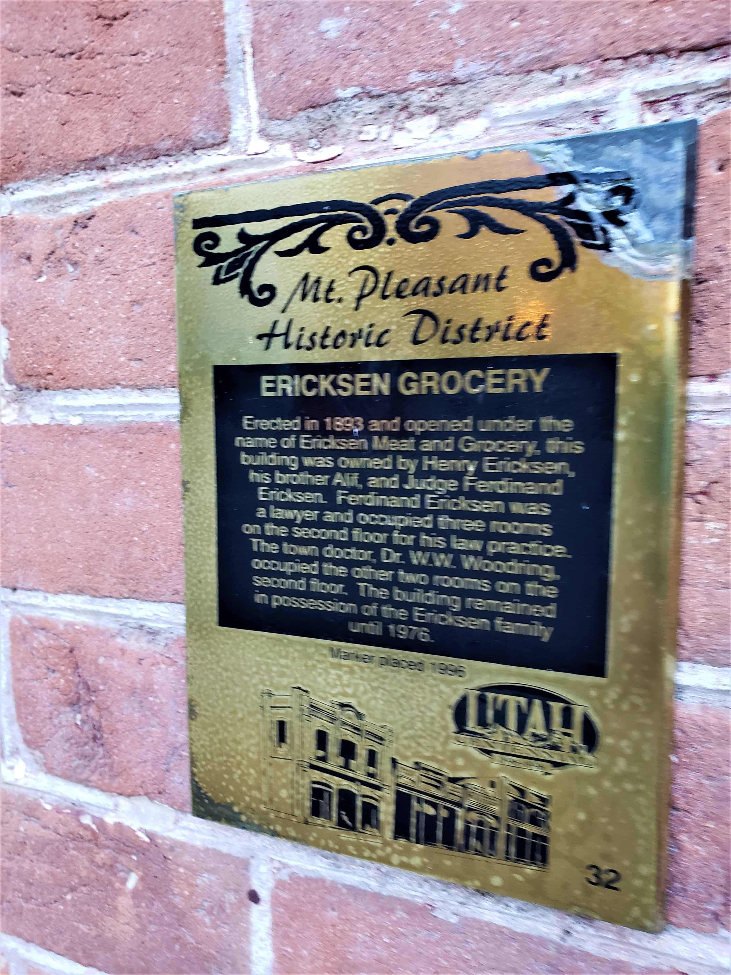
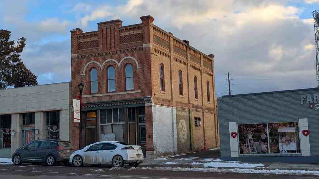
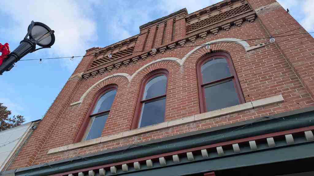
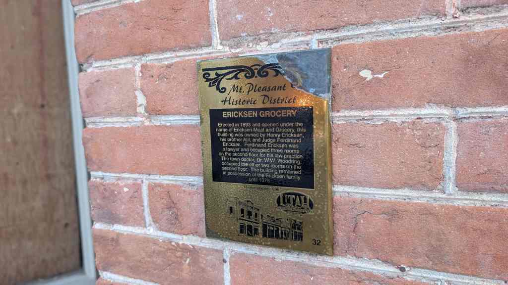
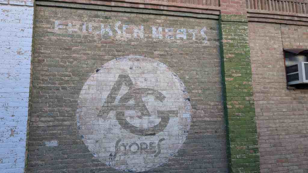
Erected in 1893 and opened under the name of Ericksen Meat and Grocery, this building was owned by Henry Ericksen, his brother Alif, and Judge Ferdinand Ericksen. Ferdinand Ericksen was a lawyer and occupied three rooms on the second floor for his law practice. The town doctor, Dr. W.W. Woodring, occupied the other two rooms on the second floor. The building remained in possession of the Ericksen family until 1976.
After taking lumber out of Pleasant Creek Canyon in late 1851, a band of Mormon colonists from Manti led by Madison D. Hambleton returned in the spring of 1852 to establish the Hambleton Settlement near the present site of Mt. Pleasant. During the Walkara (Walker) Indian War, the small group of settlers relocated to Spring Town (Spring City) and later to Manti for protection. The old settlement was burned down by local Native Americans, so when a large colonizing party from Ephraim and Manti returned to the area in 1859, a new, permanent townsite was laid out in its present location—one hundred miles south of Salt Lake City and twenty-two miles northeast of Manti.
Among the founding settlers were Mormon converts from Scandinavia, the United Kingdom, and the eastern United States. By 1880, at which time Mt. Pleasant was the county’s largest city, with a population of 2,000, more than 72 percent of its married adults were foreign born. This ethnic diversity had an important impact on village life during the nineteenth and early twentieth centuries. For decades, five languages were commonly spoken in town, creating confusing and sometimes amusing communication problems.
Spring City was first known as “Allred Settlement”. The original settlers in 1852 were under the leadership of James Allred and most of them were his family members. When an LDS ward was organized there in 1853, Ruben W. Allred was appointed the first bishop. The settlement was abandoned in the summer of 1853 because of ongoing conflict with the indigenous people of the area, the Ute people, including San Pitch Utes (Sanpete county derives its name from the San Pitch Utes). The village was reestablished as “Springtown” in 1859 by William Black, George Black and Joseph S. Black. Christen G. Larsen was made bishop of a new LDS ward in 1860. Beginning in 1853, the Allred family and other church leaders had begun to encourage Danish immigrants to settle in Sanpete County, and, particularly after the community was reestablished in 1859, to join the Allred Settlement. By the mid-1860s locals referred to the north side of town as “Little Copenhagen” or “Little Denmark”. Spring City was also a site of fighting during the Black Hawk War.(*)
This one and a half story Victorian farm house was constructed in 1912 for Peter Johansen, builders were Charlie Jacobsen, carpenter, with Lois Christensen and Mill Peterson brick masons. A cattle rancher, Peter Johansen was born May 14, 1861 in Mt. Pleasant, Utah and first came to Emery County as a herder for the Mt. Pleasant cooperative herd.
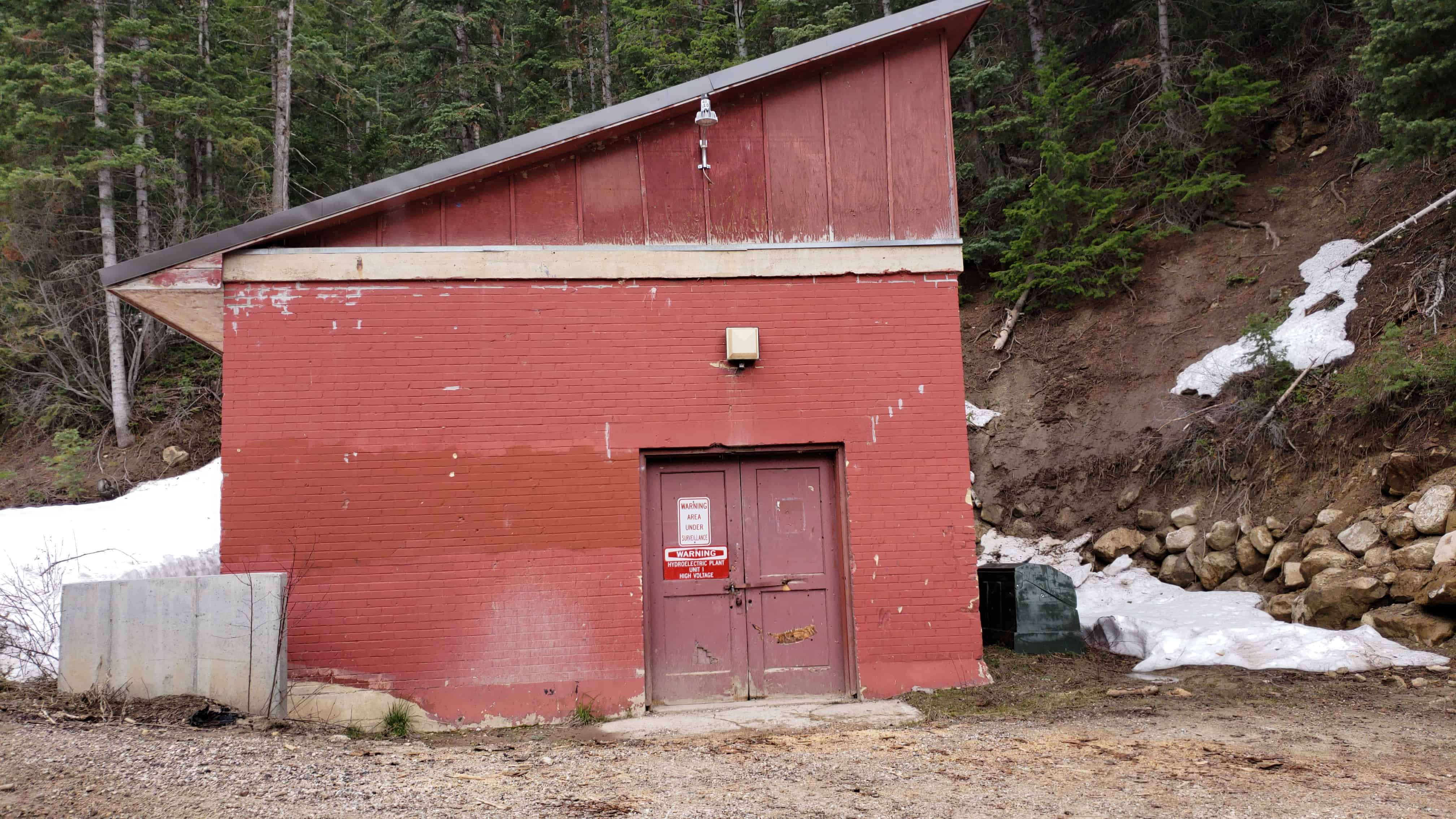
830 North Center Street in Castle Dale, Utah – added to the National Historic Register (#80003900) on March 19, 1980
From the national historic register’s nomination form:
The Johansen home is one of the finest old houses in Castle Dale and remains in the family of the original owner. It was one of the most modern in town at the time of construction and had all the latest conveniences including gas, light, and a dumbwaiter between the pantry off the kitchen and the cellar under the house so food could be rapidly brought up for cooking or serving. The house was carefully planned by the owner’s wife, who made a cardboard model of the house showing each room in detail that was used as a sort of blueprint for building.
Several people helped to build the house. The head carpenter was Charlie Jacobsen of Mt. Pleasant, a cousin of Peter Johansen, the original owner. Charlie hired another carpenter, Charlie Jensen of Orangeville, to help on the job. Lars Christensen and Mill Peterson were the brick masons, using brick that had been specially shipped from Provo for this house. Their work required great precision for once they put up a wall using the wrong thickness of mortar, making the wall the wrong height. They had to tear the whole thing down and start over. Because of their effort to do the job right, however, the house has endured for generations without sagging, cracking or bulging.
Only the very finest materials were used to build this house. Peter Johansen ordered all the wood through his sister, Mina Miller of Huntington, and she obtained flooring, window casings, door casing etc. from back east. A man named Glair finished the woodwork by staining, varnishing and polishing it in place. The stained glass windows also came from back east, and may even have come originally from Italy. On the ground floor are two beautiful fireplaces, one in the dining room and one set into a corner of the front room. These have heavy cast iron fireplace surrounds with decorative designs on the covers. The covers can only be inserted after the grate is disassembled, so they fit tight to keep out drafts. The cover in the dining room shows a cowboy on his horse; the living room cover has a shield and bough design. The surrounds are in turn surrounded by glazed ceramic tile, also shipped from the east.
The original owner, Peter Johansen II, was a cattle rancher known throughout Castle Valley as “Pete Jo.” He was born on May 14, 1861, at Mt. Pleasant, Sanpete County, Utah. His parents were Danish converts to the Church of Jesus Christ of Latter-day Saints who had come to Utah in the mid-19th Century. Pete Jo grew up in Mt. Pleasant and got into the cattle business by tending the town herd. All the townsfolk put their stock into that herd and it was run over in Emery County during the summers. In the fall Pete Jo returned the cattle to Mt. Pleasant and each animal was claimed by its owner.
Pete Jo spent so much time in Emery County that he decided to settle there. In 1898 he took out a patent of 160 acres of land he was homesteading in Huntington Canyon. He farmed this land and raised livestock there. Although he had started with the Mt. Pleasant herd, he eventually acquired his own by first buying a heifer with his herding wages, then buying another and another until with purchase and natural increase he was able to establish his own herd. He then moved permanently to Emery County. He married Zora Elizabeth Cook of Huntington and they settled on the homestead during the summer, moving to Huntington town during the winter.
Huntington Canyon had always been one of the main trails for people coming over from Sanpete County. During the time that Pete Jo moved to Emery County, many other young Sanpete men were doing the same. The pressure of population on the land forced the move, and the final settlement call of Brigham Young in 1877 and 1878 encouraged many to come to Emery County. Like Pete Jo, several men were herders and had traveled the Huntington route, going up Pleasant Creek Canyon to the left fork of Huntington Canyon and then down into Castle Valley. Traffic between Emery and Sanpete County was frequent and actively benefitted Emery County settlement. Parts for the first Emery County grist mill were dragged by oxen through two feet of snow from Fountain Green, Sanpete County, in 1879. During the same winter several men from Emery County tramped to Manti through Salina Canyon to get Christmas gifts for the children of Castle Dale. (In those rough years the children could count on treats only once a year and no one wanted to disappoint them.) The year 1880 marked the first major settlement in Emery County, and the railroad completion through Price (then northern Emery County) in 1883 encouraged further settlement. In 1890, when Pete Jo became a permanent resident, the Emery population had grown to 5,076.
Conditions in Huntington did not prove ideal, and Pete Jo began looking elsewhere for a home. He planned to move to Oregon but the house deal fell through, so instead the family came to Castle Dale (about ten miles south of Huntington) in December, 1903. They moved into a newly constructed house on the Castle Dale townsite. which the family still owns. Pete Jo bought bench land from Richard C. Miller in 1909. Around 1911 they began construction on the present home which was completed and occupied by Pete Jo and his family in 1912. He was the first settler to build up on the bench away from town. While the men worked on constructing the new house, Pete’s wife, Zora, cooked all the meals at their house in town and brought it to the new homesite in buckets, walking the mile up the hill. Zora contributed a great deal to the house in her design for it, the cardboard model, and in her attention to the workmen’s welfare. Unfortunately she didn’t live very long to enjoy it, dying in July 1914 in the new house. Pete Jo later married Sophia Monsen Poulsen of Mt. Pleasant.
The Peter Johansen house was built on cattle. Pete Jo had brought his substantial herd to Castle Dale in 1903 and soon found both summer and winter pasture for them. He first bought summer grazing land up in Joe’s Valley, about 24 miles away. That land is now inundated by the Joe’s Valley Reservoir, but they also bought other land higher up where the family still runs cattle. Before the dam was built, Pete Jo raised hay and alfalfa in the flat mountain valley, his original grazing purchase. Slightly later he leased land from the Bureau of Land Management (BIM) down on Sinbad in the San Rafael Desert, 32 miles from Castle Dale. He ran his herds there during the winter, a practice followed by his son, Byron, and grandson Kirk, who still puts the cattle on the Sinbad range. In the fall they had to drive the cattle up to the railroad in Price to sell the beef which would be shipped over to the larger market in Denver. Pete Jo’s three sons, Eugene, Merrial and Byron, all had cattle in the family herd and they always sold together with their father who then doled out the money. Around 1929 Pete Jo also started raising sheep, an activity taken over by the second son, Merrial. The cattle was sometimes kept at the 40 acres behind the Johansen home in Castle Dale. Especially in the winter, which can hit hard on Sinbad, the weak cows and those about to calve were brought to the Castle Dale spread where they could be more easily tended. Generally the men would stay in Castle Dale throughout the year, riding out to check on the herds as often as the weather demanded.
Pete Jo used horses extensively in his work, and was the first to introduce the Hamiltonian, an excellent breed of riding horse, to the Castle Dale area. He also had teams of Percherons and Clysdales to plow the land behind the house where he planted his crops.
Through hard labor and family cooperation, several kinds of crops were grown on the 40 acres in Castle Dale. Hay was the main crop, but the family also raised grains, vegetables and had an orchard which still produces succulent apples for all the relations. When Pete Jo bought the property there was a huge wash through the middle of the field behind the house. Pete Jo and his boys dug out all the surface rocks on the rest of the farm and dumped them into the wash. They filled it in and built a fence at the bottom. As years went by the mud settled out of the water carried down the wash and began to fill up the low land at the bottom, submerging the fence. This process was repeated for several seasons, and now there are four or five fences on top of each other at the bottom of the wash.
In spite of his involvement with the farm and the herd, Pete Jo had time for other work in the community. He was a charitable person who took the time to bring flour and beef to the widows and orphans of Castle Dale. He was also a good businessman, holding stock in the Castle Dale Co-op and serving on the board of directors of the Emery County Bank. When he died on August 10, 1936, the community lost both a leader and a friend.
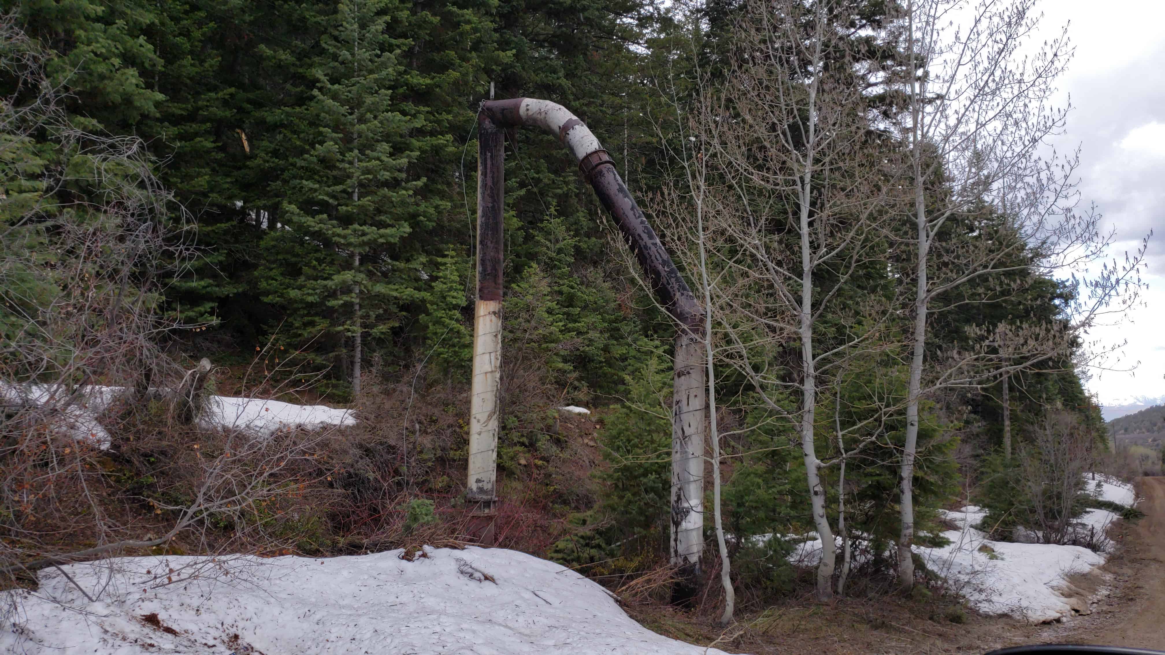
The Johansen property went to his children and the youngest son, Byron, moved into the house with his family. Byron built the smaller log cabin that still stands behind the house and constructed another one on the Sinbad range, where he also made ponds for the cattle. The second log building behind the Johansen home has been there since the house was constructed. It was originally used as a granary at the Johansen house on the Castle Dale townsite. Harnesses and other equipment were kept in the second story, and on the ground floor were several grain bins where different kinds of grain were stored. During the construction of the new home the old granary was moved to its present site by wagon. The wagon box was removed and the building put on the wheels with the reach connecting them. The team was hooked up, it was dragged intact to its current location and set on a foundation of flat stones laid out behind the house. The workmen then had a sturdy building for a home.
Most of the house has changed very little since construction. Electricity and running water were put in soon after they came to Castle Dale and the old gas generator in the basement was removed. At that time a bathroom was added. The upstairs has been slightly remodeled to include another bathroom and small kitchen, but the main structure of the house and the outside appearance remain unchanged. Byron’s widow, Delia Peterson Johansen, now lives alone in the house while her son Kirk manages the farm and the herd. This house and farm will remain in the family for the foreseeable future and will continue as a tangible reminder of generations of hard-won prosperity in rural Utah.
The Peter Johansen House is a large one-and-a-half story Victorian farm house built of brick on a poured concrete foundation. It incorporates components ordered from catalogs and design elements inspired by architectural pattern books of the period in a design created by Zora Johansen, the owner’s wife, who used a cardboard model to plan the house. Around the house are old cottonwood trees and to the rear there are two log outbuildings.
The house is composed of a main hip-roofed block with four projecting gable-roofed bays, one on each side. There are two brick chimneys with corbelled caps, one at the peak of the main roof, the other at the ridgeline of the rear gabled bay. A cornice with modillion brackets runs under the eaves and forms large returns at the gable ends of the bays. The (west) front and rear bays extend farther out from the main block of the house than do the shallow side bays.
Walls of the house are built of brick shipped from Provo, Utah, over 100 miles north. Window openings have stone sills and lintels. The windows and door units are said to have been obtained from “back east,” probably ordered by catalog from an eastern U.S. mill work firm, a common practice in the period. Most of the windows are double-hung one-over-one pane, though the first story windows in the front and south side bays are large fixed units with stained glass transoms. On the north side on the house, near the front, is a small rectangular stained glass window that lights the interior entry hall.
At the northwest corner of the house, next to the front bay, is the two-story front porch. Its first level has three doric col urns supporting a wooden cornice with modillion brackets. Two transomed doors, one in the main block of the house, the other in the north side of the bay, open onto the first story. The upper level of the porch is smaller. It is entered from a second story doorway that slices through the cornice and lower part of the roof of the house. The doorway is sheltered by a steep-gabled pedimented roof that projects from the main hip roof, supported by two wooden doric columns. There are wooden balustrades on both levels of the front porch. There is also a one-story southeast side porch with doric columns, now enclosed.
To the northeast of the house are two one-story gable-roofed log outbuildings. The closer of the pair is an old granary originally built in Castledale a mile away and hauled to this site to provide housing for workmen during construction of the main house. It is built of squared logs with half-dovetail notching. The front (west) façade has a symmetrical window-door-window arrangement. On the south side is a rough open stair leading to an upper entrance in the novelty-sided gable end. The roof is wood shingled.
The other log structure was built in 1936 or 1937 by Byron Johansen, son of the original owner, when he took over the house. It is constructed of logs hewn fiat on the top and bottom to fit tightly together, but left rounded on the exposed sides. They are assembled by means of square notching. There is a door opening in the front (east) façade and a window in the south façade. Gable ends have vertical plank siding above the top of the log walls, and the roof is covered with wood shingles.
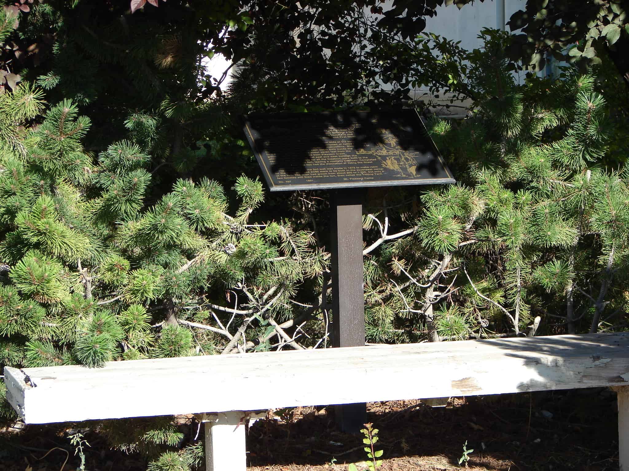
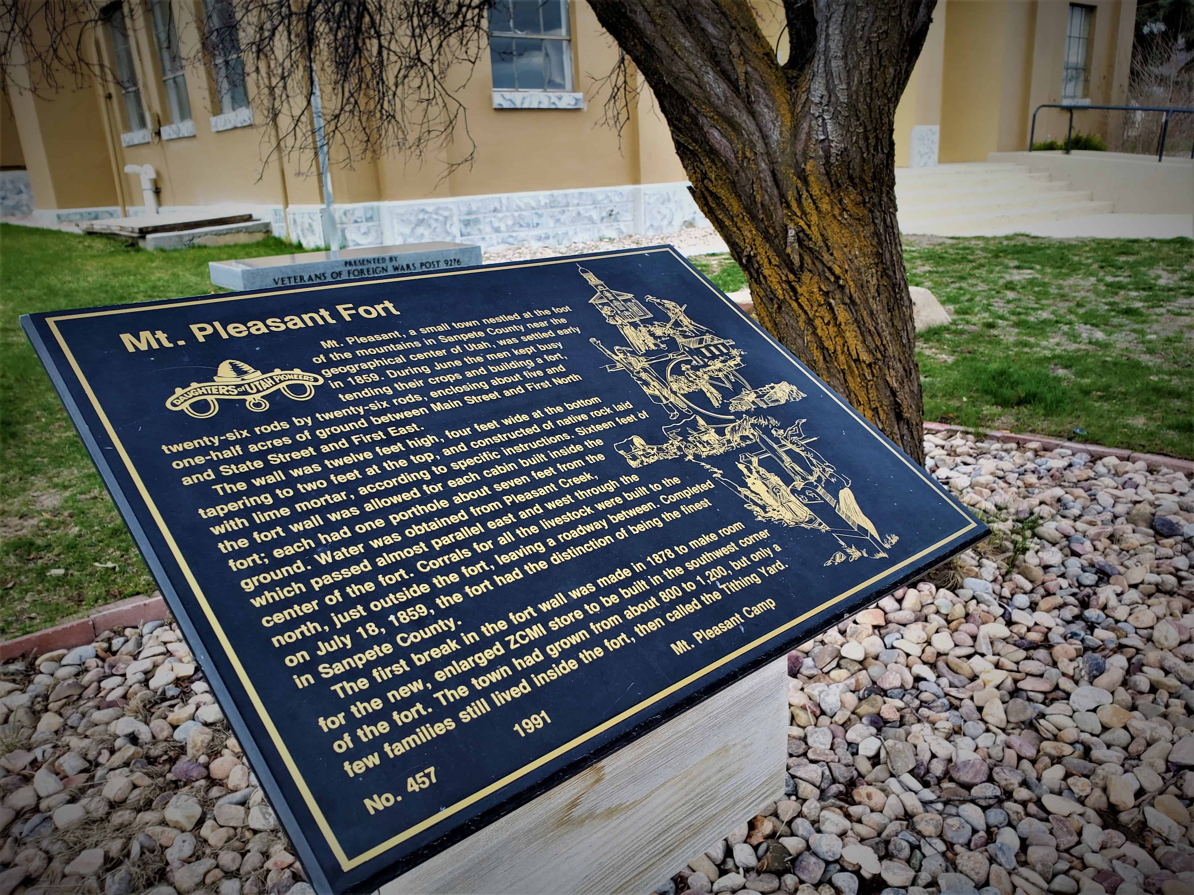
Mt. Pleasant, a small town nestled at the foot of the mountains in Sanpete County near the geographical center of Utah, was settled early in 1859. During June the men kept busy tending their crops and building a fort, twenty-six rods by twenty-six rods, enclosing about five and one-half acres of grounds between Main Street and First North and State Street and First East.
The wall was twelve feet high, four feet wide at the bottom tapering to two feet at the top, and constructed of native rock laid with lime mortar, according to specific instructions. Sixteen feet of the fort wall was allowed for each cabin built inside the fort; each had one porthole about seven feet from the ground. Water was obtained from Pleasant Creek, which passed almost parallel east and west through the center of the fort. Corrals for all the live-stock were built to the north, just outside the fort, leaving a roadway between. Completed on July 18, 1859, the fort had the distinction of being the finest in Sanpete County.
The first break in the fort wall was made in 1878 to make room for the new, enlarged ZCMI store to be built in the southwest corner of the fort. The town had grown from about 800 to 1,200, but only a few families still lived inside the fort, then called the Tithing Yard.
On Sept. 7, 1872, the final peace treaty of the Utah Black Hawk Indian War was signed at the home of Bishop Seeley by General Henry A. Morrow, Orson Hyde, Amasa Tucker, Fredrick Olson, Reddick Allred and William S. Seeley. Representing the Indians were sub-chiefs Tabiona, White Hare, Angitzebl and others who served under Chief Black Hawk. The war cost Utah $1,535,000.00, the lives of more than 75 whites and several times that many Indians.
The bell atop the monument is the bell that used to be atop the Hamilton School.