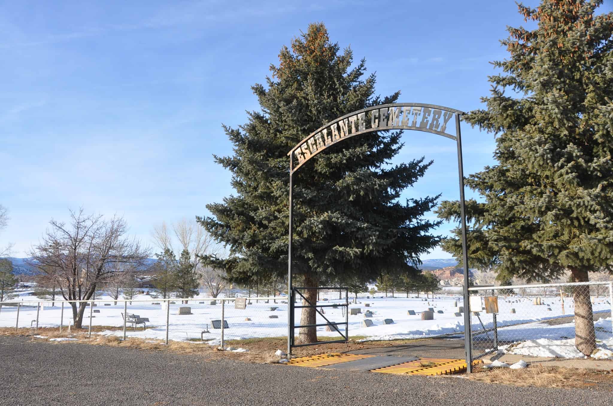
Previously known as Potato and also Spud Valley, Escalante is in Garfield County, Utah. It is named after Silvestre Velez de Escalante, a missionary and the first European explorer in the general area although he never came to this valley.
The first white people here were a group of Mormon cavalry during the Black Hawk Indian War of the mid-1860s.
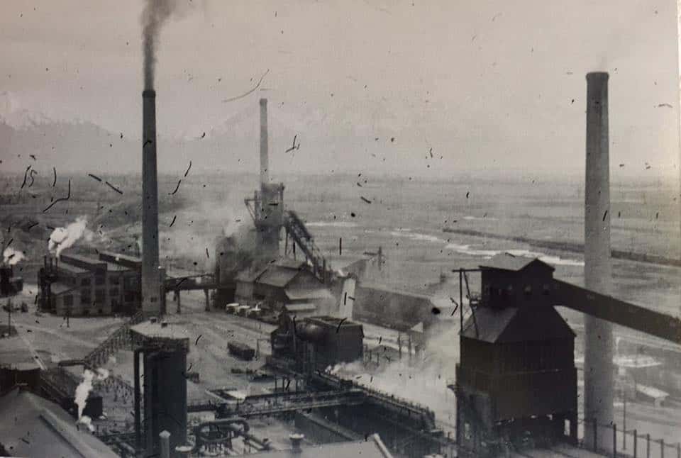
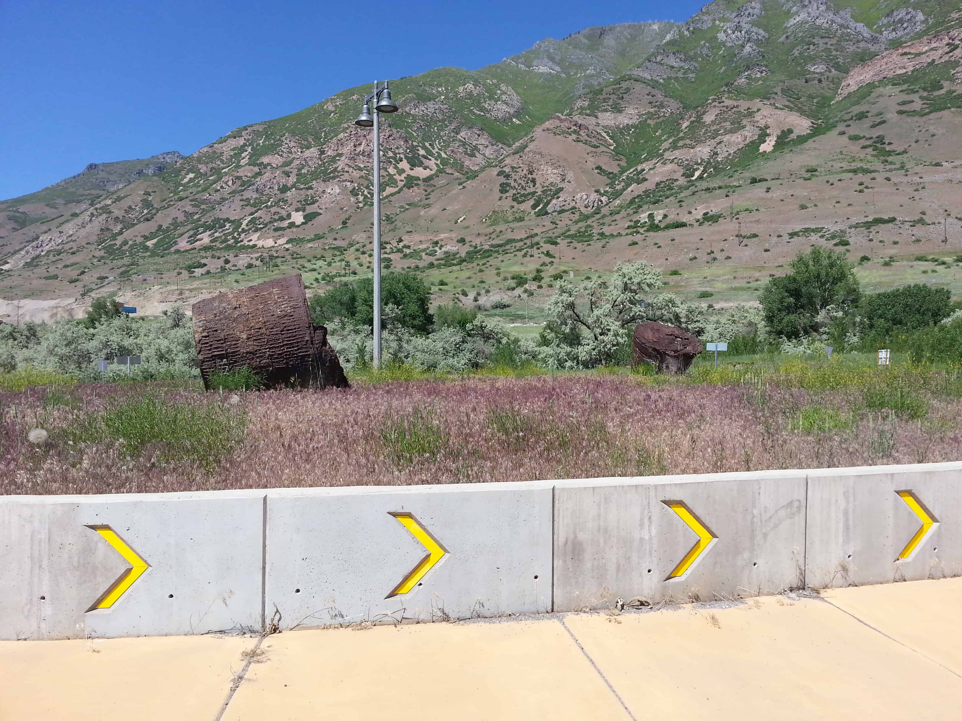
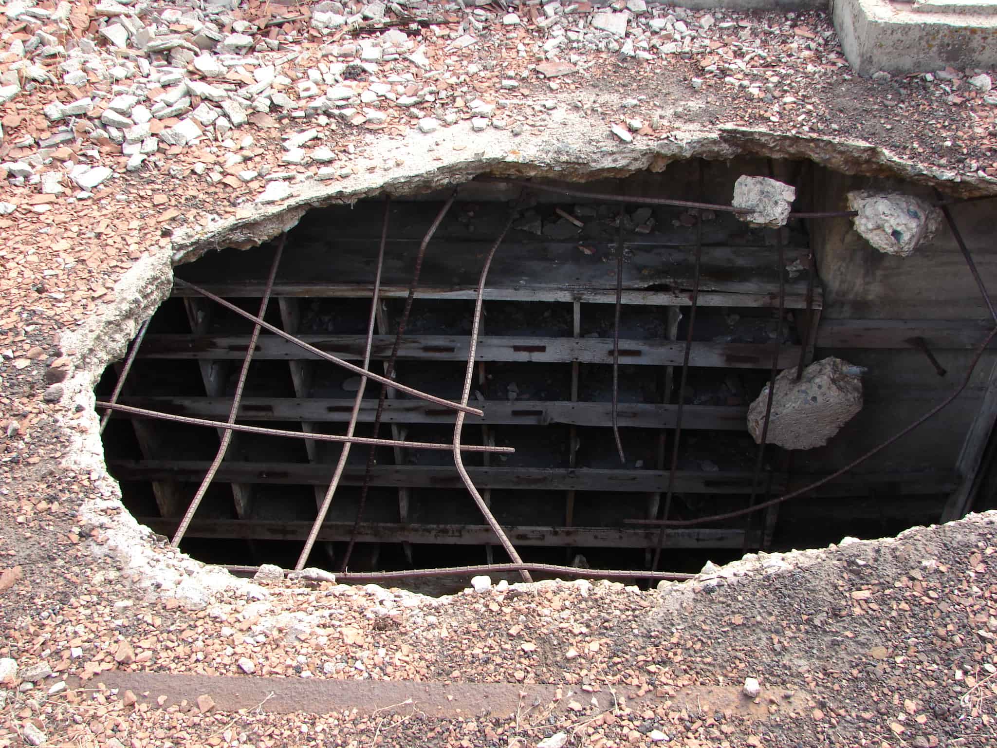
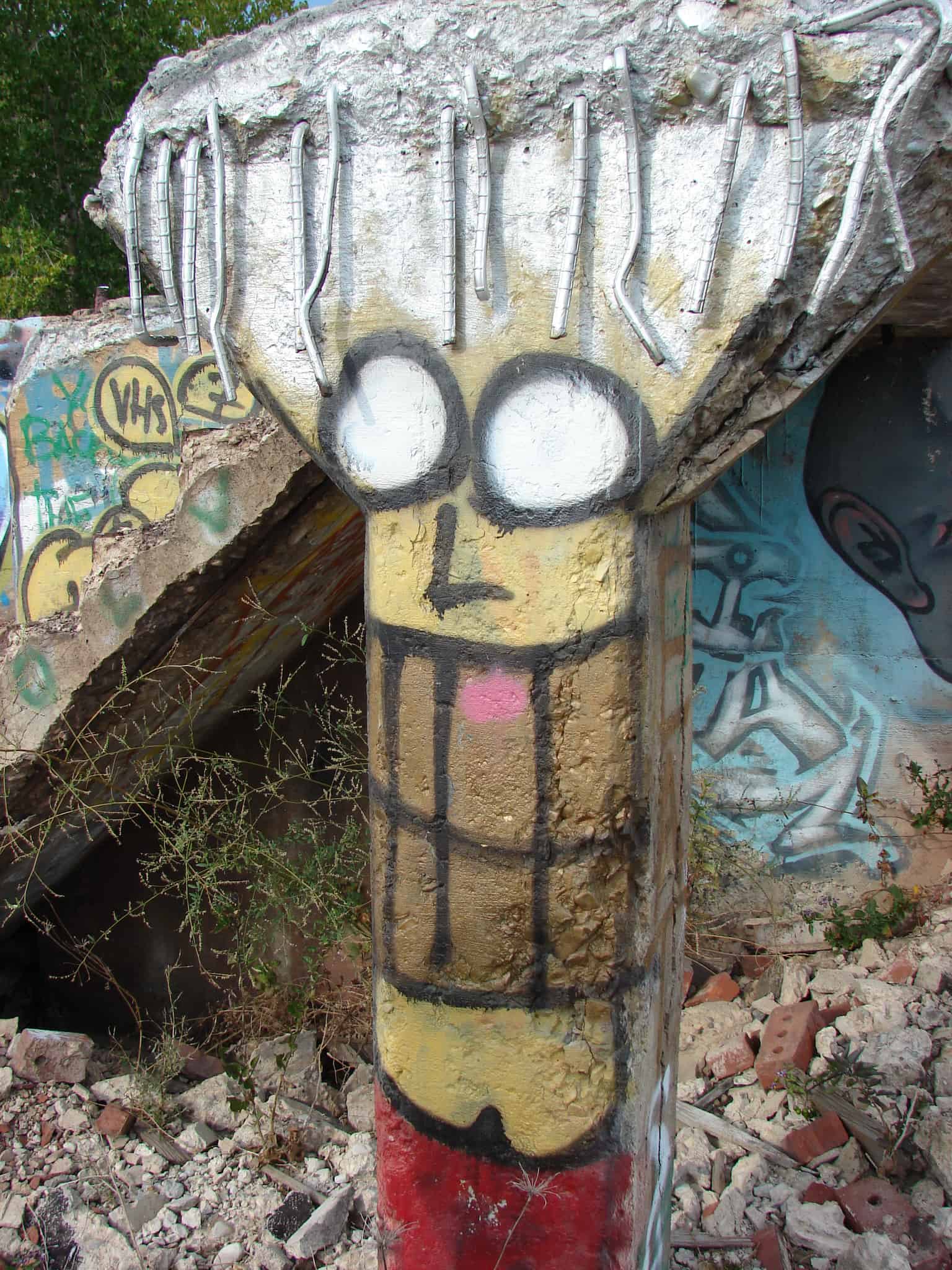
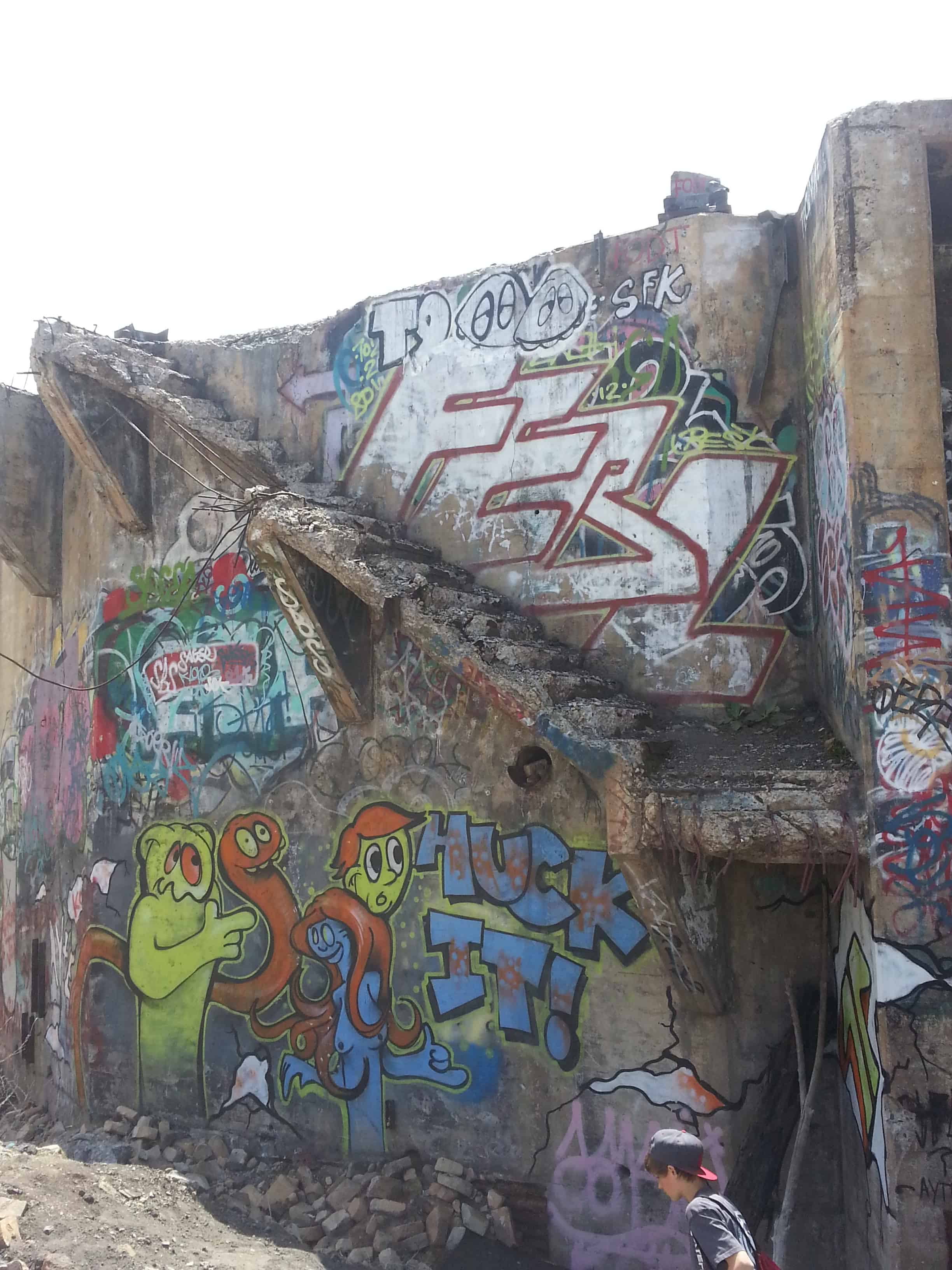
Ironton, Utah is between Springville and Provo and is the old location of the Columbia Steel Corporation’s pig iron plant. Many foundations and remains can be seen, lower in this post are photos of us exploring the remains.
The coal mine operated by the company was near Sunnyside, limestone is derived from local sources near Provo. Geneva Steel Company eventually took over the plant and mine.(*).
Update May 2016: It’s mostly being taken down for new development, see photos here.
The Geneva Steel Plant near Orem was the largest and most significant of several defense-related industries developed in Utah during the World War II period. The $200 million plant was financed by the federal government to insure that the nation’s steel industry would be able to meet the increased demand for steel by both military and industrial users. The actual construction and operation of the plant was turned over to Columbia Steel Company and the U.S. Steel Corporation. Approximately 10,000 workers were involved in the construction project, which extended from November 1941 to December 1944. Shortages of construction workers, equipment, and materials delayed the completion of the plant and made it more costly than planned.
The Columbia Steel Company was previously located near Provo at Ironton.
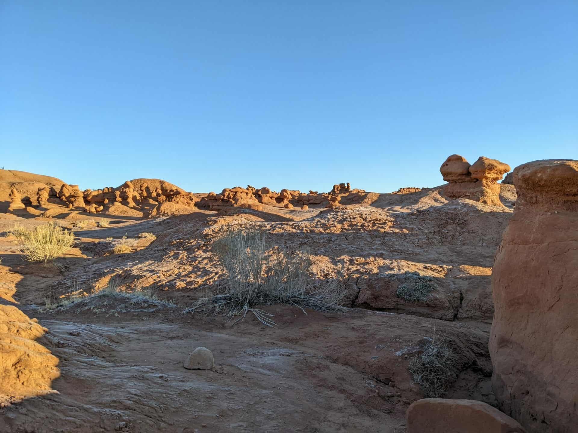
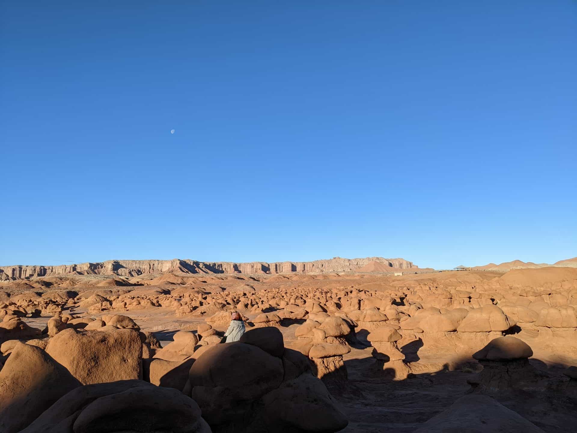
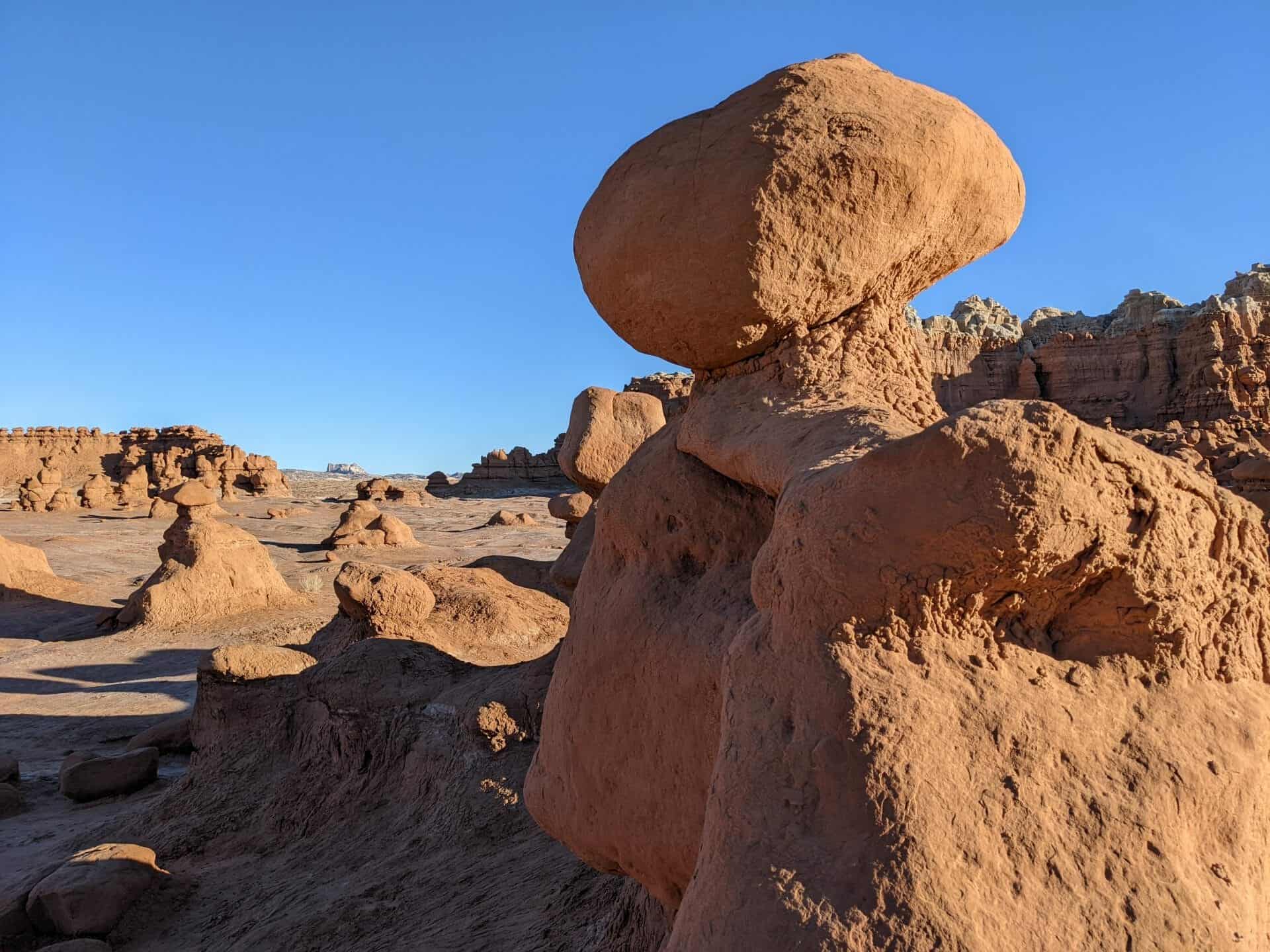
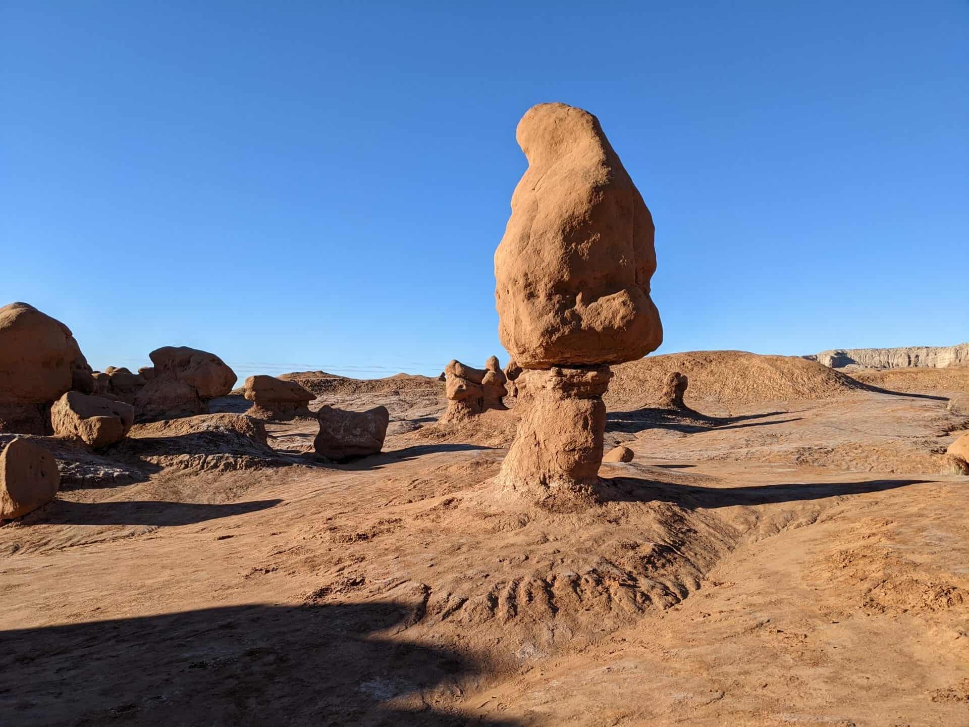
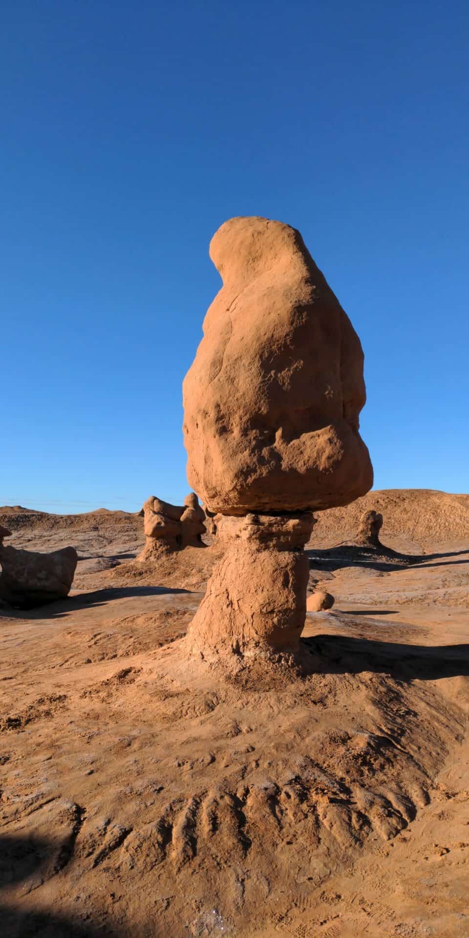
Cowboys searching for cattle first discovered secluded Goblin Valley. Then in the late 1920s, Arthur Chaffin, owner/operator of the Hite Ferry, and two companions were searching for an alternative route between Green River and Caineville. They came to a vantage point about a mile west of Goblin Valley and were awed by what they saw, five buttes and a valley of strange-shaped rock formations surrounded by a wall of eroded cliffs.
In 1949, Chaffin returned to the area he called Mushroom Valley. He spent several days exploring the mysterious valley and photographing its scores of intricately eroded creatures. The area was acquired by the state of Utah and in 1964 was officially designated a state park.
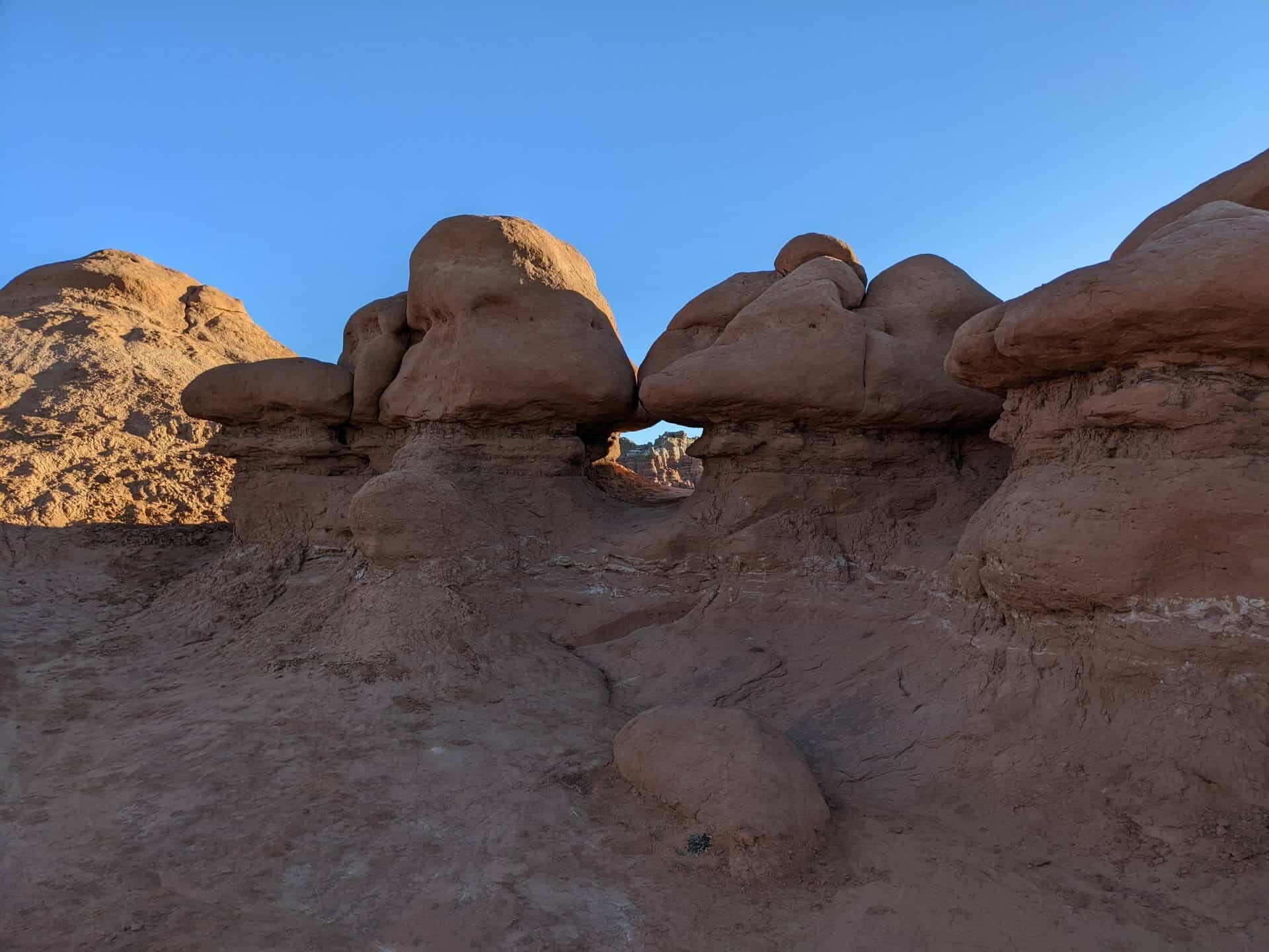
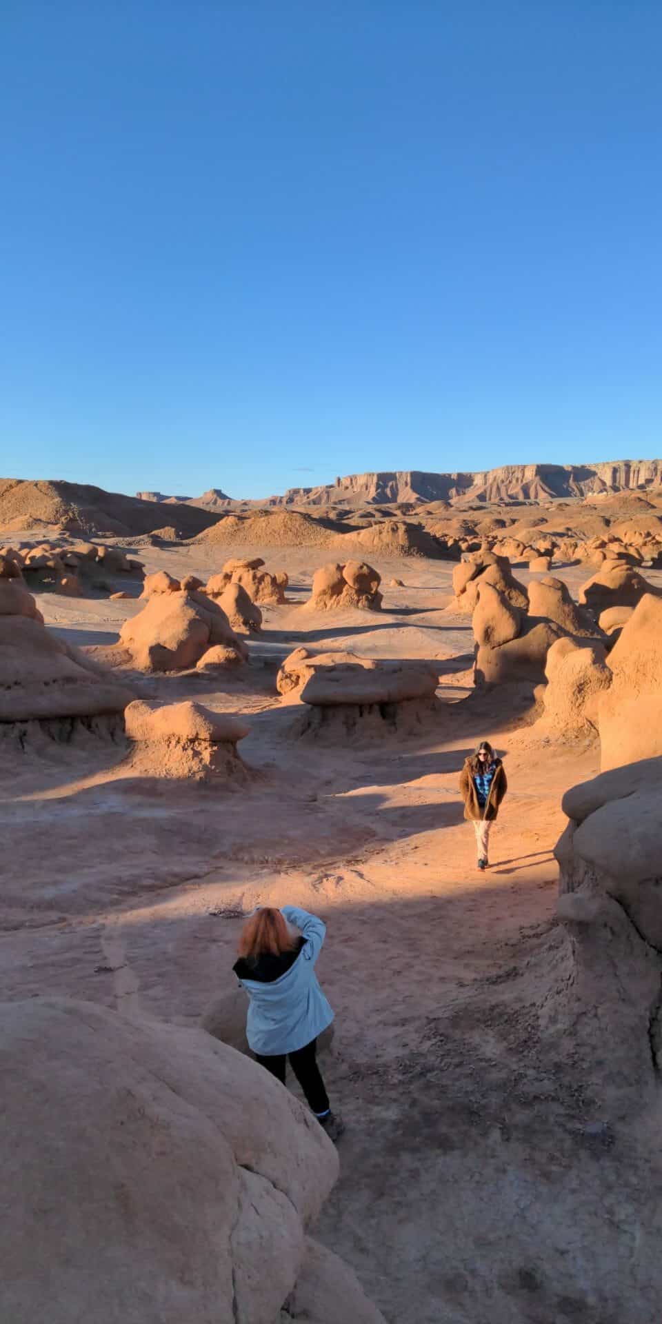
Goblin Valley State Park is a showcase of geologic history. Exposed cliffs reveal parallel layers of rock bared by erosion. Because of the uneven hardness of sandstone, some patches resist erosion much better than others. The softer material is removed by wind and water, leaving thousands of unique, geologic goblins. Water erosion and the smoothing action of windblown dust work together to shape the goblins.
Bedrock is exposed because of the thin soil and lack of vegetation. When rain does fall, there are few plant roots and little soil to capture and hold the water, which quickly disappears, in muddy streams without penetrating the bedrock.
Bluffdale, named for its twenty-five square miles of bluffs and dales, extends from Herriman on the west to Riverton on the north, Draper on the east and the Utah County line on the south. Originally it was part of West Jordan, first settled in 1848-1849. On July 29, 1858, Orrin Porter Rockwell paid five-hundred dollars to Evan M. Green for sixteen acres of land near the Crystal Hot Lakes (adjacent to the present Utah State Prison). This land included a hotel with dining facilities, stable, brewery, and pony express station. As the community expanded, the Bluffdale area became part of South Jordan, then Riverton. In 1883 the Bluffdale School Precinct was formed from parts of Herriman, South Jordan and Draper. On August 1, 1886, the Bluffdale Ward of The Church of Jesus Christ of Latter-day Saints was organized with Lewis H. Mousley as Bishop. For a short time the town was called Mousley. There are seven irrigation canals that originate at the Jordan Narrows in the Bluffdale area and serve the Salt Lake Valley. One of the earliest was the Utah and Salt Lake Canal started in 1862. Some of the early buildings included an adobe church, built in 1887-1888, a tithing house, and a three-room schoolhouse constructed in 1893.
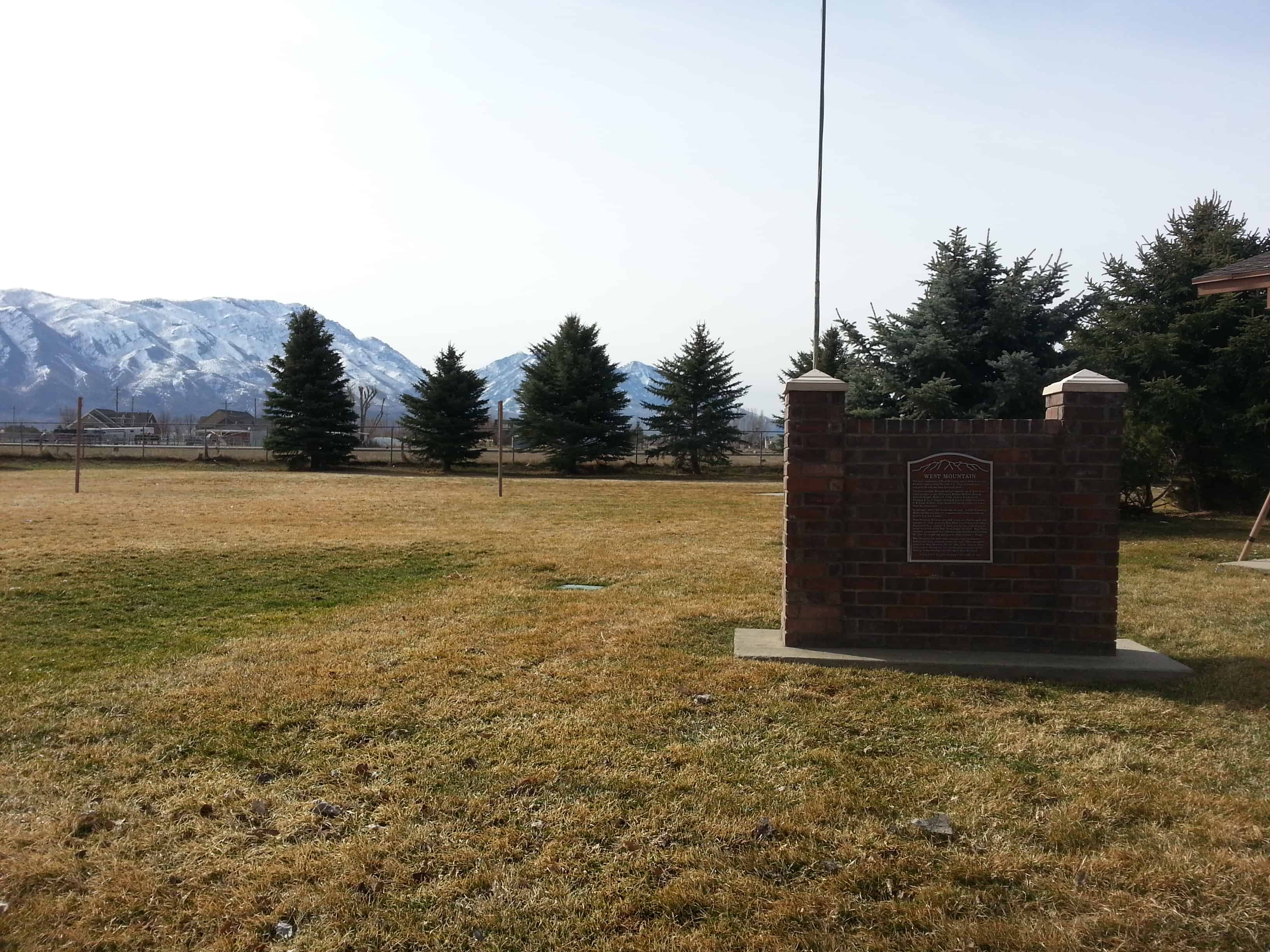
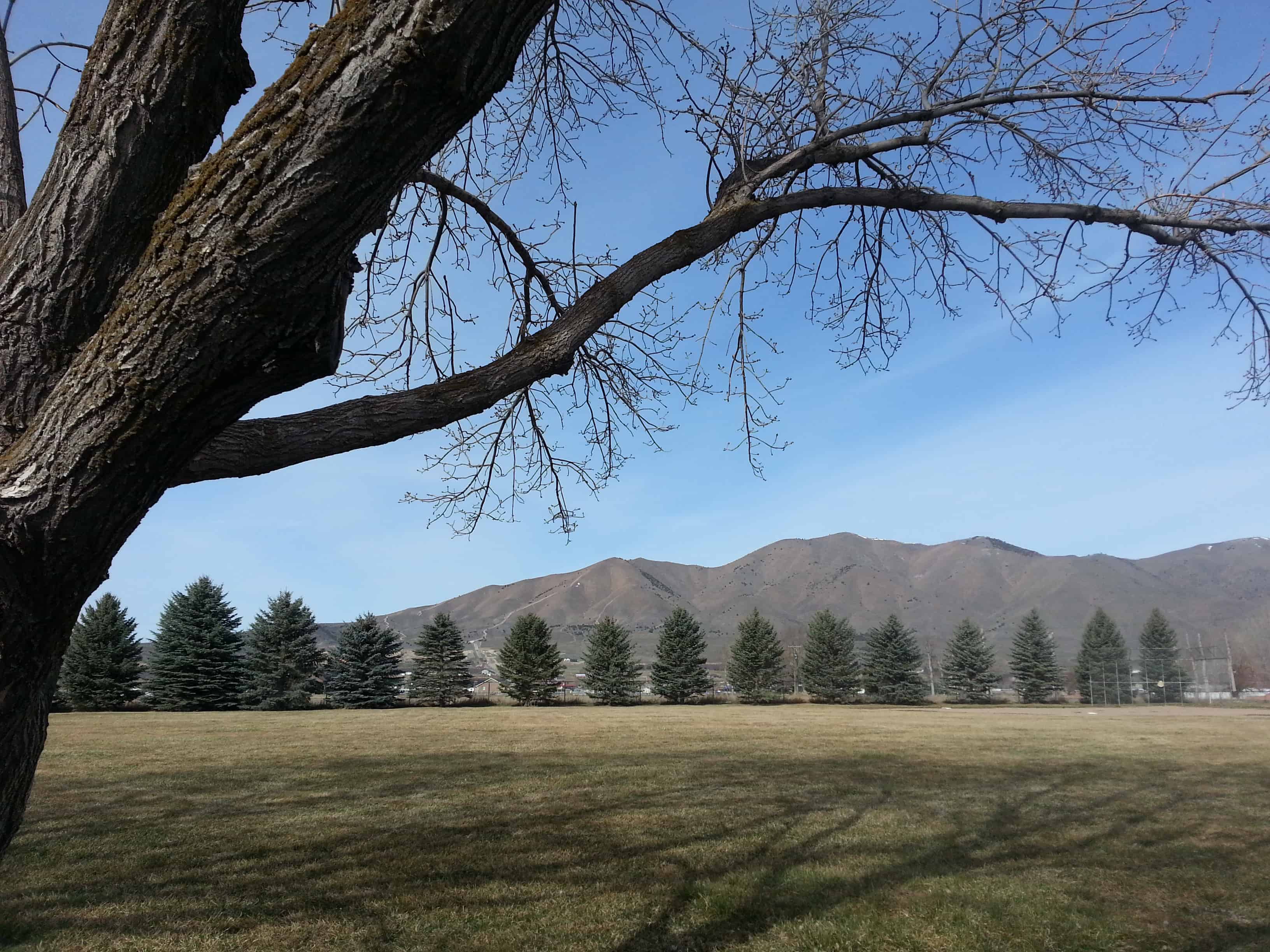
A small town at the base of West Mountain and named for it, West Mountain, Utah is just west of Payson and Benjamin.
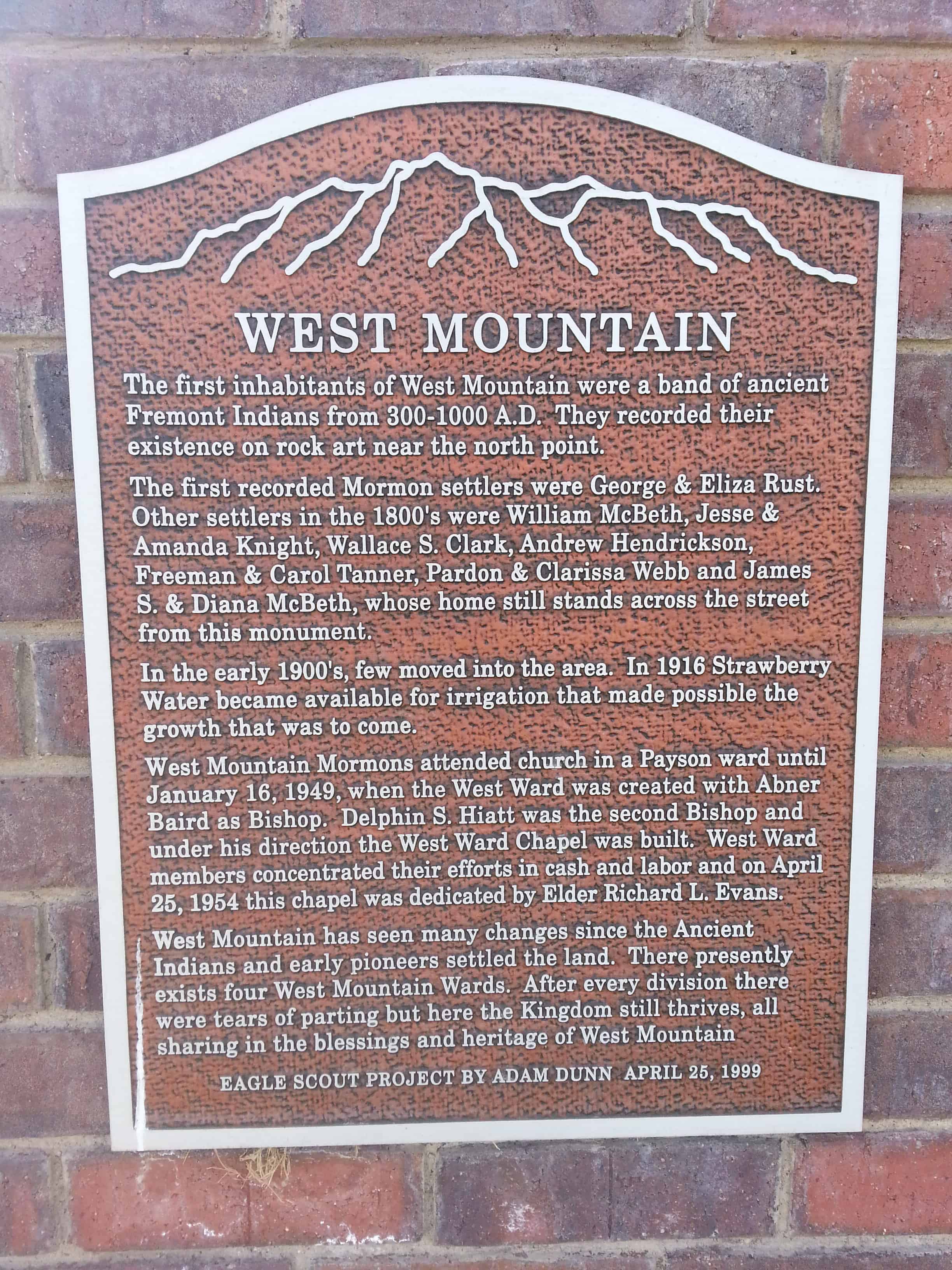
A monument at the chapel in West Mountain reads: The first inhabitants of West Mountain were a band of ancient Fremont Indians from 300-1000 A.D. They recorded their existence on rock art near the north point.
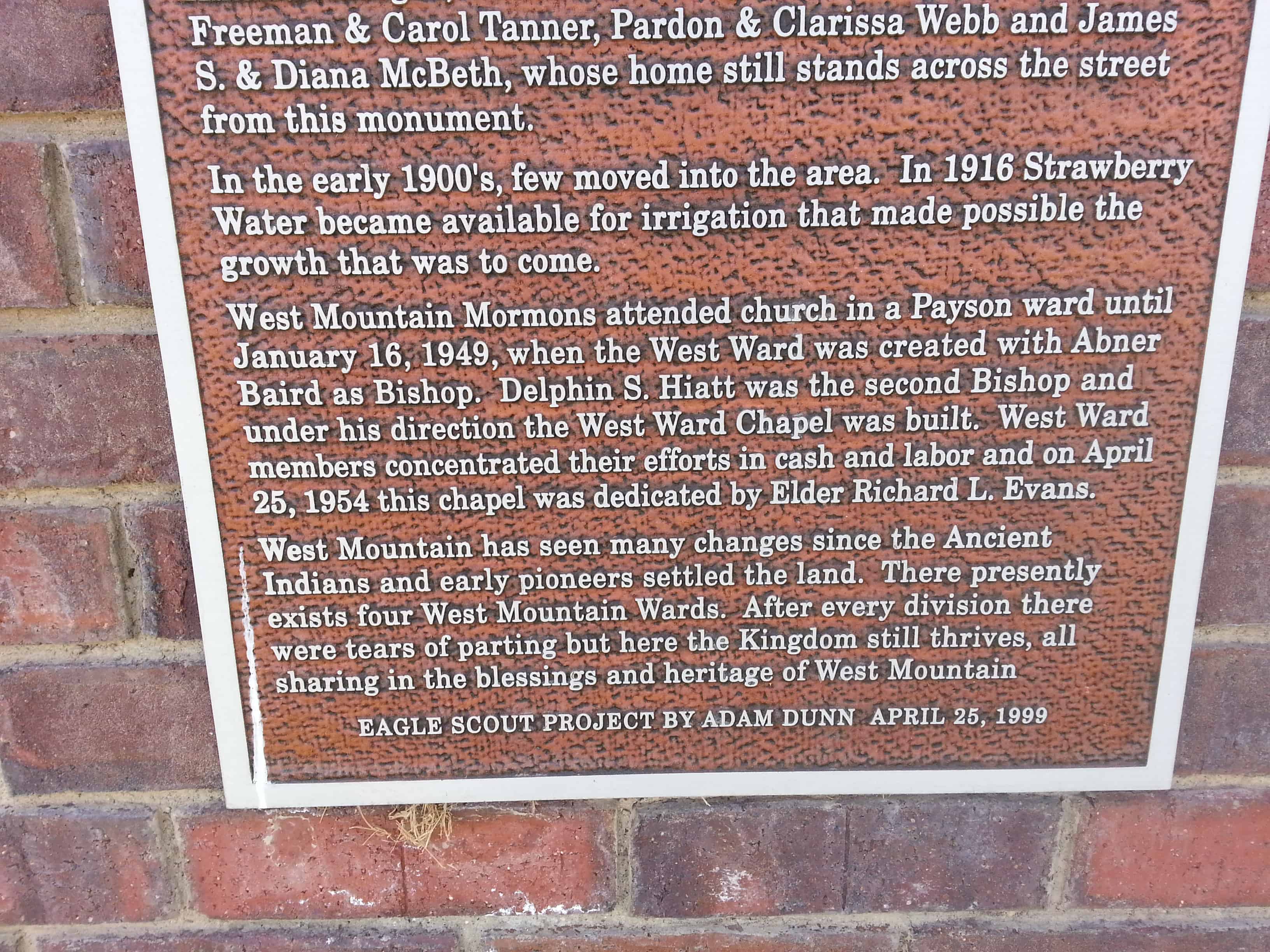
The first recorded Mormon settlers were George and Eliza Rust. Other settlers in the 1800′s were William McBeth, Jesse and Amanda Knight, Wallace S. Clark, Andrew Hendrickson, Freeman and Carol Tanner, Pardon and Clarissa Webb and James S. and Diana McBeth, whose home still stands across the street from this monument.
In the early 1900′s, few moved into the area. In 1916 Strawberry Water became available for irrigation that made possible the growth that was to come.
West Mountain Mormons attended church in a Payson ward until January 16, 1949, when the West Ward was created with Abner Baird as Bishop. Dephin S. Hiatt was the second Bishop and under his direction the West Ward Chapel was built. West Ward members concentrated their efforts in cash and labor and on April 25, 1954 this chapel was dedicated by Elder Richard L. Evans.
West Mountain has seen many changes since the Ancient Indians and early pioneers settled the land. There presently exists four West Mountain Wards. After every division there were tears of parting but here the Kingdom still thrives, all sharing in the blessings and heritage of West Mountain.
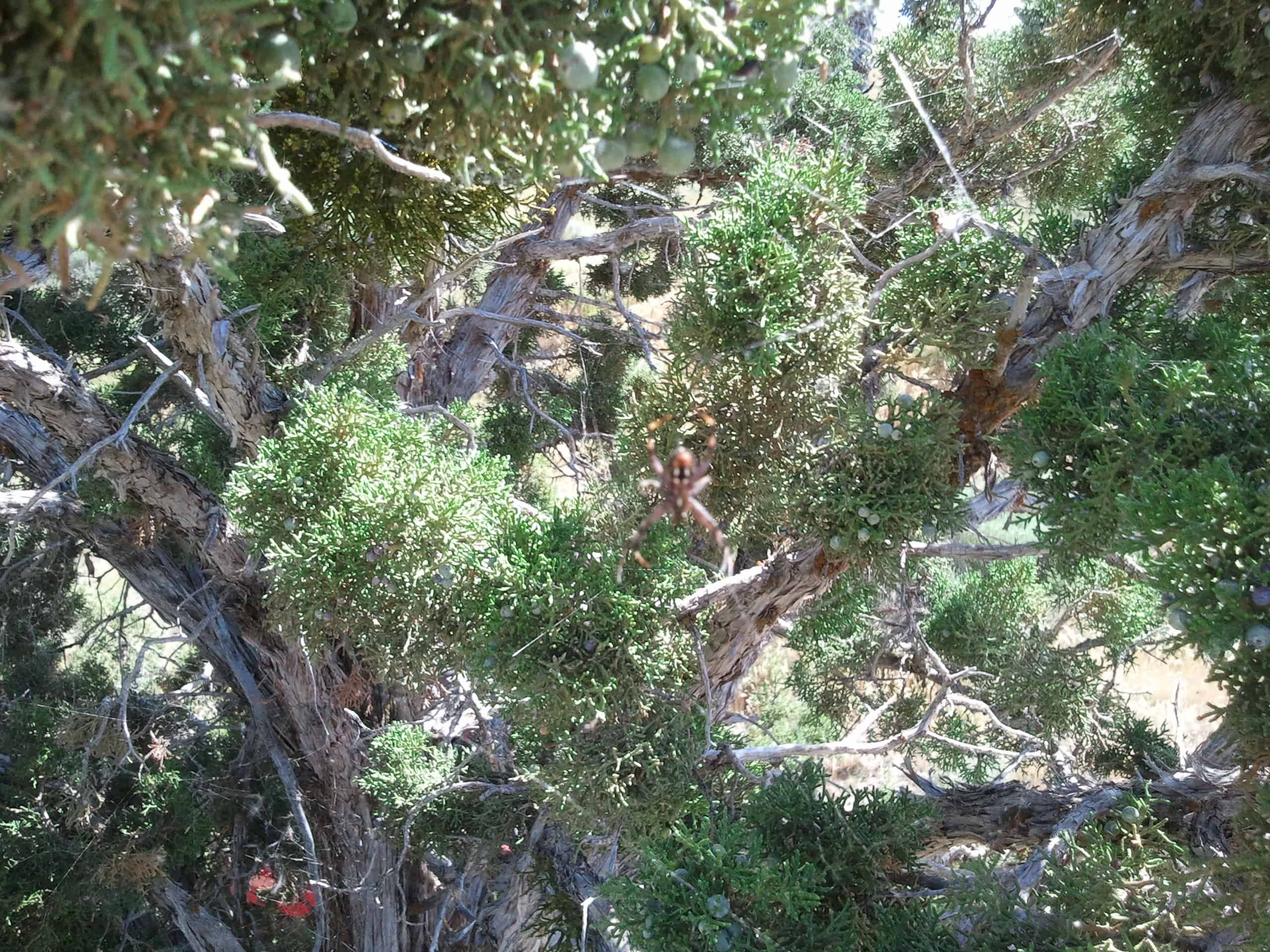
There are plenty of geocaches up there to keep you entertained, but be careful what time of year you go if you’re going to hike around at all because we call it spider mountain for a good reason, every bush, tree or rock has a spider on it, some bushes have hundreds. That was in July.
There’s a fun road that takes you up to the top, it’s a dirt road but it’s graded and you can take pretty much anything up there.
I saw this in a group in a member of on facebook….
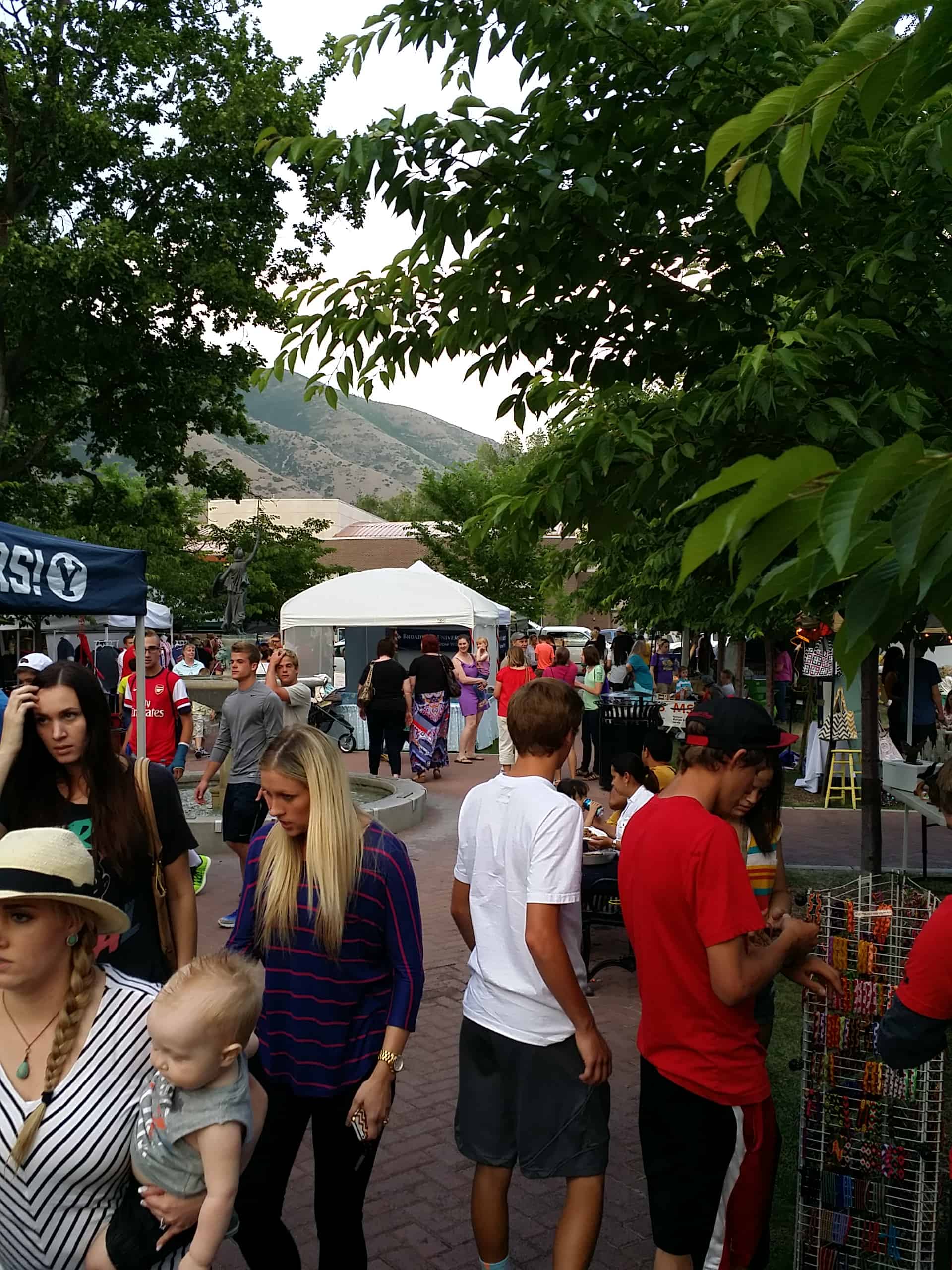
In case you didn’t know the history, the very first Art City Days celebration was held over the third weekend of June, in 1967. Here is the article with the very first committe. Prior to this, the Kolob Stake held a city wide celebration called Kolob Days.
Art City Days in a festival put on in Springville, Utah every summer.
Grandpa’s irrigation ditches left deep gashes in the side of Week’s Hill. Vaguely conscious that a great lake had once covered the entire valley, I became fascinated as a child with the fact that the layers of clay and sand in the irrigation washes had been laid down in a time so long ago that it was hard to comprehend. Yet, there it was, before my eyes.
I remember the feeling so well, of curling up against the clay walls, in the cool of an afternoon shadow, and with a fingernail scraping at the sand and thinking, “This sand is like a silent witness, a calendar of a time so long ago that it is unbelievable. The last time this sand was stirred was the day it settled in the bottom of that mystery lake that existed here so long ago.I remember thinking how neat it would be to find something more than just the sand. A leaf, maybe. Or a bone. Or, beyond all my imaginings, a skeleton of some prehistoric animal that had settled there and now was being revealed as irrigation water cut away at this clay calendar of time.
So when I read an article in the Deseret News telling that the remains of a giant Pleistocene ground sloth had been found in a sandy bank in Orem, I just had to see it.
Fortunately, state paleontologist Dave Gillette figured there would be a few nuts like me and opened the site for public viewing one whole day, right in the middle of the four or five days it took to remove the skeleton.
When I arrived, they had just exposed a femur and were carefully dissolving with vinegar the gravel around a huge kneecap. As Dave and his assistants worked, they explained to those of us behind a timid barrier of yellow “Police Line – Do Not Cross” ribbon the story of this particular ground sloth, as they perceive it might have been.
Somewhere between 11,000 to 14,000 years ago, the surrounding mountains were virtually the same as now, except they rose abruptly from the waters of the lake, which covered most of the state. About that same time, the lake broke through a natural dam in southern Idaho and drained into the Snake River for a long time, dropping its level somewhat and leaving broad deltas along the base of the mountains. Much of the eastern part of Sandy City is what remains of that delta as well as the city of Orem.
Well, our particular sloth, whose pelvis was in full view before our very eyes, was probably somewhere up the Provo River when he kicked the can and drifted down river.
The river, instead of cutting south after exiting Provo Canyon in the deep, broad valley it now flows along, shot out across the delta to a mouth on the west edge of the Orem bench. There, the sloth was deposited on the broad edge of the delta and buried in gravel, probably during the spring flood season.
One of Dave’s assistants described how he probably had all kinds of stuff growing on him, a traveling apartment house for algae and grubs. They assume this because his small cousin, the tree sloth, still extant in the Southern Hemisphere, is very slow due to a very low metabolism and, consequently, picks up lots of hitchhikers. Our sloth, because of his size, would have been slower still.
I can picture him now, dragging himself along the low hills, walking on the pinky claws of his rear feet, picking at the vegetation as he went. Though he averaged a thousand pounds, he had cousins in South America that weighed in at over 3,000. By the time of his death, his species was almost extinct.
Ron Robinson discovered our friend in the gravel several weeks ago when he found a single bone on the surface and showed it to his brother, a geologist. They experienced what I always would have liked to but never thought I would.
But at least I saw him, and in the hour or so that I sat and marveled at his history, a suppressed desire of my childhood was being played out. All in all, it was a very special afternoon, thanks to Dave Gillette, his associates, and the Utah County Chapter of the Utah Statewide Archaeological Society, who were giddy enough to share the discovery with the rest of us.
– Dennis Smith is an artist and writer living in Highland, Utah County.
In the 1860′s, a town named Granite was located at the mouth of Little Cottonwood Canyon by ore miners of Alta, Silverton and Tannersville. Its desertion began as the mines closed about 1882. The surrounding country had been settled by Latter-day Saints. Granite Ward organized July 1877, chose Solomon J. Despain, bishop. A rock ward house was used for worship and school until the completion in 1890 of the one-room building on this block.
Four miles east of Sandy City and south of Butler. In 1870 it was a good campsite for teamsters, quarrymen, and miners who were working in the Mormon church granite quarries and the mines in the vicinity. When transportation became more efficient during a time of reduced operations in this area, the camp was abandoned, only to be subsequently rejuvenated with modern, permanent residences. The town was named Granite because of its proximity to the granite quarries that provided the blocks for the Salt Lake Temple.