The first half of the twentieth century was a period of transition for the city of Sandy. The mining, smelting and small farm era was being replaced by a more diversified economy. In some ways the town still resembled the earlier predominantly agricultural community founded by Mormon settlers in the 1860s, especially as the “boom town” economy created around the mining industry waned. The population of Sandy remained around 1,500 for the four decades between 1900 and 1940. However, the city was defining itself as the political, economic, civic and social center for a major portion of the southeast Salt Lake Valley. This period of Sandy’s history laid the groundwork for city’s eventual transformation from small town to suburb.
The transition began with the failure of several canyon mines which fed Sandy’s economy. As sampling and smelting plants shifted to other locations, Sandy’s impact as a mining town diminished.
While the dominant force in the economy of Sandy during the 1870s, 1880s and 1890s was undoubtedly that of mining, the local agricultural community had not ceased to develop. The local agricultural economy saw Sandy through the mining boom and subsequent depression.
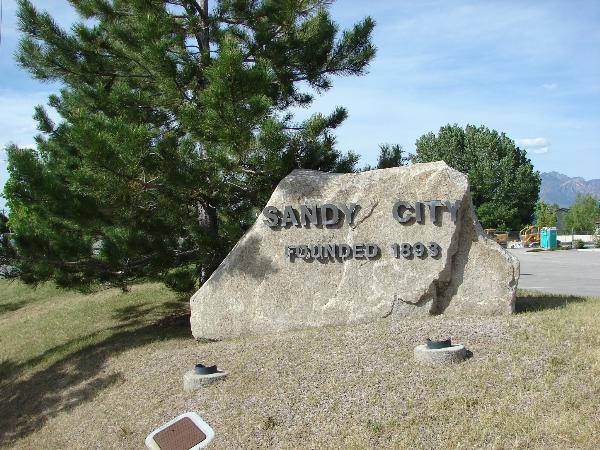
The community was also seeing a great deal of civic development. The city of Sandy was incorporated on September 26, 1893. By 1911 the city was managing its own water resources and had a volunteer fire brigade of twenty-five, complete with two fire trucks. Utah Power and Light began servicing Sandy in 1913, and by 1914 the city was managing a park and a cemetery.
Economically, the city was changing dramatically. The depletion of the mineral resources in the Alta area and the loss of the smelting and sampling industries had changed the economic structure of Sandy City significantly. Moreover, a series of national and local depressions beginning in 1893 and continuing to the onset of World War II had made small-scale single-crop agricultural enterprises nearly impossible. Sandy farmers had an especially difficult time, needing to overcome the additional challenges of water scarcity and the arid, sandy soil.
Fortunately irrigation methods improved steadily through these years, and several Sandy farmers were able to successfully continue to raise hay and grain. Despite the success of these specialized agricultural industries, most farming in Sandy during the first half of the twentieth century was purely subsistence level. Between 1900-1920, the number of farms doubled, but nearly all were very small scale. Eighty-five percent of the farms were smaller than forty-nine acres. Six farms were between two hundred and one-thousand acres, and one farm was 1,217 acres.
During the first half of the twentieth century, the majority of Sandy residents continued to live on their farms. Most managed to survive economically by combining subsistence farming with other occupations, primarily cottage industries and mercantilism. The majority of occupations were highly diversified. Sandy appeared to have at least one resident involved in occupations associated with early urbanization: a physician, a dentist, a barber, a plumber etc. The most common business listed was dry goods. The Sandy City Bank founded in 1907, employed four, and had the largest deposits of any bank in the southern portion of the Salt Lake valley. Several residents listed their civic responsibilities: city treasurer, postmaster, marshal, justice of the peace.
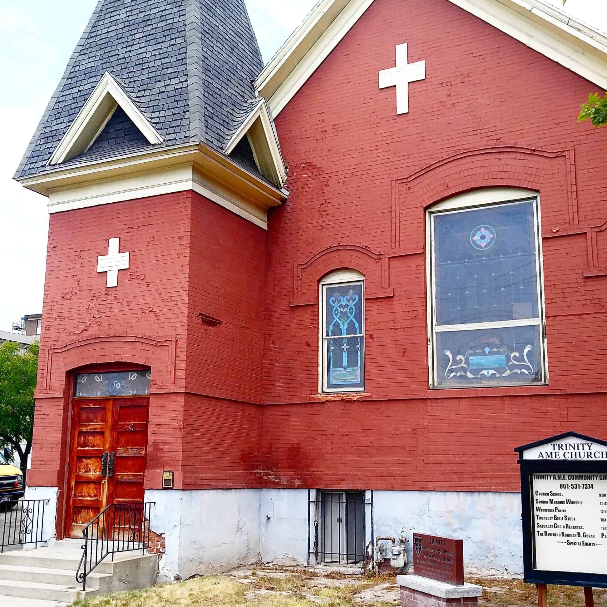
As the non-Mormon or “Gentile” population moved out of Sandy with the decline of the mining industry, Mormonism continued to be the dominant religion. By the 1920s, the LDS population had grown large enough to require the construction of two new ward buildings. The Sandy Second Ward meetinghouse was completed in 1921 and the Third Ward in 1926. In addition to the three LDS wards, the 1927-28 gazetteer lists two other congregations: the Sandy Congregational Church and the Inter-Mission (Swedish/Lutheran) Church.
Before the 1900s, transportation between Sandy and other towns in Salt Lake County had been limited to pedestrian or horse traffic on rutted, dirt roads. Several railroad lines and mining related spurs had converged at Sandy by the 1880s, but the service they performed was primarily freight. The extension of the State Street streetcar line from Murray to Sandy on July 4, 1907 gave Sandy residents easier access to the shops and recreations of Salt Lake City.
A few residents may have commuted to work in Salt Lake, but the city generally remained self-contained. Buses began to replaced streetcars in the 1920s, at about the same time State Street’s south end was paved for automobile traffic. The last streetcar to operated in the Salt Lake Valley was discontinued in the 1946. By that time, automobiles were becoming increasingly more common, even in Sandy.
The original township of Sandy had expanded to the west of the railroad tracks with the boom of the mining industry. After the turn of the century growth was slower. At the west boundary of the city, commercial buildings as well as bungalows and period cottages appeared along State Street, the main artery to Salt Lake City. The institutional buildings, both civic and religious, were also made of brick and exhibited a variety of popular styles and decorative elements. Of the remaining large commercial and institutional buildings, examples ranged from the Renaissance Revival to PWA Moderne.
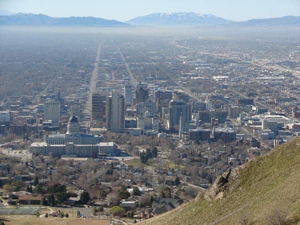
The Specialized Agriculture, Small Business, and Community Development Period in Sandy was a time of transition from farmlands and mining industries to quiet neighborhoods and small town civic pride. The architecture of the historic square mile of Sandy, as it is called, illustrates this transition, and stands in marked contrast to later development. In the years since World War II, Sandy has plated nearly 300 subdivisions and annexed over 10,000 acres, making it one of Salt Lake’s largest “bedroom” communities. Though Sandy’s city center has been moved adjacent to the mall, the city’s historic downtown is a distinctive reminder of Sandy’s small town past.
Olmsted Power Plant (one of the first power plants in America)
(Near the mouth of Provo Canyon, 1018 North 1630 East in Orem, Utah)
In 1830 Michael Faraday of England discovered that when a coil of wire was moved near a magnet, the magnet induced a current of electricity in the wire. Faraday’s experiments resulted in the dynamo which generates electricity.
Anxious to capitalize on this exciting new power source, investors throughout the world began to develop and build these dynamo machines.
Installation of the electric lines began which would transform the world from a labor-intensive planet to one in which electrical energy could multiply the efforts of people by thousands of times.
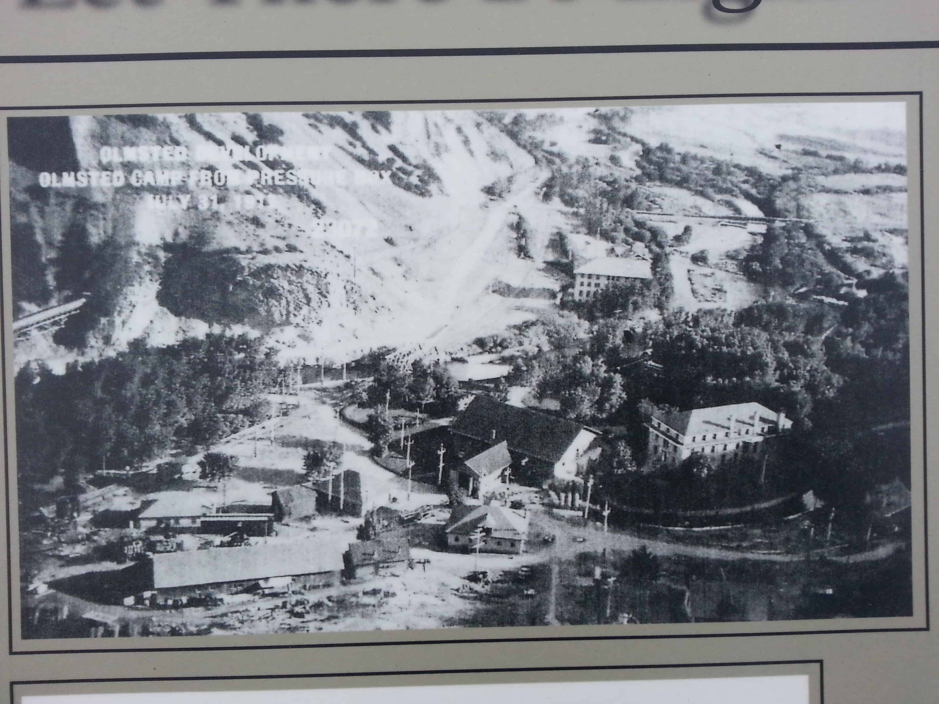
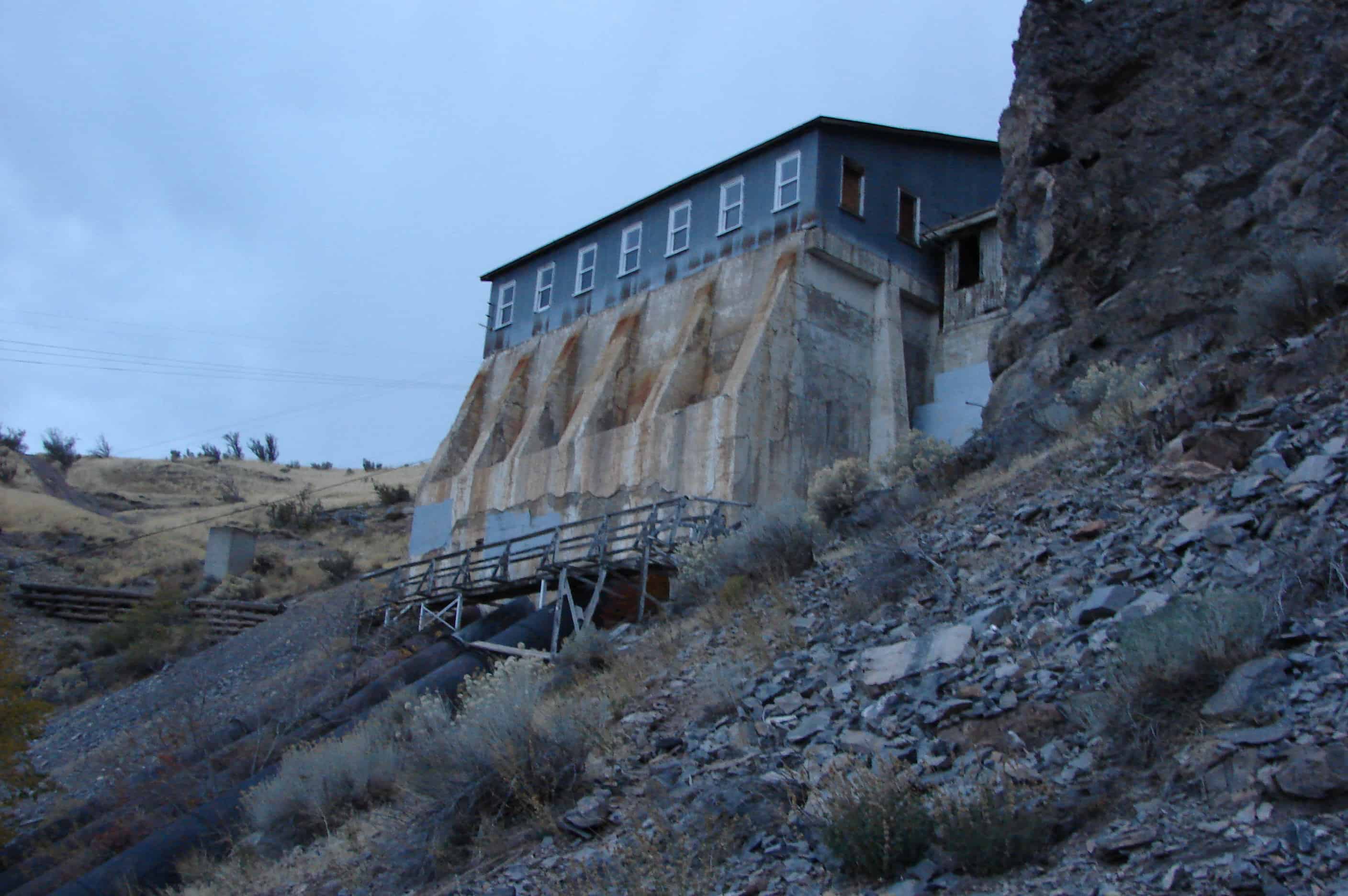
One of the early leaders in that effort in the United States was the Telluride Power Company. They selected a site at 1600 East 800 North, alongside the Provo River, to build one of the first power plants in America. Their Olmsted Power Plant became operational in 1904, supplying surrounding areas up to fifty miles away with electric power.
One of the unique features of the Olmsted Power Plant was that it used some of the most knowledgeable engineers in the country to establish on-the-job training programs for its employees. At the time, Olmsted offered one of only two competent training programs in electrical engineering in the entire United States, with the other one offered at Ohio State University.
In 1912, with less than 1,000 residents living on the Orem Bench, poles were erected to carry electric wires which were supplied with power generated at the Olmsted Power Plant.
Also in 1912, Utah Power and Light Company purchased the Telluride Power Company, which included the Olmsted Power Plant. This plant is still a fully-operational power plant. Also on the property are a few Craftsman-style residences, the 1937 “Home of Ideas” (a model home built to showcase the future of electricity use), and a large building constructed for educational use.
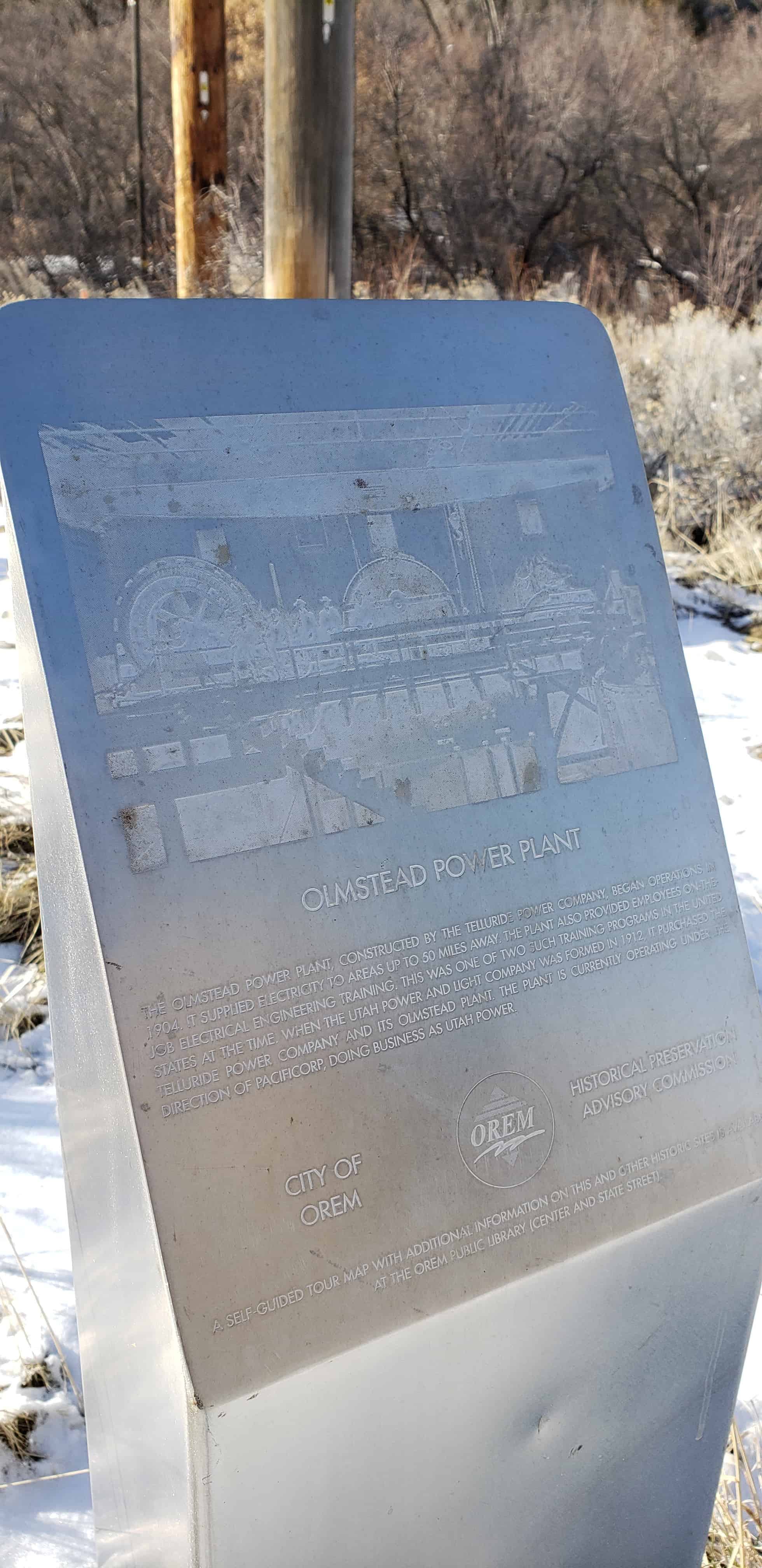
Olmstead Power Plant The Olmstead Power Plant, constructed by the Telluride Power Company, began operations in It supplied electricity to areas up to miles away. The plant also provided employees on the job electrical engineering training. This was one of two such training programs in the United States at the time. When the Utah Power and Light Company was formed in , it purchased the Telluride Power Company and its Olmstead Plant. The plant is currently operating under the direction of Pacificorp, doing business as Utah Power.
Let there be Light Olmsted Power Plant
The Olmsted Power Plant, a historic structure, was constructed in by a predecessor to Rocky Mountain Power and is still in use today. The plant generates power from water diverted from the Provo River. During the last 100 years, water has reached the plant by both wooden flume and steel pipeline.
The Olmsted Station Powerhouse is located at 1018 North 1630 East in Orem, Utah and was added to the National Historic Register (#72001262) on June 26, 1972.
In 1903, L. L. Nunn, a pioneer in the development of alternating current high voltage transmission, with his brother and chief engineer, P. H, Nunn, supervised construction of the Telluride Power Company’s Olmsted Station Power House and the establishment of the Telluride Institute. The Institute, which accommodated up to 40 students, was the first corporation sponsored electrical school in the United States. The school closed in 1912 when Utah Power and Light Company acquired Olmsted Station.
The building was completed April 12, 1904.
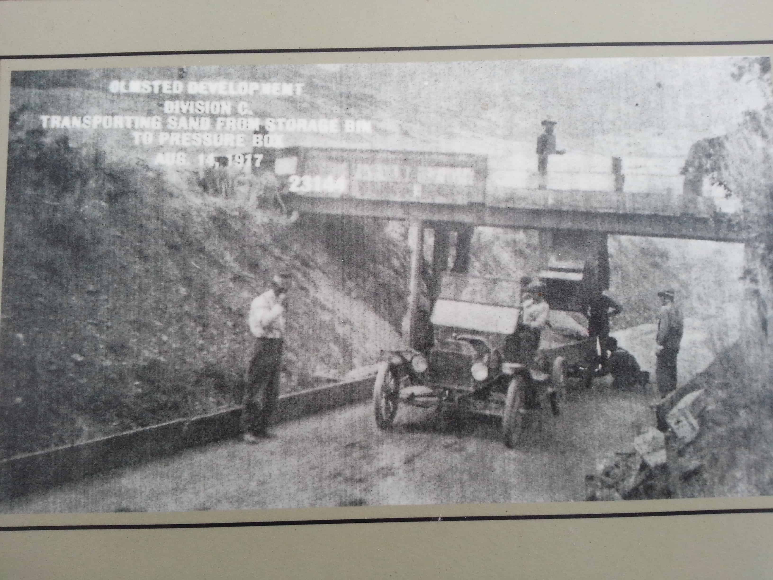
The 1917 extension (1917-1922), which called for a fourth turbine and generator, involved much additional construction. The original wood flume was replaced by a larger capacity wood flume; the pressure box was reconstructed to accommodate a fourth penstock; an I.P. Morris, 514 RPM, and a general electric generator, 2400 volt, 1895 Amp, were installed; one of two original water driven exciters was replaced by a motor driven type; extensive concrete work was done in the power house and an adjacent substation was constructed. In 1948-1951 a steel flume replaced the frequently damaged wood flume.
There are several nice parks in Provo Canyon, above is Canyon Glen Park.
Provo Canyon takes you from Provo, North-East up to the Heber City area, there are many gorgeous views, waterfalls, cliffs and colors. The Provo river winds through and is often filled with fly-fisherman and rafters. I have seen many deer, bald eagles and a moose among other more common wildlife.
There is a lot of history in Provo Canyon, most based around the river and water usage.
A list if the historic markers in the canyon (not complete yet, still adding them):
The Canyon was an alternate route into Utah Valley and plans were made to fortify the road against the U.S. Army. The Provo Canyon Guard Station was constructed in 1857 as a possible defense against the advancing U.S. Army during the Utah War.
The new road through Provo Canyon was completed in 1858, after the Utah War began. Because the road was not federally owned, but was operated by the territorial government, tolls were charged for maintenance.
In 1899, the Rio Grande Western Railroad came to Heber and started grading for the Provo Canyon line. The railroad continued to operate for over seventy years. It was very active in transporting large numbers of sheep to distant markets as Heber Valley became known as the sheep shipping center of Western America. The line was abandoned in 1969 by the Denver and Rio Grande railroad. Tracks were mostly removed and only those between Bridal Veil Falls and Heber were kept in place. The Wasatch Mountain Railway Company took over these tracks in 1969 and began “Heber Creeper” excursions in 1971. The “Heber Creeper” currently runs from Heber City to Vivian Park.
The Olmstead Spillway is seen up to the west as you’re entering the canyon, if you looked at the cliffs in 1904 this is the spillway for the Olmstead Flume you would have seen. Notice the size of the timbers used for construction and the water spilling from the overflow.
1904 Spillway
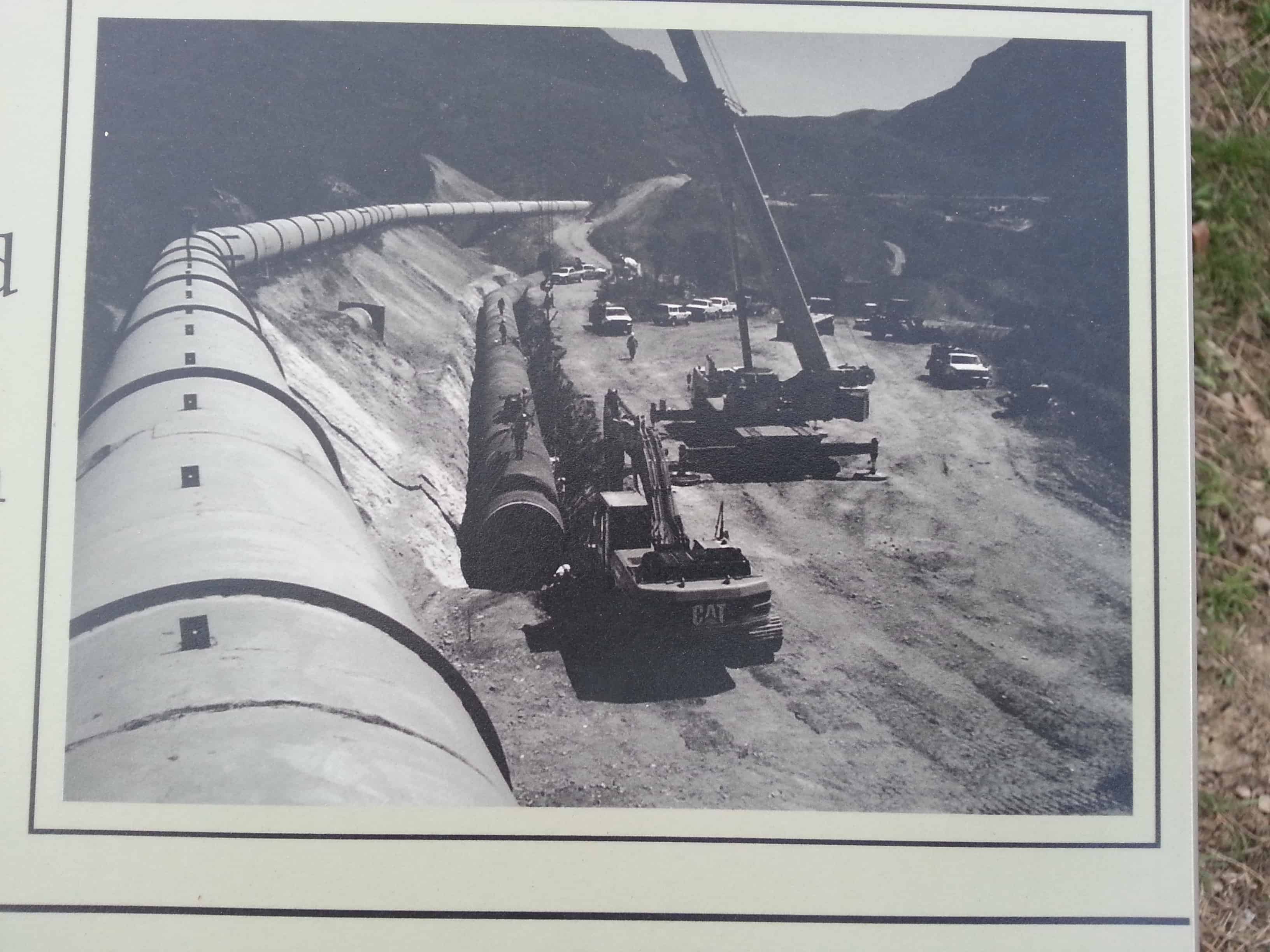
In 1949, the wooden flume was replaced with a steel pipeline and a siphon spillway instead of an overflow spillway. The pipeline shown in this photo is encased in concrete in the next photo.
1949 Spillway
2013 Spillway
Gravel Processing Plant On a hill a little past the spillway, a large gravel screening operation was set up to provide sand and gravel for the construction of new footings and the pressure box for the wooden flume. A reservoir was later constructed here.
***
Provo Canyon Gravel Processing Plant –
Flume Break In 1915, just north in the Canyon, the wooden flume broke and flooded a farm.
Provo Canyon Flume Break
The flume was repaired and eventually replaced in 1949 with a pipeline and an inverted siphon. In 2005, it was replaced again with a buried steel pipe. The Timpanogos Park is now where the farm once stood.
In 1899, the Rio Grande Western Railroad came to Heber and started grading for the Provo Canyon line. The railroad continued to operate for over seventy years. It was very active in transporting large numbers of sheep to distant markets as Heber Valley became known as the sheep shipping center of Western America. The line was abandoned in 1969 by the Denver and Rio Grande railroad. Tracks were mostly removed and only those between Bridal Veil Falls and Heber were kept in place. The Wasatch Mountain Railway Company took over these tracks in 1969 and began “Heber Creeper” excursions in 1971. The “Heber Creeper” currently runs from Heber City to Vivian Park.
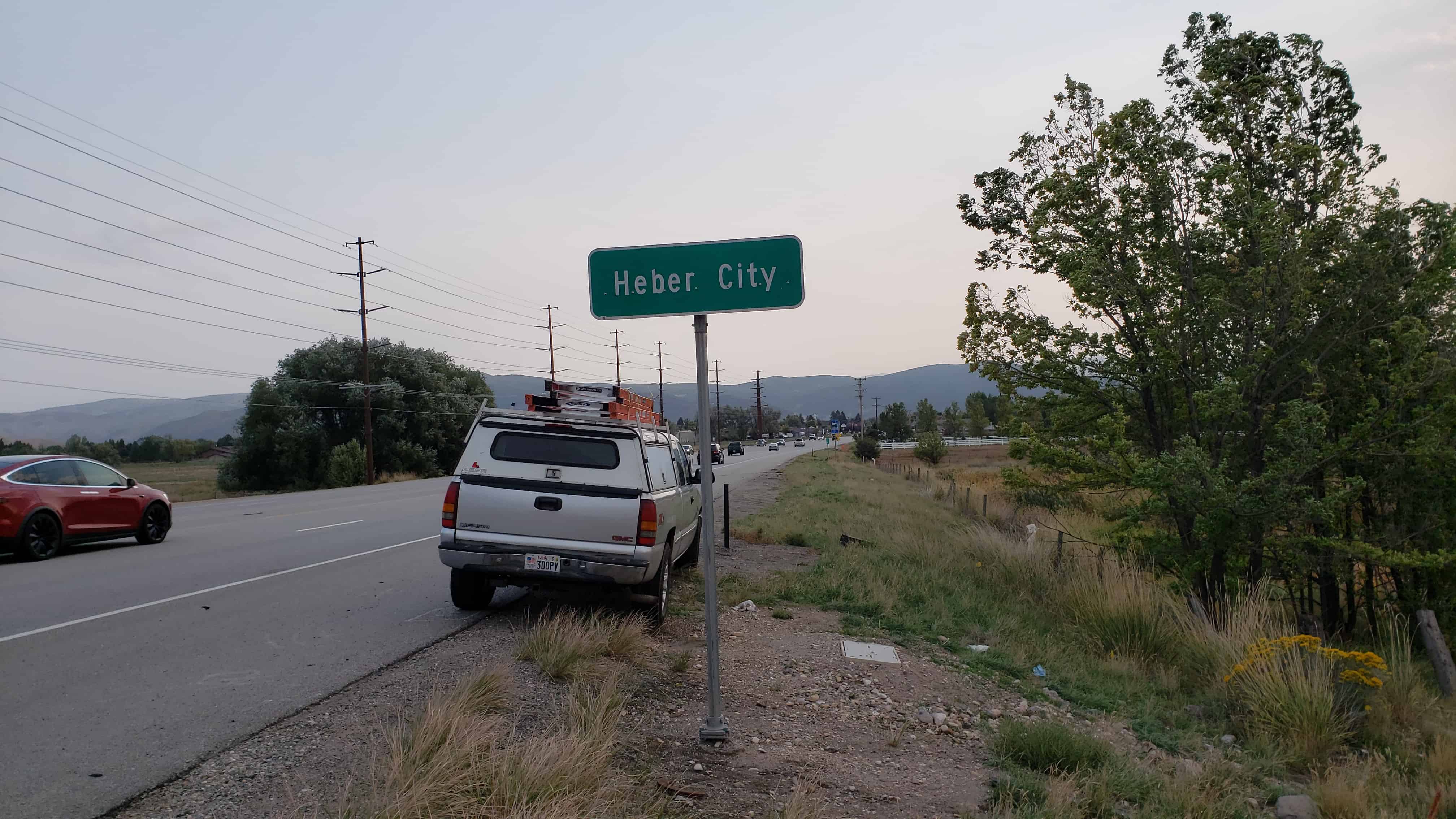
Heber City is a city in Wasatch County. The population was 11,362 at the 2010 census. Heber City was founded by English emigrants who were members of The Church of Jesus Christ of Latter-day Saints in the late 1850s, and is named after the Mormon apostle Heber C. Kimball. It is the county seat of Wasatch County. The original Heber City town square is located on the west side of main street between Center street and 100 north and currently houses city offices as well as the historic Wasatch Stake Tabernacle and Heber Amusement Hall. The city was largely pastoral, focusing largely on dairy farms and cattle ranching, and has since become a bedroom community for Orem, Provo, Park City and Salt Lake City.
Heber City was first settled in 1859 by Robert Broadhead, James Davis and James Gurr. John W. Witt built the first house in the area. The area was under the direction of Bishop Silas Smith who was in Provo. In 1860 Joseph S. Murdock became the bishop over the Latter-day Saints in Heber City and vicinity.
When the Mormons arrived in the Great Basin in 1847, they welcomed the opportunity to shape a virgin land into the Kingdom of God, and they pursued an aggressive colonization pattern. Heber Valley in the Wasatch Mountains, forty miles southeast of Salt Lake City and twenty-eight miles northeast of Provo, could not be settled until there was a wagon road through either Parley’s or Provo canyons. The first attempt to build such a road, however, was delayed by the Utah War and the Move South. Once Johnston’s Army was settled at Camp Floyd near Utah Lake, Brigham Young responded to appeals by residents of Provo to build a road up the canyon. By 1859 a road linked Provo and Heber Valley and newcomers who were looking for land settled the little valley communities of Heber City, Midway, Charleston, Center Creek, Daniels, and Wallsburg.
According to John Crook, the first historian of the area, most of the initial settlers came from England and had been converted by Heber C. Kimball. To honor Kimball, they decided to name the valley and the first settlement after him. The residents harvested their first crops in 1859 but then returned to Utah Valley for the winter. The next year they returned to make permanent homes. They initially built a fort for protection from Indian raids. Once fear of raids ended, they started to build homes in the surveyed townsite. The settlers built using locally quarried red sandstone as well as adobe and brick. The sandstone was also shipped and used in buildings in other parts of the state.
When the area was settled, the northern part of what is now Wasatch County (including Heber City and Midway) was in Salt Lake County and the southern part (including Wallsburg in Round Valley) was in Utah County. In 1862 the Utah legislature created Wasatch County and made Heber City the county seat. At the time the county was created there were more than 1,000 people living in the area. Heber City was incorporated as a town in 1889 and as a city in 1901.
Hinckley was first settled in 1876 by Estraus F. Pack. In 1891, the name Bloomington was dropped and the town was renamed Hinckley after Ira N. Hinckley.
Just about a half mile up Hobble Creek Canyon from Springville is what we always called Hobble Creek Reservoir as kids growing up near it, but a lot of “official” things I see call it “Hobble Creek Catch Basin.” It was usually a fun place to fish and swim and raft and play but occasionally would be empty.
The fishing was good, I caught Rainbow Trout and German Brown Trout in it. I would often walk in the creek from the Reservoir to the golf course as a kid.
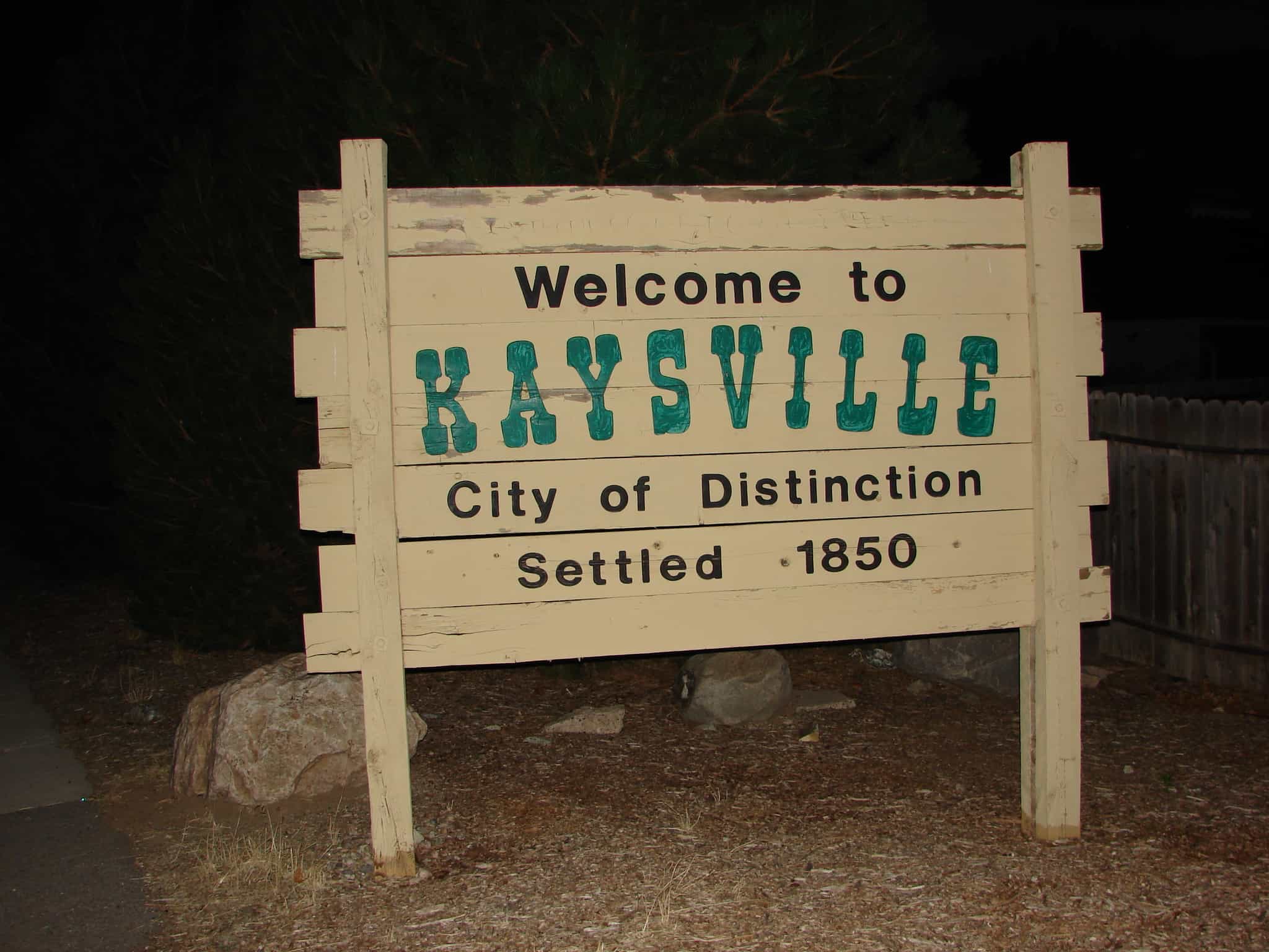
The Kaysville area was originally settled by Hector Haight shortly after Mormon pioneers arrived in 1847. He had been sent north to find feed for the stock and soon thereafter constructed a cabin and brought his family to settle the area. Farmington, Utah, also claims Hector Haight as its original settler. Two miles north of Haight’s original settlement, Samuel Holmes built a cabin in 1849 and was soon joined by other settlers from Salt Lake, namely Edward Phillips, John Green, and William Kay.
An Elephant I saw in someone’s yard in Kaysville.
Although settlement began in the 1840s, the name of Kaysville connects with the fact that in 1851 William Kay was made the bishop in the vicinity by Brigham Young and Heber C. Kimball.
After the move south in 1858 because of the Utah War there was an attempt to rename the community Freedom, but Brigham Young convinced the residents to retain the old name.
In 1868 Kaysville became the first city incorporated in Davis County.
An adobe meetinghouse was built in 1863. Its was replaced by the Kaysville Tabernacle in 1914. In 1930 Kaysville had 992 people. They all were in the Kaysville Ward which also covered most of the rest of the Kaysville Precinct.
By 2008 there were seven Mormon stakes (similar to a diocese) in Kaysville.
In November 2009, Kaysville voters elected Steve A. Hiatt as Mayor. He was sworn in on January 4, 2010.