• About JacobBarlow.com
  • Cemeteries in Utah
  • D.U.P. Markers
  • Doors
  • Exploring Utah Email List
  • Geocaching
  • Historic Marker Map
  • Links
  • Movie/TV Show Filming Locations
  • Oldest in Utah
  • Other Travels
  • Photos Then and Now
  • S.U.P. Markers
  • U.P.T.L.A. Markers
  • Utah Cities and Places.
  • Utah Homes for Sale
  • Utah Treasure Hunt

JacobBarlow.com

~ Exploring with Jacob Barlow

JacobBarlow.com

Tag Archives: Historic Districts

City Creek Canyon Historic District

08 Wednesday Sep 2021

Posted by Jacob Barlow in Uncategorized

≈ 4 Comments

Tags

City Creek Canyon Historic District, Historic Districts

City Creek Canyon is significant as a large, open park area near the center of Salt Lake City. The first park in the city to take advantage of existing natural terrain, the park is defined by the edges of the shallow canyon, which separates the Capitol Hill area from the Avenues. The park documents the efforts of city improvement groups, part of a national movement that saw the organization of such federations as the American Civic Association/ devoted to the promotion of civic improvement and city planning. Part of the park includes Memory Grove, a memorial park created after World War I.

The district is listed on the National Register of Historic Places (#80003919)

Because of the strong geographic boundaries of the canyon, a small group of residences are popularly associated with the canyon area and are included in the historic district. Replacing earlier homes built in the area the houses were built in styles typical of the period from 1880 from 1920. They include residences of the families of Mornom apostles Erastus Snow and Parley P. Pratt, and several other prominent Mormon Church leaders.

In the 1860’s and 1870’s Brigham Young gave and sold sections of the area to members of his family and to his friends. Several of these people built houses in the lower section of the canyon mouth, probably because the canyon was wider at that point. The upper section of the canyon area remained undeveloped because it was narrower and more difficult to reach. P.J. Moran, a construction firm, and the city water works were developed in this area.

The city acquired the upper section of the canyon in 1902 when a Mrs. Young sold some property in the canyon to the city. That same year the city council passed a resolution suggesting that the canyon be made into a park because it was a natural site for recreation and there was no park in the area. The council also voted to ask the city engineer to straighten the channel of City Creek and build a sixty-six foot road between State Street and Canyon Road. The park would be called City Creek Park and it would be open for the use of the citizens of Salt Lake.

Although the city passed the resolution to create the park in 1902 and similar suggestions were made during the next few years, the first improvements were not made until 1914. At that time some trees were planted by the mayor. The major developments in the park did not come until after World War I, however. At that time the Service Star Legion, a group of women whose sons had served during World War I, asked the city if the area could be set aside as a memorial to those who died during the war. A similar park had been made in Baltimore in 1919 by the Legion. The city agreed to the proposal, and the area was dedicated as a manorial park in 1924. Since then a number of monuments have been added and it is now a memorial to all men and women who lost their lives in defense of their country.

South of Memory Grove there are two small green areas in the center of Canyon Road. Originally Canyon Road had been built in two sections, with one side on each side of the City Creek. In 1909 the city decided to put the creek underground to protect the water supply and to prevent accidental drownings in the creek. About that time the residents of the area petitioned the city to make the creek bed that was being filled in into park areas. By 1912 a small formal park had been completed on the strip between 3rd and 4th Avenue and a green area was constructed in the park area above 4th Avenue.

Today Memory Grove and the small Canyon Road parks are unique in Salt Lake City and very unusual for downtown settings in large cities. The parks are within a few blocks of the downtown shopping center, yet since they are set in the mouth of a canyon, they are isolated from the bustle of city life. People from all walks of life use the park to escape from their daily routines.

The district also contains fifty-two residences, of which there are six landmarks, thirty-five contributory and seven non-contributory houses.

In the 1860’s and 1870’s, Bri^iam Young started to divide his property in the area. Much of it went to his children who later sold it to Salt Lake residents. The first homes were built in the area in the 1880’s. In 1880 Helaman Pratt, a son of Parley P. Pratt, acquired some property from J.C. Kinsberry, who owned a mill in the area. Pratt built a house in the area that is still standing. In the early 1890’s Franklin Richards Snow, a son of Erastus Snow, bought the house. Snow was instrumental in forming the Consolidated Wagon and Machinery Company, a leading Salt Lake City business, and he later became an investment broker. His sons and sons-in-law were among those that built other houses in the Canyon Road Subdivision.

Snow was born in Salt Lake in 1854 and his family moved to St. George in 1862. In 1888 he cams to Salt Lake and started the Consolidated Implement Company with his brother George H. Snow. He served as secretary and treasurer of the company and the Consolidated Wagon and Machine Company. He later became an investment officer.

Snow was an active member of he Mormon Church. He was the first stake superintendent of religion classes and on the High Council. He was also a counselor to the stake president, Richard W. Young.

Later Pratt’s brothers, Mathoni and Parley P. Pratt, Jr. also built in the area. Mathoni built his house in 1887 and it is still standing. Qrson F. Whitney, an assistant LDS Church Historian, bishop, and Mormon Apostle, bought his home in 1905. Whitney is also remembered for his three volume History of Utah. Parley P. Pratt Jr. ‘s home has been replaced by an apartment building, but two small houses that his widow, Brigamenia, built are still standing.

Another pioneer who lived in the area was Erastus Snow, one of the first members of Brigham Young’s party to enter the Great Salt Lake Valley in 1847. Snow lived in St. George for most of his life. Erastus Snow was a polygamist and in 1888 he built the house on Canyon Road for his second wife, Minerva. Snow died in the house that same year.

One of the most unusual sites in the area is Ottinger Hall. The hall was built in 1900 by the Volunteer Fireman Association and is listed on the National Register.

The houses in the City Creek Cmypn Historic District are similar to the houses built in the Avenues and in Capitol Hill. The majority of them were built between 1880-1919 and are similar to the houses built in Salt Lake during that period.

The four houses that were built in the 1880s are mainly high pioneer and early Victorian style. The Minerva Snow house is a high style pioneer architectural plan while the Blair-Alt home which was built during the sane period of time represents early Victorian style. Five houses were added to the area during the 1890s. They are mainly vernacular with some elements of Italianate and Eastlake. The Hermann Anderson house is one of the best examples of Eastlake ornament in Salt Lake City.

The majority of the homes in the district were built between 1900-1920 which was the tine that Salt Lake was experiencing a great deal of growth. In the 1910s bungalows and pattern book houses were constructed. The six homes built in the 1920s were bungalows, influenced by Tudor and Prairie styles.

The City Creek Canyon Historic District is a large park area with a small residential section at the south end. The parks and the homes document an important era of city growth and civic improvement.

Sites in the City Creek Canyon Historic District

  • 170 Canyon Road – 1925
  • 172 Canyon Road – Boyce Home – 1922
  • 174 Canyon Road – 1967
  • 180 Canyon Road – 1939
  • 183 Canyon Road – Blair Home – 1888
  • 193 Canyon Road – 1941
  • 194-198 Canyon Road – Middaugh Home – 1923
  • 197 Canyon Road – 1938
  • 204 Canyon Road – 1904
  • 207 Canyon Road – Anderson House – 1892
  • 208 Canyon Road – Squires/Cobb House – 1903
  • 211 Canyon Road – Kimball House – 1904
  • 212 Canyon Road – 1906
  • 217 Canyon Road – Snow House – 1888
  • 218 Canyon Road – 1901
  • 220 Canyon Road – 1903
  • 224 Canyon Road – 1903
  • 225 Canyon Road – 1927
  • 226-228 Canyon Road – 1946-47
  • 230-230A Canyon Road – 1916
  • 231 Canyon Road – Walter Squires – 1905
  • 232-234 Canyon Road – 1939
  • 233 Canyon Road – Ottinger Hall – 1900
  • 236 Canyon Road – 1903
  • 238 Canyon Road – 1930
  • 244 Canyon Road – 1899
  • 248 Canyon Road – 1904
  • 252 Canyon Road – Pratt/Snow House – 1880
  • 260 Canyon Road – 1919
  • 266 Canyon Road – 1919 – Arthur L. Smith
  • 272 Canyon Road – 1919
  • 278 Canyon Road – 1911
  • 282 Canyon Road – 1905
  • 288 Canyon Road – Ralph Snow – 1905
  • 485 Canyon Road – Memory Grove – 1924
  • 181 Canyon Side – Nebeker House – 1924
  • 226 Spencer Court – 1911
  • 230-234 Spencer Court – Spencer Dplx – 1916
  • 238-240 Spencer Court – 1916
  • 142 3rd Ave
  • 114 4th Ave – Calder House – 1923
  • 116 4th Ave – Ross House – 1926
  • 121 4th Ave – Pratt House – 1897
  • 123 4th Ave – Pratt House – 1898
  • 125-127 4th Ave – 1940
  • 136 4th Avenue – Moyle house – 1923
  • 145 4th Avenue – 1903
  • 146 4th Avenue – 1969
  • 151 4th Avenue – Kimball House – 1902
  • 152 4th Avenue – Whitney House – 1903
  • 156 4th Avenue – Pyper House – 1903
  • 159-161 4th Avenue – Best House – 1907
  • 160 4th Avenue – Pratt/Whitney House – 1887
  • 163 4th Avenue – Ezra O. Best –
  • 165 4th Avenue – Best House – 1902

Preservation Utah‘s pamphlet from the 53rd Annual Historic Homes Tour of the City Creek Canyon Historic District on May 18, 2024 said this about the district:

In the early years of settlement, City Creek was an essential source of water for residents of Salt Lake City. However, City Creek was also subject to intense, destructive floods, and an aqueduct constructed in the late 1860s failed to control flooding, so in the early 1900s the creek was enclosed in a concrete pipe that ran under Canyon Road and still runs under North Temple Street today.

City Creek was also the source of power for various mills and a foundry. The most notable enterprise was Brigham Young’s Empire Mill located just north of the current site of Memorial House that served as the namesake for the canyon tract (basically, the entire canyon) that was deeded to Young in 1857 by the territorial legislature. For years, entry to the canyon was controlled through the Eagle Gate, and those desiring to enter were required to pay a toll.

In the 1870s, Brigham Young began apportioning land in City Creek Canyon to family and friends. But residential development happened slowly with the first homes not constructed until the 1880s. As late as 1900, only a handful of residents inhabited the canyon, perhaps due to the fact that floods still regularly raged down the canyon. But with the turn of the century and the construction of the pipeline, construction accelerated and by 1920 the number of houses had more than quadrupled. This same period saw the development of City Creek Park, the oval occupying the center of the neighborhood. By 1940, City Creek had been built out, and the neighborhood that you see today has changed little since.

The City Creek neighborhood is distinctive because of its setting-unlike that of any other in Salt Lake City-with houses crowding the canyon sides and clustered along the creek. Because of its unique character, City Creek was designated a historic district in 1980. But the canyon also provides a distinctive setting for the house on East Capitol Street. Sitting as it does along the canyon. rim, it faces the canyon and is as much of the canyon as it is of Capitol Hill. (In fact, until the late 1920s East Capitol Street was called West Canyon Road.) And the home on Third Avenue sits at the canyon mouth, where the canyon opens to the city, and for years would have been just steps away from the creek.

So this year’s tour is in many ways as much about setting as it is about the architecture of individual houses, about how a particular feature-in this case, a canyon-can inform the setting for individual houses and even an entire neighborhood.

Jefferson Avenue Historic District

09 Sunday May 2021

Posted by Jacob Barlow in Uncategorized

≈ 3 Comments

Tags

Historic Districts, Jefferson Avenue Historic District, NRHP, Ogden’s Central Bench Historic District, utah, Weber County

The Jefferson Avenue Historic District is a residential area in Ogden, Utah, developed between the 1880s and 1920s. The district includes both sides of Jefferson Avenue between 25th Street and 27th Street. It is bounded by the central business district to the west, and residential areas to the north, east
and south. It was added to the National Register of Historic Places (#98001214) on September 25, 1998. Washington Boulevard, located two blocks to the west, is the main street running through Ogden. The standard grid system plan, typical of hundreds of Utah towns, is also characteristic of Ogden. The district is within this grid, in which the north-south running streets (Jefferson Avenue) are generally local residential in nature, with less traffic than the east-west streets which function as minor collectors (25th Street, 26th Street and 27th Street). The district includes 40 buildings, of which 32 (80%) contribute to the historic character of the district.

The Jefferson Avenue Historic District is a residential neighborhood that attests to the rapid growth and prospering economy of Ogden during the decades from 1880 to 1900 by its abundance of substantial Victorian period homes. As in other towns along the Wasatch Front, the preferred residential areas in Ogden have been on the east side, moving farther up the bench as utility services were improved and the population increased. The Jefferson District easily fits into this pattern. It is located only two blocks east of Washington Boulevard, originally Main Street, close to the heart of the city. Although some of the buildings replaced earlier dwellings, most were the first on their lot.(*)

Conforming to the grid pattern of planning preferred in the Mormon culture, the Jefferson District is in this respect part of a greater scheme. Studies of Sanborn Insurance Maps and the extant buildings in the Jefferson District suggest a progression of phases. It grew from a sparsely settled neighborhood of smaller homes, to denser development and larger houses in the Victorian style. Yet some smaller, more modest dwellings survived and multiplied in the midst of the Victorian presumptuousness, indicating that the area was not exclusively upper class, but that it also was within reach of the middle classes for building or rental property. Unique house specimens are nevertheless an important factor of the district’s character. Some architect-designed homes are known (i.e., 2523 Jefferson was designed by William W. Fife, a prominent Ogden architect), while others show the originality and sophistication that suggest an architect’s involvement (i.e., 2580 Jefferson and 2504 Jefferson).

The Jefferson District could be considered the first “wave” of residential development that marched up the bench east of the main commercial district, beginning with the prosperous economy of the 1890s and continuing until after the end of World War I. When the height of the Victorian period waned and the next generation of the prominent families of the neighborhood moved farther east (e.g., Eccles Avenue Historic District), the demand for housing close to the downtown area increased, and as the larger homes were sold, or the original owners died, the houses were divided into rental units to meet this demand.

Ogden grew and prospered so quickly in the late nineteenth century that it attracted real estate promoters and boosters from all over the country. William Hope “Coin” Harvey, perhaps the most famous of these, lived in the Jefferson District. Harvey (2671 Jefferson), who along with his group of
boosters known as the Order of Monte Cristo, advertised Ogden as a railroad, mining, and livestock center. As a ploy to endorse Ogden’s real estate, Harvey promoted Ogden’s Carnival, a grand event planned to coincide with New Orleans’ Mardi Gras. Although the carnival only lasted for a few days in 1890, Ogden gained national exposure and a boost in business and real estate. Newspapers outside Utah proclaimed Ogden as the “Boom City of West.” Although Ogden probably felt a slowing of business and growth in the mid 1890s with the “Cleveland Depression,” it was booming again by the turn of the century. The townspeople built impressive brick buildings and invested in a host of new export industries which were serviced by the railroad: canning, flour mills, sugar beet production. One example of this is David Eccles (2580 Jefferson) who was the president of the Amalgamated Sugar Company and was instrumental in the development of other Ogden industries as mentioned previously. After his death, his son David C. Eccles (607 25th Street) took over as vice-president and general manager.

Of course, the railroad lay behind most of this prosperity. Railroad business fostered the growth of industry and banking, providing revenue for the construction of beautiful buildings and parks. Many of Ogden’s leading financiers lived in the Jefferson District.

  • David C. Eccles (607 25th Street) was the president of Utah National Bank of Ogden.
  • Patrick Healy (2529 Jefferson) was a vice-president of Commercial National Bank.
  • Abbott R. Heywood (2540 Jefferson) was a vice-president of Commercial National Bank.
  • Isadore Marks (2547 Jefferson) was an important member of the Ogden community and was representative of the non-Latter Day Saint Utahns who had moved to the intermountain west after the establishment of the railroad.9 He was also a vice-president of Commercial National Bank.

Some of Ogden’s leading entrepreneurs who became wealthy by participating in railroad-related businesses also lived in the Jefferson District.

  • Thomas H. Carr (2520 Jefferson) was one of the founders of Rexall Drug Stores, and owned and operated a prosperous drug store on 25th Street.
  • Patrick Healy (2529 Jefferson) built the Healy Hotel located on the corner of Wall Avenue and Ogden’s popular 25th Street, which was directly across from the Union Station, the hub of railroad activity in Ogden.
  • Hiram H. Spencer (2555 Jefferson) was the mayor of Ogden and also the manager of the Eccles Lumber Company. He was the president of the Ogden Rapid Transit, and a vice-president of Amalgamated Sugar.

Many members of the controlling body that made up Ogden’s local government lived in the Jefferson Avenue District. Among them were:

  • Judge Jacob Boreman.(2554 Jefferson) served as a second district judge during Utah’s territorial period and practiced law in Ogden.
  • Abbott R. Heywood (2540 Jefferson) was the mayor of Ogden and also a vice-president of Commercial National Bank.
  • Edmund T. Hulaniski (2523 Jefferson) who was significant to Ogden’s politics by serving as city, county, and district attorney, police judge, and chairman of the county and city Republican Committees. From 1907 to 1909 he was a member of the Utah State Senate. He lived in the
    Jefferson District from 1882 until his death in 1928.
  • Thomas A. Whalen (2532 Jefferson) served on the city council, and was also a member of the executive committee for Commercial National Bank.

There were other influential people not previously mentioned, that lived within the Jefferson District and contributed significantly to the growth of Ogden.

  • Emil Bratz (2640 Jefferson) established a successful real estate, loan and investment company and was the director of the Hurst Realty & Mercantile Company of Ogden.
  • William Eccles (2555 Jefferson) was the brother of the influential businessman, David Eccles. William was affluent in his own right as the president of W.H. Eccles Lumber Company.
  • Robert H. Hinckley (2560 Jefferson) was one of Ogden’s most prominent citizens who was recognized for local, state, and national achievement. He established the Hinckley Dodge automobile dealership in Ogden, was a director of the Chamber of Commerce, president of the Rotary Club, and helped develop the Ogden Airport and was a vice-president of Utah Pacific Airways. With his political success, he was asked to join the Franklin D. Roosevelt Administration as the Assistant Secretary of Commerce and the Director of Contracts Settlement. He established the Hinckley Institute of Politics at the University of Utah. He and Ed Noble worked together to purchase the RCA network and reorganize it as the American Broadcasting Company (ABC).
  • Abrelia Clarissa Seely Hinckley (2560 Jefferson) was also a contributing person in Ogden. She was a founder of the first Board of Directors of the Ogden YWCA, and also the first president of the
    Utah Wool Growers Association Women’s Auxiliary.
  • John Hoxer (2540 Jefferson) manufactured and sold canvas products. He owned and operated Ogden Tent & Awning Company, a nationally known business in the canvas industry.
  • Fred M. Nye (2546 Jefferson) was a leading Ogden retail merchant. He also served on the Ogden City Board of Education for 20 years, and was a Trustee of Utah State Agricultural College (now Utah State University). He was elected to the Ogden City Charter Commission, where he aided in drafting the City’s council-manager form of government.
  • Adam Patterson, Sr., (2547 Jefferson) was the organizer, president and general manager, of the Vineyard Land and Livestock Company. He was also a director of the Utah-Idaho Central marriage, theocratic rule, and Mormon-Gentile conflict. Upon his retirement from a judgeship, he moved to Ogden where he practiced law and engaged in real estate.
  • Thomas Jordan Stevens (2575 Jefferson) served in several capacities of government on the City and State level, and at one time was the Weber County Sheriff. He was the executive vice president of the Utah Loan and Trust Company, and served as advisor to two territorial Governors. He was appointed as Commissary General on the staff of Governor Heber M. Wells, and held the rank of Colonel.
  • William H. Wattis (2649 Jefferson), along with his brothers, established the Utah Construction Company, which grew into a major international multibillion dollar business corporation. Among his other business interests were the Vineyard Livestock Company which controlled some 40 ranches of 250,000 acres of land located in Utah, Nevada and Idaho. He was also the president and vice president of several Ogden companies, and the president of Dee Memorial Hospital of Ogden. In 1919, he was listed as one of the Men Who Are Making Ogden.
  • Thomas Whalen (2532 Jefferson) was an active real estate man. He was also involved with the executive committee of Commercial National Bank, served for two years on the Ogden City Council, and was a tax appraiser. He also built the house located at 2540 Jefferson as the mirror twin of his own and in which John Hoxer resided.

Most of the buildings within the district are still used as residences. Two churches were built in the district in the historic period, the First Baptist Church (c. 1923-26), located at 2519 Jefferson Avenue, and the First Methodist Church (1928), located at 2604 Jefferson.

Many of the houses are accompanied by small outbuildings, usually simple frame garages, some of which were built during the historic period, but are no longer considered contributing to the historic nature of the district due to significant alterations that have taken place. Two exceptions should be noted. The house located at 2640 Jefferson (1903), built in the Victorian/Four Square style, has a two-story carriage house connected with it. The Prairie style house located across the street at 2649 Jefferson (c. 1891 and extensively remodeled c. 1914) has a very good example of a one story carriage house connected with it.

Seven (17.5%) of the buildings that were built during the period of significance have been significantly altered. These include two houses (2529 and 2547 Jefferson) that had been modified with additions to the front of the buildings that obscure the historic fabric. The remaining five buildings have been so significantly altered, that the original stylistic features have been either completely removed, or covered over to the extent that the building no longer resembles its original style.

Two buildings within the district were already listed individually in the National Register prior to the district being listed. These include the Bertha Eccles House, built in 1893, and located at 2580 Jefferson. It was listed in the National Register in 1971. Also listed, was the Farnsworth (Robin) Apartment complex, built in 1922, and located at 2539 Jefferson. It was listed in 1987 as part of the thematic nomination “Three Story Apartment Buildings in Ogden, 1908-1928.”

Architecture and Development Patterns

The most impressive dwellings are brick and stone houses built from the early 1880s through the early 1890s. With asymmetrical facades, multiple roof pitches and planes, and heights reaching two and one-half stories, these homes reflected the prosperity of their owners. They were built for some of the most influential people in Ogden, and became an area of social activity during a period of substantial economic growth.

The 1906 Sanborn maps show the character of the district that is visible today. In 1903 a new wave of building occurred in the Jefferson District, and with it came a new stylistic change: the Four Square. Thereafter, only one Victorian style residence was built (2683 Jefferson). Three Four Square type houses were built in the district between 1903 and 1905: 607 25th Street, 2627 Jefferson and 2640 Jefferson. While still substantial in size, the Four Square reflected the changing attitudes of the population and the rejection of the Victorian presumptuousness.

Beginning in 1906, the bungalow era arrived in the Jefferson District. The shift to the bungalow style of architecture in Utah was a reflection of the phenomenon sweeping the nation during this time: a trend toward efficient, affordable, and relatively simple homes. Bungalows replaced the Victorian cottage as the house for the middle class. Eight bungalows (2520 Jefferson, 2546 Jefferson, 2604 Jefferson, 2615-17 Jefferson, 2619 Jefferson, 2656 Jefferson, 2659-61 Jefferson, and 2687 Jefferson) were built between 1906 and 1915.

After 1915, only one residential dwelling was built (2583 Jefferson, c. 1949). However, two churches were built on lots previously occupied by residences. A First Baptist Church in the English Palladian style was built between 1923-26, on the southwest corner of 25th Street and Jefferson Avenue. It replaced an earlier residential structure. Another church, the First Methodist Church, which was built in 1928 on the southeast corner of 26th Street and Jefferson Avenue, also replaced an earlier structure that appears on the 1890 and 1906 Sanborn maps. The original structure appears to have been a square duplex of undefinable style.

Jefferson Avenue could be considered one of the first “waves” of building that steadily progressed east from the heart of the city. As the aesthetic tastes of affluent citizens changed, so did the location of their homes. The Eccles Avenue Historic District, located several blocks east, is a perfect example of the changing tastes of the aristocracy. Houses there were built between 1909 and 1920 with a majority being Prairie Style. It was not the property owners of the Jefferson District that lived in the Eccles District, but rather their sons and daughters. For example, Patrick Healy and his wife Mary Ann, lived at 2529 Jefferson. Healy, a prominent member of Ogden’s business and financial circles, built and operated the Healy Hotel, a very prosperous hotel located across the street from the Union Station. Their son, Patrick Healy Jr., and his wife Mary Sodwick Healy, built a home on the corner of 26th and Eccles Avenue (Eccles Avenue Historic District) in 1920.

Capitol Hill Historic District

03 Saturday Oct 2020

Posted by Jacob Barlow in Uncategorized

≈ 21 Comments

Tags

Capitol Hill Historic District, Historic Districts, Salt Lake City, Salt Lake County, utah

The Capitol Hill District is significant as the oldest surviving residential area in Salt Lake City. Its streets and houses document over one hundred thirty years of residential construction and neighborhood development. The scale and irregularity of the streets and blocks are not typical of the rest of Salt Lake, either today or in the past. Rather they were a product of the steep hillside which made the area unattractive for redevelopment and ensured its survival. The District preserves a representative cross section of the City’s arid the State’s architectural .and historical resources, ranging from the high style mansions of Arsenal Hill to the tightly packed workmen’s cottages of Reed Street. The buildings and patterns of neighborhood life on the Hill are representative of other early neighborhoods of the City now broken or vanished.

The Capitol Hill Historic District was added to the National Historic Register (#82004135) on August 2, 1982.

Related:

  • Capitol Hill Neighborhood
  • Salt Lake City’s Historic Districts

During the initial period of settlement, roughly 1850 to 1880, traditional vernacular/folk architectural designs predominated in the Marmalade district of Capitol Hill. House plans conformed to the rigid geometric categories found in most parts of the United States during the middle years of the 19th Century. The square cabin type (Richard Collett, 328 Almond St, c. 1875); Alonzo Raleigh, main brick section, 640 Wall St., c. 1860; and John Makauna , 249 Reed St., c. 1885) represented the basic building unit for early Utah builders. Placing two, square rooms side by side yielded the “double pen” type (Henry Arnold, main stone section, 640 Wall St., c. 1860; Daniel Cross, 467 Center St., c. 1865; William Southam, 540 West Capitol St,, c. 1880) A center passage inserted between the two square rooms characterized the “central hall” type (Ebenezer Beesley, 80 W. 300 N., c. 1860; Ricbard V. Morris, 314 Quince St., c, 1865; John Irvine, 521 Center St, c. 1880). The “hall and parlor” house, a larger rectangular plan internally divided into two rooms of unequal size, was another popular house plan (Anders W. Winberg, 560 N. 200 W., c. 1855; John Platts, 364 Quince St., c. 1860). Stylistically, these early homes reflected the controlled symmetry of the Federal and Greek Revival periods. By the early 1870s and 1880s however, the Gothic Revival was emerging as an important influence in Utah architecture and several of the Marmalade houses are fine local renderings of this important style (August Carlson, 378 Quince St., c. 1872; Swen J. Jonasson, 390 Center St., c. 1872; Thomas Quayle, 355 Quince St., c. 1881).

Capitol Hill Significant Sites
(Address, Original Owner, Construction Date)

  • 217 Almond Street
  • 301 Almond Street
  • 309 Almond St – Joseph & Annie Shaw Home
  • 318-320 Almond St – Edwin Rawlings Duplex
  • 319 Almond St
  • 319 #rear Almond St
  • 321 Almond St
  • 321 #rear Almond St
  • 322 Almond Street – Edwin Rawlings – c. 1873
  • 323-327 Almond St
  • 326 Almond St
  • 328 Almond Street – Richard Collett – Late 1870s
  • 329 Almond St
  • 334 Almond St
  • 337 Almond St
  • 343 Almond St
  • 349 Almond St – William Claud Clive House
  • 350 Almond St
  • 135 Apricot Avenue – Albert Adkison Home – 1905
  • 98 W Apricot Ave
  • 63 W Apricot Ave
  • 233 East Capitol
  • 235 East Capitol – Richard Bird – 1937
  • 239 East Capitol – George A. Fisher – 1936
  • 273 East Capitol – William H. Dickson – 1905
  • 300 East Capitol – LDS Church – 1871, rebuilt 1979
  • 400 East Capitol – Capitol Hill Ward – 1928
  • 540 East Capitol – William Southam – 1879
  • 620 East Capitol Street
  • 621 East Capitol Street
  • 649-651 N East Capitol Blvd
  • 658 East Capitol Street
  • 314 Center Street – Fergus Coalter – 1880
  • 318 Center Street – Engbert Olson – 1873
  • 328 Center Street – Browning-Aures Home – 1875
  • 390 Center Street – Swen J. Jonasson – 1872
  • 415 Center Street – Alexander Edwards – 1903
  • 421 Center Street – Alexander E. Carr – 1900
  • 444 Center Street – Edward E. Jones – 1873
  • 467 Center Street – Daniel Cross – 1865
  • 521 Center Street – John Irvine – 1883
  • 525 Center Street – Benjamin F. Cummings – 1905
  • 566 Center Street – Andrew P. Lindholm House – 1890
  • 586 Center Street – Mrs. Elizabeth A. P. Raleigh – 1904
  • 594 Center Street – Alonzo H. Raleigh – 1860s
  • 126 Clinton Street – Ephraim Jensen – 1903
  • 140 Clinton Street
  • 140 Girard – Ebenezer Farnes – 1898
  • 41 Gordon Place – Kimball Whitney Cemetery – 1848
  • 65-67 Gordon Place – Richard Chamberlain – 1910
  • 69-71 Gordon Place – Richard Chamberlain – 1910
  • 31 Gray Avenue – Charles Henry Jeninson – 1904
  • 48 Hillside Avenue – Carol Lindsay Ashton – 1926
  • 200 North Main Street – Alfred B. McCune – 1901
  • 300 North Main Street – Daughters of Utah Pioneers Museum – 1950
  • 321 North Main Street – William R. Calderwood – 1910
  • 469 North Main Street – Paul E. B. Hammer – 1879
  • 503 North Main Street – Joseph Dean – 1873
  • 311 Quince Street
  • 314 Quince Street – Richard Vaughn Morris – 1866
  • 317 Quince Street – Robert C. Newson – 1890
  • 319 Quince Street
  • 322 Quince Street
  • 324 Quince Street
  • 325 Quince Street – William Asper – 1870s
  • 330 Quince Street
  • 333 Quince Street – Matthew N. Asper House – 1908
  • 334 Quince Street – Joseph M. Watson – 1866
  • 335 Quince Street – James Watson – 1866
  • 336 Quince Street
  • 343 Quince Street
  • 344 Quince Street
  • 347 Quince Street
  • 348 Quince Street
  • 352 Quince Street
  • 355 Quince Street – Thomas Quayle – 1881
  • 364 Quince Street – John Platts – 1858
  • 365 Quince Street
  • 366 Quince Street
  • 368 Quince Street
  • 369 Quince Street
  • 375 Quince Street – Neils C. Christensen – 1887
  • 378 Quince Street – August W. Carlson – 1872-73
  • 390 Quince Street – William Morrow – 1868
  • 406 Quince Street
  • 414 Quince Street
  • 422 Quince Street
  • 426 Quince Street – Anna Eliza P. Burnswood House
  • 434 Quince Street – Robert Bowman – 1879 & 1895
  • 442 Quince Street – Walter Kiddle Home – 1880
  • 450 Quince Street
  • 452 Quince Street
  • 145 North State Street – William Bernard Dougall Jr. – 1904
  • 158 North State Street – Ashby Snow – 1909
  • 163 North State Street – John Henry Bailey Sr. – 1906
  • 170 North State Street – Edwin Gallachers – 1925
  • 180 North State Street – Willard T. Cannon – 1918
  • 204 North State Street – Charles P. Brooks – 1890
  • 264 North State Street – Kestler Apartments – 1915
  • 268 North State Street – Kestler Apartments – 1913
  • 300 North State Street – Council Hall – 1865, rebuilt 1960
  • 229 Reed Avenue – James Crookston – 1888
  • 233 Reed Avenue – Elwood B. Tyson – 1888-92
  • 241 Reed Avenue – Emma J. Whitecar – 1887
  • 249 Reed Avenue – John Makaula – 1885
  • 382 Wall Street – Osborne J. P. Widtsoe – 1911
  • 429 Wall Street – Edward T. Ashton – 1916
  • 604 Wall Street – James H. Van Natta Jr. – 1882
  • 630 Wall Street – Henry Arnold – 1873-78
  • 668-670 Wall Street – Joseph A. West – 1908
  • 680 Wall Street – Charles J. Mullett – 1872
  • 36 East 200 North – J. Golden Kimball – 1880
  • 45 East 200 North – Seckels-Spence – 1889
  • 53 East 200 North – Charles G. Crismon – 1906
  • 55-65 East 200 North – Snow “Villa” Apartments – 1927
  • 95 East 200 North – Edward D. Woodruff – 1906
  • 10 West 300 North – Elias L. T. Harrison – 1870
  • 80 West 300 North – Ebenezer Beesley – 1860s
  • 102-104 W 300 N
  • 112 W 300 N
  • 122 W 300 N
  • 128 W 300 N
  • 132 W 300 N
  • 142-148 W 300 N
  • 230 West 300 North – Winter Apartments – 1900
  • 129 West 400 North – Charles L. Berry – 1892-93
  • 160 West 400 North – John D. Nutting – 1894
  • 227 West 400 North – Harden Bennion – 1892
  • 168-170 West 500 North – 19th Ward Chapel – 1890-92
  • 136-146 West 600 North – James J. Wyatt – 1885
  • 337 North 200 West – Joseph Larson – 1909
  • 516 North 200 West – John M. Eslinger – 1892
  • 560 North 200 West – Anders W. Winberg – 1845, 1856
  • 633 North 200 West – Joseph Silver – 1878
  • 672 North 200 West – Jacob F. and Susa Young Gates – 1904
  • 700 North 200 West – 24th Ward Chapel – 1906
  • 705 North 200 West – Rhoda W. Sanborn – 1893
  • State Capitol

Intrusions

  • 221 Ardmore Place
  • 221 Ardmore Place
  • 221 Ardmore Place
  • 221 Ardmore Place
  • 221 Ardmore Place
  • 221 Ardmore Place
  • 345 North 200 West
  • 450 North 200 West – Washington School

The advance party of Mormon settlers arrived in Salt Lake Valley on July 24, 1847. The following day Great Salt Lake City was platted. In accordance with Joseph Smith’s precepts for the City of Zion, many of the Twelve Apostles chose their inheritances to be shared among their family, friends, and followers. Land north and west of Temple Square fell to Heber C. Kimball, First Counselor to President Brigham Young. This land rose in a gentle slope to the north, leveled in a beach terrace left by receding ancient seas, and then rose more sharply to a rounded summit later named Ensign Peak. To the west the hillside fell away sharply along a major fault line. To the east, City Creek cut a steep canyon through the bench. The
remaining peninsula of high ground pushed out from the hills toward Temple Square. In 1888 the City government set aside twenty acres on the broad, level top of the hill for the capitol to be built when Utah should become a state.

In the first decades of settlement, the water of City Creek supplied the center of the city with culinary and irrigation water and powered a string of mills that sprawled down the canyon and followed the creek to the west around the south slope of the Hill. Above the mills, close to Temple Square and the city center and looking southwest across the valley to the Oquirrh Mountains, rose the houses of the Kimball family and their friends. From midway up the slope the hill was bare, pocked with gravel pits. At a distance stood the City powder magazine and arsenal which gave its name to the south slope, Arsenal Hill. Farther north the City Wall ran from the hot springs baths diagonally to the southeast, crossed the open top of the Hill, plunged into City Creek Canyon, mounted the other side and continued to the east. Begun in 1853, the rock and adobe wall served more as a public works project than as a practical defense. The wall soon fell into disrepair and eventually disappeared entirely, its location remembered in the diagonal line of Wall Street.

Citizens of the City of Zion were ideally to be farmer-craftsmen, each family supplying many of its own needs in a walled city of small garden farms. Settlers preferred the soil of the flat valley floor. Its soil was richer than the land on the Hill, and more easily cultivated and watered by ditches from the mouths of the “wet” canyons. The regular grid of the city plats thrust tentatively onto the lower slopes of the Hill but then quickly disappeared in gravel and brush. From the earliest years of settlement, however, settlers of more modest means were attracted to this less desirable land located within an easy walk of the center of the city. Most were emigrants from the British Isles and Scandinavia, their originally slender resources strained by the cost of the Atlantic passage. Like August Winberg, a blacksmith, (560 North 200 West, c. 1854-1855) or John Platts, a mason, (364 Quince Street, c. 1856), they were craftsmen who relied on their trades for their livelihood and often built their simple houses themselves.

Most of these early residents on the Hill probably managed by some contrivance to supply enough water for small gardens as well as their household needs. John Platts is reported to have grown prize peaches on his high sloping lot. Brick and stone cisterns appear on fire insurance maps of the nineteenth century, small ponds appear in early photographs, wells are known to have existed on the lower slopes, and a few sections of irrigation ditches survive. The difficulty of bringing water to the hillside, however, was probably the single most important factor in confining early settlement to the lower margin of the Hill.

Water was probably first brought to the Hill by extending the system of ditches and flumes that supplied the mills in City Creek Canyon. By the late 1880s City Creek had been tapped in three places by a system of cast iron mains that brought the water to distributing reservoirs located on high points around the city. One line served a cement-lined reservoir located just north and east of the present Capitol Building. A second line, interconnected with the first, ran from a holding reservoir in the canyon down the east edge of the Hill and turned west on 300 North, then angled northwest and downhill along Center Street. Wooden stave pipe, some in use until the 1930s, distributed the water to users, many of whom must first have been served by public taps. The head of this gravity system was sufficient to supply all of Capitol Hill.

Dependable water accelerated the development of the upper slopes of the Hill. When the area was finally platted in the 1860s, some of the wandering lanes that crossed the face of the hill, such as Vine and Crooked Street -later straightened and renamed Almond, were surveyed and recorded as city streets. In place of the north-south streets of the regular city plats were diagonal streets that more or less paralleled the old City Wall. The eastwest streets of the city grid, however, were uncompromisingly projected up
the slope, producing some “streets” that are still impassable. The eight-rod streets laid out in the rest of the city, “wide enough to turn a team of oxen,” were simply inconceivable on the hillside. The result was the west slope’s most distinctive feature – the layout of its streets and blocks. Streets of varying width and grade cross each other at unpredictable angles defining small blocks of varying shape and size. In the early 1880s the west slope became a more fashionable place to live and the original street names
-Bird, Cross, Locust – were replaced uniformly with names of fruits. This stylish scheme of names gave the area a name of its own, the Marmalade District, or more usually simply the Marmalade.

In the 1880s and 1890s substantial mansions appeared at the corners of blocks low on the south and west slopes of the Hill. John R. Park, (166 North State St., c. 1875, demolished), Charles P. Brooks, (204 N State St., 1890), Robert N. Baskin, (200 N. State St., c. 1876, demolished), William S. McCornick, (199 N. State St., c. 1886, demolished), and William A. Hooper, (348 N.200 West, c. 1880?, demolished) placed their homes away from the smells and dust of the city but within an easy walk or a pleasant drive and with fine views of the valley. The comfortable houses of the upper middle class – successful craftsmen and contractors, small manufacturers and merchants, professional men and secondary officials of government and the Church – were more characteristic of the west slope of the Hill. Their homes appeared on the corners of blocks all over the Hill and clustered on the broader and more imposing diagonal streets, especially Quince and Center Streets. E. L. T. Harrison, an architect, (10 West 300 North, c. 1870), Henry Arnold, businessman (640 Wall St., c. 1860 et seq.), James Watson, stone contractor, (335 Quince, c. 1866), William J. Silver, ironmaster, (518 Center St., c. 1860 and 1897), and William Asper, lumberman and contractor, (325 Quince St., 1870’s), found sites on the Hill for the houses that expressed their success and substantial position in the community.

The middle and lower classes found lots between the corners, on the narrower east-west streets, and occasionally behind the first rank of houses and in the interiors of blocks. These clerks, (William Henry Perkes, 92 Apricot St., 1873), craftsmen, (William Southam, 540 West Capitol St., c. 1880), and factory workers built smaller, simpler homes. Laborers bought or rented small cottages like the tightly packed row that survives on Reed Street at the north end of thd district. Tenements (136-146 W. 600 N. , James
J. Wyatt, c. 1885), and boarding houses (318 Center St., Engbert Olsen, 1873) were less common. More commonly, even the poorest houses were occupied by their owners.

Residents of the Hill found their neighborhood conveniently close to the varied activities of the city. They found work in the business district of the central city and in a variety of manufacturing and retail establishments such as the Z. C.M.I. Tannery, 244 W. 500 N. , Davis, Howe, § Co., hardware, 115-127 N. West Temple, the Utah Soap Manufacturing Co., 245 W. 500 N. , and Silver’s Iron Works, 149 W. North Temple – all located within a half hour’s walk of any part of the Hill. The University of Deseret, the L.D.S. Church University, the city’s only public high school, a private academy, the Keeley Institute for the Cure of Addiction, and the Keogh-Wright Hospital were all located within a few blocks of Capitol Hill. By the 1890s streetcar lines up 300 West and down the diagonal of Center Street tied the Hill even more closely to the city.

As the properties were repeatedly divided into smaller lots and the population grew, small groceries, meat markets, and occasional general merchandise stores appeared every few blocks to meet the needs of their immediate neighborhood. The number of these small establishments peaked in the 1920s before the automobile made possible the re-centralization of retail sales. With the exception of the Z.C.M.I. Shoe Factory and the J. W. Summerhays Tannery, later operated by the United Order of the Nineteenth Ward, no manufacturing enterprises of any size or permanence took root in the district. Occasional family enterprises -a blacksmith shop or shops producing soap or sausage or paper boxes -appeared, but overall the Hill remained an area of modest houses and the stores and churches that met their needs.

The population of the Hill appears to have retained its predominantly Mormon character longer than other central neighborhoods of the city. The small, sometimes awkward hillside lots may have found buyers among the continuing flow of new foreign converts of slender means more readily than among newcomers from “the States.” The latter were more likely to be gentiles and of more substantial means. The original Nineteenth Ward of the L.D.S. Church stretched away to the Jordan River on the west and the Warm Springs on the north. As the city grew this original jurisdiction was repeatedly subdivided into new wards so that the district at one time was represented in four wards and contained three functioning ward chapels (19th Ward Chapel, 168 West 500 North, 1890-1892; 24th Ward Chapel, 700 North 200 West, 1906; Capitol Hill Ward Chapel, 400 North West Capitol, 1928-1929). But the Hill was most strongly associated with the Nineteenth Ward (168 West 500 North, 1892). There was no ready division between the residential neighborhood that spread down the west slope and the residential blocks to the west. A Pugsley from west of 300 West was as likely to sit on the ward building committee as an Asper from Quince Street. Three Hundred West had more shops but was essentially another residential street.

In the 1880s, however, the number of gentiles on the Hill began to rise. The Denver and Rio Grande Western Railroad shops were conveniently close and many engineers and other railroad men chose the Marmalade and the blocks immediately to the West to settle their families. “Mining men” – engineers, managers, promoters, surveyors – initially almost invariably gentiles, chose houses on the Hill, apparently accepting the necessity for travel and frequent, prolonged absences. Men trained in the new trades -telegraph and telephone men and electricians such as Stephen D. Greenwood, telegraph lineman (642 Center St., 1909) – found the Hill attractive and within their means. The establishment of the Plymouth Congregational Church, (354 W. 400 N., c. 1893, demolished) reflects the new gentile presence. A modest amount of religious diversity was thereby added to the economic and social diversity that had characterized the Hill from the earliest days of settlement.

After 1900 residential construction was concentrated on the upper parts of the west and south slopes of the hill. Unattractive when water and transportation were difficult, this land was never built upon or had been bought cheaply and built up with insubstantial houses that were razed for new construction. The Alfred McCune (200 N. State St., 1901) and Edward D. Woodruff (95 E. 200 N, 1906) mansions replaced earlier construction on Arsenal Hill where the John R. Park house yielded to three substantial houses in the first two decades of the twentieth century. The upper reaches of Arsenal Hill had remained bare since the explosion in 1876 of the forty tons of powder then stored there. Although the arsenal land was sold off by the city shortly after 1900, the top of the slope showed only scattered buildings as late as the 1930s.

The completion of the Capitol Building in 1916 and the planting of its grounds made the crest of the hill an attractive residential area, however, and new houses appeared to flank the Capitol on the south and west. The present grounds incorporate additional land initially platted into residential streets upon which several houses were built and subsequently razed. The houses built by men such as George S. Ashton (404 Wall St., 1920), first Bishop of the Capitol Hill Ward (400 West Capitol, 1928-1929) and the contractor for the stone in the Capitol Building, appear modest because of the subsequent inflation of popular conceptions of the space necessary in a house. Indeed the social-economic status of many Hill residents will be underestimated unless this inflation is remembered.

Although residential construction in the upper areas of the Hill remained active in the late 1920s and even recovered from the depression slump in the late 1930s, prestigious house sites were no longer being sought on the Hill. After World War II the aging housing stock on the Hill and the exodus to the suburbs began to take their toll as they did on other central residential neighborhoods. New construction of single family homes continued on the upper slopes of Arsenal Hill but in the Marmalade such new construction as occurred was two, three, and four unit rental housing of a plain, unornamented character. Conversion into rental units of single family houses, both smaller and larger, which had begun in the 1930’s accelerated in the 1950s.

Much of the housing on the Hill slumped from modest to marginal and the area acquired a questionable reputation. It housed a mixture of long-time residents, low-income tenants, transients, and university students. The most deteriorated sections were generally believed to harbor prostitutes and drug dealers. The restoration of Capitol Hill began in the 1960s with long-term residents determined to preserve their neighborhood, acquired impetus from the surge of interest in preservation, and was well underway by the time shortages of gasoline prompted a return to inner city neighborhoods. Many houses in the district are undergoing renovation or restoration. Some of the new construction of multiple-unit structures has been sympathetic, but the area is under increasing pressure from developments whose massing and scale would irreparably damage the character of Capitol Hill.

South Temple Historic District

12 Thursday Mar 2020

Posted by Jacob Barlow in Uncategorized

≈ 17 Comments

Tags

Historic Districts, NRHP, Salt Lake City, Salt Lake County, South Temple Historic District, utah

One of the historic districts in Salt Lake, The East South Temple Historic District consists of that part of South Temple Street from State Street (100 East) to Virginia Street (1350 East) containing 10 1/2 large blocks on the south and 20 small blocks on the north, The street slopes gradually from east to west, and marks the boundary between the flatter areas of the original settlement and the steeper “dry bench” of the Avenues to the north. South Temple was the first stately residential boulevard in Utah. The district consists of that part of the street which continues to display many fine old homes of both architectural and historical significance. A. variety of buildings exists in the district, including large mansions, carriage houses, churches, commercial and office buildings, a school, hospital, medical clinics, clubhouses, apartment buildings and gas stations. The density of buildings per blockscape ranges from 1 to 12 with an average of 4.7 buildings per block elevation. Natural and geographic features are not prominent in the district.

The South Temple Historic District was added to the National Historic Register (#82004147) on July 14, 1982.

The district consists primarily of large, high-style residences built from the late 1880s through 1915. There are also a few small vernacular residences which survive, though moderately altered, as remnants of the street’s pioneer period. Larger buildings before 1930 include major religious architecture (cathedral of the Madeleine, First Presbyterian Church, Masonic Temple), as well as large, significant apartment projects (Eagle Gate, Maryland). A. number of buildings have been erected along South Temple Street since the historic period. Some of these, particularly the earlier structures, are architecturally compatible with the period buildings. Many of the most recent larger structures are inconsistent with the residential character of the street.

A large number of architectural styles are represented on South Temple. Many of the buildings are the best examples of their styles in Utah, as well as the best residential work of the architects who designed them. Examples include:

  • Chatequesque: Kearns Mansion, Carl M. Neuhausen
  • Victorian Romanesque: Cathedral of the Madeleine, C.M. Neuhausen
  • Gothic Revival: First Presbyterian Church, Walter E. Ware
  • Queen Anne: Emmanuel Kahn House
  • Classical Revival: Enos Wall Mansion, Richard K.A. Kletting; Keith-Brown Mansion, Frederick A. Hale
  • Shingle Style: Markland House, Frederick A.. Hale
  • Renaissance Revival: Alta Club, Fred A.. Hale
  • Prairie Style: Ladies Literary Club, Ware and Treganza
  • Egyptian Revival: Masonic Temple, Scott and Welch
  • Colonial Revival: Terry House, Henry Ives Cobb

South Temple is significant as the first stately residential boulevard in Utah and remains today, much of it still residential, as a reminder of a lifestyle that is gone. It served as the only primary east-west route in early settlement days between the city and Red Butte Canyon, and Fort Douglas (established in 1862). The buildings which line this street from Third East to Virginia Street are unique reflections of some of the people who have greatly influenced the history and development of the state of Utah. Included in this group of people are: senators, governors, mayors and other political figures; mining men, who made their fortunes in the small mining towns surrounding the Salt Lake Valley and then used their new wealth to build impressive, ostentatious mansions for their families; and immigrant merchants who became financially successful. Along the street are many fine structures of both architectural and historical significance. The excellence of design and craftsmanship, the landscaping, and the diversity of periods and styles represented, sets the street apart from any other area of Salt Lake City.

South Side of South Temple (west to east)North Side of South Temple (west to east)
– State Street –– State Street –
100 E South Temple – Alta Club109 E South Temple – Eagle Gate Apartments
136 E South Temple139 E South Temple – Elks Club Building
140 E South Temple
150 E South Temple – Annex Apartments151 E South Temple
164 E South Temple – Priskos Parking Pavilion201 E South Temple
174 E South Temple – Grant House239 E South Temple – Covey & Buckingham Apartments
178 E South Temple
– 200 East – – A Street –
210-222 E South Temple – Also Crystal Palace275 E South Temple
242 E South Temple283 E South Temple
260 E South Temple – Hagensbarth House25 B Street
– 300 East –– B Street –
312 E South Temple319 East South Temple – John J. Daly House
326 E South Temple – Barbara Worth Apartments331 East South Temple – Cathedral of the Madeleine
338 E South Temple
348 E South Temple– C Street –
370 E South Temple12 C Street – First Presbyterian Church
411 E South Temple – Enos Wall Mansion
– 400 East –– D Street –
420 E South Temple427 E South Temple
430 E South Temple – Whitmore Oxygen Company435 E South Temple
434 E South Temple – Mrs. Backer’s Pastry Shop445 E South Temple
466 E South Temple455 E South Temple / 400 1st Ave
– 500 East –– E Street –
508 E South Temple481 E South Temple
505 E South Temple – Steiner American Building
– F Street –
550 E South Temple529 E South Temple – Keith-Brown Mansion
551 E South Temple – Ferguson Hall
555 E South Temple
576 E South Temple – Ezra Thompson, Jr. House559 E South Temple
– 600 East –– G Street –
610 E South Temple – Walker-McCarthey Mansion603 E South Temple – Thomas Kearns Mansion
630 E South Temple617 E South Temple – Epley/Glendinning House
650 E South Temple – Masonic Temple
666 E South Temple – Masonic Temple– H Street –
670 E South Temple – Masonic Temple633 E South Temple
678 E South Temple –  Emanuel Kahn Mansion641 E South Temple
649 E South Temple
667 E South Temple
– 700 East –– I Street –
702 E South Temple699 E South Temple
744-750 E South Temple701 E South Temple – Morris & Alice Evans House
754 E South Temple709 E South Temple
770 E South Temple
780 E South Temple– J Street –
731 E South Temple – Daniel C. Jackling Mansion
747 E South Temple
769 E South Temple
– 800 East –– K Street –
808 E South Temple – George M. Downey House777 E South Temple
824 E South Temple807 E South Temple
838 E South Temple837 E South Temple
848 E South Temple
850 E South Temple – Ladies Literary Club Building– L Street –
862 E South Temple839 E South Temple – Maryland Apartments
873 E South Temple
– 900 East –– M Street –
908 E South Temple935 E South Temple
920 E South Temple
926 E South Temple– N Street –
– Haxton Place –943 E South Temple – Filer/Godbe House
3-5 S Haxton Place951 E South Temple
966 E South Temple – George Stiehl House955 E South Temple
974 E South Temple – Frank Cameron House963 E South Temple
969 E South Temple
973 E South Temple – Phillip Wrigley House
– 1000 East –– O Street –
1050 E South Temple – Holy Cross Chapel1001 E South Temple
24 S 1100 E1007 E South Temple
1021 E South Temple
1027 E South Temple
1033 E South Temple
1037 E South Temple – David O. McKay House
– P Street –
1051 E South Temple
1053 E South Temple
1059 E South Temple
1061 E South Temple
1067 E South Temple
1081 E South Temple – Walker/Town Club House
– 1100 East –– Q Street –
1106 E South Temple – Patrick/Dolly Moran House1107 E South Temple
1108 E South Temple – Patrick Moran House1117 E South Temple
1116 E South Temple – Pedar Franklin House1127 E South Temple
1160 E South Temple – Wasatch Playground1135 E South Temple – Walter C. Lyne House
1164 E South Temple
1172 E South Temple– R Street –
1176 E South Temple30 R Street – Wasatch Elementary
1167 E South Temple – Hatfield-Lynch Home
1177 E South Temple – Armstrong Mansion
– 1200 East –– S Street –
1204 E South Temple1205 E South Temple – Markland/Walker House
1224 E South Temple1207 E South Temple
1228 E South Temple1219 E South Temple
1240 E South Temple1229 E South Temple – Louis Terry House
1242 E South Temple– T Street –
1244 E South Temple1259 E South Temple
1250 E South Temple1283 E South Temple – Mayflower Apartments
1256 E South Temple
1264 E South Temple – Ayres/McClain House– U Street –
1268 E South Temple – Ayres/Jacobs House1309 E South Temple
1274 E South Temple1317 E South Temple
1280 E South Temple – Knickerbocker Apartments1321 E South Temple – Federal Heights Apartments
– 1300 East –
– Virginia Street –

South Temple includes some of the best work by Utah’s major architects. Richard Kletting’s all-concrete Classical Revival mansion for Enos Wall is one of the largest of Kletting’s residential designs. Several of Frederick Male’s finest residences (including the Downey House, the Keith-Brown Mansion and the Markland house) and his Renaissance Revival Alta Club are on South Temple. Henry Ives Cobb, the New York architect who designed the Boston and Newhouse buildings on Exchange Place, did the Terry House, one of the most elaborate and academic Colonial-Georgian Revival houses in Utah. A number of other buildings on South Temple are among the very finest examples of their styles built in Utah and these include the Cathedral of the Madeleine, (C.M. Neuhausen) the First Presbyterian Church (Walter E. Ware), the Kearns Mansion (C.M. Neuhausen) and the Ladies Literary Club (Ware and Treganza). Two of the most architecturally significant apartment blocks are on South Temple, the Eagle Gate and the Maryland (Bernard O. Mecklenburg). The loss of significant buildings on South Temple, attributable in large part to the zoning changes of 1935 and 1959, shows the continuing prestige of South Temple addresses — even though the newer architecture does not reach the standards of the old.

The South Temple Historic District includes a significant deviation from the original plat of the city in Haxton Place. Purchased by James T. Keith, a Salt Lake dentist, Haxton Place is reportedly modeled after London’s street of the same name and was laid out by Englishman Thomas G. Griffin. Although a simple cul-de-sac with two pairs of stone and iron pillars at the entrance, Haxton Place is distinguished by the unique variants of various Colonial Revival designs built there.

South Temple became important as the major traffic route between Fort Douglas and the city after 1862. During this period the roadbed was crooked and covered with deep, fine dust ground by wheels of military wagons and wagons going to Red Butte Canyon for building stone. Peddlers and merchants made frequent use of the street, which was also a parade route.

The full force of Victorian architecture began to express itself on South Temple in the 1870s. The Gardo House, built in 1876 and designed by Joseph Ridges and William H. Folsom for Brigham Young’s wife, Amelia Folsom, was a splendid French Second Empire monument, unfortunately razed in 1926 for the Federal Reserve Bank. Old adobe homes were gradually replaced with larger structures and lots were subdivided, reducing open spaces and eliminating orchards.

The gaslight era (the 1880s) was no more evident than on South Temple. Earlier kerosene lights were replaced by gas lights supported by fancy metal standards. Electric lights appeared by 1900. Modern water and sewer systems were also installed in the 1890s, replacing the pioneer water ditches which had served for irrigation and culinary purposes.

The period from 1889-1893 marked the Utah Building Boom. Several fine residences in the new Victorian style — Shingle Style, Chateauesque and Eastlake — were built. Perhaps the period of heaviest growth for South Temple was 1889-1901 when the nouveaux-riche mining, railroad and commercial tycoons built opulent mansions on the street. Government officials like Mayor James Glendenning also were attracted to the street. Towers, pinnacles, vast porches and balconies, carved stone decoration, stained glass windows and imported materials, styles and craftsmen characterized the period.

Between 1900 and 1910 South Temple’s best known residences were built in 1900-1901. These include the mansions of Thomas Kearns, Enos Wall, and David Keith. Late Victorian and Neo-Classical Revival styles dominated the architecture. The dirt street, for so many years an inconvenience, was finally paved, first with brick and later with asphalt, in the early 1900s. The old rock wall which surrounded the city and ran along part of South Temple was dismantled and the orchards totally disappeared. By this time, oxen, mule and horse teams were being replaced by gas-powered automobiles. Jitney auto buses were gone. The street had the contrasts of beauty and utility, its palatial mansions serviced by a network of metal tracks, telephone poles and a thick web of electrical wires. Old church landmarks, including the Tithing Office, were replaced by the Bishop’s Building and Deseret Gym on North Temple and Hotel Utah on South Temple. The homes of early church leaders were replaced by turn-of-the-century apartments and club buildings: Eagle Gate Apartments, Covey and Buckingham Apartments, B.P.O.E. (Elks) Club, the Alta Club and the University Club. The change in land use spread to the east where older homes were replaced by the Romanesque Catholic Cathedral and the Gothic Presbyterian church.

Salt Lake Northwest Historic District

11 Wednesday Mar 2020

Posted by Jacob Barlow in Uncategorized

≈ 4 Comments

Tags

Historic Districts

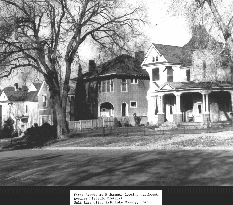
The Salt Lake Northwest Historic District, one of Salt Lake City’s historic districts.

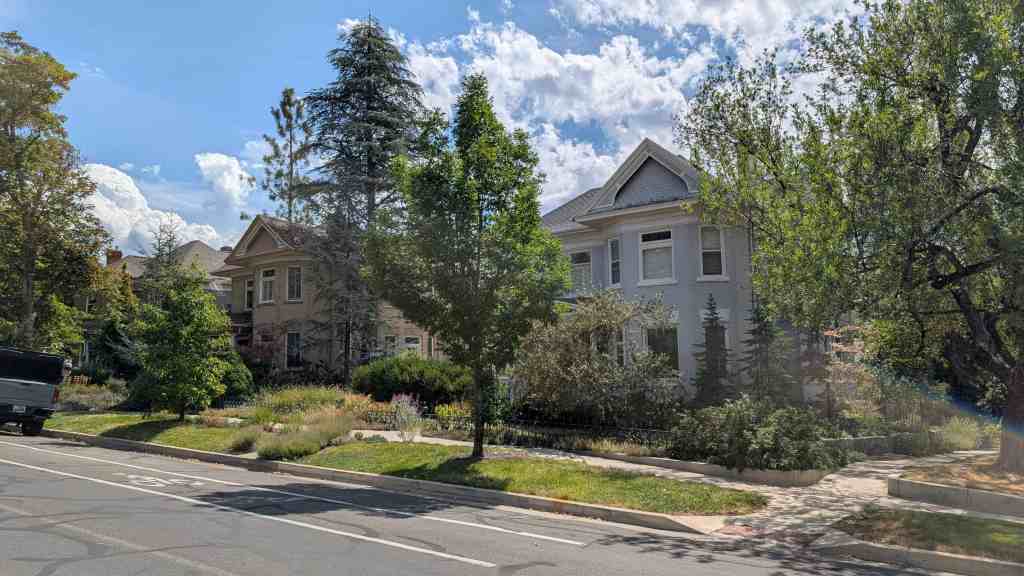
The Salt Lake City Northwest Historic District is a 28-square-block (280-acre) residential neighborhood developed between the 1850s and the 1950s. The roughly rectangular-shaped district includes 1,489 buildings, of which 1150 (77%) contribute to the historic character of the neighborhood. There are 339 (23%) total noncontributing buildings. Of the 248 non-contributing primary buildings, 129 are altered historic buildings and 119 are considered out-of-period. Ninety percent of the contributing buildings are single-family dwellings dating from the mid-1850s to 1950. Six percent of contributing buildings are duplexes, mostly built between the 1890s and 1950. The housing stock also includes several apartment buildings and residential courts. Approximately half of the contributing commercial buildings are found along North Temple. The others are small commercial blocks (often combined with residential space) scattered throughout the neighborhood. Also included among the contributing buildings are four religious facilities and one former library. The district lies just a few blocks north and west of Salt Lake City’s downtown, and is separated from the central business district by several railroad lines near the eastern boundary of 500 West. At the western boundary is the Utah State Fairpark. The district’s north and south boundaries are two major thoroughfares, 600 North and North Temple. (more here)

Single Family Dwellings: Early Settlement Period. 1850s-1879

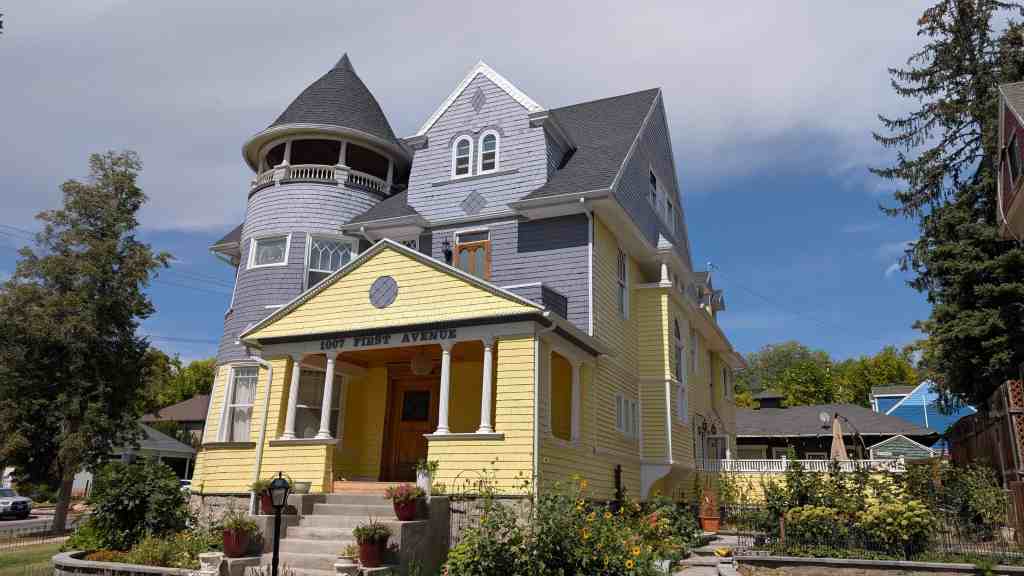
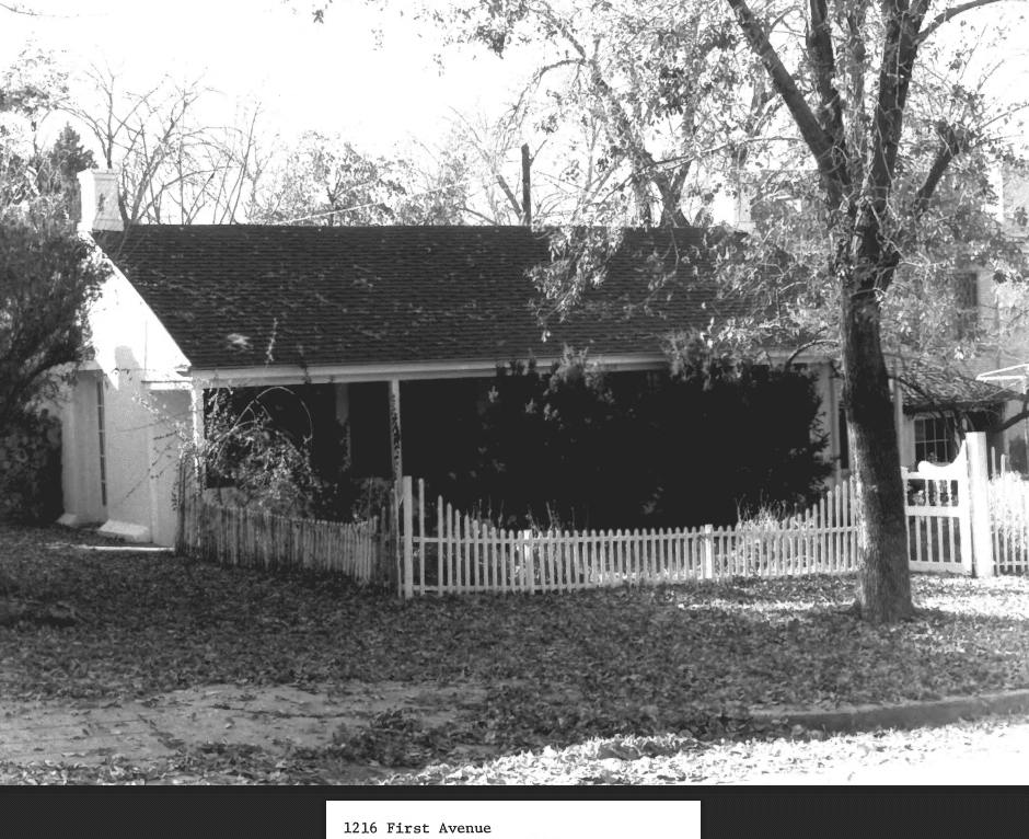
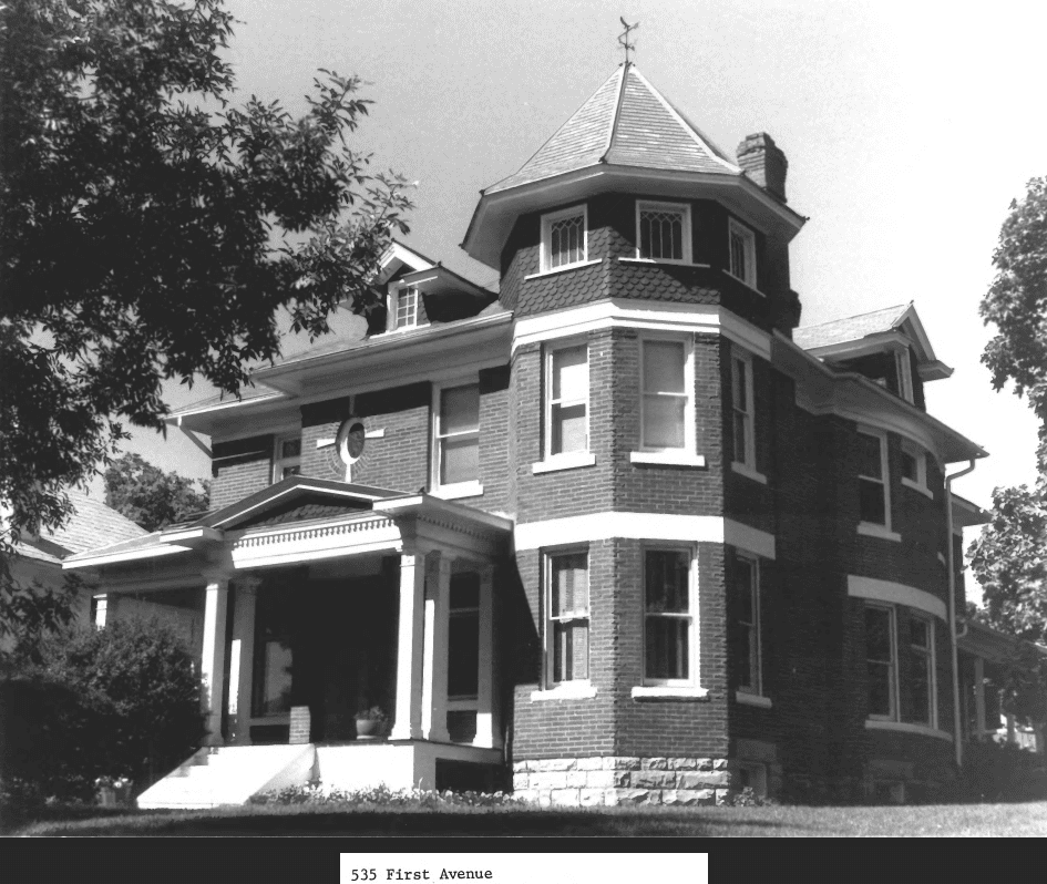
There are 742 contributing single-family dwellings located within the Salt Lake City Northwest Historic District, only eleven of which have been identified as having been built before 1879. However, historical documents suggest the actual number is much higher. Unfortunately additions, alterations, and the general lack of documentation makes it difficult to come up with an exact number. The eleven also include the district’s two properties previously listed on the National Register: the Nelson Wheeler Whipple House at 564 West 400 North (built in 1854 and listed in 1979), and the Thomas and Mary Hepworth House at 725 West 200 North (built in 1877 and listed on April 21, 2000).

The Whipple and Hepworth houses represent the higher end architecture of the settlement period. The typical small home is represented by the example at 126 North 800 West. Built circa 1870, this house is a 540-square foot hall-parlor with a frame addition. It is constructed of adobe brick covered with stucco on a stone foundation. A more unique example is what appears to be an unfinished Georgian-influenced single-cell house, at 423 North 600 West, probably built in 1868. This unusual house has a number of turn-of-the-century additions, however the main portion is adobe. Only a handful of early frame houses are extant in the neighborhood, and most have been substantially altered. No log dwellings were identified in the reconnaissance-level survey of the area, however it is possible existing log structures may have been incorporated into later additions and covered by a veneer. Most settlement-era homes have little stylistic detail other than classical symmetry. The most common house type from the era is the hall-parlor. Other types are represented by only one or two examples.

Single-family Dwellings: Victorian Urbanization. 1880-1910

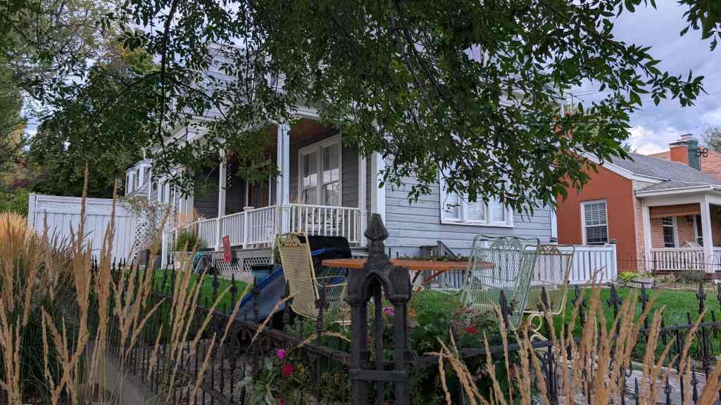
Houses representing the types and styles of the Victorian era comprise 39% of the number of single-family dwellings, the largest percentage of associated housing stock in the district. These houses are found throughout the Salt Lake City Northwest Historic District as distinct architectural entities, in tracts of two or three, and occasionally in a residential court setting. Stylistically, a small percentage of these homes demonstrate the transition from earlier houses and possess Classical, Greek Revival or Italianate features. Examples range from early hall-parlors with added wings to late Victorians with Queen Anne-style towers. One interesting example of a transitional house spanning several decades is located at 344-346 North 600 West. This two-story house built in several phases between 1882 and 1954 has walls of adobe, stucco, brick, and frame. The stylistic elements of the house include Greek Revival cornice returns, Victorian details on the octagonal north wing, and Period Revival porch enclosures.

Single-family Dwellings: Early Twentieth Century. 1910-1939

The dominant architectural style of the early twentieth century was the Bungalow. Nineteen percent of contributing single-family houses in the Salt Lake City Northwest Historic District are Bungalows in type and style. The Bungalow was intended to be a comfortable, sheltering, low profile house. While early Bungalows like the one at 578 North Dexter Street were built contemporaneously with Victorian houses, by 1915 the Bungalow had become the everyman’s house replacing the earlier Victorian cottages. Most of the Salt Lake City Northwest Historic District’s Bungalows are modest homes (as are Utah bungalows in general) with little decorative detail, however several in the district are distinctive. The Langton Park Bungalows built in 1918 are a combination of Arts & Crafts and the California styles. Brick Bungalows at 575 West 200 North and 251 North 700 West have a hint of Prairie School influence. A row of brick Bungalows, also from 1924, on 500 North, includes one at 1043 West 500 North with a distinctive porte-cochere. The description of Bungalow as a type, as well as a style, fits most of the Bungalows in the district. The houses usually have the narrow end to the street with a variety of roof styles (simple gable, hipped, and clipped gable), and a full or half-width porch. The few Foursquare houses in the district are modest in size with bungalow influence and are not similar to the traditional two-story, upscale Foursquares found in other parts of Salt Lake City. The most popular material for Bungalows was brick, with wood and stucco used for decoration. Frame Bungalows are also found throughout the district, though many have been altered. Stone was used as a foundation material in early Bungalows, however after 1915, concrete was used increasingly. During the Bungalow period, the use of concrete — as well as better drainage — increased the occurrence of fully excavated basements. The Bungalow period also has examples of new materials such as striated brick and concrete block. There is even one brick Bungalow with a volcanic rock veneer on its lower half.

After World War I, the Bungalow remained popular, but the Period Revival movement favored by veterans who had served in Europe was evident in the architecture of the 1920s in Utah. Several Bungalows, built in 1926, along 1000 West near 400 North show some period revival details. Within the Salt Lake City Northwest Historic District, construction of residences slowed considerably between the late 1920s and the start of World War II. Period revival cottages account for only three percent of houses in the area, a percentage much lower than contemporaneous neighborhoods on Salt Lake City’s east side. Among them are modest English period cottages like the one at 878 West 500 North, built in 1929, and four found on Chicago Street, built between 1928 and 1929.

Single-family Dwellings: World War II and Post-World War II Era. 1940-1950

Twenty-nine percent of single-family dwellings in the Salt Lake City Northwest Historic District were built during the 1940s. Surprisingly, a number of homes in the district were built in the early 1940s, although access to materials and labor was severely restricted. Two examples from 1941 represent the World War II Era. The house at 843 West 500 North is one of nine houses (some brick, some frame) built on the block, and typifies the minimal traditional house developed by Federal Housing Administration to promote home ownership during the depression. The “minimal traditional” elements of 863 West 500 North are evident in its modest 865 square-foot (two-bedroom) footprint, and limited decorative brick details. A more unique example is found at 460 North Chicago Street, another small square, brick masonry house with corner metal casement windows giving it a more Modern appearance.

Multiple-family Dwellings: Duplexes (Double Houses) & Apartment Buildings

Six percent of residences within the Salt Lake City Northwest Historic District are duplexes (also known historically as double houses), with another one percent being historic apartment buildings. Approximately half of the duplexes were built between 1890 and 1910, and are found both along the main streets and in residential courts between 500 and 800 West. Stylistically, these early duplexes come in two varieties: the urban model with a flat-roof and decorative brick parapets; and the more domestic-looking, hipped or gable roof structure. Despite being rental units (or perhaps because they are rentals), these duplexes have survived relatively intact with only minor changes, such as the replacement of the classical porch columns with wrought iron. Brick masonry was used for most of these buildings, however there are a few frame examples such as the duplexes at Tuttle Court. The remaining half of the duplexes date from the Bungalow era or the post-World War II period, and with few exceptions, are found in the western half of the district. Many, especially later, duplexes are found on corner lots as part of rental buffers for subdivision development. A few are frame-sided or stucco Bungalows, including one Langton Park triplex, but most are brick structures from the late 1940s.

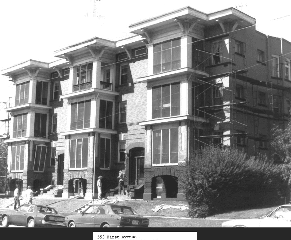
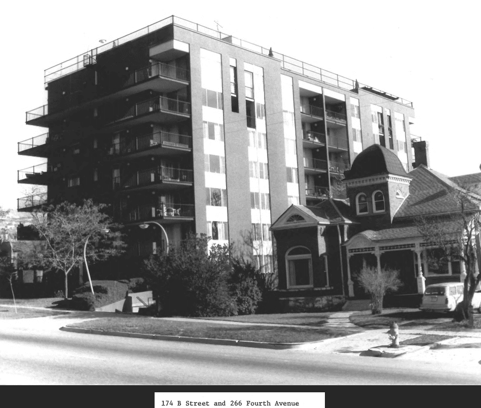
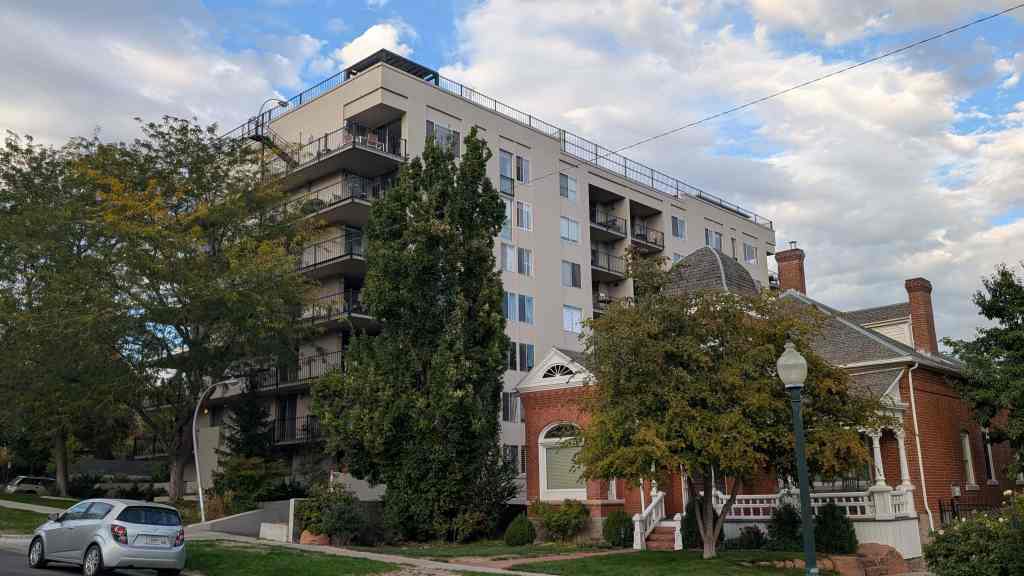
There are six historic apartment blocks in the Salt Lake City Northwest Historic District. All are small with only four to six units, not big enough to be classified as walk-ups. The oldest is the four-unit block at 540 North 600 West, built in 1897 and later converted to commercial use. This building features decorative brickwork on the parapet and originally had a full-width porch and balcony. Not far from this building stand the most recent historic apartments, twin six-unit blocks at 545 and 555 West 500 North, built fifty-years later in 1947. The two-story Boyer Apartments, as they were known, were constructed of brick with pyramidal roofs and minimal traditional detailing.

Commercial Buildings

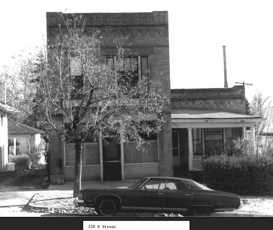
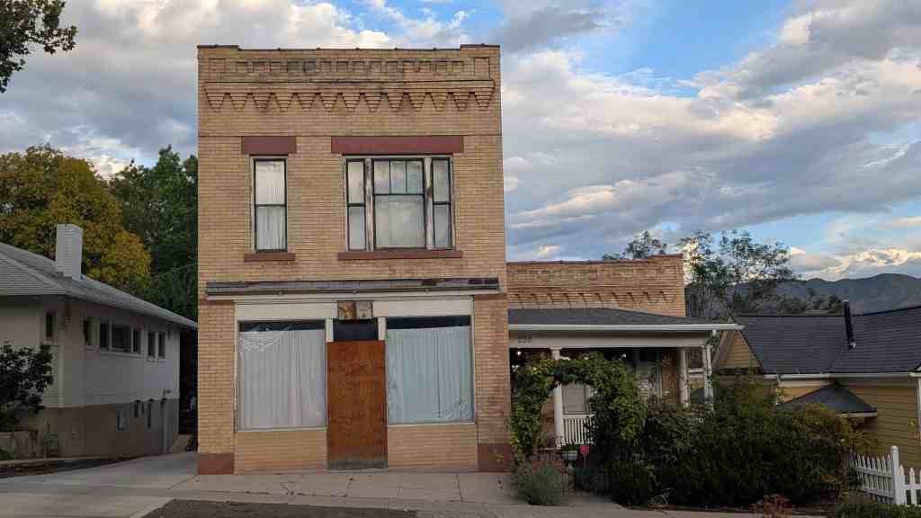
Ironically, nearly one-third of contributing commercial buildings identified in the Salt Lake City Northwest Historic District historically combined residential space with commercial use. An interesting example is located at 613 West 200 North where a 1910 frame shop was built in front of and connected to an 1871 adobe hall-parlor. In contrast, at 776 West North Temple, the commercial block came first in 1888, followed by the six-room residence, in 1895, both with elaborate brick work. In other cases, the residence space is less obvious. The 1905 commercial block at 246 North 600 West was built in front of an 1880 house. Also built in 1905, the brick commercial building at 730 West 400 North was built with a second-floor family flat incorporated in the original design.

One of the most significant and prominent commercial buildings is the Horsley Building located at 606 West North Temple and constructed in 1912. The Horsley Building resembles a small hotel court in the commercial style with retail space on the main floor and sixteen apartments on the second. Among the non-residential commercial buildings is the former LDS Church 22nd Ward Cooperative Store at 480 West 500 North. The remainder of historic commercial buildings represents a miscellaneous mix of period and style. Two of the more significant examples are the auto garages built at 319 North 800 West in 1928, and the Romney Motor Lodge, built in the 1940s, one of the few remaining historic motel courts left in Salt Lake City.

Institutional Buildings

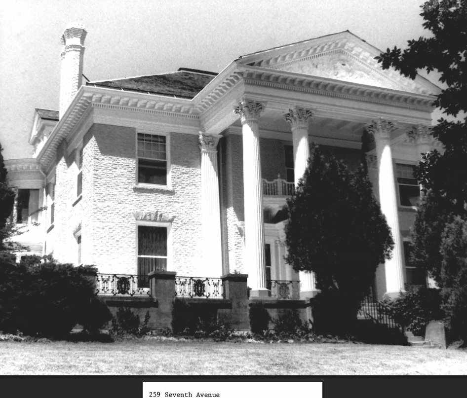
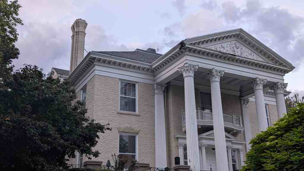
While the contributing institutional buildings in the Salt Lake City Northwest Historic District are few in number (five), they present an architecturally impressive group of historic resources. Four are ecclesiastical buildings originally associated with the Church of Jesus Christ of Latter-day Saints (LDS Church or Mormon Church), and one is a former Salt Lake City branch library. The oldest is the 28th Ward Meetinghouse built in 1902 and located at 750 West 400 North. The building is constructed of brick on a stone foundation in the Gothic Revival style. In 1914, the building was enlarged to the rear with an unusual semi-circular addition that included an auditorium, amusement hall, and classrooms. Though no longer used as a church, the building retains a high degree of historic integrity.

The 34th Ward Meetinghouse at 131 North 900 West, built in 1921, is a brick Neo-Classical structure on a raised basement. The temple-front façade features six massive Doric columns supporting a pediment. This building has been modified somewhat over the years but still retains its historic character. The south wing of the 16th Ward Meetinghouse was built on the site of an earlier chapel destroyed by fire at 129 North 600 West. The new chapel, constructed between 1929 and 1930, is based on a standard meetinghouse design nicknamed the “Colonel’s Twins” because of the two projecting wings, one for the chapel and one for the amusement hall. The 16th Ward building is a brick structure and incorporates Colonial Revival motifs such as keystone, round arches, and cornice returns. This building, used for many years as a Catholic community center, and currently a residence, is in excellent condition.

The Riverside Stake Center, the only meetinghouse within the Salt Lake City Northwest Historic District still used by the LDS Church, is located on the west side at 947 West 200 North. Constructed in 1952-1953, this building is an early example of postwar modernism institutional architecture in Utah. The building is constructed of brick, stone veneer, and cast concrete. The main entrance is recessed under a swooping canopy. The building is in excellent condition and has had only minor alterations.

One of the most historically significant buildings is the Our Lady of Guadalupe Catholic Church located at 731 West 300 North. However the building is non-contributing because a 1972 expansion has obscured the original chapel relocated to the area from an army base in Kearns in 1947. Another significant building is the former Spencer Branch Library, located 776 West 200 North, was built in 1921. The library is T-shaped in plan and is constructed of striated brick. The broadside faces the street with a symmetrical façade. Classical and Colonial Revival details are found in the concrete keystone and end stones of the round relieving arches, and in the Tuscan columns supporting a rounded pediment at the main entrance. The building is currently owned and maintained by the Free Church of Tonga and has seen little exterior alteration.

Outbuildings

Though the Salt Lake City Northwest Historic District retains a semi-rural feel, the hundreds of coops and sheds once found in the rear of nearly every property have all but disappeared. With the possible exception of the circa 1880s stone granary in the rear of 165 North 900 West, extant outbuildings in the Salt Lake City Northwest Historic District are not individually significant. Garages, which began appearing in the district in the late 1910s, make up the vast majority of the 461 contributing outbuildings identified in the 1991 reconnaissance level survey of the area. These garages are mostly single-car, simple-gable frame structures that face the street. The alleys platted by the turn-of-the-century subdivisions appear to have been vacated early (most in the first half of the century) and few garages were accessed from the alleys.

The History of the Salt Lake City Northwest Historic District

Early Settlement Period. 1847-1869

On July 24, 1847, a small contingent of members of the Church of Jesus Christ of Latter-day Saints (LDS or Mormon Church) entered the Salt Lake Valley under the direction of Brigham Young. On August 2, 1847, a little more than a week later, Orson Pratt and Henry G. Sherwood began to survey what was then known as the City of Great Salt Lake. In less than a month, the survey of Plat A, consisting of 135 blocks, was completed. The land was divided into ten-acre blocks, each containing eight lots of one and one-quarter acres. Streets were 132 feet wide. Only one house could be constructed on each lot with a standard setback of twenty feet from the front of the property. The rear of the property was to be used for gardens and outbuildings. Farmland was provided in the outlying areas. Forty acres were set aside for the temple, and four other blocks were for public grounds to be laid out in various parts of the city. After the church officials selected lots for their personal use, the remainder of the land was divided by casting lots. Scarce resources such as timber and water were to be held in common with no private ownership. Within two years, the population of Salt Lake City had grown to 6,000. Plat B was laid out in sixty-three blocks to the east in 1848, and in 1849, the eighty-four blocks of Plat C were surveyed on the west side. The Salt Lake City Northwest Historic District consists of five blocks along the western edge of Plat A and twenty-three blocks of Plat C.

In February of 1849, the city was divided into nineteen wards of the LDS Church and a bishop was selected to preside over each ward. The northwest portion of the city was within the boundaries of the 16th ward (South Temple to 300 North, and 300 West to the Jordan River) and the 19th ward (a triangle-shaped area 300 North to Beck’s Hot Springs [800 North], and 300 West [base of the foothills] to the Jordan River). Though lots were allocated and the basic governing (church) hierarchy in place, early settlement proceeded slowly. Most of the earliest settlers spent their first few winters in crude log cabins, tents, or in wagon beds, in or near the fort (present day Pioneer Park at 300 South and 300 West). A few houses were built in the 16th Ward in 1848, but the church’s official historian was “unable to find out positively whether any of the pioneers of Utah built houses or resided in the Nineteenth Ward prior to 1849, although it is possible that one of two families became settlers in 1848.” By 1850 a number of settlers had moved to their lots and begun building permanent homes. Some of the houses may have been log (newly hewn or relocated from the fort site), but most were built of adobe (or mud-dried bricks). An adobe pit was first established near the fort site in order to provide bricks for the fort wall, and later brick was available for home building.

The majority of these houses were single-story, one or two-room (single cell and hall-parlor) dwellings, which were plastered as soon as the owner had the resources. The Nelson Wheeler Whipple House, an eight room, two-story house built in 1854, was one of the few exceptions. Whipple, who immigrated to Utah in 1850, had various occupations (policeman, gunsmith, carpenter, cabinet maker and superintendent of the Municipal Bath House), but is best known for his lumber business and shingle mill. The house at 564 West 400 North (within the 19th Ward boundaries) was home to his entire family: himself, three wives and seventeen children. The house was listed on the National Register of Historic Places in 1979.

From the beginning, the west side of the city was less desirable for settlement than the east. Topographically, the northwest district is one of the lowest areas within the city limits and before the advent of drainage systems, was often covered with water. Some improvement came in 1856 when the three channels of City Creek were directed along North Temple to the Jordan River, and land west near the river was reclaimed. However, the poor-quality alkaline soil and brackish water of the Jordan River prevented extensive cultivation and the land was used mostly for pasturage. An October 1852 census of members in the 19th Ward numbered 300 people in addition to about 100 children under the age of eight, however most of those lived east of 300 West in the Marmalade District. Four years later, Frederick Kesler, bishop of the 16th Ward, concerned for members of his ward, visited every dwelling to ascertain the amount of provisions on hand. He recorded visiting “521 souls” in 132 houses. Frederick Kesler (1816-1899) was a prominent millwright whose engineering skills and inventiveness contributed much to the early economy of Utah. Kesler was bishop of the 16th Ward for forty-three years, and died at his home at 556 West North Temple (now demolished).

Salt Lake City grew quickly in the two decades between 1847 and 1869, and has been described by many historians as an “instant city.” The population increase was steady, supported by the annual influx of Mormon convert immigrants, mostly from England and Scandinavia, and the characteristically high Mormon birthrate. While the arid soil and necessity of irrigation systems made crop production difficult, the cash crop of gold dust left in Salt Lake City by “forty-niners” traveling to and from California gave rise to a thriving mercantile district in the center of town. The overall economy benefited by this traffic, and early Utah settlers gradually became more prosperous. The city was incorporated in 1851 with many lines of the original charter devoted to regulating burgeoning commerce. On the west side, just as on the east side, families built new homes or enlarged older ones, often relegating former log cabins to outbuilding status. By the late 1860s, Salt Lake had several brickyards, and though small adobe houses were built up until the 1880s, brick became the most sought-after building material. The houses were surrounded by shade trees usually lindens and poplars. The settlers dug irrigation ditches and built fences around their lots, planted gardens and small orchards, and raised whatever livestock was necessary for family subsistence. Most heads of households were merchants, mechanics, or artisans.

Victorian Urbanization and the Coming of the Railroad. 1870-1910

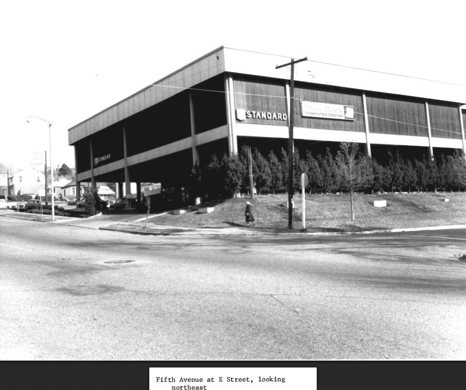
Historians generally agree that the completion of the transcontinental railroad on May 10, 1869, is a benchmark in Utah’s history: the official end of the pioneer era in Utah. In January of 1870, the Mormon church-sponsored Utah Central Railroad completed a line connecting Salt Lake City to the Union Pacific line at Ogden. In 1872, Union Pacific acquired control of the Utah Central, as well as interests in another Mormon railroad, the Utah Southern, which ran south from Salt Lake to Provo. The 400 West corridor provided the best grade and location for the tracks, and within a few years a warehouse district had developed next to the city’s central business district. The coming of the railroad had a direct effect on the neighborhoods west of the track for even one track created a barrier to east-west movement. By the time of the 1889 Sanborn map, the Utah Central-Union Pacific Railroad had laid six lines of track near 500 West, and the Denver & Rio Grande Railway, which had completed its Salt Lake to Denver line in 1883, had a track running north to south along 700 West. The 1898 Sanborn map shows that in the decade before the turn of the century, the Oregon Short Line Railroad (incorporated by Union Pacific/Utah Northern Railway) had laid seventeen sets of track (through lines and sidings) separating the west side of town from the east at 500 West and North Temple.

The impact of railroad on the settlers was mixed. Many early residents simply left. Samples of title abstract records indicate a number of “original occupants” of the Plat C blocks did not maintain their ownership when deeds began to be officially recorded by the federal land system in the 1870s. Patty Sessions (1795-1893), one of Utah’s most prolific midwives, had lived near the corner of North Temple and 500 West since 1850. In 1870 she sold her property to the Utah Central Railroad and moved to Bountiful, Utah. Some early residents sold their property to their neighbors, and others sold to land speculators from outside the area.

The relative proximity of the tracks determined development patterns in the decades after the coming of the railroad. The area nearest to the tracks, 500 West and 800 West, experienced tentative development and the original pioneer lots subdivided and built-up with a random mix of cottages, duplexes, residential courts and commercial buildings. In contrast, the land west of 800 West was suburbanized and subdivided in a late nineteenth-century real estate frenzy, which peaked in 1888, when the Salt Lake County Surveyor was authorized to approve all plats and maps. Between 1888 and 1903, ten subdivisions were platted within the northwest district’s boundaries. The interest in subdivision development on the west side may have been stimulated by the 1889 electrification and subsequent expansion of the city’s streetcar system that produced a streetcar line on North Temple from the central business district to 1000 West.

A look at three subdivisions illustrates the variety of persons involved in developing the area. William Langton (1854-1928) and his wife Frances Alma Jones Langton (1859-1941), were longtime residents of the 16th Ward. Not only were they involved in the Langton Park Subdivision of 1896, they built a number of duplexes and other properties in the neighborhood. According to one tribute, William Langton “did much to promote building of homes on the west side of Salt Lake City.” Dr. Leslie W. Snow (1862-1935) and his wife Ida Daynes Snow (1871-1955), who developed the Snow Subdivision in 1903, were Utah natives and members of the LDS Church, but never lived on the city’s west side. Arvis Scott Chapman (1839-1919), William J. Lynch (1862-1931), and Isadore Morris (1844-1906) who platted the Oakwood Subdivision on behalf of the Mount Moriah Masonic Lodge in 1903, were entrenched eastsiders and non-Mormons to boot. While some Salt Lake real estate speculators turned a profit, west side speculation remained just that. Many lots in these turn-of-the-century subdivisions were not built upon until the 1950s. The disadvantages of the west side were numerous. During high water seasons the neighborhoods were flooded both from the Jordan River backing up into the irrigation ditches and the City Creek water flowing from the higher levels of the city. In referring to the 1893 typhoid epidemic, the city health commissioner stated, “It is from poor drainage and seepage from privy vaults and cesspools, a condition so much facilitated by this low and damp section of the city, that presumably, is the cause…for the preponderance of typhoid fever in that section over that of any other in the city.” By the 1890s, the west side had become the official and unofficial dumping ground of the city. Because the crematory, located near Warm Springs, could not process all of the city’s “night soil,” trenches were dug at a site half a mile west of the Jordan River and the sewage coverage with two feet of dirt, a practice repeatedly objected to by west side residents. In 1894, the canal running along 900 West had become the receptacle for so much stagnant water and filth that it was condemned and filled.

Transportation was another major deterrent to development. Movement over the tracks was discouraged due to the danger of fast running trains and the delay of slow and standing ones. The streetcar system that had proliferated on the east side was limited to two lines in the west. In addition, street improvements were late in coming to the west side. While streets began to be paved, curbs and gutters installed, and sewers placed in some sections of the city beginning in the 1890s, parts of the west side were without these improvements until the 1920s. Water mains and pipes (replacing well water) were laid in 1890s, and City Creek was partially channeled underground. The west side eventually received electricity by the turn of the century.

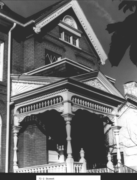
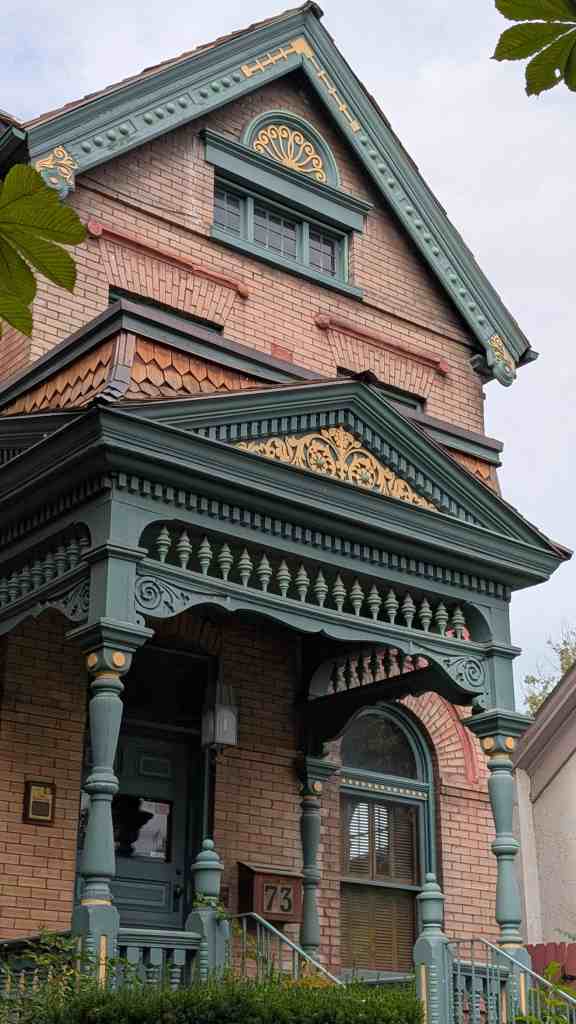
Despite problems, the railroad era brought modest prosperity to the west side. One-third of all historic buildings in the Salt Lake City Northwest Historic District were constructed during this period. Cottages, and a few fancier homes, built with fired brick, both as structural material and as a veneer over adobe, appeared all over the district. The Thomas and Mary Hepworth House, built in 1877, is a distinctive house that represents an early transition from the pioneer era to the Victorian era. Thomas and Mary immigrated to Utah in 1852, and in 1872 purchased a piece of property on the west side, where they live for five years while Thomas built up a family meat market. In 1877, the house at 725 West 200 North was built of fired brick. The Hepworth House is the only remaining example of a two-story central-passage house with vertical Victorian proportions and Italianate ornamentation in Salt Lake City. It was listed on the National Register of Historic Places in April 2000.

The Victorian Eclectic cottage, most often a cross wing constructed of brick, became ubiquitous in Salt Lake City, and a number of beautifully preserved examples can be found in the northwest district. The central block with projecting bays was another popular house type in the district. The frame house was also very popular as the railroad brought lumber into timber-scarce Salt Lake City. The railroad also had an impact on the decorative aspect of domestic architecture. The rather austere classical adobe houses of the pioneer period were essentially vernacular buildings meant to mimic the houses the early settlers left behind in the east and mid-west. With the coming of the railroad, access to a variety of materials, and the availability of pattern books and handbooks, allowed local builders to produce exact replicas of Victorian cottages being built all across the United States. Ornamentation such as lathe-turned porch posts, spindle work and sometimes “gingerbread” cut woodwork was found on Victorian cottages throughout the district. In addition, many of the older homes converted to cross wings and/or “dressed up” with Victorian ornamentation in the 1880s and 1890s.

Multiple-family housing began to appear in the district in the early 1890s. According to one report, in April of 1888, there was a “scarcity of rentable houses and a great demand for them,” particularly four-room cottages for small families. The most popular type of multiple-family housing was the double house, or duplex. Most were brick, some were frame, and the earliest examples resembled Victorian cottages with gable roofs and wood ornamentation. The Tuttle Court complex, built by Mary Anne Taylor Tuttle (1832-1924) around 1895, has four of the oldest and best-preserved frame examples in the district. The original owner of multiple-family housing was often a builder or businessman who lived nearby. The circa 1904 brick duplex at 745-747 West Jackson Avenue was built by William H. Jones (?-1935?), a carpenter who lived at 635 West 400 North; and the circa 1900 brick triplex at 216-218 North 800 West was built by Kay Bridge (1876-1952), a plasterer, living at 666 West North Temple.

Several commercial buildings, mostly one and two part blocks, were constructed during this period. Near the tracks was the Solomon Brothers’ Shoe Factory and David James’ pipe factory (neither building is extant). By the late 1890s, North Temple Street had the beginnings of a commercial strip with a cobbler, a blacksmith, a bakery and a meat market. One of the oldest surviving buildings was built in 1888, when Arthur Frewin (1855-1940) built a general mercantile business at 780 West North Temple. Four years later he built an addition on the back, and in 1895 built a residence for his family adjoining the store. The enterprise appears to have been quite prosperous, as is attested by the large typeface of his name in the city directories, and the quality of the corbelled brickwork on both buildings. More modest one-part block examples include the 22nd Ward Cooperative store, which stills stands, though somewhat altered at 580 West 400 North; and the frame store/tinshop attached to an adobe hall-parlor at 613 West 200 North. Two-part block examples include 815 West 300 North and 730 West 400 North, both somewhat altered by façade siding.

Economically, the neighborhood was still represented by a solid merchant/artisan middle-class, but many had new urban jobs: clerks, bookkeepers, agents, civil servants etc.; however, two major changes in the economy occurred during this period: 1) the need for family subsistence farming dropped dramatically, and 2) approximately 1 out of every 5 heads of a household worked for a railroad or a railroad-dependent industry at least some time in his life. Many had long-term commitments. Willard W. Bywater (1853-1915), a Welsh LDS convert, was, for many years, a pattern maker for the Oregon Short Line Railroad. Bywater’s neighbor at 155 North 700 West, Robert Bridge, Jr., (1871-1942), a Salt Lake City native, spent 50 years as a sheet metal worker for the Union Pacific.

Just as in the pioneer era, the population growth of the district was steady. When the Jackson Elementary School at 750 West 200 North was built in 1892, it was one of the largest schools in Salt Lake City (the building was demolished and replaced by a new building in the 1980s). The growth of the Mormon population necessitated a split of the original 19th Ward. In 1889, the 22nd Ward was created from the west portion of the 19th Ward. Two more wards were created from the 22nd in February 1902, when the western half was divided: the 28th Ward (railroad tracks to 900 West) and the 29th Ward (900 West to the Jordan River). By the end of that year, both congregations built Gothic Revival chapels: the 28th Ward at 750 West 400 North, and the 29th Ward (just outside the district boundaries) at 1104 West 400 North. The LDS ward meetinghouses in the area served as social centers, as well as worship spaces, for the community. In winter, when snow and mud made the journey to town unpleasant and treacherous, “plays, operettas, vaudevilles, and minstrel shows,” often produced by ward members, were scheduled in the meetinghouses. Non-Mormon social centers were also built. The Methodists had a small church at the corner of 800 West and 400 North, the Endeavor Presbyterian Church was located at 630 West 200 North, and there was dance hall on 600 West (none extant).

The railroad, as well as the mining and smelting industries it supported, brought thousands of immigrants to Utah. Within the LDS community, the immigrant converts established neighborhood enclaves (e.g. “Danish Town” was the nickname for a block on Marion Street where a number of Danish immigrants lived, and in the 100 block along 700 West, a number of Welsh converts built homes). These LDS immigrants assimilated quickly and easily into the Utah’s cultural climate, but for other immigrants the process was not so easy. As LDS convert immigration (primarily from Scandinavia and the British Isles) declined in the last three decades of the 19th century, non-Mormon immigration increased. A small percentage of Chinese, who came with the railroad, stayed to make homes in Salt Lake City. The majority of Chinese lived near Salt Lake’s Chinatown, located near downtown and centered around Plum Alley which ran north from 200 South to 100 South between Main and State streets; however, 1898 Sanborn map shows three Chinese vegetable gardens with “shanties” in the neighborhood around 700 West and 300 North. Other ethnic enclaves were established near the tracks just south and east of the northwest district. Greek Town consisted of more than sixty businesses lining 200 South between 400 and 500 West streets. A small Italian community, Little Syria and Lebanese Town were also near the tracks. Non-Mormons (mostly the ethnically diverse immigrants who came to work in the railroad and mining industries) lived in the southern and western portions near downtown while Mormons and the more affluent, longtime-resident non-Mormons lived to the north, east, and the southeast. Only a few of the recent immigrants lived in the rental duplexes and houses available in the northwest district at this time. However in the first half of the twentieth century they would gradually move from the “ethnic ghettos” north to become home and business owners in the northwest neighborhoods.

Immigration and Industrialization. 1900-1929

By the turn of the century the Salt Lake City Northwest Historic District, had all the makings of a middle-class streetcar subdivision with neighborhoods consisting of attractive homes, gardens, and shade trees, and a few prestigious commercial buildings. The Horsley Block, a large commercial building with apartments, designed by the prestigious Salt Lake architectural firm, Pope & Burton, was built at 606 West North Temple in 1912. The vacant land at the west end, known as the Deseret Agricultural & Manufacturing Society Fairgrounds & Race Track, was officially designated as the site of the Utah State Fair in 1902. The fair grounds (just outside the district boundaries) include a number of architecturally significant structures built in the first quarter of the twentieth century and was listed on the National Register of Historic Places in 1981. City services improved greatly during this period. After two disastrous floods in 1908 and 1909, during which North Temple was navigable only by boat, the drainage and sewage systems of the west side became a priority. The North Temple viaduct was completed over the Oregon Short Line tracks in 1912. City streets were paved and some curb and gutter installed by 1926.

However, though part of the northwest district remained middle-class, the neighborhoods closest to the railroad tracks became increasingly working-class. Economically more diverse, but because the newer immigrant populations were subject to prejudice, not ethnically or religiously more diverse. In a 1914 University of Utah thesis written on The Housing Problem in Salt Lake City, the author noted, “the landlords prefer Americans to Southern Europeans…Thus when Italians, Greeks, Japs or Chinese apply for a house and the landlord is particular who shall occupy the place, the rent is a little higher than for the ordinary houses in the same locality and of the same size.” Thus for the most part, the majority of residents of the northwest district, including renters, were homogeneous to the residents in the last half of the nineteenth century.

The store at 730 West 400 North illustrates the gradual shift in population in the neighborhood. In 1905 Henry Walsh (1866-1933), and his wife Ruth May Brown (1870-1936), built a two-story commercial block building with a grocery store on the main floor and residential space above. Apparently the grocery business did not provide all of the family’s needs for by 1910 Henry was working as a watchman for the railroad and Ruth was running the store. In 1916, Joseph Balzarini, an Italian immigrant with a Hungarian wife, bought the building and also operated a grocery. Joe Balzarini sold the store to the Caputo family. Rosario (1883-1970) and his wife Cristina (1888-1979) Caputo were also Italian immigrants who not only ran a successful business for nearly half a century, but also raised eleven children in the upstairs apartment. In addition the Caputo store was the neighborhood’s de facto community center for Italian Catholics, peacefully coexisting with the LDS 28th ward house across the street.

Meanwhile, the LDS community continued to thrive. The 28th Ward built an amusement hall addition to the chapel in 1914. Another division came when the 34th Ward was created and a Neo-Classical chapel built in 1921 at 131 North 900 West. One of the greatest assets came to the community when the John D. Spencer Branch of the Salt Lake City library was built in 1921 at 776 West 200 North. The classically styled building designed by prominent Utah architect Joseph Don Carlos Young was built next to the Jackson Elementary school making the block a natural venue for community gatherings.

In the northwest neighborhoods, a subtle physical change was taking place. Numerous Bungalows began to appear throughout the district as infill and in tracts on previously subdivided lots, and the semi-rural feel of the neighborhood was lost in urban density. Blacksmith shops disappeared, and in 1928, the Earnshaw family built an auto garage and service station at 319 North 800 West. The barns, coops, and other outbuildings in the backyards and along the vacated alleys were demolished and replaced with automobile garages. The number of homes with garages during this period was only about twenty percent and most residents still relied on the streetcar or their own two feet for transportation.

The greatest change to the northwest district was an economic change. The ratio of railroad workers to nonrailroad workers increased dramatically from the previous decades. In fact, in the 1910 census enumeration for the district, the percentage of heads of household who list “railroad” in the type of industry column ranges from 25 to 50 percent for some streets. There appears to be a slight decrease in the 1920 census. In the following sample of housing built during this period, the dominance of railroad-related occupations is illustrated. Of the two men who lived in the 1908 flat-roofed brick duplex at 235-237 North 600 West, one worked for an electric company and the other worked at the Garfield Smelter. Living in a row of 1909 Victorian cottages near 1000 West and 400 North, two-thirds of the adult male residents held railroad jobs. A survey of the original residents of fourteen Langton Park bungalows (built in 1918) along 900 West, states “the majority of the residents worked for the railroad — either the Oregon Short Line or Denver and Rio Grand [sic] as switchmen, brakemen, baggage agent, signal man, fireman, or as conductors.” Three out of four original occupants of four period cottages, built in 1928-1929, on the 300 block of Chicago Street worked for the railroads.

Depression Years and the World War II Era

With the notable exception of the 16th Ward’s new Colonial Revival style chapel and amusement hall built at 129 North 600 West in 1930, there is little evidence of construction activity in the northwest district during the few years after the start of the Depression. By 1935 more than one in five Salt Lake residents were on relief, and one in three of the rest lived below the poverty level. The residents of the district, like their counterparts throughout the nation, survived as best they could. Many people in the northwest district lost their jobs or were on reduced salaries. The Works Progress Administration (WPA) and the construction-related Public Works Administration (PWA) programs may have provided jobs for a few. The few possibilities for such work in the area were street and sewage improvements, projects at the fair grounds, and the municipal airport. The LDS Church’s Welfare Plan, established in 1936, helped provide food and employment through the several LDS wards in the neighborhood. Many residents worked odd jobs, started cottage industries, planted gardens in those oversized city lots, and sent their children to gather stray chunks of coal dropped by passing trains. During this period, many of the residential courts and private streets, which had never been under city oversight, fell into squalor and disrepair.

In the early 1940s, just as the nation was beginning to rebound economically, some new housing was built in the northwest district. Most are scattered individual homes, but one large tract of nine houses built in 1941 on the 800 block of 500 North is noteworthy. The small, square, brick and frame houses were based on “minimal traditional” designs produced by the Federal Housing Administration (FHA) during the depression to encourage home ownership. Not surprisingly, the majority of original owners of these cottages had railroad-related jobs. One of the casualties of the depression was the streetcar system. In 1941 the last trolley took a final ceremonial run down the streets of the Salt Lake City. A shortage of gasoline put electric-run trolleys back into service for a brief period during World War II, but by 1945 the trolleys were once again forced to retire. Jobs returned to the west side as the advent of war kick-started railroad, smelting, and other important wartime industries.

Post-War Suburban Expansion and Post-Freeway Isolation. 1945-1950s

At the end of World War II, post-war housing was at a premium. In January of 1946, the FHA estimated that Salt Lake faced a shortage of six thousand housing units. In the northwest district, builders responded by filling up nearly every vacant lot with World War II era cottages and early ranch-type houses, especially in the western portion of the district away from the railroads. In contrast, the eastern edge saw little residential construction beyond the twin six-unit apartment blocks (built 1947) near Turtle Court, and the small-scale industries along the railroad expanded. To the south, North Temple began to take shape as a commercial and transportation corridor with new motels, restaurants, service stations, and a supermarket taking the place of many nineteenth century homes and businesses. And, north of 600 North (just outside the district boundaries), in 1946, construction began on the ambitious Rose Park subdivision, where many of the northwest district’s residents would eventually relocate.

The end of World War II also saw a change in the economics of the Salt Lake Valley. The era of railroad dominance began to decline as the trucking industry, which had been growing steadily since the 1920s, outpaced the railroads in freight transport. A decade after construction, only two workers living in the 1941 houses on 500 North still had railroad jobs. Another change had occurred and the same street, which had been fairly homogeneous in 1941, now had neighbors with names like Hatanaka, Hoopiiania, and Gonzales.

One of the pivotal movements for the northwest district came in 1947 when the Our Lady of Guadalupe Parish, an offshoot of the St. Patrick’s Catholic Parish, bought property at the corner of 300 North and 700 West. A surplus army chapel from Camp Kearns was purchased and relocated to 715 West and 300 North. Mexican and Mexican-American families moved to the area, many to take the remaining railroad jobs. As the Spanish-speaking population grew, so did the Guadalupe Parish’s auxiliary organizations to support them. The neighborhood LDS churches also changed during this period. As the population of the Rose Park area grew, the LDS Church changed boundaries and most of the northwest district was included in the newly formed East Riverside Stake. In 1952-1953, a large conference hall for the new stake congregation was built at 947 West 200 North.

Physically, the biggest change to the district during this time appeared in the mid-1950s. The Denver and Rio Grande line down 700 West was pulled up to make way for Interstate 15. With the completion of the freeway in 1956, the west side neighborhoods were even further isolated from the rest of the city. The construction of the freeway destroyed whole neighborhoods between 600 and 700 West, and the value of the remaining homes was greatly reduced. One man living on 700 West, complained to the county tax assessor in a letter that he “couldn’t get an offer at any price” on his house. The only place within the district to cross the freeway was located at a 300 North underpass.

Salt Lake City’s West Side: 1960s-2000

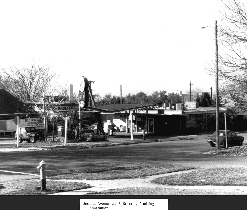
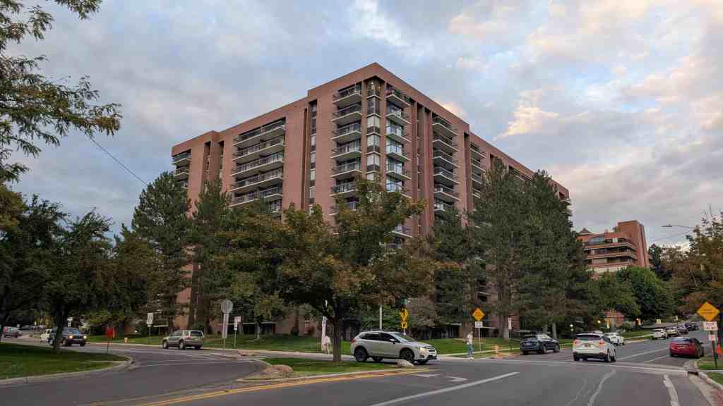
The history of the Salt Lake City Northwest Historic District in the last half of the twentieth century is an interplay of economic change, cultural diversification and neighborhood solidarity. The district has remained solidly working class. A number of medium-density apartment complexes were built in the area in the 1970s and 1980s. The institutional buildings have changed. The old Jackson school was torn down and replaced with a more modern one. The Spencer library closed its doors in 1964, when a new Rose Park branch was opened. The library served for a time as a Rape Crisis Center, and is currently owned by the Free Church of Tonga in America. First Step House, a counseling and transitional housing center, acquired the LDS 28th Ward building. Nearly all the historic buildings along North Temple disappeared, replaced by strip malls, fast food restaurants, etc. The remaining commercial buildings scattered throughout the district have changed uses: the Caputo store is an artist’s studio, and the old Haslam store on 600 West is a boxing club. The Horsley building now serves as the American Plasma Center.

The Salt Lake City Northwest Historic District has a high reputation for community services. The Capitol West Boys’ and Girls’ Club is located in the district. The Guadalupe parish established a stronghold in the district, and in 1972, built a large new chapel next to the old one on 300 North (the old barracks chapel is extant, but not recognizable). Around the same time the parish purchased the old 16th Ward meetinghouse when it was no longer needed by the LDS Church, and established the Guadalupe Center, an educational community center known as La Hacienda, which served the area for many years. The neighborhood has attracted other religious, ethnic and cultural communities. The 29th Ward (just outside the boundaries of the district) was converted to the Hope Refugee Friendship Center. Chiefly serving Vietnamese, the center offered aid to Laotian, Hmong, and Cambodian refugees. Vietnamese immigrants built a Buddhist Temple at 469 North 700 West. Today the neighborhood is one of the most ethically diverse in Salt Lake City.

Despite diversity, the neighborhood has strong communal ties. The Guadalupe, LDS and numerous newer churches in the area provide a sense of community. This year [2001] in May, the Fairpark Fiesta, a neighborhood carnival was held near Jackson Elementary School, hopefully to become an annual event. Preparations for the Utah State Fair unite the western neighborhoods every September. In the most recent decade, new construction of single-family dwellings has been encouraged in the district, and there appears to be an upswing in home ownership versus rentals in the area. Perhaps the strongest indication of stability in the district is in the range of residents. From the direct descendants of early Utah pioneers to non-English speaking immigrants of only a few years, most are happy to call this Salt Lake neighborhood home.

Salt Lake City’s Historic Districts

02 Sunday Feb 2020

Posted by Jacob Barlow in Uncategorized

≈ 3 Comments

Tags

Historic Districts, NRHP, Salt Lake City, Salt Lake County, utah

(the above image is from slc.gov)

Salt Lake City has 13 historic districts listed on the National Register of Historic Places.

  • Avenues Historic District
  • Bennion-Douglas
  • Bryant
  • Capitol Hill Historic District
  • Central City Historic District
  • City Creek Canyon Historic District
  • Exchange Place Historic District
  • Gilmer Park Historic District
  • Liberty Wells Historic District
  • Northwest Historic District
  • South Temple Historic District
  • U of U Circle Historic District
  • University Neighborhood Historic District
  • Westmoreland
  • Yalecrest Historic District

Related Posts:

  • Neighborhoods of Salt Lake City
  • Salt Lake City, Utah
  • Utah’s Historic Districts

Park City Main Street

09 Friday Nov 2018

Posted by Jacob Barlow in Uncategorized

≈ 7 Comments

Tags

Historic Districts, NRHP, park city, Park City Main Street, summit county, utah

2018-09-04 11.33.02

Park City Main Street

Park City’s commercial historic district represents the best remaining metal mining town business district in the state of Utah, exhibiting unique historical and architectural qualities. The Park City mining district, opened in 1869, early was recognized as a top bonanza camp; and, according to one historian, ranked high “as one of the most profitable argentiferous lead mines of the world.” Consumed by a conflagration in June 19, 1898, Park City’s main business district lay in ruins; and its rebuilding, through public and private support, attested to the confidence and attachment demonstrated toward the city. The present commercial district is a product of that confidence of 1898, and also of a confidence born out of the area’s rebirth as a recreational center, beginning in the 1960s.

The Park City Main Street Historic District in Park City, Utah was added to the National Register of Historic Places (#79002511) on March 26, 1979 and the boundary was expanded January 21, 2020.

Some of the places on Main Street:

  • 601 Main St – Rodney W. Schreurs Centennial Park
  • 586 Main St – The Mortuary
  • 573 Main St – The Claimjumper Hotel
  • 560 Main St – Franz The Bear
  • 540 Main St – Masonic Hall
  • 528 Main St – City Hall Park City, Park City Museum, “Ten O’Clock Whistle” and Old Public Library
  • 524 Main St – Emmett “Bud” Wright
  • 515 Main St – Star Meat & Grocery
  • 509 Main St – Summit County Sheriff’s Office
  • 508 Main St – XIX Olympic Winter Games
  • 461 Main St – Anderson Apartments
  • 450 Main St – Post Office
  • 449 Main St – The Club
  • 447 Main St – The Alamo
  • 442 Main St – Frank Andrew Building
  • 438 Main St – Car 19
  • 434 Main St – Rocky Mountain Bell Telephone Office
  • 430 Main St – Jenkins Photography Studio – Jenkins Confectionery
  • 427 Main St – War Veterans Memorial Building
  • 420 Main St – Samuel LePage Raddon
  • 419 Main St – The Oak Saloon
  • 417 Main St – Miner Memorial
  • 402 Main St – Banksy Art at the Hulbert’s Drugs building
  • 368 Main St – The Frankel Building
  • 350 Main St – The Golden Rule Store
  • 328 Main St – The Egyptian Theater
  • 312 Main St – Giacoma Building
  • 309 Main St – The Bardsley Building
  • 301 Main St – The First National Bank
  • 109 Main St

Mining has played an important role in the history of Utah as well as in the history of the United States. Its contribution to industrialization, technology, and the economy is well documented. In the case of Utah, mining helped to diversify the economy by precipitating much of the area’s subsequent industrial development. Additionally, many of Utah’s mining ventures attracted, and provided ample profits for, numerous entrepreneurs, both on a state and national level.

The early search for precious metals in Utah was promoted primarily by non-Mormon groups, especially the U.S. Army. Brigham Young had instructed church members to pursue agriculture, and warned that the lure of precious metals would cause outside infiltration into the Utah Territory.2 In 1862, Colonel Patrick E. Connor led a force of Nevada and California volunteers into Utah to protect the overland mail route and to watch the Mormons. His men were veterans of the California and Nevada gold fields; thus, experienced miners. As a consequence, their abundance of leisure time was spent in prospecting the hills of the Wasatch and Oquirrh mountains. By 1868, Conner’s men, and other prospectors, entered the area that was to become Park City.

Sources remain uncertain as to who made the first discovery, but the first claim filed in the district became the Young American lode, recorded on December 23, 1868. However, the discovery of the rich Ontario mine initiated efforts to mine lode ores and acted as the catalyst for Park City’s rapid noteriety as a great silver mining camp. In 1872, shortly after the discovery, the mine was sold to George Hearst, a San Francisco “mining man,” and run by R. C. Chambers until 1901 (sold for $27,000 and reportedly produced some $50,000,000).

Coupled with the completion of the Transcontinental Railroad, that spurred mining development in 1869, the Ontario ignited new growth in the district of Park City. The Pinon, Walker and Webster, Flagstaff, McHenry, Buckeye, and others also shipped small amounts of ore. By 1879, the Ontario operation flourished, with homes springing up near the mine and lower down the canyon near the present site of Park City a camp burgeoned.

Studies have characterized the development of mining communities as having occurred primarily in three stages: settlement, camp and town. Settlement being the initial phase, while the camp stage signified a period of population growth, promising mineral strikes, building booms (principally in wood), formation of governments, and the laying out of streets. The town phase occurred when a camp established itself as a significant location because of its mining prosperity. Architecture became more elaborate, as wood structures exhibited more elaborate detailing and were joined by more decorative stone and brick edifices. Park City appeared to have followed this mold.

As a harbinger of things to come, the city suffered a fire in December, 1882, that destroyed several of its principal buildings, including F. Fisher’s Hotel, Wisemann § Clark’s Jewelry, the Theriot Building (saloon), and the Park City Bank Building. In August, 1885, another fire claimed the .American Hotel. Such setbacks did not scorch spirits as Park City became a “city” in 1884.

Mining operations continued to develop in the late 1880s and early 1890s. In 1885, John J. Daly formed the Daily Mining Co., and later the Daly West, with claims owners J. B. Haggin, George Hearst, R. C. Chambers, and Daly. The Daly-Judge (John Judge) Mining Co., formed in 1901, and consolidated its holdings in 1902. In 1892, David Keith, W. V. Rice, Thomas Kearns, A. B. Bnery, and John Judge acquired a lease on the Mayflower claim, and while working the interior found that it extended into Silver King property. Thus, the Silver King Mining Company was incorporated for $3,000,000. The property, well managed, quickly attained high ranking among bonanza silver lead mines. Prosperity loomed as eternal.

Financial crises, especially the Panic of 1893, dampened the flame of prosperity. Economic upturns and downturns have always affected mining regions. But the Silver King endured, as it began to produce in 1893 when most silver mines closed, such as the Daly-West and Ontario. However, it was not the depression that threatened Park City’s future, but a fire that gutted the lower end of the town.

On June 19, 1898, fire raged through the Park City Commercial district. The blaze was then the greatest in Utah history. Main Street lay in ruins, with only a few gaunt walls remaining. Loss was estimated at over $1,000,000 and some 200 business houses and dwellings perished. Park City and its future appeared dead.

Residents, merchants, and concerned citizens responded with incredible speed. The Park Record, the local newspaper set up shop in a tent, and a Women’s Relief Committee, headed by the wives of prominent mine owners, organized on June 20. Merchants began to rebuild almost immediately, a sign of the confidence in Park City’s future.

As mentioned, Park City began to develop as did other mining communities, from settlement to camp, to town. Several fine brick and stone structures perished in the blaze. For example, City Hall, the Park City Bank, and the Grand Opera House, exhibiting fine architectural design in the use of window and entry arches, as well as elaborately detailed facades and decorative cornices. These structures, and others, represented the transition of Park City from camp to town, but the fire altered that course. Thus, Park City retreated back to a “camp” phase, at least in terms of its physical character.

Frame buildings sprang up quickly. These structures (some remaining) exhibited architectural styles of typical Victorian period mining town commercial buildings–one and two story structures, some with flat roofs, others with gable roof and false fronts, and most often wood cornices (some bracketed). Facades generally had central indented entrances flanked by display windows and transoms over windows and doors. Two story blocks also contained an entrance, either next to the ground floor entry or to the side, for access to the upper floor. Some contained porches and second story balconies (elements that are reappearing in restoration projects). By August, 1898, E. D. Sutton and Co., Meats and Grocery, had erected the largest building (remaining) since the blaze.

Stone and brick followed, however, with new commercial buildings using similar door and window placements as the frame, but adding decorative detailing, such as door and window arches, Queen Anne brick work, and piers (all elements remaining). M. A. Hancock, a local contractor who rebuilt many of the structures, was given the contract to rebuild City Hall, which reached completion in November 1898. Architect Fred A. Hale, Salt Lake City, designed a fine brick structure to house the First National Bank of Park City, and the Silver King Mining Co. office. The building remains, invoking the memory of David Keith, Thomas Kearns, W. V. Rice, and James Parrel, prominent entrepreneurs of Park City and the state. Likewise the Rocky Mountain Bell Co. hired Richard Kletting, Utah’s foremost architect, to design their brick office (remaining) and in 1905 the Utah Independent Telephone Co. housed itself in a most unique brick structure fashioned in the Mission style of architecture complete with a curvilinear gable roof line. The interior brick ceiling is composed of a series of barrel vaults (the structure remains and was named “The Alamo”).

Main Street was rebuilt. The Salt Lake Tribune lamented the way in which mining camps were laid out. Specifically, that mines were often located at the head of a ravine, in the direction of the prevailing winds, and streets set in that direction, with buildings on either side. Despite the concern, Park City’s Main Street remained the same in direction, but different in content. Building commenced in frame, but between approximately 1904 and through he 1920s stone and brick appeared more often.12 The town phase of development appeared complete.

The Park City commercial district contained numerous businesses, as well as various social halls and meeting places, public buildings and at the base the Union Pacific Railroad Depot (built in 1885, withstanding the 1898 fire, and remining). A scrutiny of Utah business directories reveals that in 1892-1893, 112 businesses (including physicians and lawyers, but not mining companies) existed; while in 1903-1904, approximately 136 concerns operated in Park City. By 1918-1919, the number had declined to 87, and in 1920-1921, 75. All facets of daily living were embodied in the district, and while the situation has changed, Park City’s present recreational emphasis still finds Main Street as a vital link in every day life.

City Hall, the Post Office, and a W.P.A. War Memorial Building helps to document public life. Labor strife and discontent in 1916 led to the jailing of members of the Industrial Workers of the World (I.W.W.), or Wobblies. Documenting this event is an insignia, dated August 8, 1916, burned on the wall of the communal cell in the basement of City Hall, which remains. The jail area itself stands in fair condition. In addition, City Hall functioned as a territorial jail for Utah Territory. The W.P.A. War Memorial Building, built in 1939, served the community as a recreational facility.

Social halls, saloons, and a theater remain as reminders of Park City’s heritage. The I.O.O.F., Masonic, and Elks buildings help to document the existence of numerous fraternal and secret societies that flourished in most mining towns, and who comprised a major thread in the town’s social fabric. Rasband’s Hall, now the Young Apartments, functioned as a dance hall, with fine dances and orchestras well remembered in its confines. Constructed in 1926, by John Rugar, the Egyptian Theater, which replaced the Dewey Theater, remains as the only such structure, and is remembered as the first movie house in Park City having sound movies.

Thus, the significance of the Park City commercial district lies in the areas of commerce, politics, government, social, transportation, labor and mining; as well as signifying the contributions made by prominent and well-known members of the community (i.e. David Keith, Thomas Kearns, W. V. Rice, James Parrel, E. D. Sutton, Mrs. C. V. Hodgson, to name a few). As mentioned, the area functioned and continues to function as an important element in daily life in Park City. A low ebb was reached in the city in the 1950s, but the area’s rejuvenation as a recreational community in the 1960s has prompted a surge; thus an increase in commercial activity. Such a condition has heightened the community’s awareness of Park City’s mining town character and heritage. As such, a Land Management Code, delineating historic districts and instituting preservation ordinances, was passed in 1976. Main Street merchants seem especially desirous of restoring and preserving these structures, which truly form one of Park City’s key assets in documenting both its own history as well as that of the mining era in the state of Utah.

Avenues Historic District

04 Wednesday Jul 2018

Posted by Jacob Barlow in Uncategorized

≈ 65 Comments

Tags

Avenues, Historic Buildings, Historic Districts, Historic Homes, Historic Markers, NRHP, Salt Lake City, Salt Lake County, utah

2018-01-13 15.46.10

Avenues Historic District

The Avenues in Salt Lake City are full of historic buildings and homes.   I had pages created for Historic Homes in Salt Lake and Historic Buildings in Salt Lake but there were enough in the Avenues I wanted to separate them out.

The Avenues Historic District was added to the National Historic Register (#80003915) on August 27, 1980.


Slowly trying to document every property in The Avenues, choose a page below to see properties along that street or avenue:

First AvenueA Street
Second AvenueB Street
Third AvenueC Street
Fourth AvenueD Street
Fifth AvenueE Street
Sixth AvenueF Street
Seventh AvenueG Street
Eighth AvenueH Street
Ninth AvenueI Street
Tenth AvenueJ Street
Eleventh AvenueK Street
Twelfth AvenueL Street
Thirteenth AvenueM Street
Fourteenth AvenueN Street
Fifteenth AvenueO Street
Sixteenth AvenueP Street
Seventeenth AvenueQ Street
Eighteenth AvenueR Street
S Street
T Street
U Street
Virginia Street

From the National Register’s nomination form (1980):
The Avenues is a large historic district of almost 100 square blocks of late 19th and early 20th century domestic architecture. Most of the structures are 1 1/2 to 2 1/2 stories. Beginning around the turn of the century a number of apartment buildings in various revival styles were built in the southwest corner of the district.

Over one hundred architect-designed homes have been identified in the district, in styles from Queen Anne to the Prairie Style. These structures are a significant element of the visual character of the district, which is unusual in its integration of architectural styles. The diversity of styles is a result of the subdivision of the original blocks, originally laid out with four lots to the block. As the neighborhood changed, more and more of the original lots were subdivided by the original owners, producing a diversity which is one of the important characteristics of the district. Several significant public and commercial buildings remain in the district, including Rowland Hall-St. Marks School (National Register), the Danish Evangelical Lutheran Church, and the Twentieth and Twenty-seventh LDS Wards.

There are a total of about 2,238 sites within the district. One hundred forty-three of these are significant and categorized as follows: 48 significant for both architecture and history; 57 significant for architecture, and 29 for history.

There are 116 intrusions which make up less than six per cent of the buildings in the district, and are primarily recently constructed apartment buildings, with a few large, new commercial structures. Brigham Young’s Grave, 140 First Ave, has been included in the district as a significant site, both because of Brigham Young’s importance as a Mormon and political leader and pioneer, as well as the general feeling of the grave as an integral part of the Avenues. In addition, this is the only “family plot” cemetery in the Avenues, and this portion of the area was owned by Young, close to his residence on South Temple.

The Avenues neighborhood of Salt Lake City is the northern-most section of the crescent formed by the Wasatch Mountains on the eastern boundary of the Salt Lake Valley. Unlike the long eastern section of the crescent which flattens out partway up the slope to form the “East Bench,” the Avenues is relatively steep all the way to the crest of the foothills. The difficulty of getting water to this slope delayed the settlement of the greater part of the area until almost the end of the nineteenth century.

McIntyre House

The Avenues, laid out in the early 1850’s as Plat D of Salt Lake City, was the first section of the city to deviate from the original city plan of ten acre blocks. Probably a consequence of the steep slopes and the lack of water on the “Dry Bench,” the smaller streets and blocks of the Avenues resulted in a streetscape considerably different from the rest of the city. The differences became even more pronounced when the quarter-block lots were subdivided by their original owners, sometimes with houses so close together that blocks assumed almost the appearance of row houses.

The variation from the original city plat is also reflected in the street names. Originally the north-south streets were named for trees, and the four east-west avenues were named Fruit, Garden, Bluff and Wall Streets. By 1885, the east-west streets had become First, Second, Third and Fourth Streets; and the north-south streets had been lettered, from A to U Streets (V Street became Virginia).

The few remaining maps make it difficult to determine the pattern of house and street development in the Avenues. The history of Darlington Place, in the area of about First to Third Avenues between P and S Streets, is one documented example. Beginning in about 1890, Elmer Darling and Frank McGurrin began selling lots and building homes. By 1892, Darling reported in the New Year’s Day issue of the Tribune that “fifty residences adorn our Darlington Place which were not there in 1890.” Recognizing the developers’ success, streetcar companies extended lines on First and Third Avenues through the new development.

Improved transit, along with the expanded water supply on the Avenues after 1900, accelerated the construction of homes on streets that had been platted (but not settled) since the mid-1880’s. As a result, architectural styles tend to reflect the pattern of development. Most of the two and a half story Victorian era homes are found below Fourth Avenue; above Seventh Avenue the majority of homes are one and a half story bungalows of various stylistic variations.

While they account for less than one percent of all residences, the very large, often architect-designed homes in the Eastlake, Queen Anne and Shingle styles, and later the Prairie and Craftsman styles greatly influence the visual character of the Avenues. Some of the state’s best examples of residential architectural styles were built there, including the William Barton house, 231 B Street, (vernacular/Gothic); the Jeremiah Beattie house, 30 J Street, (Eastlake); the David Murdock house, 73 G Street, (Queen Anne); the E.G. Coffin house, 1037 First Avenue, (Queen Anne); the N.H. Beeman house, 1007 First Avenue, (Shingle style); the Vto. Mclntyre house, 257 Seventh Avenue, (Classical Revival); the James Sharp house, 157 D Street, (Craftsman); and the W.E. Ware house, 1184 First Avenue, (Colonial Revival).

234 I Street and 236 I Street

Several significant public and commercial buildings remain on the Avenues. Three churches are important landmarks: the Danish Evangelical Lutheran Church (387 First Avenue), the Twenty-seventh Ward (185 P Street) , and the Twentieth Ward (107 G Street) . The early buildings of Rowland Hall-St. Marks school are the only remaining historic school buildings in the district. There are also a few remaining examples of neighborhood commercial structures.

Most of the homes built before 1900, about one third of all the residences, were much plainer than the examples of high style architecture. While incorporating a few elements of various styles – for example, the irregular plans and massing of the Queen Anne style – most Avenues homes lack the elaborate detailing and decorative trim of even the more plain pattern book designs of the period. These houses might more accurately be called “Victorian Builders’ Eclectic. ” While such a phrase lacks the defined characteristic s of traditional stylistic categories of the period, it indicates the casual and general approach to house design reflected in most Avenues homes. While not landmarks themselves, these eclectic designs form a consistent background for the more elaborate examples of pattern book and architect-designed homes.

After about 1900, fashionable neighborhoods were developed to the east and south of the Avenues, around the new campus of the University of Utah (Federal Heights, Gilmer Park, the “Ivy League” streets). The number of very large residences built on the Avenues declined. Some subdivision of larger lots continued, and a number of moderately large, pattern-book bungalows in various styles (especially Prairie Style and Craftsman bungalows) were built. Although the streets on the middle and upper Avenues had been opened for development by the expanded water system, most of the elaborate examples of early twentieth century architecture were built below Seventh Avenue or along the western edge of the Avenues overlooking City Creek Canyon. More modest bungalows filled in the blocks between Fourth and Seventh Avenues, and dominate the area between Seventh and Eleventh Avenues. These early twentieth century homes comprise about one fourth of all the homes in the Avenues. While the styles and floor plans had changed, these homes, like the “Builders’ Eclectic ” before the tum of the century, represented the filtering down of current architectural ideas to local contractors, carpenters and developers.

In the southwest comer of the Avenues, which touches the edge of City Creek Canyon and the central business district, a number of larger apartments, mostly three or four stories, was built. These apartments, built with elements of various early 20th century styles (Mediterranean, Spanish Colonial Revival, Tudor, Art Moderne), comprise almost all of the buildings higher than 2 1/2 stories . They document the twentieth century trend in the Avenues toward rental properties, both the conversion of single family houses and the construction of new apartment buildings.

ASPECTS OF THE DISTRICT’S CHARACTER:

Architectural Styles

Within the Avenues, there are a great number of architectural styles. Often a wide range of styles may be found along one block. These diverse styles are, however, drawn into cohesive patterns because of a similarity of roof pitch, siting, and setback. Diversity is not always the rule. Scattered throughout the district are many pattern book houses. In some instances, these pattern book houses were built side by side by the same builder. This produces a number of duplicates or mirror image variations of the same house.

Density

There is a dense pattern of building in the district. Side yards are usually very small and in some cases almost non-existent. An almost townhouse-like feeling is created on many streets as a result of this dense building pattern and the maintenance of a uniform setback. The tradition of placing the narrow side of the building facing the street reinforces this prevailing pattern.

1184 E First Avenue

Setback

Although the construction date of Avenues buildings varies considerably, a fairly uniform setback line was established at an early date in the district. The infill process since that time has tended to hold to that setback line. This helps to establish a definite wall of continuity throughout the district.

Walls of Continuity

Definite walls of continuity are formed along many streets. A number of factors are responsible for creating this aspect of the district: similar setbacks, styles, roof pitches, front porches, retaining walls, fences, landscaping and duplication of the same house type along one street.

Retaining Walls

On the north, west, and east sides of the streets in the district, retaining walls or terraced yards are often used to create a flat building site. These retaining walls were frequently topped with cast iron fences. The remaining retaining walls serve to place a building on a platform above the street level and delineate the property line.

Front Porches

The front porch is an important aspect of most of the architectural styles to be found in the Avenues district . It is on the front porch that the most decorative and ornate detailing is to be found. The front porch also provides a visual and physical separation from the semi-public space of the front yard. A sense of human scale is created with the single story front porch and a sense of visual relief is imparted through the deep shadow line cast by the front porch. To strip a front porch off an Avenues house or even to remodel the front porch is to destroy much of what imparts character and visual interest to the district.

Fences

At one time, fences at the property line was mandatory in Salt Lake City and the continued presence of original fences or sympathetic replacements is an important part of the Avenues district . Good examples of intact wrought iron fences include 1006 Third Avenue and 1037 First Avenue. Remaining stone walls are now less common; 975 and 983 Third Avenue are examples of red and gray sandstone. Two of the best cobblestone walls are found at 203 Fourth Avenue and 307 M Street.

1216 E First Avenue

Landscaping

The district contains a wide variety of mature shade trees. These trees are most frequently found in the planting strip and are maintained by the city. Street trees soften the transition from the paved streets to the semi-public front yards and are important in terms of establishing a wall of continuity through the district.

Unfortunately, the spacing of the street trees in the district is not nearly as close today as in the earlier periods. The density of tree planting and retaining walls helped to establish the character of the district; but some new construction and sparser planting alter s the traditional feeling of the neighborhood.

Most of the street trees now in the Avenues are the result of city tree planting programs. A City ordinance in 1923 authorized specific varieties; maple and plane trees were the most common. In 1932 an ordinance assigned a specific species to each street on the Avenues, with maple and plane again the most frequently used varieties. A few unusual tree species have been identified on the Avenues, including a native big tooth mountain maple at 637 Third Avenue, believe transplanted well before 1900. A European linden brought from England for W.C. Staines before 1869 is located on what are now the grounds of the 20th Ward Chapel on Second Avenue.

123 E Second Avenue
123 E Second Avenue

Statement of Significance

The area functioned primarily as a middle-class suburb for the downtown commercial district. In its development L.D.S. Church officials, artisans, merchants, mining entrepreneurs, local governmental officials, educators, physicians, attorneys, and laborers all combined to make the Avenues a diverse residential section of Salt Lake City. The Avenues also contained a variety of service-related enterprises. As a whole, the Avenues became an increasingly mixed area, reflecting a general trend. In 1890 about two-thirds of the residents were Mormons, whereas by 1917 it approached 50 percent. By the late nineteenth century, a variety of occupations were represented in the district. These included the following:

  • physicians
    Dr. Panagestes Kassinikos, 903 1st Ave.
    Dr. Alice E. Houghton, 911 3rd Ave.
    Dr. Ellis R. Shipp, 711 2nd Ave.
    Dr. Samuel H. Allen , 206 8th Ave.
  • lawyers and judges
    William M. McCarty, 1053 3rd Ave.
  • architects
    Walter E. Ware, 1184 1st Ave.
  • L.D.S. Church Officials
    Brigham H. Roberts, 77-79 C St.
    Heber J. Grant, Church President from 1918-1945, 201 8th Ave.
  • educators and politicians
    Noble Warrum, 1153 2nd Ave.
    Dr. Christian N. Jensen, 1202 4th Ave.
    Orson F. Whitney, 764 4th Ave.
    Lydia D. Alder, 320 1st Ave.
    Heber M. Wells, Governor of Utah, 1896-1904, 182 G St.
    George H. Dern, Utah Governor, 1925-1933, and U.S. Secretary of War, 1936-1940, 36 H. St.
  • musicians, artists, photographers
    Anton Pedersen, 509 3rd Ave.
    James J. McClellan, 688 1st Ave.
    Joseph J. Daynes, 38 D St.
    Henry Culmer, 33 C St.
    Charles R. Savage, 80 D. St.
  • merchants
    Castleton Brothers, 740 2nd Ave.
    J.C. Penney, 371 7th Ave.
  • clerks and laborers
    Orrin Morris, 19 G St.
    David A. Coombs, 1216 1st Ave.
    Oscar H. Cools, 83 Q. St.

William H. McIntyre, a prominent mining magnate, purchased a mansion at 259 7th Avenue, deviating from the traditional pattern of mining entrepreneurial families locating on Salt Lake’s palatial South Temple Street.

The neighborhood exhibited in the early decades of the twentieth century a trend toward the increase of rental property. This factor, combined with the growth of absentee ownership, led to a gradual deterioration of the area. In recent years the Avenues has experienced a neighborhood revitalization which has led the way for such activity in other Salt Lake City neighborhoods.

86 B Street – Caithness Apartments

HISTORY

Salt Lake City was founded by the Mormons in July, 1847. The main motivations in founding the new city were religious; thus, the city was a clearly defined and well executed planned settlement, patterned after Joseph Smith’s plat for the City of Zion. This “Mormon village” was designed so farmers could live in town and drive to their fields each day for work.

By the 1850s industry began to develop in Salt Lake City, with the crafts and trades predominating. The next two decades saw a rapid growth in industry and manufacturing. With these trends Salt Lake was changing from a village to a city. It was during this critical transitional change that the Avenues district of Salt Lake City developed. The Avenues were established primarily for artisans, tradesmen, common laborers and others who desired to live in proximity to the city. In addition, “the Avenues district is unique in Salt Lake City for having a small grid iron plan platted on rather steep slopes. This plan, which affords comfortable regularity wit h residential scale, was set by the initial survey work on Plat D done in the early 1850s. This survey employed 2-1/2 acre blocks and 82-1/2′ wide streets and was the first platted area of the city to deviate from the original city plan of 10 acre blocks and 132′ wide streets, based on the ‘Plat of the City of Zion.’

“The blocks contained within Plat D were surrounded by a wall of mud and vegetation which Brigham Young had built around three sides of the city. The wall, which was built in 1853 and 1854, was 8.5 miles long and has been called the longest and most ambitious undertaking of any of America’s walled cities.” In the Avenues area the wall ran along Fourth Avenue, then south on “N” Street. By 1860 it was reported that the wall was crumbling away, having not been maintained.

73 G Street – David L. Murdoch House

Avenues street names also deviated from the numbered streets in Salt Lake City. Initially, the names were as follows: Fruit St (First Avenue); Garden Street (Second Avenue); Bluff Street (Third Avenue); and Wall Street (Fourth Avenue). The north-south streets were named Walnut (A Street) , Chestnut (B), Pine (C), Spruce (D), Fir (E), Oak (F), Elm (G), Maple (H), Locust (l) Ash (J) Beech (K), Cherry (L), Cedar (M), and Birch (N, the eastern boundary of the City Wall). However, by 1885 the “Avenues” were referred to as First, Second, Third and Fourth Streets, and the north-south streets were lettered, from A Street to V (later Virginia ) Street. This is the only use of lettered streets in Utah. I n 1907, perhaps to avoid confusion with the street names below South Temple (First South, Second South, etc.), the City Commission voted to change the numbered streets to avenues.

“The Avenues district was once called the ‘dry bench’ due to the lack of water. Because of this paucity, the district developed fairly slowly.” Both residential and commercial development in the area followed the availability of water. “Until the 1880s, when a pipeline was run along Summit Street (Sixth Avenue) from Sudbury Mill on City Creek, settlement was primarily limited to the areas below Wall Street (Fourth Avenue). Individual buildings were constructed during this period in the areas above Wall Street but water sources were limited to wells or hauling by pack animals or residents.” In 1860 the Salt Lake City slaughter yards were moved to the area east and south of the City Cemetery (including the southeast corner of the district) to utilize the water from Dry Canyon and Red Butte Canyon, east of the Avenues. This area became known as “Butcherville ” since workers from the slaughter yards settled there to be near their jobs. During the 1880s this section was also used for brickmaking, again, because of the availability of water from Dry Canyon (the same water supply used for the operation of the City Cemetery).

“In 1911, an 18 inch main was built from City Creek to 13th Avenue and “J ” Street. This temporarily solved the water problem for the upper Avenues and allowed rapid development of the area. However, by the mid-1920s, the limit to which water could be pumped wit h existing equipment was reached and construction of residences higher on the slope was postponed awaiting new sources of water supply.”

553 E First Avenue – Dorius Apartments

“Concurrent wit h the development of water supplies for the district was the establishment of a rail system in the district. By the 1890s trolley lines existed on 1st, 3rd, and 6th Avenues; thus, these streets are wider and flatter than the other Avenue streets. ” By 1921 the streetcar system ran along 3rd, 6th, and 9th Avenues.

The residential and occupational patterns of the Avenues illustrate s the evolution of the area. The western portion of the area is located near the L.D.S. Temple. Mormon ecclesiastical leaders, as well as temple workers, have lived in this section of the neighborhood. Various “family patterns” of Avenue home and land ownership have been identified. Important Utah families, such as the Lyons, Romneys, Hansens, Claytons, Brains, Grants, Glades, and Wells maintained strong ties in the Avenues, wit h properties remaining i n family possession. For the most part , these families dealt in real estate.

Ownership records indicate that Avenue homes were built by both men and women. The westeen portion of the district contained various “polygamous houses;” that is , houses built by one man for his several wives. For example, the homes for Henrietta Woolley Simmons and Rachel Emma Simmons, both built in about 1874, are located at 379 and 385 5th Avenue. Both women were wives of Joseph M. Simmons. Widows built homes both for personal use and as rental properties to serve as a source of income. This trend toward rental property would become a prominent one in the Avenues in the twentieth century. Development companies also contributed largely to Avenues growth, especially after 1900. Pattern book houses became much more common. Important among such companies were Salt Lake Security and Trust Company, Modem Home Building Company, and the National Real Estate and Investment Company. In addition, the Heber J. Grant Company, and Taylor, Romney, and Armstrong families built numerous dwellings in the 1910s and 1920s.

535 E First Avenue

The mixed character of Avenues population in the late nineteenth and early twentieth centuries reflected the changing character of Salt Lake City. With the increased influence of the mining industry in Utah and improved rail transportation, as well as general rising industrial activity, the socio-economic environment shifted away from the city’s earlier agricultural emphasis. In addition, while Avenues residents may not have controlled religious or economic affairs, as may have been the case for residents of South Temple, many were the key functionaries in the businesses whose influences were felt throughout the state.

Commercial activity in the form of service-related enterprises existed in the Avenues. Included were: small neighborhood grocery stores, dry good and sundry stores, barbershops, shoe shops, laundries, and drug stores, as well as the early slaughter yards and brick yards. In 1921 the Avenues rail system proceeded up “B” Street, then east along Sixth and Ninth Avenues and also up “E” Street, and along Third Avenue. This represented further growth on the upper Avenues.

174 B Street and 266 E Fourth Avenue

Churches and schools were built in the area to meet the needs of residents. The L.D.S. Church maintained four wards, the Eighteenth (135 A Street, demolished), the Twentieth (107 G Street) , the Twenty-first (680 Second Avenue, demolished) and the Twenty-seventh (185 P Street) . A Danish Evangelical Lutheran Church was built at 387-389 First Avenue in about 1909. Catholic residents worshipped at the Cathedral of the Madeleine on B Street and South Temple. Avenue schools included: Longfellow School (Comer of J and First), Lowell School (E Street and Second Avenue), Rowland Hall-St. Marks (205 First Avenue, National Register), the Eighteenth Ward School (A Street and Second Avenue) and Ensign School (475 F Street). The Groves-L.D.S. Hospital (Eighth Avenue between C and D Streets) was built to serve the entire city, and many hospital personnel lived in the Avenues.

The historical character of the Avenues forms a tie for the district, but its architectural framework provides the necessary visual elements for an effective district. Setbacks, the spacing of buildings, heights, retaining walls, fences, walls of continuity formed along streets, landscaping, and a variety of architectural styles characterize the Avenues district.

In the early portion of the 20th century a trend began in the Avenues toward rental properties, and reached higher proportions in the depression years of the 1930s. Some accounts maintain that by 1963 two-thirds of all Avenues housing were rentals; whereas, the average for Salt Lake City as a whole was about fifty percent. Such a trend, with an increasingly transient population, combined with the move toward absentee ownership which by the 1960s helped to account for the deteriorating character of the area. It was to the advantage of the absentee landlord to allow rental property to deteriorate as property taxes are assessed according to improvements to the structure on the property.

228 B Street

Since the mid-1960s a neighborhood revival has occurred due to the increasing cost of new construction combined with a basic disenchantment with suburban living. New and old residents have joined to seek the revitalization of old residences and preserve the visual and architectural elements that characterize the area. Such a movement has also occurred in other neighborhoods. The Greater Avenues Community Council was organized as an advocacy group attempting to preserve the life style of one of Salt Lake City’s first residential area. The group has been instrumental in the preparation of the Avenues Master Plan and a number of down-zoning fights. Preservation efforts have met with a high degree of success.

Salt Lake City is experiencing a neighborhood revival wit h the Avenues district a principal mover in that direction. A historian who worked on the Avenues survey has written that the Avenues “… continues to be what it has been for nearly a century, an area where people from diverse backgrounds and a variety of income levels can live together.”

The Avenues Historic District contains the following boundary: from State Street and South Temple north to Canyon Road, east between Third and Fourth Avenue to the stairs on 4th Avenue, then north on both sides of A Street to Sixth Avenue, including the west side of A to 9th Avenue: east along the south side of 9th to B Street, then south to the Mclntyre House (259 7th Avenue). From that point the boundary proceeds east along both sides of 7th Avenue excluding a parking terrace next to 259, to N Street, dropping south to include both sides of 4th Avenue to Virginia Street. The district then includes the west side of Virginia south to the north end of 1st Avenue and then follows west between 1st Avenue and South Temple back to the beginning point (following South Temple property lines).

402-416 E Sixth Avenue

Although the Avenues neighborhood extends from A Street to Virginia Street and from 1st to 11th Avenues, this boundary was chosen based upon an extensive architectural and historical survey. This area was selected primarily because of it s concentration of significant sites , which have been divided into three categories: historical significance, architectural significance , and those significant because of both factors . This boundary has 134 of the 143 identified significant sites, 57 of the 65 architecturally significant sites, 29 of the 29 historically significant buildings, and 43 of those 48 sites significant for both. In addition, it also contains over 90 per cent of the two and two-and-a-half story dwellings, which represents an important visual feature of the character of the Avenues.

The boundary includes a condominium intrusion at Canyon Road and 2nd Avenue because this corner was considered an integral geographical part of the Avenues; and eliminating this intrusion but including two contributory houses on the northwest side would create a needless and complex irregularity in the boundary. Another factor in the determination of the boundary was the 1870 “Birds Eye View of Salt Lake City, ” by Augustus Koch, which clearly showed 7th Avenue as the uppermost point of Avenues settlement.

Avenues development closely followed the availability of water. Until the 1880s when a pipeline was run along Sixth Avenue, settlement was primarily limited to Fourth Avenue. In 1911 a water main was constructed along Thirteenth Avenue to J Street, which allowed development in the upper Avenues. This factor contributed to further expansion northward, especially evident in the creation of a new school. Ensign School (475 F Street ) in 1912, and a new LDS Ward, the Ensign Ward (Ninth Avenue and D Street), 1913, to serve the increasing population above Seventh Avenue. Together, these factors clearly illustrated the geographical development of the Avenues area. The northwest section of the historic district above Seventh Avenue was included because of the “family patterns” of ownership, especially evident in the block between A and B Streets and Eighth and Ninth Avenues and because of the existence in the vicinity of the palatial Mclntyre House.

206 E Street

a

Christeele Acres Historic District

06 Wednesday Nov 2013

Posted by Jacob Barlow in Uncategorized

≈ Leave a comment

Tags

historic, Historic Districts, Historic Homes, Orem, utah, utah county

Image

Christeele Acres Historic District

(Roughly bounded by State Street, 900 South, 450 East, and 1010 South)

The Christeele Acres Historic District is a residential subdivision built in 1943. The district consists of sixty-two single-family dwellings and three duplexes on sixty-five rectangular lots. The buildings are all one-story brick World War II-era cottages, similar in scale and materials. Built during World War II for defense workers, the design and construction of the houses were tightly controlled. The floor plans and stylistic elements were based on the Federal Housing Administration (FHA) “minimum house” prototypes developed in the 1930s. The majority of the dwellings have four principal rooms and approximately 700
square feet of living space. While World War II-era houses in general were stylistically plain, the homes in Christeele Acres display an unusually high degree of variety for the time period. Not including the duplexes, there are eight distinct façade treatments and several minor variations in floor plans. In addition, the houses were well constructed and demonstrate a high quality of materials and workmanship. With few exceptions the houses and yards have been maintained and are in good condition.

Image
Image
Image
Image
Newer posts →

Follow Jacob

Follow Jacob

Come wander with me on Youtube.

Blog Stats

  • 2,106,900 hits

Social and Other Links

BarlowLinks.com

Recent Posts

  • Scout Monument
  • Provo High School Seminary Building
  • 821 E 100 S
  • 820 E 100 S
  • 817-819 E 100 S

Archives

Loading Comments...